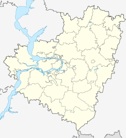
Syzran
| city
Sysran
Сызрань
|
||||||||||||||||||||||||||||||||||||||||||
|
||||||||||||||||||||||||||||||||||||||||||
|
||||||||||||||||||||||||||||||||||||||||||
| List of cities in Russia | ||||||||||||||||||||||||||||||||||||||||||
Sysran ( Russian Сызрань , scientific transliteration : Syzran ') is a city with 178,750 inhabitants (14 October 2010) on the right bank of the lower Volga River in the Samara Oblast in Russia .
geography
The city is located on the banks of the Saratov reservoir of the Volga, about 120 km west of the regional capital Samara and about 30 km north of the administrative border with the Ulyanovsk Oblast . The urban area extends along the Volga over a length of up to 17 km. The closest city is Oktyabrsk 19 km west of Syzran.
history
Syzran was founded as a fortress in 1683. It was supposed to secure the trade route running there, as the present city area was not far from the eastern border of the Russian tsarist and was therefore considered endangered. Syzran is named after the river Sysranka , whose name comes from the Turkic languages and originally meant something like "flowing out of the gorge".
Syzran fortress lost its military importance in the early 18th century. Instead, trade developed rapidly in the place, which was favored by its location directly on the Volga. At the end of the century Syzran was already an important trading center, which is why it was given city status and its own city coat of arms in 1781.
In 1874 the city received its own train station with the construction of the almost 1,400 kilometer long Syzran – Vyazma railway line and six years later a railway bridge over the Volga. This not only promoted trade but also industrialization . At the beginning of the 20th century, Syzran was already an important industrial city and one of the largest grain processing centers in Russia . In July 1906 a catastrophe occurred. A huge fire destroyed over 5,000 buildings. A large part of the predominantly wooden town was destroyed. More than 1,000 people lost their lives and over 30,000 their homes. It took several years to restore the city.
After the October Revolution in 1917, the economic profile of Sysran began to change: the main branch of industry was no longer grain processing, but the extraction and processing of mica slate , which was initially used as fuel and later as a raw material in the pharmaceutical industry. In addition, other industries such as mechanical engineering and crude oil processing were built in Syzran during the Soviet era . After the German raid in June 1941, a number of factories were evacuated to Syzran from the more western parts of the country. Thanks to its location, the city itself was spared the fighting, which explains the historical cityscape, which is still relatively well preserved today.
The airfield northeast of the city ( ⊙ ) was from October 1, 1952 to October 1, 1953 the training base for the first 220 military pilots of the KVP-Luft (forerunner of the NVA Air Force) - referred to as the top secret "Course X" . The Air Force College is located in the city .
Population development
| year | Residents |
|---|---|
| 1897 | 32,383 |
| 1939 | 77,946 |
| 1959 | 148.391 |
| 1970 | 173.347 |
| 1979 | 178,498 |
| 1989 | 174,335 |
| 2002 | 188.107 |
| 2010 | 178,750 |
Note: census data
Economy and Transport
Thanks to the factories built in Syzran during the Soviet era, the city is still an important industrial center of the Samara Oblast. Sysran's largest operations include an oil refinery, a plastics factory, a factory for agricultural machinery and an oil production plant, as well as a thermal power station and companies in light industry, wood processing and the food industry.
The city is located on the M5 Ural trunk road . This is where the R228 begins , which leads via Saratov to Volgograd . Syzran is also an important railway junction , the main stations of which are the main and marshalling yard Syzran 'I and another marshalling yard east of the city on the route to Samara (Oktyabrsk station). Urban public transport consists of numerous bus routes and, since September 2002, also a trolleybus route , making the Syzran trolleybus system currently the youngest in Russia.
sons and daughters of the town
- Vasily Boldyrew (1875-1933), General
- Anatoly Tscherepashchuk (* 1940), astrophysicist and university professor
- Valery Tretyakov (* 1941), Colonel General
- Vyacheslav Chebanenko (1942–1997), chess player
- Vladimir Trofimenko (1953-1994), track and field athlete
- Valery Loginov (* 1955), chess player
- Michail Kornijenko (* 1960), cosmonaut
- Natalja Ionowa (* 1986), pop singer
- Jekaterina Wetkowa (* 1986), handball player
Individual evidence
- ↑ a b Itogi Vserossijskoj perepisi naselenija 2010 goda. Tom 1. Čislennostʹ i razmeščenie naselenija (Results of the All-Russian Census 2010. Volume 1. Number and distribution of the population). Tables 5 , pp. 12-209; 11 , pp. 312–979 (download from the website of the Federal Service for State Statistics of the Russian Federation)
- ↑ Болдырев Василий Георгиевич , grwar.ru (Russian)
- ↑ Третьяков Валерий Степанович , encyclopedia.mil.ru (Russian)
Web links
- Unofficial website (Russian)
- Syzran on mojgorod.ru (Russian)


