Novokuibyshevsk
| city
Novokuibyshevsk
Novokuebyshevsk
|
||||||||||||||||||||||||||||||||||||||||||
|
||||||||||||||||||||||||||||||||||||||||||
|
||||||||||||||||||||||||||||||||||||||||||
| List of cities in Russia | ||||||||||||||||||||||||||||||||||||||||||
Novokuibyshevsk ( Russian: Новоку́йбышевск ) is a city with 108,438 inhabitants (as of October 14, 2010) in Russia , in Samara Oblast . Occasionally the name Nowaja Samara (Russian Но́вая Сама́ра ) is used unofficially .
geography
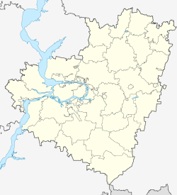
Novokuibyshevsk is located in central Russia , near the left bank of the Volga and around 20 km southwest of the Oblast capital Samara . Together with eight smaller localities (two villages and six settlements) the actual city of Novokuibyshevsk forms the territorial unit " District-Free City of Novokuibyshevsk" (Russian Городско́й о́круг Новокуйбышевск ).
The closest cities are Samara and Chapayevsk, 18 km southwest of Novokuibyshevsk .
history
Novokuibyshevsk was founded as an industrial and residential area for the neighboring Samara, which was then called Kuibyshev (Russian Ку́йбышев ) after the politician Valerian Kuibyshev . The city's beginnings date back to 1946, when the construction of the Novokuibyshev oil refinery began. Originally only planned as a small workers' settlement, the place continued to grow due to its convenient location in terms of transport. In 1952 it was granted city rights and in the mid-1960s exceeded the city mark of 100,000 inhabitants. In 1992 the Mayak settlement (Russian Мая́к ) was incorporated into Novokuibyshevsk.
Population development
| year | Residents |
|---|---|
| 1959 | 62,755 |
| 1970 | 103,707 |
| 1979 | 109,029 |
| 1989 | 112,987 |
| 2002 | 112,973 |
| 2010 | 108,438 |
Note: census data
Economy and Transport
Novokuibyshevsk is an industrial city where petroleum processing and chemical industries play the most important role in the economy. In addition, there is a pipeline factory, two thermal power stations and several companies from the light and food industry. The large number of pollutant-intensive industrial companies in a relatively small area causes a high level of air pollution in Novokuibyshevsk, even by Russian standards.
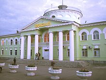
The city's main traffic connections start from neighboring Samara , where there is a connection to the M5 trunk road , an inland port and an international airport. Novokuibyshevsk also has its own train station with connections to Samara, Chapayevsk and Syzran, among others .
sons and daughters of the town
- Inga Abitowa (* 1982), long-distance runner
- Alexander Abrosimov (born 1983), volleyball player
- Natalja Achrimenko (* 1955), shot put
- Vladimir Fyodorowitsch Malosemlin (* 1956), middle-distance runner
- Oleg Saitow (* 1974), boxer
Individual evidence
- ↑ a b Itogi Vserossijskoj perepisi naselenija 2010 goda. Tom 1. Čislennostʹ i razmeščenie naselenija (Results of the All-Russian Census 2010. Volume 1. Number and distribution of the population). Tables 5 , pp. 12-209; 11 , pp. 312–979 (download from the website of the Federal Service for State Statistics of the Russian Federation)
Web links
- Novokuibyshevsk on mojgorod.ru (Russian)
- Unofficial Portal (Russian)
- City unofficial website (Russian)
- City information (Russian)


