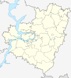
Besentchuk
| Urban-type settlement
Besentschuk
Безенчук
|
||||||||||||||||||||||||||||||
|
||||||||||||||||||||||||||||||
|
||||||||||||||||||||||||||||||
| List of large settlements in Russia | ||||||||||||||||||||||||||||||
Besentschuk ( Russian Безенчу́к ) is an urban-type settlement in the Samara Oblast ( Russia ) with 22,952 inhabitants (as of October 14, 2010).
geography
The settlement is located about 50 kilometers southwest of the Oblast capital Samara on the left of the Volga , the extreme left tributaries of which run about eight and the main arm about 15 kilometers from Besentchuk. A little west of the settlement, the river of the same name, Besechuk , flows towards the Volga.
Besentchuk is the administrative center of the Besentchuk Rajon of the same name .
history
The place was established in 1886 and received urban-type settlement status in 1958 .
Population development
| year | Residents |
|---|---|
| 1939 | 4.117 |
| 1959 | 10,376 |
| 1970 | 12,605 |
| 1979 | 17,670 |
| 1989 | 23,650 |
| 2002 | 23,921 |
| 2010 | 22,952 |
Note: census data
culture and education
The Samara N. M. Tulaikow Agricultural Research Institute is located in the settlement . There is an agricultural and a medical school.
Economy and Infrastructure
There are mechanical engineering, construction and food industries (processing of products from the surrounding agricultural area) in Besentchuk. Crude oil is produced in the Rajon .
The settlement is located on the railway line Moscow –Samara– Chelyabinsk (southern branch of the Trans-Siberian Railway ; route km 1035) opened on this section in 1877 , from which the Samara freight bypass line to Kinel, completed in 1970, branches off.
Individual evidence
- ↑ a b Itogi Vserossijskoj perepisi naselenija 2010 goda. Tom 1. Čislennostʹ i razmeščenie naselenija (Results of the All-Russian Census 2010. Volume 1. Number and distribution of the population). Tables 5 , pp. 12-209; 11 , pp. 312–979 (download from the website of the Federal Service for State Statistics of the Russian Federation)
Web links
- Unofficial Portal (Russian)


