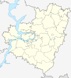
Bolshaya Glushitsa
| Village
Bolshaya Glushitsa
Большая Глушица
|
||||||||||||||||||||||||||||||||||
|
||||||||||||||||||||||||||||||||||
|
||||||||||||||||||||||||||||||||||
Bolschaja Gluschiza ( Russian Большая Глушица ) is a village (selo) in Samara Oblast ( Russia ) with 9667 inhabitants (as of October 14, 2010).
geography
The place is in the Volga region , a good 90 kilometers as the crow flies south-southeast of the Samara Oblast Administrative Center , on the left bank of the left Volga tributary Great Irgis (Bolshoi Irgis) at the confluence of the left tributary Gluschiza.
Bolshaya Glushiza is the administrative center of the Bolschegluschizki Rajon named after him and the rural community of the same name (selskoje posselenije) , to which, in addition to Bolshaya Glushiza, the settlements Kobsewka (12 km southeast) and Morez (11 km west-northwest) belong.
history
The village was founded in 1779 under the name Gluschiza after the river that flows into the Great Irgis. The initially low population growth accelerated due to the influx of resettlers from central Russia from 1828. After the creation of the village Malaya Gluschiza ("Little Gluschiza"), located about 20 km to the west, downstream on the Great Irgis, in 1831 the name of the original village became common Bolshaya Gluschiza ("Groß-Gluschiza") a. Due to its favorable location on the trade route ("Trakt") between Samara and Uralsk (today Oral in Kazakhstan), the village developed into a regionally important trading point and became the seat of a Volost in Ujesd Nikolajewsk (today Pugachev), which was initially part of the Saratov Governorate and from 1851 belonged to the newly formed Samara Governorate .
In 1928 Bolshaya Glushitsa became the administrative center of a Rajon formed from the former Volost.
Population development
| year | Residents |
|---|---|
| 1897 | 8,166 |
| 1939 | 6,707 |
| 1959 | 6.276 |
| 1970 | 9,651 |
| 1979 | 9,460 |
| 1989 | 9,883 |
| 2002 | 10.133 |
| 2010 | 9,667 |
Note: census data
traffic
The federal highway A300 (part of the European route 121 ) passes east of the village and connects Samara with the state border with Kazakhstan that runs almost 90 km south of Bolshaya Glushiza (there continues as M32 in the direction of Oral - Aqtöbe - Schymkent ).
The nearest train station is about 40 km south of the neighboring district center Bolshaya Chernigovka on the Pugachev - Krasnogwardejez ( Buzuluk ) route.
Web links
Individual evidence
- ↑ a b Itogi Vserossijskoj perepisi naselenija 2010 goda. Tom 1. Čislennostʹ i razmeščenie naselenija (Results of the All-Russian Census 2010. Volume 1. Number and distribution of the population). Tables 5 , pp. 12-209; 11 , pp. 312–979 (download from the website of the Federal Service for State Statistics of the Russian Federation)


