Europastrasse 121
| Europastrasse 121 | |

|
|
| map | |
| Basic data | |
| Overall length: | approx. 2700 km |
|
States : |
|
|
Course of the road
|
|
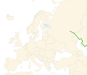
The European route 121 (short: E 121 ) runs from Samara in Russia in a southerly direction via Kazakhstan and Turkmenistan to the Turkmen-Iranian border. The 232-kilometer section in Russia is designated A300 (formerly M32), in Kazakhstan the designations are A28 , A33 and A34 . In Oral (Uralsk) the European route 38 is crossed , in Atyrau the European route 40 , with which the E 121 runs parallel to beinu . From Beinu the route runs in a south-westerly direction to Schetibai east of Aktau , where it branches off from the A33 to the east and leads south via Shangaosen (formerly Nowy Usen) to the Turkmen border. On the Turkmen side it will be continued as R18 ; here Garabogaz is reached first. From Türkmenbaşy to Serdar it runs parallel to European route 60 . The northern section to beinu is also part of the planned Asian highway AH63 . The route from Oral to Atyrau is 487 kilometers, from Shetibai to the Turkmen border 237 kilometers.
Cities along the way
Samara - Oral - Atyrau - beinu - Schetibai - Shangaosen - Türkmenbaşy - Serdar
Web links
- European Agreement on Main International Traffic Arteries (AGR) (English, with list of European roads; PDF; 275 kB)
- AGR Map (map of European roads; PDF; 319 kB)
