European route 127
| European route 127 | ||||||||||||||||||||||||||||||||||||||||||||||||||||||||||

|
||||||||||||||||||||||||||||||||||||||||||||||||||||||||||
| map | ||||||||||||||||||||||||||||||||||||||||||||||||||||||||||
| Basic data | ||||||||||||||||||||||||||||||||||||||||||||||||||||||||||
| Overall length: | 1237 km | |||||||||||||||||||||||||||||||||||||||||||||||||||||||||
|
States : |
||||||||||||||||||||||||||||||||||||||||||||||||||||||||||
|
Course of the road
|
||||||||||||||||||||||||||||||||||||||||||||||||||||||||||
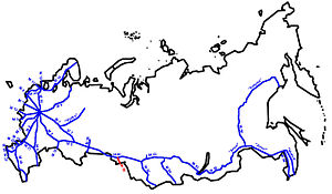
The European route 127 leads from Omsk in Russia in a south-easterly direction to the Kazakh border and on Kazakh territory via Pavlodar , Semei (Semipalatinsk) and Saissan to the border with the People's Republic of China at Maikaptschigai .
Since the number was assigned in the Soviet period until 2010, the entire length of the trunk road was also called M38. The Russian section was given the number A320 in 2010.
