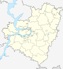
Kinel-Cherkassy
| Village
Kinel-Cherkassy
Кинель-Черкассы
|
||||||||||||||||||||||||||||||
|
||||||||||||||||||||||||||||||
|
||||||||||||||||||||||||||||||
| List of large settlements in Russia | ||||||||||||||||||||||||||||||
Kinel-Cherkassy ( Russian Кине́ль-Черка́ссы ) is a village (selo) in the Samara Oblast ( Russia ) with 17,252 inhabitants (as of October 14, 2010).
geography
The place is located in the Volga region , about 85 kilometers as the crow flies east-northeast of the Samara Oblast Administrative Center and 15 kilometers northeast of the city of Otradny . The Samara tributary Great Kinel (Bolshoi Kinel) flows through Kinel-Cherkassy , into which the Small Kinel (Maly Kinel) flows.
Kinel-Cherkassy is the administrative center of the Kinel-Cherkassy Raion of the same name as well as the rural community of the same name (Selskoje posselenije) , to which, in addition to Kinel-Cherkassy, the eight villages and settlements of Tousakowo, Altuchowo, Vinno-Bannowo, Volnaja Solyanka, Svobodnyje Nai-Leben, Prosweschcheniye and Prokopenki belong.
history
The establishment of the place is related to the connection of the area around Orenburg to the Russian Empire and its protection against the repeatedly rising Bashkirs and nomads from the steppe areas to the south in the 18th century. In 1739 Tsarina Anna Ivanovna issued an ukase on the settlement of peasants from the Cherkassy area in today's Ukraine in order to strengthen the border line of the empire beyond Orenburg. By 1742, 618 families had arrived at the Orenburg fortress and were distributed among already existing fortified settlements. Many of the settled farmers did not understand the difficult conditions and living conditions, which differed greatly from their area of origin, and expressed their wish to be able to return. 46 families were finally allowed to settle in the hinterland. They founded Kinel-Cherkassy on the left bank of the river in 1744 and named it after the river and its place of origin.
In the following years, more farmers from the governorates of Kiev and Kharkov came to the area, as well as dispersed participants in the Pugachev uprising and later farmers from other parts, mainly from southern central Russia. In addition to Russians and Ukrainians , the settlers also included members of other ethnic groups, such as the Tatars , Mordvins and Chuvashes .
In the 1890s, the railway line from Samara via Ufa and Zlatoust to Chelyabinsk , which a little later became part of the Trans-Siberian Railway , passed the village, which had a positive effect on economic development.
In 1928 Kinel-Cherkassy became the administrative center of a newly established Rajon.
Population development
| year | Residents |
|---|---|
| 1793 | 2,846 |
| 1939 | 11,811 |
| 1959 | 14.091 |
| 1970 | 15,165 |
| 1979 | 17,555 |
| 1989 | 17,690 |
| 2002 | 18,536 |
| 2010 | 17,252 |
Note: from 1939 census data
Culture and sights
In Kinel-Cherkassy the Church of the Ascension of Christ ( Вознесенская церковь / Voznesenskaja zerkow ) from 1839 has been preserved, which was one of only two churches in the oblast that was not closed during the Soviet period.
Economy and Infrastructure
Kinel-Cherkassy is the center of an agricultural area with various businesses in the food industry, as well as the building materials industry. Vegetable cultivation in greenhouses , mainly tomatoes, is well developed .
The settlement is located on the Samara - Ufa - Chelyabinsk railway, part of the southern route of the Trans-Siberian Railway (station name Tolkai ; route kilometers 1208 from Moscow ). South of the town leads the regional road R225 from Samara to Buguruslan past in Kinel-Cherkassy a cross connection to trunk road from the M5 when a good 50 km away Sernovodsk branches.
On the eastern edge of the village is the Kinel-Cherkassy military airfield, which was built in 1940 (also Tolkai after the nearby train station), where a DOSAAF flight school was located in the 1970s-1980s and, since 1993, a transport and combat helicopter regiment of the Russian Air Force (previously Telavi , Georgia ) was stationed. However, the regiment was disbanded in 2009.
Individual evidence
- ↑ a b Itogi Vserossijskoj perepisi naselenija 2010 goda. Tom 1. Čislennostʹ i razmeščenie naselenija (Results of the All-Russian Census 2010. Volume 1. Number and distribution of the population). Tables 5 , pp. 12-209; 11 , pp. 312–979 (download from the website of the Federal Service for State Statistics of the Russian Federation)
- ↑ History ( Memento of the original from March 28, 2010 in the Internet Archive ) Info: The archive link was inserted automatically and has not yet been checked. Please check the original and archive link according to the instructions and then remove this notice. in the information portal of Kinel-Cherkassy Raion (Russian)
- ↑ History of the Samara Eparchy ( Memento of the original from June 7, 2008 in the Internet Archive ) Info: The archive link was inserted automatically and has not yet been checked. Please check the original and archive link according to the instructions and then remove this notice. on a website of the Samara Eparchy of the Russian Orthodox Church (Russian)

