Oktyabrsk
| city
Oktyabrsk
Октябрьск
|
||||||||||||||||||||||||||||||||||||||||||
|
||||||||||||||||||||||||||||||||||||||||||
|
||||||||||||||||||||||||||||||||||||||||||
| List of cities in Russia | ||||||||||||||||||||||||||||||||||||||||||
Oktjabrsk ( Russian Октябрьск ) is a city in Samara Oblast ( Russia ) with 27,244 inhabitants (as of October 14, 2010).
geography
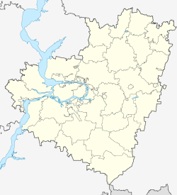
The city is located in the southwest of the Volga bend Samarskaya Luka , about 150 km west of the Oblast capital Samara . It stretches in a narrow strip over 20 kilometers on the right bank of the Volga , which is dammed up here to form the Saratov reservoir . To the west, Oktyabrsk merges almost seamlessly into the city of Syzran .
Oktyabrsk is administratively directly subordinate to the oblast .
The city lies on the railway line between Moscow and Samara, opened on this section in 1877 ( Oktyabrsk station at 975 km). In the urban area there is still the Pravaya Volga train station (literally right Volga , i.e. right Volga river ), near which the line crosses the Volga on an almost 1,500 meter long bridge with a five kilometer long dam. The M5 Moscow – Samara – Chelyabinsk highway also passes north of Oktyabrsk . The city has a river port on the Volga.
history
The first settlements arose on the territory of today's city towards the end of the 17th century, for example Gorodishche in 1684 as one of the fortifications of the Syzran defense line along the then border of Tsarist Russia and in 1704 Batraki as a ferry point across the Volga.
In 1880, in connection with the construction of a railway bridge across the Volga, the settlement of Pravaya Volga was built and in 1882 an asphalt works a few kilometers upstream Pechorsky, which was renamed Pervomaiski in 1925 .
In 1942, the places that had grown together in the meantime, including the large village of Kostytschi, located between Batraki and Pravaya Volga, were united to form Octyabrsky Rajon of the city of Syzran (name derived from oktyabr , Russian for October ; refers to the October Revolution ). In 1956 the Rajon became an independent city under its current name.
Population development
| year | Residents | annotation |
|---|---|---|
| 1939 | 18,930 | only workers' settlement Batraki (10,106) and Kostychi village (8,824) |
| 1959 | 33,771 | |
| 1970 | 33,981 | |
| 1979 | 29,769 | |
| 1989 | 27,449 | |
| 2002 | 25,336 | |
| 2010 | 27,244 |
Note: census data
Culture and sights
Oktyabrsk has had a local museum since 1995.
economy
The main branches of industry are the construction and building materials industry (insulating materials, reinforced concrete, wood and metal structures, asphalt, refractory materials). There is also a textile and wood processing industry.
Individual evidence
- ↑ a b Itogi Vserossijskoj perepisi naselenija 2010 goda. Tom 1. Čislennostʹ i razmeščenie naselenija (Results of the All-Russian Census 2010. Volume 1. Number and distribution of the population). Tables 5 , pp. 12-209; 11 , pp. 312–979 (download from the website of the Federal Service for State Statistics of the Russian Federation)
Web links
- Oktjabrsk on mojgorod.ru (Russian)


