Ust-Kinelski
| Urban-type settlement
Ust-Kinelski
Усть-Кинельский
|
||||||||||||||||||||||||||||||
|
||||||||||||||||||||||||||||||
|
||||||||||||||||||||||||||||||
Ust-Kinelski ( Russian Усть-Кине́льский ) is an urban-type settlement in Samara Oblast ( Russia ) with 9,988 inhabitants (as of October 14, 2010).
geography
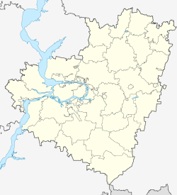
The settlement is about 30 km east-northeast of the center of Oblastverwaltungszentrums Samara on the right bank of the Great Kinel (Bolshoi Kinel), about 4 km above the confluence of the right in the Volga creek Samara .
Ust-Kinelski is one of two urban-type settlements (next to Alexejewka ) in the Kinel district and is located about 6 km northwest of Kinel city center.
history
Its history begins with the establishment of Alexejewsker Middle Agricultural School on a Cossack agriculture no. 2 referred to the neighboring Alexeyevka (in time Alexejewsk belonging) area in 1900. This took 1903 the teaching in the new buildings and became 1919 as Faculty incorporated into the newly founded Samara University. In 1922 the educational institution became an independent university as the Samara Agricultural Institute , from 1935 to 1991 the Kuibyshev Agricultural Institute (at that time the city was called Samara Kuibyshev ) and since 1995 the Samara State Agricultural Academy.
A housing estate soon grew around the school, which from 1928 was on the territory of the newly formed Kinelski rajon. The place name used since the 1930s at the latest refers to the location not far from the mouth of the Great Kinel; Ust- from Russian ustje for "mouth". In 1964, the settlement's administration was the city Soviets assumed by Kinel, (confirmed in 2008) from its territory in 2004 emerged the present city circle within which Ust-Kinelski has its own territorial administration.
Due to the construction of a larger prefabricated housing estate , the place grew particularly in the late 1970s and 1980s, and since 1987 it has had the status of an urban-type settlement.
Population development
| year | Residents |
|---|---|
| 1989 | 7257 |
| 2002 | 8995 |
| 2010 | 9988 |
Note: census data
traffic
The regional road 36K-851 (formerly R225) from Samara to Buguruslan , which is similar to a motorway , runs south of Ust-Kinelski . The 36K-238 branches off between the settlement and the city of Kinel, initially as a southern bypass of Kinel and then further up the Samara River to the neighboring district of Bogatoje to the southeast .
The nearest train station is the major railway junction Kinel, 5 km away, where the southern route of the Trans-Siberian Railway Samara - Ufa - Chelyabinsk - Omsk branches off to Orenburg and further to Central Asia as well as the southern freight bypass of Samara.
Web links
- Ust-Kinelsky on the Kinel District Official Website (Russian)
Individual evidence
- ↑ a b Itogi Vserossijskoj perepisi naselenija 2010 goda. Tom 1. Čislennostʹ i razmeščenie naselenija (Results of the All-Russian Census 2010. Volume 1. Number and distribution of the population). Tables 5 , pp. 12-209; 11 , pp. 312–979 (download from the website of the Federal Service for State Statistics of the Russian Federation)

