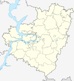
Sergievsk
| Village
Sergijewsk
Сергиевск
|
||||||||||||||||||||||||||||||||
|
||||||||||||||||||||||||||||||||
|
||||||||||||||||||||||||||||||||
Sergijewsk ( Russian Сергиевск ) is a village (selo) and former city in Samara Oblast ( Russia ) with 8661 inhabitants (as of October 14, 2010).
geography
The place is about 100 kilometers as the crow flies northeast of the Samara Oblast Administrative Center on the right bank of the left Volga tributary Sok , a little below the confluence of the left tributary Surgut .
Sergijewsk is the administrative center of him named Rajons Sergijevski and the rural municipality of the same name (selskoje posselenije) , (km 12 northeast) which also includes the three villages Borowka, Studjony Kliuch (10 km west) and Uspenka (10 km northwest) and the four settlements ( possjolok) Gluboki (7 km northeast), Michailowka (13 km north), Rogatka (5 km northeast) and Rybopitomnik (10 km west-southwest) belong.
history
The place goes back to a fortress built in 1703 not far from the then southeast border of the Russian Empire to the inner-Asian steppe areas as part of the "New" or "Second Trans- Kama Line" ( Novo-Sakamskaja or Wtoraja Sakamskaja linija ). The name of the fortress (Sergijewskaja krepost) and thus the current place name refers to St. Sergius of Radonezh .
With the shift of the border to the southeast, the fortress lost its military importance as early as the 1730s. The settlement that arose near the fortress became the administrative seat of a Ujesd of Orenburg Oblast in 1782 within the governorship of Ufa and received city rights as such. The Ujesd was dissolved again in 1784 and joined the Ujesd Buguruslan of the Ufa Oblast, from which the Ufa Governorate emerged in 1796 ; Sergievsk had the status of a city without an administrative function (saschtatny gorod). In 1851 the place came with the Ujesd to the newly formed Samara Gouvernement , now with the status of a "suburb" (prigorod) and subsequently as the seat of a Volost .
With the introduction of the Rajon subdivision, Sergievsk became the administrative seat of a Rajon named after him on July 16, 1928 - at the latest from this point in time with the status of a village, initially within the Okrug Buguruslan of the Middle Volga Oblast (Sredne-Wolschskaja oblast), from which, after several administrative ones Redesign and renaming in 1936 the Kuibyshev Oblast emerged as a direct forerunner of today's Samara Oblast.
Population development
| year | Residents |
|---|---|
| 1897 | 3057 |
| 1939 | 5108 |
| 1959 | 5967 |
| 1970 | 6770 |
| 1979 | 7930 |
| 1989 | 8367 |
| 2002 | 8282 |
| 2010 | 8661 |
Note: census data
traffic
Sergievsk is connected by the regional road 36K-544 with the federal highway M5 Ural ( Moscow - Samara - Chelyabinsk ) about eight kilometers to the south-east of the urban-type settlement Suchodol . A western bypass around the town bears the number 36K-560, the continuation in the north neighboring Rajonzentrum Tschelno-Werschiny number 36K-520th
A good two kilometers southeast of the village on the opposite bank of the Sok is the Sernyje Vody II train station near the village of Surgut, the end point of an 86 km long branch line from Krotowka on the (Moscow -) Samara - Ufa - Chelyabinsk - Omsk line . The branch line was opened in 1896 as a narrow-gauge railway ( gauge 1000 mm) and converted to broad gauge in the 1920s . 1996 the passenger traffic was stopped; the nearest railway stations with passenger traffic are now more than 50 km away to the south-east in Kinel-Cherkassy (station name Tolkai ) also on the Samara - Omsk route and to the north in Chelno- Verhiny (station name Chelna ) on the Ulyanovsk - Tschischmy (- Ufa) route.
Personalities
- Ekaterina Kalugina (* 1993), Russian professional dancer
Web links
Individual evidence
- ↑ a b Itogi Vserossijskoj perepisi naselenija 2010 goda. Tom 1. Čislennostʹ i razmeščenie naselenija (Results of the All-Russian Census 2010. Volume 1. Number and distribution of the population). Tables 5 , pp. 12-209; 11 , pp. 312–979 (download from the website of the Federal Service for State Statistics of the Russian Federation)

