Zhigulyovsk
| city
Zhigulyovsk
Chigulevsk
|
||||||||||||||||||||||||||||||||||||||||||
|
||||||||||||||||||||||||||||||||||||||||||
|
||||||||||||||||||||||||||||||||||||||||||
| List of cities in Russia | ||||||||||||||||||||||||||||||||||||||||||
Zhiguljowsk ( Russian Жигулёвск ) is a city in Samara Oblast ( Russia ) with 55,565 inhabitants (as of October 14, 2010).
geography
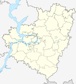
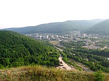
The city is located opposite the city of Tolyatti , on the northern edge of the Volga Arch Samarskaya Luka with the Schiguli Mountains , about 90 km west of the Oblast capital Samara on the right bank of the Volga , which is dammed here to form the Kuibyshev reservoir .
Zhiguljowsk is administratively directly subordinate to the oblast . Five villages with a total of 4,975 inhabitants are directly administered by the city, so that the total population of the administrative unit city of Zhiguljowsk is 62,412 (2009 calculation).
The town lies on the 1961 opened, electrified railway Sysran -Samara (about Schiguljowskoje More on the left bank of the Volga, where the short branch line to the near Togliatti branches). The M5 Moscow –Samara– Chelyabinsk highway also runs through Schiguljowsk, which is similar to a motorway in the direction of Samara. The railway line and road cross the Volga on the crown of the dam.
history
In place of today's town, the villages Morkwaschi and Otwaschnoje have been known since 1647 and 1840 respectively . In the 19th and early 20th centuries, this idyllic section of the Volga was a popular place to stay for poets and painters. So worked Ilya Repin in Morkwaschi 1870 his famous picture The Wolgatreidler .
In the 1940s, with the discovery of oil deposits, the Otvaschny workers' settlement was established , which in 1946 received the status of an urban-type settlement . In 1949 it merged with the surrounding villages and was renamed Schiguljowsk , after the ridge south of the village.
With the start of construction of the dam of the Kuibyshev reservoir in the immediate vicinity in 1950, the place began to grow rapidly, so that on February 22, 1952 the city was granted.
In 2004 the former urban-type settlement Jablonewy Owrag (Russian for apple tree canyon ) was incorporated into the Volga River northwest of the city center.
Population development
| year | Residents |
|---|---|
| 1959 | 46.117 |
| 1970 | 52,130 |
| 1979 | 46.157 |
| 1989 | 44,801 |
| 2002 | 48,770 |
| 2010 | 55,565 |
Note: census data
Culture and sights
To the south of the city, practically the entire Volga arch is taken up by the 134,000 hectare Samarskaya Luka National Park, established in 1984 . The park administration is located in Zhigulyovsk.
economy
In Zhigulyovsk is the for GidroOGK belonging Schiguljowsker hydroelectric plant (formerly Volga W.-I.-Lenin-power plant ) with a capacity of 2300 MW. Samaraneftegas produces oil in the area . Limestone is mined in several places. There is a cement plant in the Jablonewy Owrag district . There are also electrical engineering and wood industries.
Individual evidence
- ↑ a b Itogi Vserossijskoj perepisi naselenija 2010 goda. Tom 1. Čislennostʹ i razmeščenie naselenija (Results of the All-Russian Census 2010. Volume 1. Number and distribution of the population). Tables 5 , pp. 12-209; 11 , pp. 312–979 (download from the website of the Federal Service for State Statistics of the Russian Federation)
Web links
- City administration website (Russian)
- Zhiguljowsk on mojgorod.ru (Russian)


