Vélingara
| Vélingara | ||
|---|---|---|
|
|
||
| Coordinates | 13 ° 9 ′ N , 14 ° 6 ′ W | |
| Basic data | ||
| Country | Senegal | |
| Kolda | ||
| Department | Vélingara | |
| ISO 3166-2 | SN-KD | |
| height | 42 m | |
| Residents | 32,161 (2013) | |
|
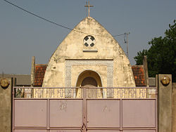
Church in Vélingara
|
||
Vélingara is a city in southern Senegal . It is prefecture of the Vélingara department in the Kolda region .
Geographical location
Vélingara is located in the east of the Kolda region and thus also in the east of Casamance on the northern edge of the Vélingara crater . Gambia in the north is 12 km away and Guinea-Bissau in the south is 52 km.
population
The last censuses showed the following population figures for the city:
| year | Residents |
|---|---|
| 1988 | 14,068 |
| 2002 | 20,806 |
| 2013 | 32,161 |
traffic
Vélingara is a stage on the national road N 6 , which, starting from the city and port city of Ziguinchor , connects the south and east of Casamance via Tambacounda with the rest of the country.
Partnerships
Since 1993 there has been a twinning with Huy (Belgium) .
See also
Web links
Commons : Vélingara - collection of images, videos and audio files
Individual evidence
- ↑ Measure distances with google maps
- ↑ Senegal: The most important places with statistics on their population

