Velden (Venlo)
| province |
|
| local community |
|
|
Area - land - water |
18.34 km 2 17.83 km 2 0.51 km 2 |
| Residents | 5,155 (Jan 1, 2018) |
| Coordinates | 51 ° 25 ′ N , 6 ° 10 ′ E |
| Important traffic route |
|
| prefix | 077 |
| Postcodes | 2286, 5914, 5916, 5941, 5943, 5971 |
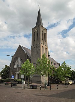
| Church of Velden | |
Velden is a village in the Dutch city of Venlo in the province of Limburg .
location
Velden is located on the Maas about 5 km north of the center of Venlo on Rijksstraatweg N 271. It is 2 km to the German border in the east. The driveway to Europastraße 34 is 2 km south of the village.
history
During the War of the Spanish Succession, Velden was also occupied by Prussian troops and was part of the Prussian Gelderland until 1814. Then it fell to the Kingdom of the Netherlands, which determined the border with Germany by the distance of a cannon shot to the east from the banks of the Meuse. In the peace treaty of London in 1839 the borders were set and the entire area went to the Netherlands in 1866. Until January 1, 2010, Velden belonged to the former municipality of Arcen en Velden .
Infrastructure
In Velden there is a Maas ferry to the other bank to Grubbenvorst, which can also be used by motorists and cyclists. The Pieterpad long-distance hiking trail goes through the village. Velden was voted the greenest village in the Netherlands in 1999, along with two other locations.
Personalities
- Ger Koopmans (* 1962), Dutch politician
Web links
Individual evidence
- ↑ Kerncijfers wijken en buurten 2018 Centraal Bureau voor de Statistiek , accessed on September 1, 2018 (Dutch)

