Vennvorland
| Vennvorland | |||
|---|---|---|---|
| View of the foothills of the Venn near Kornelimünster | |||
| Systematics according to | Handbook of the natural spatial structure of Germany | ||
| Greater region 1st order | Low mountain range threshold | ||
| Greater region 2nd order | 24, 25, 27–33, 344, 56 → Rheinisches Schiefergebirge |
||
| Main unit group | 56 → Vennvorland |
||
| Geographical location | |||
| Coordinates | 50 ° 46 '36 " N , 6 ° 5' 1" E | ||
|
|||
| state | North Rhine-Westphalia | ||
A part of the landscape of the northern Eifel on the northwestern edge of the High Fens and in the transition area to the Jülich-Zülpicher Börde is called the Vennvorland . These include the area around the cities of Aachen and Stolberg as well as parts of Eschweiler and the municipality of Langerwehe in the Düren district . It is a densely built-up area and covers most of the Aachen city region . Parts of the Hohes Venn-Eifel Nature Park also belong to this area. The area is hilly with an average height of 200 m to just over 350 m above sea level. NHN., Where theBrandenberg in the Aachen forest with height 355.4 is the highest point.
Natural structure
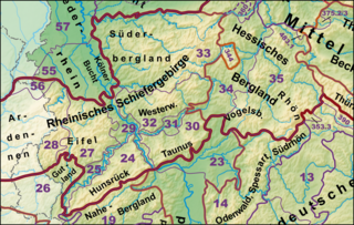
In the handbook of the natural structure of Germany , the Vennvorland forms the main unit group 56 and is part of the higher-level natural area Rheinisches Schiefergebirge . It consists of the following sub-units:
- 56 Vennvorland
- 560 Vennfoot area
- 561 Aachen hill country
- 561.0 Stolberger Talung
- 561.1 Aachen boiler
- 561.2 Aachen Forest
- 561.3 Vaals hill country
Individual evidence
- ↑ [1] www.Tim-online.nrw.de
- ↑ E. Meynen , J. Schmithüsen et al: Handbook of the natural spatial structure of Germany - Federal Institute for Regional Studies, Remagen / Bad Godesberg 1953–1962 (9 deliveries in 8 books, updated map 1: 1,000,000 with main units 1960)
- ↑ Online map of the main unit groups with a list of the main units
- ↑ http://geographie.giersbeck.de/karten/123.pdf Die Geographische Landesaufnahme Naturräumliche Umführung

