
Administrative association Rosenbach
| coat of arms | Germany map | |
|---|---|---|
 Help on coat of arms |
Coordinates: 50 ° 33 ' N , 12 ° 2' E |
|
| Basic data (as of 2010) | ||
| Existing period: | 1994-2010 | |
| State : | Saxony | |
| County : | Vogtland district | |
| Area : | 67.38 km 2 | |
| Residents: | 4543 (Dec. 31, 2008) | |
| Population density : | 67 inhabitants per km 2 | |
| License plate : | V, AE, OVL, PL, RC | |
| Association key : | 14 5 23 5403 | |
| Association structure: | 3 municipalities | |
| Administrative Chairman: | Thomas Meinel | |
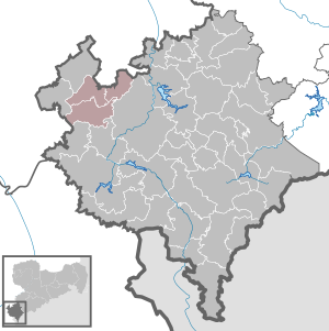
| Location of the administrative association Rosenbach in the Vogtlandkreis | ||
  |
||

The administrative association Rosenbach was an administrative association in the Free State of Saxony in the Vogtlandkreis west of Plauen . Administrative associations are corporations under public law to which the associated municipalities have voluntarily delegated various administrative tasks. Member communities were
The administrative association existed from 1994 until January 1, 2011 when the participating municipalities merged to form the municipality of Rosenbach / Vogtl. The seat of administration was Mehltheuer.