Vigala
| Vigala | |||
|
|||
| State : |
|
||
| Circle : |
|
||
| Coordinates : | 58 ° 46 ′ N , 24 ° 16 ′ E | ||
| Area : | 269.81 km² | ||
| Residents : | 1,507 (01/2010) | ||
| Population density : | 6 inhabitants per km² | ||
| Time zone : | EET (UTC + 2) | ||
| Website : | |||

|
|||
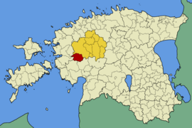
Vigala ( German Fickel ) was a rural community in the Estonian district of Rapla with an area of 269.81 km². It had 1507 inhabitants (January 1, 2011). The municipality was located about 90 km from Tallinn .
structure
In addition to the main town Kivi-Vigala, the rural community also included the villages of Araste, Avaste, Jädivere, Kausi, Kesu, Kojastu, Konnapere, Kurevere, Leibre, Läti küla, Manni, Naravere, Oese, Ojapere, Paljasmaa, Palase, Pallika, Päärdu, Sääla, Tiduvere, Tõnumaa, Vaguja, Vanamõisa, Vana-Vigala and Vängla.
Personalities
- Ants Laikmaa (1866–1942), painter
- Veljo Tormis (1930–2017), composer
- Andres Uibo (* 1956), composer
Attractions
- The German-Baltic manor house of Vana-Vigala (German: Sickenkos , later Alt-Fickel ), which Boris von Uexküll had built in 1775, is worth seeing . It is surrounded by a nine- hectare park that was first mentioned in 1751. This is where the von Uexküll family's cemetery is located .
- In the park at the manor house forms regularly in winter on the River Vigala the Eisrad Vana-Vigala .
- The former Konofer manor was also located in Vigala before the territorial reform.
- Marienkirche
Web links
- Vigala Municipality website (Estonian)

