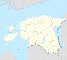
Rapla (city)
| Rapla (city) | ||
|
||
| State : |
|
|
| Circle : |
|
|
| Coordinates : | 58 ° 59 ′ N , 24 ° 48 ′ E | |
| Height : | 67 m | |
| Residents : | 9,704 (2007) | |
| Time zone : | EET (UTC + 2) | |
| Telephone code : | (+372) 048 | |
| License plate : | L. | |
| Mayor : | Jaan Urvet | |
| Postal address : | Viljandi mnt 17 79511 Rapla |
|
| Website : | ||
|
|
||
Rapla ( German Rappel ) is a city in the municipality of the same name Rapla in Estonia . It is the center of Rapla County .
geography
The Vigala River flows through Rapla . The city is about 45 km from Tallinn .
history
Rapla was first mentioned in 1241 as Rapal . The Maria Magdalena Church was built at the end of the 13th century . The place and the church initially belonged to the manor of Alu. 1478 both came under the rule of the Monastery of Padise . It was not until 1705 that Alu and Rapla separated and became independent administrative units.
Rapla experienced its boom in the second half of the 19th century. A pharmacy was opened on site in 1866, a village school in 1868 and a stagecoach station in 1893 . In 1901 a new church was consecrated on the north bank of the river. From 1900 the place benefited from the narrow-gauge railway that ran from Tallinn to Viljandi . A brick and lemonade factory are located near Rapla .
In 1945 Rapla became a large village ( Alevik ). On January 1, 1993, the place received city rights.
Attractions
The Evangelical Lutheran church, completed in 1901, with its pseudo-Romanesque double tower facade is well worth seeing . It is the largest rural church in Estonia.
Town twinning
sons and daughters of the town
- Adam Johann Baron von Krusenstern (1770–1846), German-Baltic admiral of the Russian fleet
- Otto Tief (1889–1976), soldier in the Estonian War of Independence, later a lawyer
- Anton Vaarandi (1901–1979), Estonian literary scholar and journalist
- Arnold Arakas (1908-1946), Estonian football player
- Viktor Piisang (1918–1944), Estonian football player
- Andres Langemets (* 1948), Estonian poet, essayist and literary critic
- Urve Tiidus (* 1954), Estonian politician
- Anne Veski (* 1956), Estonian pop singer
- Ervin Õunapuu (* 1956), Estonian writer
- Urmas Sisask (* 1960), Estonian composer and musician
- Piret Bristol (* 1968), Estonian writer
- Siiri Sisask (* 1968), Estonian singer and politician
- Kristiina Ehin (* 1977), Estonian poet and translator
- Märt Avandi (* 1981), Estonian actor
- Vaiko Eplik (* 1981), Estonian musician, singer, composer and music producer
- Vjatšeslav Zahovaiko (* 1981), Estonian football player
- Pärt Uusberg (* 1986), Estonian composer, choir director and actor
- Mick Pedaja (* 1993), Estonian singer-songwriter in the New Age or Ambient area
Web links
- City website (Estonian, English, Russian)


