
Desert on the Lindenbrink
The desert on the Lindenbrink is a deserted early medieval settlement near Riehe in the district of Schaumburg in Lower Saxony .

Location and description

The settlement was west of Riehe on the Lindenbrink elevation, which is 61 m above sea level. NN stands out a few meters from the flatter surroundings. A stream flows at the foot of the elevation. Nearby, Hellweg in front of Santforde , running in an east-west direction, is assumed.
The name of the settlement has not been handed down historically. According to old stories, there were houses on the hill. Corresponding information can be found in a community file, according to which the first five houses of Riehe were on the Lindenbrink. An indication of an earlier development are plowed stones, which older farmers of the place report.
Investigations
The local home history working group carried out initial investigations in 2012 by inspecting the Lindenbrink fields. In 2016, volunteers from the municipal archeology of the Schaumburg landscape carried out further field inspections and searches with the metal detector . Since the plowing depth was lowered from 21 to 26 cm during the cultivation of the fields from 2016 onwards, which threatened the destruction of lower-lying finds, in 2018 the municipal archeology commissioned geophysical surveys on the area using a magnetometer . This made it possible to identify various findings that were interpreted as pits , pit houses and a well. In addition, due to the dry spring of 2018, the post pits of a roughly 30-meter-long building could be identified on aerial photographs based on vegetation features .

Inspection finds
The finds recovered during inspections include various types of fibulae , such as cross, cross disc, braketeate and disc fibulae . These are small jewelry-like objects with Christian symbols that date from the 7th to 10th centuries. Some of the items found were costly in the Middle Ages, which indicates the presence of nobility at this location. The higher quality pieces include a sword belt fitting and a bronze pendant from the 12th century depicting a griffin decorating a horse harness . Other finds were loom weights and a knife as well as ceramic fragments as blue-gray goods from the Middle Ages .
Individual finds will be shown in 2019 and 2020 in the Lower Saxony State Museum and the Braunschweig State Museum in the Saxones special exhibition . A new history of the old Saxons is shown.
excavation

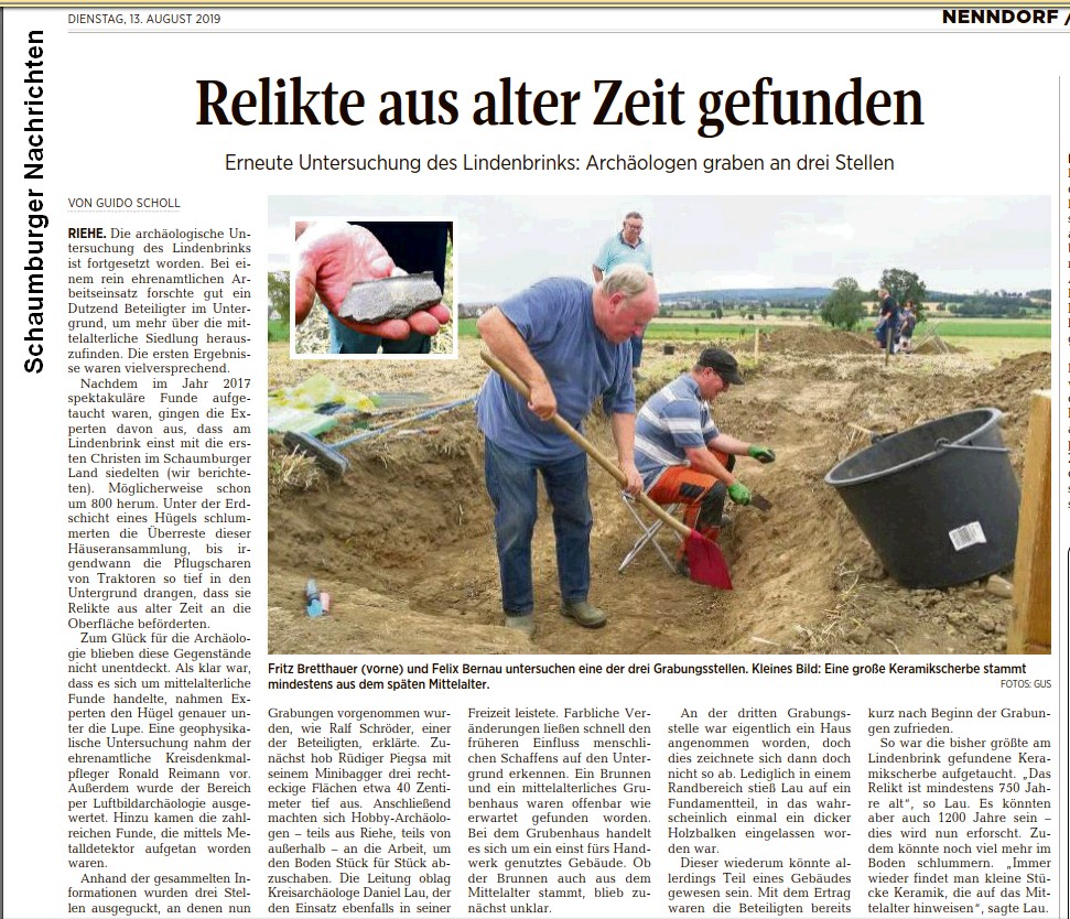
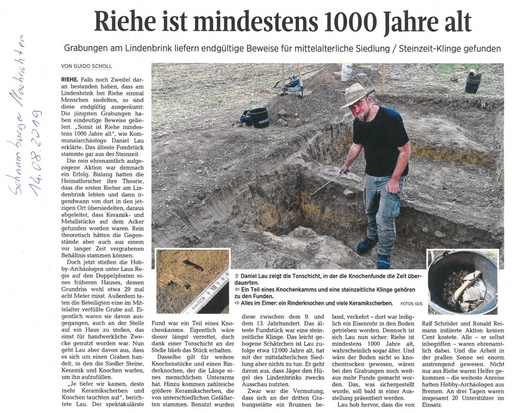
In the summer of 2019, the previous investigation results were checked on small-scale probes at three locations, which were carried out by voluntary helpers under the direction of the local archaeologist Daniel Lau from the Schaumburg landscape. One of the discoveries was a double post pit in a building measuring 29 × 8 meters. There was also a pit in the shape of a ditch that was filled in in the Middle Ages. Inside were ceramic shards from the 9th to 13th centuries and animal bones that have been preserved because of the clayey soil. A special find was a fragment of a comb made of bone. The oldest find was a stone blade from the Paleolithic Age about 12,000 years old , which, however, has no relation to the medieval settlement.
rating

The slightly elevated area of the Lindenbrink with a stream in the immediate vicinity offered itself as a suitable settlement site, as people used to settle on fertile soils and on the flood-proof edges of watercourses. When choosing the place, the proximity to Hellweg may also have played a role. It is assumed that the Lindenbrink was already settled around the year 800 during the Christianization period. The assumption is based on the early medieval cross disc fibulae found and other finds with Christian symbolism. They can be assigned to the time of Charlemagne , when the Franks brought the Saxons in northern Germany to Christianity . With the exception of Stadthagen , there have not yet been any comparable finds in the northern area of the Schaumburg district} . The settlement had until 12./13. Century and then fell desolate.
literature
- Ronald Reimann: All good things come in threes in: FAN-POST 2019 of the Friends of Archeology in Lower Saxony , pp. 37–39 ( online , pdf)
- Ronald Reimann: All good things come in threes. Probe at an early medieval site in: FAN-POST 2020 of the Circle of Friends for Archeology in Lower Saxony, pp. 42–43 ( online )
Web links
Individual evidence
- ↑ Open the cover of the story in the Schaumburger Wochenblatt of February 28, 2018 as a web link; Open the cover of the story as a pdf
- ↑ Andrea Göttling: Magnetic field brings light into the dark in Schaumburger Nachrichten of February 26, 2018
- ↑ Shards cause amazement in the Schaumburger Wochenblatt of August 9, 2017
- ↑ Lindenbrink finds are shown in the Landesmuseum in Schaumburger Nachrichten of April 16, 2019
- ↑ From the field to the exhibition in NANU from April 2019
- ↑ Exciting excavation: This is what researchers at Lindenbrink found in Schaumburger Nachrichten on August 12, 2019 (payment barrier)
- ↑ Guido Scholl: Relics from ancient times found in Schaumburger Nachrichten of August 13, 2019 (paper edition)
- ↑ Rieher excavation: Relics from the Middle Ages and Stone Ages found in Schaumburger Nachrichten of August 13, 2019 (payment barrier)
- ↑ Guido Scholl: Riehe is at least 1000 years old in Schaumburger Nachrichten of August 14, 2019 (paper edition)
- ^ Mute witnesses of the first Christians in Schaumburger Nachrichten of July 31, 2017
- ↑ In the footsteps of the first Christians in Schaumburg in the Schaumburger Wochenblatt of August 2, 2018
- ↑ Archaeological finds make the rounds in the Schaumburger Wochenblatt of February 2, 2018
Coordinates: 52 ° 21 '2.5 " N , 9 ° 23' 44.5" E