
True sight on the Middle Rhine


The " Wahrschau" on the Middle Rhine is a measure for the information and control of shipping traffic in the Middle Rhine Valley with the help of signal systems. It affects an almost 7 km long section of the Rhine , which is very narrow and has strong currents, tight curves and some shallows , which is why the visual and radio contact between the ships is severely impaired and not sufficient to avoid dangerous situations.
In maritime and inland waterway transport, looking to the point means "paying attention" or "caution".
As early as the middle of the 19th century, the captains of the Rhine ships were warned of dangers by special observation stations. In 1972 traffic light systems were converted, which were initially operated from the Bankeck, Betteck and Ochsenturm signal points . The signaling points have been centrally controlled since 1993, but monitoring at the three stations was initially still necessary until the radar monitoring system went into operation in 1997 and the Oberwesel district control center , an operating point of the Bingen water and shipping office , also took over the entire monitoring.
Route Oberwesel - Sankt Goar

Since 1972, ship traffic on the route between Oberwesel and Sankt Goar has been regulated with traffic lights in accordance with Section 12.02 of the Rhine Shipping Police Ordinance (RheinSchPV). Before that, the skippers were "seen" with flag signals.
Originally, a five-kilometer stretch between Oberwesel and Sankt Goar was divided into four sections. Since the amendment to the RheinSchPV of November 29, 2012, there are now seven newly structured sections with effect from December 1, 2013 on approximately seven kilometers:
- km 548.50 - km 549.50,
- km 549.50 - km 550.57,
- km 550.57 - km 551.30, Ochsenturm Oberwesel to below Tauberwerth
- km 551.30 - km 552.40, Tauberwerth to above Geisenrück (rocks in the middle of the river and fairway division)
- 552.40 km - 553.60 km, Geisenrück to Betteck
- km 553.61 - km 554.34, Betteck to Loreley
- km 554.34 - km 555.43, Loreley to Bankeck
Ships entering the True Sight Line must report to the Revierzentrale via radio. Depending on the size of the ship, this then provides the signals for the areas through which the ships pass. The ascent is reported below the bank counter and the descent above the Ochsenturm. Mountaineers may have to wait for the descent before driving around the bank and bed corner. The descent is only allowed for vehicles with radar in this section and before from Bingen (km 530) at night.
Signal points
The signal points are all on the left (i.e. western) bank, are controlled by the district control center in Oberwesel and monitored by four land radar stations . The headquarters can be reached via VHF channel 18 and is staffed around the clock. The radar stations are located in Oberwesel, across from the Kammereck, across from the Loreley and at signal station E at the bank .
| Signal point | Location | River km | Visible for | shows |
|---|---|---|---|---|
| A. | At the ox tower | 550.57 | Downhill | white light: descent free 2 red lights: descent blocked |
| Ascent | Descent above on two signal fields | |||
| B. | At the Kammereck | 552.80 | Downhill | white light: a formation of over 110 meters in length passes the Betteck zu Berg 2 red lights: downhill travel blocked |
| C. | At the Betteck | 553.61 | Ascent | Descent in sections 3 to 5 on three signal fields |
| D. | Opposite the Loreley (Lützelsteine) | 554.34 | Ascent | Descent in sections 4 to 6 on three signal fields 2 red lights: ascent blocked |
| E. | Bank check | 555.43 | Ascent | Descent in sections 6 and 7 on two signal fields 2 red lights: ascent blocked |
The signal fields indicate the oncoming valley traffic in the respective sections with one to three illuminated bars:

|

|

|

|
| No descent | At least 1 single driver up to 110 m in length | At least 1 single driver over 110 m in length or 1 formation up to 110 m in length | At least 1 bandage over 110 m in length |
Examples
| Signal point E At the bank near St. Goar for the ascent with the pilot museum. The following is displayed: At least one single skier coming down to the valley up to 110 m in section 7 and at least one downhill skier over 110 m or a group up to 110 m in section 6. |
|
| Signal point C Am Betteck for the ascent. The following is displayed: at least one descent up to 110 m in section 5 (meaning the ship on the left in the picture), no descent in sections 4 and 3. |


Probation 1910
In the Rhine Shipping Police Ordinance of 1910 , the sight on the route from Bingen to Sankt Goar is regulated. True viewers were set up in the following places:
- at the Binger Loch on the Mäuseturm , see Wahrschau in the Mäuseturm
- opposite the mouse tower on the customs wall, to register the rafts going from Rüdesheim to the valley
- at the Wirbelley
- below the ox tower
- at the Kammereck
- at the Betteck
- opposite the Loreley
- at the bank check
The ships going uphill were made aware of the descent by raising flags or baskets. A ship going down into the valley was announced with a red flag, a tow with a white flag, and a raft with a white and a red flag.
The true viewers for the second fairway at Binger Loch and for the left-hand fairway above the Kammereck showed baskets of the same color instead of the flags.
If a small red flag was shown next to the usual flag at the Betteck or at the Bankeck, this meant that the announced valley driver was in sight of the probationary post.
- Another true viewing station was in Pfaffendorf in front of the Koblenz ship bridge , which was in operation with interruptions until 1947. When the ship bridge in Koblenz was open, it gave the ships passage with a flag.
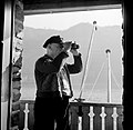
Wahrschauer am Bankeck, April 1, 1955

Mäuseturm 1910 with flagpoles for the truth

Verbelley station near Lorchhausen 1969

The true viewing station in Koblenz-Pfaffendorf


See also
literature
- Günther J. Janowitz: Why is it so beautiful on the Rhine, a book for connoisseurs and lovers - technology, romance, nature, history, art, shipping in two millennia - new maps of the Rhine from Mainz to Cologne . Sera-Print publishing house, Einhausen 2000, ISBN 3-926707-09-7 .
- Karl-Heinz Lautensack: Rheinschif (f) sails yesterday and today . Self-published, 2003, ISBN 3-00-012331-8 .
- Wasser- und Schifffahrtsdirektion Südwest: Compendium of the Wasser- und Schifffahrtsdirektion Südwest . Organizational and technical data, inland navigation, tasks, waterways. Self-published, Mainz June 2007.
Web links
- Rhine Shipping Police Ordinance (RheinSchPV) (PDF file; 196 kB)
- Traffic safety systems for inland navigation (PDF file; 1.19 MB)
- The light - true vision in the mountain range of the Rhine with signal game
Individual evidence
- ↑ Publication for the new Lichtwahrschau Oberwesel - St. Goar Rhein-km 548.50 - 555.43 on ELWIS.de ( Memento of the original from March 4, 2016 in the Internet Archive ) Info: The archive link was inserted automatically and has not yet been checked. Please check the original and archive link according to the instructions and then remove this notice. , PDF file