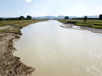
Waipaoa River
| Waipaoa River | ||
|
Waipaoa River with a view of the Raukumara Range |
||
| Data | ||
| location | Gisborne Region, North Island, New Zealand | |
| source | Raukumara Range | |
| muzzle |
Pacific Ocean Coordinates: 32 ° 42 ′ 48 " S , 177 ° 56 ′ 31" E 32 ° 42 ′ 48 " S , 177 ° 56 ′ 31" E
|
|
| Left tributaries | Waingaromia River | |
| Communities | Whatatutu , Puha , Te Karaka , Kaitaratahi , Ormond , Patutahi . | |
The Waipaoa River is a river in the Gisborne region in the northeast of New Zealand's North Island . It rises on the east side of raukumara range , flows 80 kilometers to the south and flows south of Gisborne in the Pacific belonging Poverty Bay . The New Zealand State Highway 2 follows the river over its lower half.
Major tributaries are Wharekopai , Waikohu , Mangatu , Waingaromia, and Waihora River . Whatatutu , Puha , Te Karaka , Kaitaratahi , Ormond and Patutahi are located on the river .
swell
- "New Zealand Travel Atlas", Wise Maps Auckland. ISBN 0-908794-47-9 .
