Walkertshofen (Erdweg)
Coordinates: 48 ° 19 ' N , 11 ° 18' E
Walkertshofen is a part of the municipality Erdweg in the district of Dachau ( Bavaria ). The village has about 340 inhabitants.
geography
Walkertshofen is located about one kilometer southwest of Erdweg on the Steindlbach, which flows into the Glonn in Erdweg .
history
Walkertshofen is one of the oldest places in the Dachau district and was first mentioned in 784. In 1550, healing springs were discovered in Walkertshofen, after which there was a large spa operation until around 1554.
Attractions
- Catholic parish church of St. Mary of the Assumption: in the core late Gothic, baroque and in the 18th and 19th centuries Century extended;
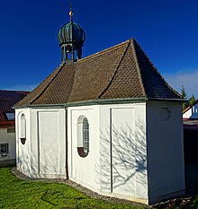
- Catholic Gnaden- und Brünndl Chapel Maria Hilf: central building (octagon), built around 1630/40;
literature
- Joseph Scheidl: The former Wildbad in Walkertshofen . In: Amperland , Volume 2, 1966, pp. 15-17.
Individual evidence
- ↑ Wilhelm Störmer: singing Bach, Ried, Walkertshofen and Pleitmannswang in 784 | News on the history of the Huosier . In: Amperland . Volume 20, 1984, p. 663–665 ( digital copy [PDF]).
- ↑ Parish Church of the Assumption in Walkertshofen - (Hans Schertl)
- ^ Klausenkapelle in Walkertshofen - (Hans Schertl)
Web links
Commons : Walkertshofen - collection of pictures, videos and audio files
- Walkertshofen in the location database of the Bayerische Landesbibliothek Online . Bavarian State Library
- Erdweg community


