Warrenton (Georgia)
| Warrenton | ||
|---|---|---|
|
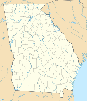
Location in Georgia
|
||
| Basic data | ||
| State : | United States | |
| State : | Georgia | |
| County : | Warren County | |
| Coordinates : | 33 ° 24 ′ N , 82 ° 40 ′ W | |
| Time zone : | Eastern ( UTC − 5 / −4 ) | |
| Residents : | 2.013 (as of: 2000) | |
| Population density : | 410.8 inhabitants per km 2 | |
| Area : | 4.9 km 2 (approx. 2 mi 2 ) of which 4.9 km 2 (approx. 2 mi 2 ) are land |
|
| Height : | 158 m | |
| Postal code : | 30828 | |
| Area code : | +1 706 | |
| FIPS : | 13-80592 | |
| GNIS ID : | 0333368 | |
| Website : | warrenton.georgia.gov | |
Warrenton is a city with 2013 residents (2000) in the US state of Georgia . It is located in Warren County and is its administrative seat.
geography
Warrenton is northwest in Warren County. The neighboring towns are Norwood , Norris and Thomson . The next larger city, Augusta , is about 71 kilometers to the east, the capital of Georgia, Atlanta , about 196 kilometers to the west. The urban area extends over an area of 4.9 km².
population
In the year 2000, 2013 people lived in the city, of which 49.1% men and 50.9% women. Compared to the 1990 census , the population has decreased by 8.3%. The median age of the citizens of Warrenton is 35.3 years. 69.4% of the population are African American and 29.4% are white. In 1999, the average annual per capita income was $ 12,778, well below the US average ($ 21,587). About 36% of the total population and 30.7% of families live below the poverty line. This means that the proportion of the poor is significantly higher than the national average.
schools
Warrenton has a public high school , Warren County High School, and a private high school, Briarwood Academy.
history
The city was named after Joseph Warren , the first American officer to die in the American Revolutionary War .
