
Water of Buchat
| Water of Buchat | ||
 Middle reaches of the Water of Buchat |
||
| Data | ||
| location | Aberdeenshire , Scotland | |
| River system | Don | |
| Drain over | Don → North Sea | |
| River basin district | Scotland RBD | |
| source | Confluence of two streams in the Cairngorms 57 ° 15 ′ 17 ″ N , 3 ° 6 ′ 35 ″ W |
|
| muzzle | at Bridge of Buchat in the Don Coordinates: 57 ° 13 '15 " N , 2 ° 59' 31" W 57 ° 13 '15 " N , 2 ° 59' 31" W.
|
|
| length | 16 km | |
The Water of Buchat is a river in Scotland . It is created by the confluence of two source streams on the slopes of the Ladder Hills on the northeastern edge of the Cairngorm Mountains in the Aberdeenshire region . It initially runs one kilometer in an easterly direction before turning south-east. The Water of Buchat follows the Glen Buchat valley and , after a distance of 16 km, flows into the Don , which finally drains into the North Sea in Aberdeen . The river takes on numerous streams on its course, but has no noteworthy tributaries. There are no towns or villages along the course of the river. Only individual farmsteads are passed.
Glenbuchat Castle was built near the estuary around 1590 . The fortress was owned by the Gordon Clan , who used it until 1738. It has been in a ruinous state since 1840. Today it is classified as a Scheduled Monument and is administered by Historic Scotland . At the confluence, the A97 crosses the Water of Buchat.

Ford through the river
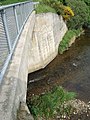
Estuary from the bridge of the A97


Individual evidence
- ↑ a b Entry in the Gazetteer for Scotland
- ↑ Scheduled Monument - Entry . In: Historic Scotland .
- ^ Entry in the Gazetteer for Scotland