Turn (leash)
| Turn | ||
|
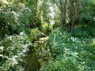
The “longer” arm of the turn just before its mouth at Angerstein |
||
| Data | ||
| location | Southern Lower Saxony | |
| River system | Weser | |
| Drain over | Leine → Aller → Weser → North Sea | |
| source | Weendespring in Weende (Göttingen) 51 ° 34 ′ 3 ″ N , 9 ° 56 ′ 26 ″ E |
|
| muzzle | near Nörten-Hardenberg - Angerstein in the Leine Coordinates: 51 ° 37 '20 " N , 9 ° 55' 34" E 51 ° 37 '20 " N , 9 ° 55' 34" E
|
|
| length | 3.9 km shorter arm 9.2 km longer arm |
|
The turn is a small tributary of the Leine in southern Lower Saxony . Its source, the Weendespring, is located in the Weende district of Göttingen and is a karst spring that also supplies parts of Göttingen with drinking water. The turn is a stream with a considerable water flow from the start.
course
It winds first through the Weender Altdorf, where it is partially divided into two arms, before it flows through the former monastery grounds and finally leaves the village of Weende northwards. After it has crossed under Bundesstraße 3 , it divides again: one arm flows westwards directly into the Leine, while another flows a few kilometers, strictly straightened and mostly without wood on the banks, northwards through the agricultural landscape in the Leinegraben . The turnaround passes Bovenden and finally flows into the Leine near Nörten-Hardenberg-Angerstein .
Web links
Remarks
- ↑ Own measurement with Top50Viewer
