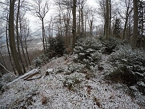
Weghausköchel
| Weghausköchel | ||
|---|---|---|
|
Weghausköchel highest point |
||
| height | 684 m above sea level NN | |
| location | Bavaria , Germany | |
| Mountains | Bavarian Prealps | |
| Dominance | 1.1 km → Steinköchel | |
| Notch height | 57 m | |
| Coordinates | 47 ° 37 '33 " N , 11 ° 9' 47" E | |
|
|
||
The Weghausköchel is a 684 m high wooded rocky knoll in the Bavarian Prealps within the Murnauer Moos nature reserve in Bavaria . Together with Steinköchel , Wiesmahdköchel , Schmatzerlköchel and Langer Köchel , the Köchel rise like islands out of the Murnauer Moos.
Web links
Weghausköchel on openstreetmap.org

