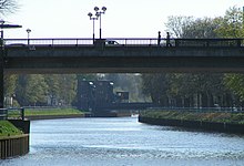
West German sewer network
The West German canal network in the narrower sense consists of 447 kilometers of canals navigable by freight ships in the Ruhr area and in the north to Papenburg and Oldenburg. As a federal waterway, the canals are administered by the Federal Waterways and Shipping Administration; Responsible is the Waterways and Shipping Directorate West in Münster and for the first 8 km of the coastal canal the Waterways and Shipping Directorate Northwest in Aurich.
The West German canals connect the rivers Rhine , Ems , Weser and Elbe , which run from south to north, and thus create a coherent network of waterways for freight shipping. They establish the connection between the German North Sea ports, their hinterland and the Rhine river area and give the central and eastern Ruhr area access to the North Sea ports, to the Rhine estuary ports and to southern Germany.
In addition to the canals of the West German canal network in the narrower sense listed below, the Mittelland Canal (325.32 km) and the Elbe Lateral Canal (115.14 km) as a connection to and from Hamburg also belong to the network .
The West German sewer network in the narrower sense includes the
- Rhine-Herne Canal (RHK) with a connecting canal to the Ruhr with 45.69 km
- Wesel-Datteln Canal (WDK) with 59.99 km
- Datteln-Hamm Canal (DHK) with 47.09 km
- Dortmund-Ems Canal (DEK) with 223.45 km
- Coastal Canal (KüK) with Dörpen branch canal with 70.45 km
- Elisabethfehn Canal (EFK) with 14.79 km (only for pleasure craft)
The economic focus of this sewer network is in the industrial area between the Ruhr and Lippe. Between 15% and 20% of the freight traffic on German waterways is regularly moved on the canals.
| 1999 | 2000 | 2001 | 2002 | 2003 | 2004 | 2005 | 2006 | 2007 | 2008 | 2009 | |
|---|---|---|---|---|---|---|---|---|---|---|---|
| Germany as a whole | 229 | 242 | 236 | 232 | 220 | 236 | 237 | 243 | 249 | 246 | 204 |
| including West German sewer network in the narrow sense |
41 | 43 | 39 | 38 | 39 | 41 | 41 | 41 | 44 | 42 | 43 |
| for comparison: Lower Rhine | 149 | 162 | 162 | 161 | 152 | 165 | 164 | 172 | 175 | 174 | 152 |
The inland navigation is almost continuously for large barges with 110 meters long, 11.40 meters wide and 2.80 meters draft and pushed convoys possible of 185 meters length. Only in the Datteln-Hamm Canal is there a narrower section on which no two-way traffic is possible.
Significant structures are the Dattelner Meer as the intersection of DEK, DHK and WDK and the water transfer from the Lippe in Hamm to feed the Herne - Münster apex of the sewer network. Historic buildings are the Henrichenburg ship lift from 1899 and various canal bridges over streets or rivers. For tourism, some of the canals are opened up by museums, marinas as well as hiking and cycling trails.
literature
- Writings of the Association for European Inland Shipping and Waterways e. V. , various years. WESKA (Western European Shipping and Harbor Calendar), Binnenschiffahrts-Verlag, Duisburg-Ruhrort
- M. Eckoldt (Hrsg.): Rivers and canals, The history of the German waterways . DSV-Verlag, 1998
Web links
- Sewer network. (West German Canals) Waterways and Shipping Directorate West
- Feeding the West German sewer network (PDF; 1.1 MB) Waterways and Shipping Directorate West
Individual evidence
- ↑ a b c Lengths (in km) of the main shipping routes (main routes and certain secondary routes) of the federal inland waterways ( memento of the original from January 21, 2016 in the Internet Archive ) Info: The archive link was automatically inserted and not yet checked. Please check the original and archive link according to the instructions and then remove this notice. , Federal Waterways and Shipping Administration
- ↑ Directory E, Ser. No. 47, 63, 5, 7, 25 of the Chronicle ( Memento of the original from July 22, 2016 in the Internet Archive ) Info: The archive link was inserted automatically and has not yet been checked. Please check the original and archive link according to the instructions and then remove this notice. , Federal Waterways and Shipping Administration
- ↑ Directory F of the Chronicle ( Memento of the original from July 22, 2016 in the Internet Archive ) Info: The archive link was automatically inserted and not yet checked. Please check the original and archive link according to the instructions and then remove this notice. , Federal Waterways and Shipping Administration
- ↑ Traffic report of the Waterways and Shipping Directorate West from the beginning of 2010 (PDF; 4.4 MB)


