
Wesel-Datteln Canal
| Wesel-Datteln Canal | |||||||||||||||||||||||||||||||||||||||||||||||||||||||||||||||||||||||||||||||||||||||||||||||||||||||||||||||||||||||||||||||||||||||||||||||||||||||||||||||||||||||||||||||||||||||||||||||||||||||||||||||||||||||||||||||||||||||||||||||||||||||||||||||||||||||||||||||||||||||||||||||||||||||||||||||||||||||||||||||||||||||||||||||||||||||||||||||||||||||||||||||||||||||||||||||||||||||||||||||||||||||||||||||||||||||||||||||||||||||||||||||||||||||||
|---|---|---|---|---|---|---|---|---|---|---|---|---|---|---|---|---|---|---|---|---|---|---|---|---|---|---|---|---|---|---|---|---|---|---|---|---|---|---|---|---|---|---|---|---|---|---|---|---|---|---|---|---|---|---|---|---|---|---|---|---|---|---|---|---|---|---|---|---|---|---|---|---|---|---|---|---|---|---|---|---|---|---|---|---|---|---|---|---|---|---|---|---|---|---|---|---|---|---|---|---|---|---|---|---|---|---|---|---|---|---|---|---|---|---|---|---|---|---|---|---|---|---|---|---|---|---|---|---|---|---|---|---|---|---|---|---|---|---|---|---|---|---|---|---|---|---|---|---|---|---|---|---|---|---|---|---|---|---|---|---|---|---|---|---|---|---|---|---|---|---|---|---|---|---|---|---|---|---|---|---|---|---|---|---|---|---|---|---|---|---|---|---|---|---|---|---|---|---|---|---|---|---|---|---|---|---|---|---|---|---|---|---|---|---|---|---|---|---|---|---|---|---|---|---|---|---|---|---|---|---|---|---|---|---|---|---|---|---|---|---|---|---|---|---|---|---|---|---|---|---|---|---|---|---|---|---|---|---|---|---|---|---|---|---|---|---|---|---|---|---|---|---|---|---|---|---|---|---|---|---|---|---|---|---|---|---|---|---|---|---|---|---|---|---|---|---|---|---|---|---|---|---|---|---|---|---|---|---|---|---|---|---|---|---|---|---|---|---|---|---|---|---|---|---|---|---|---|---|---|---|---|---|---|---|---|---|---|---|---|---|---|---|---|---|---|---|---|---|---|---|---|---|---|---|---|---|---|---|---|---|---|---|---|---|---|---|---|---|---|---|---|---|---|---|---|---|---|---|---|---|---|---|---|---|---|---|---|---|---|---|---|---|---|---|---|---|---|---|---|---|---|---|---|---|---|---|---|---|---|---|---|---|---|---|---|---|---|---|---|---|---|---|---|---|---|---|---|---|---|---|---|---|---|---|---|---|---|---|---|---|---|---|---|---|---|---|---|---|---|---|---|---|---|---|---|---|---|
 Wesel-Datteln Canal near Schermbeck |
|||||||||||||||||||||||||||||||||||||||||||||||||||||||||||||||||||||||||||||||||||||||||||||||||||||||||||||||||||||||||||||||||||||||||||||||||||||||||||||||||||||||||||||||||||||||||||||||||||||||||||||||||||||||||||||||||||||||||||||||||||||||||||||||||||||||||||||||||||||||||||||||||||||||||||||||||||||||||||||||||||||||||||||||||||||||||||||||||||||||||||||||||||||||||||||||||||||||||||||||||||||||||||||||||||||||||||||||||||||||||||||||||||||||||
| Water code | DE : 75101 | ||||||||||||||||||||||||||||||||||||||||||||||||||||||||||||||||||||||||||||||||||||||||||||||||||||||||||||||||||||||||||||||||||||||||||||||||||||||||||||||||||||||||||||||||||||||||||||||||||||||||||||||||||||||||||||||||||||||||||||||||||||||||||||||||||||||||||||||||||||||||||||||||||||||||||||||||||||||||||||||||||||||||||||||||||||||||||||||||||||||||||||||||||||||||||||||||||||||||||||||||||||||||||||||||||||||||||||||||||||||||||||||||||||||||
| abbreviation | WDK | ||||||||||||||||||||||||||||||||||||||||||||||||||||||||||||||||||||||||||||||||||||||||||||||||||||||||||||||||||||||||||||||||||||||||||||||||||||||||||||||||||||||||||||||||||||||||||||||||||||||||||||||||||||||||||||||||||||||||||||||||||||||||||||||||||||||||||||||||||||||||||||||||||||||||||||||||||||||||||||||||||||||||||||||||||||||||||||||||||||||||||||||||||||||||||||||||||||||||||||||||||||||||||||||||||||||||||||||||||||||||||||||||||||||||
| location | Germany : North Rhine-Westphalia | ||||||||||||||||||||||||||||||||||||||||||||||||||||||||||||||||||||||||||||||||||||||||||||||||||||||||||||||||||||||||||||||||||||||||||||||||||||||||||||||||||||||||||||||||||||||||||||||||||||||||||||||||||||||||||||||||||||||||||||||||||||||||||||||||||||||||||||||||||||||||||||||||||||||||||||||||||||||||||||||||||||||||||||||||||||||||||||||||||||||||||||||||||||||||||||||||||||||||||||||||||||||||||||||||||||||||||||||||||||||||||||||||||||||||
| length | 60 km | ||||||||||||||||||||||||||||||||||||||||||||||||||||||||||||||||||||||||||||||||||||||||||||||||||||||||||||||||||||||||||||||||||||||||||||||||||||||||||||||||||||||||||||||||||||||||||||||||||||||||||||||||||||||||||||||||||||||||||||||||||||||||||||||||||||||||||||||||||||||||||||||||||||||||||||||||||||||||||||||||||||||||||||||||||||||||||||||||||||||||||||||||||||||||||||||||||||||||||||||||||||||||||||||||||||||||||||||||||||||||||||||||||||||||
| Built | 1915-1930 | ||||||||||||||||||||||||||||||||||||||||||||||||||||||||||||||||||||||||||||||||||||||||||||||||||||||||||||||||||||||||||||||||||||||||||||||||||||||||||||||||||||||||||||||||||||||||||||||||||||||||||||||||||||||||||||||||||||||||||||||||||||||||||||||||||||||||||||||||||||||||||||||||||||||||||||||||||||||||||||||||||||||||||||||||||||||||||||||||||||||||||||||||||||||||||||||||||||||||||||||||||||||||||||||||||||||||||||||||||||||||||||||||||||||||
| Expanded | 1966-1990 | ||||||||||||||||||||||||||||||||||||||||||||||||||||||||||||||||||||||||||||||||||||||||||||||||||||||||||||||||||||||||||||||||||||||||||||||||||||||||||||||||||||||||||||||||||||||||||||||||||||||||||||||||||||||||||||||||||||||||||||||||||||||||||||||||||||||||||||||||||||||||||||||||||||||||||||||||||||||||||||||||||||||||||||||||||||||||||||||||||||||||||||||||||||||||||||||||||||||||||||||||||||||||||||||||||||||||||||||||||||||||||||||||||||||||
| class | Vb | ||||||||||||||||||||||||||||||||||||||||||||||||||||||||||||||||||||||||||||||||||||||||||||||||||||||||||||||||||||||||||||||||||||||||||||||||||||||||||||||||||||||||||||||||||||||||||||||||||||||||||||||||||||||||||||||||||||||||||||||||||||||||||||||||||||||||||||||||||||||||||||||||||||||||||||||||||||||||||||||||||||||||||||||||||||||||||||||||||||||||||||||||||||||||||||||||||||||||||||||||||||||||||||||||||||||||||||||||||||||||||||||||||||||||
| Beginning | Branch from the Rhine at RH km 813.24 | ||||||||||||||||||||||||||||||||||||||||||||||||||||||||||||||||||||||||||||||||||||||||||||||||||||||||||||||||||||||||||||||||||||||||||||||||||||||||||||||||||||||||||||||||||||||||||||||||||||||||||||||||||||||||||||||||||||||||||||||||||||||||||||||||||||||||||||||||||||||||||||||||||||||||||||||||||||||||||||||||||||||||||||||||||||||||||||||||||||||||||||||||||||||||||||||||||||||||||||||||||||||||||||||||||||||||||||||||||||||||||||||||||||||||
| The End | It flows into the Dortmund-Ems Canal near Datteln | ||||||||||||||||||||||||||||||||||||||||||||||||||||||||||||||||||||||||||||||||||||||||||||||||||||||||||||||||||||||||||||||||||||||||||||||||||||||||||||||||||||||||||||||||||||||||||||||||||||||||||||||||||||||||||||||||||||||||||||||||||||||||||||||||||||||||||||||||||||||||||||||||||||||||||||||||||||||||||||||||||||||||||||||||||||||||||||||||||||||||||||||||||||||||||||||||||||||||||||||||||||||||||||||||||||||||||||||||||||||||||||||||||||||||
| Descent structures | Friedrichsfeld , Hünxe , Dorsten , Flaesheim , Ahsen , Datteln | ||||||||||||||||||||||||||||||||||||||||||||||||||||||||||||||||||||||||||||||||||||||||||||||||||||||||||||||||||||||||||||||||||||||||||||||||||||||||||||||||||||||||||||||||||||||||||||||||||||||||||||||||||||||||||||||||||||||||||||||||||||||||||||||||||||||||||||||||||||||||||||||||||||||||||||||||||||||||||||||||||||||||||||||||||||||||||||||||||||||||||||||||||||||||||||||||||||||||||||||||||||||||||||||||||||||||||||||||||||||||||||||||||||||||
| Ports | Rhein-Lippe-Hafen , Emmelsum, Marina Munderloh, WDK works harbor, Hanse Marina Dorsten, Fürst-Leopold sports boat harbor, Dorsten, Marl-Brassert, Marl Chemical Park, Auguste Victoria, Marina Flaesheim , WSA construction harbor | ||||||||||||||||||||||||||||||||||||||||||||||||||||||||||||||||||||||||||||||||||||||||||||||||||||||||||||||||||||||||||||||||||||||||||||||||||||||||||||||||||||||||||||||||||||||||||||||||||||||||||||||||||||||||||||||||||||||||||||||||||||||||||||||||||||||||||||||||||||||||||||||||||||||||||||||||||||||||||||||||||||||||||||||||||||||||||||||||||||||||||||||||||||||||||||||||||||||||||||||||||||||||||||||||||||||||||||||||||||||||||||||||||||||||
| Kilometrage | Ascending eastwards from km 0.25 to km 60.24 | ||||||||||||||||||||||||||||||||||||||||||||||||||||||||||||||||||||||||||||||||||||||||||||||||||||||||||||||||||||||||||||||||||||||||||||||||||||||||||||||||||||||||||||||||||||||||||||||||||||||||||||||||||||||||||||||||||||||||||||||||||||||||||||||||||||||||||||||||||||||||||||||||||||||||||||||||||||||||||||||||||||||||||||||||||||||||||||||||||||||||||||||||||||||||||||||||||||||||||||||||||||||||||||||||||||||||||||||||||||||||||||||||||||||||
| Downhill | To the west | ||||||||||||||||||||||||||||||||||||||||||||||||||||||||||||||||||||||||||||||||||||||||||||||||||||||||||||||||||||||||||||||||||||||||||||||||||||||||||||||||||||||||||||||||||||||||||||||||||||||||||||||||||||||||||||||||||||||||||||||||||||||||||||||||||||||||||||||||||||||||||||||||||||||||||||||||||||||||||||||||||||||||||||||||||||||||||||||||||||||||||||||||||||||||||||||||||||||||||||||||||||||||||||||||||||||||||||||||||||||||||||||||||||||||
| Responsible WSD | Waterways and Shipping Office Duisburg-Meiderich | ||||||||||||||||||||||||||||||||||||||||||||||||||||||||||||||||||||||||||||||||||||||||||||||||||||||||||||||||||||||||||||||||||||||||||||||||||||||||||||||||||||||||||||||||||||||||||||||||||||||||||||||||||||||||||||||||||||||||||||||||||||||||||||||||||||||||||||||||||||||||||||||||||||||||||||||||||||||||||||||||||||||||||||||||||||||||||||||||||||||||||||||||||||||||||||||||||||||||||||||||||||||||||||||||||||||||||||||||||||||||||||||||||||||||
| The Wesel-Datteln Canal is an artificially created canal and is between 4.5 and 6 m deep | |||||||||||||||||||||||||||||||||||||||||||||||||||||||||||||||||||||||||||||||||||||||||||||||||||||||||||||||||||||||||||||||||||||||||||||||||||||||||||||||||||||||||||||||||||||||||||||||||||||||||||||||||||||||||||||||||||||||||||||||||||||||||||||||||||||||||||||||||||||||||||||||||||||||||||||||||||||||||||||||||||||||||||||||||||||||||||||||||||||||||||||||||||||||||||||||||||||||||||||||||||||||||||||||||||||||||||||||||||||||||||||||||||||||||
|
course
|
|||||||||||||||||||||||||||||||||||||||||||||||||||||||||||||||||||||||||||||||||||||||||||||||||||||||||||||||||||||||||||||||||||||||||||||||||||||||||||||||||||||||||||||||||||||||||||||||||||||||||||||||||||||||||||||||||||||||||||||||||||||||||||||||||||||||||||||||||||||||||||||||||||||||||||||||||||||||||||||||||||||||||||||||||||||||||||||||||||||||||||||||||||||||||||||||||||||||||||||||||||||||||||||||||||||||||||||||||||||||||||||||||||||||||
The Wesel-Datteln-Canal (WDK, water code number: 75101) is a federal waterway in the state of North Rhine-Westphalia and, after the Rhine, the busiest waterway in Germany. The shipping canal runs through the northern Ruhr area and connects the Rhine River near Wesel with the Dortmund-Ems Canal at the Datteln waterway intersection . The 60 km long canal runs parallel to the south of the Lippe in the immediate vicinity.
course

Because of its course along the Lippe, the Wesel-Datteln Canal and its eastern extension, which is now known as the Datteln-Hamm Canal , were called the Lippe Lateral Canal during the planning and construction phase (but also today unofficially) . The canal entry locks on the Rhine are the Friedrichsfeld locks between Voerde and Wesel. The ships drive up the canal to Berg to the Datteln waterway intersection. With a total of six canal steps, each initially with a lock , a height difference of a maximum of 44 meters is overcome, depending on the Rhine water level. Alongside the Rhine-Herne Canal, it is the gateway to the only German west-east waterway connection via the Dortmund-Ems Canal and the Mittelland Canal to the Oder .
The canal is crossed by 4 railway bridges, 49 road and path bridges, 7 pedestrian bridges and 9 pipe / cable bridges as well as by 29 culverts and culverts or by 59 pipe and cable culverts .
Economical meaning
The Wesel-Datteln Canal connects the northern Ruhr area across the Rhine with the seaports of Rotterdam , Antwerp , Amsterdam and Zeebrugge . The large industry based on the canal has oriented almost all of its supply and disposal logistics to this shipping canal. For example, the Marl Chemical Park has created its own port facilities.
In 2003 17.5 million tons of goods were transported on the Wesel-Datteln Canal at around 23,400 locks. The throughput at the canal in 2004 was around 6.1 million tons. The largest envelope along the Wesel Datteln channel have the Marler ports on the Marl Chemical Park and the Auguste Victoria mine / Blumenthal with about 4 million tons of throughput per year.
The canal is a class Vb inland waterway and can therefore be used by large motor freight ships and corresponding associations.
administration
The canal is administered by the Duisburg-Meiderich Waterways and Shipping Authority. The outskirts of Friedrichsfeld (WDK km 0.000 - 26,000), Dorsten (WDK km 26,000 - 55,000) and Datteln (WDK km 55,000 - 60.225) are responsible for on-site entertainment. The Datteln water police station and its guard service group in Dorsten, Dortmund and Hamm are responsible for the police. The water security along the canal is ensured by the DLRG -Oruppen Voerde, Datteln, Haltern and Marl, by the water rescue service Datteln and the volunteer fire brigades Dorsten and Haltern.
history
The main reason for building the canal was to support the north and east migration of mining and industry with a powerful waterway and, if necessary, to relieve the Rhine-Herne Canal.
Despite the beginning of the war , construction began in 1915, although it had to be stopped in 1916. At Dorsten, the Lippe was moved about 500 m to the north. Construction work could only be resumed in a targeted manner from 1924, so that trial operation could finally begin on June 2, 1930. The official commissioning did not take place until a year later, but the opening date is still 1930. Various construction measures ensured a later compensation for subsidence.
At 6 million tons per year, the calculated performance was already achieved at the end of the 1930s. In 1958, work began on building another lock in addition to the existing 225 m long and 12 m wide locks. In 1966 the second lock in Friedrichsfeld started operations. By 1970, all canal steps were equipped with a second, smaller lock 110 m long and 12 m wide for the European ship in order to cope with the increased traffic. In 1990, the expansion of the sewer profile, which began in 1966, was largely completed using one-sided sheet pile construction . This means that even large push convoys can use the canal. In 1992/93 the lifting gates of all locks were also replaced.
In 2005, the 80-year-old barge Ostara presented the floating touring exhibition Change through Canal - 75 Years of the Wesel-Datteln Canal . The ship of the Westphalian Industrial Museum moored at locks and ports and showed an exhibition about shipping on the Lippe and the history of the Wesel-Datteln Canal.
Drainage
The Wesel-Datteln Canal is a link in the water supply network that the West German canals (Datteln-Hamm, Dortmund-Ems, Rhein-Herne and Wesel-Datteln) form. This network serves not only for shipping for the locks and to compensate for seepage and evaporation, but also to a large extent for the public, agricultural and industrial water supply in the form of service water (cooling water for power plants) and consumption water. The demand is covered on the one hand by extraction from the upper lip at the Hamm water transfer , and also by the connecting canal of the Rhine-Herne Canal to the lower reaches of the Ruhr and in exceptional cases from the Rhine . On the other hand, by pumping back lock water, consumption for shipping is minimized. For this purpose, the WDK was equipped with pumping stations on its six canal steps when it was built. Since 1931, this chain of pumping stations has made the water supply much easier, especially with the increasing traffic. In the 1980s, the pumping stations were modernized and their capacity increased. The entire water supply of the West German canals has been regulated by the remote control center in Datteln since 1984.
Channel levels
Order from the Rhine to the Datteln Sea:
Ports and marinas
There are two ports at the confluence of the canal into the Rhine: south of Emmelsum, the public port of the city of Voerde and north of the Rhine-Lippe port (Wesel), both ports are economic development areas. Shortly after the first lock at kilometer 2.7 of the canal, the Munderloh marina is located in the branch canal of the Wesel water and shipping authority. With the Friedrichsfeld berth (this is also a resting place for water hikers ) and the turning basin just behind it, the high traffic volume is taken into account.
In Hünxe there is a small water hikers resting place, also in Dorsten; there are also the two sport boat harbors Hanse-Marina-Dorsten and Yachthafen Dorsten. The port of Dorsten is located shortly after the Dorsten lock, and the port of Marl is located shortly before the chemical park . The ports of the Marl Chemical Park and the Auguste Victoria mine are transshipment points for the largest volumes of freight transported on the canal. In Haltern- Hamm-Bossendorf at the Katharinen Chapel there is another rest area and in Flaesheim the marina at the entrance to the quarry pond . Behind the last lock in the Datteln Sea is the last resting place on the canal.
The hiking rest areas on the Wesel-Datteln Canal usually offer a maximum stay of 72 hours; that is significantly more than the usual day. The marinas on this canal have the disadvantage of being open to the waterway. Since the locks are also carried out at night, cargo shipping takes place continuously, and the frequent sheet piling also reflects the waves again.
Recreational use
A service route runs parallel to the canal almost continuously from Datteln to Friedrichsfeld, which can also be used as a bicycle and footpath. Only at the Marl Chemical Park do you have to leave the service route on the canal and switch to the cycle route on the Lippe. The service route primarily serves as a control and rescue route. Other users have to submit and are only tolerated. The task of the Waterways and Shipping Administration (WSV) is to maintain the "safety and ease of shipping"; she is not responsible for the design of leisure facilities. For this reason, contracts have been and are in some cases concluded between the WSV and the neighboring cities in order to be able to officially designate the service routes (at least in part) as cycling and hiking routes.
Most of the service roads are water-bound and therefore only conditionally recommendable as a cycle path.
There are several campsites on the banks of the canal, for example at the Flaesheim Marina. In summer the canal is used for swimming despite official bans. For anglers, the Wesel-Datteln Canal is looked after by the Landesfischereiverband Westfalen and Lippe.

The lift gate of the large, older lock in Datteln

Hünxe canal step, underwater from the north bank. Typical lock group of the WDK: large lock on the left, small lock on the right
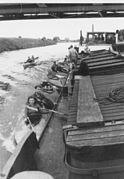
Club athletes with folding boats around 1950

Today's recreational use of the Wesel-Datteln Canal


literature
- M. Eckoldt (Ed.), Rivers and Canals: The History of the German Waterways. DSV-Verlag Hamburg 1998
- Change through the canal - 75 years of the Wesel-Datteln Canal: the floating exhibition from June 2 to September 30, 2005 on the historic barge OSTARA. Duisburg 2005
Web links
- General Diction Waterways and Shipping - West Branch, WDK
- The WDK on wsa-duisburg-meiderich.wsv.de (Waterways and Shipping Office)
- Aerial photos of the locks for comparison
- Water information for rowers
- Information on the Wesel-Datteln Canal on SkipperGuide
Individual evidence
- ↑ Directory E, serial no. 63 der Chronik ( Memento of the original of July 22, 2016 in the Internet Archive ) Info: The archive link was inserted automatically and has not yet been checked. Please check the original and archive link according to the instructions and then remove this notice. , Federal Waterways and Shipping Administration
- ↑ a b Now already record traffic jams on the canals in NRW? (PDF; 116 kB) State Parliament of North Rhine-Westphalia , July 18, 2018, accessed on April 7, 2019 .
- ↑ Lengths (in km) of the main shipping lanes (main routes and certain secondary routes) of the federal inland waterways ( memento of the original from January 21, 2016 in the Internet Archive ) Info: The archive link was inserted automatically and has not yet been checked. Please check the original and archive link according to the instructions and then remove this notice. , Federal Waterways and Shipping Administration
- ↑ DIN 4054 hydraulic engineering, terms, September 1977
- ↑ Lippe estuary with advertised commercial areas for the ports of Emmelsum and Rhein-Lippe ( memento of the original from November 16, 2011 in the Internet Archive ) Info: The archive link was automatically inserted and not yet checked. Please check the original and archive link according to the instructions and then remove this notice.