White Strait
| White Strait | ||
|---|---|---|
| Connects waters | McMurdo Ice Shelf | |
| with water | Ross Ice Shelf | |
| Separates land mass | White Island | |
| of land mass | Black Island | |
| Data | ||
| Geographical location | 78 ° 13 ′ 0 ″ S , 166 ° 48 ′ 0 ″ E | |
|
|
||
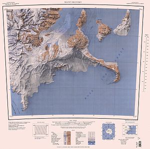
| Map with the White Strait between Black Island and White Island (top right) | ||
The White Strait is a strait off the Scott coast of the East Antarctic Victoria Land . In the Ross Archipelago , it separates Black Island from White Island .
Participants in the Discovery Expedition (1901–1904) led by British polar explorer Robert Falcon Scott mapped it for the first time. Scientists from a 1958 to 1959 campaign of the New Zealand Geological Survey Antarctic Expedition named it after the mountaineer M. R. White, who was involved in this venture.
Web links
- White Strait in the Geographic Names Information System of the United States Geological Survey (English)
- White Strait on geographic.org (English)
- White Strait , photos and information on the website of Antarctica NZ Digital Asset Manager (English)
Individual evidence
- ^ John Stewart: Antarctica - An Encyclopedia . Vol. 2, McFarland & Co., Jefferson and London 2011, ISBN 978-0-7864-3590-6 , p. 1696 (English).

