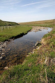
Whitrope Burn
|
Whitrope Burn Butter Sike in the upper reaches |
||
|
The Whitrope Burn |
||
| Data | ||
| location | Scottish Borders , Scotland | |
| River system | River Esk (Solway Firth) | |
| Drain over | Hermitage Water → Liddel Water → River Esk (Solway Firth) → Solway Firth → Irish Sea | |
| River basin district | Solway Tweed XRBD | |
| source | west of the Limekiln Edge 55 ° 18 ′ 10 ″ N , 2 ° 43 ′ 54 ″ W |
|
| muzzle | in the Hermitage Water Coordinates: 55 ° 15 ′ 6 " N , 2 ° 46 ′ 50" W 55 ° 15 ′ 6 " N , 2 ° 46 ′ 50" W
|
|
| Right tributaries | Sundhope Burn | |
The Whitrope Burn is a watercourse in the Scottish Borders , Scotland . It arises as Butter Sike west of the Limekiln Edge and initially flows in a westerly direction. It crosses under the B6399 road and then turns in a southerly direction, alternating the west and east side of the road several times. It flows south of the hamlet of Hermitage into Hermitage Water .
Web links
Commons : Whitrope Burn - collection of images, videos and audio files
