
Wiesenbeker pond
| Wiesenbeker pond Sincerity pond |
|||||||||
|---|---|---|---|---|---|---|---|---|---|
 |
|||||||||
|
|||||||||
|
|||||||||
| Coordinates | 51 ° 37 ′ 7 ″ N , 10 ° 29 ′ 16 ″ E | ||||||||
| Data on the structure | |||||||||
| Lock type: | Earthfill dam | ||||||||
| Construction time: | 1715 | ||||||||
| Height above valley floor: | 14.5 m | ||||||||
| Height above foundation level : | 18 m | ||||||||
| Height of the structure crown: | 348.44 m | ||||||||
| Crown length: | 120 m | ||||||||
| Crown width: | 3.5 m | ||||||||
| Operator: | Harz waterworks | ||||||||
| Data on the reservoir | |||||||||
| Altitude (at congestion destination ) | 347.54 m | ||||||||
| Water surface | 7 ha | ||||||||
| Reservoir length | 540 m | ||||||||
| Reservoir width | 140 m | ||||||||
| Storage space | 480 000 m³ | ||||||||
| Catchment area | 3.26 km² | ||||||||
| Design flood : | 20 m³ / s | ||||||||


The Wiesenbeker Teich (formerly Aufrichtigkeiter Teich ) is an artificial pond near Bad Lauterberg in the Harz Mountains in the district of Göttingen , Lower Saxony . It is one of the Upper Harz ponds . The Wiesenbeker pond and its structures were placed under monument protection.
Since 2010 it has been part of the " Upper Harz Water Regale " under the name Bergwerk Rammelsberg, Old Town of Goslar and Upper Harz Water Management as a UNESCO World Heritage Site .
description
The pond, which was put into operation in 1715, once served to supply water to the copper mine "Aufrichtigkeit" in Lauterberg. When ore mining was stopped there, it supplied the Lauterberger Königshütte .
The Wiesenbeker pond is dammed by an earth dam. The embankment seal consists of turf that was installed here - for the first time in the Harz Mountains - in the middle of the embankment and not on the embankment on the water side ("core seal"). The harrow was also placed in the middle of the dam. All ponds of the Upper Harz that were later created were built according to this “Lauterberg pond construction method”.
Remodeling and renovation work
In 1960 the bottom outlet was rebuilt, whereby the harrow shaft was expanded with octagonal precast concrete parts , clear width 1.10 meters, and the outlet run was provided with a 300 mm cast iron pipe . In 1980 the flood relief system for the design flood was significantly expanded . In 1992, the Harzwasserwerke, as the operator, carried out a thorough renovation of the dam seal.
Monument protection
The flood relief system, which is not really a monument, has a significant impact on the southern end of the dam. At the northern end of the dam is a hotel built in the 1960s that has been vacant and decaying since the late 1990s. Since the hotel and forecourt are almost on top of the embankment, the dam structure is not very much influenced by the monument at this point.
An open-air swimming pool with various pools, diving boards, etc. on the south bank was dismantled in 2010 into a "green embankment". The harrow house was last renovated in 2012; In doing so, an attempt was made to bring the original architectural style of the Upper Harz Striegelhäuser back to life.
use
The operator of the pond has been Harzwasserwerke GmbH since 1991. On the south bank there is a campsite with leisure facilities and a sandy beach.

Harrow house for operating the bottom outlet (harrow)

Dam and flood relief (front right)

Flood relief
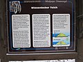
Information board at the pond


The pond is on a stage of the Harzer Baudensteig .