Upper Harz ponds
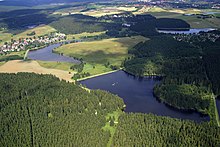
The Oberharzer ponds are around 70 smaller and larger reservoirs , which are mainly located around the mining town of Clausthal-Zellerfeld , the district of Buntenbock and Hahnenklee in the Upper Harz . Most of the ponds were artificially created by miners from Upper Harz between the 16th and 18th centuries. They are an essential part of culture monument Upper Harz Water shelf and thus belong to the UNESCO - World Heritage Sites . Around half of the reservoir ponds are classified as dam structures . However, they have now become a typical part of the Upper Harz Mountains and are sometimes home to extremely rare plant and animal species.
The Upper Harz ponds also include the oldest still operating dams in Germany.
purpose

The reservoirs were originally built to store water to drive water wheels to supply energy to the Upper Harz ore mines. With these water wheels the operation of the pumps , the conveyor systems, the stamping works and from 1820 also the driving skills were ensured. The ponds initially obtained the water for storage from their natural catchment area , which was then often considerably enlarged by additional collecting ditches.
Today the ponds are operated for reasons of monument protection, landscape conservation, nature conservation and recreation. Some ponds are used for flood protection, some other ponds are used for drinking water. The ponds are operated by the Harzwasserwerke , which also operate six modern dams in the Lower Saxony part of the Harz Mountains.
Architectural style
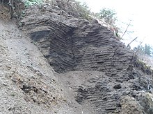
The barricades are constructed as earth dams. The dam contact area was often not cleared of the existing vegetation and topsoil. The embankment material was usually extracted on site: Small quarries were usually built in the future storage space , which at the same time increased the storage space.
Loam or clay could not be used as a sealing material, as it was not available in sufficient quantities in the Upper Harz Mountains. However, the Upper Harz miners had found through experience that turf sods can be used excellently as sealing construction material: Using turf sods stacked on top of each other like masonry, a partially meter-thick layer was built into the dam, which ensured that the dam was leakproof. Observations show that these do their job even after centuries and that they are not subject to any significant weathering even with disused dams.
A wooden run functioned as the bottom outlet, which was usually made of oak due to its longer durability. A so-called “harrow” was used as a closure, which, like a plug, closed the inlet opening of the wood race and could be pulled using a rod. Both sod sealing and wooden bottom drain are still in use in many ponds.
The dams are between 4 and 15 m high and the storage volumes of the reservoirs vary between 10,000 and 600,000 m³. A special exception is the Oderteich north-east of Sankt Andreasberg , which is the only pond not to be sealed with turf but with granite gravel and which, with a dam height of 21 m and a storage volume of 1.7 million m³ of water, clearly shows the dimensions of the other ponds towers.
Flora and fauna
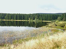
Although the waters are artificially created, rare flora and fauna have developed in many of the Upper Harz ponds. These are nutrient-poor and rather cool still waters. The noble crayfish , which became extinct in most European waters due to the cancer plague , was able to survive in many Upper Harz ponds thanks to the isolated location. Operators and fisheries tenants are successfully striving to strengthen the population.
The centuries-old operation with constantly changing water levels has also given extremely rare plant communities a habitat: Lively chickweed , deer leaps and strandling can be found on many pond floors . They depend on the fact that the water levels in the reservoir continue to change and the nature conservation authorities have agreed an operating plan with the operators to ensure the existence of these plants in the affected waters. Kleinseggenried can be found at other ponds .
The fish stock is mainly characterized by the leasing fishing clubs that stock the ponds with fish. Only domestic fish species are desired, in particular eel and catfish stock should be avoided because of the incompatibility with the crayfish population.
Table of the Upper Harz ponds


The following list largely includes the reservoirs built by miners from the Upper Harz, as far as they are still in operation or clearly visible remains of the dam. Mill ponds are not listed. A total of 143 dams and former dams are documented.
| Surname | construction time | Storage space in m³ | Height above valley floor in m | Dam (T) |
|---|---|---|---|---|
| Old water strider pond | before 1565 | 32,000 | 5.30 | - |
| Capercaillie pond | 1684 | 61,000 | 7.74 | - |
| Bärenbrucher pond | before 1634 | 186,000 | 7.09 | T |
| Carler pond | 1673 | 14,000 | 5.10 | - |
| Einersberger pond, upper one | before 1672 | 140,000 | 9.16 | T |
| Einersberger pond, middle | before 1672 | 16,000 | 7.74 | - |
| Einersberger Teich, Unterer (†) | - | |||
| Duck swamp | after 1600 | - | ||
| Eschenbacher Teich, Oberster (†) (also: Kleiner Prinzen-Teich) | - | |||
| Eschenbacher pond, upper one | 1548 | 62,000 | 10.50 | - |
| Eschenbacher pond, lower | 1548 | 167,000 | 8.85 | T |
| Eulenspiegler pond | around 1546 | 61,000 | 3.43 | - |
| Flambach pond, upper one | 1701 | 88,000 | 6.50 | T |
| Flambach pond, lower | 1693 | 48,000 | 5.03 | - |
| Raft pond, upper one | before 1680 | 11,000 | 5.00 | - |
| Raft pond, lower one | before 1680 | 10,000 | 4.28 | - |
| Flößteich (Pißtal) (†) | - | |||
| Fortuner pond | 1721 | 296,000 | 14.33 | T |
| Grumbacher pond, newcomer | after 1714 | 108,000 | 8.67 | T |
| Grumbacher pond, upper one | before 1680 | 180,000 | 10.50 | T |
| Grumbacher pond, middle | after 1680 | 72,000 | 9.20 | - |
| Grumbacher pond (lower) | before 1680 | 82,000 | 7.52 | - |
| Haderbacher pond | before 1693 | 103,000 | 9.43 | T |
| Hahnebalzer pond, upper one | before 1695 | 66,000 | 8.11 | - |
| Hahnebalzer pond, lower one | 1676/86 | 52,000 | 6.50 | - |
| Hasenbacher pond | 1660 | 140,000 | 9.12 | T |
| Hasenteich (†) | - | |||
| Hausherzberger pond, upper one | 1588 | 180,000 | 7.18 | T |
| Hausherzberger pond, lower | before 1613 | 198,000 | 9.35 | T |
| House of Saxony pond | - | |||
| Herzberger pond (Goslar) | around 1560 | 95,000 | 12.00 | T |
| Help God pond | before 1763 | 12,300 | 8.30 | - |
| Hirschler pond | before 1671 | 599,000 | 11.40 | T |
| Hüttenteich, Zellerfeld | before 1673 | 13,000 | 6.42 | - |
| Hut pond, Altenau | 1688 | 49,000 | 11.73 | |
| Huttaler pond, upper (†) | - | |||
| Huttaler pond, lower (†) | - | |||
| Jägersbleeker pond | around 1670 | 380,000 | 13.65 | T |
| Johann-Friedricher Pond | 1674 | 96,000 | 6.79 | T |
| Carp pond (Hahnenklee) (†) | before 1680 | - | ||
| Kellerhalsteich, Oberer | before 1679 | 68,000 | 10.78 | - |
| Kellerhalsteich, Middle | 1724 | 436,000 | 14.90 | T |
| Kellerhalsteich, Unterer | before 1679 | 53,000 | 8.10 | - |
| Pine wood pond | before 1671 | 248,000 | 9.72 | T |
| Klein-Clausthaler pond | around 1680 | 29,000 | 8.34 | - |
| Crane pond, kid | before 1675 | 11,000 | 2.47 | - |
| Crane pond, big one | before 1675 | 110,000 | 8.24 | T |
| Kreuzbach pond | before 1680 | 9,000 | 5.58 | - |
| Kuttelbacher pond | 1674 | 163,000 | 12.75 | T |
| Long pond | 1719 | 15,000 | 6.73 | - |
| Long pond | before 1606 | 49,000 | 7.30 | - |
| Nassenwieser pond, upper one | around 1671 | 132,000 | 8.82 | T |
| Nassenwieser pond, lower (†) | before 1743 | 48,000 | 6.0 | - |
| New pond (Lautenthal) (†) | after 1680 | 11,800 | 5.8 | - |
| Oderteich | 1715-1721 | 1,670,000 | 18.00 | T |
| Okerteich, kid | 22,000 | - | ||
| Peacock pond, upper one | before 1551 | 121,000 | 8.27 | T |
| Peacock pond, middle one | before 1551 | 259,000 | 9.53 | T |
| Peacock pond, lower | before 1551 | 214,000 | 8.94 | T |
| Pixhaier pond | 1672 | 281,000 | 8.75 | T |
| Polstertal pond | 1728 | 46,000 | 6.48 | - |
| Prince pond | 1686 | 385,000 | 8.74 | T |
| Tube pond | - | |||
| (Lower) Schalke pond | 1730 | 151,000 | 11.28 | T |
| Schalke pond, Middle (†) | before 1680 | 150,000 | 9.10 | |
| Schalke pond, Oberer (†) | 1733 | 14.35 | - | |
| Schlackentaler pond (upper) | 1921-22 | 3,200 | 4.46 | - |
| Schröterbacher pond | 1652 | 73,000 | 9.06 | - |
| Schwarzenbach pond | before 1608 | 146,000 | 7.39 | T |
| Semmelwies pond | 1691 | 53,000 | 7.24 | - |
| Silver pond | 1755 | 22,000 | 8.0 | - |
| Spiegelthaler pond, upper one | before 1673 | 51,000 | 7.67 | - |
| Spiegelthaler pond, Unterer | 1672 | 152,000 | 10.91 | T |
| Stadtweger pond | 1727 | 294,000 | 10.12 | T |
| Stuffentaler pond (†) | - | |||
| Swamp pond (Buntenbock) | before 1639 | 189,000 | 6.91 | T |
| Than pond | before 1684 | 12,000 | 6.45 | - |
| Water strider pond | before 1659 | 25,000 | 5.78 | - |
| Wiesenbeker pond (Bad Lauterberg) | 1715 | 480,000 | 14.50 | T |
| Zankwieser pond | 1688 | 107,000 | 9.67 | T |
| Zechenteich, upper one | before 1661 | 33,000 | 5.85 | - |
| Zechenteich, Middle | before 1661 | 45,000 | 6.70 | - |
| Ziegenberger pond | around 1645 | 313,000 | 8.94 | T |
(†) means: pond out of order, largely dry. Dam remains are present.
"T" means: dam in accordance with the Lower Saxony Water Act.
Where no data is stored, the ponds usually passed into other hands before mining was stopped and therefore not so precisely documented.
Decommissioning and dismantling
More than half of the 143 reservoirs are no longer in operation. Sometimes we only know about them from historical sources, sometimes they were flooded by ponds that were later enlarged; but most of them were shut down . The remains of the dam can usually still be found in the area and are recognizable to the trained eye. Insofar as traces of these structures are still present in the relief, these have also been defined as ground memorials and are part of the documentation of the world cultural heritage.
These shutdowns took place primarily when the mines supplied were no longer productive, had to be abandoned and no other important system could be supplied from this pond. Another reason for shutdown was the pending of particularly complex repairs. Very often a combination of the two reasons led to the decommissioning of a dam . The miners still refer to this process as " throwing ". Another reason for decommissioning a dam could be a structural failure in the form of a dam burst , which did not always lead to a reconstruction of the barrier structure .
In order that they no longer pose a threat, disused dams have to be dismantled so that, even in exceptional cases, the water can no longer be dammed. As a rule, in these cases the dam structure was provided with a rather complex slit that had to reach down to the valley floor. If this dismantling was missed or only incompletely carried out, the building could in individual cases contribute to critical situations centuries later; An example of this is the structural failure at the Upper Schalke Pond in 2017.
See also
- Upper Harz water shelf
- List of lakes in Lower Saxony
- List of lakes in Germany
- Rammelsberg mine, old town of Goslar and Upper Harz water management
literature
- Walter Knissel , Gerhard Fleisch: “Oberharzer Wasserregal” cultural monument - an epoch-making achievement . 2nd Edition. Paper plane, Clausthal-Zellerfeld 2005, ISBN 3-89720-725-7 .
- Martin Schmidt : The water management of the Upper Harz mining industry . 3. Edition. Harzwasserwerke, Hildesheim 2002, ISBN 3-00-009609-4 (series of publications by the Frontinus Society, issue 13).
Web links
- UNESCO World Heritage in the Harz Mountains
- Ponds around Clausthal-Zellerfeld, Buntenbock and Hahnenklee
Individual evidence
- ↑ "Oberharzer Wasserregal" declared a World Heritage Site. (No longer available online.) Tagesschau.de , August 1, 2010, archived from the original on August 4, 2010 ; Retrieved October 2, 2012 .
- ↑ a b c Justus Teicke, Katharina Malek , Der Bruch des Oberen Schalker Teichdammes in Jui 2017 in: Our Harz, history and stories, culture and nature from the entire Harz, Oberharzer Druckerei and Verlag Fischer & Thielbar GmbH, Clausthal-Zellerfeld, booklet 6/2020, page 103 ff
- ↑ a b Justus Teicke and Kathrin Baumann: Dam operation for nature conservation in: WasserWirtschaft 04/2010
- ↑ a b c Justus Teicke and Katharina Malek: Traces of a cultural landscape - The historical Upper Harz water management with its artificial ponds in monument preservation, reports on monument preservation in Lower Saxony, publication by the Lower Saxony State Office for Monument Preservation, Hanover, issue 2/2020


