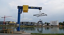
Winterhafen (Linz)
The winter port in Linz is an inland port and is located in the district of Lustenau in the Hafenviertel district and primarily includes the winter port with the former bunker facilities and the shipyard of Österreichische Schiffswerften AG as well as residential and office buildings.
history
Today's Winterhafen area is a former tributary of the Danube , which branched off from the main river. The island in between was used for agriculture until the floods in 1572, when it was badly damaged. On the side arm there were especially businesses with high water requirements, such as B. tanners or dyers. The side arm silted up more and more over the centuries and became a factory arm , where boatmen carried out their work and the first Linz industrial companies (e.g. Stadtbräuhaus or the woolen factory) were located.
When the Danube was regulated in the 19th century , the factory arm was largely filled in from 1889 to 1892. The lowest branch, which is still navigable today, is the winter harbor, which was used from 1897 to 1900 to protect Danube ships from ice in winter. The winter quarters between Passau and Korneuburg or Fischamend along the Danube, previously used by boatmen, were natural bays that largely disappeared due to the Danube regulation.
The plan for the construction of a winter port was negotiated with the one for regulating the Danube on Niederwasser near Linz on December 10, 1895. Originally a port area of 4 ha with a depth of 2 m below the deepest low water level in Linz was planned, which was then expanded to an area of 6.5 ha. The construction of the winter port began in May 1897.
The winter port in Linz was a naval base during both world wars , and during the Second World War it was the main berth for the Danube Flotilla, a small division of the German navy . Part of the unit's command was also housed here.
Location, size and use
The winter harbor is south of the Danube. The harbor basin has a length of around one kilometer and a width of between 60 and 150 meters and a water surface of around 6.5 hectares. The harbor is closed off on the right-hand side against the Danube by a dam about 20 m wide. On the southern bank, the building of the harbor master's office with the workshops of the hydraulic engineering administration was erected and connected with railroad tracks so that it can serve as a transshipment point . The winter harbor was only used to a very limited extent for this purpose. Today, the winter harbor is mainly used for the activities of the Österreichische Schiffswerften AG and leisure shipping. The dam between the winter harbor and the Danube is also used as a bathing facility. This square, the so-called Donaustrand Winterhafen , was created in 2009 on the occasion of Linz 2009 - European Capital of Culture . In 2015, the Donaustrand Winterhafen was refilled over a length of 300 meters and a width of 10 to 15 meters after a flood and around 14,000 cubic meters of material was used for this .
See also
Web links
Individual evidence
- ↑ Ernst Neweklowsky: The Danube near Linz and its regulation , Natural History Yearbook (NJKB), Linz 1955 website Upper Austrian Provincial Museum, S. 205th
- ↑ a b c d Ernst Neweklowsky: The Danube near Linz and its regulation , Natural History Yearbook (NJKB), Linz 1955, website of the Upper Austrian State Museum, p. 209.
- ↑ Future use and design of the Winterhafen area , press release by the City of Linz's municipal authorities on September 24, 2014.
- ↑ Ernst Neweklowsky: The Danube near Linz and its regulation , Natural History Yearbook (NJKB), Linz 1955 website Upper Austrian Provincial Museum.
- ↑ Schotterbank at Steinmetzplatzl brings back the "Danube Beach" , Oberösterreichische Nachrichten of January 29, 2016.
- ↑ Summer on the Donaustrand , Linz 09, July 2, 2008.
Coordinates: 48 ° 19 ′ 11 ″ N , 14 ° 18 ′ 40 ″ E


