Wylerberg
| Wylerberg | ||
|---|---|---|
| height | 75.9 m | |
| location | Gelderland , Netherlands | |
| Coordinates | 51 ° 49'12 " N , 5 ° 57'0" E | |
|
|
||
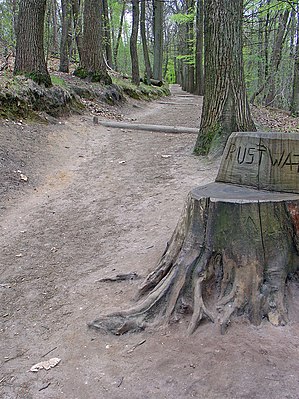
The Wylerberg or Teufelsberg ( Dutch Duivelsberg ) is a hill near Nijmegen that originally belonged to the German municipality of Wyler / North Rhine-Westphalia. In 1949 the mountain was placed under Dutch contract management by the British military administration on the initiative of the Netherlands and in 1963 it was finally Dutch territory.
history
The German name is derived from the neighboring village of Wyler . In the Middle Ages, the Mergelp Castle was located on the mountain .
Today the Wylerberg is an approximately 125 hectare nature reserve . Its border is the German-Dutch border in the east. In the north the area is bounded by the village of Beek and the main road behind which the Wylermeer lies. In the south, the road from Berg en Dal to Wyler forms the border.
The Wylerberg is the only one of the areas annexed after the Second World War that has remained with the Netherlands to this day.
House Wylerberg
The Wylerberg was inherited in 1906 by Marie Schuster-Hiby, who built a villa ( 51 ° 49 ′ 24.5 ″ N , 5 ° 56 ′ 12.1 ″ E ) there in the expressionist style by the architect Otto in 1921–1924 Bartning had it built. In 1965 the Schuster-Hiby family sold the building to the Dutch state. House Wylerberg, which today houses nature conservation organizations, has been a listed building since 1985.
literature
- Herman Grote: Het vergeten monument - The forgotten monument , Ubbergen 2007.
- Heinrich Friedrich Wiepking-Jürgensmann : garden and house. I. The house in the countryside. Berlin 1927. pp. 78-80.
Web links
swell
- ↑ Treaty between the Federal Republic of Germany and the Kingdom of the Netherlands to regulate border issues and other problems existing between the two countries . BGBl. 1963, Part II, pp. 461–597, Appendix A
- [1] Border contract, compensation contract, financial contract


