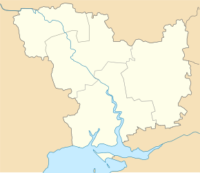
Vysunsk
| Vysunsk | ||
| Висунськ | ||

|
|
|
| Basic data | ||
|---|---|---|
| Oblast : | Mykolaiv Oblast | |
| Rajon : | Bereznehuwate district | |
| Height : | 26 m | |
| Area : | 3.587 km² | |
| Residents : | 2,191 (2001) | |
| Population density : | 611 inhabitants per km² | |
| Postcodes : | 56241 | |
| Area code : | +380 5168 | |
| Geographic location : | 47 ° 15 ' N , 32 ° 49' E | |
| KOATUU : | 4821180701 | |
| Administrative structure : | 5 villages | |
| Address: | вул. Ковтюха 3 56241 с. Висунськ |
|
| Website : | City council website | |
| Statistical information | ||
|
|
||
Vysunsk ( Ukrainian Висунськ ; Russian Висунск Wissunsk ) is a village in the east of the Ukrainian Oblast Mykolaiv with about 2200 inhabitants (2001).
The 1767 by Haidamaks village founded and volatile farmers from north lying regions of Ukraine is the administrative center of the same name, 156.48 km² District Municipality in Rajon Beresnehuwate to which even the villages Vasylivka ( Василівка , ⊙ ) with about 15 residents, Odradne ( Одрадне , ⊙ ) with about 25 inhabitants, Pryshyb ( Пришиб , ⊙ ) with about 430 inhabitants and Semeniwka ( Семенівка , ⊙ ) with about 140 inhabitants.
The village is located on the banks of the Wyssun , a 195 km long right tributary of the Inhulez , 10 km south of the Beresnehuwate district center and 85 km northeast of the Mykolaiv oblast center . The territorial road T – 15–08 runs through Wyssunk . The regional road P-81 runs to the south and west of the village .
Web links
- Entry on Wyssunsk in Brockhaus-Efron (Russian)
Individual evidence
- ↑ a b local website on the official website of the Verkhovna Rada ; accessed on September 9, 2018 (Ukrainian)
- ↑ history Wyssunsk in the history of the towns and villages of the Ukrainian SSR ; accessed on September 9, 2018 (Ukrainian)
- ^ Website of the district council on the official website of the Verkhovna Rada; accessed on September 9, 2018 (Ukrainian)

