
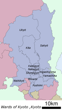
Yamashina-ku (Kyoto)
|
Municipality of Kyoto |
|
|---|---|
  |
|
| Coordinates | 34 ° 58 '21 " N , 135 ° 48' 49" E |
| surface | 28.78 km² |
| Residents | 134,259 (Oct 1, 2019) |
| Population density | 4665 inhabitants / km² |
| Start-up | Oct. 1, 1976 |
| Community key | 26110-6 |
Administration address |
14-2, Nagitsuji-Ikejirichō, Yamashina-ku, Kyōto 607-8511 |
Yamashina-ku ( Japanese 山 科 区 ) is one of eleven boroughs ( ku ) of Kyōto , Japan .
history
Yamashina was originally an independent city ( chō ) in Uji County until it was incorporated into Kyōto on April 1, 1931 and temporarily became part of the Higashiyama-ku district . On October 1, 1976, Yamashina was raised to a separate municipality.
traffic
Yamashina Station is just one stop from Kyoto Station on the Tōkaidō Main Line ( Biwako Line ).
Attractions

Yamashina-ku is home to the tombs of Emperor Tenji , the oldest imperial tomb in Kyoto, and Sakanoue no Tamuramaro , a general of the Heian period , the Ōishi shrine and several important temples. The Biwasee Canal runs through the district.
Web links
- official website (Japanese)
Fushimi-ku | Higashiyama-ku | Kamigyō-ku | Kita-ku | Minami-ku | Nakagyō-ku | Nishikyō-ku | Sakyō-ku | Shimogyō-ku | Ukyō-ku | Yamashina-ku