Yoa lake
| Yoa lake | ||
|---|---|---|

|
||
| Yoa lake | ||
| Geographical location | Ennedi-Ouest region ; Ounianga kebir ; Sahara ; Chad | |
| Tributaries | Groundwater | |
| Drain | Evaporation , underground drainage | |
| Data | ||
| Coordinates | 19 ° 3 ′ 0 ″ N , 20 ° 31 ′ 0 ″ E | |
|
|
||
| Altitude above sea level | 378 m | |
| surface | 4 km² | |
| length | 3.5 km | |
| width | 2.5 km | |
| Maximum depth | 26 m | |
|
particularities |
||
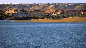
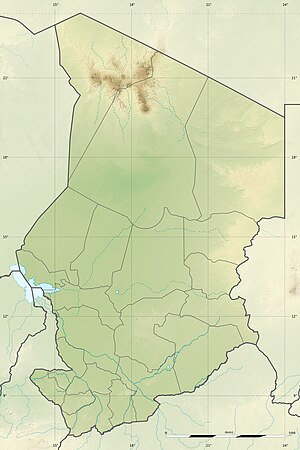
The Yoa Lake (also Jua Lake) is the second largest of the lakes of Ounianga in the Ennedi-Ouest region in the northeast basin of Chad . These lakes stand out because of their headlands running in north-south direction. They are the remains of a much larger lake that made up this basin during the so-called green Sahara period , from around 10,000 to 1,500 BC. Lasted, filled. There are currently fifteen lakes in the basin with a total area of approximately 20 km².
Hydrogeology
The highly salty Lake Yoa is characterized by a complex underground exchange process that it has in common with all lakes in the Ounianga .
Climate change
Lake Yoa is of interest for studies on global climate development. A team from the University of Cologne led by Stefan Kröpelin took a core from the sediment from the bottom of the lake. Since Lake Yoa has existed continuously since the wet season, the sediments at the bottom of the water were protected from erosion and scattering. The analysis of the pollen in the core showed that the transition from forest to desert in the vicinity of Lake Yoa took place gradually. In between there were periods of bush and grassland before the area became completely desert.
This conclusion is in contrast to the work of Peter de Menocal and his colleagues at Columbia University , who took a core from the oceanic sediments off the west coast of Mauritania in 2000 . Because of the dust pollution in this core, the authors concluded that desertification was rapid, over a period of only a few hundred years.
The difference between these two results is not surprising on closer inspection. The ocean core traces the entire northern part of the African landmass, while the Lake Yoa data provides more detailed information about conditions in the areas south and west of it. These areas provided the material with which the trade winds prevailing in the Holocene covered Lake Yoa. It is possible that both happened: North Africa was quickly becoming drier and, in certain areas, the process of desertification occurred through a series of ecological transitions.
Individual evidence
- ↑ Stefan Kröpelin: Lakes in the Sahara - a high-precision environmental archive. In: forschung - Magazin der Deutschen Forschungsgemeinschaft , Issue 3, 2008, pp. 4–9 (available online at Schattenblick.net, accessed on December 4, 2015)
- ↑ Stefan Kröpelin et al .: Annually laminated sediments at Ounianga Kebir, Chad, characterized using a micro-fluorescence core scanner. In: Geophysical Research Abstracts 10, 2008. ( Abstract , PDF).
- ↑ Kenneth Chang: Shift From Savannah to Sahara Was Gradual, Research Suggests , New York Times . May 9, 2008. Retrieved August 28, 2009.
