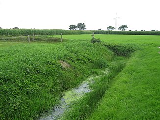
Hohebier draw trench
|
Zuggraben Hohebier Hohebier or Zuggraben |
||
|
Source of the moat near Updorf |
||
| Data | ||
| Water code | DE : 93914261 | |
| location | Wittmund district | |
| River system | Harle | |
| Drain over | Menkenfelder Tief → Abenser Leide → Harle → North Sea | |
| source | in Updorf on Brinksweg 53 ° 34 '14 " N , 7 ° 45' 41" O |
|
| Source height | approx. 3 m above sea level NN | |
| muzzle | Menkenfelder Tief coordinates: 53 ° 35 '10 " N , 7 ° 43' 59" E 53 ° 35 '10 " N , 7 ° 43' 59" E |
|
| Mouth height | approx. 2 m above sea level NN | |
| Height difference | approx. 1 m | |
| Bottom slope | approx. 0.33 ‰ | |
| length | 3.1 km | |
| Catchment area | 50 ha | |
| Residents in the catchment area | 1000 | |
| Navigable | not navigable | |
The Zuggraben High beer is a Schloot in the area of the city Wittmund district Wittmund in East Friesland. It rises in the north of Updorf, runs north through Wittmund, then northwest and flows north of Angelsburg into the Menkenfelder Tief . It belongs to the Harle river system.
