
Konya (province)
| Konya | |
|---|---|
| Province number: | 42 |
  |
|
| Counties | |
 |
|
| Basic data | |
| Coordinates: | 37 ° 1 ′ N , 33 ° 6 ′ E |
| Provincial capital: | Konya |
| Region: | Central Anatolia |
| Surface: | 38,257 km² |
| Population: | 2,161,303 (2016) |
| Population density: | 56.49 inhabitants / km² |
| Political | |
| Governor: | Yakup Canbolat |
| Seats in Parliament: | 14th |
| Structural | |
| Telephone code: | 0332 |
| Features : | 42 |
| Website | |
| www.konya.gov.tr (Turkish) | |
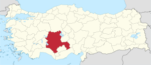
The Turkish province of Konya is the largest province in Turkey in terms of area . Their capital is the Konya of the same name ( Ottoman قونیه, from ancient Greek Ἰκόνιον Ikónion , Latin Iconium ). Its neighboring provinces are Ankara in the north , Isparta , Afyonkarahisar and Eskişehir in the west, Mersin , Karaman and Antalya in the south and Niğde and Aksaray in the east .
population
The population of the provincial capital is 1,073,791. In 2016, there were around 2,161,303 people in Konya Province. The population density was thus about 56 inhabitants / km². In 2011, 1,527,937 of the provincial population lived in cities and 510,618 in rural areas. In 1927 the population was 504,125. At the 1965 census, the urban share of the population was 32% and has now risen to 75% in 2011. According to a 1996 study by the Türk Dil Kurumu , residents speak a West Anatolian dialect of Turkish that is in the same group with the southern dialect of Mersin.
geography
With 38,257 km² Konya is the largest province in Turkey. It lies in the inner Anatolian plateau at an average altitude of 1016 m. The highest mountains in the province are Geyik (3130 m), Bolkar Mountains (3134 m) and Aydos Mountains (3240 m) in the Taurus Mountains on the southern border of the province.
Lack of water
The mean annual precipitation of 326 mm is the lowest in Turkey. It is even lower in places like the salty Tuz Gölü , which arose in this region with little water or runoff. Other Konya's lakes and waters are the Beyşehir Gölü , Çavuşçu Gölü , Akşehir Gölü, Suğla Gölü, Ereğli Akgöl and the Yunak Akgöl.
One tries to counteract the water shortage by building reservoirs. For this reason, z. B. created the Sille dam .
Counties
Konya has been a major city since 1986 (Büyükşehir belediyesi). After an administrative reform in 2014, all districts are directly subordinate to the Lord Mayor of Konya. The former mayors of the municipalities ( Belediye ) were downgraded to the rank of Muhtar . Therefore, the 31 rural districts with their 620 villages are also urban districts:
History and culture
Çatalhöyük , one of the oldest human settlements , is located southeast of Konya, approx. 40 km away . About 70 km to the west are the Hittite spring shrine Eflatun Pınar and the possibly associated large sculpture near Fasıllar . In the district, close to the border with Karaman, on a rock cone is the late Hittite rock relief at Kızıldağ with a portrait of King Hartapu and several inscriptions in Luwian hieroglyphs .
politics
Konya is traditionally a conservative province. Islamic conservative parties like the Adalet ve Kalkınma Partisi (AKP) or the Fazilet Partisi (FP) achieved their highest election results there. The political development of the province according to the election results for parliament:
| 2015 (November 1st) | 2015 (June 7th) | 2011 | 2007 | 2004 | 1999 | 1994 | 1989 | 1984 |
|
ACP 73.94% |
ACP 65.00% |
ACP 69.63% |
ACP 65.31% |
ACP 54.35% |
FP 30.88% |
RP 32.68% |
DYP 26.14% |
ANAP 45.66% |
Individual evidence
- ↑ Turkish Institute for Statistics , accessed December 24, 2017
- ↑ Konya Province website
- ^ Turkish Institute for Statistics ( Memento from July 13, 2012 in the web archive archive.today ), accessed April 23, 2012
- ↑ 1965 census (tr) ( Memento from July 21, 2012 in the web archive archive.today )
Adana | Adıyaman | Afyonkarahisar | Ağrı | Aksaray | Amasya | Ankara | Antalya | Ardahan | Artvin | Aydın | Balıkesir | Bartın | Batman | Bayburt | Bilecik | Bing oil | Bitlis | Bolu | Burdur | Bursa | Çanakkale | Çankırı | Çorum | Denizli | Diyarbakır | Düzce | Edirne | Elazığ | Erzincan | Erzurum | Eskişehir | Gaziantep | Giresun | Gümüşhane | Hakkâri | Hatay | Iğdır | Isparta | İstanbul | İzmir | Kahramanmaraş | Karabük | Karaman | Kars | Kastamonu | Kayseri | Kırıkkale | Kırklareli | Kırşehir | Kilis | Kocaeli | Konya | Kutahya | Malatya | Manisa | Mardin | Mersin | Muğla | Muş | Nevşehir | Niğde | Ordu | Osmaniye | Rize | Sakarya | Samsun | Siirt | Sinop | Sivas | Şanlıurfa | Şırnak | Tekirdağ | Tokat | Trabzon | Tunceli | Usak | Van | Yalova | Yozgat | Zonguldak