List of streets and squares in Berlin-Baumschulenweg

The list of streets and squares in Berlin-Baumschulenweg describes the street system in the Berlin district of Baumschulenweg with the corresponding historical references. At the same time, this compilation is part of the lists of all Berlin streets and places . Baumschulenweg has officially been part of Berlin since the Greater Berlin Act of 1920.
overview
Baumschulenweg has 18,842 inhabitants (as of December 30, 2019) and includes the postal code area 12437. The 52 officially dedicated streets have a total length of 27.9 kilometers, 13 streets are only partially part of the district.

The Baumschulenstraße as the connection between the tree nursery founded by Franz Späth in 1865 with the Späth Arboretum and the storage area on the Spree and with the Baumschulenweg station on the Görlitzer Bahn was significant for the development of the district. Through streets before 1900 were the Neue Krugallee (in the north) and the Rixdorf-Canner Kreischaussee (in the south). Until the construction of the Späthstrasse junction on the 113 federal highway , the Berliner Ring was only accessible from Baumschulenstrasse via Köpenicker Landstrasse as part of federal highway 96a . Since then there has been a direct motorway connection to the Berlin city motorway (2004) and the A 113 (2008) via this junction . Cross-connections with Main function through the district are from the center to Schoeneweide the B 96a (Kopenicker road), the Kiefholzstraße ( Kreuzberg / Treptow - Johannisthal ), the stretch of road Sonnenallee / Südostallee ( Neukölln - Karl Horst and Schoeneweide) and the Königsheideweg to Johannisthaler Chaussee and Stern dam. East of the Späthschen Arboretum streets were named for the Späthsfelde settlement in 1936 , when this location still belonged to Britz in the Neukölln district.
The first streets were laid out near the train station by real estate companies, east of Baumschulenstrasse from 1904 by Glanz and Scheibler . The Berlin construction company was active to the west of Baumschulenstrasse. In 1929 and 1930, several streets on both sides of Baumschulenstrasse were named after formerly German (mostly bilingual) places that came to the Republic of Poland as a result of the First World War after the Treaty of Versailles and a referendum under Allied control in 1920/1921. In the 1960s, housing was shortened and reallocated along Kiefholzstrasse to the border with West Berlin (which was already paved at the time) . What remains are the settlement areas in the south of the district, which were wet lowland areas before the construction of the Teltow Canal (see the map from Meyers Konversations-Lexikon from 1894). Although mostly allotment gardens are still being built, houses are also being built here. Since the fall of the Wall , there have been street extensions and new names such as Sperlingsweg and Privet Drive. The last change to a street name so far took place on August 13, 2010 when Britzer Allee was renamed Chris-Gueffroy-Allee, the last victim of the Berlin Wall.
Overview of streets and squares
The following table gives an overview of the streets and squares in the district as well as some related information.
- Name / location : current name of the street or square. Via the link Location , the street or the square can be displayed on various map services. The geoposition indicates the approximate center of the street length.
- Traffic routes not listed in the official street directory are marked with * .
- Former or no longer valid street names are in italics . A separate list may be available for important former streets or historical street names.
-
Length / dimensions in meters:
The length information contained in the overview are rounded overview values that were determined in Google Earth using the local scale. They are used for comparison purposes and, if official values are known, are exchanged and marked separately.
For squares, the dimensions are given in the form a × b for rectangular systems and for (approximately) triangular systems as a × b × c with a as the longest side.
If the street continues into neighboring districts, the addition ' in the district ' indicates how long the street section within the district of this article is. - Name origin : origin or reference of the name.
- Notes : further information on adjacent monuments or institutions, the history of the street and historical names.
- Image : Photo of the street or an adjacent object.
| Name / location | Length / dimensions (in meters) |
Origin of name | Date of designation | Remarks | image |
|---|---|---|---|---|---|
|
Agave dough
( Location ) |
950 | Agave , genus of the Amaryllis family | Sep 24 1936 | Until 1938, the climb belonged to Britz , it is located between Alpenrosenweg and Autobahn 113 and belongs to the Späthsfelde settlement and location . |

|
| Alpenrosenweg
( Location ) |
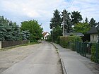
710 | Alpine rose , ornamental plant | Sep 24 1936 | Established as Straße 90 , it belonged to Britz until 1938 . On May 25, 1999, the Alpenrosenweg was extended and has been between Mahonienweg and Johannisthaler Chaussee ever since. |
|
| At Buckersberg
( Location ) |
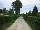
600 | attached KGA "Buckersberg" | Aug 9, 1991 | Plots 1–14 on the border with Johannisthal are on the eastern side of the road, while allotment gardens border on the other side. The route is between the 113 motorway and Kleinbauersweg in the KGA 'Lindenthal'. |
|
| At the church
( Location ) |
50 × 40 | Evangelical Church to the Father's House , first church in Treptow | May 2, 2011 | The square is not officially dedicated and was inaugurated with a ceremony to mark the 100th anniversary of the Baumschulenweg community. |

|
| Apricot dough
( Location ) |
520 | Apricot , stone fruit | Sep 24 1936 | The path in Späthsfelde is between Johannisthaler Chaussee and Thujaweg. |

|
|
Baumschulenstrasse
( Location ) |
1920 | Späthsche nursery | 1890 | It is located between Königsheideweg and Kiehnwerderallee on the banks of the Spree at the landing stage for the F11 ferry . Plots 56–60 (east side) belong to Johannisthal , the west side between Neuer Krugallee and the bank of the Spree belongs to Plänterwald . Since 1842 the street has been known as the Ablageweg , it led through the Cölln Heath to the “southern Spreeablage ”. With the tree nursery in Späth , the name Baumschulenweg came up, which was used for the location and the establishment of the Baumschulenweg stop . With the paving initiated by Späth, the tree nursery 'street' was out of the way . Architectural monuments: Complete settlement of Baumschulenstrasse, Rodelbergweg, Köpenicker Landstrasse north of the railway line and No. 79–83 Evangelical Church of the Father's House and Higher Girls' School 1910–1912 |

|
| Behringstrasse
( Location ) |
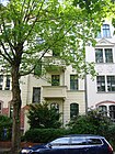
310 | Emil von Behring (1854–1917), bacteriologist and serologist | 1894 | The street is south of the Baumschulenweg station and runs parallel to the embankment between Baumschulenstrasse and Gondeker Strasse. It was laid out by the non-profit Berlin building cooperative and built on with one- and two-family houses for minor officials and workers. The terraced houses numbers 13-19 and 38-48 were built from 1893 to 1896 by the design office of the Berlin building cooperative (Gabriel Wohlgemuth, Helbig, Syring) and are under monument protection. The same applies to house number 5, a tenement house owned by Emil Grosser (1897–1898). The entire settlement is designated as a monument. | |
| Berberitzenweg
( Location ) |
850 | Barberry , sea buckthorn | Sep 24 1936 | Initially referred to as Straße 93 (still belonging to Britz ), it is located between Alpenrosenweg and Autobahn 113 . Like the Agavensteig, it belongs to the Späthsfelde settlement and location. |

|
| Bodelschwinghstrasse
( Location ) |
130 | Friedrich von Bodelschwingh (1831–1910), Protestant theologian, member of the Prussian state parliament | Oct 18, 1910 | Originally known as Straße 6 , it is located between Rinkartstraße and Mörikestraße. In 1910/11, the first parish-owned Protestant “Father's House” church and the adjoining parish and parish house were built according to designs by Heinrich Reinhardt and Georg Süßenguth. The Bodelschwinghstraße connects to the west and was named on the initiative of the parish. |

|
|
Chris-Gueffroy-Allee
( Location ) |
1090 | Chris Gueffroy (1968–1989), last victim of the Berlin Wall | Aug 13, 2010 | On 29 January 1842, the way was Britz in Britz avenue named. On the 49th anniversary of the construction of the Wall , it was initially renamed in the Baumschulenweg district after the wall victim Chris Gueffroy; on September 3, 2010 also in the Neukölln part. Plots 11–52 are in the district between Späthstraße and the Britzer-Allee-Brücke. There are allotment gardens on the road, it goes over to Neukölln on the south bank of the Britzer connecting canal. | |
|
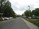
Dornbrunner Strasse
( Location ) |
310 | Dornbrunn , place in the former province of Poznan , Poland | May 17, 1930 | Set up as Straße 54 , it lies between Heidemühler Weg and Hallbergerzeile and runs there as a one-way street . |
|
|
Eichbuschallee
( Location ) |
280 (in the district) |
the oak bush lay nearby | Jan. 29, 1842 | An existing rack path , i.e. H. a lane hewn through the Cölln Heath to separate the forests was created after they were cut down (1829–1840) along the oak bush and named in connection with a royal cabinet order . Plots 1–15 (odd) on the eastern edge of the road between Köpenicker Landstrasse and Neuer Krugallee belong to Baumschulenweg. The road continues in the Plänterwald district . |

|
| Ekkehardstrasse
( Location ) |
200 | Ekkehard IV (around 980 – after 1057), monk in St. Gallen, poet and chronicler | Oct 8, 1909 | Set up as Straße 24 , it is located between Baumschulenstraße and Mosischstraße. The western part is built on, on the eastern edge is the embankment of the Görlitzer Bahn . |

|
| Ernststrasse
( Location ) |
190 | Unterforster Ernst, one of the two magistrate foresters who oversaw the deforestation of the Cöllnsche Heide and first resident of the forester's house built in 1794 | 1894 | The street lies between Baumschulenstrasse and Marientaler Strasse, it was laid out in 1894 by the Berlin building cooperative . Bruno Möhring's apartment house No. 5 from 1895 is a listed building. |

|
| Eschenbachstrasse
( Location ) |
120 | Wolfram von Eschenbach (around 1170 / 80– around 1220), poet | Oct 19, 1906 | Set up as street 23a , it lies between Baumschulenstraße and Trojanstraße and runs there as a one-way street. |

|
|
Forsthausallee
( Location ) |
310 (in the district) |
first forester's house on the later tree nursery route from 1794 | May 13, 1930 | In the district, plots 1 (odd) and 2–36 (even) lie between the east bank of Heidkampgraben and Baumschulenstrasse. The Neukölln section as a section of the Rixdorfer-Canner-Kreischaussee was named with the royal order of January 29, 1842 and still designated in 1930, but is now overbuilt. The Treptower part was included in 1930. The part of Forsthausallee to Rixdorfer Strasse located in the district east of Baumschulenstrasse was renamed Südostallee on October 20, 1932 together with the then ( Johannisthaler ) Kaiserstrasse and the part of Rixdorfer Strasse west of Kaiserstrasse. |

|
| Frauenlobstraße
( Location ) |
660 | Heinrich von Meißen, called Frauenlob (1250 / 1260–1318), poet | Oct 19, 1906 | As Straße 7 , Straße 55 was included in 1929 (and thus significantly extended), it lies between Heidekampweg and Radenzer Straße. |

|
|
Gloss road
( Location ) |
370 | Ernst Glanz (1843–1918), chemist and property owner, who after Scheibler's death in 1899 and his son Franz Scheibler drew up a development plan for the area between the S-Bahn line, the Teltow Canal and Baumschulenstrasse | Feb 10, 1905 | Set up as street 22 , it lies along the railway line between Baumschulenstraße and Güldenhofer Ufer. Glanz had acquired land together with Scheibler and drawn up the development plan for Baumschulenweg Ost around 1900. The layout and development began in 1904. The northeast side with the old buildings and trees is opposite the railway line. |

|
| Gondeker Street
( Location ) |
190 | Gondek , place (today: Gądki) in the former province of Poznan , Poland | Aug 9, 1929 | Established as Straße 67 , it is located between Behringstraße and Kiefholzstraße. |

|
| Güldenhofer Ufer
( Location ) |
160 | Güldenhof , place in the former province of Poznan , Poland | Aug 9, 1929 | Set up as street C , it is located between Köpenicker Landstrasse and Glanzstrasse on the west bank of the Britz connecting canal . The Güldenhofer Ufer 8-12 housing estate was built in 1929 and 1930 by Wilhelm Oehme and AE Schneider and is a listed building. |

|
|
Hallberger line
( Location ) |
130 | Hallberg , Ort (now Ciazyn) in the former province of Poznan , Poland | May 17, 1930 | Set up as Straße 59 , it is located between Dornbrunner and Radenzer Straße. |

|
| Hanselstrasse
( Location ) |
410 (in the district) |
Hansel , figure from Grimm's fairy tale Hansel and Gretel | Jul 14, 1961 | Set up as Straße 32 in Neukölln , it was laid out in 1928. An extension in Baumschulenweg was created by building new apartments in the Kiefholzstrasse / Heidekampweg area. The planned course was interrupted by the construction of the wall . After 1990, a footpath and cycle path crossed the Wall Path between the two sections . In the district lies the road between Kiefholzstrasse and Heidekampweg. |

|
| Heidekampweg
( Location ) |
420 | east of the Heidekampgraben | after 1880 | The path is between Sonnenallee and Hänselstraße. It was laid out around 1850 between Baumschulenstrasse and Kiefholzstrasse as Separationsweg XI . In 1934 Alwin-Gerisch-Strasse was included. In 1961 the Heidekampweg between Kiefholzstraße and Frauenlobstraße was abolished and swiveled in the direction of the Baumschulenweg-Neukölln S-Bahn line, which was closed at the time . In the 1960s, a new residential area was built in this section. |

|
| Heidemühler way
( Location ) |
230 | Heidemühl, place of the former province of West Prussia , today Borowy Mlyn in the Chojnice district, Poland | Aug 25, 1939 | It is located between Radenzer and Dornbrunner Straße. Established as Straße 49 , it was laid out as Brahnauer Straße as early as 1929 . This was done together with neighboring streets that were named after German places that came to Poland through the Versailles Agreement. |

|
| Hohenbirker way
( Location ) |
120 | Hohenbirken , Upper Silesian town, today a district of Racibórz in Poland | March 20, 1929 | The road was laid out on open space XIII and lies between Kiefholzstrasse and Heidemühler Weg. |

|
|
Johannisthaler Chaussee
( Location ) |
1160 (in the district) |
Johannisthal , southeastern neighboring town | 1929 | In the district it is located south of the Königsheide between Königsheideweg and the north bank of the Teltow Canal at the Fanny-Zobel Bridge with lots 3–85 (odd) and 4–102 (even). Johannisthaler Chaussee was named that way before 1911 between Buckow and Rudower Straße. The continuation to the Treptow district took place in 1929. |
 |
|
Kiefholzstrasse
( Location ) |
1880 (in the district) |
The pine wood, old name for pine trees, was previously located here | Nov 25, 1895 | In the district, the plots 148–289 are (continuously) between the S-Bahn overpass and Rixdorfer Straße. The street was already included in the development plan for Berlin and the surrounding area from 1830 and was named Kiefholzweg on January 29, 1842 , its expansion began in 1848. When it was fortified, it was named "Street" in 1895. Here is the Berlin-Baumschulenweg crematorium , a cremation facility with a sacred building , which was designed by the Berlin architects Axel Schultes and Charlotte Frank . Monument: Kiefholzstrasse 274/275
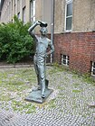
The bronze sculpture Der Schwimmer , made by the artist Gertrud Classen in 1966 , has stood in a small park on the corner of Hohenbirker Weg since 1975 . This figure was stolen in May 2018. It turned up after an intensive police investigation at the yard of a scrap metal dealer, when it was already sawed into 10 pieces. The district office received the parts back and stores them in a depot. A restoration and re-installation is not ruled out, but there is currently no financial basis. The suspect could also be identified. |
|
| Königsheideweg
( Location ) |
1750 (in the district) |
adjacent Königsheide | Oct. 20, 1932 | In the district it is located between Baumschulenstrasse / Späthstrasse and Ostweg at the KGA “Gemütliches Heim”, whereby the Königsheide on the northern edge of the road belongs to Johannisthal . In the street of Johannisthaler Chaussee (named around 1908) was the historical connection from Berlin to Johannisthal, which later also became part of the Rixdorf –Johannisthal district road . The Königsheideweg was formed in 1932 from the part of Johannisthaler Chaussee (which belonged to Britz until 1938) from Baumschulenstraße and the streets in Johannisthal (Stubenrauchstraße and Parkstraße ). |

|
| Köpenicker Landstrasse
( Location ) |
760 (in the district) |
Connection route from Berlin to the then independent city of Köpenick | around 1896 | The Köpenicker Weg has been mentioned since 1842. For the trade exhibition in 1896, Berlin took over the fortification, repairs and chaussing . In the district, the street is between Eichbuschallee and the Marggraff Bridge on the east bank of the Britz connecting canal with lots 153–277 (odd) and 186–276 (even). The road continues westward in the Plänterwald district . Garden monument: open spaces in the front garden area of Köpenicker Landstrasse 78–148. |

|
|
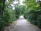
Lake bottom
( Location ) |
190 | Kannenlake, former boggy place there ; in a forest map from 1793, the road appears as a Kannenlake | April 4, 1934 | It is located between Köpenicker Landstrasse and Neuer Krugallee and is a footpath in a 40-meter-wide green strip with multi-family houses on both sides. It is not included in the (official) LOR system and gives its name to the local allotment garden. |
|
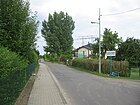
| Privet Drive
( Location ) |
1130 | Privet , ornamental shrub | Oct. 1, 1996 | Established as Straße 19 , it was not officially designated as an interest path; A designation as Elisabeth-Schiemann-Straße was planned . It lies between Späthstrasse and Johannisthaler Chaussee. |
|
| Ludwig-Klapp-Strasse
( Location ) |
180 | Ludwig Klapp (1865–1921), local politician and land surveyor, chairman of the “Treptower Kommunalverein”, was a member of the Treptower municipal council for the formation of Greater Berlin in 1920 and also a city councilor in Berlin | Nov 9, 1926 | Established as Straße 61 , it was initially laid out between Görlitzer Bahn and Kiefholzstraße. Due to developments in the 1950s, it is now an angled cul-de-sac south of Ekkardstrasse. |

|
|
Mahonia Path
( Location ) |
560 | Oregon grape , ornamental shrub | Sep 24 1936 | Established as Straße 91 , the street in the Späthsfelde settlement belonged to Britz until 1938 . It was located between Johannisthaler Chaussee and Thujaweg and was extended to Königsheideweg on May 25, 1999 in a further development - turning to the north. |

|
| Marientaler Strasse
( Location ) |
200 | Mariental, former estate at the southwest end of Baumschulenweg (formerly part of Britz ) | 1896 | The road between railway and Kiefholzstraße was founded in 1894 by at Schulze-Delitzsch exploratory Berlin cooperative created. Construction began in the same year. Gut Mariental was created around 1840 after the Köllnische Heide was cleared from the former forester's house and belonged to Rixdorf . |

|
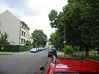
| Mörikestrasse
( Location ) |
340 | Eduard Mörike (1804–1875), poet, narrator and translator | Sep 9 1904 | Set up as Straße 12 , it was initially laid out as far as Wohlgemuthstraße. Due to the overbuilding in the 1960s, it is now only between Kiefholzstrasse and Frauenlobstrasse. |
|
| Mosischstrasse
( Location ) |
240 | Eduard Mosisch (1814-1884), art gardener and first mayor of Treptow and from 1784 first mayor, in 1880 he resigned in favor of his son Richard, a local politician | Oct 28, 1899 | The street lies between Kiefholzstrasse and Ekkehardstrasse. Set up as road 16 , it was laid out between Görlitzer Bahn and Heidekampweg. Due to the development around 1960, the southern section was canceled. In recognition of the merits of the first two Treptow mayors, Mosischstrasse was named in 1899 by resolution of the Treptow municipal representatives. |

|
|
New Krugallee
( Location ) |
990 (in the district) |
The “Neuer Krug” inn near Schöneweide was on this road | Jan. 29, 1842 | In the district it is between Eichbuschallee and Rodelbergweg. The Plänterwald on the northern edge of the road belongs to the district of the same name . The "Neue Krug" was previously the last stop on the postal connection from Silesia to Berlin before reaching the city. The road was planned in a plan before 1842 and was partially available as an access road for storage on the banks of the Spree. |

|
| New Späthstrasse
( Location ) |
500 (in the district) |
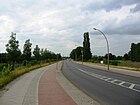
Franz Späth (1839–1913), gardener and botanist | Aug 1, 2004 | In the district it is between Späthstraße and the north bank of the Teltow Canal. After the construction of the federal motorway 113 with the junction Späthstraße, the old (now disused) Späthstraße bridge to Britz was no longer able to cope with the traffic. With the completion of the new bridge over the Teltow Canal and the motorway, a new road layout was necessary, from which the name can be derived. |
|
|
Radenzer Strasse
( Location ) |
430 | Radenz , place in the former province of Poznan , Poland | May 17, 1930 | The street is laid out as street 50 between Heidemühler Weg and Südostallee. |

|
| Rinkartstrasse
( Location ) |
400 | Martin Rinkart (1586–1649), theologian, song poet. | Oct 18, 1910 | Set up as Straße 9 , it is located between Kiefholzstraße and Heidekampweg. At the corner of Rinkartstrasse and Bodelschwinghstrasse there is a bronze sculpture by Karl-Heinz Schamal entitled “The Gardener” (1962/1966). | |
| Rixdorfer Strasse
( Location ) |
500 (in the district) |
Rixdorf , northern neighbor | around 1900 | In the district it is between Kiefholzstrasse and the south side of the bridge over the Görlitzer Bahn . It was part of the old road connection between Rixdorf and Köpenick and Königs Wusterhausen . Around 1910 part of the Rixdorf-Canner-Kreischaussee was included, so it led from today's Schnellerstraße to the Teltow Canal. On October 20, 1932, part of Rixdorfer Strasse was incorporated into Südostallee. |

|
| Toboggan trail
( Location ) |
250 | Between 1923 and 1929, the toboggan hill was created as a special attraction for Berlin | Apr 4, 1934 | It is located between Glanzstrasse and Neuer Krugallee. The Cecilienstraße was established as Straße 4 in 1905 between the railway embankment on the Glanzstraße and the Köpenicker Landstraße. In 1931 the road 95 was included and named as Braunweg , which was renamed Rodelbergweg in 1934. |

|
|
Scheiblerstrasse
( Location ) |
360 | Carl Scheibler (1827–1899), chemist and promoter of the German sugar industry. Scheibler acquired several pieces of land in Baumschulenweg in 1852 in order to build a sugar factory there, but this was never realized. | Feb 10, 1905 | Set up as street 23 , the residential street with old trees is located between Baumschulenstraße and Güldenhofer Ufer. Scheibler had acquired land together with Glanz and drawn up the development plan for Baumschulenweg Ost around 1900. They began in 1904 with the plant and development. The house on the corner of Scheiblerstraße 6 / Rodelbergweg 10 was built in 1910 and 1911 by C. Kaun & G. Krajewski and is a listed building. | |
| Schöntal way
( Location ) |
120 | Schöntal , place in the former province of West Prussia, Poland | March 20, 1929 | Set up as Straße 213 , it is a spur road north of Mosischstraße. The planned route to Kiefholzstrasse was not implemented; here is the allotment garden “Zur Linde”. |

|
| Schraderstrasse
( Location ) |
210 | Karl Schrader (1834–1913), politician, co-founder of the Bbg Berliner Baugenossenschaft | Sep 9 1904 | Set up as street 10 , it lies between Baumschulenstrasse and Heidekampweg, over which it continues as a dead end . |

|
|
Sonnenallee
( Location ) |
290 (in the district) |
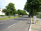
Sun | Aug 16, 1928 | In the district, the plots 372-416 are between the east bank of the Heidekampgraben and Baumschulenstrasse, the larger part is in Neukölln . The Kaiser-Friedrich-Strasse in Neukölln was renamed Sonnenallee in 1920. In 1928 the extension set up as Straße 85 to Baumschulenweg was included. On May 11, 1938, the street was renamed Braunauer Strasse , including the remaining Kaiser-Friedrich-Strasse . The street was renamed Sonnenallee on July 31, 1947. Between Baumschulenweg and Neukölln there was the Sonnenallee border crossing between East and West Berlin from 1961 to 1990. In the 1943 address book, Braunauer Strasse in the Treptow district (Baumschulenweg is not separately named as a district) with the properties 371-399 (odd, left-hand side) and 372-402 (even, right-hand side) is included. Except for the petrol station at Braunauer Straße 400 (owner: German = American Petroleum = Ges., Tankwart A. Wasikowski) and for 399 “go. to Baumschulenstr. 65 n. Heidekampweg 1 “, the other properties are named“ construction site ”. |
|
| Späthsfelder Weg
( Location ) |
940 | leads through the Späthsfelde settlement | Sep 24 1936 | Established as road 94 , it is located between Königsheideweg and the federal motorway 113 . The site was parceled out in 1932. |

|
| Späthstrasse
( Location ) |
760 (in the district) |
Franz Späth (1839–1913), owner of what was then the world's largest tree nursery with a nursery and local politician | Aug 3, 1903 | Established as street 12 , it was laid out around 1864 and named in 1903 with the part of Britzer Allee that adjoins it to the south . The entire Späthsfelde location was still part of the Britz district at that time and was assigned to the Treptow district and the Baumschulenweg district east of the Teltow Canal, which was completed in 1908 . In Baumschulenweg the street lies between the banks of the Teltow Canal and the Königsheideweg. The entire complex and individual objects of the Späth'sche tree nurseries as well as the attached Späth Arboretum , which is open to visitors during the summer months, are listed as architectural monuments . |

|
| Sperlingsweg
( Location ) |
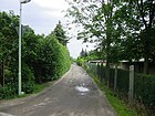
550 | Sparrow , songbird | Sep 1 1999 | The unpaved, partly concreted narrow driveway runs parallel to the federal motorway 113 between Späthstraße and the allotment garden area and then in an arc to Privet Drive. |
|
| Stormstrasse
( Location ) |
130 | Theodor Storm (1817–1888), writer and poet | Oct 19, 1906 | Set up as street 22a , it is located on the embankment of the Görlitzer Bahn between Baumschulenstraße and Trojanstraße. |

|
| Street 16
( Location ) |
140 | Not dedicated, numbered street in the allotment garden | before 1912 | Road 16 is a short and narrow access road that ends at the Wall Trail . Streets 4, 7, 11, 16, 17, 19, 20 and 21 are not dedicated private streets in the allotment gardens "Siedlung Daheim" (zip code 12437) and "Siedlung X". The gardens in the western area of the settlement were partially cleared when the A 113 was built . This settlement, also known as the “Späthstraße allotment garden”, with the streets mentioned lies between the Teltow Canal, Britzer Connection Canal , Chris-Gueffroy-Allee and Späthstraße. The street 16 opens up the allotment gardens "Harmonie" and "Elder bush" and ended in GDR times directly at the border to West Berlin. Two mighty concrete blocks still mark the transition to the former death strip on the Britz connecting canal. In contrast to the allotment gardens east of Späthstrasse, the local ones are neither listed as a street nor as a KGA in the address directory for the living environment-oriented spaces (PDF; 480 kB), and they are not mentioned in Berlin's allotment garden development plan. Until the Berlin regional reform in 1938, the area belonged to the Neukölln district, Britz district. |

|
| Street 17
( Location ) |
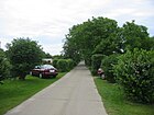
460 | Not dedicated, numbered street in the allotment garden | before 1912 | The street begins in the west at the intersection of Straße 16 / Straße 19 and leads in the east to Chris-Gueffroy-Allee. Together with road 16, it thus opens up the allotment gardens. |
|
| Street 19
( Location ) |
325 | Not dedicated, numbered street in the allotment garden | before 1912 | Road 19 extends road 16 at the intersection with road 17 in a southerly direction and ends in a dead end. |

|
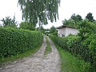
| Street 20
( Location ) |
155 | Not dedicated, numbered street in the allotment garden | before 1912 | The path branches off in the southern part of road 19 and runs parallel to road 2 in a west-east direction. |
|
| Street 21
( Location ) |
310 | Not dedicated, numbered street in the allotment garden | before 1912 | The road branches off from road 17 and runs south. There it meets street 20 at a right angle. |

|
|
Südostallee
( Location ) |
1140 (in the district) |
is located in the southeast of Berlin | Oct. 20, 1932 | In the district it is located between Baumschulenstrasse and Rixdorfer Strasse with plots 2–4 (even) and 3–55 (odd). The southern roadside east of the Britzer Zweigkanal with allotment gardens and the Königsheide belongs to the district Johannisthal . When it was named in 1932, the Johannisthaler Kaiserstraße , which has been named since 1900 (from 1910 to 1920 Königschaussee ) and the part of the Forsthausallee east of Baumschulenstraße were combined. At the time it was named, the latter still belonged to the Neukölln district (Britz district) and was run from 1902 to 1910 as part of the Rixdorf-Canner-Kreischaussee . The Südostallee is used to access the basement of the Baumschulenweg crematorium . |

|
|
Thuja path
( Location ) |
440 | Thuja , arborvitae, ornamental plant | Sep 24 1936 | Established as Straße 95 , when it was named in Späthsfelde it still belonged to Britz in the Neukölln district. The path lies between the Alpenrosenweg and the Aprikosensteig. |

|
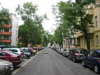
| Trojan Street
( Location ) |
170 | Johannes Trojan (1837-1915), writer | Oct 19, 1906 | Set up as Straße 16 , it is located between Köpenicker Landstraße and Stormstraße. |
|
|
Wohlgemuthstrasse
( Location ) |
330 | Gabriel Wohlgemuth (1850–1898), architect, board member of the bbg , buried in the Jewish cemetery in Weißensee . He bought several pieces of land in Baumschulenweg and wanted to build Art Nouveau houses there. Due to his sudden death he did not live to see the completion. | Sep 9 1904 | Set up as Straße 13 , it lies between Baumschulenstraße and Heidekampweg, over which it continues as a dead end. After Wohlgemuth's death, the Berlin building cooperative bbg began building the area west of Baumschulenstrasse in 1904. Between 1940 and 1947 it was named as the Lauerzeile . |
Planned and former streets
In the 1943 address book Baumschulenweg is included in the Treptow district.
| Surname | from | to | named in | Remarks |
|---|---|---|---|---|
| Filing path | Jan. 29, 1842 | around 1880 | - Baumschulenweg | The deposit was the anchorage on the Spree before reaching Berlin. |
| Alwin-Gerisch-Strasse | Nov 9, 1926 | Apr 4, 1934 | → Heidekampweg | Alwin Gerisch (1857–1922), chairman of the SPD, member of the Reichstag. As an additional sign on Heidekampweg, a plaque in memory of Alwin Gerisch was installed on August 8, 2012. |
| Baumschulenweg | around 1890 | March 4, 1905 | → Baumschulenstrasse | to Späth's nursery |
| Brahnauer Strasse | Aug 9, 1929 | Aug 25, 1939 | → Heidemühler Weg | Brahnau, place in the former province of Posen (Poland) |
| Braunauer Strasse | May 11, 1938 | July 31, 1947 | → Sonnenallee | Braunau am Inn , district town in Upper Austria. |
| Braunweg | Jan. 23, 1931 | Apr 4, 1934 | → Toboggan trail | Lily Braun (1865–1916), writer, suffragette |
| Britzer Allee | Jan. 29, 1842 | Aug 13, 2010 | → Chris-Gueffroy-Allee | as a road also in Neukölln connection to the southwestern neighboring town |
| Cecilienstraße | Feb 10, 1905 | Jan. 23, 1931 | - Braunweg | Named after the Crown Princess Cecilie by resolution of the Treptow municipal council . |
| Elisabeth-Schiemann-Strasse | intended | not executed | → Privet Drive | Elisabeth Schiemann (1881–1972), crop researcher and resistance fighter against the Nazi regime |
| Open space XIII | plan | March 20, 1929 | → Hohenbirker Weg | Information in the development plan |
| Rack path | around 1810 | Jan. 29, 1842 | → Eichbuschallee | Frame: old name for a lane. Rack paths divided the forest into hunts or blows. |
| Prospect path | before 1960 | Oct. 1, 1996 | → Privet Drive | Path for those interested in colony grounds |
| Johannisthaler Chaussee | after 1912 | Oct. 20, 1932 | → Königsheideweg | Road to the neighboring village to the east |
| Johannisthaler Chaussee (Britz) | before 1911 | Oct. 20, 1932 | → Königsheideweg | Chaussee to the neighboring town, before the construction of the Teltow Canal until 1938, Britz bordered further east |
| Kaiserstraße (part) | March 14, 1905 | Oct. 20, 1932 | → Südostallee | mostly in Johannisthal Wilhelm I (1797–1888), German Emperor, King of Prussia |
| Kiefholzweg | Jan. 29, 1842 | Nov 25, 1895 | → Kiefholzstrasse | Kiefholz, local forest |
| Kiehnwerderallee | Jan. 29, 1842 | Sep 24 1997 | - repealed as a street | Plänterwald district |
| Köpenicker Weg | Jan. 29, 1842 | around 1896 | → Köpenicker Landstrasse | Connection path to Köpenick |
| Lauerzeile | Dec 11, 1940 | July 31, 1947 | → Wohlgemuthstrasse | Gustav von Lauer (1808–1889), medic |
| Parkstrasse (Johannisthal) | 1892 | October 20, 1932 | → Königsheideweg | Johannisthal |
| Rixdorf-Canner-Kreischaussee | Jan. 29, 1842 | May 13, 1930 | → Forsthausallee | also located in Neukölln, connection to the historic forest house Canne |
| Separation route XI | around 1850 | after 1880 | → Heidekampweg | Separation - pre-forms of today's land consolidation |
| Street 4 | plan | March 19, 1905 | - Cecilienstraße | east of Baumschulenstrasse |
| Street 6 | plan | Oct 18, 2010 | → Bodelschwinghstrasse | west of Baumschulenstrasse |
| Street 7 | plan | Oct. 19, 1909 | → Frauenlobstraße | west of Baumschulenstrasse |
| Street 9 | plan | May 17, 1930 | → Rinkartstrasse | west of Baumschulenstrasse |
| Street 10 | plan | Sep 9 1904 | → Schraderstrasse | west of Baumschulenstrasse |
| Street 12 | plan | Sep 9 1904 | → Mörikestrasse | west of Baumschulenstrasse |
| Street 12 | plan | Aug 3, 1903 | → Späthstrasse | Späthsfelde belonged to the Neukölln district until 1938 |
| Street 13 | plan | Sep 9 1904 | → Wohlgemuthstrasse | west of Baumschulenstrasse |
| Street 16 | plan | Oct 28, 1899 | → Mosischstrasse | west of Baumschulenstrasse |
| Street 16 | plan | Oct 19, 1906 | → Trojan Street | west of Baumschulenstrasse |
| Street 19 | plan | Oct. 1, 1996 | → Privet Drive | Späthsfelde settlement |
| Street 22 | plan | Feb 10, 1905 | → Glanzstrasse | east of Baumschulenstrasse |
| Street 22a | plan | Oct 19, 1906 | → Stormstrasse | west of Baumschulenstrasse |
| Street 23 | plan | Feb 10, 1905 | → Scheiblerstrasse | east of Baumschulenstrasse |
| Street 23a | plan | Oct 19, 1906 | → Eschenbachstrasse | west of Baumschulenstrasse |
| Street 24 | plan | Oct 8, 1909 | → Ekkehardstrasse | west of Baumschulenstrasse |
| Street 32 | plan | Aug 16, 1928 | → Hanselstrasse | A Hänselstrasse had already been laid out in Neukölln. |
| Street 49 | plan | Apr 12, 1905 | - Brahnauer Strasse | |
| Street 50 | plan | May 17, 1930 | → Radenzer Strasse | |
| Street 54 | plan | May 17, 1930 | → Dornbrunner Strasse | |
| Street 55 | plan | Apr 12, 1905 | → Frauenlobstraße | west of Baumschulenstrasse |
| Street 59 | plan | May 17, 1930 | → Hallberger line | |
| Street 61 | plan | Nov 9, 1926 | → Ludwig-Klapp-Strasse | west of Baumschulenstrasse |
| Street 65 | plan | around 1935 | entered between Sonnenallee and Forsthausallee | |
| Street 67 | plan | Aug 9, 1929 | → Gondeker Strasse | |
| Street 80 | around 1935 | after 1943 | Located between Sonnenallee and a (today's) western arm of the Heidekampweg. In 1943, it is listed as the cross street on the left-hand side of Braunauer Strasse at the corner of property 371 (thus belonging to Baumschulenweg) between "Neukölln district" and Heidekampweg. Opposite, the street 86 is noted to the right of the Braunauer Straße going off between Braunauer Straße 378 and 382. | |
| Street 85 | plan | Aug 16, 1928 | → Sonnenallee | |
| Street 90 | plan | Sep 24 1936 | → Alpenrosenweg | Späthsfelde belonged to the Neukölln district until 1938 |
| Road 91 | plan | Sep 24 1936 | → Mahonia Way | Späthsfelde belonged to the Neukölln district until 1938 |
| Street 93 | plan | Sep 24 1936 | → Berberitzenweg | Späthsfelde belonged to the Neukölln district until 1938 |
| Street 94 | plan | Sep 24 1936 | → Späthsfelder Weg | Späthsfelde belonged to the Neukölln district until 1938 |
| Street 95 | plan | Sep 24 1936 | → Thuja path | Späthsfelde belonged to the Neukölln district until 1938 |
| Street 213 | plan | March 20, 1929 | → Schöntaler Weg | |
| Street C | plan | Aug 9, 1929 | → Güldenhofer Ufer | Embankment on the Britz Canal |
Further locations in Baumschulenweg
Allotment gardens
The paths of the allotment gardens are mostly paths that do not meet the street criteria or are not publicly dedicated as private roads . On the other hand, paths in allotment gardens are often postal addresses. In Baumschulenweg, south of the Königsheide and in the corner between the Britzer Zweigkanal and Teltowkanal (the former here and the other not in the entire length of the district) there are garden colonies that are (fictitious) permanent use colonies due to the Berlin allotment garden law . On the other hand, during the construction of the federal motorway 113 with junction 2 (Späthstraße) and its compensation systems, which are located in the adjacent motorway section on Baumschulenweger Flur, the interests of the general public were rated higher than the property of an allotment garden. Twelve percent of the district's allotment gardens are in the district.
| Allotment gardens , colony, settlement | Area hectares |
Number of parcels |
Inventory status | Remarks | founding year |
|---|---|---|---|---|---|
| Apricot dough
( Location ) |
14,405 | 30th | no permanent stock | Private | |
| Tree friends
( Location ) |
8,723 | 18th | fictitious permanent allotment gardens | owned by the province to road 16 |
1987 |
| Flower grove
( Location ) |
19,378 | 42 | fictitious permanent allotment gardens | native, a permanent user | |
| Britzer Allee
( Location ) |
49,527 | 127 | fictitious permanent allotment gardens | native, a permanent user | 1912 |
| Buckersberg
( Location ) |
35,467 | 75 | fictitious permanent allotment gardens | national | |
| Own clod
( Location ) |
18,235 | ?? | |||
| Unity
( Location ) |
23,018 | ?? | |||
| Rock solid
( Location ) |
8,113 | 11 | ?? | ||
| Formosa
( Location ) |
15,538 | 14th | ?? | ||
| KGA Forsthausallee
( Location ) |
16,580 | 43 | The facility is permanently secured until after 2025, after which residential development is to take place. | national | |
| Happiness
( Location ) |
38,467 | 67 | fictitious permanent allotment gardens | national, 4 permanent users | |
| Cozy home
( Location ) |
90,624 | 188 | fictitious permanent allotment gardens | national, 22 permanent users | 1919 |
| Cosiness III
( Location ) |
57,083 | 136 | no permanent stock | state-owned but 28 parcels on 10,631 m² private 5 permanent users plus street 16 |
1902 |
| Gold willow
( Location ) |
55,306 | 118 | fictitious permanent allotment gardens | national, 11 permanent users | |
| harmony
( Location ) |
30945 | 76 | no permanent stock | state-owned but 26 parcels on 9,310 m² private plus street 16 |
|
| Heath by the water
( Location ) |
17.1513 | 267 | fictitious permanent allotment gardens | state owned, 19 permanent users After the construction of the Teltow Canal, the water level is lower here. |
|
| Home plaice
( Location ) |
18162 | 46 | ?? | ||
| Hermannsruh
( Location ) |
47,033 | 90 | fictitious permanent allotment gardens | national, 7 permanent users | |
| KGA Holderbusch
( Location ) |
18,162 | 9 | ?? | ||
| KGA elderberry bush
( Location ) |
87,746 | 159 | ?? | also street 16 | |
| KGA evergreen
( Location ) |
16,882 | 29 | ?? | ||
| KGA Kuckucksheim II
( Location ) |
34.005 | 76 | ?? |
also street 16 |
1922 |
| KGA Lakegrund
( Location ) |
10,900 | 34 | The facility is permanently secured until after 2025, after which residential development is to take place. | national | |
| KGA Lerchenhöhe
( Location ) |
17,107 | 52 | no permanent stock | state-owned, 3 permanent users plus street 16 |
|
| KGA Lindental (oasis)
( Location ) |
48,255 | 79 | fictitious permanent allotment gardens | national, 4 permanent users | 1922 |
| KGA Mariengrund
( Location ) |
28,972 | 82 | The facility is permanently secured until after 2025, after which residential development is to take place. | state-owned but 12 plots on 6,106 m² private |
1919 |
| KGA Meran (agreement)
( Location ) |
11,352 | 30th | ?? | ||
| KGA morning sun
( Location ) |
25,460 | 53 | ?? | 1927 | |
| KGA Friends of Nature
( Location ) |
5,485 | 16 | no permanent stock | national | |
| KGA New Zealand
( Location ) |
38,633 | 70 | fictitious permanent allotment gardens | national, 3 permanent users | 1897 |
| KGA Oberer Damm
( Location ) |
54,059 | 113 | ?? | national | |
| KGA Silberlinde
( Location ) |
27.006 | 78 | fictitious permanent allotment gardens | national | 1910 |
| KGA Späthstrasse
( Location ) |
14,347 | 30th | ?? | national | 1932 |
| KGA Späthswalde
( Location ) |
58,395 | 113 | fictitious permanent allotment gardens | national, 9 permanent users | |
| KGA Treidelweg
( Location ) |
12,674 | 15th | ?? | A towing railway ran along the Teltow Canal here until around 1944. | 1927 |
| KGA Zur Linde
( Location ) |
60,800 | 145 | The facility is permanently secured until 2025, after which residential development is to take place. | state owned but 15 parcels on 3,012 m² private land |
1887 |
Open spaces
- Späth'sche tree nursery ( location ) with its neighboring planting areas ( location ) and the arboretum ( location ).
- Old municipal cemetery ( location ) with the Baumschulenweg crematorium
- New municipal cemetery Baumschulenweg ( location )
- Sports facilities
Traffic areas
- Görlitzer Bahn with the Berlin-Baumschulenweg station ( Lage ), plus the Neukölln railway line, with several S-Bahn lines
- Britzer Zweigkanal between the inflow Heidekampgraben ( Lage ) and the Spree ( Lage )
- Federal motorway 113 with the junction Späthstraße ( Lage ) and the retention basin ( Lage ), a compensatory measure for the construction of the motorway.
| Street number |
designation | roadway | Location direction |
Step StEP road connection |
OKSTRA class |
Length (m) |
|---|---|---|---|---|---|---|
| 99457 | Eg Dresden AS Späthstraße | Main roadway | > South | I: spacious | A. | 630 |
| 99458 | Eg Dresden AS Späthstraße | Main roadway | > North | I: spacious | A. | 620 |
| 99459 | E.g. Dresden | Main roadway | AS Späthstraße and AS Johannisthaler Chaussee | I: spacious | A. | 1200 |
| 99460 | E.g. Dresden | Main roadway | AS Johannisthaler Chaussee and AS Späthstraße | I: spacious | A. | 1140 |
| 99463 | Eg Dresden AS Johannisthaler Chaussee | Main roadway | > South | I: spacious | A. | 510 |
| 99464 | Eg Dresden AS Johannisthaler Chaussee | Main roadway | > North | I: spacious | A. | 560 |
| 99467 | E.g. Dresden | Main roadway | AS Johannisthal Chaussee and AS Stubenrauchstraße | I: spacious | A. | 530 |
| 99462 | Eg Dresden AS Johannisthaler Chaussee | entrance | from Johannisthal Chaussee Ost | II: superior | A. | 330 |
| 99453 | Eg Dresden AS Späthstraße | exit | to Späthstrasse West | II: superior | A. | 330 |
| 99454 | Eg Dresden AS Späthstraße | entrance | from Späthstraße Ost | II: superior | A. | 330 |
| 99455 | Eg Dresden AS Späthstraße | exit | to Späthstraße Ost | II: superior | A. | 300 |
| 99456 | Eg Dresden AS Späthstraße | entrance | from Späthstrasse West | II: superior | A. | 310 |
| 99461 | Eg Dresden AS Johannisthaler Chaussee | exit | to Johannisthaler Chaussee West | II: superior | A. | 280 |
See also
literature
- Baumschulenweg in words and pictures, supplemented edition 2008, compiled by Jürgen Krämer, Treptow district writer from 1971 to 1988
Web links
- Map of Berlin 1: 5000 with district boundaries. Senate Department for Urban Development Berlin, 2009, accessed on July 13, 2011 .
- Berlin-Brandenburg Statistics Office: Directory of streets and squares in the Treptow-Köpenick district (as of February 2015); pdf
- Streets in Baumschulenweg by Kaupert Media
Individual evidence
- ↑ Place “An der Kirche” ceremoniously inaugurated Website of the Evangelical Church Community Berlin-Baumschulenweg, accessed on June 28, 2012.
- ↑ Entire complex of the Rodelbergweg / Baumschulenstrasse 245-259 (odd) settlement from 1929/1930
- ↑ Church to the father's house : school, church, teacher's house, parish and rectory
- ↑ Row house settlement Behring-, Ernst-, Marientaler Straße
- ↑ According to Kauperts.de, this designation is the most likely and can be supported by the nearby Eschenbachstrasse .
- ↑ More details on the magistrate forester named Ernst
- ↑ Ernststrasse 5: Möhring tenement house
- ↑ Gretelstraße is in the Neukölln district.
- ↑ In a site plan by Baumschulenweg from 1880, the Heidekampgraben street is designated as Separationsweg XI.
- ↑ a b Brahnau: today a district of Bydgoszcz (Poland), on May 11, 1938 the Sonnenallee in Braunauer Strasse was named after the birthplace of Adolf Hitler . On May 11, 1938, Kaiser-Friedrich-Strasse and Sonnenallee were renamed Braunauer Strasse. In 1947 the entire route of Braunauer Strasse was named Sonnenallee. The street was named in honor of Adolf Hitler, who was born in Braunau, on the occasion of his 50th birthday. see Kaupert.de
- ↑ The Kiefholz was mentioned in a file of the Berlin magistrate from 1714 as its property.
- ↑ Complete system of the Baumschulenweg community school, school and teachers' house from 1900–1901
- ↑ Katrin Bischoff: Stolen, sawed up, sold . In: Berliner Zeitung (print edition), January 14, 2019, p. 22.
- ↑ Garden monument of the open spaces from 1930/1939 in the front garden area of Köpenicker Landstrasse 78–148
- ↑ More details on Martin Rinkart
- ↑ In the Berlin address books, all properties that have been awarded but not yet built on or used are designated as construction sites.
- ↑ Ensemble tree nursery Späth
- ↑ a b c Berlin address book 1943> Heads of household, companies and commercial enterprises registered by the commercial court sorted by street> Treptow administrative district> Treptow
- ↑ taking into account www.alt-berlin.info/seiten
- ↑ Press release Schild for Alwin Gerisch on berlin.de
- ↑ Senate for Urban Development Berlin: Allotment gardens in the district ( Memento of the original from September 29, 2013 in the Internet Archive ) Info: The archive link was inserted automatically and has not yet been checked. Please check the original and archive link according to the instructions and then remove this notice. (PDF; 26 kB)
- ↑ Gartenfreunde Treptow, overview of the affiliated associations ( Memento from April 9, 2008 in the Internet Archive )
- ↑ Effects of the extension A100 ( Memento of July 21, 2013 in the Internet Archive )
- ↑ gartenfreunde-berlin.de: Colonies in Treptow-Köpenick
- ↑ KGA data Treptow-Köpenick ( Memento of the original from September 29, 2013 in the Internet Archive ) Info: The archive link was automatically inserted and not yet checked. Please check the original and archive link according to the instructions and then remove this notice. (PDF; 38 kB) accessed June 12, 2012.
- ↑ With ?? colonies are marked for which there is still a need for clarification through an on-site inspection.
- ↑ Gartenfreunde Treptow: Anniversaries ( Memento from February 8, 2015 in the Internet Archive )
- ↑ a b c d The property , Journal des VDGN, 11 / 12-2016, p. 07.
- ^ Chronicle of the KGA Gemütliches Heim
- ↑ website gemuetlichkeit3.de.to/
- ↑ a b History of KGA Mariengrund ( Memento of the original from December 1, 2012 in the Internet Archive ) Info: The archive link was automatically inserted and not yet checked. Please check the original and archive link according to the instructions and then remove this notice.
- ^ Location of the KGA Silberlinde
- ↑ History of the KGA Spaethswalde ( Memento of the original from February 19, 2015 in the Internet Archive ) Info: The archive link was inserted automatically and has not yet been checked. Please check the original and archive link according to the instructions and then remove this notice.
- ^ Tobogganing in Berlin - Treptow-Köpenick
- ↑ FIS Broker Detail Network (regional reference system)
- ↑ Clarification of the situation on map 1: 5000, produced by the district surveying offices (Senate Department for Urban Development and the Environment)


