List of streets and squares in Berlin-Friedrichshain

The list of streets and squares in Berlin-Friedrichshain describes the street system in the Berlin district of Friedrichshain with the corresponding historical references. At the same time, this compilation is part of the lists of all Berlin streets and places .
overview
The district is bounded by: Lichtenberger Straße, Mollstraße , Otto-Braun-Straße , Am Friedrichshain, Virchowstraße, Margarete-Sommer-Straße, Danziger Straße , Landsberger Allee , Hausburgstraße, Thaerstraße, Eldenaer Straße, Ringbahn- Trasse , Kynaststraße, Rummelsburger See and the Spree .
Friedrichshain essentially comprises the postcode areas 10243, 10245, 10247 and 10249 (which still covers areas in Prenzlauer Berg ). In the border areas to the neighboring districts of Mitte and Lichtenberg , small areas of Friedrichshain belong to the postal code areas 10178, 10179 and 10317. When the road system was developed, the areas shown here belonged to the post districts O 17 , O 34 and O 112, Boxhagen-Rummelsburg and Friedrichsberg .
On December 30, 2019, the Friedrichshain district had 136,035 inhabitants, whose residential buildings are in 179 dedicated streets, plus 23 town squares in the district. From the streets 11 continue into the neighboring districts or partly belong to them. The total length of all city and federal roads in Friedrichshain is 84.5 kilometers. In the district, two streets have the rank of federal highways , the B 96a in the course of Stralauer Allee - Warschauer - Petersburger - Danziger Straße and the merged B 1 and B 5 across the street Strausberger Platz - Karl-Marx-Allee - Frankfurter Allee.
Not all architectural and garden monuments are listed in detail in the following table because they can be found in the sister project List of Cultural Monuments in Berlin-Friedrichshain .
According to a resolution by the district council of the Friedrichshain-Kreuzberg district on February 23, 2005, streets and squares should initially only be named or renamed after women in order to equalize the number of streets dedicated to men and women. However, exceptions are possible in the event of greater public interest.
Overview of streets and squares
The following table gives an overview of the streets and squares in the district as well as some related information.
- Name / location : current name of the street or square. Via the link Location , the street or the square can be displayed on various map services. The geoposition indicates the approximate center of the street length.
- Traffic routes not listed in the official street directory are marked with * .
- Former or no longer valid street names are in italics . A separate list may be available for important former streets or historical street names.
-
Length / dimensions in meters:
The length information contained in the overview are rounded overview values that were determined in Google Earth using the local scale. They are used for comparison purposes and, if official values are known, are exchanged and marked separately.
For squares, the dimensions are given in the form a × b for rectangular systems and for (approximately) triangular systems as a × b × c with a as the longest side.
If the street continues into neighboring districts, the addition ' in the district ' indicates how long the street section within the district of this article is. - Name origin : origin or reference of the name.
- Notes : further information on adjacent monuments or institutions, the history of the street and historical names.
- Image : Photo of the street or an adjacent object.
| Name / location | Length / dimensions (in meters) |
Origin of name | Date of designation | Remarks | image |
|---|---|---|---|---|---|
|
Alt-Stralau
( Location ) |
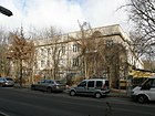
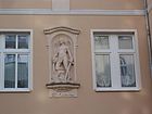
960 | Old village center of Stralau | 1900 | The road leads from the intersection of Stralauer Allee / Markgrafendamm to Tunnelstrasse. From 1887 to 1900 it was called Dorfstrasse . Architectural monuments are the historic factory building of the carpet company M. Protzen & Sohn (No. 3 and 4), the central office and a workshop building of the former Stralauer Glashütte (No. 63, 66 and 67). A Karl Marx memorial is located at number 18 . The historical building shown in the photo below served as the headquarters of the inland shipping company Berlin during the GDR era. |
 |
| At Comeniusplatz
( Location ) |
135 | Johann Amos Comenius (1592–1670), Moravian educator | Jul 4, 1904 | The street, first street 4a, section XIV in the development plan, forms the northern boundary of the square of the same name and connects the Gubener with Marchlewskistraße . House number 6 is part of a listed residential complex from 1955. |

|
| At the container terminal
( Location ) |
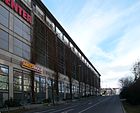
130 | Frankfurter Allee container station | Jan. 1, 1997 | The short traffic route is the access road from Möllendorffstrasse to the railway facilities, on the area of which there was a large container transshipment point in GDR times. This access was created with the container station and enables access to the parking garage at the "Ring Center". Before 1945 there was road 13 in this route (which was not laid out). The access road led to the railway area, slightly offset to the southwest . The access road (albeit unnamed) can still be found on the map in 1961, it is in the area of the Lichtenberg-Friedrichshain district border. The street protrudes into the Lichtenberger area. The street “Am Containerbahnhof” has no separate properties assigned to it. On the north side, nine meters from the edge of the road (strips of trees across from Möllendorffstrasse 117) and on the south side, the six-meter-wide sidewalk and the Möllendorffstrasse 118 building belong to Friedrichshain. In the latter is the parking garage of the adjoining shopping center (Frankfurter Allee 115/117 in Lichtenberg), the street is the entrance to the parking garage and the storage and delivery areas behind it. |
|
| At the Oberbaum
( Location ) |
200 | Oberbaum , river barrier of the former Berlin customs wall in the Spree | before 1841 | The street area between Warschauer Strasse and Oberbaumbrücke is designated on Oberbaum . In the Berlin address book of 1841, streets from the area around old Berlin were listed for the first time , since this street (Oberbaum, am) already existed and it was built on with residential buildings. |

|
| At the Ostbahnhof
( Location ) |
510 | Berlin Ostbahnhof | May 24, 1951 | The street runs from the street of the Paris Commune (east) to Andreasstraße, then shifted slightly to the north about forty meters further to the west and ends there as a dead end.
The street was laid out in the western part in 1844 as Breslauer Straße from the corner of Krautstraße and Holzmarktstraße to Koppenstraße and ran towards the terminus at the time. In 1887, after the station was rebuilt, it was extended to the east under the name Am Schlesischen Bahnhof as far as Fruchtstrasse (today the Paris Commune Street). After the Schlesische Bahnhof was renamed "Ostbahnhof" in 1950, Am Schlesischen Bahnhof became Am Ostbahnhof in 1951 . In 1964, the Breslauer Straße was named that way. A tram line ran through the entire street until 1966. Later the road was shortened to the west. Part of it now belongs to the property of a gas station. The median of Holzmarktstrasse now runs across the former property at Breslauer Str. 1, where a mass brawl with dead and seriously injured people in the “Naubur” bar in 1928 took place. The street called Am Ostbahnhof from 1867 to around 1950 was in a different location and is now called "Am Wriezener Bahnhof". |

|
| At the post station
( Location ) |
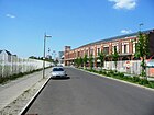
300 | former post station | Nov 16, 2006 | At the Postbahnhof was laid out in 2006, it goes off the street of the Paris Commune. |
|
| At Rudolfplatz
( Location ) |
120 | Rudolf von Stralow († around 1288), owner of the village of Stralau | Nov 28, 1900 | The street, first street 47a, section XIV of the development plan, forms the southern boundary of the square of the same name and connects Dannecker and Modersohn streets. It got its name after Rudolfplatz, which was named in 1896. In addition to the Zwingli Church , the substation at Rudolfplatz 3 is also worth mentioning as a Berlin monument. |

|
| At the store
( Location ) |
180 | Palm kernel oil storage , industrial monument on the Stralau peninsula | 1997 | At the Speicher there is a cul-de-sac from Palmkernzeile. |

|
| At the Wriezen train station
( Location ) |
130 | Wriezener Bahnhof , formerly located here | Nov 16, 2006 | The northern part of the street was probably first laid out in 1867 at the same time as the Ostbahnhof and was named "Am Ostbahnhof". The Ostbahnhof only existed until 1882, after which passenger traffic was relocated to the Silesian Railway Station, but the street retained its name at least until 1946. However, when the Silesian Railway Station was renamed "Ostbahnhof" in 1950, the name would have been very misleading and the street became Renamed to "Am Wriezener Bahnhof". The street is still entered in the city map from 1961, but was probably no longer built on after the rubble was cleared. It was later repealed.
In 2006 the road was laid out again. Like the former street of the same name, it initially leads from the street of the Paris Commune south of the route of the former Eastern Railway. Then, however, it bends south and runs over the former station area to the newly created street "An der Ostbahn", which is north of the current Ostbahn. |

|
| At the brewery
( Location ) |
280 | a company of the former Patzenhofer brewery that produced here between 1855 and 1990 | March 1, 1997 | The street runs from Richard-Sorge-Strasse in an easterly direction and ends as a cul-de-sac , which, however, is within walking distance to Petersburger Strasse. Before that, it was the extended Heidenfeldstrasse that had no official name. |

|
| At the Michaelbrücke
( Location ) |
150 | Michael Bridge | Dec. 30, 1878 | The street leads from Holzmarktstrasse to the bridge. The road was approved as a public road as early as 1875, but was only given its name three years later. On February 19, 1879, the road section was added on the bridge. |

|
| At the Ostbahn
( Location ) |
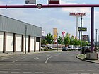
800 | Prussian Eastern Railway | Nov 16, 2006 | The Ostbahn branches off the street of the Paris Commune and runs parallel to the Stadtbahn on the site of the former Wriezen train station . It was created in 2006. |
|
| At the Schilling Bridge
( Location ) |
160 | Schilling Bridge | July 22, 1841 | The street extends from Andreasstraße to the bridge. The street is nameless on the East Berlin city maps of the 1970s and 1980s. The Schilling Bridge was not shown at all; it was right next to the Berlin Wall . |

|
|
Andreasstrasse
( Location ) |
820 | St. Andrew's Church | Jan. 23, 1863 | The street runs north from Holzmarktstraße to Karl-Marx-Allee. The name Wülknitzstrasse , initially requested by a chamber judge , was not approved. House number 46, together with the neighboring buildings by the Egon Hartmann architects' collective, was built in 1952 as one of the first new buildings in what was then the south block of Stalinallee , and is a listed building . |

|
| Annemirl-Bauer-Platz
( Location ) |
140 (curved) × 120 × 80 | Annemirl Bauer (1939–1989), painter | Sep 18 2010 | The square, which can already be seen on city maps in the 1940s, is to the west of the new entrance to Ostkreuz station. On the occasion of the completion of the renovations in this area in 2010, he was named by Annemirl Bauer at the request of a family member. |

|
| Auerstrasse
( Location ) |
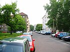
440 | Carl Auer von Welsbach (1858–1929), Austrian chemist and inventor | May 31, 1951 | Until 1951 the street was called Richthofenstraße after the Berlin police chief Bernhard von Richthofen . Auerstraße connects Weidenweg with Richard-Sorge-Straße. At Auerstraße 13-17 there is a day-care center designed by Anton Gerber in 1953/1954 and protected as a historical monument. Furthermore, houses number 8–30, completed in 1954, belong to the Karl-Marx-Allee Nord building ensemble and are also under monument protection. The Auerdreieck , a public green area, is located in the Auerstraße, Weidenweg and Löwestraße area (lower picture). |
 
|
|
Bahrfeldtstrasse
( Location ) |
320 | Albert Bahrfeldt (1846–1918), entrepreneur and local politician | 1912 | The street, referred to as street 2a in the development plan in the 19th century , runs from Krachtstraße to Palmkernzeile on the Stralau peninsula. |

|
|
Bänschstrasse
( Location ) |
960 | Willi Bänsch (1908–1944), resistance fighter against National Socialism | May 31, 1951 | Until 1951 it was called Mirbachstraße after the Prussian officer Ernst von Mirbach . Bänschstrasse connects Liebigstrasse with Pettenkoferstrasse in an east-west direction. Numerous residential buildings and the Samaritan Church on the central island are under monument protection. At number 50 there is a memorial plaque for the resistance fighter Artur Ogrowsky . | |
| Barnimstrasse
( Location ) |
300 | Barnim , plateau in Brandenburg northeast of Berlin | Aug 15, 1845 | The name applied for as Sametzkistraße after the owner was not approved because the owner did not pay the taxes for the specific area to the street tax authorities. A memorial plaque commemorates the former women's prison in Barnimstrasse . The street runs from Otto-Braunstrasse to Büschingstrasse. |
 |
|
Bersarinplatz
( Location ) |
160 × 140 (oval shape) |
Nikolai Bersarin (1904–1945), Soviet Colonel General, 1945 first Soviet city commander of Berlin | July 31, 1947 | The town square was built between 1862 and 1882 according to the Hobrecht plan . In 1895 it was named Baltenplatz and in 1947 it was renamed Bersarinplatz . This name was retained after discussions in the 1990s about Bersarin's role in Berlin's history. Thaerstraße, Rigaer Straße and Weidenweg are streets leading from the square, and Petersburger Straße is divided by it. |

|
|
Flower Street
( Location ) |
210 | Gardens by Jean David Bouché (1747–1819), original owner of the area of the street and gardens | Aug 18, 1816 | The street, designated as Lehmgasse in a plan from 1723 , received its name in 1816. It connects the Andreas- with the Krautstraße. After the removal of buildings on this street that had been destroyed in World War II, it was shortened accordingly. |

|
|
Böcklinstrasse
( Location ) |
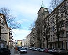
130 | Arnold Böcklin (1827–1901), Swiss painter | before 1901 | The street is a southerly connection from Wühlischstraße to Sonntagstraße. The former Max Kreuziger School (numbers 1 and 5) and the Trinity Church (numbers 7/8) are listed as historical monuments . |
|
|
Bödikerstrasse
( Location ) |
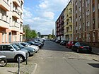
410 | Tonio Bödiker (1843–1907), first President of the Reich Insurance Office | Dec 2, 1897 | According to the development plan, the traffic route was first called Straße 42 , in 1904 Straße 42a was included. The Bödikerstraße runs from Stralauer Allee in a northerly direction to Laskerstraße. |
|
| Bootsbauerstrasse
( Location ) |
100 + 100 | Boat builder , craft widespread in Stralau in the 19th century | 1997 | Before 1997, there was no official designation as it was a private road. It consists of two parallel lanes with a wide, green central promenade. Starting from Bahrfeldtstraße, this street extends over the fishing course. |

|
| Bossestrasse
( Location ) |
240 | Robert Bosse (1832–1901), Prussian politician | June 11, 1902 | The street, laid out as street 43 according to the development plan , connects Stralauer Allee with Persiusstraße. |

|
|
Boxhagener Platz
( Location ) |
140 × 90 | Boxhagen , former colony, later part of the rural community Boxhagen-Rummelsburg , in which the square was located. | 1900 | According to the development plan he was first called Place D . The square is surrounded by Grünberger, Krossener, Gärtner and Gabriel-Max-Straße. |

|
|
Boxhagener Strasse
( Location ) |
1600 | Boxhagen , former colony, later part of the rural community Boxhagen-Rummelsburg , to which the road led. | before 1868 | Boxhagener Strasse originally led from Frankfurter Allee south-east over Warschauer Strasse to the Boxhagen colony. Outside Berlin it led as Boxhagener Chaussee or Alt-Boxhagen to the Stralau-Rummelsburg train station. When the Frankfurter Allee was rebuilt after the Second World War (between 1949/50 and 1961 Stalinallee ), the western section fell away.
At number 51 there is a memorial plaque for the resistance fighter Alfred Kowalke . The residential and commercial buildings numbers 70–72, 73, 76–78, 95–97 and 111 are listed architectural monuments. The Promise Church , the former cemetery chapel of the Parochial Parish (number 100), was built in the cemetery in 1879 according to plans by Gustav Knoblauch and served as a church from 1949 to 1996. It is a listed building. Since 2007 it has also been used as a theater. The Block 74 area with the Box Seven residential area is located on the street (No. 79-82) . |
 |
|
Büschingstrasse
( Location ) |
360 | Anton Friedrich Büsching (1724–1793), geographer | July 30, 1833 | The street runs from Mollstrasse to Friedenstrasse. From 1878 to 1898 the Berlin Asylum Association for the homeless operated accommodation for male homeless people in No. 4 . The Salvation Army opened its first men's home here in 1911. |

|
|
Caroline-Herschel-Platz
( Location ) |
30 × 30 × 20 | Caroline Herschel (1750–1848), astronomer | Dec. 1, 2007 | The square is at the Boxhagener / Wühlischstrasse fork in the road. Until 2007 he was nameless. The Star Guardian sculpture by the artist Christine Gersch has been located here since 2006 . |

|
| Colbestrasse
( Location ) |
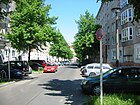
360 | unclear origin | May 31, 1951 | The first name from 1874 was Friedrich-Karl-Straße after Friedrich Karl of Prussia . Colbestraße runs south from Frankfurter Allee to Boxhagener Straße .
At house number 10 there is a memorial plaque for the resistance fighter Maximilian Kubitzek . The houses number 20-24 are under monument protection. |
|
|
Comeniusplatz
( Location ) |
125/100/ 140/35 (trapezoidal shape) |
Johann Amos Comenius (1592–1670), Moravian educator | Apr 13, 1904 | He was first as according to development plan space B , respectively. The town square is delimited by Am Comeniusplatz, Gubener Straße, Torrellstraße and Marchlewskistraße . At the edge of the square there is a bust in honor of the namesake. | |
| Corinthstrasse
( Location ) |
725 | Lovis Corinth (1858–1925), painter | May 31, 1951 | From around 1860 it was streets 40 and 40a , on August 23, 1902, the traffic route was named Goßlerstraße after the Prussian politician Gustav von Gossler . The street runs in an east-west direction from Modersohnstraße to Markgrafendamm. The listed buildings of the Emanuel Lasker School, opened in 1913 as a community dual school, are located at numbers 1–5. |
 |
|
Danneckerstrasse
( Location ) |
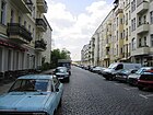
390 | Johann Heinrich von Dannecker (1758–1841), sculptor | May 24, 1951 | The name between 1896 and 1951 was Caprivistraße , named after Chancellor Leo von Caprivi . It begins on Rudolfstrasse, grazes on Rudolfplatz and ends on Stralauer Allee . The Zwinglikirche stands on plots 2 and 4 . |
|
| Diestelmeyerstrasse
( Location ) |
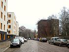
270 | Lampert Distelmeyer (1522–1588), Chancellor of the Mark Brandenburg | March 17, 1891 | The street was designated as street 42a in the development plan . It starts as a footpath on Friedenstraße , becomes a driveway after about 200 meters and ends at Matthiasstraße . |
|
| Dirschauer Strasse
( Location ) |
200 | Dirschau , town in West Prussia , since 1920 Tczew | June 28, 1907 | Dirschauer Straße, in the first development plan Straße 17, Section XIV , connects Simplonstraße (north) with Revaler Straße (south). |

|
| Dolziger Strasse
( Location ) |
540 | Dolzig , village and estate in East Brandenburg, which has belonged to Lubsko since 1945 , relevant at the time it was named as the birthplace of Empress Auguste Viktoria | Apr 4, 1895 | Dolziger Straße, referred to as Straße 69a in the development plan , runs in an east-west direction from Eldenaer Straße / Proskauer Straße to Pettenkoferstraße. The tenement houses number 8-13 from the beginning of the 20th century are under monument protection. |

|
|
Döringstrasse
( Location ) |
105 | Theodor Döring (1803–1878), actor | December 19, 1912 | Döringstraße was designated as Straße 22, Section XIV in the first development plan . It is a small connecting road between Simplonstraße (north) and Revaler Straße (south). |

|
| Dossestrasse
( Location ) |
260 | Dosse , tributary of the Havel | January 1905 | The street was only laid out at the beginning of the 20th century in the former "Colonie Friedrichsberg". It goes west from the Gürtelstrasse and after a bend leads south to the Oderstrasse. |

|
|
Ebelingstrasse
( Location ) |
200 | Emil Ebeling (1801–1883), banker and local politician | Feb 12, 1898 | Its first name according to the development plan was Straße 43a . Ebelingstraße is a one-way street that leads off Petersburger Straße and ends at Ebertystraße. At number 5 there is a memorial plaque for the resistance fighter Alfred Fuchs. The buildings number 12-14a of the Weisbachgruppe residential complex are under monument protection. |

|
| Ebertystrasse
( Location ) |
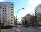
680 | Eduard Eberty (1840–1894), local politician | Jan. 8, 1901 | The first name according to the development plan was Straße 48, Abt. XIII . From the Landsberger Allee outgoing, the road ends at the fork in the road Thaer-, Eldenaer- and Mühsamstraße. At number 48 there is a memorial plaque for the resistance fighter Emil Burchardt . The buildings number 11/12 of the Weisbachgruppe residential complex are under monument protection. |
|
| Eckertstrasse
( Location ) |
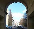
220 | Heinrich Eckert (1819–1875), entrepreneur who ran factories on the parcel of land adjacent to Lichtenberg | Aug 4, 1897 | Eckertstraße, first street 41a, section XIII / 2 , of the development plan, is a connecting street between Weidenweg and Mühsamstraße. On Weidenweg it leads through the residential building there. The Heinrich-Ferdinand-Eckert-Oberschule , located on property number 16 , was built in 1907/08 according to plans by Ludwig Hoffmann as a community double school and is a listed building .
Worth mentioning is a Wohnungsneubnau on the property Eckertstraße 1.2, the long time as unbebaubar was. In the 2010s, however, a residential building with 13 residential units was built here according to plans by Orange Architects , which the BDA awarded third prize in a competition for the best designs in 2018. The creativity in the design is particularly exemplary: an open staircase and a loggia serve as a meeting place for the residents, while wide balconies and roof terraces have been implemented. |
|
| Ede-and-Unku way
( Location ) |
70 | Ede and Unku , title characters in a youth book by Alex Wedding | Jan. 27, 2011 | The path that was already in place in the 1980s was only named in 2011. It connects Dossestraße with Scharnweberstraße or two daycare centers . |

|
| Edith-Kiss-Strasse
( Location ) |
150 | Edith Bán-Kiss (1905–1966), Hungarian sculptor and painter | Feb 13, 2014 | The street on the former freight yard was initially laid out under the name Planstraße D. As it passes the new nationwide sales center of Mercedes-Benz , the company suggested the names Bertha Benz or Mercédès Jellinek . At the suggestion of the Friedrichshain-Kreuzberg pirate faction in the commemorative plaque commission, the culture committee recommended that the street be named after Edith Bán-Kiss. BVV followed this recommendation on December 19, 2012, with the CDU abstaining . The official name was on February 13, 2014. The picture shows the Mercedes house in the foreground, built with black artificial stone slabs, steel and glass. |

|
| Ehrenbergstrasse
( Location ) |
370 | Christian Gottfried Ehrenberg (1795–1876), microbiologist | Nov 28, 1900 | According to the development plan, it was first called Straße 46a . Starting from Stralauer Allee, the street runs over Rotherstraße to Rudolfstraße.
The old industrial buildings of the company Narva / Osram with the numbers 11-14 and 17-23 are listed. |

|
| Eldenaer Strasse
( Location ) |
1170 | Eldena , part of the city of Greifswald in Mecklenburg-Western Pomerania | 29 Aug 1881 | According to the development plan, it was first called Straße 68 . Starting at the fork in Thaerstrasse, Ebertystrasse and Mühsamstrasse, it runs to the Lichtenberg district border . An obtuse-angled bend is created on Proskauer / ( August-Lindemann-Straße ) to the east-north-east, while Dolziger Straße continues the direct street course. The Lichtenberg district begins at the eastern edge of the railway ditch, so the Eldena road bridge over the S-Bahn line and the long-distance railway tracks (between which a ramp is under the bridge) forms the east end of the street before the street continues on Scheffelstraße . The name Scheffelstrasse Bridge is also listed in the Berlin street directory without this name being found in the Berlin 1: 5000 map. Plots 2–32 (continuous) and the road area belong to Friedrichshain, the entire length of the north side with plots 33–65 (continuous) belongs to the Prenzlauer Berg district . This course of the district boundary continues on the northern edge (plot 33 is undeveloped) of the bridge to the district boundary to Lichtenberg. |

|
| Erich-Steinfurth-Strasse
( Location ) |
250 | Erich Steinfurth (1896–1934), resistance fighter against National Socialism | July 27, 1962 | The name between 1882 and 1962 was Madaistraße , after the local politician and police president of Berlin Guido von Madai . The street connects Koppenstrasse with the Paris Commune Street . At the end of the Second World War, only three front houses were preserved on their northeastern side, which are still used for residential purposes. It runs directly northeast parallel to the Ostbahnhof building. It is known as the “antique flea market” or as the “station mission” and more of a pedestrian zone. In 1962 the "Clubhouse of the Railway Workers at Berlin Ostbahnhof" and the "Madaistraße" located directly at the Ostbahnhof were named Erich Steinfurths. |
 |
| Ernst-Zinna-Weg
( Location ) |
210 | Ernst Zinna (1830–1848), fighter in the March Revolution of 1848 | Dec 1, 2011 | The path leads past the cemetery of those who fell in March and into the Volkspark Friedrichshain ; only this park path was initially called Ernst-Zinna-Weg on March 18, 2000. The public transport route from Landsberger Allee to the entrance to the Friedrichshain Clinic did not receive its official name until December 2011. |

|
|
Finowstrasse
( Location ) |
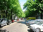
500 | Finow , tributary of the Oder | 13 Sep 1905 | At first it was called Straße 35b according to the development plan . Finowstrasse runs from Frankfurter Allee to Weserstrasse.
The houses number 1–4 are under monument protection . |
|
| Fishing trip
( Location ) |
410 | Stralauer Fischzug , historical folk festival on the Stralau peninsula | March 12, 1999 | The street connects the Glasbläserallee with the Palmkernzeile and lies on the Stralau peninsula. |

|
|
Forckenbeckplatz
( Location ) |
250 × 110 | Max von Forckenbeck (1821-1892), Mayor of Berlin | Apr 4, 1895 | At first, the town square was designated as Platz R according to the development plan . The square square is bordered by Eldenaer, Proskauer, Bänschstrasse and Liebigstrasse. |

|
|
Frankfurter Allee
( Location ) |
1440 (in the district) |
Frankfurt (Oder) , city in Brandenburg | Sep 20 1872 | From 1800 to 1872 it was called Frankfurter Chaussee ; then for the first time Frankfurter Allee ; 1949/1950 to 1961 Stalinallee . The avenue is part of the entry and exit road from the center of Berlin to the east ( B 1 / B 5 ). It begins at Frankfurter Tor (west) and extends to the intersection of Rosenfelder Straße (east). It crosses the district border to Lichtenberg at the ring railway and railway bridge at the S-Bahn and U-Bahn station Frankfurter Allee . |

|
|
Frankfurter Tor
( Location ) |
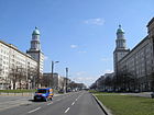
170 × 120 | Frankfurter Tor of the Berlin customs wall , which was about 800 meters further west | Nov 8, 1957 | Frankfurter Tor square is located at the intersection of Petersburger Strasse – Warschauer Strasse / Karl-Marx-Allee – Frankfurter Allee and forms a rectangular area there. The historic eponymous gate was on Friedenstrasse (100 m east of the intersection of the Paris Commune and Karl-Marx-Allee) leading to the extended Marchlewskistraße. When the avenue was rebuilt in the late 1950s, two corner buildings were designed like gates. The entire development (house numbers 1–9) is a listed building. |
|
| Franz-Mehring-Platz
( Location ) |
340 × 50 + 130 × 40 |
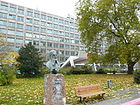
Franz Mehring (1846–1919), historian | March 3, 1972 | The first name of the then round town square was from 1867 to 1972 Küstriner Platz after the town of Küstrin , since 1945 Kostrzyn nad Odrą in Poland. The square was redesigned after it was completely destroyed in World War II and consists of a rectangular area (west of the Paris Commune Street ) and a prismatic area (east of the Paris Commune Street), on which the building of the printing works and daily newspaper Neues Deutschland is located. |
 |
| Fredersdorfer Strasse
( Location ) |
250 | Fredersdorf, part of the community Fredersdorf-Vogelsdorf in Brandenburg | March 20, 1964 with interruption | The traffic route emerged from Straße 2 and Straße 8, Section XIV of the development plan. From 1873 to 1964 it was called Königsberger Straße after the East Prussian city of Königsberg (after the Second World War as Kaliningrad in Russia). The road was gradually shortened. The remainder received her name in 1964. From 1989 to 1991 it was called Timbaudstrasse after the French resistance fighter Jean-Pierre Timbaud . Fredersdorfer Straße connects Marchlewski- and Rüdersdorfer Straße . The residential buildings with the numbers 13-15 and 25-27 are listed along with buildings in neighboring streets. |

|
|
Friedenstrasse
( Location ) |
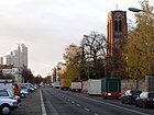
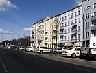
1040 | Peace of Frankfurt 1871 | 1892 | The street is a historical section of the Berlin excise wall and was first called Communication . It runs in a north-west-south-east direction between the street Am Friedrichshain and the Weidenweg and continues as the street of the Paris Commune . It leads past the Volkspark Friedrichshain and across the United Nations Square . At house number 3 there are memorial plaques for Rabbi Felix Singermann and a synagogue that used to be there. Along this street there are several architectural monuments such as the Bartholomäuskirche , the fairytale fountain in Volkspark Friedrichshain and the Resurrection Church . |
|
| Friedrich-Junge-Strasse
( Location ) |
370 | Friedrich Junge (1786–1858), businessman and local politician | 1904 | According to the development plan, it was first called Straße 5 and is located on the Stralau peninsula. The road runs from Alt-Stralau (south) to Fischzug (north). |

|
| Friedrichsberger Strasse
( Location ) |
240 + 90 | Friedrichsberg , historical district in the east of Friedrichshain | Dec. 30, 1878 | At first the street was designated as street 5 according to the development plan . It connects the Friedenstrasse with the Palisadenstrasse and continues after a slight bend as Lebuser Strasse. |

|
| Fritz-Schiff-Weg
( Location ) |
140 | Fritz Schiff (1889–1940), physician, persecuted by National Socialism | Oct 1, 2000 | The path continues on Richard-Sorge-Straße south of the Weidenweg. The former Kosmos cinema stands between it and Ludwig-Pick-Straße . |

|
|
Fürstenwalder Strasse
( Location ) |
220 | Fürstenwalde , city in Brandenburg | Feb 8, 1884 | At first the private road was called Heinelshof because the master carpenter A. Heinel had it laid out on his property. After the magistrate acquired the road land in 1873, it became a public road and was given its current name in 1884. Fürstenwalder Straße connects Palisadenstraße with Neue Weberstraße and through a gate for pedestrians also with Karl-Marx-Allee. |

|
|
Gabriel-Max-Strasse
( Location ) |
390 | Gabriel von Max (1840–1915), painter | around 1901 | First the street was designated as street 14a according to the development plan . After the name was given, the spelling Gabriel Maxstraße (Berlin address book from 1905) was initially used . It connects Boxhagener Straße in the north with Simplonstraße in the south, touching Boxhagener Platz . The apartment buildings number 3 and 20 are under monument protection. |

|
|
Gartnerstrasse
( Location ) |
470 | Employed in the then nurseries in Boxhagen | before 1882 | The first name was street 19 according to the development plan . Gärtnerstrasse runs from Boxhagener Strasse to Simplonstrasse, where it changes its name to Modersohnstrasse . It's a one-way street from Boxhagener to Wühlischstraße. |

|
| Georgenkirchstrasse
( Location ) |
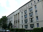
350 | George Church | Feb 3, 1862 | From 1748 to 1786 the traffic route was called Kirch-Gasse , until 1799 Große Kirch-Gasse and Am Georgen-Kirchhof . Then it was called Große Georgen-Kirchgasse , and part of it was also called Kleine Georgen-Kirchgasse . The following description can be found in the Berlin address book of 1822: [The street Am Georgen-Kirchhof] “is located in the Königsviertel, near the Georgenkirche (No. 1 at the church), has 35 houses, is 135 paces long and belongs to No. 1–12 to the 19th pole. Rev. ... by No. 13–45 to the 4th police station. “The Große Georgen-Kirchgasse led from the Gollnowsgasse to the Kleine Georgen-Kirchgasse with 48 houses over a length of 525 paces, the Kleine Georgen-Kirchgasse from the Landsberger Straße to the Georgenkirchhof with 12 houses and one Length of 130 paces. The name Georgenkirchstraße, which was made in 1862, probably combined the two previous streets. In 1901 the house numbers were counted from Friedenstraße to Georgenkirchplatz and back with a total of 70 parcels. In house number 1a a “deaconess nursing station” was indicated, in house number 2 there were the 139th and 161st community schools as well as the “1. Municipal advanced training school for girls ”and the registry office no. 8. House no. 11 housed the 6th Berlin community school. In the 1960s, some buildings along the street were rebuilt and the course of the street corrected a little. The "Berliner Missionsgesellschaft" listed at Georgenkirchstrasse 69/70 in 1901 became the Evangelical Mission House. This building complex and an administrative building (house number 2) from the 1950s (on the picture on the right) are now under monument protection. |

|
|
Glassblower Avenue
( Location ) |
310 | Glassblowers from the Stralauer Glashütte | Feb. 1, 2001 | The road, which was laid out in 2001, branches off from Alt-Stralau northeast and leads over the Fischzug road to the banks of the Rummelsburger See . Apart from the remains of the former glass factory, there are no other buildings on the western side. |

|
| Glatzer Strasse
( Location ) |
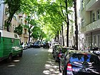
100 | Glatz , a town in Lower Silesia , since 1945: Kłodzko | 1907 | Glatzer Strasse is a small connecting road between Boxhagener and Weserstrasse. At number 6 there is a memorial plaque for the resistance fighter Werner Seelenbinder . |
|
| Graudenzer Strasse
( Location ) |
210 | Graudenz , town in West Prussia , since 1920: Grudziądz | Apr 2, 1891 | At first it was designated as Straße 7b according to the development plan . The street connects the Gubener with the Lasdehner street. The residential complex "Wohnzelle Friedrichshain" is a listed building. |
 |
| Grünberger Strasse
( Location ) |
1080 | Grünberg , town in Lower Silesia , since 1945: Zielona Góra | Oct 11, 1936 | According to the development plan, it was first called Straße 9 . Between April 30, 1899 and October 10, 1936 it was called Romintener Strasse .
Starting at Gubener Strasse, going across Warschauer Strasse , it ends at Boxhagener Strasse and the local Wismarplatz . At the corner Kadiner street stood until its destruction in World War II, the Lazarus Church . It was cleared of rubble in 1949 and blown up on September 10, 1949. The first Lazarus Church, a half-timbered building erected in 1892, was demolished in 1905 and rebuilt for the Hope Valley Lobetal Foundation . It has been there ever since. There are memorial plaques for the resistance fighters Georg Klinger and Werner Schaumann at houses number 63 and 85 . |

|
| Gryphiusstrasse
( Location ) |
390 | Andreas Gryphius (1616–1664), poet and playwright | 1903 | First the street was designated as street 29 according to the development plan . Leaving Weserstraße in a southerly direction, it ends at Simplonstraße. The buildings with the numbers 1–8 belonging to the Helenenhof housing estate are listed along with houses in neighboring streets. |

|
| Gubener Strasse
( Location ) |
860 | Guben , town in Brandenburg | March 5, 1874 | At first it was called Straße 6 according to the development plan . The extension was called Straße 6a , which was added to the first section in 1900 (spelling: Gubenerstraße ). In 1964 part of the old Königsberger Strasse was added. The street runs from Hildegard-Jadamowitz-Straße to Warschauer Straße. At house number 5 there is a memorial plaque for the member of the KJVD Herbert Neumann. Several tenement houses are architectural monuments. |
 |
|
Belt Street
( Location ) |
680 | the expansion of the street planned in 1874 as part of a ring road ("belt") around Berlin city center | around 1876 | Initially, the traffic route was named Straße 37 in the development plan . The street runs from the intersection Frankfurter Allee / Möllendorffstraße in a southerly direction to Weserstraße, where it changes its name to Neue Bahnhofstraße. At number 20-24 there is a memorial plaque for the resistance fighter Kurt Ritter . As part of a nationwide pilot trial by the Federal Ministry of Transport , the rule to turn right for cyclists was introduced in April 2019 in nine cities, including five intersections in Berlin . Frankfurter Allee and Gürtelstraße are one of these intersections. There, free right turns from Frankfurter Allee into Gürtelstrasse were permitted. |

|
|
Haasestrasse
( Location ) |
120 | Friedrich Haase (1825–1911), actor and theater director | December 19, 1912 | It was first named Straße 21 in the development plan . Haasestrasse connects Simplonstrasse (north) with Revaler Strasse (south). |

|
| Hausburgstrasse
( Location ) |
600 (east side) | Otto Hausburg (1831–1920), administrative director of the central cattle and slaughterhouse | June 11, 1902 | At first it was called Straße 48b according to the development plan . Starting at Landsberger Allee , it ends in a southerly direction at Thaerstraße. The east side of the street is in the Prenzlauer Berg district and forms the border with the Alter Schlachthof development area . The former 243rd and 267th community school (house number 20) is a listed building. |

|
| Hedwig-Wachenheim-Strasse
( Location ) |
340 | Hedwig Wachenheim (1891–1969), social politician and historian | Nov 16, 2006 | The street was built in 2006 in the area around the Mercedes-Benz-Arena (then O 2 World). |

|
| Heidenfeldstrasse
( Location ) |
200 | Theodor Heidenfeld (1834–1884), lawyer and attorney at the Berlin Regional Court | Feb 12, 1898 | In the development plan it was called Straße 42a, Section XIII / 2 . It goes south-east from Ebertystraße, but after renovation work in the 21st century it is a dead end. It is connected to Petersburger Strasse by foot. At house number 3 there is a memorial plaque for the resistance fighter Erich Prenzlau . Some buildings on the south-east side, together with the development of neighboring streets, form a monument complex. |

|
| Helenenhof
( Location ) |
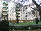
130 | Helene von Budde, wife of Hermann von Budde | around 1906 | The street was laid out in 1905/1906 for the Helenenhof residential complex of the civil servants' housing association . Their development is a listed building along with other houses in neighboring streets. At house number 1 there is a memorial plaque for the resistance fighter Kurt Machler . |
|
| Helen-Ernst-Strasse
( Location ) |
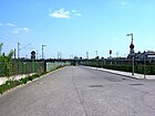
630 | Helen Ernst (1904–1948), illustrator and resistance fighter against National Socialism | Nov 16, 2006 | After the completion of the Mercedes-Benz-Arena (at that time O 2 World) it was laid out for traffic development on the premises of the Anschutz Entertainment Group in 2006. |
|
| Helmerdingstrasse
( Location ) |
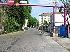
80 | Karl Helmerding (1822–1899), Berlin folk actor and comedian | December 29, 1912 | According to the development plan, it was first called Straße 23, Section XIV . It forms the southern extension of Holteistraße and connects Simplon and Revaler Straße. |
|
| Helsingforser Platz
( Location ) |
45 × 40 × 25 (triangular shape) |
Helsingfors, the Swedish name for Helsinki , capital of Finland | June 28, 1907 | In the Hobrecht Plan (Section XIV) in the 19th century an unnamed area was identified. It is bounded by Revaler Straße in the north-west, Marchlewskistraße in the north-east and Helsingforser Straße. The square is cut by a turning loop of the tram . The postal address includes two house numbers. The square was rebuilt between 2013 and 2014 and its design is now based on the southern Finnish landscape. A lookout point called Wriezener balcony was also created over the Wriezener open space laboratory , another park on the site of the former Wriezener train station . |

|
| Helsingforser Strasse
( Location ) |
320 | Adjacent Helsingforser Platz | July 26, 1951 | In 1873 it was called Bromberger Strasse after the town of Bromberg in the province of Posen , and since 1945 Bydgoszcz in Poland. It goes from Warschauer Straße to the northwest and after the intersection with Pillauer Straße it ends as a dead end . The Dathe Gymnasium is located at number 11–13. |

|
| Hermann-Stöhr-Platz
( Location ) |
70 × 60 | Hermann Stöhr (1898–1940), pacifist and resistance fighter against National Socialism | Jan. 4, 1998 | The square on the north side of the Ostbahnhof is bordered by Langestrasse (north), Koppenstrasse (west) and Erich-Steinfurth-Strasse (south) and a footpath (east). This remaining area remained after the development with a shopping center. |

|
| Hildegard-Jadamowitz-Strasse
( Location ) |
730 | Hildegard Jadamowitz (1916–1942), resistance fighter against National Socialism | Dec 20, 1957 | The street in the west-east route between the Paris Commune Street (formerly Fruchtstrasse ) and Kadiner Strasse has been rebuilt. The route crosses the former Memeler Strasse (where the Friedrichshain fire station was located) and Königsberger Strasse to Komturei-Platz , all of which no longer exist. After the fall of the Wall, the fire station was converted into the Kulturhaus Friedrichshain and the district library (picture). In the summer of 2012, this road was the subject of some press reports because the road surface is in such poor condition that a speed limit had to be set at 5 km / h. The bus traffic previously routed through the street was diverted. |

|
|
Highest street
( Location ) |
380 | upper layer on the slope of the Barnim | around 1857 | When it was first mentioned in the Berlin address book in 1857, it was spelled Höchststrasse , and in the 1880s Höchstestrasse . The accountant Sametzki had it created around 1830; it originally ran from the former Landsberger to Büschingstrasse. With the construction of new houses instead of the ones destroyed in the Second World War and the relocation of streets, it now connects Georgenkirchstraße via Büschingstraße with the development area of the United Nations Square . |

|
| Holteistrasse
( Location ) |
490 | Karl von Holtei (1798–1880), writer | June 1902 | The street begins at Simplonstraße, crosses Boxhagener Straße and ends at Weserstraße. According to the development plan, it was first called Straße 28, Section XIV . It is shown for the first time in the Berlin address book (suburbs; Boxhagen-Rummelsburg) from 1903. In the 1901 city map of Berlin, the route between Simplonstrasse in the south and Alt-Boxhagen (now Boxhagener Strasse) in the north was already entered without a name. |

|
| Holzmarktstrasse
( Location ) |
980 (in the district) |
Formerly the municipal timber trading center located here | around 1685 | Originally called only the part to Lichtenberger road to the area to Krautstraße was the wooden Marketplace and to Koppstraße the wood road . On August 13, 1835, all parts were given the common and currently valid street name. A development with residential houses did not take place until around 1850. The western side of the street belongs to the district of Mitte . It leads from Alexanderstraße (west) to Andreasstraße (east). |
 
|
|
Huebnerstrasse
( Location ) |
170 | Carl Hübner (1827–1910), local politician | Apr 4, 1895 | In the development plan it was first called Straße 50a, Section XIII / 2 . It connects Eldenaer Straße (north) with Weidenweg (south). |

|
|
Jessnerstrasse
( Location ) |
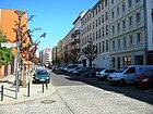
610 | Leopold Jessner (1878–1945), theater and film director | May 24, 1951 | The street runs between Frankfurter Allee and Weserstraße in a north-south direction, touching Traveplatz. When it was first named around 1874, it was called Kronprinzenstrasse in honor of the future Emperor and King of Prussia Friedrich III. After the Second World War, the Berlin city administration renamed numerous streets, which were named after rulers or soldiers. The primary school on Traveplatz is located on her. |
|
| Jollenseglerstrasse
( Location ) |
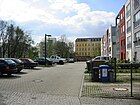
360 | Dinghy , single-masted sailing boat | 17 Sep 2007 | The Jollenseglerstraße on the Stralau peninsula was created in connection with the construction of new residential buildings. It runs from Alt-Stralau to the northeast. |
|
| Jungstrasse
( Location ) |
530 | Wilhelm Jung (1833–1890), entrepreneur | around 1877 | This traffic route in the former Friedrichsberg Colony was laid out around 1877 and reached from Frankfurter Allee (north) to Straße 31 (south) at the Colonie Boxhagen , located on Boxhagener Straße / Wismarplatz. At number 18 there is a memorial plaque for the resistance fighter Walter Homann . | |
|
Kadiner Strasse
( Location ) |
310 + 80 | Kadinen , officially Cadinen, place in West Prussia , since 1945 Kadyny in Poland, summer residence of Kaiser Wilhelm II. | June 11, 1902 | When it was built, it was called Straße 9a, Section XIV , of the development plan. The first spelling was Cadiner Straße . It goes north from Grünberger Straße and, after the confluence with Hildegard-Jadamowitz-Straße, makes a bend to the east to develop the residential buildings on Karl-Marx-Allee. The houses at Kadiner Straße 11 and 12 are listed architectural monuments. At number 16 there is a memorial plaque for the resistance fighter Georg Lehnig . |

|
|
Karl-Marx-Allee
( Location ) |
2100 (in the district) |
Karl Marx (1818–1883), philosopher and economist | Nov 13, 1961 | The avenue was originally called Große Frankfurter Straße west of the intersection with Fruchtstraße (since 1971 street of the Paris Commune) , east of it Frankfurter Allee . It was decided to rename it to Stalinallee on December 21, 1949 (the 70th birthday of Josef Stalin ), but it was not officially implemented until January 3, 1950. On November 13, 1961, it was renamed Karl-Marx-Allee . It extends from Alexanderplatz (east) to Frankfurter Tor (west). |

|
| Kinzigstrasse
( Location ) |
440 | Kinzig , tributary of the Rhine | March 20, 1939 | On December 6, 1874, the new street was named Blumenthalstraße after the Prussian Field Marshal Leonhard von Blumenthal . During the Nazi era it was renamed to its still valid name. It runs between Frankfurter Allee (north) and Weserstraße (south) with a footpath to Boxhagener Straße. The house number 29 is a monument. |

|
| Kleine Andreasstrasse
( Location ) |
160 | Andreasstrasse or Andreaskirche | 25 Aug 1865 | At first it was called Street D . The Kleine Andreasstraße in the Stralau district goes eastward from the Krautstraße and opens up the residential development. |

|
| Kleine Markusstrasse
( Location ) |
280 | St. Markus Congregation, founded here in 1854 | 23 Aug 1862 | It emerged from the Rosen-Quer-Gasse (also Rosenquergasse ; which led into the center of the district), which was already in existence in the middle of the 18th century and is said to have been named after the Swiss captain Imbert Rollaz du Rosey (1657-1704), who had a garden here. It runs westwards from Krautstraße in a U-shape. |

|
|
Knorr promenade
( Location ) |
150 | Georg Knorr (1859–1911), entrepreneur | 1912 | It was built in 1911–1913 like an avenue by Friedrichsberger Bank in the middle of the workers' district in Boxhagen for wealthy citizens. The Knorr promenade leads from Wühlischstrasse to Krossener Strasse. |

|
| Kochhannstrasse
( Location ) |
620 | Heinrich Kochhann (1805–1890), Berlin politician | 23 Aug 1902 | At first it was called Straße 42b, Section XIII / 2 of the development plan. Kochhannstrasse connects Richard-Sorge-Strasse across Petersburger Strasse with Hausburgstrasse. Houses 13–15b (in the north-east section) belong to the Weisbach group and are a listed building. |

|
| Konitzer Strasse
( Location ) |
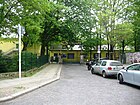
130 | Konitz , town in West Prussia , since 1920 Chojnice in Poland | December 19, 1912 | In the development plan of 1863 it was given the name Straße 18, Section XIV . The small cul-de-sac goes south from Simplonstrasse. The long controversial “ Wagenburg ” was located in its imaginary southern extension . |
|
|
Kopernikusstrasse
( Location ) |
500 | Nicolaus Copernicus (1473–1543), astronomer | around 1902 | In the development plan it was called Straße 10, Section XIV . After the naming of an eastern section, the western section up to Gubener Straße was added on September 15, 1903. The original, eastern section was renamed Simplonstraße in 1906 .
The current Kopernikusstraße begins in the west on Gubener Straße as a continuation of Torellstraße, crosses Warschauer Straße and continues after Simon-Dach-Straße as Wühlischstraße. At number 19 there is a memorial plaque for the resistance fighter Karl Pinnow . |

|
| Koppenstrasse
( Location ) |
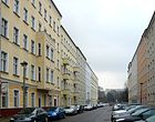
1120 | Christian Koppe († 1721), Berlin city governor and councilor | around 1840 | From around 1705 there was the Koppens-Gasse in the route , which had been laid out in the meadows and fields of the city governor Koppe. Around 1840 it was already entered on city maps as Koppenstrasse. It leads from Friedenstraße (north) over Karl-Marx-Allee to Am Ostbahnhof (south) in a guide that is slightly rotated several times. A little-noticed memorial is the stele in memory of those persecuted by the Nazi regime on the corner of Singerstrasse. It was molded from concrete based on a design by Werner Richter and erected in 1975. The Andreas-Gymnasium is located in the street. |
|
| Krachtstrasse
( Location ) |
200 | Louis Kracht (1865–1928), Stralau local politician, tax collector and property owner | around 1912 | Up until 1912 the street was called Seeweg because it ran on the Stralau peninsula between the Rummelsburger See and the Spree. It was shortened to the section between the fishing course and Alt-Stralau. |

|
| Krautstrasse
( Location ) |
660 | Johann Andreas Kraut (1661–1723), banker, Privy Council of War and Minister in the Kingdom of Prussia | Dec 31, 1860 | In the beginning of the 18th century the traffic route was named Krauts-Gasse ; At the request of the residents, it became the street indicated above. The north-south street leads from Blumenstrasse / Neue Blumenstrasse to Holzmarktstrasse. |

|
| Kreutzigerstrasse
( Location ) |
260 | Julius Ludwig Kreutziger (1826–1874), owner of the Hohen-Schönhausen farm No. 4 | around 1876 | First it was written on Creutzigerstrasse . It was not until 1893 that the spelling with "K" appeared. From Boxhagener Straße it is the northern continuation of Gabriel-Max-Straße and a dead end; initially it led to Frankfurter Allee . |

|
| Krossener Strasse
( Location ) |
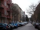
580 | Crossen , a town in Silesia, since 1945 Krosno Odrzańskie in Poland | 1902 | In Hobrecht's development plan it was called Straße 16a, Dept. XIV . The traffic route, which was still written on Crossener Straße (with C ) until 1929, runs in a straight line from Simon-Dach-Straße (west) to Boxhagener Straße (east). At number 27 there are memorial plaques for the resistance fighters Fritz Fieber and Karl Kunger . |
|
| Kynaststrasse
( Location ) |
1000 | Kynast, mountain and castle in the foothills of the Giant Mountains , since 1945 Chojnik Castle | around 1908 | The first name was Parallelweg (around 1890 to around 1908). The road leads from Alt-Stralau to the north along the Ringbahn and crosses the tracks of the S-Bahn lines to the east at Ostkreuz station . It was completely renewed between 2008 and 2010; a second branch of the road was laid out, which leads to the main road. The new branch and the properties east of Kynaststrasse with house numbers 18 to 25 are in Rummelsburg. |

|
|
Landsberger Allee
( Location ) |
1330 (in the district) |
Altlandsberg , city in Brandenburg | Dec 31, 1992 | The section from Alexanderplatz to Landsberger Platz (crossing with Friedenstraße) was called Landsberger Straße until 1950 , from there to the border with Berlin-Lichtenberg it became Landsberger Allee . In 1950 the entire street was renamed Leninallee after Vladimir Ilyich Lenin and renamed Landsberger Allee in 1992. Parts of the street run through Prenzlauer Berg , Lichtenberg , Fennpfuhl , Alt-Hohenschönhausen and Marzahn . After the renaming, the Friedrichshain section extends as an extension of Mollstrasse at United Nations Square to Hausburgstrasse in a west-east route. |
 
|
| Long street
( Location ) |
420 |
Length of street or a local resident named Lange (unclear) |
March 7, 1861 | Before the 17th century the name Grusestraße was found , after that it was called Langes Gasse , probably due to the everyday language of the residents. In old city maps it was marked as Lange Gasse . An official designation by the magistrate took place on December 8, 1860 at the request of the neighboring house owners. In 1969, when the area was rebuilt, it was shortened by an eastern piece, which was named Mehlbeerenweg. It runs east to Koppenstrasse. |

|
| Langenbeckstrasse
( Location ) |
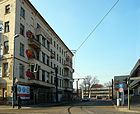
250 | Bernhard von Langenbeck (1810–1887), surgeon | Apr 2, 1891 | First (1877) it was Street 16b and Street 31, Dept. IVX in the Hobrecht Plan . Until after the Second World War, the street led from Landsberger Allee around the corner to Elbingerstraße , Danziger Straße. Then it was shortened to a small remainder during the construction of the Friesenstadion and later during the construction of the sports and recreation center (SEZ) in the years 1979–1981, which essentially serves as a turning loop for the tram. |
|
|
Lasdehner Street
( Location ) |
240 | Lasdehnen , a village in East Prussia , since 1945 Krasnosnamensk in Russia | May 15, 1935 | At first it was called Straße 7a, Section XIV of the development plan. From 1893 to 1935 the street was called Litauer Straße , after the country Lithuania , sometimes also written Litthauerstraße , and it reached from Frankfurter Allee directly to Gubener Straße. It is now a cul-de-sac that branches off from Hildegard-Jadamowitz-Strasse in a south-westerly direction. Worth mentioning here is the listed municipal dual school from 1909, built according to plans by Ludwig Hoffmann . During the GDR era, the three-winged building housed the high schools "Kurt Schlosser" and "John Sieg". |

|
| Laskerstrasse
( Location ) |
140 | Eduard Lasker (1829–1884), politician and lawyer |
May 22, 1910 with interruption |
In the development plan it was named Straße 39, Section XIV . From 1938 to 1947 the street was called Bassewitzstraße , after Friedrich Magnus von Bassewitz , a senior official in the province of Brandenburg at the time . In 1947 it was renamed Laskerstrasse. The street connects Bödikerstraße with Markgrafendamm; at its western end are the Lasker sports fields. |

|
| Lebuser Street
( Location ) |
200 | Lebus , city in Brandenburg | June 7, 1890 | In the development plan it was called Straße 5, Section XV . In 1890 it was named Lebuser Straße, and in some documents it was also written Lebusser Straße . That was officially established in 1958 on Lebuser Straße. It connects Friedrichsberger Strasse with Andreasstrasse in a north-south direction. |

|
| Lehmbruckstrasse
( Location ) |
360 | Wilhelm Lehmbruck (1881–1919), sculptor and graphic artist | May 31, 1951 | At first it was called Straße 46b, Section XIV in the development plan. On September 23, 1898 it was named Beymestrasse after the Prussian politician Carl Friedrich von Beyme . After the Second World War, street names were often renamed after rulers or Prussian personalities. It runs between Rudolfstraße (north) and Stralauer Allee (south). |

|
| Lenbachstrasse
( Location ) |
300 | Franz von Lenbach (1836–1904), painter | around 1902 | In the development plan it was first called Straße 27a, Section XIV . It connects Boxhagener Strasse (north) with Simplonstrasse (south). |

|
| Libauer Strasse
( Location ) |
260 | Libau , city in Latvia , since 1920 Liepāja | 4th July 1904 | Libauer Strasse was first Strasse 14a, Section XIV , in the development plan. It connects Wühlischstraße in a north-east-south-west route with Revaler Straße. |

|
| Lichtenberger Strasse
( Location ) |
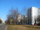
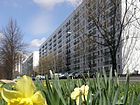
820 | Lichtenberg , municipality east of Berlin | Dec 6, 1874 | The street was planned in 1872 as a connection between Landsberger Strasse and Palisadenstrasse (development plan Section XV ). It ran over the former Klaeger property. It got its name in 1874. The southern extension to what was then Stalinallee / Strausberger Platz was laid out when the avenue was rebuilt and included in this name on December 20, 1957. The section from Strausberger Platz to Holzmarktstraße, previously since 1861 Markusstraße (named after the one that was demolished in 1957 after war damage), Markuskirche was finally also named Lichtenberger Straße on December 17, 1969. The first named area was then spun off again and is part of the United Nations Square . - The west side partly belongs to the district of Mitte . |
|
| Liebigstrasse
( Location ) |
820 | Justus von Liebig (1803–1873), chemist | Aug 15, 1881 | In the development plan, it was streets 59 and 59a, Section XIII / 2 , a section of which was removed as Augsburger Straße . When the name was finally given, the street from Frankfurter Allee (south) to Eldenaer Straße (north) became Liebigstraße. In 1953/1954 the street layout was changed due to the development of the Frankfurter Tor so that it now leads at right angles to the east to Proskauer Straße. It became known throughout Germany from 2010 to February 2011 because an alternative residential project in house number 14 dramatically opposed the evacuation of the property with numerous supporters. | |
|
Löwestrasse
( Location ) |
340 | Albert Löwe (1823–1886), Berlin entrepreneur and local politician | March 23, 1898 | In the development plan it was first called Straße 47a, Section XIII / 2 . At its confluence with Weidenweg, Mögliner Strasse joined to the south and ended on Frankfurter Strasse . Together with a southern section of Auerstraße and part of Weidenweg, it forms a triangle, in the spacious interior of which there is a public green area, which, however, does not have a separate name, but is called "Auer Dreieck" by residents. |

|
| Ludwig-Pick-Strasse
( Location ) |
240 | Ludwig Pick (1868–1944), pathologist and victim of the Nazi regime | Oct 1, 2000 | The short street created when the Kino Kosmos was built was only given its own name around 40 years later. It goes south from Weidenweg, leads east past the cinema, then bends to the east and forms the driveway to a senior citizens' residential complex. |

|
|
Mainzer Strasse
( Location ) |
320 | Mainz , today's capital of Rhineland-Palatinate. Around 1900 the seat of the "Süddeutsche Immobiliengesellschaft", which opened up the surrounding area along Frankfurt Allee | around 1894 | It runs between Frankfurter Allee and Boxhagener Straße. In the development plan it was called Straße 19, Dept. XIV . It is listed for the first time in the 1896 address book. The street became known nationwide when Mainzer Straße was cleared in 1990. |

|
|
Marchlewskistrasse
( Location ) |
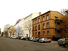
1110 | Julian Marchlewski (1866–1925), politician and co-founder of the Spartakusbund | March 16, 1950 | At first it was called Communication between the Frankfurt and Stralau Thor (around 1735); In 1876 the street was named Memeler Straße after the city of Memel , 1923-1939 and since 1945 Klaipėda in Lithuania. It leads from Hildegard-Jadamowitz-Strasse south-east to Helsingforser Platz / Warschauer Strasse. Despite extensive war damage, some architectural monuments have been preserved in the street, including a former teacher's residence (picture). The Weberwiese skyscraper is also located on this street . |
|
| Mariane-von-Rantzau-Strasse
( Location ) |
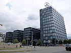
220 | Mariane von Rantzau (1811–1855), first superior of the Bethanien Deaconess Hospital | Nov 16, 2006 | The road was laid out on the former freight yard in 2006 and belongs to the catchment area of the Mercedes-Benz-Arena . The Mercedes-Benz Sales Germany is located here. It connects Mühlenstrasse with Helen-Ernst-Strasse. |
|
| Markgrafendamm
( Location ) |
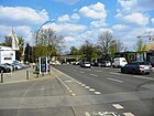
700 | Margrave Albrecht Friedrich of Brandenburg-Schwedt (1672–1731) | around 1857 | It was laid out at the beginning of the 19th century on the north bank of the Spree as a Knüppeldamm and was unofficially called Markgrafendamm because it was built on the orders of Margrave Albrecht Friedrich. It runs between the main street at Ostkreuz station (north) and Stralauer Allee (south). |
|
| Matkowskystrasse
( Location ) |
60 | Adalbert Matkowsky (1857–1909), actor | December 19, 1912 | In the development plan it was first called Straße 24, Section XIV . When it was named, it was called Mathkowskistraße . On April 21, 1932 she received the corrected name. It runs between Simplonstrasse and Revaler Strasse. |

|
| Matternstrasse
( Location ) |
210 | Theodor Mattern (1820–1886), Berlin merchant, dye works owner and local politician | March 23, 1898 | In the development plan it was first called Straße 44b, Section XIII / 2 . It connects Petersburger Strasse (southwest) with Ebertystrasse (northeast). |

|
| Matthiasstrasse
( Location ) |
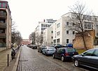
200 | Thomas Matthias (around 1520–1576), Berlin Mayor and politician of the Electorate of Brandenburg | Apr 2, 1891 | The traffic route was laid out as road 42b, section XIII / 2 , of the development plan. It leads from Landsberger Allee opposite the Friedrichshain Hospital in a south-east direction. At its southern end, Diestelmeyerstraße goes westwards. |
|
| Max-Fettling-Platz
( Location ) |
50 × 20 (kidney-shaped) |
Max Fettling (1907–1974), trade union official and victim of the uprising of June 17, 1953 | June 17, 2003 | The green space, which was created when the hospital was built at the end of the 19th century, is located in front of the former main entrance on Ernst-Zinna-Weg. More than 100 years later, its importance was highlighted with its own name. |

|
| Whitberry Path
( Location ) |
165 | Whitberries , a genus of pome fruit that were planted here near the road | July 1, 1999 | The route was separated from Lange Straße in the eastern section. It is located behind the swimming pool on Holzmarktstrasse and is a dead end . |

|
|
Mercedes place
( Location ) |
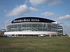
160 × 160 | Mercedes-Benz Arena | Nov 15, 2015 | The space created in 2008 is bordered by Mildred-Harnack-Straße, Mühlenstraße, Hedwig-Wachenheim-Straße and the event hall. From 2008 to November 2015 it was called O2-Platz . After that, the name of the square was adapted for the new naming authority of the 'arena'. |
|
| Mildred-Harnack-Strasse
( Location ) |
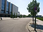
300 | Mildred Harnack (1902–1943), resistance fighter against National Socialism | Nov 16, 2006 | The road was laid out on the former freight yard in 2006 and belongs to the catchment area of the Mercedes-Benz-Arena . |
|
|
Modersohnstrasse
( Location ) |
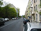
740 | Otto Modersohn (1865–1943), painter | May 24, 1951 | First was Street 45, Dept. IVX . On July 15, 1896, it was named Hohenlohestrasse after the prince and later Chancellor of the Reich, Chlodwig zu Hohenlohe-Schillingsfürst . It was not until the end of World War II that aristocratic names were erased from the streets that the street was given its name. The north-south street is the extension of the Gärtnerstraße and runs as Modersohn bridge over tracks to Stralauer Allee. |
|
|
Mollstrasse
( Location ) |
680 (in the district) |
Joseph Moll (1813–1849), revolutionary | Aug 9, 1963 | The traffic route in the existing route was only created in 1963, but it runs largely on a section of the former Landsberger Straße until it meets Frankfurter Straße . Mollstrasse connects Torstrasse (east) via United Nations Square with Landsberger Allee (west). In the district, the plots 19–32 are between Otto-Braun-Straße and Platz der United Nations on the north side, but not the street land . |
 
|
|
Müggelstrasse
( Location ) |
265 | Müggelsee , the largest lake in Berlin | 1905 | The north-south traffic route between the back of the houses on Frankfurter Allee and Weserstraße was first shown in the address book in 1905. Müggelstraße is interrupted by Traveplatz . |

|
|
Mühlenstrasse
( Location ) |
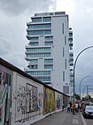
1050 | Windmill that stood here in the 18th century | around 1786 | The street runs parallel to the banks of the Spree between the Paris Commune and Warschauer Strasse. It was described in a historical address book from 1822 as follows: It "is located in the Stralau district, between Stralau Thor and Fruchtstrasse, [...] has 83 house numbers, is 1,380 paces long and belongs to the 21st police station". The electoral windmill that gave it its name was originally located on property number 9. Opposite were two-story rental houses that housed restaurants and small shops. Craftsmen often had their workshops on the farms. However, this street is known far beyond Berlin because the longest surviving section of the Berlin Wall is located on its south side , which became the East Side Gallery through the image design of a total of 118 artists . On the opposite side is the entrance to the event hall Mercedes-Benz-Arena . In February 2014, the Mediaspree initiative had applied for the street to be renamed “On the death strip”. That was rejected by the BVV. |

|
|
Arduous road
( Location ) |
600 | Erich Mühsam (1878–1934), writer | May 31, 1951 | The street runs between Löwestrasse and Ebertystrasse and crosses Petersburger Strasse. It was mentioned in the development plan at Straße 44a, Section XIII / 2 . In 1893 it was named Zorndorfer Straße after a former German town, since 1945 Sarbinowo (Dębno) east of the Oder in Poland, known from the Battle of Zorndorf in 1758. After the new border was drawn at the end of World War II and the founding of the GDR , it got hers Names. |

|
|
Müncheberger Strasse
( Location ) |
190 | Müncheberg , city in Brandenburg |
before 1900 with interruption |
The existing route has been shortened compared to the historical route through new residential developments after the Second World War. Therefore, the original street name was reassigned on July 1, 1996. It branches off from Koppenstrasse in an easterly direction. |

|
|
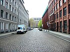
Naglerstrasse
( Location ) |
200 | Karl Ferdinand Friedrich von Nagler (1770–1846), Prussian postmaster general | Nov 28, 1900 | In the development plan it was first called Straße 46, Section XIV . It connects Rotherstraße (north) with Stralauer Allee (south). |
|
| New Bahnhofstrasse
( Location ) |
430 | Traffic route from Boxhagen to the Stralau-Rummelsburg ring and suburban train station | before 1905 | The street was laid out around 1903 and called Bahnhofstraße the way to the railway station “Stralau-Rummelsburg”. After renovation work at the station, it was given the addition "New" in 1905. Neue Bahnhofstrasse is the southward extension of the Gürtelstrasse. This is where the renowned Knorr-Bremse plant was located in the now listed building that was built between 1913 and 1916. |

|
|
New flower street
( Location ) |
400 + 220 | The name was determined by the relocation of the former Blumenstrasse | Aug 9, 1963 | After the rubble had been cleared away and new houses were built, the western part of the former Blumenstrasse, which was named after the Bouché Gardens, fell away. However, because the name is closely linked to the revolutionary labor movement, the street name was reassigned after the completion of the rebuilding of the area with the addition "New" for a changed route. The Neue Blumenstrasse now consists of a west-east section and a north-south section. In the district there is only one street section without an address assignment. The larger section belongs to the Mitte district. |

|
| New Weberstrasse
( Location ) |
300 | by relocating what was then Weberstrasse | Dec 20, 1957 | The clearing of rubble after the Second World War was followed by redevelopment and an extension of Weberstrasse to Lebuser Strasse, which was given the name "Neue Weberstrasse". The Weber Street was named in 1821 after the resident here Webern, Seidenwirkern, Strumpfwirkern, clothiers and other engaged in the weaving trader. |

|
| Niederbarnimstrasse
( Location ) |
300 | Niederbarnim , historical area in Brandenburg | 1904 | The first name was Straße 14, Section XIV of the development plan. The street, formerly located just outside the Berlin city limits in Friedrichsberg , belonged to the Niederbarnim district until 1920 .
It connects Proskauer Strasse (north) from Frankfurter Allee with Simon-Dach-Strasse (south) on Boxhagener Strasse. |

|
| Niemannstrasse
( Location ) |
130 | Albert Niemann (1831–1917), opera singer | December 19, 1912 | In the development plan it was first called Straße 20, Section XIV . It runs between Simplon and Revaler Strasse. The Modersohn primary school is located here. |

|
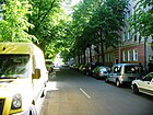
| Oderstrasse
( Location ) |
540 | Or , the border river between Germany and Poland | around 1900 | From 1877 the traffic route was called Straße 34, Section XIV. It runs from Jungstraße to Gürtelstraße and forms the southern boundary of Traveplatz. |
|
|
Otto-Braun-Strasse
( Location ) |
400 (in the district) |
Otto Braun (1872–1955), politician ( SPD ) | Nov 1, 1995 | The previous names were Rennweg and Rönnweg (16th century – 17th century), Bernauer Straße (17th century – 1810), Neue Königstraße (1810–1966) and Hans-Beimler-Straße (1966–1995). Only the house number range 78–90 (even) belongs to Friedrichshain. The district boundary runs diagonally across the road from Friedenstrasse (northeast, southern edge of the former Königsplatz) to Mollstrasse (northwest corner of the intersection), this course of the district boundary was created by the widening of the Neue Königsstrasse from Alexanderplatz to Greifswalder Strasse and the changes to Mollstrasse in the 1960s Years. The high-rise building on Königstadt-Carrée on 78/80 is noteworthy , with the park at the Protestant St. Bartholomew's Church forming the north end. The ten-storey apartment blocks 82/84 (south of Barnimstrasse ) and 86/88 (north of Barnimstrasse) are supplemented by the hotel building (No. 90), which was set up in 2008 in a former commercial building. |

|
|
Palisadenstrasse
( Location ) |
810 | Palisades , part of the old Berlin city fortifications that ran along this street | July 30, 1833 | The earlier spelling was Pallisadenstrasse . This traffic route is the core of a series of new residential buildings and modernized old buildings built in the 1980s, which were mainly carried out by construction companies from Suhl . The East Berlin magistrate summarized the building complex under the term palisade triangle. Noteworthy is the earlier house at number 2, which was known as the Cossack House . Above the front door there was a relief showing a riding Cossack with a lance stretched out. The name and the facade decoration of the house reminded of the liberation of Berlin from the French troops by the Cossacks under the general Tschernischew. It was through this house that one of the outnumbered Cossacks had escaped into Weberstrasse. |
 
|
| Palm kernel line
( Location ) |
250 | Palm kernel oil storage , industrial monument on the Stralau peninsula | July 15, 1999 | The Palmkernzeile is a newly designated street between Fischzug (northeast) and Alt-Stralau (southwest). |

|
| Persiusstrasse
( Location ) |
510 | Paul Persius (1832–1902), politician | 5th Sep 1903 | The first name was Street 40b, Section XIV , of the development plan. It runs from Corinthstraße to Markgrafenstraße. |

|
|
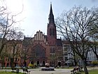
Petersburg square
( Location ) |
210 × 50 | adjacent Petersburger Strasse | Aug 4, 1897 | Between 1982 and 1991 the complex was called Kotikowplatz after the Soviet general Alexander Georgievich Kotikow . It got its original name back on December 1, 1991. Petersburger Platz is at the same time a street and a rectangular green city square on Petersburger Straße and serves largely as a children's playground. The Pentecostal Church is on the western side . |
|
|
Petersburg Street
( Location ) |
1120 | Saint Petersburg , the former capital of the Russian Empire |
Feb. 23, 1874 (with interruption) |
In the development plan it was first called Straße 6, Abt. XIII / 2 , from 1874 it got its name. Between 1947 and 1991 the main line was called Bersarinstraße after Nikolai Bersarin , the first city commandant of Berlin after the end of the Second World War. At the house number 94 there is a memorial plaque for the victims of the SA - Keglerheim which used to be there . |

|
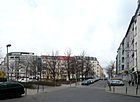
| Pettenkoferstrasse
( Location ) |
770 | Max von Pettenkofer (1818–1901), chemist and hygienist | May 13, 1905 | In the development plan it was called Straße 66a, Section XIII / 2 . It leads from the Alter Schlachthof development area south-east to Frankfurter Allee. Of lying about her Schleiden space , an entrance to the station Frankfurter Allee , the Ring-Center I and the Pettenkofer primary school. |
|
| Pillauer Street
( Location ) |
90 | Pillau , town in the East Prussia province , since 1945 Baltiysk | July 17, 1876 | In the development plan it was first called Straße 14, Dept. XV . It runs between Helsingforser Straße (SW) and Marchlewskistraße (NE). |

|
| Pintschstrasse
( Location ) |
230 | Julius Pintsch (1815–1884), entrepreneur | Aug 15, 1898 | In the development plan it was first called Straße 41c, Section XIII / 2 . It connects Kochhannstrasse with Straßmannstrasse. |

|
|
United Nations Square
( Location ) |
no precise details possible (see right) | United Nations | March 13, 1992 | The name of a square that previously existed in the vicinity was Landsberger Platz ; in the 1960s, Leninplatz was established in connection with the construction of new residential buildings . After the oversized Lenin monument was removed , the square was given its existing name. Part of the residential development towards Lichtenberger Straße belongs to the United Nations Square. |

|
| Proskauer Strasse
( Location ) |
530 | Proskau , town in Upper Silesia , since 1945 Prószków in Poland | Oct 18, 1881 | In the development plan it was first called Straße 61, Section XIII / 2 . It leads south from the Alter Schlachthof development area to Frankfurter Allee. Forckenbeckplatz is located on it .
The cycle paths were marked in green over a total length of around 1000 meters on behalf of the Senate Department for the Environment, Transport and Climate Protection and by the state-owned company Infravelo as the builder and project manager between September and November 2018. |
|
| Pufendorfstrasse
( Location ) |
300 | Samuel von Pufendorf (1632–1694), natural and international law expert | May 3, 1895 | The traffic route was laid out as road 42c, section XIII / 2 of the development plan. It runs between Friedenstrasse (northeast) and Matthiasstrasse (southwest). - An archaeological find from 2016 that unearthed the first poor cemetery at the gates of Berlin is remarkable . The excavations and the evaluation of the relevant archive material showed that this cemetery was in use between 1800 and 1881. At least 4,000 buried people have already been identified. The burial took place in simple open wooden boxes, usually several dead people were placed in one box . The investigations should be completed in spring 2017. |

|
|
Revaler Strasse
( Location ) |
980 | Reval , capital of Estonia , since 1918 Tallinn | 5th Sep 1903 | In the development plan it was first called Straße 12a, Section XIV . It leads from Helsingforser Platz (west) to Simplonstraße in multiple, slightly angled tours. At number 99 there are memorial plaques for the resistance fighters Fritz Fieber and Karl Kunger . In addition, the Deutsche Reichsbahn built a repair shop here at the beginning of the 20th century , which continued to be used after the GDR was founded. It has only been closed since 1990 and is now used for cultural purposes as an interim use. |

|
|
Richard-Sorge-Strasse
( Location ) |
890 | Richard Sorge (1895–1944), journalist and spy during World War II | 17 Sep 1969 | The street, first street 41, section XIII / 2 according to the development plan , was named Tilsiter Straße on March 8, 1883 after the East Prussian town of Tilsit (since 1945: Sovetsk ). At the northern end of the street, on a corner plot of land facing Landsberger Allee, the listed remains of the Aktien-Brauerei-Gesellschaft Friedrichshöhe are located . Some utility buildings of this complex were demolished around the year 2000 and in their place were new buildings that keep a footpath to the cemetery behind. The corner buildings of the new residential complex are designed like gatehouses (left edge in the picture). There are memorial plaques for the resistance fighters Anna and Max Christiansen-Clausen , Heinz Nawrot (No. 10), Eugen Neutert (No. 65) and Richard Sorge at houses number 8, 10 and 65 as well as at the corner of Weidenweg . |

|
|
Riga Street
( Location ) |
1250 | Riga , capital of Latvia | June 24, 1893 | When it was first constructed, it was streets 58 and 58a, Section XIII / 2 of the development plan. Between 1890 and 1895 it was called Eckartsbergstrasse . On December 19, 1912, the entire street up to the railway line was renamed Rigaer Strasse. This street runs parallel to Frankfurter Allee to the north and connects Bersarinplatz with Pettenkoferstraße. Numbers 9/10 belong to the Galilee Church , number 81 is the school building of the Heinrich-Hertz-Gymnasium , both are under monument protection. There are memorial plaques for the resistance fighters Fritz Riedel and Ernst Pahnke at houses number 64 and 94 . |

|
| Rochowstrasse
( Location ) |
180 | Friedrich Eberhard von Rochow (1734–1805), educator | 13 Sep 1905 | The traffic route was laid out as road 44a, Abbot XIV , of the development plan. From 1904 to 1905 the street after Rudolf von Bennigsen was called Bennigsenstraße . It connects Corinthstraße in a north-south route with Stralauer Allee. |

|
| Rotherstrasse
( Location ) |
400 | Christian von Rother (1778–1849), Prussian Minister of State | Aug 15, 1898 | In the development plan it was first called Straße 47a, Section XIV . It connects Warschauer Platz (west) with Danneckerstraße (east) and runs parallel to Stralauer Allee to the north. |

|
|
Rüdersdorfer Strasse
( Location ) |
850 | Rüdersdorf , municipality in Brandenburg |
Feb. 9, 1864 (with interruption) |
It connects Koppenstraße in a south-eastern direction with Marchlewskistraße, after which it continues as Torellstraße. In the development plan it was first called Straße 11, Dept. XV . On July 17, 1876, the extension ( street 32 ) was included in the name. Between June 20, 1989 and November 30, 1991 it was called Babeufstrasse after the French socialist revolutionary François-Noël Babeuf .
The Ellen Key School is under the number 20-27 . The Catholic St. Antonius Church , a listed building monument, is hidden behind the street front. The nationally known Berghain disco is located on the site of the former thermal power station . |
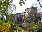
|
|
Rudolfplatz
( Location ) |
160 × 60 (trapezoidal shape) |
adjoining Rudolfstrasse | July 15, 1896 | In the development plan, the green area was first called Platz H, Section XIV . The town square is bordered by Rudolfstraße (north), Modersohnstraße (east), (street) Am Rudolfplatz (south) and Danneckerstraße (west). On two sides it is surrounded by closed rows of houses, on the north side in another green area is the day care center of the Jugendwerk Aufbau Ost e. V. (Rudolfstraße 15a), on the east side is the Emanuel-Lasker-Oberschule (Modersohnstraße). |

|
| Rudolfstrasse
( Location ) |
620 | Rudolf von Stralow († around 1288), then owner of Stralau | May 3, 1895 | In the development plan it was first called Straße 47, Section XIV . It runs from Warschauer Strasse along the U-Bahn depot to Modersohnstrasse or the beginning of the Modersohn Bridge. From the south, Ehrenbergstrasse, Lehmbruckstrasse and Danneckerstrasse join Rudolfstrasse. The parish hall of the Zwingli Church is just before Rudolfplatz. |
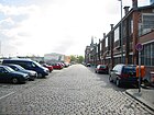
|
| Rummelsburger Platz
( Location ) |
110 × 30 (× 10) ( trapezoidal shape ) |
Berlin-Rummelsburg , part of the Lichtenberg district | May 3, 1862 | According to the development plan, the green area was initially laid out as Place C, Section XV . It is located north of a section of the East Side Gallery . |

|
|
* (Samariterplatz)
( Location ) |
85 × 35 (oval) |
Samaritan Church | Apr 4, 1895 | When it was first constructed, the square was initially called Platz OI, Section XIII / 2, according to the Hobrecht plan . (*): An official naming on Samariterplatz is not documented. However, this name appears in address books and other materials to identify the area around the Samaritan Church. A corresponding official sign is also missing. The square around the church is completely surrounded by the north and south carriageway of Bänschstrasse. There is a playground just east of the church. The closed lanes on Bänschstrasse have been used for a Kiez Christmas market since 2006. |

|
|
Samariterstrasse
( Location ) |
615 | Samaritan Church | Apr 4, 1895 | The traffic route emerged from streets 63 and 63a, Section XIII / 2 of the development plan. Samariterstraße connects Eldenaer Straße with Frankfurter Allee and runs in a north-south direction. |

|
| Scharnweberstrasse
( Location ) |
910 | Georg Scharnweber (1816–1894), Berlin lawyer, politician | 1893 | According to the development plan, it was laid out as Straße 32, Section XIV . It runs south parallel to Frankfurter Allee between Mainzer Strasse (west) and Gürtelstrasse (east). At number 19 there is a memorial plaque for the resistance fighter Clara Grunwald . |
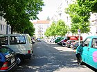
|
|
Schleidenplatz
( Location ) |
80 × 70 × 65 | Matthias Jacob Schleiden (1804–1881), botanist | 23 Aug 1905 | When the triangular square was laid out between 1874 and 1881, it was named Platz R 1, Section XIII / 2, according to the development plan . Schleidenplatz is bordered by Rigaer Strasse, Pettenkoferstrasse and Waldeyerstrasse. It is considered the "gate" to the Samaritan quarter . |

|
| way to school
( Location ) |
180 | School , the schools here | Aug 1, 1997 | The narrow footpath that was created during the construction of the Spartacus primary school in Friedenstraße and the renovation / new building of the Margarethe-von-Witzleben-School for the hard of hearing in Palisadenstraße was only named after the fall of the Wall . |

|
| Schreinerstrasse
( Location ) |
770 | Otto Schreiner (1816–1898), Berlin local politician | July 15, 1896 | According to the development plan, it was first called Straße 58b, Section XIII / 2 . It connects Proskauer (east) with Pettenkoferstraße (west) north parallel to Frankfurter Allee. |

|
| Seumestrasse
( Location ) |
405 | Johann Gottfried Seume (1763–1810), writer | around 1905 | The street is recorded in the Hobrecht Plan , Section XIV , but the street number has not been passed down. When the name was given, there was still no development along the traffic route, as can be seen from the address book from 1905. It runs in a straight line from Wismarplatz to Simplonstraße. | |
| Siegfried Hirschmann Park
( Location ) |
70 | Siegfried Hirschmann (1863–1942), entrepreneur | 8 Sep 2017 | The private road is in the Box Seven residential area , which is between Boxhagener, Holtei and Weserstraße. | |
| Silvio-Meier-Strasse
( Location ) |
190 | Silvio Meier (1965–1992), squatter | Apr 26, 2013 | Starting from Frankfurter Allee northwards, the street ends at Rigaer Straße. At first it was designated as Straße 63b according to the development plan . Until April 26, 2013 the street was called Gabelsbergerstraße , after the inventor and stenographer Franz Xaver Gabelsberger (1789–1849). The decision by BVV Friedrichshain-Kreuzberg to rename it to Silvio Meier , a squatter and activist of the left-alternative scene who was killed by neo-Nazis in 1992 , on the 20th anniversary of his death on November 21, 2012, could initially not be implemented due to a lawsuit by a local businessman. The lawsuit was withdrawn and the name change became effective on April 26th. |

|
|
Simon-Dach-Strasse
( Location ) |
570 | Simon Dach (1605–1659), poet | 22 Aug 1903 | According to the development plan, part of the street 14 was called Section XIV , into which the remaining part was included on September 15, 1903. It now extends from Boxhagener Strasse (as an extension of Niederbarnimstrasse) to Revaler Strasse. At number 33 there is a memorial plaque for the resistance fighter Rudolf Paetzold . Since the end of the 20th century, this street has become known far beyond Berlin because of its numerous trendy bars. |

|
|
Simplonstrasse
( Location ) |
840 | Simplon , alpine pass in Switzerland | Sep 15 1906 | In 1906 the eastern part of Kopernikusstraße was named Simplonstraße. In 1939, the extension to Neue Bahnhofstrasse, which until then was called Ludwig-Lehmann-Strasse , was also named Simplonstrasse. The Revelation Church (church building, parish and rectory) is located at house number 31–37 . |

|
| Singerstrasse
( Location ) |
850 (in the district) |
Paul Singer (1844–1911), co-founder and chairman of the SPD | July 31, 1947 | The street runs in a west-east direction between Schillingstrasse and Franz-Mehring-Platz. The section between Schillingstrasse and Lichtenberger Strasse is in the Mitte district .
First it was called Grüner Weg or Der Grüne Weg (before 1748), from 1926 to 1933 Paul-Singer-Straße , then until 1947 Brauner Weg . The street is the main location of the film The Legend of Paul and Paula . |
 |
|
Sunday street
( ) |
500 | Johann Gottfried Sonntag (1750–1822), landowner | around 1901 | According to the development plan, it was first called Straße 26a, Section XIV . Around 1893 their route was already entered on city maps, but it did not yet have a name. Sonntagstraße runs in a north-west-south-east direction between Wühlischstraße and Ostkreuz S-Bahn station . |
 |
|
Stralauer Allee
( Location ) |
1300 | Stralau location | June 7, 1896 | On a map from 1874, the street Vor dem Stralauer Thore was drawn in this route from Warschauer Strasse to Markgrafendamm . According to the development plan around 1900, it was run as Straße 41, Section XIV . This busy street runs roughly in an east-west direction between Am Oberbaum / Mühlenstraße near the Ostbahnhof and Markgrafendamm / Elsenbrücke . The area of the former east port extends on its south side, all of which are historic buildings under monument protection. |

|
|
Stralauer Platz
( Location ) |
370 × 180 | adjacent Stralauer Strasse | Feb. 24, 1823 | The square that existed next to the Royal Wood Market in the 18th century was named in 1823. After the buildings destroyed in the Second World War had been removed and the arterial road widened, Stralauer Platz is an area cut through by a divided motor road as a link between Holzmarktstrasse and Mühlenstrasse, between Andreasstrasse (west) and the Paris Commune (east). . There is a monument complex from the beginning of the 20th century (see picture below). |
 
|
|
Paris Commune Street
( Location ) |
1030 | Paris Commune , Paris City Council March to May 1871 | 17th March 1971 | In the 18th century it was called Bullen-Winckel (before 1735–1801), then Bullen-Gasse (before 1801–1820) and finally Fruchtstrasse (1820–1971). It runs from north (Karl-Marx-Allee) to south (Stralauer Allee / Stralauer Platz), where it cuts through Franz-Mehring-Platz and affects the Ostbahnhof. |

|
|
Straßmannstrasse
( Location ) |
610 | Wolfgang Straßmann (1821–1885), Berlin politician and social reformer |
Aug. 4, 1897 with interruptions |
First there were roads 43b and 46b, section XIII / 2, according to the development plan . The street was called Ermelerstrasse between 1938 and July 31, 1947 . It runs between Richard-Sorge-Strasse and Hausburgstrasse. House number 14 is a listed school building . |
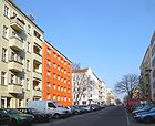
|
|
Strausberger Platz
( Location ) |
150 × 130 (oval shape) |
Strausberger Straße, which is located further north and originally opened onto the square | before 1906 | As early as 1906, it was entered by name on a city map as the place where Krautstrasse, Weberstrasse , Strausberger Strasse and Grosse Frankfurter Strasse came together . When the Stalinallee was rebuilt, it was moved a few meters further west. It was planned to move the Stalin monument, erected in 1951 opposite the German Sports Hall , to Strausberger Platz. Until the development and the new routes were completed around 1955, it was designed as a roundabout and decorated with a fountain from Fritz Kühn's studio . |

|
| Strausberger Strasse
( Location ) |
300 | Strausberg , city in Brandenburg | March 7, 1864 | The traffic route, initially written on Straussberger Strasse , extended from Landsberger Platz via Palisadenstrasse to Frankfurter Strasse on the "old" Strausberger Platz. After the war damage and the subsequent rebuilding of the residential area, it was shortened in 1952 and then in 1971. In the existing route it runs between Friedenstrasse and Palisadenstrasse. |
 |
|
Tamara-Danz-Strasse
( Location ) |
470 | Tamara Danz (1952–1996), singer and front woman of the group Silly | Nov 16, 2006 | The road was laid out on the former Wriezen freight yard in 2006 and belongs to the catchment area of the Mercedes-Benz-Arena . It branches off to the north at Stralauer Allee and then makes a swivel towards the Warschauer Brücke, which it crosses under. |

|
| Thaerstrasse
( Location ) |
230 (in the district) |
Albrecht Daniel Thaer (1752–1828), founder of agricultural sciences | Oct 18, 1881 | According to the development plan, it was first called Straße 50, Section XIV . The north-eastern section of the street runs in Prenzlauer Berg . |

|
| Torellstrasse
( Location ) |
160 | Otto Torell (1828–1900), Swedish glaciologist and polar researcher | June 11, 1902 | According to the development plan, it was first called Straße 10a, Section XI . It is the southern boundary of Comeniusplatz and forms a link between Rüdersdorfer Strasse and Kopernikusstrasse. |
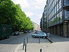
|
| Traveplatz
( Location ) |
160 × 60 | adjacent street of the same name | 1908 | According to the development plan, the green area was first called Place F, Section XIV . The square is bordered by Travestraße (north), Jessnerstraße (east), Oderstraße (south) and Weichselstraße (west) and is landscaped. |

|
| Travestrasse
( Location ) |
160 | Trave , river in Schleswig-Holstein | 1905 | According to the development plan, it was first called Straße 50, Section XIV . It limits the Traveplatz; Müggelstraße goes off in the middle to the north. |

|
| Tunnel road
( Location ) |
520 | Spreetunnel between Stralau and Treptow, built 1895–1899 | 1900 | The traffic route was previously called the Extended Village Road when the tunnel was not yet opened. The eponymous tunnel for a former tram is still there, but has been flooded since the end of the Second World War . The tunnel itself and the access ramp are on the Berlin list of monuments. The listed village church of Stralau is located in the Stralau cemetery in the northwest area of Tunnelstrasse . |
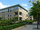
|
|
Valeska-Gert-Strasse
( Location ) |
180 | Valeska Gert (1892–1978), dancer and cabaret artist | Nov 16, 2006 | The road was laid out on the former freight yard in 2006 and belongs to the catchment area of the Mercedes-Benz-Arena . |

|
| Virchowstrasse
( Location ) |
500 (in the district) |
Rudolf Virchow (1821–1902), pathologist | March 17, 1891 | In Hobrecht's development plan it was referred to as Straße 32, Section XIII / 2 . The northern part of the street runs in Volkspark Friedrichshain and forms the border between the districts of Friedrichshain and Prenzlauer Berg. The connection to the southern section of the road is only available as a footpath and bike path. On one side of the southern section of the street is the wall and the entrance and exit for commercial and rescue vehicles to the Friedrichshain Clinic . |

|
| Voigtstrasse
( Location ) |
600 | Ferdinand Voigt (1836–1905), Berlin local politician | Apr 13, 1904 | Voigtstrasse emerged from Strasse 67, Section XIII / 2 of the development plan and by including the extension, Strasse 67a (on September 13, 1905). It goes south from Pettenkoferstraße and flows into Frankfurter Allee . |
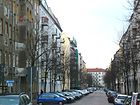
|
|
Waldeyerstrasse
( Location ) |
220 | Wilhelm von Waldeyer (1836–1921), anatomist | June 28, 1907 | According to the development plan, it was first called Straße 66b, Section XIII / 2 . An unofficial name as Mühlenweg soon disappeared. It connects Pettenkoferstraße with Frankfurter Allee and touches Schleidenplatz . |
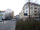
|
| Wanda-Kallenbach-Strasse
( Location ) |
60 | Wanda Kallenbach (1902–1944), victim of the Nazi regime | Nov 16, 2006 | The road was laid out on the former freight yard in 2006 and belongs to the catchment area of the Mercedes-Benz-Arena . |
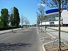
|
| Warsaw Square
( Location ) |
330 × 25 | adjacent street of the same name | Apr 1, 1896 | In the development plan it was named Platz L, Section IV . The street on the east side of the square was called Am Warschauer Platz until 1943 and was included in Warschauer Platz until about 1948. The facility is at the same time a street and a space between the railway facilities and Stralauer Allee parallel to Warschauer Strasse on the other side of the underground line . It is worth mentioning the stair pavilion at the northern end, which leads up from Warschauer Platz to Warschauer Straße underground station and is also known as the “mouse tower” by the residents. | |
|
Warschauer Strasse
( Location ) |
1600 | Warsaw , capital of Poland | Apr 1, 1874 | According to the development plan, it was first called Straße 11, Section XIV . It runs from Frankfurter Tor over the Warschauer Brücke and ends at Stralauer Allee. At the houses number 46, 47 and 60 there are memorial plaques for the resistance fighters Georg Pinke , Herbert Firl and Heinrich Thieslauk . |

|
| Wedekindstrasse
( Location ) |
300 | Frank Wedekind (1864–1918), writer | July 26, 1951 | The first name of the street was Posener Straße from 1873 after the former German city of Posen , since 1945 Poznań in Poland. - It connects the Rüdersdorfer with the Gubener Straße and then continues eastwards as Grünberger Straße. The buildings Wedekindstrasse 7–15, 10, 17–25 are part of a larger monument complex around Karl-Marx-Allee. On the photo you can see the building ensemble of the former police headquarters and fire brigade, also a listed monument. |

|
| Weichselstrasse
( Location ) |
350 | Vistula , river in Poland | 13 Sep 1905 | According to the development plan, it was first called (1877) Straße 33, Dept. XIV . It connects Frankfurter Allee with Weserstraße and continues to the south in Holteistraße. |
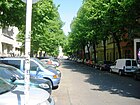
|
| Pasture path
( Location ) |
1070 | Pastureland that was here before | around 1874 | The willow path was laid out in 1859, but initially remained nameless. It is marked by name on the city map of Berlin in 1875 as the eastern extension of Pallisadenstrasse . On October 18, 1881, its extension, street 45 and part of street 57 (from square N to square R) were added. The Weidenweg now runs as an extension of Palisadenstraße north parallel to Karl-Marx-Allee and leads over Bersarinplatz to Forckenbeckplatz . There are tram tracks on a small eastern section. At the corner of Bersarinplatz (vacant lot to the southwest), a new senior home was built in 2011. |
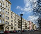
|
| Wine route
( Location ) |
280 | two vineyards that no longer exist ("Beiersdorfer Weinberg" and "Sametzkischer Weinberg") to which the road led | Nov 16, 1830 | On August 23, 1841, the connection between what was then Mehnerstrasse and the city wall on Büschingplatz was given the name Weinstrasse. The section between the former Gollnowstrasse and Mehnerstrasse was spun off again on August 9, 1963. The Weinstrasse now runs between Friedenstrasse (NE) and Barnimstrasse (SW) in a straight line through the residential area. |
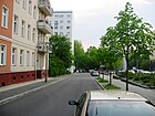
|
| Weisbachstrasse
( Location ) |
110 | Valentin Weisbach (1843–1899), banker and chairman of the association founded in 1888 for the 'improvement of small apartments in Berlin' and buyer of the property on which Weisbachstrasse was later laid out. | Jan. 9, 1901 | In the development plan it was listed as road 48a, section XIII / 2 . The residential buildings of the complex Eberty-, Ebeling-, Kochhann- and Weisbachstraße 1–8 were built according to plans by the architect Alfred Messel and are under monument protection. |

|
| Weserstrasse
( Location ) |
710 | Weser , river in Northern Germany | before 1901 | According to the development plan, it was first called Straße 31, Section XIV . It leads from the intersection Colbestraße / Boxhagener Straße at Wismarplatz south-east to Gürtelstraße. There is a former listed factory at Weserstraße 44/45. |

|
| Wilhelm-Stolze-Strasse
( Location ) |
360 | Wilhelm Stolze (1798–1867), inventor of a shorthand | 23 Sep 1898 | According to the development plan, it was first called Straße 41b, Section XIII / 2 . When new residential complexes were built in the Leninallee / Richard-Sorge-Strasse / Dimitroffstrasse area in 1965/1966, the former northern section of this street was abolished. It now connects the Straßmannstraße with the Kochhannstraße and then leads as a footpath past a children's combination to the street An der Brauerei. At number 31 there is a memorial plaque for the resistance fighter Georg Müller. |

|
|
Wismarplatz
( Location ) |
60 × 25 × 40 (triangular) |
Wismar , city in Mecklenburg-Western Pomerania | 5th Sep 1903 | It was listed in the development plan as place E, Dept. XIV . The town square is south of Boxhagener Straße. It is just a small area with benches and lawns and bushes. Its western and southern borders are street sections, but they are also called Wismarplatz. They are 50 m and 70 m long. Diagonally opposite, north of Boxhagener Straße, a larger parking area is designed as a playground, which is bordered by Weserstraße and Jungstraße. |

|
| Wriezener Karree
( Location ) |
650 | Wriezener station , the 1903-1949 terminus of the railway line to Wriezen was | 1986 | The square runs from the street of the Paris Commune eastwards on the former site of the Wriezener Bahnhof with a bend south to An der Ostbahn and at the same time it forms a "U" back to the Paris Commune. It almost exactly follows the streets Am Ostbahnhof and Friedrichsfelder Straße that used to exist here . |

|
|
Wühlischplatz
( Location ) |
100 × 50 (triangular shape) |
August Wühlisch (1805–1886), merchant and landowner | around 1901 | When it was built in accordance with the development plan, it was given the designation Platz G, Dept. XIV . The small, fenced-in green area was last redesigned in 1995. It is surrounded by Wühlischstrasse, Holtei- and Sonntagstrasse. |

|
|
Wühlischstrasse
( Location ) |
870 | August Wühlisch (1805–1886), merchant and landowner | around 1901 | In the development plan of the 19th century, there are only indicated routes between Warschauer Straße and the Colonie Boxhagen , in 1901 this street was already registered with its name. It leads from Simon-Dach-Straße, as a continuation of Kopernikusstraße southeast to Boxhagener Straße. The Wühlischplatz and the Caroline-Herschel-Platz are located on it. |

|
|
Zellestrasse
( Location ) |
190 | Robert Cell (1829–1901), Mayor of Berlin | Apr 4, 1895 | It was laid out as street 59b, Section XIII / 2 , of the development plan. The street runs from Rigaer Straße north to Forckenbeckplatz . Here you will find the Friedrichshain Music School (picture) with a renovated concert hall in a monument from 1914. |

|
No longer existing streets and squares
- Am Warschauer Platz : connecting street between Warschauer Platz and Rotherstraße, which was included in Warschauer Platz between 1946 and 1948.
- At the Bartholomäuskirche : After the St. Bartholomäuskirche east of Otto-Braun-Straße . The road was closed between 1946 and 1948.
- Andreasplatz : It was a small green area between Grüner Weg and Kleine Andreasstraße. It was completed on April 25, 1865 and named after the adjacent Andreasstrasse. In the following years a fountain (1898), a three-part rounded marble bench and groups of figures were set up as decorations. The figures represented a “father group” (sculptor Wilhelm Haverkamp ) and a “mother group” (sculptor Edmund Gomansky ) and were made of light marble. After the Second World War, the square disappeared.
- Augsburger Strasse : Listed in the Berlin address book in 1874. The name was officially deleted in 1881, and Liebigstraße later followed this route.
- Brommystraße : Brommystraße (named after Admiral Karl Rudolf Brommy ) led from Kreuzberg to Friedrichshain southeast of the Ostbahnhof across the Spree. After the Spree Bridge was destroyed in World War II, the road was divided. The short stub on the Friedrichshain side was called Brommystraße until the 1960s. The name is still used for the Kreuzberg section.
- Büschingplatz Square, which, like the adjacent Büschingstrasse, was named after the theologian Anton Friedrich Büsching . It was given up around 1966 when the area around Lenin Square was rebuilt (since 1992, it has been the United Nations' Square).
- Elisabethstraße , a parallel street south of Landsberger Straße between Alexanderplatz and Waßmannstraße, which was also moved in 1963, existed until 1963. The street was named in 1831 after Elisabeth Ludovika of Bavaria , later Queen of Prussia, before it was called Baumstraße . Most of the street was in Berlin-Mitte.
- Friedrichsfelder Strasse , to Berlin-Friedrichsfelde . The street was named in 1876 and closed in 1986 when the area was developed; part of the street forms the Wriezener Karree street.
- Gollnowstraße Eastern extension of Linienstraße, whose name it was until around 1778. Then it was named after the mason Johann Gollnow. In 1963 the street was closed.
- Hahnstraße , a street between Boxhagener Straße and Wühlischplatz that existed until about 1972, named around 1912 after Ernst Hahn, a local politician in the Boxhagen-Rummelsburg community to which the street belonged.
- Insterburger Strasse , named after the town of Insterburg in 1893, named Chernyakhovsk since 1945 , ran between Auerstrasse and Weidenweg and was closed in 1958.
- Komtureiplatz : Place on Frankfurter Allee and Gubener Strasse named after a commandery of the Teutonic Knights Order, which existed until 1964.
- Mehnerstraße : Mehnerstraße (after the landowner Carl Gottfried Mehner; † around 1836) ran from Büschingplatz to the northwest. It was drawn in in 1963 when the area was rebuilt.
- Markusstrasse , after the St. Markus Church, which was destroyed in 1944. The street ran from Michaelbrücke to Strausberger Platz. Around 1969 the street was removed when the area was rebuilt, and the extension of Lichtenberger Straße runs roughly in its location.
- Müncheberger Strasse , named after the town of Müncheberg in 1874 , connected Koppenstrasse with Fruchtstrasse, comprised 31 built-up plots and ceased to exist around 1972.
- Schmückertstrasse , named after the politician Gottlieb Heinrich Schmückert in 1907. The short street between Modersohnstrasse and Rochowstrasse was drawn in in 1958.
- Tübbeckestraße : the short street was an extension of Persiusstraße between Markgrafendamm and the embankment of the Berliner Ringbahn . The name, not known before 1912, comes from the landowner and local politician Julius Tübbecke. From 1966 the name was dropped.
- Waßmannstrasse , ran between Büschingplatz and Karl-Marx-Allee. During the construction of the new development area, it was drawn in on August 9, 1963 along with some of the surrounding streets. The name comes from the landowner David Waßmann. The street had had the name since 1831, before it was called Waßmann-Gasse .
- Weberstraße , ran between Büschingplatz and Strausberger Platz as an extension of the Linienstraße-Gollnowstraße street. It was also called Linienstraße until 1821, before it got its later name after the local weaving mills. On August 9, 1963, it was withdrawn like other streets in the area.
More green areas or facilities in the district
Parks
| Surname | Area (rounded in m²) |
Origin of name | Date of designation | Remarks | image |
|---|---|---|---|---|---|
|
Dora Benjamin Park
( Location ) |
23,400 | Dora Benjamin (1901–1946), economist, social scientist and psychologist | Feb 6, 2009 | A park that existed years before between the northern bank of the Spree and the Alt-Stralau street was designed, built and named. |

|
|
East Side Park
( Location ) |
16,200 | East Side Gallery | 2009 | The park between the former wall and the banks of the Spree began in 2007, after a long period of preparation. It is 1.6 hectares and caused construction costs of around 1.4 million euros. It is not yet connected in spring 2012; there is a western area, with a riverside walk and the historic post walk. According to a bronze plaque on a boulder, cherry trees donated by Japanese citizens were planted here in April 2005 as part of the Sakura campaign fundraising campaign . They expressed their joy about the German (re) unification. The action came from the Sakura Organizing Committee and was supported by the TV Asaki Network. The motto for this part of the park is: “No one is a stranger here under the branches of the cherry trees in bloom.” The part of the East Side Park further to the east has a promenade, a boat dock and a snack bar with a viewing platform. |
 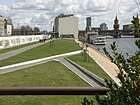
|
|
Park on the Spree
( Location ) |
20,000 | is on the Spree | 2010 | According to the Friedrichshain-Kreuzberg District Office, the park should have been completed in 2010. Deutsche Bahn AG is responsible for preparing the area as a compensatory measure . In May 2015, the first construction work could be seen. |

|
| officially nameless; Pocket-Park and Ritterhof (optional)
( Location ) |
3000 | Pocket (English) for "pocket", meaning "small" | The official sign for the “protected green space” does not show a name. On OpenStreetMap it is under Pocket Park; on the information board of the water town Stralau it is called Ritterhof. |

|
|
| Strela Park
( Location ) |
2600 | Based on the old spelling of Stralau | 1998 | A narrow area covered with old trees north of Alt-Stralau, which extends as far as the shore area of the Rummelsburger See. There is a day-care center about in the middle west of the main path . The official sign for the 'protected green space' reads 'Strela-Platz'. |

|
|
Volkspark Friedrichshain
( Location ) |
490,000 | after Friedrich II. (1712–1786), Prussian king | handed down | Recreation area in the north of Friedrichshain (south of the Bötzowviertel ) with tobogganing hill, ponds, skate track and some snack options |

|
| Wenden Park
( Location ) |
9,100 | Wenden , first settlers on the peninsula | It is located south of Alt-Stralau and directly adjoins the cemetery grounds. In its area many old trees have survived, including one as a natural monument designated horse chestnut (number 2-7 / B; see Winter picture). |

|
Allotments and cemeteries
| Surname | Area (rounded in m²) |
Origin of name | Date of establishment | Remarks | image |
|---|---|---|---|---|---|
| Allotment garden Stralau "Alfred Kowalke"
( Location ) |
12,351 | Alfred Kowalke , resistance fighter | 1948 | The permanent allotment garden colony is located on the Stralau peninsula in a north-south extension between Alt-Stralau and the Nixenkai along two access routes. It comprises 47 parcels and was created after the Second World War as an emergency shelter or for self-sufficiency with fruit and vegetables. |

|
|
Cemetery of the March Fallen
( Location ) |
1,200 | Victims of the March Revolution | March 22, 1848 | It was created for the victims of the March Revolution of March 18, 1848, those who fell in March . In 1925, the Berlin architect Ludwig Hoffmann redesigned the facility and brought it into the three-sided shape that was still in existence. Further redesigns took place in 1948 and 1957. |

|
|
Georgen-Parochial II and V and St. Petri cemeteries
( Location ) |
37,000 (irregular shape; roughly measured) |
Parishes of St. Georgen-Parochial and St. Petri in Berlin-Mitte | 1825 | The three individual cemeteries are next to each other and have a common administration: cemetery of the St. Petri community (laid out in 1838) and cemeteries II and V of the Georgen Parochial community (laid out in 1848 and 1825, respectively). |

|
|
Georgen Parochial Cemetery IV
( Location ) |
19,350 | Evangelical Georgen Parish of Berlin | 1867 | In the cemetery there is a chapel built in 1879 according to plans by Gustav Knoblauch . There is also a common grave of the three resistance fighters against the National Socialist regime Fritz Riedel , Kurt Ritter and Willi Heinze on the site . |

|
Riverside green belt along the Stralau peninsula
Around the Stralau peninsula, to the north-west of the Paul and Paula Ufer , a riverside path was laid out from 1998, the various sections of which are designated as “protected green spaces”. It serves as a hiking and cycling path, and its parts have been given names that largely relate to history. These are (clockwise):
- Bottle quay
This is where the landing stage for the bottles manufactured or recycled in the Stralau glassworks was located. ( Location ) - Storage quay
after the preserved, listed palm kernel oil storage facility ( location ) - Nixenkai
( location ) - Bartholomäus-Ufer
( location ), around 240 m long - Hansa-Ufer
( location ); around 280 m long. The name was given after the Geppertschen Hansa shipyard founded in 1911 on the peninsula, which still exists. - On the Schwanenberg
( location ), about 100 m on the north-eastern bank and 100 m on the south-eastern bank. The imaginary extension of the tunnel road from the turning loop to the southeastern tip of the Stralau peninsula divides this green area. - Regatta bank
( location ), about 250 m long. The naming was based on the historical regatta route (rowing boats, sailing boats) running along the Spree along the peninsula. - Riverside path of the Wenden Park
(connected to the west of the Alt-Stralau cemetery) ( location ) - Caroline-Tübbecke-Ufer
( location ), about 460 m long. It was named after the wife of Julius Tübbecke, after whom a street in Friedrichshain was called in the 20th century , but which was closed. - Uferweg The most
south-eastern section on the Stralau peninsula, which leads to the railway / park path bridge and does not (yet) have a specific name.
( Location )
See also
- List of cultural monuments in Berlin-Friedrichshain
- List of stumbling blocks in Berlin-Friedrichshain
literature
- Jan-Michael Feustel : Walks in Friedrichshain , Berlinische Reminiscences No. 64, Haude & Spener, Berlin 1994, ISBN 3-7759-0357-7 .
- Institute for Monument Preservation (Ed.): The architectural and art monuments of the GDR. Capital Berlin-I . Henschelverlag, Berlin 1984, p. 430 ff .
Web links
- Street directory Friedrichshain. kaupert media gmbh, accessed on October 30, 2010 .
- Streets and squares in Friedrichshain according to the Berlin / Brandenburg Statistics Office (as of March 2015)
Individual evidence
- ^ Name more streets, squares and public buildings after women , SPD Friedrichshain-Kreuzberg
- ↑ BD residential complex on Comeniusplatz / Marchlewskistraße, Wedekindstraße / Gubener Straße around 1955 by Rudolf Weise
- ↑ Berlin city map from 1932
- ↑ Berlin city map 1961
- ↑ The course of the district is marked on the 1954 map, but no street is drawn. See: Pharus City Map Berlin Large Edition. Around 1954.
- ↑ RBS information on the selected address , access to the website via address search with "Show address location on map in geoportal" ( Memento from May 18, 2015 in the Internet Archive )
- ↑ Oberbaum, Am . In: General housing gazette for Berlin, Charlottenburg and its surroundings , 1841, part III, p. 501.
- ^ Breslauer Straße ( memento of March 24, 2016 in the Internet Archive ) on www.luise-berlin.de
- ↑ Tagesspiegel.de: The battle at the Silesian station Tagesspiegel December 28, 2008
- ↑ Monument substation
- ↑ Berlin city map 1906 : Am Ostbahnhof
- ↑ Berlin city map from 1989; on-line
- ↑ Architectural monument at Andreasstrasse 46
- ↑ Berlin city map 1946 : the small truncated pyramid-shaped area between Sonntagstraße, Lenbachstraße and Simplonstraße is nameless.
- ↑ Invitation to the Kiezfest on the occasion of the place designation after Annemirl Bauer on September 18, 2010 ( Memento from August 25, 2010 in the Internet Archive )
- ↑ Monument ensemble Auerstraße 8–30
- ↑ Bänschstrasse 25, 29, 32–55, 57–74, Ev. Samariterkirche, tenement houses and streets with central promenade including Proskauer Straße 17a
- ↑ a b c d e f g h i j k l m n o p q r s t u v w x y Hans-Rainer Sandvoss: Resistance 1933–1945. Resistance in Friedrichshain and Lichtenberg. Editor of the German Resistance Memorial Center, Berlin, 1998, ISSN 0175-3592 ; Pp. 330-332
- ↑ BD Böcklinstrasse 1–5, Max Kreuziger Elementary School, 1953/1954 by Hans Schmidt
- ↑ BD Böcklinstraße 7/8, Kath. Hl. Dreifaltigkeits-Kirche with rectory, 1914–1915 by Wilhelm J. Frydag
- ^ Boxhagener Straße (alphabetical street overview) . In: Allgemeiner Wohnungs-Anzeiger together with address and business manual for Berlin , 1868, Part V, p. 62.
- ↑ Berlin city map from 1893 , Berlin city map from 1906
- ↑ Boxhagener Straße 70–72, residential buildings and stables from the end of the 19th century.Boxhagener Strasse 73, 76–78, factory building Boxhagener Straße 95–97, two-story horse stable in the courtyard, entry in the Berlin State Monument List by Wilhelm Magnus in 1893Boxhagener Straße 111, storey factory with residential and commercial building, 1904 by Arnold Kuthe
- ↑ Architectural monument of the Promise Church
- ↑ Under “Colbe” there is (also) no plausible namesake on the Internet. - On the other hand, it is very likely that Carl Wilhelm Kolbe the Elder in the old spelling (with "C") was the namesake. This painter, writer and Germanist mainly worked in Berlin, was a member of the Berlin Academy of the Arts and was related to Daniel Chodowiecki . A document from the district archive has not yet been found.
- ↑ BD Colbestraße 20–24, apartment buildings
- ↑ BD school building Corinthstraße 1–5 by Ludwig Hoffmann
- ↑ BD complex Dolziger Strasse 8–13, apartment buildings
- ↑ on the person of Emil Carl Ebeling
- ↑ a b c d Housing complex Weisbach- / Ebeling- / Eberty- / Kochhannstraße. 1899–1905 by Alfred Messel
- ↑ Architectural monument school Eckertstrasse 16
- ↑ Nikolaus Bernau: Model for housing construction . In: Berliner Zeitung , October 19, 2018, p. 10.
- ↑ Homepage Orange Architects with a view of the Eckertstaße house. Retrieved October 19, 2018.
- ↑ Ede and Unku come to the street sign , brief information in the Berliner Zeitung , February 3, 2011, p. 21
- ↑ Info from the Kreuzberg Museum
- ↑ Minutes of the meeting of the Friedrichshain-Kreuzberg Memorial Plaque Commission on September 27, 2012 ( Memento from May 3, 2013 in the Internet Archive ) (PDF; 68 kB)
- ↑ Idea of the pirates. Berlin snubbed Daimler. In: taz , December 21, 2012
- ↑ Thomas Lackmann: Daimler address honors Nazi victims. Der Tagesspiegel , February 13, 2014, accessed on February 14, 2014 .
- ↑ Ehrenbergstrasse 11-14, 17-23, Auergesellschaft industrial plant, later Osram and Narva
- ^ Ralf Schmiedecke: Berlin-Friedrichshain. The archive images series. Sutton Verlag Erfurt 2006. ISBN 3-86680-038-X ; P. 67
- ↑ erich-steinfurth-strasse-wehrhaft-am-ostbahnhof
- ↑ The renaming was decided on the birthday of Josef Stalin on December 21, 1949, the street signs were changed on January 3, 1950 (see Lemma Stalinallee and information on Luise-Berlin -> enter Stalinallee in the search window).
- ↑ The location was built over with buildings from Stalinallee: which means that the eastern section of Friedenstraße is built over and Marchlewskistraße is shortened. See the city map of Berlin 1906 ( Memento from December 27, 2015 in the Internet Archive ): above in the plan Frankfurter Thor
- ↑ Frankfurter Tor 1–9, residential and commercial buildings, 1955–1960 by the Hermann Henselmann architects' collective
- ↑ Marchlewskistraße 16–22, 24–30, 25 (D), 25a – c (D), residential complexes and high-rise on Weberwiese, 1951/1952 by the Hermann Henselmann design collective; Fredersdorfer Strasse 13–15, 25–27
- ↑ Explanation of the name in Friedenstrasse . In: Berliner Adreßbuch , 1907, Part III, p. 219.
- ↑ on the person of Friedrich Junge
- ↑ Heinel, A., carpenter; still Andreasstrasse . In: Allgemeine Wohnungs-Anzeiger together with address and business handbook for Berlin , 1867, Part I, p. 221.
- ↑ House and General Addreßbuch the Royal. Capital and residence city Berlin to the year 1822 . CFW Wegener, Berlin 1822, p. 106
- ↑ House and General Addreßbuch the Royal. Capital and residence city Berlin to the year 1822 . CFW Wegener, Berlin 1822, pp. 104/105
- ↑ Georgenkirchstrasse . In: Address book for Berlin and its suburbs , 1901, Part III, p. 199.
- ↑ Otto-Braun-Strasse 90 / Georgenkirchstrasse 2, administration building, after 1955 Georgenkirchstrasse 69/70, Ev. Mission house, parish hall, residential and farm buildings with enclosure at Friedenstrasse 2
- ↑ Friedrichshain residential cell, residential complex, 1949–1951 by the Ludmilla Herzenstein design collective with Hans Scharoun, Helmut Riedel, Richard Paulick, Schmidt and Zahn
- ^ Street names of Berlin: Berlin history. Retrieved May 5, 2019 .
- ^ Romintener Strasse . In: Berlin address book , 1929, III.
- ^ Ralf Schmiedecke: Berlin-Friedrichshain. The archive images series. Sutton Verlag Erfurt 2006. ISBN 3-86680-038-X ; P. 73.
- ↑ www.kirchensprengung.de, entry "Lazarus Church"
- ↑ The Friedrichshain Cathedral. In: Friedrichshainer ZeitZeiger .
- ↑ Grünberger Straße 1–11 / Kadiner Straße 12, residential complex, around 1955 ,Apartment buildings, commercial complexes and former factories: Grünberger Straße 44–54
- ↑ Helenenhof, residential complex, 1903–1905 by Erich Köhn
- ↑ Gubener Strasse 11–13d, tenement house, around 1955 Gubener Straße 53 / 53a, 55/56, 58, residential complex, around 1955 Gubener Strasse 54, tenement house, around 1890 Gubener Strasse 57, tenement house, around 1890
- ↑ Green arrow for cyclists: Berlin starts pilot project. April 5, 2019, accessed April 5, 2019 .
- ↑ Hausburgstrasse 20, 243rd and 267th community school, 1904–1906 by Ludwig Hoffmann
- ^ Helsingforser Platz (Berlin) . In: Berliner Adreßbuch , 1910, Part III, p. 340.
- ^ W. Kraus: Redesign of the Helsingforser Platz. Senate Department for Urban Development and the Environment, accessed on June 30, 2014 .
- ↑ Berlin city map from 1932 (online) ( Memento from January 20, 2016 in the Internet Archive )
- ↑ Karin Schmidl: crawl across the mogul slope. In: Berliner Zeitung , August 14, 2012
- ^ Suburbs> Boxhagen-Rummelsburg> Holteistraße ("undeveloped") . In: Berliner Adreßbuch , 1903, Part V, p. 5.
- ↑ Holzmarktstrasse on Kauperts.de
- ↑ on the person of Wilhelm Jung
- ↑ Grünberger Strasse 1–11 / Kadiner Strasse 12, residential complex, around 1955 Kadiner Strasse 11, residential and commercial building, 1903-04 by H. Heinig
- ↑ Architectural monument at Kinzigstrasse 29, residential building, designed by Julius Breiter in 1873
- ↑ Rosen-Quer-Gasse on Luise-Berlin ( Memento from July 9, 2012 in the web archive archive.today )
- ^ Kopernikusstraße on Kauperts.de
- ↑ Koppens-Gasse on Luise-Berlin ( Memento from July 17, 2012 in the web archive archive.today )
- ↑ Illustration of the stele in Koppenstrasse
- ↑ Institute for Monument Preservation (Ed.): The architectural and art monuments of the GDR. Capital Berlin-I . Henschelverlag, Berlin 1984, p. 462 f .
- ↑ Krauts-Gasse on Luise-Berlin ( Memento from 7 July 2012 in the web archive archive.today )
- ↑ Berlin city map 1893 ( Memento from July 17, 2012 in the web archive archive.today ): Kreutziger Strasse with connection to Frankfurter Allee
- ^ Address directory for the Lichtenberg district. (PDF; 503 kB) Berlin-Brandenburg Statistics Office, January 2018, p. 15 , accessed on April 4, 2018 (Kynaststrasse: assignment between house number and part of town in Berlin's Lichtenberg district).
- ↑ Land Berlin, surveying offices of the district offices (ed.): Landeskartenwerk Berlin 1: 5000 (K5) . (administrative boundaries, property numbering, street names). Berlin 2017 ( website with download option ).
- ↑ "Section" changed to Section IVX, since this number is displayed when accessing the original 1895 address book.
- ↑ City map from 1932, online ( Memento from July 18, 2012 in the web archive archive.today )
- ↑ Litauer Straße on Luise-Berlin ( Memento from July 12, 2012 in the web archive archive.today )
- ↑ Information on Lichtenberger Straße according to documents in the Berlin State Archives; Page 251 ( Memento of March 4, 2016 in the Internet Archive ) (PDF; 1.0 MB)
- ↑ Berlin city map 1906 ( Memento from July 17, 2012 in the web archive archive.today ), city map 1906 see Trasse Markusstraße
- ↑ www.kirchensprengung.de: Markuskirche
- ↑ to Luise Berlin ( Memento from January 6, 2017 in the Internet Archive )
- ^ Map from 1906 on landkartenarchiv.de
- ^ Memeler Strasse on Luise-Berlin ( Memento from May 17, 2005 in the Internet Archive )
- ↑ on the person of Marianne Rantzau
- ↑ According to the rbb report of July 23, 2015 history lesson at Mercedes-Platz ( memento of May 19, 2016 in the Internet Archive ), the name of the hall was also to be renamed. After Kaupert , the name of the square was changed on July 1, 2015. According to a publication by the Berliner Morgenpost, the Mercedes-Benz Arena is still on O2-Platz ; on September 29, 2015 , the official renaming did not take place until mid-November 2015, as there had been protests after the publication of the planned renaming in the official gazette.
- ↑ Explanation of street names in Luise-Berlin , accessed on April 18, 2011
- ↑ Berlin city map 1932 ( Memento from July 22, 2012 in the web archive archive.today )
- ↑ Mühlenstraße> Rechnungsrat Sametzki . In: CF Wegener: House and General Address Book of the Royal. Capital and residence city Berlin , 1822, part II, p. 279.
- ↑ Passage named after a forced laborer / Initiative wants East Side Gallery “On the death strip”. In: Neues Deutschland , February 14, 2014
- ↑ Berlin city map 1893 ( Memento from July 23, 2012 in the web archive archive.today ): Straße 44, Section XIII (2) in the route of the existing Mühsamstraße
- ^ Ralf Schmiedecke: Berlin-Friedrichshain. The archive images series. Sutton Verlag Erfurt 2006. ISBN 3-86680-038-X ; P. 37
- ↑ Münchebergerstrasse . In: Address book for Berlin and its suburbs , 1900, part III, p. 432 (between Koppenstrasse and Fruchtstrasse).
- ^ Surroundings of Berlin> Friedrichsberg> Straße 34 . In: Berliner Adreßbuch , 1895, Part V, p. 116.
- ↑ Berlin city map 1961
- ↑ Explanation of street names on Kauperts / Luise-Berlin; Retrieved February 23, 2010
- ↑ Inge Kiessig: Escape in the Cossack House . Tribune series: Berlin street stories (3) from October 7, 1983
- ↑ Green coating - Proskauer Strasse. Retrieved April 25, 2019 .
- ↑ Uwe Aulich: Where wine barrels were once stored . In: Berliner Zeitung , December 27, 2016, p. 9.
- ^ Tilsiter Strasse on Luise-Berlin
- ↑ Berlin city map from 1895 (online) ( memento from July 19, 2012 in the web archive archive.today ) with Eckartsbergstrasse
- ↑ Babeufstraße on Stadtgeschichte.de
- ^ Homepage of the Jugendwerk Aufbau Ost; accessed on March 16, 2010 ( Memento from March 4, 2016 in the Internet Archive )
- ↑ Emanuel Lasker High School
- ^ Kauperts / LBV: History of the Berlin streets
- ↑ Samariterplatz . In: Berliner Adreßbuch , 1907, Part III, p. 683.
- ↑ Info on die-friedrichshainer.de
- ^ Karin Schmidl: A street for Silvio Meier. In: Berliner Zeitung , 4./5. August 2012, p. 23
- ↑ Jörn Hasselmann, Tiemo Rink:Why a businessman complains against the name being changed to Silvio-Meier-Straße.In: Der Tagesspiegel
- ^ Official Journal for Berlin, publisher Landesverwaltungsamt Berlin, Volume 63, No. 19, page 633, published in Berlin on May 10, 2013, ISSN 0943-9064
- ↑ Hans-Jürgen Mende (Ed.): Guide to Berlin's street names: Friedrichshain , Luisenstädtischer Bildungsverein, Berlin 1993, p. 145
- ^ Luise Berlin on the Green Way. Historic: Friedrichshain
- ↑ on Sunday as a person
- ↑ Berlin city map from 1895 ( memento from July 18, 2012 in the web archive archive.today ): Sonntagstraße on the blue marked route in the Stralau-Rummelsburg area
- ↑ Berlin city map from 1893 ( Memento from January 20, 2016 in the Internet Archive ), here in front of the Stralauer Thore
- ↑ Central magazine of the Städt. Gas works, built by Reimer and Körte from 1906–1908
- ↑ Explanation of street names at Kauperts / Luise-Berlin; Retrieved February 23, 2010
- ↑ Strausberger Platz on the city map from 1906 ( memento from July 19, 2012 in the web archive archive.today )
- ↑ Traveplatz . In: Berliner Adreßbuch , 1908, part III, p. 817., for the first time this year in the address book, part Berlin in the drawing still place F and "undeveloped"
- ↑ Berlin city map 1896 ( Memento from July 28, 2012 in the web archive archive.today ): Extended village street on Stralau
- ↑ Monument Tunnelstraße 12 with all associated tunnel structures
- ↑ Berlin city map from 1943 ( memento from July 30, 2012 in the web archive archive.today ): Warschauer Platz and Am Warschauer Platz
- ↑ Wedekindstraße 10 / Marchlewskistraße 60 / Rüdersdorfer Straße 56–58, police station and fire brigade, around 1957
- ↑ Berlin city map 1875 ( Memento from August 2, 2012 in the web archive archive.today )
- ↑ Street overview> Beiersdorf. Vineyard . In: General housing indicator for Berlin, Charlottenburg and surroundings , 1849, part II, p. 292.
- ↑ Boxhagener Straße 76–78 / Weserstraße 44/45, Paul Meyer factory for electrical instruments, residential and office building, around 1895
- ↑ Berlin city map from 1932 ( Memento from July 18, 2012 in the web archive archive.today ): Am Ostbahnhof and Friedrichsfelder Straße instead of the Wriezener Karrees
- ↑ Berlin city map from 1895 ( memento of July 23, 2012 in the web archive archive.today ): the later Wühlischstrasse crosses the border line marked in blue
- ↑ Zellestrasse 12, teacher's house and auxiliary school, 1913/1914 by Ludwig Hoffmann and Georg Matzdorff
- ^ Ralf Schmiedecke: Berlin-Friedrichshain. The archive images series. Sutton Verlag Erfurt 2006. ISBN 3-86680-038-X ; P. 54
- ^ Luise-Berlin to Augsburger Strasse in Friedrichshain
- ^ VEB Landkartenverlag Berlin, street map of Berlin 1961
- ↑ a b c d e f g h Street directory of Edition Luisenstadt 2008 for historical streets in Friedrichshain
- ^ Dora-Benjamin-Park on Kauperts.de
- ^ Information from the Friedrichshain-Kreuzberg District Office on the East Side Park, accessed on February 24, 2012 ( Memento from May 12, 2012 in the Internet Archive )
- ↑ Information from the Friedrichshain-Kreuzberg District Office on the Park on the Spree, accessed on February 24, 2012. ( Memento from May 12, 2012 in the Internet Archive )
- ↑ Database natural monuments in Berlin (PDF); Appendix 1, page 8
- ↑ Information on KGA Stralau on Stadtentwicklung.berlin ( Memento from September 25, 2011 in the Internet Archive )
- ↑ Information from the Berlin Waterways Authority on the Geppertschen Hansa shipyard , accessed on February 24, 2012
- ↑ Caroline-Tübbecke-Ufer on Kauperts.de
