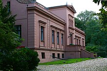
List of streets and squares in Berlin-Mahlsdorf

The list of streets and squares in Mahlsdorf describes the complete street system in the Berlin district of Mahlsdorf in the Marzahn-Hellersdorf district with the corresponding historical references. At the same time, this compilation is part of the lists of all Berlin streets and places .
overview
The Hönower Straße - Hultschiner Damm street , which runs from northeast to south, is the longest traffic route in the district at around 6.7 kilometers. On Hönower Straße north of Alt-Mahlsdorf are the oldest houses in the village on the former Anger . The village community and estate belonged to the Niederbarnim district in the Prussian province of Brandenburg . In 1874 the municipality of Mahlsdorf came to the newly formed district of Biesdorf , and the estate remained legally independent until 1912. In 1919 the city of Lichtenberg bought the manor from the Schrobsdorff heirs and made some of it available as settlement land for Lichtenberg citizens, especially war invalids. Mahlsdorf and its streets are only listed in the Berlin address book after the rural community became part of Greater Berlin and the Lichtenberg administrative district there in 1920 . In the 1920s, the ' Kiekemal ' settlement area emerged in the south and at around the same time the 'Elsengrund' and 'Eichenhof' settlements with their road networks in the west of the district, so that the corresponding connections had to be expanded.
The widening and straightening of the Berlin entry and exit roads B 1 / B 5 in the time of the GDR irretrievably destroyed parts of the old village center. After reunification , new residential quarters were built in the north and north-east, and numerous new single-family houses were built in the Mahlsdorf-Süd residential area. Since then, new roads have been built primarily in Mahlsdorf-Nord as access roads to the newly built settlement houses. The width of the street, the pavement and the state of development of some streets correspond to the suburban location of the district or the age of the streets and paths.
21 streets were given names according to tree species, other plants or landscapes, 20 street names honor people with regional references, 10 streets are named after former German locations that now belong to Poland and the Czech Republic as a result of the two World Wars, and 58 street names refer to artists, Writers, musicians or composers. In the explanations of the names of the streets named after German places, today's administrative structures are mentioned, not the ones that were valid when they were named.
There are 246 dedicated streets in the district (as of December 2016), plus eleven named places. 31 of the streets continue in the neighboring districts under the same name. Alt-Mahlsdorf is designated as a federal road with the B 1 and B 5 on the same route. In the superordinate road network of Berlin , Hönower Straße and Hultschiner Damm belong to the superordinate , Dahlwitzer Straße and Kohlisstraße to the regional road connections . Due to the settlement location of the district, the number of supplementary roads is comparatively large; these lead traffic to the settlement roads. Partly or in full length belong to category IV: Akazienallee (910 m), Am Rosenhag (220 m), An der Schule (60 m), Donizettistraße (660 m), Elsenstraße (1080 m), Fritz-Reuter-Straße (170 m), Kressenweg (300 m), Landsberger Straße (890 m), Lemkestraße (2490 m), Pilgramer Straße (930 m), Rahnsdorfer Straße (1290 m), Ridbacher Straße (340 m), Wilhelmsmühlenweg (750 m) and Wodanstraße (560 m). The total length of all federal, urban and residential roads in the district is 142.3 kilometers.
Mahlsdorf has 29,360 inhabitants (as of December 30, 2019) and includes the postcode area 12623.
Overview of streets and squares
The following table gives an overview of the streets and squares in the district as well as some related information.
- Name / location : current name of the street or square. Via the link Location , the street or the square can be displayed on various map services. The geoposition indicates the approximate center of the street length.
- Traffic routes not listed in the official street directory are marked with * .
- Former or no longer valid street names are in italics . A separate list may be available for important former streets or historical street names.
-
Length / dimensions in meters:
The length information contained in the overview are rounded overview values that were determined in Google Earth using the local scale. They are used for comparison purposes and, if official values are known, are exchanged and marked separately.
For squares, the dimensions are given in the form a × b for rectangular systems and for (approximately) triangular systems as a × b × c with a as the longest side.
If the street continues into neighboring districts, the addition ' in the district ' indicates how long the street section within the district of this article is. - Name origin : origin or reference of the name.
- Notes : further information on adjacent monuments or institutions, the history of the street and historical names.
- Image : Photo of the street or an adjacent object.
| Name / location | Length / dimensions (in meters) |
Origin of name | Date of designation | Remarks | image |
|---|---|---|---|---|---|
|
Maple Avenue
( Location ) |
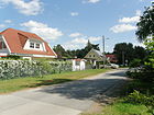
1220 | Maple , native deciduous tree | Oct. 27, 1902 | It runs in a west-east direction between Hultschiner Damm and the state border with Brandenburg and continues in Hoppegarten (district Waldesruh) as Buchenstrasse. |
|
| Acacia avenue
( Location ) |
900 (in the district) |
Acacia , native deciduous tree | Nov 23, 1907 | It runs in a west-east direction between Hultschiner Damm and the state border with Brandenburg before it becomes the Heinrich-Heine-Promenade in Hoppegarten (part of Waldesruh municipality). The 108 bus runs through it in full. |

|
| Albrecht-Dürer-Strasse
( Location ) |
770 | Albrecht Dürer (1471–1528), painter | Feb 12, 1920 | It is located between Landsberger Strasse and Melanchthonstrasse in a south-east-north-west direction. Until the construction of the new Dürergärten home estate at the beginning of the 2010s, it began as a dead end just before Rembrandtstrasse . Since then, the residential buildings 1–5A on the southwest side and 41A and 44 on the north side have been located in the area of this residential area. In the 1930 address book, these properties are named as construction sites. The plots continue across Frans-Hals-Platz with 5C to 18 at the playground on Melanchthonstraße, and 19–41A follow on the opposite side. At the corner of Pfarrhufenweg is the Protestant cruciform church, which is a listed building (picture). |

|
|
Alice Heart Square
( Location ) |
70 × 70 × 70 | Alice Herz (1882–1965), German-American pacifist , victim of the Nazi regime and fighter against the US Vietnam War | Jan. 27, 2003 | The small triangular square is bounded by Hörselbergstrasse , Giesestrasse and Briesener Weg . According to the development plan, it was designated 18th place . In line with the Berlin trend of preferring to name streets and squares after women, the nameless square was named after Alice Herz on the day of commemoration for the victims of National Socialism . The Jewish Herz family lived in a house at Akazienallee 4/5 in Mahlsdorf-Süd until 1933 . |

|
|
Alt-Mahlsdorf
( Location ) |
2020 | Alt-Mahlsdorf | July 26, 1927 | Alt-Mahlsdorf is a section of the federal highways B 1 / B 5 . The historical course is no longer preserved. It was originally called Berliner Strasse . A historic post milestone has been preserved in the area between Hönower Straße and An der Schule . As in other districts, the name was formed by the prefix Alt- in order to limit the large number of main and village streets in the Berlin urban area formed in 1920. As a trunk road, the residents are noisy. There are some houses that are set back on a parallel access road. On the south side of the road there are some fields and an Alba recycling center. The north side of the street borders on two business parks. |

|
| Altonaer Strasse
( Location ) |
310 | Altona , district of Hamburg | Feb 12, 1920 | It is a north-west-south-east street between Lemke and Landsberger Strasse in the north of Mahlsdorf. In the northeast corner of Mahlsdorf are streets named after Hanseatic cities. |

|
| At Barnim
( Location ) |
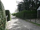
380 | Barnim , high plateau and region in Brandenburg | June 1, 1995 | The four meter wide street runs in a north-south direction as a connection between Großmannstrasse and Elsenstrasse. Before that, the connecting route between the extended Grunowstrasse and Elsenstrasse had no name. The residents also called it Elsenstrasse . On the west side it is built on the odd plots 1–23 with 14 settlement houses that connect to the bank vegetation at Elsensee (a Kaulsdorf quarry pond). According to the map of Berlin 1: 5000 this strip of shore is parceled out. On the east side, the residential buildings are on a 70-meter-wide strip that borders the KGA Elsenstrasse. The address is Am Barnim 2–22, with the numbers 6 and 12 being shared properties. There is an access road to each of these. |
|
| At the cornfield
( Location ) |
750 (in the district) |
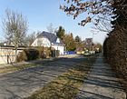
Description of the location of the cornfield | June 27, 1925 | The street 71 , which was built around 1910, became the current street name in 1925. The middle of the street forms the border to the Kaulsdorf district and runs from Treskowstraße to Alt-Kaulsdorf / Alt-Mahlsdorf in a slight north-south route. |
|
| At the lupine field
( Location ) |
1070 (in the district) |
Lupine , butterflies | June 27, 1925 | The street was built at the beginning of the 1920s from Straße 138 , Straße 113 and Straße 140 . It runs from Heinrich-Grüber-Strasse in the Kaulsdorf district over the district boundary on Briesener Weg to Melanchthonstrasse. The eastern section between Hönower and Melanchthonstrasse is the oldest area ( 138 ). The house numbers 65–92 belong to Mahlsdorf, the rest to Kaulsdorf . |

|
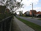
| Am Rosenhag
( Location ) |
1000 (in the district) |
Description of the location from Hag and Rose | June 27, 1925 | At first it was called Straße 132 , which curved slightly between Briesener Weg (west) and Guthmannplatz (east) or at the Siedlergärten / Marderweg. In the course of its development, it was continuously extended eastwards. It begins in the east at Guthmannplatz, crosses Hönower Straße, crosses the district boundary to Kaulsdorf am Briesener Weg and continues about 100 meters west of it as Ingolstädter Straße. The numbers 1–18a and 25–43 belong to Mahlsdorf. |
|
| On the blackthorn
( Location ) |
420 | historical field name with blackthorn bushes | June 27, 1925 | When it was first installed around 1920, it was called Strasse 147 . The traffic route runs from the Wacholderheide street in a northerly direction to the Berlin city limits and continues as Kirschallee in the Brandenburg municipality of Hoppegarten ( Hönow district ). To the west is the blackthorn pond. |

|
| At Theodorpark
( Location ) |
230 | see Theodorstrasse | 2014 | The street connects the Theodor Street with the Pilgramer Street in a west-east direction. The eponymous first name came from the vicinity of Theodorstrasse . | |
| At the settler gardens
( Location ) |
630 | Settlers , former garden settlement on this area | June 27, 1925 | The traffic route was called Straße 133 in its layout . It runs from Guthmannplatz to the north to about 80 meters north of Greifswalder Straße on the Berlin city limits and continues as Fichtengrund in the Brandenburg municipality of Hoppegarten (district Hönow ). |

|
| At school
( Location ) |
1030 | first community school | July 26, 1951 | Around 1901 the street was initially called Walderseestraße after the Prussian general Alfred von Waldersee (1832–1904). The traffic route runs between the embankment of the Prussian Eastern Railway (in the north) and Alt-Mahlsdorf (in the south) along the eastern part of the former Angers , but in some sections only as a footpath. Today's Friedrich Schiller Elementary School (built in 1904, expanded until 1909), the first community school in Mahlsdorf (picture), is located in the An der Schule 13-17 area. In the western area there is a small industrial park with low-rise buildings. In May 2015, the Mahlsdorfer Markt shopping complex was opened at the southern end of the street . In the Berlin street directory, 450 meters of the street An der Schule are included as a footpath ( RBS : FUWE and according to the object catalog with "X"). The rest of the street is designated as a street, 60 meters of which is also a supplementary street . |
 
|
| Arndtstrasse
( Location ) |
530 (in the district) |
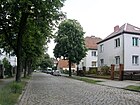
Ernst Moritz Arndt (1769–1860), poet and politician | Nov 23, 1907 | Lot number 21a (connection to the Hirschpfad) belongs to the Kaulsdorf district . Arndtstrasse runs in a straight line southwest from Roedernstrasse to the forest promenade. |
|
| Arturweg
( Location ) |
300 | Artur, male first name | 2014 | The private road branches off in a U-shape from the public road Am Theodorpark. The street name was assigned at the suggestion of the developer. It was named in the development area “Pilgramer Straße / Theodorstraße” in the development plan XXIII-9b. | |
| Attinghausenweg
( Location ) |
440 | Attinghausen , municipality in the canton of Uri in Switzerland | May 11, 1938 | The path was initially called Schillerstraße in 1902 and thus adapted itself to the name given by the writers of the other built streets. It runs from Bergedorfer Straße southwest to the forest promenade at Köpenicker Forst. |

|
|
Bachstrasse
( Location ) |
480 | Johann Sebastian Bach (1685–1750), composer | 1915 | Bachstraße connects Landsberger Straße (west) with Lortzingstraße (east). |

|
| Badener Strasse
( Location ) |
960 | Baden , 1918–1945 Land of the German Empire | Feb 12, 1920 | It runs in an east-west direction from Hultschiner Damm to Grenzstrasse. |

|
| Balsaminenweg
( Location ) |
510 | Balsamines , plant family | 1915 | The path in the Eichenhof housing estate, at its first installation, Straße 90 , leads from the Korianderweg north-east to the Goldregenstraße at Elsensee. |

|
| Banat Street
( Location ) |
100 | Banat , historical region in Romania, Serbia and Hungary | March 11, 1937 | At first it was called Straße 58 . The Banater Straße runs from the Hochwieser Straße to the Zipser Weg in a west-east alignment. |

|
| Bausdorfstrasse
( Location ) |
360 | Bausendorf, long-established Kossäten - and farmer's family | before 1910 | The street in Mahlsdorf Süd runs in a west-east direction from Hultschiner Damm to Pilgramer Straße . In the 19th century, the Bausdorf family did a great job of developing settlements in Kaulsdorf and Mahlsdorf. In the Kaulsdorf district there is a street of the same name north of the railway embankment between Heinrich-Grüber-Straße and Lohengrinstraße, which continues in Mahlsdorf as Wodanstraße . In the Berlin street directory, the street number 40279 (for Kaulsdorf) and 40280 for the Mahlsdorf residents clearly show that the two rural communities in Barnim were independent in 1910. |

|
| Beethovenstrasse
( Location ) |
720 | Ludwig van Beethoven (1770–1827), composer | 1920 | Beethovenstrasse is the eastern continuation of Schubertstrasse, runs parallel to the south parallel to the embankment of the Prussian Eastern Railway and ends as a dead end at the city limits of Berlin. A footpath leads to Hoppegarten , where it becomes Meistergasse in an industrial area. |

|
| Begasstrasse
( Location ) |
410 | Reinhold Begas (1831–1911), sculptor | Feb 12, 1920 | It connects Mirower Strasse (west) with Waldesruher Strasse in the Waldesruh part of the Brandenburg community of Hoppegarten (east). |

|
| Bergedorfer Strasse
( Location ) |
1140 (in the district) |
Bergedorf , district of Hamburg | May 16, 1938 | Today's street was built in two sections and was first named Fasanenstraße (July 1909–1938) and Heinrich-Heine-Straße (1920–1938). It runs in a slightly curved west-east route between An der Wuhle and Hultschiner Damm . The house numbers 94-124 (to the junction of Seebadstrasse) are in the Kaulsdorf district . |

|
| Muskrat Street
( Location ) |
750 | Muskrat , species of rodent | May 28, 2010 | The street connects Stralsunder Straße in the northeast in a zigzag shape with Kaulbachstraße in the southwest. | |
| Birkensteinweg
( Location ) |
80 (in the district) |
Birkenstein, adjacent part of the municipality of Hoppegarten in Brandenburg | Feb 21, 1940 | At first the path was called Straße 119 . It connects the Griebenweg with the Gartenweg, which is already in the Brandenburg municipality of Hoppegarten (part of the municipality of Birkenstein). |

|
| Bluestar Path
( Location ) |
420 | Squill , blue blooming bulbous plant | June 9, 1933 | At first the path in the settlement was called Eichenhof Straße 87 . It runs between the Butterblumensteig (in the south) and the Goldregenstraße (in the north). It finds its southern continuation in the Wickenweg. |

|
| Blumberger Strasse
( Location ) |
150 | Blumberg , part of the municipality of Ahrensfelde in Brandenburg | Feb. 28, 1978 | The short traffic route between Thorner and Dirschauer Straße in the north-east-south-west route was laid out for the development of terraced houses. |

|
| Brachetweg
( Location ) |
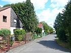
110 | Brachet, old German for June | March 18, 1935 | At first it was called Weg IV in the Elsengrund settlement. The Brachetweg forms a short connection between the Maipfad and Heuetsteig in the area between Elsensee and Butzer See. In the Elsengrund settlement there are streets according to the names of the months and the spring festivals. |
|
| Brown Bear Trail
( Location ) |
100 | Brown bear , predator | Aug 20, 2007 | The spur road leads from Landsberger Strasse south-east. It was created for a small settlement area. |

|
| Bremer Strasse
( Location ) |
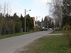
1030 | Bremen , city and state | Feb 12, 1920 | It runs in a south-west-north-east direction between Walter-Leistikow-Weg and Greifswalder Straße. In the northeastern tip of Mahlsdorf there are other streets named after Hanseatic cities. |
|
| Briesener way
( Location ) |
2070 | Briesen , town in the province of West Prussia , since 1920 Wąbrzeźno in Poland | May 11, 1938 | In 1906 the traffic route was laid out as Friedrichstrasse . The path connects Wodanstrasse in the southwest with Hönower Strasse in the northeast. |

|
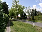
| Bruchsaler Strasse
( Location ) |
620 | Bruchsal , town in Baden-Württemberg | Feb 12, 1920 | It connects the Hultschiner Damm in the east with the Karlsruher Straße in the west. |
|
|
Butower Strasse
( Location ) |
990 | Bütow , town in the Pomeranian province , Bytów in Poland since 1945 | May 11, 1938 | When it was first built in 1908, it was called Pfarrstrasse . It begins at Hultschiner Damm and runs eastwards to Lehnitzstrasse. |

|
| Burggrafenstrasse
( Location ) |
560 (in the district) |
Burgrave , medieval official | July 27, 1906 | House numbers 1–33 east of Briesener Weg belong to the district; the numbers 34–37 are in Kaulsdorf .
It connects Ernst-Haeckel-Straße (in the west) with Florastraße (in the east) and forms a few short cross-branches. |

|
| Buttercup dough
( Location ) |
440 | Buttercup , native wildflower | June 9, 1933 | At first it was called Straße 85 . It is a walking and cycling path between Kressenweg and Blausternweg through the Eichenhof settlement in a west-east direction. |

|
|
Charlotte-von-Mahlsdorf-Ring
( Location ) |
Charlotte von Mahlsdorf (1928–2002), founder of the Wilhelminian style museum in Mahlsdorf | 17th March 2018 | The private road is located in the Hultschiner Damm building area opposite the Wilhelminian-style museum. | ||
|
Daffingerweg
( Location ) |
620 | Moritz Daffinger (1790–1849), Austrian painter | Feb 21, 1940 | At first the path was called Straße 41 . It runs in a straight line between Stralsunder Strasse (in the southwest) and Dahlwitzer Strasse (in the northeast). |

|
| Dahlwitzer Strasse
( Location ) |
1080 | Dahlwitz-Hoppegarten , part of the municipality of Hoppegarten in Brandenburg (towards the street) | before 1838 | The straight north-west-south-east route is located in the north-east corner of the district and is included in the Berlin road network as a regional road connection. It is labeled L 339 in the state of Brandenburg and connects the Hoppegartener Straße of the Hönower settlement in the north with the New Hönower Weg in the Birkenstein district of Dahlwitz-Hoppegarten . On the west side of the street are the consecutively numbered plots 1–31, mostly built with residential buildings, and 32–60 on the opposite side from Hönow. In the southern section there is a discounter department store on 60, on 57 a flat retail building under 47 the KGA "Dahlwitzer Straße" is addressed and under 43 the 60 meter wide strip of the KGA "Mahlsdorf Nordspitze". In the north-east there are again settlement houses (42-32). Already in the address book of 1922 the street course between the districts Dahlwitz and Hönow is listed in horseshoe numbering with eleven built-up lots and otherwise the indication of construction sites (mainly on the west side). |

|
| Dirschauer Strasse
( Location ) |
170 | Dirschau , town in the province of West Prussia , since 1920 Tczew in Poland | March 8, 1920 | It runs between Gielsdorfer Straße (west) and Neuenhagener Straße (east). |

|
| Donathstrasse
( Location ) |
130 | Donath, former settler and landowner in the Mahlsdorf estate | Nov 23, 1907 | It connects the Vierradener Weg (in the south) with the Kastanienallee (in the north). In the 1930s there was still no development on the street, but in 1925 there was Donathplatz with construction sites. However, because there was no more space here later, it must have been built over and included in the course of Donathstrasse. |

|
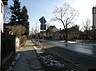
| Donizettistraße
( Location ) |
1160 | Gaetano Donizetti (1797–1848), Italian composer | Feb 12, 1935 | First (from April 17, 1902) the traffic route was called Wagnerstrasse after the composer Richard Wagner . The west-east street, which is slightly swiveled several times, runs between An der Schule and Lortzingstraße. |
|
| Drake Street
( Location ) |
320 | Johann Friedrich Drake (1805–1882), sculptor | Feb 12, 1920 | It connects Rauchstrasse (north) with Golzower Strasse (south). |

|
|
Dürer Gardens
( Location ) |
580 | Based on the existing Albrecht-Dürer-Strasse | before 2010 | The rectangular, ring-shaped traffic route opens up a residential area of the new residential estate through which Albrecht-Dürer-Strasse leads. In the RBS system, this traffic train is run as a private road , whereby the maintenance and equipment are subject to the settlers. Until construction began, there was a green wasteland here, and development began in 2010. In the square of the surrounding streets, the plots of land on Rembrandtstrasse and Lenbachstrasse were already in place, the plots on Lenbachstrasse are assigned to them and the recently built settlement houses on Walter-Leistikow-Strasse are accessed from this through a cul-de-sac, creating the Dürer gardens are not symmetrical to Albrecht-Dürer-Strasse, which was only extended with the settlement and to which the adjacent homes belong. The numbering of the plots of the Dürer gardens start at the northwest corner with 1 and lead clockwise on the outside of the Ringstrasse 1-41, whereby the 15 through the houses of the Landsberger Strasse does not exist. Within the road ring, the straight plots 2–40 are located in a clockwise direction. The five-meter-wide access road to the properties was the access road to the construction site when the settlement was built in 2010–2012. |

|
| Durlacher Platz
( Location ) |
120 × 70 | Durlach , district of Karlsruhe in Baden-Wuerttemberg | Feb 12, 1920 | The undeveloped space is bounded by Mannheimer Straße (north), Durlacher Straße (east), Freiburger Straße (south) and Wickenweg (west). |

|
| Durlacher Strasse
( Location ) |
130 | Durlach , district of Karlsruhe in Baden-Wuerttemberg | Feb 12, 1920 | It connects Mannheimer Strasse with Freiburger Strasse and touches Durlacher Platz. |

|
|
Ebereschenallee
( Location ) |
500 | Mountain ash or rowanberry | Nov 23, 1907 | It runs in a west-east direction between the Hultschiner Damm and the Erich-Baron-Weg. |
 
|
| Eberleinstrasse
( Location ) |
220 | Gustav Eberlein (1847–1926), sculptor | Feb 12, 1920 | The street begins in the north on the Berlin city limits as a continuation of Karl-Marx-Straße in the Brandenburg municipality of Hoppegarten (district Waldesruh) and ends in the south on Begasstraße. |

|
| Eichenhofweg
( Location ) |
240 | Eichenhof, name of the first settlement built here on dry meadows | May 11, 1938 | In 1907, the route was called Wiesenstrasse . It connects the Wickenweg (west) with the Hultschiner Damm (east). In front of plot number 9, a stumbling block was laid on May 22, 2008 in honor of the painter and sculptor Walter Reissner, who lived here and was deported to Auschwitz in 1943 and killed there. |

|
| Ice path
( Location ) |
270 | Eismond, old German for January | March 18, 1935 | At first it was called Weg I in the Elsengrund settlement. It leads from the Kressenweg over the Pfingstweg to the Maipfad. With the location of this path in the lowland area of three lakes, icing may have been observed frequently and the cold location in the area was noticed. In the Elsengrund settlement there are streets after the old German month names and the spring festivals. |

|
| Ellaweg
( Location ) |
100 | June 13, 2015 | The path runs from the Laraweg to the street Am Theodorpark. | ||
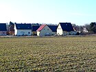
| Elsenstrasse
( Location ) |
1070 + 270 | Else, out of date for alder | Feb 12, 1920 | The street runs in an east-west direction from Hultschiner Damm to Kressenweg and continues in Kaulsdorf as street Am Niederfeld.
House number 13a is the International Waldorf School. The road forms a branch leading northwards / westwards. The Berlin balcony is located between her and Alt-Mahlsdorf . |
|
| Meerkat Trail
( Location ) |
130 | Meerkat , small feline wild animal | June 1, 2001 | The spur road leads from Landsberger Strasse south-east, and at the same time it is the continuation of Walter-Leistikow-Weg. The meerkat trail was laid out for a new settlement area. |

|
| Erich-Baron-Weg
( Location ) |
1210 | Erich Baron (1881–1933), victim of the Nazi dictatorship | May 24, 1951 | When it was first installed in 1907, it was called Königsweg . The street begins north on the forest promenade at Köpenicker Forst, then bends northwest and ends at Hultschiner Damm . The BEST Sabel elementary school is located at number 118 in a listed school building . | |
| Eschenstrasse
( Location ) |
80 (in the district) |
Ash , native deciduous tree | 1922; only proven officially created in 1926 | It is the north-west-south-east connection between Heerstraße in Kaulsdorf and Roedernstraße. The numbers 1–4 and 50 / 50a belong to Mahlsdorf (from Seebadstrasse to Roedernstrasse). |

|
|
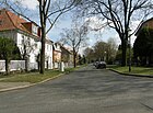
Fauststrasse
( Location ) |
170 | Johann Georg Faust (~ 1480–1541), doctor, astrologer | before 1920 | It connects Giesestrasse with Briesener Weg. |
|
| Field
( Location ) |
640 | Field , border strip between two fields | June 27, 1925 | At first it was called 141 Street . The field runs between wild rose trees (north) and Pfarrhufenweg (southeast), slightly angled twice. The Mahlsdorf elementary school is located here (number 47). The building is listed as a 'Mahlsdorf Nord primary school'. |

|
| Florastrasse
( Location ) |
1900 | Flora , Roman goddess of blossom | July 27, 1906 | Florastraße begins in the southwest on the embankment of the Prussian Eastern Railway . This is where the Deutsche Bahn (DB) offices are located . Opposite the DB (Systel GmbH) complex, the 'residential park am Rohrpfuhl' with small-scale development was laid out in the 2000s. Florastraße ends in the northeast at the Wildrosenhöölz road. |
 
|
| Frans-Hals-Platz
( Location ) |
120 × 60 | Frans Hals (~ 1580–1666), Dutch painter | 1922 | It was initially called number 19 , in the address book of 1922 it can already be found under its current name (in the spelling Franz-Hals-Platz: first name with "z"). The square is bounded by Albrecht-Dürer-Strasse (northeast), Rembrandtstrasse (southeast), Frans-Hals-Strasse (southwest) and Lemkestrasse (northwest). |

|
| Frans-Hals-Strasse
( Location ) |
120 | Frans Hals (~ 1580–1666), Dutch painter | Feb 12, 1920 | It runs between Lemke and Rembrandtstrasse on the square of the same name in a south-easterly direction. |

|
| Freiburg Street
( Location ) |
520 | Freiburg im Breisgau , city in Baden-Württemberg | Feb 12, 1920 | It begins in the east on Hultschiner Damm and ends after a right-angled swivel southwest as a road on Badener Straße. |

|
| Ferret way
( Location ) |
760 | Ferret , marten predator | June 27, 1925 | The path was laid out as road 79 . It connects the Wilhelmsmühlenweg in a north-south route with Alt-Mahlsdorf . |

|
| Friedenstrasse
( Location ) |
970 | Peace of Frankfurt , ended the Franco-German War in 1871 | Apr 17, 1906 | The traffic route lies between Hultschiner Damm (southeast) and Grenzstrasse (northwest). |

|
| Friesacker Street
( Location ) |
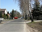
460 | Friesack , city in Brandenburg | May 16, 1938 | When it was first built around 1920, it was called Meyerbeerstraße after the German composer Giacomo Meyerbeer and thus adapted to the street names in the area. It runs in a west-east direction between Landsberger and Lortzingstrasse. |
|
| Fritz-Reuter-Strasse
( Location ) |
160 | Fritz Reuter (1810–1874), writer | 1901 | It connects Hönower Straße (west) with An der Schule (east). The name was given at the request of a namesake living in Mahlsdorf, the surveyor Fritz Reuter; just like Lessingstrasse and Walderseestrasse (at the school) were named at his request. At the corner of the street An der Schule, Mahlsdorf's former post office building has been preserved, which was converted into a medical center. |

|
|
Georginenweg
( Location ) |
500 | Georgine, obsolete for dahlia | June 9, 1933 | At first it was called Straße 89 . The traffic route in the Eichenhof settlement connects the Korianderweg in the Elsengrund settlement with the Golden Rain Road . |

|
| Gerhart-Hauptmann-Strasse
( Location ) |
210 | Gerhart Hauptmann (1862–1946), writer | Feb 12, 1920 | It runs from Roedernstrasse (northeast) to Bergedorfer Strasse (southwest). |

|
| Gielsdorfer Strasse
( Location ) |
660 | Gielsdorf , part of Altlandsberg in Brandenburg | Nov 12, 1969 | When it was first named on March 8, 1920, it was called Graudenzer Strasse after the West Prussian town of Graudenz in Poland, Grudziądz . It runs from Treskowstraße to Dirschauer Straße, and after an offset to the east, it continues to Alt-Mahlsdorf . |

|
| Giesestrasse
( Location ) |
340 (in the district) |
Giese, name of a long-established family | July 17, 1909 | It runs between the in Kaulsdorf lying Zanderstraße and the Jacques-Offenbach-place in the Hönower street in west-east direction. The numbers 70-102 and 79-99 (from Hörselbergstraße) belong to Mahlsdorf (this section of the street was called Zeppelinstraße until 1937 ). |

|
| Gorse path
( Location ) |
60 (in the district) |
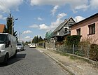
Gorse , spring flowering shrub | June 27, 1925 | The Ginsterweg was laid out around 1907 as Straße 129 . It runs from Greifswalder Strasse (south) to the Berlin city limits and continues as Ginsterstrasse in the Hönow district of the Brandenburg municipality of Hoppegarten. |
|
| Golden Rain Road
( Location ) |
750 | Laburnum , spring flowering shrub | June 9, 1933 | Laid out as road 83 , it connects the Kressenweg (west) with the Hultschiner Damm (east) in the Eichenhof estate. |

|
| Golzower Strasse
( Location ) |
350 | Golzow , municipality in Brandenburg | May 31, 1951 | From around 1750 it was called Dorfstraße , and from May 22, 1911, Alte-Fritz-Straße after King Friedrich II of Prussia . It runs from Mirower Strasse (northwest) to Waldesruher Strasse in the Brandenburg municipality of Hoppegarten (district of Waldesruh) (southeast) directly on the eastern Berlin city limits. After the Second World War, street names after monarchs were no longer desirable. |

|
| Götzkeweg
( Location ) |
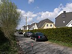
120 | Götzke, a long-established family in Mahlsdorf | Feb 21, 1940 | According to the development plan, the path was called Straße 125a . It connects the Griebenweg (northwest) with the Hobeckweg (southeast). It was named after the Götzke family, whose members were active in various functions in Mahlsdorf. |
|
| Graffplatz
( Location ) |
90 x 70; 190 (street) |
Anton Graff (1736–1813), Swiss painter | Feb 21, 1940 | When it was first built around 1920, the green space was called Hansaplatz . Graffplatz comprises a street and a square northeast of Kolberger Straße. |

|
| Greifenweg
( Location ) |
130 | Bird of prey , family of birds of prey | Aug 20, 2007 | The spur road leads from Landsberger Strasse south-east and serves to develop a newly built small settlement area. |

|
| Greifswalder Strasse
( Location ) |
1280 | Greifswald , city in Mecklenburg-Western Pomerania | Feb 12, 1920 | It begins a little south of the Berlin city limits on Hönower Straße. Then it meanders in a west-east direction to Dahlwitzer Strasse. Almost its entire length is used by bus route 395. In the northeast corner of Mahlsdorf are streets named after Hanseatic cities. |

|
| Border road
( Location ) |
400 | Border between the villages of Kaulsdorf and Mahlsdorf | around 1910 | It runs in a northeast-southwest direction between Mannheimer Strasse and Eschenstrasse. Since the administrative reform of 2001, Grenzstraße has been completely located in the Mahlsdorf district. |

|
| Griebenweg
( Location ) |
910 | Greaves, resident family since the 15th century | Feb 21, 1940 | In the planning phase, the traffic route was called Straße 95a , and it is mentioned for the first time in documents after 1930. The Griebenweg runs from Dahlwitzer Strasse in the southwest to Zochestrasse in the northeast. |

|
| Grossmannstrasse
( Location ) |
300 | Paul Großmann (1865–1939), local chronicler | May 1, 1995 | When it came to the route, the route was initially called the Extended Grunowstrasse . The road was laid out for a new settlement area and runs east of the Elsensee between Am Barnim and Rosa-Valetti-Straße. Only its north side is built on. |

|
| Grunowstrasse
( Location ) |
1360 | Ernst Grunow (1862–1923), landowner | Oct. 27, 1903 | It leads from Hultschiner Damm (west) to the Berlin city limits (east). Grunow was successfully involved in the development of traffic and settlement in Mahlsdorf. |

|
| Gustavstrasse
( Location ) |
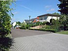
160 | Gustav , male first name | March 17, 2003 | It was created in the 21st century in connection with a new development and runs from Theodorstraße (west) to over Heribaldstraße (east). |
|
| Guthmannplatz
( Location ) |
30 × 30 | Guthmann , Jewish family formerly living in Mahlsdorf | Feb 21, 2008 | It marks the five-armed intersection of Am Rosenhag , An den Siedlergärten , Wacholderheide , Kieler Straße and Marderweg . It is cut into two parts by the Kieler Strasse – Am Rosenhag street. The place was called, according to the Berlin address 1938 Market Square . However, the name is not found in any official documents and there was no corresponding street sign. The Guthmann family, who lived at Lemkestrasse 156 until 1943, were victims of the Holocaust except for their son Leopold . |

|
|
Hamburger Street
( Location ) |
1300 | Hamburg , city and state | Feb 12, 1920 | It was laid out before 1920 and runs slightly curved several times from Kieler Strasse (southwest) to the Berlin city limits (northeast). There it continues as Auf der Höhe in the Hönow district of the Hoppegarten community. In the northeastern tip of Mahlsdorf there are other streets named after Hanseatic cities. |

|
| Hamster street
( Location ) |
150 (in the district) |
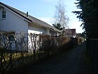
Hamster , rodent | June 27, 1925 | It was created from several numbered streets ( street 79 and street 80 ). The larger section of this road runs in the Kaulsdorf district . Your Mahlsdorf area lies between Am Kornfeld and the Frettchenweg and is in parts just a footpath and bike path. |
|
|
Handelstrasse
( Location ) |
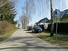
530 | Georg Friedrich Handel (1685–1759), composer | around 1920 | It runs from Beethovenstrasse in the west over the intersection with Lortzingstrasse to the Berlin city limits. In the area of the Brandenburg municipality of Hoppegarten , Zimmermannsgasse continues in an easterly direction. |
|
| Heidestrasse
( Location ) |
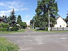
290 | Heath , type of landscape with poor soils | Feb 12, 1920 | The short west-east connection runs between Mirower and Summter Straße . |
|
| Herderstrasse
( Location ) |
270 | Johann Gottfried Herder (1744–1803), poet | Feb 12, 1920 | It extends from Roedernstrasse in a northeast-southwest direction to Bergedorfer Strasse. |

|
| Heribaldstrasse
( Location ) |
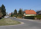
290 + 40 | Heribald, male first name | March 8, 1935 | At their facility it was called Straße 52 . It connects Karlstrasse (south) with Gustavstrasse (north). |
|
| Ermine way
( Location ) |
290 | Ermine , native predator | June 27, 1925 | First the way was called Straße 142 . It connects the Wildrosenhöölz street with Greifswalder Straße in a south-north route. |

|
| Hermioneweg
( Location ) |
300 | January 21, 2017 | The path branches off from Theodorstraße and leads back to Theodorstraße in a U-shape. | ||
| Herweghstrasse
( Location ) |
330 | Georg Herwegh (1817–1875), poet | Feb 12, 1920 | It runs in a north- westerly direction from Hultschiner Damm to Herderstrasse. |

|
| Haydough
( Location ) |
220 | Heuet, old German for the month of July | March 18, 1935 | At first the Heuetsteig was called Weg VIII . It is located in the area between Elsensee and Butzer See and connects the Kressenweg with the Hornungweg. In the Elsengrund settlement there are streets according to the names of the months and the spring festivals. |

|
| Hobeckweg
( Location ) |
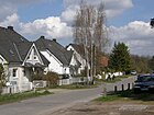
470 | Heinrich Hobeck (15th century), large landowner on the territory of today's Mahlsdorf | Feb 21, 1940 | First the way was called Straße 124 . It runs from Kötteritzweg to Zochestrasse parallel to the Berlin city limits. |
|
| Hochwieser Strasse
( Location ) |
260 | Hochwies , German name of the city of Veľké Pole in Slovakia | March 11, 1937 | At first it was called Strasse 57 . It runs from Rahnsdorfer Straße (in the south) over Iglauer Straße and ends in the north as a dead end. |

|
|
Hönower Strasse
( Location ) |
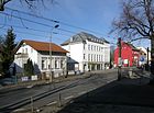
3100 | Hönow , part of the municipality of Hoppegarten in Brandenburg (direction of the road) | May 11, 1938 | In a south-north direction, the street connects the Alt-Mahlsdorf street with the Berlin city limits to the Hönow district of the Brandenburg municipality of Hoppegarten . The 195 bus line runs along its entire length.
A connection from the village center of Mahlsdorf to Hönow as a road to Hönow is proven as early as 1838 . The section in the village was simply called Dorfstrasse . In 1895, Mahlsdorf received a railway connection, the village road to the south was up to the highway Berlin- Frankfurt (Oder) in Bahnhofstrasse renamed. Numerous architectural monuments along this road are remarkable. |
|
| Hörselbergstrasse
( Location ) |
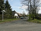
190 | Hörselberge , mountain range in Thuringia | around 1920 | It connects the Wodanstrasse with the Briesener Weg and touches the Alice-Herz-Platz. The reference to Richard Wagner's works exists because of the surrounding Lohengrin, Wodan and Siegfriedstrasse. There was Wagnerstrasse in Mahlsdorf (renamed Donizettistrasse ) |
|
| Hornungweg
( Location ) |
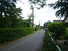
540 | Hornung, old German for the month of February | March 18, 1935 | The name given in 1935 summarized the first names Weg II and Weg XI . The Hornungweg runs between Elsenstraße (in the north) and Kressenweg (in the south) parallel to the east bank of the Elsensee. In the Elsengrund settlement there are streets according to the names of the months and the spring festivals. |
|
|
Hultschiner dam
( Location ) |
3620 | Hultschin , town in the province of Silesia , since 1920 Hlučín in the Czech Republic | March 11, 1937 | It was initially called Cöpenicker Straße and Köpenicker Allee (from 1907) and leads from Alt-Mahlsdorf to the border of the Köpenick district. It has been used by trams since 1907 . There are also architectural monuments such as the 'St. Hubertus' (see photo below) after which the corner is popularly named. Other interesting buildings are the “Kiekemal School” (house number 219) or the “Cabaret Knieriem”. Kaulsdorfer Weg , number 8 of the 20 green main routes in Berlin, runs along part of the street . |
 
|
| Hummelstrasse
( Location ) |
560 | Ferdinand Hummel (1855–1928), composer and conductor | May 11, 1938 | When it was first named in 1905, the traffic route was called Schulstrasse . Hummelstraße runs slightly upwards from An der Schule (West) to Kuhnaustraße, at this point it forms a small, triangular, nameless square and descends slightly to Landsberger Straße (in the East). Surrounding streets southeast of the train station are also named after musicians. |

|
|
Ifflandstrasse
( Location ) |
880 | August Wilhelm Iffland (1759–1814), theater director | Feb. 17, 1908 | It runs from Langenbeckstraße on Langenbeckplatz southwest to Bütower Straße on Lehnitzplatz. |

|
| Iglauer Strasse
( Location ) |
230 | Iglau , German name of the city of Jihlava in the Czech Republic | March 11, 1937 | At first it was called Straße 55 . It goes from Pilgramer Straße eastwards and ends behind the confluence of Hochwieser Straße just before the Berlin city limits as a dead end. |

|
| Immortellenweg
( Location ) |
510 | Immortelle , a composites | June 9, 1933 | When it was first built, the path was named Straße 86 . The Immortellenweg begins in a west-east direction on Blausternweg, then bends to the north and ends about 60 meters behind the Golden Rain Road . |

|
|
Jacques-Offenbach-Platz
( Location ) |
Jacques Offenbach (1819–1880), composer | Oct. 2014 | Place in the middle of the roundabout into which Hönower Straße, Giesestraße and Ridbacher Straße flow | ||
| Jahnstrasse
( Location ) |
160 | Friedrich Ludwig Jahn (1778-1852), educator ("Turnvater Jahn") | Oct. 27, 1902 | It connects Wolfsberger Strasse with Pilgramer Strasse. |

|
| Kantstrasse
( Location ) |
30 in the district |
Immanuel Kant (1724–1804), philosopher | Feb. 17, 1938 | It leads from Rauchstrasse in the Kiekemal settlement over the city limits to the Heinrich-Heine-Promenade in the Waldesruh settlement (Dahlwitz-Hoppegarten). With only 30 meters of its southern part, Kantstraße belongs to the Kiekemal settlement in the Mahlsdorf district. The longer northern part is beyond the Berlin city limits in the Waldesruh von Dahlwitz-Hoppegarten settlement in the Märkisch-Oderland district. In the official map of the administrative district of Lichtenberg, the road is not yet planned for 1926, the plan update from 1930 still shows a piece of forest. She is shown under her name on the official card from 1938. It is included in the official Berlin street directory as Gemeindestraße (44602), the adjacent properties belong to Rauchstraße. | |
|
Karlshafener Strasse
( Location ) |
730 (in the district) | Bad Karlshafen , city in Hesse | May 10, 1951 | First (from 1906) it was called Viktoriastraße after the German Empress Auguste Viktoria . she
begins about 100 meters northeast of the Briesener Weg in Kaulsdorf , crosses the district boundary on Briesener Weg and ends in the southeast at Florastraße. |

|
| Karlsruher Strasse
( Location ) |
170 | Karlsruhe , city in Baden-Württemberg | Feb 12, 1920 | It goes eastward from Kressenweg and after a 90-degree swivel leads south to over Bruchsaler Straße. |

|
| Karlstrasse
( Location ) |
510 | Carl Otto (1852–1909), owner of a farm | Oct. 27, 1902 | It runs between Röbeler Weg and Hochwieser Straße roughly in a north-west-south-east direction. The name was given by the then mayor Eugen Voigt while Otto was still alive. Kaulsdorfer Weg , number 8 of the 20 green main routes in Berlin, runs along part of the street . |

|
| Kastanienallee
( Location ) |
580 | Chestnut , deciduous tree | Nov 23, 1907 | Kastanienallee runs in a west-east direction from Hultschiner Damm to Mirower Straße. |

|
| Kaulbachstrasse
( Location ) |
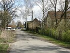
450 | Wilhelm von Kaulbach (1805–1874), painter | Feb 12, 1920 | It connects Landsberger Strasse with Bisamstrasse and touches a larger water catchment area that is secured with a fence. |
|
| Kethelitzweg
( Location ) |
400 | Otto von Kethelitz (also Kettlitz) (14th century), one of the first landowners in Mahlsdorf | March 8, 1935 | The north-south street between Elsenstrasse and Großmannstrasse was laid out as Strasse 38 in the Elsengrund settlement. This three to five meter wide unpaved driveway leads from Elsenstrasse to the south through the KGA 'Elsenstrasse', whose parcels are assigned to properties 7 and 13 on the east side and 8 and 26 on the west side. At the south end there are plots 15–225, some of which are or are being built on divided plots with single-family houses; to the south, plots of Parlerstrasse (29–29f) with settlement houses built after 2008 adjoin a narrow driveway behind the settlement houses on Großmannstrasse. With this development, the passage to Großmannstrasse was probably created. |

|
| Kiekemaler Street
( Location ) |
290 | Kiekemal Colony, settlement laid out in 1751 in Mahlsdorf-Süd | Nov. 27, 1907 | The street connects Wilhelm-Blos-Straße with Erich-Baron-Weg in a west-east direction.
The first colonists settled in the Cöpenick'sche Cämmerey at the beginning of the 19th century and called it " Kiekemal Colony ". In 1909 the enclave of the manor district of Dahlwitz was merged with the rural community of Mahlsdorf under local law. In memory of the history, a street in this area was given the name of the colony. |

|
| Kieler Strasse
( Location ) |
580 | Kiel , city in Schleswig-Holstein | Feb 12, 1920 | It connects Landsberger Strasse (southeast) with Guthmannplatz (northwest). In the northeastern tip of Mahlsdorf there are other streets named after Hanseatic cities. |

|
| Kleeackerweg
( Location ) |
500 | Clover , forage plant | June 27, 1925 | The path was laid out as road 135 shortly after 1900. It runs from Florastrasse first north-west and then bends to the north-east to Am Rosenhag. Like the street Am Lupinenfeld, the path may be named after a previously existing field . |

|
| Klopstockstrasse
( Location ) |
600 | Friedrich Gottlieb Klopstock (1724–1803), poet | Nov 23, 1907 | It connects Roedernstrasse (in the northeast) with the forest promenade (in the southwest) on the border to Köpenick. |

|
| Kohlisstrasse
( Location ) |
1140 (in the district) |
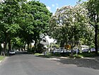
Carl Kohlis-Kyffhausen (1857–1910), writer and Berlin hotel owner | Nov 23, 1907 | By naming the street, the community honored Kohlis' commitment to the house and landowner association Mahlsdorf-Süd.
The house numbers 1-47 and 55-99 belong to Mahlsdorf, the numbers 48-54 to Kaulsdorf . The road runs parallel to the border with the Köpenick district . It begins at Hultschiner Damm in the southeast, ends in the northwest just before the confluence of Sadowastraße and continues as Ulmenstraße. The 108 bus runs through the entire length. |
|
| Kolberger Strasse
( Location ) |
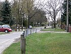
440 | Kolobrzeg , a town in the Pomeranian Province , since 1945 Kołobrzeg in Poland | Feb 12, 1920 | It connects Landsberger Strasse (in the northwest) with Terwestenstrasse (in the southeast). |
|
| Coriander path
( Location ) |
430 | Coriander , aromatic plant | Apr 26, 2002 | It runs in a west-east direction from Kressenweg to Wickenweg and forms the northern boundary of the KGA 'Kressenweg'. Before that he was nameless. |

|
|
Kornplatz
( Location ) |
120 × 100 | Theodor Körner (1791–1813), writer | after July 1951 | During the expansion of the Kiekemal settlement , it was named first place . The rectangular square is bordered by Uhland, Kohlis, Mechthild and Seestrasse. The name Körnerplatz can already be found in address books from the 1930s. A large part of its area is taken up by the Körnersee , which has existed for centuries and was known as 'Mahlsdorfer Tränke' until the 1920s. |
 
|
|
Kötteritzweg
( Location ) |
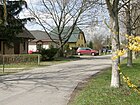
120 | Kötteritz, landowning family in Mahlsdorf | Feb 21, 1940 | It was only created in 1939/1940 and leads from the KGA 'Dahlwitzer Straße' (on Griebenweg ) in a south-easterly direction to the Berlin city limits, after which it becomes Mahlsdorfer Weg in the Birkenstein district of Hoppegarten . |
|
| Kressenweg
( Location ) |
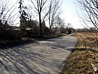
1900 | Cress , aromatic herb | Nov 11, 1935 | The Kressenweg in the Eichenhof estate connects Mannheimer Straße with the B1 / B5 (Alt-Kaulsdorf / Alt-Mahlsdorf) in a south-north direction . It originally began south of the Butterblumensteig and ended on the Golden Rain Road. Later it was connected northwards with Elsenstrasse. Since 1978 it has led north of the Golden Rain Road in an arc around the Elsengrund settlement and ends at the B1 / B5. The Julpfad (a street in the Elsengrund settlement) was included in the Kressenweg. A connection to Mannheimer Strasse was established in the south. Kaulsdorfer Weg , number 8 of the 20 green main routes in Berlin , also runs along part of the street . |
|
| Kuhnaustraße
( Location ) |
290 | Johann Kuhnau (1660–1722), composer | May 11, 1938 | When it was first named, it was called Röntgenstrasse after the physicist Wilhelm Conrad Röntgen . Kuhnaustraße connects Pestalozzistraße (south) with Donizettistraße (north) in a slightly bent route. |

|
| Kumberger way
( Location ) |
210 | Kumberg , municipality in Styria in Austria | March 11, 1937 | At first it was called Triftweg , named after the path for livestock. It is the southernmost street in the district that runs between Mirower Strasse and Waldesruher Strasse in the Brandenburg municipality of Hoppegarten (Waldesruh part of the municipality). |

|
|
Landsberger Strasse
( Location ) |
2910 (interrupted) | Altlandsberg , city in Brandenburg (direction of the road) | before 1838 | Landsberger Strasse is a remnant of a medieval connecting route between Köpenick and Altlandsberg. It begins in the south on the Alt-Mahlsdorf road , where a larger industrial area has developed to the east, known as Business Park B1 . The access arms are laid out as a rectangular network and all belong to Landsberger Straße. It is interrupted in its course by the route of the Prussian Eastern Railway and then continues to Dahlwitzer Strasse in the northeast. |
 
|
| Landvogtstrasse
( Location ) |
530 | Governor , royal administrator of an area | May 16, 1938 | The street runs from Landsberger Straße eastwards over Lortzingstraße to the Berlin city limits. It was laid out in the 1920s and was called Mendelssohnstraße until May 16, 1938, after the composer Felix Mendelssohn Bartholdy . The renaming took place on the same day as Offenbachstrasse in Pfalzgrafenweg and Liebermannstrasse in Schongauerstrasse , which indicates a joint anti-Semitic action by the National Socialists . |

|
| Langenbeckplatz
( Location ) |
115 × 65 | Bernhard von Langenbeck (1810–1887), surgeon and university professor | Feb. 17, 1908 | The rectangular square is located diagonally at the intersection of Langenbeckstrasse (in the north), Zipser Weg (in the east), Spitzwegstrasse (in the south) and Ifflandstrasse (in the west). A large part is designed with different play options (street ball court, seesaw and swings and a Tobehaus for the little ones). Towards Ifflandstrasse there is a green strip that has been left close to nature. |

|
| Langenbeckstrasse
( Location ) |
440 | Bernhard von Langenbeck (1810–1887), surgeon and university professor | Feb. 17, 1908 | It connects Wolfsberger Strasse (west) with Zipser Strasse on Langenbeckplatz (east). |

|
| Laraweg
( Location ) |
200 | June 13, 2015 | The path branches off east of Theodorstraße and ends as a dead end. | ||
| Lavender path
( Location ) |
500 | Lavender , genus of the mint family | June 9, 1933 | At first the way was called Straße 88 . The 10-meter-wide path is located in the Eichenhof settlement between Korianderweg and Goldregenstraße and forms a few development branches as an access road. Plots 19–63 (odd) and opposite 20–64 (even) are on the west side, plots 1–17 and 2–18 do not exist. |

|
| Ledebour Street
( Location ) |
1180 | Georg Ledebour (1850–1947), politician | May 24, 1951 | When the route was laid out in 1902, the traffic route was named Bismarckstraße after Otto von Bismarck , the first German Chancellor. Ledebourstrasse connects the Hultschiner Damm with the Berlin city limits in a west-east route . There, Ledebourstrasse becomes Heidemühler Weg in Hoppegarten -Waldesruh. |

|
| Lehnitzplatz
( Location ) |
190 × 90 × 120 × 140 |
Lehnitz , part of the city of Oranienburg in Brandenburg | Apr 12, 1951 | From 1908 it was called Hohenzollernplatz like the street of the same name. The irregular, rectangular green square is bordered by Bütower Straße (in the north), Lehnitzstraße (in the east), Rusternallee (in the south) and Mirower Straße (in the west). A footpath leads diagonally across the green area overgrown with bushes and trees, which connects Ifflandstrasse, which leads to the square, with the junction of Rüsternallee / Mirower Strasse. |

|
| Lehnitzstrasse
( Location ) |
2530 | Lehnitz , part of the city of Oranienburg in Brandenburg | Apr 12, 1951 | From February 17, 1908, the new street was named Hohenzollernstraße after the Brandenburg-Prussian ruling family . Lehnitzstraße leads from Rahnsdorfer Straße south-west, makes a slight bend to the south at Rusternallee and ends at Begasstraße. |

|
| Lemkestrasse
( Location ) |
2480 | Karl Lemke (1847–1906), owner of a farm in Mahlsdorf | 27 Sep 1902 | The straight road connects Dahlwitzer Strasse over Greifswalder Strasse (in the north), Kieler Strasse and the railway line with Donizettistrasse (in the southwest). The Wacholderheide traffic route was laid out symmetrically in the northern area. |

|
| Lenbachstrasse
( Location ) |
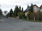
560 | Franz Ritter von Lenbach (1836–1904), painter | Feb 9, 1910 | Lenbachstrasse in Mahlsdorf-Nord connects Florastrasse (in the northwest) with Landsberger Strasse (in the southeast). Its northwest continuation is Lübzer Straße , its southeast is Weberstraße . There is also a Lenbachstraße in Kaulsdorf in the district , which refers to the same namesake. There are also Lenbachstrasse in the Friedrichshain district ( Friedrichshain-Kreuzberg ) and in Steglitz-Zehlendorf (Steglitz). The Berlin directory distinguishes between the streets of Kaulsdorf (41749) and Mahlsdorf (41750). |
|
| Lessingstrasse
( Location ) |
640 | Gotthold Ephraim Lessing (1729–1781), poet | Apr 17, 1902 | This street was named at the request of a namesake of the poet Fritz Reuter , the surveyor Fritz Reuter, who lived in Mahlsdorf ; just like Fritz-Reuter-Strasse and Walderseestrasse (at the school) were named according to his request. It runs from Roedernstrasse (in the northeast) to the forest promenade (in the southwest). |

|
| Levensauer Strasse
( Location ) |
430 | Levensau, part of the community Neuwittenbek in Schleswig-Holstein | June 27, 1925 | Created as Straße 45 , it connects the Hultschiner Damm (west) with the Pilgramer Straße (east). |

|
| Linderhofstrasse
( Location ) |
810 | Linderhof , castle in the municipality of Ettal in Bavaria | March 11, 1937 | From 1902 it was initially called Lindenstrasse . Linderhofstrasse runs from Briesener Weg (northwest) to Lemkestrasse (southeast). The eight-meter-wide street with small cobblestone pavement and suburb development is designated as a municipal street, 20 meters of Linderhofstraße are noted as a footpath according to the street directory (FUWE), the western end of the street also has no passage to Briesener Weg. |

|
| Lisztstrasse
( Location ) |
160 | Franz Liszt (1811–1886), composer | around 1920 | It connects Beethovenstrasse with Handelstrasse in a north-south direction. |

|
| Lohengrinstrasse
( Location ) |
60 (in the district) |
Lohengrin , opera by Richard Wagner | around 1910 | Only numbers 2 and 3 (east side of the short spur road) belong to Mahlsdorf. It runs as an extension of Lehnestrasse from (Kaulsdorfer) Bausdorfstrasse to the embankment in a north-south direction. In front of plot number 2, Stolpersteine were laid on May 22, 2008 in honor of Rosa and Heinrich Lange, who lived here in a garden shed and were deported to Auschwitz in 1942, where they were killed. |

|
| Lortzingstrasse
( Location ) |
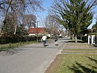
880 | Albert Lortzing (1801-1851), composer | around 1910 | It begins as a dead end about 50 meters south of Friesacker Strasse and ends in the north on Beethovenstrasse. It runs parallel to the Berlin city limits to the west (in the area of the Hoppegarten industrial park ). |
|
|
Löwestrasse
( Location ) |
440 | Carl Loewe (1796–1869), composer | 21 Sep 1922 | From 1919 it was listed in the field book as street 112 . It leads in a slight curve from Landsberger Straße to Kaulbachstraße. |

|
|
Luebecker Strasse
( Location ) |
430 | Lübeck , city in Schleswig-Holstein | Feb 12, 1920 | It connects Daffingerweg in the southeast with Greifswalder Straße in the north. Between Lemkestrasse and Wacholderheide it is interrupted by the KGA 'Wacholderheide' . In the northeastern tip of Mahlsdorf there are other streets named after Hanseatic cities. |

|
|
Luebzer Strasse
( Location ) |
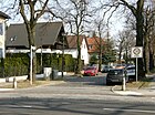
600 | Lübz , city in Mecklenburg-Western Pomerania | May 10, 1951 | When it was first built in 1910, it was called Augustastraße after the German Empress Augusta . Lübzer Straße runs in a north-west-south-east direction between Briesener Weg and Florastraße. Beyond Florastrasse, it continues as Lenbachstrasse. |
|
| Lutherstrasse
( Location ) |
300 | Martin Luther (1483–1546), theologian and reformer | Oct. 27, 1902 | It connects the Hultschiner Damm in a west-east route with Wolfsberger Strasse. |

|
|
May path
( Location ) |
160 | May , month | March 18, 1935 | At first it was called Weg V in the Elsengrund settlement. The Maipfad connects the Brachetweg (west) with the Hornungweg (east). In the RBS road system it is run as a municipal road, but has the class “VWEG” (connecting route) for road equipment. In the Elsengrund settlement there are streets with the names of the months and the spring festivals of Easter and Whitsun. |

|
| Malevkeweg
( Location ) |
100 | January 21, 2017 | The path branches off to the east from Hermineweg and ends again at Hermineweg after changing direction to the south. | ||
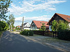
| Mannheimer Strasse
( Location ) |
980 | Mannheim , city in Baden-Württemberg | Feb 12, 1920 | Before it was officially named, it was the Friedrichshagen meadows . Mannheimer Straße runs in an east-west direction from Hultschiner Damm to Grenzstraße. |
|
| Marderweg
( Location ) |
240 | Marten , group of native predators | June 27, 1925 | Marderweg was laid out as road 102 . It begins on Lemkestrasse in a north-westerly direction, then bends north and ends at Guthmannplatz. Some sections cannot be used with motor vehicles. |

|
| Margaretenstrasse
( Location ) |
180 (in KGA Elsenstraße) |
Margarete , female first name | Feb 12, 1920 | The 10 meter wide street is between Rosa-Valetti-Straße (east) and KGA -Elsenstraße (west). Plots 1–5a (south side) and 6–9 (north side) are in consecutive numbering. A large part of the northern edge of the road is taken up by the Elsenteich with its bank area. |

|
| Markgrafenstrasse
( Location ) |
510 (in the district) |
Margrave , administrator of a border area | July 27, 1906 | The Markgrafenstraße is the continuation of the Wernerstraße in Kaulsdorf and joins the Florastraße to the east . The exact boundary of the district was set by the district office in 2005/2006 so that the properties west of Briesener Weg belong to Kaulsdorf (house numbers 1 and 24), the rest to Mahlsdorf. |

|
| Mauswieselweg
( Location ) |
170 | Mauswiesel , weasel species of the marten | May 28, 2010 | The private road runs in a south-easterly direction between Muskrat and Seidenschwanzstrasse. | |
| Mechthildstrasse
( Location ) |
730 | Mechthild , feminine given name | Nov 11, 1938 | When it was first installed, it was called Goethestrasse after Johann Wolfgang von Goethe . It runs between the Waldpromenade and Roedernstraße in a south-west-north-east direction. |

|
| Melanchthonstrasse
( Location ) |
1580 | Philipp Melanchthon (1497–1560), philologist and reformer | July 27, 1906 | The south-north street starts as a dead end about 100 meters south of Markgrafenstraße near the Rohrpfuhl, runs to an unnamed square between Am Lupinenfeld and Albrecht-Dürer-Straße, then continues northwards and ends again as a dead end at the sports field Am Rosenhag. The section from Albrecht-Dürer-Straße to the north was only expanded in the 1920s and called the Extended Melanchthonstraße . |

|
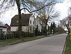
| Menzelstrasse
( Location ) |
530 | Adolph Menzel (1815–1905), painter | 23 Aug 1918 | It runs between Verdistraße and Lemkestraße (dead end) directly north of the railway embankment. To the west it continues as a nameless footpath for around 520 meters on the south bank of the Rohrpfuhl to Hönower Straße. |
|
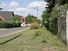
| Mirower Strasse
( Location ) |
2200 | Mirow , town in Mecklenburg-Western Pomerania | March 11, 1937 | Mirower Straße was created from Hirschgartenstraße, which was laid out in 1907, and part of Triftweg . It is a long south-north street between Kumberger Weg and Ahornallee. |
|
| Mozartstrasse
( Location ) |
380 | Wolfgang Amadeus Mozart (1756–1791), composer | July 23, 1904 | It runs from Pestalozzistraße in the south to Donizettistraße in the north. |

|
|
Müllerstrasse
( Location ) |
1130 | Ludwig Müller (1820–1890), farmer in Mahlsdorf | Oct. 27, 1902 | It connects the Hultschiner Damm (west) with the Summter Straße (east). The street is named after the owner of the property it runs over. |

|
|
Munsterberger way
( Location ) |
630 (in the district) |
Münsterberg , town in the province of Silesia , since 1945 Ziebice in Poland | June 9, 1933 | The street was built from Marienburger Strasse (around 1920; Mahlsdorf), Strasse 30 , Joachimstrasse and Breite Strasse (around 1920; Kaulsdorf). It leads from the Wuhletal train station (northwest) in the district of Berlin-Kaulsdorf , interrupted by several pedestrian areas, in a straight line to Neuenhagener Strasse (south-southeast) in Mahlsdorf. Of the total length of the street in the district, the 140 meters between Gleisdorfer and Neuenhagener Straße in front of the trading areas at Alt-Mahlsdorf are entered in the street directory as a footpath (RBS: FUWE). In the district there are plots 131–155 (north side, odd) and 130–166 (even, south side). The houses on the north side opposite 160–166 are allocated to Gleisdorfer Straße (51c, 51b) and Neuenhagener Straße (1a, 1b). At the eastern exit of the street, the properties belong to Alt-Mahlsdorf, the southern properties (21) and 23 to the northeast corner (Burger King). |

|
| Marmot trail
( Location ) |
130 | Marmot , marten predator | Aug 20, 2007 | The spur road leads from Landsberger Strasse south-east. The marmot path serves to develop a newly built small settlement area. |

|
|
Nebelsteig
( Location ) |
130 | Nebelmond, old German for November | March 18, 1935 | At first it was called Weg X in the Elsengrund settlement. The Nebelsteig leads from the middle part of the Kressenweg northwards to the Heuetsteig. In the Elsengrund settlement there are streets after the old German month names and the spring festivals. An assumption for the starting point for the naming may be the location in the lowlands of three lakes and the fog that is often observed. |

|
| Neudammer Strasse
( Location ) |
290 | Neudamm , town in the province of Brandenburg , since 1945 Debno in Poland | May 11, 1938 | First it was called Konstanzer Straße (at that time from Köpenicker Allee to Triftweg ; after the city of Konstanz ). It is an east-west street between Wolfsberger Strasse and Hultschiner Damm . |

|
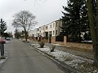
| Neuenhagener Strasse
( Location ) |
710 | Neuenhagen , municipality in Brandenburg (direction of the road) | Nov 12, 1969 | When it was built around 1920, it was called Danziger Strasse after the Hanseatic City of Danzig . It runs as a north-south street between Treskowstraße and Alt-Mahlsdorf . Some of the apartment buildings designed by Max Taut are located on it. |
|
|
Easter path
( Location ) |
80 | Easter , Christian festival | March 18, 1935 | At first it was called Weg IV in the Elsengrund settlement. The Easter path is a cul-de-sac that goes south from the Whitsun Path. In the Elsengrund settlement there are streets according to the names of the months and the spring festivals. |

|
|
Paris street
( Location ) |
600 | Paris , capital of France | Apr 17, 1906 | The street runs from Roedern Strasse to Mannheimer Strasse in a south-north direction. |

|
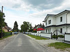
| Parkstrasse
( Location ) |
320 | Park , green area at the 'Seebad Königstal' | Apr 17, 1906 | Today's Kaulsdorfer Busch around the Eichwaldgraben on the border between Mahlsdorf and Kaulsdorf was called Königstal-Park around 1900 , to which this road ran. Its route begins on Pariser Strasse in a north-westerly direction and, after a small blunt bend, flows into Roedernstrasse. |
|
| Parlerstrasse
( Location ) |
750 | Peter Parler (~ 1330–1399), builder and sculptor | July 26, 1951 | The northern part of Metzer Strasse, which was laid out in 1906 (after the French city of Metz ) was renamed Parlerstrasse in 1951, the southern part Wickenweg . The two parts of the road were interrupted in 1938/1942.
The road begins as a dead end about 160 meters south of the golden rain road . After the land north of Goldregenstrasse (No. 16 or 17), it continues as an undeveloped roadway and then becomes the seven-meter-wide Rosa-Valetti-Strasse. Parlerstrasse continues after a westerly offset on Grossmannstrasse with lots no. 26 and 27 in a northerly direction to Margaretenstrasse. The 15-meter-wide roadway consists of a five-meter-wide strip of asphalt, which is accompanied on both sides by unpaved grass strips with birch trees. |

|
| Paul-Wegener-Strasse
( Location ) |
980 (in the district) |
Paul Wegener (1874–1948), actor | May 31, 1951 | When it was first installed on February 17, 1908, it was named Blumenthalstrasse after the Prussian General Leonhard von Blumenthal . It runs in a west-east direction from Hultschiner Damm to the Berlin city limits and continues as a forest promenade in the neighboring community of Hoppegarten (district Waldesruh). |

|
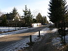
| Pestalozzistrasse
( Location ) |
620 | Johann Heinrich Pestalozzi (1746–1827), Swiss educator | around 1900 | It runs between Hönower and Landsberger Straße in a west-east direction. |
|
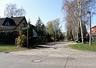
| Pfalzgrafenweg
( Location ) |
530 | Count Palatine , highest judicial representative of a ruler in his Palatinate | May 16, 1938 | When it was first named on February 12, 1920, the Pfalzgrafenweg was called Offenbachstraße after the composer Jacques Offenbach . It is a southern branch of Donizettistraße and then runs in a west-east direction parallel to it to the Berlin city limits. There is a walking connection to Industriestraße in the commercial area of the municipality of Hoppegarten in Brandenburg. |
|
| Pfarrhufenanger
( Location ) |
550 | Anger of the village priest | January 15, 2015 | The street as an extension of the Pfarrhufenweg between Sudermannstraße and Albrecht-Dürer-Straße was built as part of the development plan 10-51 "Mahlsdorfer Grünzug" to develop a new building project for 48 single-family houses. The previously undeveloped area was kept free for the expansion of the Mahlsdorf cemetery, but was earmarked for another use in 2006. | |
| Pfarrhufenweg
( Location ) |
130 | Land of the village priest | March 11, 1937 | First the way was called Straße 96 . It runs northeast between Albrecht-Dürer-Straße and Feldrain and thus forms a connection between the Kreuzkirche and the Mahlsdorf primary school. |

|
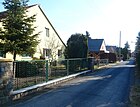
| Pentecost Path
( Location ) |
160 | Pentecost , Christian feast | March 18, 1935 | Around 1930 the settlement was Elsengrund (in address books from this period Stadtrandsiedlung called) designs, and this access road got the name path V . Today's Pfingstweg connects the Eisweg (west) with the Hornungweg (east). In the Elsengrund settlement there are streets according to the names of the months and the spring festivals. |
|
| Phlox Street
( Location ) |
600 | Phlox , genus of the pennies | June 9, 1933 | At first it was called Straße 84 . It connects the Kressenweg (west) with the Immortellenweg (east) in the Eichenhof settlement. |

|
| Pilgram Street
( Location ) |
3830 | Pilgram , German name of the town of Pelhřimov in the Czech Republic | March 11, 1937 | Pilgramer Straße was created in 1937 by merging Langestraße (laid out in 1902; also written as Lange Straße ), Kaiser-Friedrich-Straße (laid out in 1904) and Straße 53 . It runs in a south-north direction from the forest promenade to Alt-Mahlsdorf . At the end of the 20th century, a transverse arm (house numbers 286–294) was laid out on a north-eastern side and new villas were built on (bottom picture). |
 
|
| Pilsen Street
( Location ) |
1050 (in the district) |
Pilsen , German name of the city of Plzeň in the Czech Republic | March 11, 1937 | The traffic route was formed in 1937 from the western section of Triftstrasse and Blücherstrasse, named in February 1908 (after the Prussian general Gebhard Leberecht von Blücher ). Pilsener Straße connects Hultschiner Damm (west) with the Berlin city limits and ends at Karl-Marx-Straße / Mahlsdorfer Allee (southeast) in the Waldesruh part of the Brandenburg municipality of Hoppegarten . |

|
|
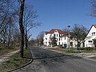
Rahnsdorfer Strasse
( Location ) |
1420 | Rahnsdorf , part of the Berlin district of Treptow-Köpenick | Oct. 27, 1902 | It leads in a south-east direction from Hultschiner Damm to the Berlin city limits, then in the municipality of Hoppegarten the street is called Friedhofstraße. The Waldkirchhof Mahlsdorf is located on the north side of Rahnsdorfer Straße (near the confluence of Lehnitzstraße) . Kaulsdorfer Weg , number 8 of the 20 green main routes in Berlin, runs along part of the street . |
|
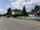
| Rastatter Strasse
( Location ) |
240 | Rastatt , city in Baden-Württemberg | Feb 12, 1920 | It connects the Hultschiner Damm (east) with the Wickenweg (west). |
|
| Rauchstrasse
( Location ) |
380 | Christian Daniel Rauch (1777–1857), sculptor | Feb 12, 1920 | Rauchstraße runs from Lehnitzstraße to Waldesruher Straße in the Brandenburg municipality of Hoppegarten (part of the Waldesruh municipality). |

|
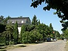
| Ravensteinstrasse
( Location ) |
130 | Ravensteiner Mühle, homestead in the Waldesruh part of the municipality of Hoppegarten in Brandenburg | around 1905 | It is located in Mahlsdorf-Süd and connects Erich-Baron-Weg (west) with Mirower Straße (east). |
|
| Reintrautweg
( Location ) |
150 | Reintraut, female first name | May 10, 2014 | The private road branches off from Arturweg in a northerly direction and ends as a dead end after turning to the east . The street name was assigned at the suggestion of the developer. It was named in the development area Pilgramer Straße-Theodorstraße in the development plan XXIII-9b. | |
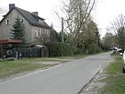
| Rembrandtstrasse
( Location ) |
930 | Rembrandt (1606–1669), Dutch painter | Feb 12, 1920 | It connects Menzelstrasse (southwest) with Walter-Leistikow-Weg (northeast). |
|
| Ridbacher Strasse
( Location ) |
250 (in the district) |
Ridbach , town in the province of East Prussia , since 1945 Rzeck, town of the urban and rural community of Biskupiec | Oct 18, 1937 | It connects Jacques-Offenbach-Platz on Hönower Straße (southeast) with Grottkauer Straße in Kaulsdorf (north). Plots 1–22 (Hönower Straße to Briesener Weg) belong to Mahlsdorf, the rest of the section belongs to Kaulsdorf . The street was created from Hellersdorfer Straße (around 1902) and Mahlsdorfer Straße, which was documented as early as the 19th century . |

|
| Wood pigeon path
( Location ) |
170 | Wood pigeon , species of bird | May 28, 2010 | The private road runs in a south-easterly direction between Muskrat and Seidenschwanzstrasse. | |
|
Röbeler way
( Location ) |
280 | Röbel , town in Mecklenburg-Western Pomerania | May 11, 1938 | When it was first named on October 23, 1902, it was named Wilhelmstrasse after Wilhelm Wernicke, land owner and parcel dealer in Mahlsdorf. The Röbeler Weg leads northeast from Rahnsdorfer Straße and ends as a dead end. Kaulsdorfer Weg , number 8 of the 20 green main routes in Berlin, runs along part of the street . |

|
| Roedernstrasse
( Location ) |
1000 | Siegfried von Roedern (1870–1954), district administrator of the Niederbarnim district | around 1905 | At first it was written Rödernstrasse . It begins at Hultschiner Damm in the east, ends shortly before the Grenzstrasse in the west and continues in Kaulsdorf as Eschenstrasse. The district administrator Roedern is honored in several Berlin districts that formerly belonged to the Niederbarnim district, as he particularly promoted the construction of the road. |

|
| Rosa-Valetti-Strasse
( Location ) |
460 | Rosa Valetti (1876–1937), actress and cabaret artist | May 1, 1995 | The seven-meter-wide Rosa-Valetti-Straße leads from Großmannstraße in a north-east direction to Hultschiner Damm . Plots 2–24 (even, southeast) and 5–23 (odd) on the street are built on, numbers 2–2D have their own driveway. The traffic route had existed as a connecting route for decades; it had the official name Zur Parlerstraße (street number 05448), corresponding to the location from Hultschiner Damm diagonally into Parlerstraße, which is slightly offset in its course and continues seven meters wide, while its northern section is 17 meters wide. |

|
| Roseggerstrasse
( Location ) |
220 | Peter Rosegger (1843–1918), Austrian writer | Feb 12, 1920 | It connects the Hultschiner Damm with the Mechthildstrasse in an east-west route. When it was first installed, it was not as long as it is today. In the 1920s it was lengthened and the new street section was named Extended Roseggerstraße , which was later incorporated into Roseggerstraße. |

|
| Hawthorn Alley
( Location ) |
200 | Hawthorn , native deciduous tree | Nov 23, 1907 | It leads in a west-east direction from Hultschiner Damm to Wilhelm-Blos-Straße. |

|
| Rubensstrasse
( Location ) |
160 | Peter Paul Rubens (1577–1640), Dutch painter | Feb 12, 1920 | It creates a north-eastward connection between Verdistraße and Kaulbachstraße in Mahlsdorf-Nord. |

|
| Ruhlsdorfer Strasse
( Location ) |
900 (in the district) |
Ruhlsdorf, part of the Marienwerder community in Brandenburg | May 31, 1951 | In 1907 it was named Steinstrasse after the Prussian state official Heinrich Friedrich Karl vom und zum Stein . It runs between Hultschiner Damm (West) and the Berlin city limits to the Waldesruh part of the Brandenburg municipality of Hoppegarten (East). | |
|
Rusternallee
( Location ) |
910 | Elm , native tree | Feb. 17, 1908 | The Rüsternallee leads from the Hultschiner Damm southeast to the Berlin city limits. In the Brandenburg municipality of Hoppegarten (part of the municipality Waldesruh), this traffic route becomes Schopenhauerstrasse. |

|
|
Schlueterstrasse
( Location ) |
220 | Andreas Schlüter (1659–1714), sculptor and architect | Feb 12, 1920 | The Schlüterstraße runs from the Rauchstraße to the south over the Begasstraße and becomes a dead end here . |

|
| Schongauerstrasse
( Location ) |
440 | Martin Schongauer (~ 1450–1491), painter and engraver | May 16, 1938 | When it was first installed, it was named Liebermannstrasse after the painter Max Liebermann on February 12, 1920 . It leads in the district from Stralsunder Strasse (southwest) to Dahlwitzer Strasse (northeast). |
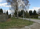
|
| Schrobsdorffstrasse
( Location ) |
810 | Renate Schrobsdorff (1844–1905), landowner in Mahlsdorf | July 2, 1904 | Schrobsdorffstraße stretches from Pilsener Straße in the north to Erich-Baron-Weg in the south and continues there as Wilhelm-Blos-Straße. - After the death of Hermann Schrobsdorff , the owner of the manor in Mahlsdorf since 1880 , the widow Renate Schrobsdorff continued the redesign of Mahlsdorf: she made land and money available for a stop on the Eastern Railway and supported the community in building a tram connection to Köpenick . The grave of the Schrobsdorff family is in the cemetery at the old parish church in Mahlsdorf . In this street (number 35/36) is the 'Theodor-Fliedner-Heim', a church of the Protestant community Mahlsdorf (see picture below). In 1880 Hermann Schrobsdorff acquired the manor and had the manor garden redesigned into a park. |
 
|
| Schubertstrasse
( Location ) |
460 | Franz Schubert (1797–1828), composer | Feb 12, 1920 | It connects Pestalozzistraße in the south with Beethovenstraße in the north. |

|
| Black Bear Trail
( Location ) |
130 | Black bear , predator family, also baribal | Aug 20, 2007 | It is an access road for new residential buildings southeast of Landsberger Strasse in continuation of Kieler Strasse. |
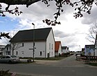
|
| Seebadstrasse
( Location ) |
260 (in the district) |
former 'Seebad Königstal' | July 17, 1909 | Only the eastern side with house numbers 27-71 belongs to Mahlsdorf, which is the section between Eschenstrasse and Ulmenstrasse; the other house numbers are in the Kaulsdorf district . After its closure, the KGA 'Werbellinbecken' was created on Werbellinstrasse on the site of the seaside resort . |
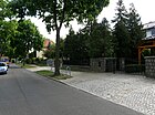
|
| Seestrasse
( Location ) |
550 | Körnersee in Mahlsdorf-Süd not far from the Köpenicker Dammheide | Oct. 27, 1902 | It runs between Hultschiner Damm in the south-east and Uhlandstrasse in the north-west and touches the north bank of the Körnersee, which gives it its name . |

|
| Waxwing Street
( Location ) |
500 | Waxwing , songbird | May 28, 2010 | The street connects Stralsunder Strasse at right angles to Bisamstrasse. | |
| Siegfriedstrasse
( Location ) |
230 | Siegfried , hero of the Nibelung saga | Oct 5, 1909 | It connects the Ridbacher with the Markgrafenstraße. |

|
| Simrockplatz
( Location ) |
110 × 60 | Karl Simrock (1802–1876), poet | March 8, 1935 | The rectangular square , laid out as square L after 1910 , is surrounded by Sudermannstrasse (east), Burggrafenstrasse (east) and Briesener Weg (north). When it was renamed in 1935, the southern boundary road was included in the square. The place served as a coal storage area in the GDR era. After it has been cleared, there are three commercial users in the north area, including a larger construction company that had a two-story new building built on the corner with Sudermannstrasse (see picture) and is acting as a sponsor of an adjoining playground.
Commons : Simrockplatz - collection of pictures, videos and audio files
|
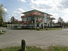
|
| Shrew Path
( Location ) |
140 | Shrew | May 28, 2010 | The private road runs in a north-easterly direction between Kaulbachstrasse and Bisamstrasse. | |
| Spitzwegstrasse
( Location ) |
200 | Carl Spitzweg (1808–1885), painter | March 8, 1935 | After the first installation, it was named Kantstrasse after the philosopher Immanuel Kant on February 17, 1908 . Spitzwegstraße runs from Ifflandstraße south along Langenbeckplatz to Lehnitzstraße in a west-east route. |
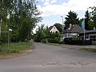
|
| Stettiner Strasse
( Location ) |
230 | Szczecin , city in the Pomeranian Province , since 1945 Szczecin in Poland | around 1920 | It connects Dahlwitzer Strasse (west) with Hamburger Strasse (east) and leads to KGA 'Dahlwitzer Strasse'. Stettiner Strasse runs parallel to the Berlin city limits just a few meters south. The street between Dahlwitzer / Lemkestrasse and Hamburger Strasse was already included in the 1922 address book. Lot 4 is developed in horseshoe numbering , numbered 11–16 (on Dahlwitzer Strasse) as a construction site and other unspecified construction sites. In the property register, 1–10b on the north side and 11–16 on the south side are also given consecutively. However, it is still around 80 meters above Hamburger Straße as a dead end in the same unpaved version with a nearly five meter wide asphalt strip as a roadway. This serves as the entrance to the housing estates 10a and 10b (in the depths along the KGA) and to the KGA gate 'Mahlsdorf Nordspitze'. Plots 2, 4, 7 and 8 are also divided. |

|
| Stralsunder Strasse
( Location ) |
500 | Stralsund , city in Mecklenburg-Western Pomerania | around 1920 | It runs eastward from Landsberger Strasse directly to the Berlin city limits behind the intersection with Terwestenstrasse. |

|
|
Street 48
( Location ) |
50 | Numbering when the road system is first created | around 1907 | It is a cul-de-sac that goes west from Pilgramer Straße between 301 and 303. Opposite on the eastern side is the entrance to an industrial park. The two built-up plots 1 and 3 belong to street 48, on the south side plot 2 is undeveloped, but covered. |
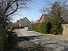
|
| Street 61
( Location ) |
650 (in the district) |
Numbering according to the plan of the street system | around 1907 | This street is included in the official directory, it belongs to the RBS class STRA, but according to Okstra as "N". Land is not assigned to it. It is a former field path that lies between the south side of Alt-Mahlsdorf (starting behind the confluence of Pilgramer Straße) and the city limits. On the northeast side there is an arable area, which is also opposite the city limits. The continuation as a field path leads to the Nesselgrund in the municipality of Hoppegarten. Due to the commercial settlement in Waldesruh , it is not continuous. According to two 'natives', there was a flak position here at the end of the Second World War . |

|
|
Straussstrasse
( Location ) |
650 | Johann Strauss (son) (1825–1899), Austrian composer | before 1920 | It is a south-north connection between Friesacker Strasse and Beethovenstrasse . It begins about 200 meters south of Friesacker Straße, initially in an east-west direction and then bends to the north. |

|
| Sudermannstrasse
( Location ) |
580 (in the district) |
Hermann Sudermann (1857–1928), writer. | after 1910, expanded in 1937 | The house number range 62–150 was from 1906 to 1937 Buddestrasse after Hermann von Budde (1851–1906), politician and general director of the German arms and ammunition factory in Berlin. In the central area, the road is not continuous for motor vehicle traffic. It leads from Kraetkestrasse in Kaulsdorf (northwest) over the intersection with Briesener Weg (district boundary) to Landsberger Strasse (southeast) just before its confluence in Alt-Mahlsdorf . Sudermannstrasse 112 is the entrance to the “Kunsthaus Flora”. |
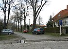
|
| Humming street
( Location ) |
2300 | Summt, living space in the municipality of Mühlenbecker Land in Brandenburg | Apr 12, 1951 | After its first installation, on February 17, 1908, it was named Königin-Luise-Straße after the Prussian Queen Luise . Summter Strasse runs between Rahnsdorfer Strasse and Rauchstrasse always west, parallel to the Berlin city limits. Kaulsdorfer Weg , number 8 of the 20 green main routes in Berlin, runs along part of the street . |

|
|
Taxusweg
( Location ) |
320 | Taxus , conifer | June 27, 1925 | At first the path was called Straße 143 . It connects the Wildrosenhöölz street with Greifswalder Straße in a south-north route. |
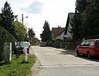
|
| Teichsängerweg
( Location ) |
210 | Reed warbler , songbird | Aug 20, 2007 | It is a cul-de-sac from Landsberger Strasse south-east. It opens up a new small settlement area. |
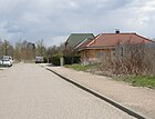
|
| Terwestenstrasse
( Location ) |
310 | Augustin Terwesten (1649–1711), Dutch painter | March 8, 1935 | Terwestenstrasse, laid out as Strasse 40 , runs in a south-west-northeast direction between Stralsunder Strasse and Dahlwitzer Strasse. Its north-eastern continuation is the Griebenweg. |

|
| Theodorstrasse
( Location ) |
700 + 180 | Theodor , land owner Theodor Bausdorf | Oct. 27, 1902 | It is a south-north street between Karlstrasse and Alt-Mahlsdorf , which has a cross branch to the west. Theodorstrasse is included in the street directory as a non-categorized municipal road, but a footpath ( RBS: FUWE ) is entered for twelve meters a little north of Gustavstrasse, which breaks the road into a north and a south section through traffic calming with traffic posts for the adjacent new housing estates. The Mahlsdorf landowner Bausdorf also gave the street its name in Kaulsdorf and Mahlsdorf. The Bausdorf family promoted the settlement of the area around both villages. |

|
| Thorner Strasse
( Location ) |
330 | Thorn , town in the province of West Prussia , since 1920 Toruń in Poland | March 8, 1920 | It is located in the Mahlsdorf-Mitte area and connects Gielsdorfer Straße with Waldowstraße in a west-east route. |

|
| Thorwaldsenstrasse
( Location ) |
270 | Bertel Thorwaldsen (1770–1844), Danish sculptor | Feb 12, 1920 | It runs from Mirower Straße (west) to Waldesruher Straße (east) in the Brandenburg municipality of Hoppegarten (part of the municipality of Waldesruh). |

|
| Tizianstrasse
( Location ) |
530 | Titian (~ 1477–1576), Italian painter | Feb 12, 1920 | It connects Stralsunder Strasse in a southeast-northwest direction with Dahlwitzer Strasse. |

|
| Treskowstrasse
( Location ) |
620 | Sigismund von Treskow (1864–1945), district administrator of the Niederbarnim district | Apr 17, 1902 | It runs from Am Kornfeld (west) to Hönower Straße (east) south parallel to the embankment of the Prussian Eastern Railway . |

|
|
Uhlandstrasse
( Location ) |
390 | Ludwig Uhland (1787–1862), poet | Nov 23, 1907 | It connects Bergedorfer Straße (north) across Kohlisstraße with the forest promenade (southeast). To the east it touches the Körnerplatz and the Körnersee. |

|
|
Ullrichplatz
( Location ) |
160 × 50 | Franz Ullrich, settler in Mahlsdorf | Nov 23, 1907 | The rectangular square is bordered by Ebereschenallee (north), Ullrichstrasse (east), Akazienallee (south) and Wilhelm-Blos-Strasse (west). Initially it was written in Ulrichsplatz (1925) or Ullrichsplatz . Ullrich was an active member of the house and landowner association founded in 1898 ("Beautification Association Kiekemal Mahlsdorf"). |

|
| Ullrichstrasse
( Location ) |
160 | Franz Ullrich, settler in Mahlsdorf | Nov 23, 1907 | It connects Ebereschenallee (north) and Akazienallee (south). It was written in Ullrichsstraße or Ulrichsstraße (1925) until the 1920s . Ullrich was an active member of the house and landowner association founded in 1898 ("Beautification Association Kiekemal Mahlsdorf"). |

|
| Ulmenstrasse
( Location ) |
120 (in the district) |
Elm , native deciduous tree | July 17, 1909 | Ulmenstrasse is a street running in a west-east direction, which continues as Kohlisstrasse. Only the odd house numbers (109–127) between Seebadstrasse and Sadowastrasse belong to Mahlsdorf, the rest are in the Kaulsdorf district . |

|
| Uslarer Strasse
( Location ) |
150 (in the district) |
Uslar , city in Lower Saxony | Nov 9, 1926 | When the name was given, Straße 114 and Straße 139 were merged; before that, they were not officially referred to as Bergstraße . It runs from Am Lupinenfeld in the Kaulsdorf district over the district boundary on Briesener Weg to Hönower Straße (house numbers 71–84). |

|
|
Verdistrasse
( Location ) |
600 | Giuseppe Verdi (1813–1901), Italian composer | around 1920 | It is a street laid north of the embankment of the Prussian Eastern Railway , which runs as an eastern continuation of Menzelstrasse from Landsberger Strasse to the Berlin city limits, where it ends as a dead end. |

|
| Vierrader Weg
( Location ) |
290 | Vierraden , part of the city of Schwedt in Brandenburg | March 11, 1937 | The traffic route laid out around 1907 was initially called Lindenallee . It connects the Erich-Baron-Weg with the Wilhelm-Blos-Strasse in an east-west direction. |

|
| Voltastrasse
( Location ) |
260 | Alessandro Volta (1745–1827), Italian physicist | Oct. 27, 1902 | It runs between Hultschiner Damm (west) and Wolfsberger Straße (east). |

|
|
Juniper heather
( Location ) |
810 | Juniper heather , heather-like biotope type | June 27, 1925 | The straight traffic route, first street 146 , connects Greifswalder Straße (north) with Kieler Straße (southwest) at Guthmannplatz. Lemkestrasse was laid out symmetrically to this. Between the two is the 'Allotment Garden (KGA) Wacholderheide'. The juniper probably shaped the heather-like landscape that was observed here. |

|
| Waldesruher Strasse
( Location ) |
540 (in the district) |
Waldesruh , part of the municipality of Hoppegarten in Brandenburg (towards the street) | after 1937 | Only the odd house numbers on the west side of the street between Rauchstrasse (north) and Kumberger Weg (south) belong to Berlin and thus to Mahlsdorf. The road has the direction from Köpenick to Waldesruh. |

|
| Waldowstrasse
( Location ) |
460 | Wilhelm von Waldow (1856–1937), Prussian state official | Apr 17, 1902 | The route leads from Treskowstrasse southwards over Thorner Strasse and ends at Waldowpark , which takes its name from the street. |

|
| Forest promenade
( Location ) |
1180 in the district |
Walk along the forest (Köpenicker Dammheide) | before 1920 | This route, which runs along the southern border with Köpenick , is included in the official directory (43448) and is listed on numerous city maps, such as Kauperts in the Mahlsdorf district, and there are corresponding official road signs on site. The private road begins west at the Hirschpfad in Kaulsdorf and ends east at Mirower Strasse, with the south side belonging to the Köpenicker Forest (Dammheide). It is (partly) the rear of the southern properties of Kohlisstraße and the Hultschiner Damm is crossed at the level of the district boundary ( Köpenick / Marzahn-Hellersdorf ). It is only passable by motor vehicle in a few very short sections. The street is marked in the street directory as STRA to RBS-Straße, but in the property catalog with an “F” as a footpath. The assigned properties 1–5 (continuously) are located in Köpenick . |
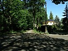
|
| Walter Leistikow Way
( Location ) |
310 | Walter Leistikow (1865–1908), painter | Feb 12, 1920 | The path runs between Lemkestraße (northwest) and Landsberger Straße (southeast), beyond that the street is called the Meerkat Path . At the corner of Landsberger Strasse, a new residential estate (1a – 4e, continuous) was built around 2009 on the south side, the access route of which is a side branch of the street. Plots 1a – 7a on the south side and across from 8–16 (continuous) belong to the street. The main entrance (no. 10) to the Mahlsdorf municipal cemetery, which was opened in 1919, is in the house number range 10–13. According to the order of development, the corner plots are each assigned to the cross streets. |
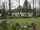
|
| Raccoon Trail
( Location ) |
330 | racoon | May 28, 2010 | The private road branches off from Kaulbachstrasse in a north-easterly direction, crosses Bisamstrasse and, after turning to the south-east, ends as a dead end . | |
| Weberstrasse
( Location ) |
230 | Carl Maria von Weber (1786–1826), composer | 1920 | It runs from Verdistraße along the eastern bank of the Weberpfuhl to Landsberger Straße and continues as Lenbachstraße . |

|
| Weidenstrasse
( Location ) |
250 (in the district) |
Willow , native deciduous tree | July 17, 1909 | It runs in the Kaulsdorf district in a north-west-south-east direction from Buchenstrasse to the district boundary on Seebadstrasse and then continues for about 100 meters in Mahlsdorf. Only the house number range 7-14 belongs to Mahlsdorf. Its south-eastern extension is Winklerstrasse . |

|
| Weitzgründer Strasse
( Location ) |
430 | Weitzgrund , part of the municipality of Bad Belzig in Brandenburg | May 31, 1951 | When it was built in 1906, it was called Sedanstrasse after the French battleground Sedan . It is a traffic route in a south-north direction between Roedernstrasse and Badener Strasse and between Freiburg and Mannheimer Strasse. Between Badener and Freiburger Straße it is interrupted by built-up properties. |

|
| Werbellinstrasse
( Location ) |
990 | Werbellin , part of the community Schorfheide in Brandenburg and Werbellinsee | Apr 12, 1951 | When it was first named in 1906, it was called Kaiser-Wilhelm-Strasse . It connects the Hultschiner Damm (southeast) with the Grenzstrasse (northwest). The KGA 'Werbellinbecken', founded in 1978, extends along it. |

|
| Wickenweg
( Location ) |
980 | Sweet pea , butterflies | July 26, 1951 | From 1906, part of today's Wickenweg was called Metzer Strasse after the French city of Metz , which belonged to the German Empire from 1871 to 1918 . It is a traffic route between Roedernstrasse and Butterblumensteig. To the north it continues as the Bluestar Trail. |

|
| Wielandstrasse
( Location ) |
570 | Christoph Martin Wieland (1733–1813), poet | Nov 23, 1907 | As a south-eastern continuation of Pariser Strasse, it leads from Roedernstrasse to the forest promenade on the border with the Köpenick district. |

|
| Wieselstrasse
( Location ) |
140 | Wiesel , family of marten | June 27, 1925 | Wieselstraße is a footpath; it was initially referred to as Straße 81 and connects Frettchenweg (west) with Gielsdorfer Straße (east). In the RBS , the requirements for road construction are shown as “STRA”, but in the property catalog it is classified as “F” (footpath). |
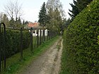
|
| Wildenbruchstrasse
( Location ) |
300 + 100 | Ernst von Wildenbruch (1845–1909), poet | Nov 23, 1907 | Wildenbruchstraße leads from Winklerstraße over Kohlisstraße to the forest promenade, where it opens up the residential area Waldpromenade 1–3 in the Köpenick district. |

|
| Wildcat Walk
( Location ) |
170 | Wild cat | May 28, 2010 | The private road runs in a south-easterly direction between Muskrat and Seidenschwanzstrasse. | |
| Wild rose trees
( Location ) |
650 | Wild rose , wood | June 27, 1925 | The traffic route, initially laid out as road 144 , connects Hönower Straße (west) with road Wacholderheide (east). |

|
| Wilhelm-Blos-Strasse
( Location ) |
1030 | Wilhelm Blos (1849–1927), journalist and politician | May 31, 1951 | At first the traffic route was called Bülowstrasse after Bernhard Ernst von Bülow , an imperial official and employee of Bismarck . It leads in a south-north direction from the forest promenade at Köpenicker Forst to Erich-Baron-Weg and continues as Schrobsdorffstraße . |
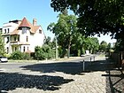
|
| Wilhelmsmühlenweg
( Location ) |
510 (in the district) |
Steam mill formerly located there | Nov 11, 1907 | The traffic route runs south parallel to the embankment of the Ostbahn from Heinrich-Grüber-Platz in the Kaulsdorf district over the district boundary on the street Am Kornfeld to Hönower Strasse. The 195 bus line runs through it the whole length of the way.
Only the house number range 139–200 (eastern section) belongs to Mahlsdorf. Before the merger with Kaulsdorfer Strasse ( Strasse 27 or Schneidemühlenweg and Friedrichstrasse ), the Mahlsdorf section was called Voigtstrasse after the farm owner in Mahlsdorf Voigt Sittig. The eponymous steam-powered Wilhelmsmühle existed in the 19th century and was there until the First World War. |
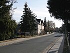
|
| Willestrasse
( Location ) |
140 | Karl Friedrich Wille (1848–1912), landowner in Mahlsdorf | Nov 23, 1907 | It is located in the area of the former ' Kiekemal ' settlement and connects the Hultschiner Damm with Wilhelm-Blos-Straße. |

|
| Winklerstrasse
( Location ) |
1270 | Carl Winkler, businessman | Nov 23, 1907 | It begins in the southeast at Hultschiner Damm , ends about 100 meters northwest of Arndtstrasse and continues as Weidenstrasse . Winkler lived on Köpenicker Straße (since the 1930s Hultschiner Damm ) and had areas in Mahlsdorf parceled out as building land, which he sold to new settlers. |
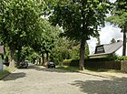
|
| Wodanstrasse
( Location ) |
550 (in the district) |
Wodan , main god of Norse mythology | around 1910 | Wodanstraße runs in an east-west direction from Hönower Straße to just before the confluence with Lohengrinstraße and continues in Kaulsdorfer as Bausdorfstraße. With the exception of house numbers 26/27, all the others belong to Mahlsdorf. Its name is borrowed from Richard Wagner's opera world , such as Siegfriedstrasse, Hörselbergstrasse and Lohengrinstrasse in the immediate vicinity, which are thematically linked to the former Wagnerstrasse (later Donizettistrasse). |

|
| Wolfsberger Strasse
( Location ) |
1100 | Wolfsberg , town in Carinthia in Austria | March 11, 1937 | First it was called Triftstraße (from October 1902), which got its name from the cattle pasture or the way there. It leads in a northeast-southwest direction from Rahnsdorfer to Pilsener Straße. |

|
|
Zipser way
( Location ) |
230 | Spiš , landscape in Slovakia with predominantly German inhabitants in the past | March 11, 1937 | With the new name, the path was merged from the former Waldstraße and Straße 59 . It connects Spitzwegstrasse on Langenbeckplatz (south) with Müllerstrasse (north). |

|
| Zochestrasse
( Location ) |
570 | Zoche, tributary of the Neuenhagener Mühlenfließ | Feb 12, 1940 | It was projected as street 127 . It begins in the south on the Berlin city limits as a continuation of the street Am Fließ in the Birkenstein part of the Brandenburg municipality of Hoppegarten . It ends in the north at the Berlin city limits to the district of Hönow von Hoppegarten and continues there as Bamberger Straße. |

|
List of former, renamed and planned streets
Due to the "Siedlung Kiekemal" and its transition from Dahlwitz to Mahlsdorf and the incorporation into Berlin in 1920, there were double street names. Renaming of streets of the same name for Greater Berlin was implemented in 1937 and 1938. In the less populated outer area, streets were renamed more than those in the inner city. In addition, after 1933 streets named after Jewish personalities were "aryanized" and streets were named after Nazi-related people. In 1951, as part of the denazification , streets named after National Socialists were given by the Magistrate of Greater Berlin , but also new street names named after the Prussian military. Renamed streets are based on themes relating to settlements and surrounding quarters.
In the 1922 address book under Mahlsdorf (Lichtenberg administrative district), Bergstraße (undeveloped), Böcklinstraße (cross street of Landsberger Straße, and in 1939 it was still undeveloped), Cöpenicker Allee (east and south) and Cöpenicker Straße (east), Feuerbachstraße ( undeveloped from Landsberger Straße) Heidelberger Straße (east, undeveloped, from Cöpenicker Allee ) listed. Furthermore, Kronprinzenstrasse (Melanchthonstrasse, Extended Melanchthon Strasse, Hönower Strasse, Strasse 188 ), Langenbeckplatz (east, Langenbeckstrasse, passage to Landsberger Strasse, Landsberger Strasse, passage to Straussstrasse, to Triftstrasse, undeveloped but with market gardens), are in the north the extended Melanchthonstrasse listed. The undeveloped Odenwaldstraße , Offenburger Straße , Raffaelstraße (undeveloped from Landsberger Straße), the Schwarzwaldstraße , Siemensstraße and Platz are also recorded . Of the mostly numbered according to the development plan, the following can be found: Strasse 45 , Strasse 71 , Strasse 79 , Strasse 133 , Strasse 136 , Strasse 137 , Strasse 142 , Strasse 144 , Strasse 145 , Strasse 146 , Strasse 147 . These temporary street names are not exclusively designated in the lower list, but are partly included in the upper list under the later name.
| formerly | from | to | renamed to (current) |
Origin of name | Remarks |
|---|---|---|---|---|---|
| Alte-Fritz-Strasse | 22 Sep 1911 | May 31, 1951 | → Golzower Strasse | Friedrich II. , Called the old Fritz | In 1751, at Friedrich's instigation, the settlement of Kiekemal was founded in the south of Mahlsdorf with Palatinate colonists. In connection with the re-congregation of the Kiekemal settlement from Dahlwitz, which is outside the Berlin city limits, to Mahlsdorf-Süd (Königstal), Dorfstrasse was renamed after Friedrich II, who was popularly known as Old Fritz after 1763. |
| Augustastrasse | around 1910 | May 10, 1951 | → Lübzer Strasse | Augusta von Sachsen-Weimar-Eisenach (1811–1890), German Empress | In the 1922 address book there is the street run in Nord Friedrichstraße, Hönower, Melanchthon-, Flora-, Lenbachstraße, most of the lots 1–39 with horseshoe numbering are marked as construction sites at this time. |
| Bahnhofstrasse | 1895 1895 | May 11, 1938 | → Hönower Strasse | Mahlsdorf stop | The Bahnhofstrasse led north over the former Dorfstrasse as a directional road to the Ostbahn . The Mahlsdorf stop was elevated to a fourth class station on April 1, 1908 and to a second class station on October 7, 1929. Mahlsdorf has been part of the S-Bahn traffic since December 15, 1930. In 1938, Bahnhofstrasse became part of Hönower Strasse, which was already named after the north of the railway line. The street in the east between Berliner Strasse , via Voigtstrasse and Treskowstrasse to the Mahlsdorf train station (Hönower Strasse, Ostbahn), on to Fritz-Reuterstrasse, Pestalozzistrasse, passage to Walderseestrasse and Berliner Strasse is recorded in the address book 1922 , the horseshoe numbering covers plots 1– 66, which are all built up, 6 the cemetery and 7 the parish. |
| Berliner Chaussee | before 1905 | before 1920 | → Berliner Strasse | Road to Berlin | The Berliner Chaussee had already called Mahlsdorfer address of the 1905th Before 1920 it will have been renamed Berliner Strasse , as it is marked under this name on the map from 1920. The designation as Chaussee may well be used as an alternative. |
| Berlin street | before 1920 | July 26, 1927 | → Alt-Mahlsdorf | Street direction to Berlin | The Berliner Straße in Mahlsdorf (East) ran from the district Kaulsdorf / Marie Burger Street (1-20 do not exist) at 21 over to Waldow-, Cöpenicker road , Bahnhof- , Waldersee- , Theodor road passage to Grunowstraße, passage to Wagner Street , Landsberger Straße, Straussstraße, Lortzingstraße and the Dahlwitz district. Most of the lots 1–124 (consecutive) were built on in 1922. |
| Bismarckstrasse | Oct 23, 1902 | May 24, 1951 | → Ledebourstrasse | Bismarck (1815–1898), Chancellor of the German Empire | On the one hand there were several streets of the same name in Berlin, on the other hand the Prussian one was replaced by a socialist personality as namesake in 1951. In 1922, Bismarckstrasse (east) between Cöpenicker Allee , Triftstrasse , Langestrasse , Waldstrasse , Hohenzollernstrasse , Königin-Luise-Strasse and the Dahlwitz district is listed with seven developed properties. |
| Blücherstrasse | Feb. 17, 1908 | March 11, 1937 | → Pilsener Strasse | Blücher (1742–1819), Prussian field marshal | With the formation of Greater Berlin, there were several streets of the same name in the city. In 1922, the Blücherstraße (east) between Triftstraße , Langestraße , Hirschgartenstraße , Ifflandstraße, Hohenzollernstraße , Königin-Luise-Straße and the Dahlwitz district is listed with mostly building sites. |
| Blumenthalstrasse | Feb. 17, 1908 | May 31, 1951 | → Paul-Wegener-Strasse | Blumenthal , Prussian Field Marshal General. | On the one hand there were several streets of the same name in Berlin, on the other hand the Prussian military was replaced in 1951 by an actor with an anti-National Socialist attitude as the namesake. In 1922, Blumenthalstrasse (Mahlsdorf Ost) between Cöpenicker Allee , Schrobsdorffstrasse , Langestrasse , Hirschgartenstrasse , Ifflandstrasse, Hohenzollernstrasse , Königin-Luise-Strasse and the Dahlwitz district is listed with a construction site and six developed properties. |
| Brahmsstrasse | Feb 12, 1920 | after 1943 | → built over | Johannes Brahms (1833–1897), composer | The Brahmsstraße joined the Offenbach- with the Wagner Street (Pfalzgrafenweg and Donizetti Street). The street was still marked by name on the map from 1943. The city map of Berlin from 1951 shows the route without a name and it was built over. In 1922, Brahmsstrasse is listed as undeveloped from Offenbachstrasse . |
| Buddestrasse | July 27, 1906 | Oct 18, 1937 | → Sudermannstrasse | Budde (1851–1906), Prussian major general | The Buddestraße in Mahlsdorf ran from the Landsberger road to the district border with Kaulsdorf. In Kaulsdorf it was continued by Sudermannstrasse and in 1937 Mahlsdorfer Buddestrasse was included. In 1922, Buddestraße (north) with the built-up properties 16, 21, 23, 26 between the districts of Kaulsdorf, Friedrichstraße , Hönower Straße, Melanchthonstraße, Florastraße and Lemkestraße is listed. |
| Bülowstrasse | July 2, 1904 | May 31, 1951 | → Wilhelm-Blos-Strasse | Bülow (1815–1879), diplomat | The street lay between Erich-Baron-Straße and the Köpenicker forest and ended at the forest promenade east. Bülowstrasse (south) is marked in 1922 Schrobsdorffstrasse, Königsweg, Ebereschenallee / Ullrichsplatz / Akazienallee, Steinstrasse , Kastanienallee, Lindenallee, Willestrasse, Kiekemaler Strasse, Cöpenick district. |
| Danziger Strasse | March 8, 1920 | November 12, 1969 | → Neuenhagener Strasse | at the time of designation Free City of Danzig | Danziger Straße is listed in the address book from 1922 with gardening shops, construction sites and three developed properties. The location is indicated from Berliner Chaussee / Marienburger Strasse, Dirchauer Strasse, Thorner Strasse, Voigtstrasse to Treskowstrasse. |
| Donathplatz | before 1921 | around 1981 | → Donathstrasse | Donath was one of the first to settle in the former Mahlsdorf estate. | The green square in the east of Donathstrasse was built on with residential buildings. The Donathplatz is noted in the 1922 address book between Kastanien- and Lindenallee. |
| Village street | End of 18th century | 1895 | → Hönower Strasse | oldest street in Mahlsdorf, mentioned in 1345 as Malterstorp | A stone fortification is the prerequisite for the use of the term street for the village meadows or anger. This is not the case in the Berlin-Brandenburg area before 1800. The Mahlsdorfer Anger was only given the name Dorfstraße when other streets were built that had to be distinguished by names. The village street extended from Alt-Mahlsdorf to about Pestalozzistraße. That was the old village center with a church, school, mill and jug. This old village center was expanded in the southern part by the development of the trunk road towards Berlin and Frankfurt, which began after 1816 . The expansion of the Mahlsdorf village center to the north began with the opening of the Mahlsdorf stop on the Eastern Railway in 1895. |
| Village street | around 1753 | 22 Sep 1911 | → Golzower Strasse | Village street of the Kiekemal colony | Two village streets had developed in the district, as next to the street village Maltersdorp mentioned in 1345, a village street was also built in the Kiekemal colony founded by King Friedrich II in 1751. Officially, Kiekemal belonged to Dahlwitz until 1911 and was then incorporated into Mahlsdorf. |
| Friedrichstrasse | July 27, 1906 | May 11, 1938 | → Briesener Weg | Friedrich II. , King of Prussia | In 1751, at Friedrich's instigation, the settlement of Kiekemal was founded in the south of Mahlsdorf with Palatinate colonists. The Friedrichstrasse is listed in 1922 for Mahlsdorf east between Wodanstraße about Zeppelin, Hellersdorfer, Markgrafenstrasse, Burggrafen-, Budde-, Victoria Street, Road 137 and Augusta Street. |
| Goethestrasse | Nov 23, 1907 | May 11, 1938 | → Mechthildstrasse | Goethe (1749–1832), poet | Goethestrasse in Mahlsdorf Süd is located in 1922 Rödernstrasse, Herweghstrasse, Roseggerstrasse, Winklerstrasse, Seestrasse, Kohlisstrasse in the Cöpenick district. mainly with construction sites. |
| Graudenzer Strasse | March 8, 1920 | Nov 12, 1969 | → Gielsdorfer Strasse | Graudenz , district town in the former province of West Prussia, Poland | The street is named in the 1922 address book. Treskow-, Voigt-, Thorner, Dirschauer, Marienburger Straße, passage to Straße 79 and five developed plots as well as a nursery are listed. |
| Hansaplatz | around 1920 | Feb 21, 1940 | → Graffplatz | Hanse , founded in the 12th century by merchants | Hansaplatz is listed in the 1922 address book between Tizianstrasse and Löwstrasse. |
| Heinrich-Heine-Strasse | Feb 12, 1920 | May 16, 1938 | → Bergedorfer Strasse | Heinrich Heine | The road between Cöpenicker Allee and the district of Kaulsdorf leads over Schiller- and Goethe-, Herder-, Uhland-, Lessing-, Klopstock-, Wieland-, Arndt-, Gerhart-Hauptmann- and Platanenstraße, with six developed properties and many construction sites in the address book 1922. |
| Hellersdorfer Strasse | Oct. 27, 1902 | Oct 18, 1937 | → Ridbacher Strasse | Hellersdorf , northern neighbor | The street was named as the directional street from Mahlsdorf to Hellersdorf. In 1922 it was listed in the address book for Mahlsdorf Nord between Hönower, Zeppelin , Siegfried, Friedrich and Hirtschulzstraße. |
| Hirschgartenstrasse | Oct 25, 1907 | March 11, 1937 | → Mirower Strasse | Hirschgarten colony | The former Hirschgartenstraße between the Rüsternallee and the Kumberger Weg was named as the directional road to the Hirschgarten colony about two kilometers to the south, from which it was only separated by the Mittelheide. In 1922, the street information in Mahlsdorf East and South is: Ahornallee, Blücher-, Blumenthal-, Pfarrstraße, Rüsternallee, Heidestraße, Akazienallee, Stein-, Kastanienallee, Ravensteinstraße, Begasstraße, Alte-Fritz-Straße, Cöpenick district. |
| Hohenzollernplatz | Feb. 17, 1908 | Apr 12, 1951 | → Lehnitzplatz | Hohenzollern , German ruling family | In 1922 the square was between Hirschgartenstrasse and Hohenzollernstrasse . |
| Hohenzollernstrasse | Feb. 17, 1908 | Apr 12, 1951 | → Lehnitzstrasse | Hohenzollern , German ruling family | After the address 1922 Hohenzollernstraße is located in Mahlsdorf east and south and is connected to the cross-roads Rahnsdorf, Grunow-, Müller, Bismarck Street , Maple Avenue, Blucher - Blumenthalstraße , Pfarrstraße , Rüsternallee, Heath Road, Acacia Avenue, Stone Street called Rauchstraße, Begas Street. |
| Jul path | March 18, 1935 | Nov 15, 1978 | → Kressenweg | Jul , North Germanic name for the turn of the year | Path XII according to the development plan was included in Kressenweg. |
| Kaiser-Friedrich-Strasse | Jul 2, 1904 | March 11, 1937 | → Pilgramer Strasse | Friedrich III. , Emperor, King of Prussia | Kaiser-Friedrich-Strasse belonged to Mahlsdorf Süd. The location is listed in the 1922 address book between Königsweg / Langestrasse , Ebereschen-, Akazien- , Kastanienallee, Donathplatz and Steinstrasse via Kiekemaler Strasse to the Cöpenick district. |
| Kaiser-Wilhelm-Strasse | Apr 17, 1906 | Apr 12, 1951 | → Werbellinstrasse | Wilhelm I , Emperor, King of Prussia | Kaiser-Wilhelm-Strasse belonged to Mahlsdorf Süd. The location is listed between Cöpenicker Allee , Metzer , Sedanstrasse and Pariser Strasse in the 1922 address book. |
| Kantstrasse | Feb. 17, 1908 | March 8, 1935 | → Spitzwegstrasse | Immanuel Kant , philosopher | A second Kantstrasse was planned in Mahlsdorf between the Kiekemal settlement and the Waldesruh settlement in Dahlwitz-Hoppegarten, which was named Kantstrasse , so that the older one was renamed. There was also the downtown Kantstrasse in Charlottenburg. Kantstrasse (east) is listed as vacant from Langenbeckplatz in 1922. |
| Queen-Luise-Strasse | Feb. 17, 1908 | Apr 12, 1951 | → Hummter Strasse | Luise Auguste Wilhelmine Amalie , Queen of Prussia | The road is virtually undeveloped (construction sites) for Mahlsdorf south and east of Rahn Straße over Grunow-, Bismarck , Blucher - Blumenthalstraße , Rüsternallee, Heath Road, Akazienallee, stone listed in the address book to Schlüterstraße 1922, smoke. |
| Royal road | Nov 23, 1907 | Apr 12, 1951 | → Erich-Baron-Weg | Königsweg: after Friedrich II. Who often used it on his way to hunt | The Königsweg in the south, with the consecutively numbered plots 1–95, runs from Cöpenicker Allee to the Cöpenick district and crosses Bülow , Kaiser-Friedrich-Strasse , Schrobsdorff-, Langestrasse , Ebereschen-, Akazienallee, Steinstrasse , Kastanien-, Lindenallee and Kiekemaler Strasse and Ravensteinstrasse. |
| Konstanzer Strasse | Feb 12, 1920 | May 11, 1938 | → Neudammer Strasse | Constance , Baden district town | The street is located in 1922 between Langenbeckstrasse and Cöpenicker Allee across Triftstrasse, the property is built on with Rawald's house, the others are construction sites. |
| Köpenicker Allee | Nov 23, 1907 | March 11, 1937 | → Hultschiner dam | Köpenick , neighboring town to the south | In 1937, Köpenicker Allee and Köpenicker Straße were renamed Hultschiner Damm |
| Köpenicker Strasse | before 1838 | March 11, 1937 | → Hultschiner dam | Köpenick , neighboring town to the south | In 1937, Köpenicker Allee and Köpenicker Straße were renamed Hultschiner Damm. |
| Long street | Oct. 27, 1902 | March 11, 1937 | → Pilgramer Strasse | Gustav August Gottfried Lange (1855–1940), landowner, local politician. | The last unpaid community leader was a long time in Mahlsdorf. He exercised his office from January 19, 1894 to July 30, 1907 on an honorary basis. In 1922, Langestrasse was located between Rahnsdorfer Strasse and Königsweg , crossed or branched off from Grunow, Müller, Bismarck , Langenbeckstrasse, Ahornallee, Jahnstrasse, Blücherstrasse, Strasse 45, Blumenthalstrasse, Bausdorfstrasse, Pfarrstrasse, and Rüsternallee. The street also appears in the spelling Lange Straße . |
| Liebermannstrasse | Feb 12, 1920 | May 11, 1938 | → Schongauerstrasse | Max Liebermann , painter, victim of the Nazi regime | The street in Mahlsdorf Nord is listed between Stralsunder and Dahlwitzer Strasse via Kolberger Strasse in the 1922 address book. Seven lots are built on, the lots on the street are parceled out in horseshoe numbers 1–31. |
| Avenue of lime trees | Nov 23, 1907 | March 11, 1937 | → Vierrader Weg | Linden , deciduous tree | Lindenallee is located in Mahlsdorf Süd in 1922 between Bülowstrasse and Königsweg, across Kaiser-Friedrich-Strasse and Donathplatz. |
| Lindenstrasse | 27 Sep 1905 | March 11, 1937 | → Linderhofstrasse | Linden , deciduous tree | In 1922, Lindenstrasse was located in Mahlsdorf Nord between Friedrichstrasse and Lemkestrasse via Melanchthonstrasse and Florastrasse. |
| Marienburger Strasse | March 8, 1920 | Jun 9, 1933 | → Münsterberger Weg | Marienburg , district town in the former province of West Prussia, Poland. | Marienburger Strasse ran from Hönower Strasse in Mahlsdorf to the local border with Kaulsdorf. In Kaulsdorf it was continued from Straße 30 , Joachimstraße and Breite Straße and with these renamed Münsterberger Weg in 1933. 1922 are listed for Mahlsdorf Ost between Berliner Straße and district Kaulsdorf, Danziger, Graudenzer Straße as well as street 79 and street 71 as a cross street. |
| Mendelssohnstrasse | around 1920 | May 11, 1938 | → Landvogtstrasse | Felix Mendelssohn Bartholdy (1809–1847), composer | In 1922, Mendelssohnstrasse is located between Landsberger Strasse and the Dahlwitz district, where Straussstrasse and Lortzingstrasse cross. |
| Metz Street | Apr 17, 1906 | July 26, 1951 | → Wickenweg | Metz , city in Lorraine, France | Metzer Strasse was originally planned from Roedernstrasse to Elsenstrasse. It was only built between Roedernstrasse and Margaretenstrasse. The section between Roedernstrasse and the Butterblumensteig / Eichenhofweg road was renamed Wickenweg in 1951. The continuous north-south course of the former Metzer Straße was interrupted between 1938 and 1942 between Butterblumensteig / Eichenhofweg and that section of Metzer Straße, which lies south of the Goldregenstraße. The section south of Goldregenstrasse to Margaretenstrasse was renamed Parlerstrasse in 1951. In 1922 it was almost undeveloped in Mahlsdorf East and South. Margaretenstrasse, Wiesenstrasse , Bruchsaler, Freiburger, Badener, Friedenstrasse, Kaiser Wilhelm, Rödernstrasse, Herderstrasse. |
| Meyerbeerstrasse | around 1920 | May 11, 1938 | → Friesacker Strasse | Giacomo Meyerbeer (1791–1864), composer and conductor | The Meyerbeerstraße in Mahlsdorf east of Landsberg, about Stras- to Lortzingstraße is 1922 with five built-up land at 1-30 in consecutive numbering. |
| Offenbachstrasse | Feb 12, 1920 | May 11, 1938 | → Pfalzgrafenweg | Jacques Offenbach (1819–1880), German-French composer and cellist | It was taken in 1922 from Brahmsstrasse to the Dahlwitz district across Straussstrasse and Lortzingstrasse. The street is surrounded by eponymous musicians and composers in the settlement area. |
| Pfarrstrasse | Feb. 17, 1908 | May 11, 1938 | → Bütower Strasse | Location on the parish | Located on parish land, the street was named on the occasion of the new rectory building planned since 1906. The street in Mahlsdorf Süd is marked from Cöpenicker Allee to Hohenzollernplatz, it crosses over Schrobsdorff-, Lange-, Hirschgarten-, Iffland-, Hohenzollernstraße. |
| 18th place | according to the development plan | Jan. 26, 2003 | → Alice Heart Square | Numbering in the development plan | The square is formed by the Briesener Weg and the Faust and Giesestrasse. It was initially designated according to the development plan and received its name in 2003 as an unnamed place. |
| Roentgenstrasse | Apr 17, 1902 | May 11, 1938 | → Kuhnaustraße | Wilhelm Conrad Röntgen (1845–1923), physicist | In 1922 the street from Pestalozzistraße to Wagnerstraße via Schulstraße for Mahlsdorf Ost is included in the address book. |
| Schiller Street | Apr 17, 1902 | May 11, 1938 | → Attinghausenweg | Schiller , poet and philosopher | The Schiller Street between Heinrich-Heine-Strasse and the district Cöpenick, it leads them over Winkler, sea and Kohlisstraße. |
| Schulstrasse | 27 Sep 1905 | May 11, 1938 | → Hummelstrasse | Street to the Mahlsdorf community school | Schulstraße is located in Mahlsdorf Ost for 1922 between Walderseestraße and Landsberger Straße. In between are Röntgen, Mozart and a projected street. Whereby the development towards Walderseestrasse is denser and on the opposite side there are construction sites. |
| Sedanstrasse | Apr 17, 1906 | June 1, 1951 | → Weitzgründer Strasse | Battle of Sedan in the war of 1870/1871 | In 1922, Sedanstraße was located between Röderstraße and Friedenstraße across Kaiser-Wilhelm-Straße. |
| Steinstrasse | Nov 23, 1907 | Jun 1, 1951 | → Ruhlsdorfer Strasse | Stein (1757–1831), Prussian statesman and reform politician | The stone road is found in 1922 by the Cöpenicker Allee Bülow Square and Kaiser-Friedrich-Strasse , silver bullet , Hirschgarten- , Hohenzollern, Queen Luise road to the district Dahl joke. |
| Triftstrasse | Oct. 27, 1902 | March 11, 1937 | → Wolfsberger Strasse → Pilsener Strasse |
Trift , path used by cattle between pasture and stable | The western part of Triftstrasse from Hultschiner Damm to the intersection with Schrobsdorffstrasse was named Pilsener Strasse, the northern part between Pilsener Strasse and Rahnsdorfer Strasse was named Wolfsberger Strasse. The Triftstraße is 1922 by Rahn Straße over Grunow-, Müller, Bismarck - Langenbeckstraße, Maple Avenue, Jahn, Blucher - Schrobsdorffstraße, Cöpenicker Avenue , Volta Street, Maple Avenue, Constance, Luther, Bismarck, Müller and Grunowstraße. |
| Triftweg | around 1920 | March 11, 1937 | → Mirower Strasse → Kumberger Strasse |
Trift , path used by cattle between pasture and stable | In 1937, the eastern part of the Triftweg between Mirower Straße and Waldesruher Straße was named Kumberger Weg, and the northern part from Kumberger Weg to the height of Golzower Straße was named Mirower Straße. |
| Extended Grunowstrasse | around 1972 | May 1, 1995 | → Großmannstrasse | Julius Hermann Grunow (1862–1923), landowner, local politician | The extended Grunowstrasse is not yet included in the 1971 city map of Berlin . It is shown on the map from 1973. With the development, the provisional addition "Extended" for the continuation of Grunowstrasse to the east was omitted. The road was created in connection with the expansion of the Am Barnim settlement. The Rosa-Valetti-Strasse was also expanded for these . |
| Viktoriastrasse | Jul 27, 1906 | May 1, 1951 | → Karlshafener Strasse | Viktoria Adelheid Marie , German Empress, Queen of Prussia, wife of Wilhelm II. | The street in Mahlsdorf Nord is included in the address book for 1922, on the Friedrichstraße , Hönower Straße, Melanchthon-, Florastraße. |
| Voigtstrasse | Oct. 27, 1902 | June 9, 1933 | → Wilhelmsmühlenweg | Sittig Voigt, Mahlsdorf farm owner | Voigt was a farmer and owner of a farm in Mahlsdorf. The road leads over its former arable land in Mahlsdorf Ost from Bahnhofstraße to the district of Kaulsdorf. |
| Wagnerstrasse | Apr 17, 1902 | Feb 12, 1935 | → Donizettistraße | Wagner (1813–1883), writer and composer | In 1922, Wagnerstrasse was almost completely built up between Walderseestrasse and Lortzingstrasse and across Lemkestrasse, passage to Landsberger Strasse, Lortzingstrasse and Straussstrasse, passage to Berliner Strasse, projected street, Mozartstrasse, Röntgenstrasse. The plots 1–94 (continuous) are about half built, on 94 there is the fire department depot. The renaming in 1935 after a different composer removed the ambiguity of streets of the same name in Greater Berlin in favor of an inner-city street. |
| Walderseestrasse | Apr 17, 1902 | July 26, 1951 | → At the school | Waldersee (1832–1904), Prussian field marshal | The street is 1922 Berliner Straße to the Ostbahn via Pestalozzistraße, Fritz-Reuter-Straße, Wagner- and Schulstraße. |
| Forest road | Oct. 27, 1902 | March 11, 1937 | → Zipser Weg | Forest : Location on the Dahlwitz Forest | Formerly there was a contiguous forest area between the Köpenicker Damm- and Mittelheide and the Dahlwitzer Forst. The forest road was renamed with road 59 in Zipser Weg. For 1922 it is listed in the address book from Müllerstrasse to Bismarckstrasse, Langenbeckstrasse and Kantstrasse to Langenbeckplatz. Of the 24 numbered plots, two double plots are built on. |
| Meadow road | 13 Sep 1907 | May 11, 1938 | → Eichenhofweg | lying on meadowland | The road led into an agricultural area, which mostly consisted of meadows. In the years after 1926, settlements emerged on the land, the streets of which were mainly named after plants. In 1922 the street between Cöpenicker Allee and Metzer Straße with lots 1–17 (consecutive), of which 8, 10/11 and 12 are built on. |
| Wilhelmstrasse | Oct. 27, 1902 | May 11, 1938 | → Röbeler Weg | Wilhelm Wernicke, landowner. | Wernicke was the landowner and parcel dealer in Mahlsdorf. In 1922 the street was between Rahnsdorfer Straße and Straße 48, and Karlstraße branches off. |
| Zeppelinstrasse | Oct 5, 1909 | Oct 8, 1937 | → Giesestrasse | Zeppelin (1838–1917), inventor (namesake of the airships of the same name) | It is located in Mahlsdorf Nord in 1922 between Hönower Strasse and the Kaulsdorf district, where it crosses Hellersdorfer, Faust, Hörselberg and Friedrichstrasse. In 1922, three of the 30 properties were built on. |
Allotment gardens
In the Mahlsdorf district there are currently (as of May 2015) nine allotment gardens (KGA). The allotment gardens in the district were created between 1955 and the 1980s. KGA 'Kaulsdorfer See' and KGA 'Wacholderheide' are listed separately in the street directory. The KGA 'Dahlwitzer Straße' and 'Helios' as well as 'Nordspitze Mahlsdorf' are located as a closed area on the Berlin city limits to Hoppegarten, Neuenhagen and Hönow and together with the KGA 'Wacholderheide' belong to Mahlsdorf-Nord. 'Kaulsdorfer See' on the western border of the district and KGA 'Werbellinbecken' belong to Mahlsdorf-Süd.
| Surname | Date of establishment | Number of parcels total area |
Origin of name | Location and Notes | image |
|---|---|---|---|---|---|
|
KGA 'Dahlwitzer Strasse'
( Location ) |
Apr 5, 1978 | 710 341,868 m² |
Dahlwitzer Strasse | The KGA is registered at the address Zochestraße / Griebenweg. Hamburger Strasse, Stettiner Strasse, KGA, Nordspitze 'and Griebenweg form the boundary. The KGA 'Helios' follows immediately to the southwest. The facility was laid out on an earlier agricultural area until 1980. The city of Berlin and the Bausdorf heirs are the owners of the land. There is a non-managed clubhouse in the KGA. In the middle of the complex there is a roundabout with a green and built-up central island and four internal driveways. In the allotment garden development plan, the entire facility is entered as Va, as a permanently secured facility through the existing development plan. 771 parcels are located on 373,140 m² of state-owned land and 30 parcels on 41,337 m² of private leased land. |
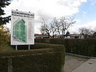
|
|
KGA 'Elsenstrasse'
( Location ) |
1979 |
97 42,969 m² |
Elsenstrasse | The KGA is listed in the allotment garden development plan at the address Kethelitzweg / Elsenstr. 8-26. The 67 parcels on 30,910 m² of state-owned land are permanently secured as a fictitious system through the representation in the land use plan. In security level IV, the 34 parcels are registered on 12,551 m², these are highly secured allotment gardens, which should be preserved in compliance with the owner rights according to the representation of the FNP. The KGA is located between Elsenstrasse, Elsenteich, Parlerstrasse and Kethelitzweg, Großmannstrasse and Am Barnim. To the northwest is the Berlin balcony . The gardens were mainly laid out by interested parties on an earlier gardening site and handed over to users on October 16, 1980. Because there were more interested parties than parcels, the tenants were drawn by lot. |

|
|
KGA 'Helios'
( Location ) |
1979 | 151 72,608 m² |
Helios (apple variety) | It joins the KGA 'Dahlwitzer Strasse' immediately to the south-east. According to the allotment garden development plan and the representation in the national maps, the KGA 'Helios' and KGA, Dahlwitzer Straße' are listed together. The KGA is permanently secured by the development plan for the entire area o inventory. As a result of a member's decision, there are 30 parcels on 41,337 m² of private leased land, which are also considered to be permanently secured by the development plan. |

|
| KGA 'Kaulsdorfer See'
( Location ) |
Oct 20, 1977 |
41 21,901 m² |
Kaulsdorf lakes | The facility is currently called the 'Community of Settlers on Kaulsdorfer See' and is entered in the Berlin register of associations. In the allotment garden development plan, the address is Friedenstrasse / Badener Strasse. It lies between the Badener, the Pariser, the Friedenstrasse and the Grenzstrasse. The gardens were laid out on fallow land in 1976/1977 and, when it was officially founded on October 20, 1977, comprised 53 plots on 2.3 hectares. After 1990 there were some changes due to reallocation to building land, reassignment to other allotment gardens, etc. As of the end of 2011 to this garden colony 34 parcels with sizes between 433 and 766 m², a total of around 1.85 ha. The facility is not very well secured in the allotment garden development plan. 11 parcels on 6147 m² of state-owned land belong to security level IIIa: fictitious permanent allotment gardens which, according to the FNP, are to be used for other purposes. In addition, 23 parcels on 14,010 m² of private land belong to the KGA, which according to the FNP are intended for another use. A termination is possible at any time, taking into account the allotment garden regulations. |

|
|
KGA '(BWF) Kressenweg'
( Location ) |
1981 |
24 12,071 m² |
Kressenweg | The KGA is bounded by Goldregenstraße, Balsaminenweg, Phloxweg and Kressenweg. The VEB 'Kombinat Geodesie und Kartographie' of the GDR laid the foundation stone for the facility in 1979 (usage contract, development plan), which was built on an earlier agricultural area. It was opened in April 1981 as the 'BWF' (Berliner Werkzeugmaschinenfabrik Marzahn) allotment garden division. In January 1982 the users were able to occupy their parcels. The KGA 'BWF Kressenweg' is included with the number 44181 on the western edge of the district. The KGA is listed as Kressenweg 48, the property on the northern edge of Kressenweg 66 / Goldregenstraße includes the KGA parking lot, and Goldregenstraße 6 is one of the 24 parcels that are covered with arbors and gardens. Access to the parcels is through a three-meter-wide driveway between the properties, which is within the enclosure of the facility. This system is not included in the allotment garden development plan. |

|
|
KGA 'Mahlsdorf Nordspitze'
( Location ) |
1955 |
44 25,392 m² |
Mahlsdorf northeast, in the district | The Berlin city limits and Nürnberger Straße form the boundaries of the KGA, access is from Bamberger Straße. The address of the KGA is Dahlwitzer Straße 43. In the 1930s, Berlin citizens signed their first lease agreements with the Jewish property owners. The arbors erected on the garden land became a residence because many people could no longer pay the rents for their apartments. During and after the Second World War , these were used as emergency shelters. Because of the history, five tenants still have permanent right of residence in this complex. In 1955 it became a garden colony. After the fall of the Wall , the land was transferred back to the Jewish Claims Conference (JCC). The district administration Marzahn-Hellersdorf and the users prevented the reallocation into building land; Instead, an open-ended interim lease was concluded between the JCC and the district association of Hellersdorfer Gartenfreunde. The KGA is to be converted into a permanent allotment garden. In the allotment garden development plan, 47 parcels on 26,917 m² of private land are entered as a fictitious, permanently secured facility, as the area has a development plan. The KGA was called KGA 'Dahlwitzer Str. 43' until September 30, 2009. |

|
|
KGA 'Juniper Heath'
( Location ) |
Jan. 16, 1976 | 194 121,600 m² |
Juniper Heath (road) | The street Wacholderheide, the Berlin city limits, Lemkestrasse and Kieler Strasse surround the KGA. Greifswalder Straße divides the site into a northern and a southern area. Postal address is Greifswalder / Lemkestraße. The land belongs to the Protestant parish of Mahlsdorf; its use as an allotment garden was agreed in 1965 in a lease with the East Berlin magistrate . In 1993 the use was reorganized, this time between the church and the district association of Hellersdorfer Gartenfreunde. In the long term, permanent use is sought. - In the KGA there is a clubhouse with surrounding open spaces for games and sports. The facility is located on private leased land and is permanently secured by the representation in the zoning plan, taking into account the owner's rights. (Level IV) |

|
|
KGA 'Werbellinbecken'
( Location ) |
Apr 8, 1978 |
28 14,436 m² |
Werbellinstraße and basin , a depression in the landscape | The KGA is located between Werbellinstrasse, Pariser Strasse, Grenzstrasse and Parkstrasse. There are five access routes from Werbellinstraße. The 'VEB Kombinat Tiefbau Berlin' had bought the area together with the 'Association of allotment gardeners, settlers and small animal breeders of the GDR' ( VKSK ) and thus created the 'Werbellinbecken' weekend settlement . After the reunification, it became the registered association 'Kleingartenanlage Werbellinbecken eV'; Kauperts.de describes the garden colony as a 'civil engineering colony'. The KGA is included in the allotment garden development plan under 10031 Werbellinstrasse (28 parcels on 14,072 m² of state-owned leased land) in level IIIa. |

|
|
KGA 'Wickenweg'
( Location ) |
1980 |
88 44,467 m² |
Wickenweg | It is bordered by the Korianderweg, Wickenweg, the houses on Bruchsaler Straße and the Kressenweg. The southern continuation of the Georginenweg leads into the complex. - The KGA was created on the partial area of an LPG . After the reunification it became a registered association. Together with the district office, the users created a publicly accessible adventure playground. There has been a club house since 2009, which includes a teaching garden that is to be continuously expanded. In the allotment garden development plan, the KGA Wickenweg is included as a permanently secured facility with 88 plots on Kressen- / Wickenweg on 44,467 m² of state-owned leased land, the facility area is entered in the zoning plan as grassland with the addition KGA. |

|
Further locations in Mahlsdorf
- Settlement Badener Straße ( location ): There was an allotment garden here (since 1978), the area of which was dedicated as building land in 2005 after it was sold. The KGA with eight parcels on 3423 m² was located on Freiburger Strasse, Wickenweg and Badener Strasse and until 1990 belonged to the 'Kaulsdorfer See' complex. The garden users founded their own association 'KGA Badener Straße' and the land was sold to a real estate company that rejected the status of a KGA. In exchange for compensation payments, the tenants cleared the site and new single-family houses were built.
-
Wilhelminian-style
museum in the Mahlsdorf manor : The museum, which opened in 1960, is located in a historic building that Charlotte von Mahlsdorf saved from demolition. In 1880 Hermann Schrobsdorff acquired the manor and had the manor garden redesigned into a park.
-
Landscape protection area :
Between Alt-Kaulsdorf / Alt-Mahlsdorf (north), Lassaner Straße (west), Butzer and Elsensee (south) and Hultschiner Damm (east), a protection procedure was announced in January 2012. The area is officially known as the " Berlin Balcony ". Several wooden sculptures were set up on a footpath in this area, including two “three chairs” (see picture), carved marking posts for the height above sea level, and a designed area for a former post mill at Alt-Mahlsdorf.
- In the Karree Kieler Straße, Bremer Straße, Walter-Leistikow-Weg (entrance) and Lemkestraße in Mahlsdorf-Nord is the communal cemetery Mahlsdorf, opened in 1919, on which a small chapel was built.
See also
literature
- Paul Großmann : Mahlsdorfer Strasse Directory , ed. with the participation of the municipal administration, Berlin-Mahlsdorf (Bahnhofstrasse 2): KE Schulze, 1921
Web links
- Map of Berlin 1: 5000 with district boundaries. Senate Department for Urban Development Berlin, 2009, accessed on January 15, 2012 .
- Official street directory of the Marzahn-Hellersdorf district; pdf (as of January 2015)
- Street directory Mahlsdorf. kaupert media gmbh, accessed on January 15, 2012 .
- Mahlsdorf on the side of the district office
Individual evidence
- ^ Berlin-Mahlsdorf . In: Berliner Adreßbuch , 1922, IV, p. 1747.
- ↑ Albrecht-Dürer-Strasse . In: Berliner Adreßbuch , 1930, Part IV, p. 2084.
- ↑ Mrs. A. Herz . In: Berliner Adreßbuch , 1930, IV. Part, p. 2084. "4.5 E: Heart, A, woman, owner".
- ↑ Am Barnim on Kauperts.de
- ↑ a b c Template No. 745 / IV of the Marzahn-Hellersdorf District Office from April 16, 2014 ( Memento of the original from May 25, 2015 in the Internet Archive ) Info: The archive link has been inserted automatically and has not yet been checked. Please check the original and archive link according to the instructions and then remove this notice.
- ↑ Open Mahlsdorfer Markets ( Memento of the original from May 26, 2015 in the Internet Archive ) Info: The archive link has been inserted automatically and has not yet been checked. Please check the original and archive link according to the instructions and then remove this notice. . In: Die Hellersdorfer, May 2015, p. 3
- ↑ Official street directory of the Marzahn-Hellersdorf district; pdf (as of July 2015) , Bausdorfstrasse mentioned twice, (PDF; 350 kB)
- ↑ a b c d e f g Template No. 1038 / III of the Marzahn-Hellersdorf District Office from May 3, 2010 ( Memento of the original from May 25, 2015 in the Internet Archive ) Info: The archive link was inserted automatically and has not yet been checked. Please check the original and archive link according to the instructions and then remove this notice.
- ^ Street naming in honor of Charlotte von Mahlsdorf
- ↑ a b Mahlsdorf> Donathplatz, Franz-Hals-Platz . In: Berliner Adreßbuch , 1922, Part IV, p. 1749.
- ^ Wagnerstrasse in Mahlsdorf on Luise-Berlin
- ↑ Map Map of Dürer gardens, house numbers; accessed on January 25, 2012. In January 2016, the site plan and the house example were no longer available on this website. Instead, a ticker ran across the screen: "The project is completely sold."
- ↑ a b Seven Stolpersteine in Marzahn-Hellersdorf ( Memento from May 26, 2015 in the Internet Archive )
- ↑ Elsenstrasse on Kauperts.de
- ^ Fritz-Reuter-Straße on Kauperts.de
- ↑ Marketplace, bounded by An den Siedlergärten, Am Rosenhag, Marderweg, Wacholderheide . In: Berliner Adreßbuch , 1938, Part IV, p. 2250.
- ↑ On the history of Guthmannplatz: From the survey of older residents in April 2012.
- ↑ District Office Marzahn-Hellersdorf: Press and photo session: Laying of seven stumbling blocks . March 19, 2013
- ↑ Berliner Zeitung : Only one survived . February 28, 2008
- ↑ Guthmann family, Mahlsdorf . In: Berliner Adreßbuch , 1940, Part I, p. 951. “Guthmann Otto Mahlsdorf Property Mahlsdorf Lemkestrasse 156 E (a single-family house)” (The house is registered as a new building in 1935).
- ↑ Otto Guthmann . In: Berliner Adreßbuch , 1935, part I., p. 825. “Guthmann Otto Material Verwalt Lichtenberg Bornitzstr. 11a “(The house at Lemkestrasse 156 was registered as a new building in 1935, the owner was not named in 1936 and 1937, and Otto Guthmann was named as the owner in 1938).
- ↑ When this street was named, Kauperts.de referred to a settlement 'Hochwieser' in the Austrian district of Judenburg , which, however, has no connection with other surrounding street names. Because the adjacent streets were named after the Banat landscape and the town of Spiš (Slovakia), the connection to Hochwies is highly probable. After Kauperts was contacted (answer in November 2012), the editing of the explanation made here on the origin of the name follows.
- ↑ Press release of the Marzahn-Hellersdorf district office from December 5, 2014
- ↑ Viktoriastrasse on Luise-Berlin
- ^ Karlstrasse on Kauperts.de
- ↑ Difference in the representation of the FIS Broker map display and Google Earth aerial photo 2014 and StreetView 2008
- ↑ Wine poet in Königsthal. In: Berlin Week . Edition Hellersdorf, Kaulsdorf, Mahlsdorf , December 27, 2017, p. 3.
- ^ Mahlsdorf> Körnerplatz . In: Berliner Adreßbuch , 1938, Part IV, p. 1940.
- ↑ From the collection of historical postcards in the Heimatmuseum Marzahn-Hellersdorf (online) , accessed on February 6, 2012
- ^ Mahlsdorf> Kressenweg (course) . In: Berliner Adreßbuch , 1938, Part IV, p. 2248.
- ↑ Berlin city map 1961
- ^ Mahlsdorf> Mendelssohnstrasse . In: Berliner Adreßbuch , 1925, Part IV, p. 1942.
- ^ [1] Entry on luise-berlin.de
- ↑ Address search: Lenbachstrasse
- ^ Fritz-Reuter-Straße on Kauperts.de
- ↑ Grenzstraße (course) with all cross streets in their order . In: Berliner Adreßbuch , 1922, Part IV, p. 1750.
- ↑ Binding information from the Office for Statistics of April 17, 2012 on the district affiliation.
- ^ Mahlsdorf> Melanchthonstrasse and Extended Melanchthonstrasse . In: Berliner Adreßbuch , 1922, Part IV, p. 1752.
- ^ Mahlsdorf> Marienburger Strasse . In: Berliner Adreßbuch , 1922, Part IV, p. 1752.
- ^ Kauperts.de on the Münsterberger Weg
- ^ Lichtenberg administrative district> Mahlsdorf district> Konstanzer Straße . In: Berliner Adreßbuch , 1922, Part IV, p. 1751.
- ↑ Parkstrasse in Mahlsdorf on Kauperts.de
- ↑ Explanation of the name Blumenthalstrasse in the Berlin Street Lexicon on Luise-Berlin
- ↑ PEBG Mahlsdorfer Grünzug ( Memento of the original from March 17, 2016 in the Internet Archive ) Info: The archive link was inserted automatically and has not yet been checked. Please check the original and archive link according to the instructions and then remove this notice. Retrieved December 5, 2016
- ↑ cf. Berlin address books 1925, 1930
- ↑ Information about Ravenstein… in Dahlwitz-Hoppegarten ( memento of the original from June 9, 2013 in the Internet Archive ) Info: The archive link was inserted automatically and has not yet been checked. Please check the original and archive link according to the instructions and then remove this notice.
- ↑ See list of street renaming since 1990, Office for Statistics Berlin
- ↑ Kaulsdorf district> Extended Roseggerstrasse . In: Berliner Adreßbuch , 1922, Part IV, p. 1714.
- ^ The Mahlsdorf Cemetery ( Memento from May 28, 2015 in the Internet Archive )
- ↑ Stettiner Strasse . In: Berlin address book , 1922.
- ^ Hermann Budde on Luise-Berlin
- ↑ Homepage of the Kunsthaus Flora ( Memento of the original from August 9, 2012 in the Internet Archive ) Info: The archive link was inserted automatically and has not yet been checked. Please check the original and archive link according to the instructions and then remove this notice.
- ↑ Waldpromenade on Kauperts.de
- ^ Allotment garden "Werbellinbecken" eV
- ^ Voigtstrasse on Luise-Berlin
- ^ Mahlsdorf> Voigtstrasse . In: Berliner Adreßbuch , 1922, Part IV, p. 1754.
- ↑ Winklerstrasse on Kauperts.de
- ↑ Winkler, Carl; Kaufmann, Köpenicker Str. 47 . In: Berliner Adreßbuch , 1907, Part I, p. 2668.
- ↑ Böcklinstrasse . In: Berliner Adreßbuch , 1922, Part IV, p. 1748.
- ^ Mahlsdorf (north)> Feuerbachstrasse . In: Berliner Adreßbuch , 1925, Part IV, p. 1938.
- ↑ a b Mahlsdorf (place)> Brahmsstraße, undeveloped . In: Berliner Adreßbuch , 1925, Part IV, p. 1937.
- ↑ a b c Mahlsdorf> Odenwaldstrasse, Offenburger Strasse, Raffaelstrasse . In: Berliner Adreßbuch , 1925, Part IV, p. 1942.
- ↑ a b Schwarzwaldstrasse, Siemensplatz . In: Berliner Adreßbuch , 1925, Part IV, p. 1943.
- ↑ Augustastraße (north) . In: Berliner Adreßbuch , 1922, Part IV, pp. 1747 f ..
- ^ Bahnhofstrasse (east) . In: Berliner Adreßbuch , 1922, Part IV, p. 1748.
- ^ Berliner Strasse (east) . In: Berliner Adreßbuch , 1922, Part IV, p. 1748.
- ↑ Blücherstrasse (east) . In: Berliner Adreßbuch , 1922, Part IV, p. 1748.
- ↑ Blücherstrasse (east) . In: Berliner Adreßbuch , 1922, Part IV, p. 1748.
- ↑ Blumenthalstrasse (east) . In: Berliner Adreßbuch , 1922, Part IV, p. 1748.
- ^ Brahmsstrasse (east) . In: Berliner Adreßbuch , 1922, Part IV, p. 1748.
- ↑ Buddestrasse (east) . In: Berliner Adreßbuch , 1922, Part IV, p. 1748.
- ^ Bülowstrasse (south) . In: Berliner Adreßbuch , 1922, Part IV, p. 1748.
- ^ Danziger Strasse (east) . In: Berliner Adreßbuch , 1922, Part IV, p. 1749.
- ↑ Berlin city map 1961
- ↑ Old parish church in Mahlsdorf ( Memento from May 28, 2015 in the Internet Archive )
- ^ Friedrichstrasse (north) . In: Berliner Adreßbuch , 1922, Part IV, p. 1750.
- ^ Goethestrasse (south) . In: Berliner Adreßbuch , 1922, Part IV, p. 1750.
- ↑ Graudenzer Strasse (east) . In: Berliner Adreßbuch , 1922, Part IV, p. 1750.
- ^ Hansaplatz (north) . In: Berliner Adreßbuch , 1922, Part IV, p. 1750.
- ^ Heinrich-Heine-Strasse (north) . In: Berliner Adreßbuch , 1922, Part IV, p. 1750.
- ^ Hellersdorfer Strasse (north) . In: Berliner Adreßbuch , 1922, Part IV, p. 1750.
- ^ Hirschgartenstrasse (east, south) . In: Berliner Adreßbuch , 1922, Part IV, p. 1750.
- ^ Hirschgartenstrasse (east, south) . In: Berliner Adreßbuch , 1922, Part IV, p. 1750.
- ^ Kaiser-Friedrich-Strasse (south) . In: Berliner Adreßbuch , 1922, Part IV, p. 1750.
- ^ Kaiser-Friedrich-Strasse (south) . In: Berliner Adreßbuch , 1922, Part IV, p. 1750.
- ^ Queen-Luise-Strasse (east and south) . In: Berliner Adreßbuch , 1922, Part IV, p. 1750.
- ↑ Königsweg (east and south) . In: Berliner Adreßbuch , 1922, Part IV, p. 1750.
- ^ Konstanzer Strasse (east) . In: Berliner Adreßbuch , 1922, Part IV, p. 1750.
- ↑ Langestrasse (east) . In: Berliner Adreßbuch , 1922, Part IV, p. 1751.
- ↑ Lindenallee . In: Berliner Adreßbuch , 1922, Part IV, p. 1751.
- ↑ Lindenstrasse . In: Berliner Adreßbuch , 1922, Part IV, p. 1751.
- ^ Marienburger Strasse . In: Berliner Adreßbuch , 1922, Part IV, p. 1751.
- ↑ Mendelssohnstrasse (east) . In: Berliner Adreßbuch , 1922, Part IV, p. 1751.
- ^ Metzer Strasse . In: Berliner Adreßbuch , 1922, Part IV, p. 1751.
- ↑ Meyerbeerstrasse . In: Berliner Adreßbuch , 1922, Part IV, p. 1752.
- ↑ Offenbachstrasse (east) . In: Berliner Adreßbuch , 1922, Part IV, p. 1752.
- ^ Pfarrstrasse (south) . In: Berliner Adreßbuch , 1922, Part IV, p. 1752.
- ^ Roentgenstrasse (east) . In: Berliner Adreßbuch , 1922, Part IV, p. 1752.
- ↑ Schillerstrasse (south) . In: Berliner Adreßbuch , 1922, Part IV, p. 1752.
- ^ Schulstrasse (east) . In: Berliner Adreßbuch , 1922, Part IV, p. 1752.
- ^ Sedanstrasse (east and south) . In: Berliner Adreßbuch , 1922, Part IV, p. 1752.
- ↑ Steinstrasse (south) . In: Berliner Adreßbuch , 1922, Part IV, p. 1752.
- ^ Triftstrasse (east) . In: Berliner Adreßbuch , 1922, Part IV, p. 1753.
- ↑ Viktoriastraße (north) . In: Berliner Adreßbuch , 1922, Part IV, p. 1753.
- ^ Voigtstrasse (east) . In: Berliner Adreßbuch , 1922, Part IV, p. 1753.
- ^ Wagnerstrasse (east) . In: Berliner Adreßbuch , 1922, Part IV, p. 1753.
- ↑ Walderseestrasse (east) . In: Berliner Adreßbuch , 1922, Part IV, p. 1753.
- ^ Waldstrasse (east) . In: Berliner Adreßbuch , 1922, Part IV, p. 1753.
- ↑ Wiesenstrasse (east) . In: Berliner Adreßbuch , 1922, Part IV, p. 1753.
- ^ Wilhelmstrasse (east) . In: Berliner Adreßbuch , 1922, Part IV, p. 1753.
- ^ Zeppelinstrasse (north) . In: Berliner Adreßbuch , 1922, Part IV, p. 1753.
- ^ Website of Gartenfreunde Berlin-Marzahn with the names of all KGAs, as of May 2015
- ↑ Allotment gardens in Mahlsdorf ( Memento from May 25, 2015 in the Internet Archive )
- ^ KGA Dahlwitzer Strasse eV ; accessed on February 5, 2016.
- ^ Decision of the East Berlin magistrate
- ^ Website of the KGA 'Dahlwitzer Straße' , accessed on February 9, 2012
- ^ KGA Elsenstrasse eV
- ↑ KGA Helios eV ( Memento from May 25, 2015 in the web archive archive.today )
- ↑ On March 17, 1992, the former division 2 (of 5) was re-entered in the Berlin register of associations
- ↑ Brief information on the summer apple Helios
- ↑ KGA Kaulsdorfer See eV ( Memento from May 25, 2015 in the web archive archive.today )
- ↑ KGA Kressenweg eV ( Memento from May 25, 2015 in the web archive archive.today )
- ↑ On April 2, 1996, the garden colony was entered in the register of associations at the Berlin-Charlottenburg district court as allotment gardens "Kressenweg eV"
- ↑ KGA Mahlsdorf Nordspitze eV ( Memento from May 25, 2015 in the web archive archive.today )
- ↑ In the 1990s the KGA was entered in the Berlin register of associations (number VR 16473 NZ)
- ↑ KGA Wacholderheide eV ( Memento from May 25, 2015 in the web archive archive.today )
- ↑ KGA Werbellinbecken eV ( Memento from May 25, 2015 in the web archive archive.today )
- ^ Colony civil engineering at Kauperts.de
- ↑ Level IIIa: Temporary allotment gardens which, according to the FNP, are to be used for other purposes.
- ↑ KGA Wickenweg eV ( Memento from May 25, 2015 in the web archive archive.today )
- ↑ KGA Badener Strasse on the website of Gartenfreunde Hellersdorf ( page no longer available , search in web archives ) Info: The link was automatically marked as defective. Please check the link according to the instructions and then remove this notice. , accessed February 9, 2012
- ↑ Gründerzeitmuseum in Mahlsdorf ( Memento of the original from July 17, 2012 in the Internet Archive ) Info: The archive link was inserted automatically and has not yet been checked. Please check the original and archive link according to the instructions and then remove this notice.
- ↑ Berliner Zeitung of January 12, 2012; Announcements by the Senate Department for Urban Development and Environmental Protection
- ↑ Information from the BA Marzahn-Hellersdorf on the Mahlsdorf cemetery ( Memento from August 9, 2010 in the Internet Archive ) This is where the Berlin original “Orgel-Trude” is buried.


