List of streets and squares in Berlin-Grunewald

The list of streets and squares in Berlin-Grunewald describes the street system in the Berlin district of Grunewald with the corresponding historical references. At the same time, this compilation is part of the lists of all Berlin streets and places .
overview
The district Grunewald has 10,999 inhabitants (as of December 30, 2019) and includes the zip code areas 10711, 14055, 14193, 14195 and 14199. There are 78 in the district dedicated to roads and eight named places, like the Roseneck. 17 streets are partly in the neighboring districts or continue in them. The streets in the district have a total length of 46.5 kilometers.
In 1889, the Kurfürstendamm Society laid out the Grunewald villa colony on 234 hectares of land, from which today's Grunewald district emerged. On April 1, 1899, the elevation to an independent rural community took place by cabinet order. In 1906 the Neu-Grunewald colony was incorporated into the rural community. In the 1899 address book, Grunewald in the Teltow district is given with a population of 2,650. The streets were specifically laid out at the western end of the Kurfürstendamm, whereby the compact development meant that there was no strict separation between Schmargendorf, Wilmersdorf and Grunewald. This can be found in today's street layout across the districts, but also in the address books of the 1890s. For more information, see below .
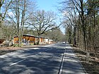
The AVUS runs through the district as part of the federal motorway 115 , which forms the southern motorway connection between the western city center and the Berliner Ring . It is located in the district between the southern border to Nikolassee with junction 2 (Hüttenweg) and junction 11 (Messedamm Süd) of the federal motorway 100 (city ring) from Rathenauplatz . In the district, 2100 meters of the main carriageway of the A 100 (AD radio tower and AS Kurfürstendamm) and 4570 meters of the A 115 (AS Hüttenweg and AD radio tower) form part of Berlin's extensive road system . These are supplemented by a total of 1250 meters of entrances / exits as higher-level roads. The main road system of the district has a connection to the Kurfürstendamm and the city center. The higher-level system includes the Rathenauplatz with the Hubertusallee / Teplitzer Straße / Hohenzollerndamm (250 meters) / Clayallee (110 meters) to the south and the Halenseestraße to the north. 100 meters of Schwarzbacher and Auguste-Viktoria-Straße, along the edge of the district of Schmargendorf, are also classified as superordinate main streets. The Koenigsallee (further west from Rathenauplatz), which also leads south, and the cross-connecting Hagenstrasse , as well as the sections of Franzensbader , Warmbrunner and Paulsborner Strasse in Grunewald, are classified as local roads . In the district there are still the supplementary roads Am Postfenn and near Haveln to the west, the Havelchaussee , which lies between Wannsee and Spandau and is important for excursion traffic. Otherwise, the Berlin forests (beyond the AVUS) will be opened up with paths for hiking and cycling, some of which are included in the road register.
With the "Aryanization of street names" in the years 1935 to 1938, many names of Jewish and other then undesirable personalities were erased and replaced by other names that were opportune at the time . The renaming could not always be reversed after the Second World War . Instead, street names in a different location are reminiscent of former Jewish residents of Grunewald.
Overview of streets and squares
The following table gives an overview of the streets and squares in the district as well as some related information.
- Name / location : current name of the street or square. Via the link Location , the street or the square can be displayed on various map services. The geoposition indicates the approximate center of the street length.
- Traffic routes not listed in the official street directory are marked with * .
- Former or no longer valid street names are in italics . A separate list may be available for important former streets or historical street names.
-
Length / dimensions in meters:
The length information contained in the overview are rounded overview values that were determined in Google Earth using the local scale. They are used for comparison purposes and, if official values are known, are exchanged and marked separately.
For squares, the dimensions are given in the form a × b for rectangular systems and for (approximately) triangular systems as a × b × c with a as the longest side.
If the street continues into neighboring districts, the addition ' in the district ' indicates how long the street section within the district of this article is. - Name origin : origin or reference of the name.
- Notes : further information on adjacent monuments or institutions, the history of the street and historical names.
- Image : Photo of the street or an adjacent object.
| Name / location | Length / dimensions (in meters) |
Origin of name | Date of designation | Remarks | image |
|---|---|---|---|---|---|
|
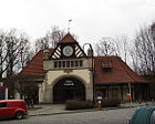
At the Grunewald train station
( Location ) |
70 × 40 ( trapezoidal shape ) |
Forecourt of the Grunewald S-Bahn station | around 1900 | The following streets lead into the square: Auerbachstraße, Fontanestraße, Winkler Straße and Trabener Straße. It forms the street around the “Karmielplatz” green area and retained the name even after the green area was named. The north-eastern part leads to the former freight yard, on which the Gleis 17 memorial is located. |
|
| At the Postfenn
( Location ) |
1440 (in the district) |
to the nearby Postfenn nature reserve | May 2, 1962 | Part of the street is in Westend . |

|
| Auerbachstrasse
( Location ) |
540 | Berthold Auerbach (1812–1882), writer | April 1, 1898 | From 1898 to 1938 the traffic route was called Auerbachstraße after the Jewish writer Berthold Auerbach . On May 16, 1938, the National Socialists turned Auerbachstrasse into Auerbacher Strasse, which was no longer named after a popular Jewish writer, but after the Saxon town in the Vogtland . A renaming was not made despite years of discussions due to residents' protests. Instead, an additional sign reminded of Berthold Auerbach. At its meeting on November 15, 2012, the district council assembly of Charlottenburg-Wilmersdorf asked the district office to rename Auerbacher Strasse to Auerbachstrasse. The designation became effective on April 8, 2013. |

|
| Auguste-Viktoria-Strasse
( Location ) |
1060 (in the district) |
Auguste Viktoria (1858–1921), wife of Wilhelm II. | March 6, 1891 | Part of the street is in Schmargendorf . |

|
|
Bernadottestrasse
( Location ) |
360 (in the district) |
Folke Bernadotte (1895–1948), Swedish officer and philanthropist | Feb 6, 1958 | Parts of the street are in Schmargendorf and Dahlem . |

|
| Bernhard Wieck Promenade
( Location ) |
80 | Bernhard Wieck (1845–1913), first official and community leader of Grunewald | Oct 22, 1959 | The previous name was Bernhard-Wieck-Straße . It connects Hagenstrasse with Spohrstrasse. It is included in the street directory as a footpath ( RBS class : FUWE) and is one of the two connections from Hagensstrasse to Griegstrasse. |

|
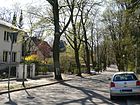
| Bettinastrasse
( Location ) |
340 | Bettina von Arnim (1785–1859), writer | Apr 1, 1898 | The street runs from Winkler Strasse to Douglasstrasse. |
|
| Bilsestrasse
( Location ) |
130 | Benjamin Bilse (1816–1902), composer and conductor | Apr 1, 1898 | The street runs from Hagenstrasse to Menzelstrasse. |

|
| Bismarckallee
( Location ) |
1320 | Otto von Bismarck (1815–1898), Chancellor of the German Empire | Apr 1, 1898 | Bismarck had a decisive influence on the establishment of the Grunewald colony. |

|
|
Bismarckplatz
( Location ) |
100 (diameter) |
Otto von Bismarck (1815–1898), Chancellor of the German Empire | Jan. 24, 1898 | The previous name was Joachimplatz from 1891 to 1898 . | |
| Brahmsstrasse
( Location ) |
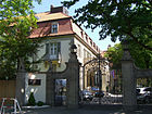
300 | Johannes Brahms (1833–1897), composer and conductor | Apr 1, 1898 | The street runs from Richard-Strauss-Straße to Hubertusbader Straße. |
|
|
Caspar-Theyß-Strasse
( Location ) |
240 + 330 (in the district) |
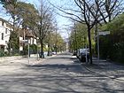
Caspar Theiss (around 1510 – around 1550), builder of the Renaissance in Berlin and the Mark Brandenburg | Apr 1, 1898 | Part of the street is in Schmargendorf . The street is interrupted by Bismarckplatz. |
|
|
Clayallee
( Location ) |
160 (in the district) |
Lucius D. Clay (1898–1978), American general, initiator of the Berlin Airlift | June 1, 1949 | The previous names were Hauptstraße from 1878 to 1934 , Cecilienstraße from 1912 to 1934, and Kronprinzenallee from 1912 to 1949 . Clayallee is the only street in West Berlin that was named after a person who was still alive at the time. Other parts run in Schmargendorf , Dahlem and Zehlendorf . The western part between Bernadottestraße and Waldmeisterstraße is in Grunewald. |

|
| Cordesstrasse
( Location ) |
270 (in the district) |
Heinrich Cordes (1852–1917), railway construction inspector | March 23, 1925 | Part of the street is in Westend . |

|
|
Dachsberg
( Location ) |
290 | Dachsberg, vineyard near Oestrich-Winkel in the Rheingau , Hesse | Apr 1, 1898 | The street name is derived from the badger burrow, because badgers preferred to dig their burrows here in the forest floor. |

|
| Delbrückstrasse
( Location ) |
710 (in the district) |
Rudolph von Delbrück (1817–1903), Prussian politician | March 6, 1891 | Part of the street is in Schmargendorf . There is also a Delbrückstraße in Friedrichsfelde . |

|
| Douglas Street
( Location ) |
590 | David Douglas (1799–1834), British botanist and plant hunter , namesake of the Douglas fir | Apr 1, 1898 | The street runs from Koenigsallee to Auerbachstraße. |

|
|
Squirrel dough
( Location ) |
570 | squirrel | May 1, 1979 | The path is a footpath to the Grunewald forest . |

|
| Eichkampstrasse
( Location ) |
450 (in the district) |
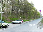
Eichkamp settlement | July 7, 1936 | The previous names were Kronprinzessinnenweg (before 1892 until after 1918) and Königsweg (until 1936). Part of the street is in Westend . |
|
| Erbacher Strasse
( Location ) |
270 | Erbach , district of Eltville am Rhein in the Rheingau | Jan. 24, 1898 | The street is located in a settlement area where streets were named after wine towns or types of wine. |

|
| Erdener Strasse
( Location ) |
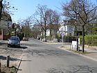
310 | Erden , municipality in the district of Bernkastel-Wittlich in Rhineland-Palatinate | Jan. 24, 1898 | The street was part of Trabener Straße from 1895 to 1898 . |
|
|
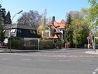
Fontanestrasse
( Location ) |
470 | Theodor Fontane (1819–1898), writer | Jan. 24, 1898 | The street runs from Auerbachstraße and Am Bahnhof Grunewald to Koenigsallee and Hagenstraße. |
|
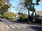
| Franzensbader Strasse
( Location ) |
110 (in the district) |
Franzensbad (today: Františkovy Lázne), health resort in the western Czech Republic | March 6, 1891 | Part of the street is in Schmargendorf . |
|
| Furtwänglerstrasse
( Location ) |
440 | Wilhelm Furtwängler (1886–1954), conductor and composer | Feb. 24, 1955 | The street runs from Wernerstraße to Hubertusbader Straße . Between 1898 and 1955 it was called Beymestrasse , named after Carl Friedrich von Beyme . |

|
|
Gillweg
( Location ) |
230 | Henry Gill (1824–1893), director of the municipal waterworks in Berlin | March 4, 1960 | The previous name was Gillstrasse from 1898 to 1960 . It connects the Rathenauplatz to Bundschuhstraße and is included in the street directory as a footpath ( RBS class : FUWE). The path leads alongside the southern tunnel entrance of the city motorway . |

|
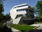
| Gneiststrasse
( Location ) |
180 | Rudolf von Gneist (1816–1895), Prussian lawyer and politician | Apr 1, 1898 | The street runs from Erdener Straße to Wissmannstraße. In the Gneiststraße 7 of stands graft society of architects built Villa M. |
|
| Gottfried-von-Cramm-Weg
( Location ) |
150 | Gottfried von Cramm (1909–1976), tennis player | Dec. 1, 1983 | Before that it was part of the Oberhaardter Weg . |

|
| Griegstrasse
( Location ) |
690 | Edvard Grieg (1843–1907), Norwegian composer | Oct 24, 1922 | The first name was street G 84 . The embassy of the state of Kuwait in Germany has been located here since 2001 in a building from 1923 (see picture). |

|
| Gustav-Freytag-Strasse
( Location ) |
330 | Gustav Freytag (1816–1895), writer | March 17, 1909 | The street runs from Douglasstraße to Koenigsallee . The northern section between Douglasstraße and Oberhaardter Weg is classified as a footpath in the street directory with a length of 90 meters. |

|
|
Hagenplatz
( Location ) |
160 × 60 (triangular shape) |
Otto von Hagen (1817–1880), forest scientist | Sep 18 1934 | Between 1912 and 1934 the area was called Kurmärker Platz . The renaming took place in connection with the renaming of Kurmärker Strasse (see under Hagenstrasse ) on the same day. |

|
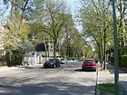
| Hagenstrasse
( Location ) |
1240 | Otto von Hagen (1817–1880), forest scientist | Apr 1, 1898 | On September 18, 1934, a part of what was then Kurmärker Strasse was added to Hagenstrasse at the western end of the road . The elimination of this name made it possible on the same day to rename the street An der Apostelkirche in Schöneberg to Kurmärkische Strasse , which helped the local government of the NSDAP -Gaus Kurmark to get the address Kurmärkische Strasse 1 . |
|
| Halenseestrasse
( Location ) |
460 (in the district) |
Halensee | July 7, 1936 | The eastern properties of the street are in Halensee and the northern section beyond the bridge over the Wetzlarer Bahn belongs to Westend . The road is divided by the motorway and is primarily used as an entry and exit to the A 100 . At the southern end of the Rathenauplatz there are some houses from the 1930s, only on the west side in the district. Its residents are exposed to heavy traffic noise at all times of the day and night; the street at Rathenauplatz and the Trabener Steg parallel to the railway bridge can be crossed. |

|
|
Hare jump
( Location ) |
270 | Vineyard near Winkel (district of Oestrich-Winkel since 1972 ) in the state of Hesse | Apr 1, 1898 | The street runs as a promenade from Koenigsallee to Winkler Straße . He is classified in the street directory in the RBS class "FUWE". On the north-east bank of the lake, the Hasensprung connects to the Wannseeweg , one of Berlin's 20 green main routes . |
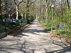
|
|
Havelchaussee
( Location ) |
4620 (in the district) |
Havel , river which runs along the road | from 1925 | Parts of the street are in Wilhelmstadt , Nikolassee and Westend . |
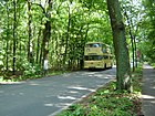
|
| Herbertstrasse
( Location ) |
370 + 180 | Herbert von Bismarck (1849–1904), politician, son of Otto von Bismarck | Apr 1, 1898 | The street is interrupted by Johannaplatz . |
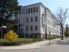
|
| Herthastrasse
( Location ) |
380 | Hertha , Germanic goddess | Apr 1, 1898 | The road was created by merging road G8 with road G9 . |
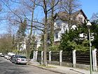
|
| Hilde-Ephraim-Strasse
( Location ) |
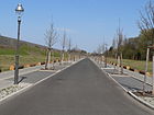
740 | Hilde Ephraim (1905–1940), resistance fighter against National Socialism | Apr 1, 2010 | The street faces northwest on Trabener Strasse and faces the former Grunewald marshalling yard. |
|
| Höhmannstrasse
( Location ) |
190 | Heinrich Höhmann (19th century), director of the Kurfürstendamm Society, co-founder of the Grunewald colony | March 17, 1909 | The street runs from Oberhaardter Weg to Regerstraße. |

|
|
Hohenzollerndamm
( Location ) |
240 (in the district) |
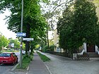
Hohenzollern , family that provided the Prussian kings and German emperors until 1918 | around 1900 | Parts of the street run through Schmargendorf and Wilmersdorf |
|
| Hubertusallee
( Location ) |
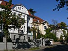
1300 | Hubertus von Liège (around 655–727), Bishop of Maastricht and Liège | Jan. 24, 1898 | Part of the east side of the street is in Schmargendorf . |
|
| Hubertusbader Strasse
( Location ) |
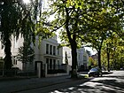
520 | Huberthusbad , sanatorium in Thale in Saxony-Anhalt | March 6, 1891 | The name of the route in the development plan was Street G 12 from 1885 . On July 1, 1967, the section between Franzensbader Strasse and Joseph-Joachim-Platz became part of Hubertusallee . |
|
| Humboldtstrasse
( Location ) |
770 | Wilhelm von Humboldt (1767–1835), scholar, statesman and co-founder of the University of Berlin | 23 Feb 1900 | The previous name between 1892 and 1900 was Boothstrasse . It lies parallel to Hubertusallee between Warmbrunner and Kunz-Buntschuh-Straße . Before the construction of the autobahn , it had a connection to the western Kurfürstendamm via Hobrechtstraße , which at that time ran through to Hubertusallee and led to Koenigsallee . |

|
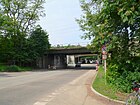
| Hüttenweg
( Location ) |
1050 (in the district) |
a previously existing here bee hut | Oct 24, 1922 | Parts of the street are in Dahlem and Zehlendorf . |
|
|
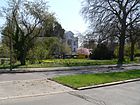
Johannaplatz
( Location ) |
80 × 50 (irregular hexagon ) |
Johanna von Bismarck (born von Puttkamer, 1824–1894), wife of Otto von Bismarck | Apr 1, 1898 | The first name from 1891 to 1898 was space A . |
|
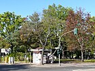
| Joseph-Joachim-Platz
( Location ) |
100 × 50 (triangular shape) |
Joseph Joachim (1831–1907), Austro-Hungarian composer and conductor | July 1, 1967 | Part of Auerbach (he) Street was 1909-1939 Joseph Joachim Street , was then in the time of National Socialism in Oberhaardter way renamed. |
|
|
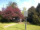
Karmielplatz
( Location ) |
70 × 40 ( trapezoidal shape ) |
Karmi'el , the Israeli twin town of Charlottenburg-Wilmersdorf | October 18, 2015 | The green space in front of the train station was given its current name on October 18, 2015 on the occasion of the 30-year city partnership between the city of Karmiel in Israel and Charlottenburg-Wilmersdorf, based on a decision of the BVV. Since the green area is part of the public road as a so-called " roadside green" , this is a renaming and not a new name. The district office deliberately opted for this variant, as this way the existing addresses can be retained and changes to the land register entries are not necessary. |
|
| Klindworthsteig
( Location ) |
80 | Karl Klindworth (1830–1916), composer, conductor and music teacher | May 16, 1938 | From 1906 to 1938 the traffic route was called Sternstraße after the Jewish music teacher Julius Stern . |

|
| Knausstrasse
( Location ) |
300 | Ludwig Knaus (1829–1910), painter | Apr 1, 1898 | Another Knausstrasse is located in Steglitz . |

|
|
Koenigsallee
( Location ) |
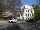
4110 | Felix Koenigs (1846–1900), banker, co-founder of the Grunewald colony | Apr 1, 1895 | Along with Hubertusallee, Koenigsallee is the most important connecting road in the district. It branches off from Hubertusallee, leads through the colony and then through the Grunewald to merge into Onkel-Tom-Straße at Hubertusweg. Before the renovation of the Rathenauplatz in 1956, the Kurfürstendamm on Halenseestrasse merged directly into Koenigsallee. Prominent personalities lived and worked in Koenigsallee: Hertha Thiele (no. 37a), Vicki Baum , (no. 45), Carl Fürstenberg (no. 53c – e), Walther Rathenau (no. 65, then no. 22) and Brigitte Mira (No. 83). |
|
| Koenigsmarckstrasse
( Location ) |
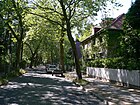
310 | Count Otto von Königsmarck (1815–1889), Upper President von Posen and briefly Prussian Minister of Agriculture | Apr 1, 1898 | The first name was street G 55 . |
|
|
Royal road
( Location ) |
2310 | The Prussian kings used the road between Potsdam and Charlottenburg . | around 1874 | As early as 1874, the Königsweg was marked on the Charlottenburg area up to Feldstrasse (today: Knobelsdorffstrasse). The course has changed several times over the decades, mainly due to the construction of the Ringbahn and the AVUS . After 1918, the Kronprinzessinnenweg up to the Großer Stern was included in the Königsweg. Part of the Königsweg from today's Messe Süd (Eichkamp) station to Königin-Elisabeth-Strasse was given the name Eichkampstrasse on July 7, 1936. The subsequent part of the Königsweg to the railway bridge was named Messedamm on the same day. |

|
| Kronberger Strasse
( Location ) |
630 | Kronberg im Taunus , climatic health resort in the Hochtaunus district in Hesse | 4th July 1929 | From 1898 to 1929 the street name Cronberger Straße was written . |

|
| Kunz-Buntschuh-Strasse
( Location ) |
260 | Kunz Buntschuh (around 1500 – after 1559), with Caspar Theiss master builder of the Berlin City Palace | Apr 1, 1898 | In 1960 the north-eastern part came to the Storkwinkel with the construction of the city motorway . |

|
|
Lassenstrasse
( Location ) |
730 | Christian Lassen (1800–1876), Indologist | April 16, 1937 | From 1898 to 1937 the traffic route was Siemensstrasse . |

|
| Leo-Blech-Platz
( Location ) |
60 × 60 (triangle shape) |
Leo Blech (1871–1958), composer and conductor | July 20, 1959 | From 1906 to 1959 the facility was called Menzelplatz . |

|
| Lynarstrasse
( Location ) |
160 + 500 | Rochus zu Lynar (1525–1596), Italian fortress builder and military, chief builder of the citadel in Spandau | Jan. 24, 1898 | The street is interrupted by Johannaplatz . |

|
|
Margaretenstrasse
( Location ) |
90 | Margarete Bräuer, daughter of the builder Carl Bräuer, who owned the property | around 1897 | The street runs as a dead end between Koenigsallee and Halensee . It is mentioned for the first time in the 1897 address book. Plots 2–5 belong to the builder Carl Bräuer. |

|
| Menzelstrasse
( Location ) |
520 | Adolph von Menzel (1815–1905), painter, draftsman and illustrator | Apr 1, 1898 | The street runs from Hagenplatz to Richard-Strauss- and Knausstraße at Leo-Blech-Platz. |

|
|
Niersteiner Strasse
( Location ) |
100 | Nierstein , municipality in the Mainz-Bingen district in Rhineland-Palatinate | Apr 1, 1898 | The street between Erbacher and Trabener Straße is located in a settlement area in which some streets were named after wine locations or types of wine. |

|
| Nikischstrasse
( Location ) |
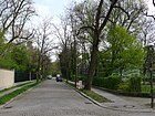
160 | Arthur Nikisch (1855–1922), Hungarian conductor | 1935 | The first name was street G 82 . Nikischstrasse was named on the occasion of the conductor's 80th birthday. |
|
|
Oberhaardter way
( Location ) |
420 | Oberhaardt, wine-growing region in the Palatinate Forest in the state of Rhineland-Palatinate | March 20, 1939 | The previous name was Joseph-Joachim-Straße and was renamed in the course of the eradication of all Jewish street names. The section west of Koenigsallee has been called Gottfried-von-Cramm Weg since December 1, 1983. |

|
|
Paulsborner Strasse
( Location ) |
410 (in the district) |
Paulsborn , farmstead laid out in 1800 and later forester's house on the Grunewaldsee | March 16, 1888 | Parts of the street are in Halensee , Schmargendorf and Wilmersdorf . |

|
|
Rathenauplatz
( Location ) |
50 × 50 | Walther Rathenau (1867–1922), industrialist, writer and politician | Aug 31, 1957 | The square was named on the occasion of the 90th birthday of the Reich Minister who was murdered in 1922. In the middle of the square is Wolf Vostell's sculpture "2 concrete Cadillacs in the form of the naked Maja". |

|
| Regerstrasse
( Location ) |
460 | Max Reger (1873–1916), composer and conductor | Oct 3, 1935 | From October 24, 1922 to October 3, 1935 Mahlerstraße after Gustav Mahler , was renamed in the course of the deletion of all Jewish street names. |

|
| Reinerzstrasse
( Location ) |
300 | Bad Reinerz (today: Duszniki Zdrój ), health resort in Lower Silesia | 1891 | The south side of the street is in Schmargendorf |

|
| Reuterpfad
( Location ) |
170 | Fritz Reuter (1810–1874), poet of the Low German language | Apr 1, 1898 | The street runs between Hubertusbader and Knausstraße to Hagenstraße. |

|
| Richard-Strauss-Strasse
( Location ) |
730 | Richard Strauss (1864–1949), composer | 22 Aug 1953 | From 1902 to 1953 the traffic route was called Jagowstraße . |

|
| Roseneck
( Location ) |
220 (diameter, irregular square shape) |
Rose garden in the turning loop of the former tram terminus | May 16, 1900 | The Roseneck square is located in the north-west of the district on Hohenzollerndamm and does not have its own property with a postal address . On the Roseneck, the Teplitzer Strasse flows from the north and the Hagenstrasse from the northwest. The Rheinbabenallee leads across the Hohenzollerndamm from the square to the southeast, but does not belong to the Roseneck, but to the Betty-Hirsch-Platz in Schmargendorf . The district boundary to Schmargendorf is on the western edge of Teplitzer Strasse along plots 40 and 42 and leads diagonally across Hohenzollerndamm and its southwestern edge (plots 103/104). After that, the open space officially known as Roseneck lies in Grunewald. However, in parlance, the entire open space with the traffic and green areas as far as Schmargendorf is called “Roseneck”. Especially since Roseneck is still used as a destination for the BVG buses . The Roseneck square was always west of the Hohenzollerndamm, but the area mentioned extended between Königsberger and Marienbader Strasse over the Hohenzollerndamm, including the square and Königsmarck- / Hundekehlestrasse. | |
| Rosensteinweg
( Location ) |
270 | Rosa Rosenstein (1907–2005), persecuted by National Socialism | Oct 26, 2012 | The private path starts from Hilde-Ephrain-Weg in the new building area on the railway site and leads to Trabener Straße. |

|
|
Schinkelstrasse
( Location ) |
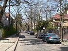
185 | Karl Friedrich Schinkel (1781–1841), Prussian architect and painter | around 1902 | The first name was street G 5 . |
|
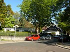
| Schleinitzstrasse
( Location ) |
175 | Gustav von Schleinitz (1820–1888), forest scientist | 1898 | The first name was street G 7 . The street was named on the 10th anniversary of the forest scientist's death. |
|
| Butterfly place
( Location ) |
50 × 30 | Butterflies , the second largest insect order in species | May 30, 1929 | Before it was named, it was A in the Eichkamp settlement . It is located west of the AVUS on Eichkampstraße, Schildhornweg and Neuer Schildhornweg flow here. |

|
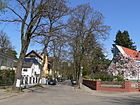
| Schwedlerstrasse
( Location ) |
230 | Wilhelm Schwedler (1823–1894), civil engineer and construction clerk | 1898 | The street runs between Lassenstrasse and Bismarckallee. |
|
| Spohrstrasse
( Location ) |
130 | Louis Spohr (1784–1859), composer, conductor, educator and violinist | Oct 24, 1922 | The first name was street G 85 . |

|
| Road on the Schildhorn
( Location ) |
400 | nearby Schildhorn peninsula | March 2, 1981 | The street goes from the Havelchaussee . |

|
|
Taubertstrasse
( Location ) |
650 | Wilhelm Taubert (1811–1891), pianist and composer | Oct 25, 1933 | From 1904 to 1925 access to the forest service field ; from January 14, 1925 to October 25, 1933 Rathenauallee , was renamed in the course of the deletion of all Jewish and undesirable street names. |

|
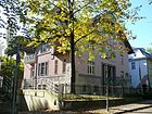
| Taunusstrasse
( Location ) |
230 | Taunus , low mountain range in Hesse and Rhineland-Palatinate | Apr 1, 1898 | The first name was Street 33 . |
|
| Teplitzer Strasse
( Location ) |
530 | Teplice (today: Teplice ), health resort in Northern Bohemia | Apr 1, 1898 | The first name was street S 11 . On July 1, 1967, a small section in the north was removed and included in Hubertusallee. The east side of the street is in Schmargendorf . |

|
|
Teufelsseechaussee
( Location ) |
2040 | nearby Teufelssee | after 1914 | The Teufelsseechaussee is a bicycle road that continues the Teufelseestrasse. There are several parking spaces on the Chaussee, it leads south past the Teufelsberg and leads to the Teufelssee and the local "Ökowerk Teufelssee". |

|
| Toni-Lessler-Strasse
( Location ) |
430 | Toni Lessler (1874–1952), educator | Sep 1 2003 | Toni Lessler ran the private Jewish forest school in Grunewald and emigrated to the USA in 1939 . From 1898 to 1936 the traffic route was called Dunckerstraße after Franz Duncker , from 1936 to 2003 Seebergsteig after Reinhold Seeberg . It was renamed under National Socialism in the course of the eradication of all Jewish and undesirable street names. |

|
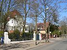
| Trabener Strasse
( Location ) |
1480 | Traben-Trarbach , town on the Moselle in the district of Bernkastel-Wittlich , Rhineland-Palatinate | around 1895 | On January 24, 1898, the northern section was detached and renamed Erdener Straße, while the previous Försterweg was incorporated in the north. The street is located in a settlement area in which some streets were named after wine locations or types of wine. |
|
|
Waldmeisterstraße
( Location ) |
430 | Woodruff , plant | Oct 24, 1922 | The first name was street G 86 . On March 21, 1956, what was then Schumacherplatz was incorporated into Waldmeisterstraße. Part of the street is in Schmargendorf . |

|
| Wallotstrasse
( Location ) |
350 | Paul Wallot (1841–1912), architect ( Reichstag building ) | Apr 1, 1898 | The street runs from Koenigsallee and Caspar-Theyß-Straße to Erdener Straße and back to Koenigsallee. The Wissenschaftskolleg zu Berlin is located here |

|
| Wangenheimstrasse
( Location ) |
680 | Conrad Freiherr von Wangenheim (1849–1926), politician | 1891 | The first name was street G 1 . It led from Schwarzbacher to Warmbrunner Strasse. Due to the construction of the city motorway on March 4, 1960, the northern section was omitted. |

|
| Warmbrunner Strasse
( Location ) |
350 (in the district) |
Bad Warmbrunn (today: Cieplice Śląskie-Zdrój ), health resort at the foot of the Giant Mountains | Jan. 24, 1898 | The previous name between 1898 and 1902 was Wilmersdorfer Straße . Part of the street is in Schmargendorf . |

|
| Werkstättenweg
( Location ) |
475 | Former Reichsbahn repair shop in Grunewald | Nov 4, 1935 | The previous names were Bahnstrasse (around 1890 to 1902) and Bahnhofstrasse (around 1902–1935). |

|
| Werner Street
( Location ) |
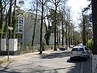
420 | Anton von Werner (1843–1915), painter, art politician | 1898 | The street runs between Bismarckallee and Richard-Strauss-Straße. Until 2008, the villa , built in 1895 by the architect Franz Ahrens as the official building of the community of Grunewald, was used as the Grunewald fire station. Until mid-2009, the building was still used as a rescue station and location for the ambulance and then converted into a residential building. |
|
| Game trail
( Location ) |
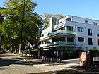
620 | formerly native game here | Oct 24, 1922 | The northwest section was called Parkstrasse from 1910 to 1934 . |
|
| Winkler Street
( Location ) |
600 | Winkel , district of Oestrich-Winkel in the Rheingau-Taunus district in Hesse | from 1898 | The street runs between Wissmannstraße and Am Bahnhof Grunewald. The Jansen house is on Winkler Strasse. |

|
| Wissmannstrasse
( Location ) |
460 | Hermann von Wissmann (1853–1905), Africa explorer , officer and colonial official, governor of German East Africa | from 1898 | The street runs from Erdener Straße and Erbacher Straße to Trabener Straße. |

|
Planned, canceled and renamed streets in Grunewald
Streets of the colony
In the Berlin address book from 1896, “Grunewald, Colonie” is mentioned for the first time with listed residents and streets (marked below with “1896”). Most of the plots are recorded as construction sites, the plot numbering already exists. In 1896 streets with the addition “(go z. Wilmersdorf)” are also included, some of which are listed in the location “Halensee” and are not described in the suburb section “Wilmersdorf with Halensee”, but with the comment “s. Grunewald, Kolonie ”(here with a K ). Specifically, it concerns Bornimerstrasse , Bornstädterstrasse (churchyard of the Colonie Grunewald), Georg Wilhelmstrasse , Henrietten-Platz , Johann Friedrichstrasse , Johann Georgstrasse , Johann Sigismundstrasse , Kronprinzendamm , Kurfürstendamm , Ringbahnstrasse , Westfälischestrasse which later belong to the district Halensee. The location of the streets in Grunewald can also be found on the supplement to the Berlin address book 1893. In the 1899 address book, Grunewald (without the addition of Colonie ) is listed under suburbs and additional entries are added. The mentioned Halenseer Straße can be found under Wilmersdorf with Halensee in the section "Halensee"
The streets that still exist are linked to current entries , explanations of renamed streets can be found in the lower section .
- Auerbachstrasse (1896) with the tram connection, location: Stadtbahn, Douglasstrasse, Fontanestrasse
- Auguste Viktoriastraße : politically belongs to Grunewald, postal to Schmargendorf
- Bettinastrasse (1896): between Winklerstrasse and Fontanestrasse
- Beymestrasse (1896): on No. 3 construction site of the "Parish Col. Grunewald", location: Wernerstr., Johanna-Platz, Herthastr. / Anlagen Herthasee, Delbrückst., Siemensstr., Schwedlerstr., Königs-Allee, also Joachimplatz, Gillstr .
- Bilsestrasse (#): Hagenstrasse and Menzelstrasse
- Bismarck-Allee (#): out of 50 house numbers, 29 houses, two new buildings, two gardens and a nursery are mentioned
- Bismarck-Platz : between Bismarck-Allee and Hubertusallee without land
- Boothstraße (1896): 1, 2, 4, 6 belongs to Halensee, politically to Wilmersdorf, location: Königs-Allee, Hobrechtstr., Gillstr., Kunz-Buntschustr., Caspar Teyssstr., Lynatstr., Paulsbornerstr.,
- Brahmsstrasse (1896): between Jagowstrasse. and Hubertusbaderstr.
- Caspar Theyßstrasse (1896): "see also Schmargendorf", location: Koenigsallee, Joachimplatz, Boothstrasse, district Schmargendorf
- Cronbergerstraße (1896): construction sites, location: Hubertusbaderstr., Taunusstr., Hagnstr., Spandauer Forst
- Dachsberg (1896): No. 5 built on, location: Jagowstr., Hubertusbaderstr.
- Delbrückstraße (1896): mostly construction sites, Königs-Allee, Bismarck-Allee, Jagowstr. District Schmargendorf
- Douglasstraße (1896): construction sites, location: Königs-Allee, Auerbachstr.
- Dunckerstr. (1896): Construction sites, location: Wernerstr., Jagowstr., Hubertusbaderstr.
- Erbacherstraße (1896): Location: Fösterweg, Trabenerstr., Kidneysteinerstr.
- Erdenerstrasse
- Fontanestrasse (1896): four of 23 built-up, location: Auerbachstr., Königs-Allee, Bettinastr., Trabenerstr./Winklerstr.
- Forest service field: Kurmärkerstr., Königs-Allee
- Försterweg (1896): Location: Trabenerstr., Niersteinerstr., Erbacherstr.
- Franzensbaderstraße (1896): “go. z. Schmargendorf ”, location: Spandauerstr., Elgersburgerstr., Reinertzstr., Hubertus-Allee, Hubertusbaderstr. For 1899 only "Restaurant Franzensbad" belongs to Grunewald in terms of postage and to Schmargendorf in terms of politics.
- Friedrichsruherstrasse (1896): “from Königs-Allee to Hobrechtstrasse. belongs to Wilmersdorf ”,“ Reisnerstr. to Spandauer Forst go to Schmargendorf ”. For 1899: go by post to Grunewald, politically to Schmargendorf
- Gillstrasse (1896): Bismarck-Allee, Kunz-Buntschu-Str., Wangenheimstrasse, Boothstrasse.
- Gneiststrasse (1896): Wissmannstrasse, Trabenerstr.
- Hagenstrasse (1896): of the 79 properties, most of them are named as construction sites with owners, 16 residential buildings, two gardens, two new buildings, between Kurmärkerstrasse and Koenigsallee, and on 41 stables.
- Hasensprung (#): "Promenade path from Königsallee to Winklerstraße"
- Herbertstrasse (1896): Königs-Allee, Johanna-Platz, Herthastr., Schleinitzstrasse.
- Herthastrasse (1896): Lynarstrasse, Königs-Allee, Bismarck-Allee, Herbertstrasse, Hubertus-Allee, Schleinitzstrasse.
- Hobrechtstraße (1896): 2–16 (even) belongs to Schmargendorf in terms of postage, and to Wilmersdorf in terms of local politics
- Hubertus-Allee (1896): Joachimplatz, Lynarstr., Herthastr. Wilmersdorferstrasse
- Hubertusbaderstraße (1896): “Hubertus-Allee to Hubertusbaderstr. 7 and from Teplitzerstr. to Franzensbaderstr. belongs to Grunewald in terms of postage and to Schmargendorf in terms of local politics ”. The St. Hubertus, Waldhaus and Waldpark restaurants are built up
- Jagowstrasse (1896): Delbrückstrasse, Siemensstrasse, Beymerstrasse, Dunckerstr., Dachsberg, Knausstrasse, Hagenstrasse.
- Joachim-Platz (1896): Bismarck-Allee / Hubertus-Allee
- Johanna-Platz (1896): Bismarck-Allee / Hebertstr. / Lynarstr. /
- Knausstrasse (1896): Jagowstrasse, Hubertusbaderstr.
- Königs-Allee (1896): No. 1 bowling club house, several new buildings, entrance to the bathing establishment, location: Hobrechtstr., Wallotstr., Lynarstr., Herthastr., Wallotstr., Königs-See, Hasensprung, Fontanstr., Douglasstr. , Hagenstr., Kurmärkerstr., Bismarck-Allee, Siemensstr., Delbrückstr., Herthasee-Park, Herthastr., Lynarstr., Caspar Theysstr., Herbertstr., Schinkelstr.
- Kunz Buntschuhstrasse (1896): Hobrechtstrasse, Gillstrasse, Boothesstrasse, Joachim-Platz, Wangenheimstrasse.
- Kurmäkerstr. (1896): a garden, a house, location: Königs-Allee, Hagenstrasse, Menzelstrasse.
- Lynarstrasse (1896): Königs-Allee, Herthastr., Johanna-Platz, Hubertus-Allee
- Margarethenstrasse
- Menzelstrasse (1896): Hagenstrasse, Sternstrasse, Bilsestr., Taubertstrasse, Knausstrasse, Jagowstrasse, Wernerstr., Kurmärkerstr.
- Kidney Straße (1896): Erbachstr, Ranger way.
- Paulsbornerstrasse (1896): district Schmargendorf, Wangenheimstrasse. Boothstrasse, Wilmersdorfestr.
- Reuterpfad (1896): Hubertusbaderstr., Hagenstr.
- Roseneckstrasse (1896): between Teplitzerstrasse and Hagenstrasse, 1 and 3 construction sites, opposite. Park facilities
- Schinkelstrasse (1896): Property 1, construction site of the steam tram consortium , Königs-Allee, Joachim-Platz
- Schleinitzstrasse (1896): Herbertstrasse, Herthastr.
- Schwedlerstrasse (1896): Siemensstrasse, Bismarck-Allee
- Siemensstrasse (1896): Königs-Allee, Schwedlerstrasse, Bismarck-Allee, Jagowstrasse, Hubertusbaderstr.
- Sternstrasse (1896): Hagenstrasse, Menzelstrasse.
- Taubertstrasse (1896): Hagenstrasse, Menzelstrasse.
- Taunusstraße (1896): Hubertusbaderstr, Cronbergerstr., Teplitzerstr.
- Teplitzerstrasse (1896): “v. Hundekehlestr. to Hubertusbaderstr. go z. Schmargendorf ”, location: Hundekehlestr., Egerstr., Spandauerstr., Hubertusbaderstr., Taunusstr., Roseneckstr., District Schmargendorf
- Trabenerstrasse (1896): Königs-Allee, Wallotstr., Erbacherstr., Gneiststr., Förster-Weg, Winklerstr., Wissmannstr.,
- Wallotstrasse (1896): Königs-Allee, Trabenerstr.
- Wangenheimstraße (1896): Kunz-Buntschustr., Caspar Theysstr., Lynastr., Paulsbornerstr., District Schmargendorf
- Warmbrunnerstrasse
- Wernerstraße (1896): # 3 is the official building of the Kurfürstendamm-Ges. i.Liqu., Location: Bismarck-Allee, Menzelstr., Jagowstr. Dunckerstr., Beymestr.
- Wilmersdorferstrasse (1896): Hubertus-Allee, facilities, Paulsbornerstrasse, Wangenheimstrasse, district Schmargendorf
- Winklerstrasse (1896): Wissmannstrasse, Trabenerstr., Auerbachstrasse, Fontanestr., Bettinastr., Hasensprung
- Wißmannstrasse (1896, with ß): Tabenerstr., Gneiststr., Winklerstr.
Formerly differently named streets
Simple name changes from street category, such as street to path or promenade to street, or spelling changes K instead of C are reserved for the entry in the main list. The street names in the development plan probably had a G in front of the numbering, S for Schmargendorf. The following list is based on the street lexicon of the Luisenstädtischer Bildungsverein.
- Bahnhofstrasse was on the site of the Grunewald train station. In the 1929 address book (administrative district Wilmersdorf> Grunewald with Grunewald = forest [including Eichkamp settlement]) it is given from the passage to Cordesstrasse to the extended Kronprinzendamm. Plots 1–4 and 6–12 are residential buildings for officials, mostly owned by the Deutsche Reichsbahn , only the wooden house No. 5 belongs to the Allgemeine Elektricitäts-Gesellschaft Berlin. Seven parties lived in house 1, three railway officials in 2 and an overnight building in 3 is occupied by the caretaker, canteen attendant and a pensioner, followed by house 4 of the laundry facility. Houses 6-10 and 12 are also inhabited by railway employees, with the respective heads of household being listed individually with their rank / job title. In addition to two apartments, building 11 houses the office of the 10th railway maintenance office.
- Beymestrasse was named after Carl Friedrich von Beyme, a Prussian politician, in 1898 , before it was renamed → Furtwänglerstrasse on February 24, 1955 .
- Boothstraße : From 1890 it was called Straße G 2 . It ran between Kurfürstendamm and Paulsborner Strasse and was named on January 8, 1892 after the arborist John Cornelius Booth , who advised Carstenn on horticultural issues. On February 23, 1900 the name was given as → Humboldtstrasse .
- Dunckerstraße : The street was named in 1898 after the publisher, publicist and politician Franz Duncker . With the " Aryanization of street names" during the Nazi era , Dunckerstrasse was renamed Seebergsteig on April 14, 1936, after the Nazi-friendly theologian .
- Access to the forest service field : Around 1904 the road G 1 , which had existed since 1885, was named in the development plan. The Forstdienstacker in Grunewald was a forest facility that was primarily used as a tree nursery. Furthermore, it was an undeveloped green (fallow) area in the square Koenigsallee – Bismarckallee – Wernerstraße – Menzelstraße through which Rathenauallee was laid on January 14, 1925 (since October 25, 1933 as → Taubertstraße ).
- Hobrechtstrasse : On January 8, 1892, the street was named after the architect and local politician James Hobrecht , who had rendered outstanding services to Berlin's sewage disposal. Due to the construction of the city motorway , Hobrechtstraße was closed on March 21, 1960 as part of the → Storkwinkel road .
- Jagowstraße : In 1902 the street was named after Traugott von Jagow (Police President of Berlin). On August 22, 1953, the name was changed to → Richard-Strauss-Straße .
- Joachimplatz : The street, laid out around 1891, was initially named after the Austro-Hungarian violinist, conductor and composer Joseph Joachim . The name was changed to → Bismarckplatz on January 24, 1898.
- Joseph-Joachim-Strasse : On March 17, 1909, a section of Auerbachstrasse was detached and renamed Joseph-Joachim-Strasse after the Hungarian composer . When the National Socialists removed all Jewish street names as part of the “Aryanization of street names”, the name was changed to → Oberhaardter Weg on March 20, 1939 . On December 1, 1983, the western section was named → Gottfried-von-Cramm-Weg . Incidentally, the extension at the transition from Teplitzer Strasse to Hubertusallee was named Joseph-Joachim-Platz on July 1, 1967 , so that the name of the seventh son of the Jewish wool merchant Joachim is again represented in the district.
- Kronprinzessinnenweg : The oldest part of the street was laid out in 1882 by the Teltow district as a district road. After 1882 it was extended to Charlottenburg. The path ran parallel to the AVUS and the course of the Kronprinzessinnenweg changed, especially with the construction of the automobile road. Between 1918 and 1920 he was included in the Königsweg in Charlottenburg. It still remained in Wilmersdorfer area, but with the change of the district border it also disappeared in Grunewald. The Kronprinzessinnenweg only remained in Wannsee and Nikolassee. In the German Empire there was no female line of succession and thus Crown Princess was the title of the Crown Prince's wife.
- Königsweg : The name for the route from Charlottenburg to Wannsee (and Potsdam ) was given from Charlottenburg. After 1918, the Kronprinzessinnenweg up to the Großer Stern was included in the Königsweg. With the construction of the automobile road and the AVUS, it lost its importance as a traffic route. On July 7, 1936, the northern section in the Eichkamp settlement was named Eichkampstrasse. The southern part from the Auerbach tunnel to the border to Nikolassee along the west side of the motorway is today a forest path that still has the name and with a length of 2320 meters in the road register under 2513 is classified as "STRA" (road construction requirement), but not a municipal road, but is assigned to class "X" according to Okstra .
- Kurmärker Platz : Named after the Kurmark , the territory in the Mark Brandenburg that has been associated with the electoral dignity since 1356 , the square was built on January 30, 1912 when the surroundings were built and the streets were laid out. The square was at the intersection of Menzel, Kurmärker and Hagenstrasse. On September 18, 1934, the name was changed to → Hagenplatz , with Kurmärker Straße being abolished and → included as a street.
- Kurmärker Straße : It was named on April 1, 1898 from the confluence of Menzel and Hagenstraße to Koenigsallee and was built on the east side. The west side was a decorative place, from 1912 as Kurmärker place . The street can still be found today as the east side of → Hagenplatz . On September 18, 1934, a section was incorporated into Hagenstrasse and the northern part merged into Hagenplatz, the intersection of Hagenstrasse / Fontanestrasse and Koenigsallee.
- Mahlerstraße : Before it was named G 83 in the development plan, it was named after Gustav Mahler , the Austrian composer and conductor. With the "Aryanization of street names" during the Nazi era, the name was changed to → Regerstraße on October 3, 1935 .
- Menzelplatz : This square at the eastern end of Menzelstrasse was named on June 15, 1906 after the Berlin painter and illustrator Adolph Menzel . Because the city had had the same name several times since 1920 , it was renamed → Leo-Blech-Platz on July 20, 1959 .
- Parkstraße : The road was laid out in three construction phases between 1902 and 1911 by the commission for the division of the Dahlem domain. Before 1910 it was named after the Messelpark (previously Ruhlandpark). It ran north of Messelpark from Spohrstrasse in Grunewald to Pacelliallee in Dahlem. On April 4, 1934, the north-western section between Spohrstrasse and Hagenstrasse was separated and it was included in the game trail (created October 24, 1922). The remaining part of Parkstrasse was renamed Helfferichstrasse on July 13, 1934 . Since February 6, 1958, this has been called → Bernadottestrasse .
- Rathenauallee : Walther Rathenau, the liberal politician and industrialist, was the victim of an attack. He was named on January 14, 1925 and on October 25, 1933, his name was renamed → Taubertstrasse . Immediately after 1945 there was a proposal to rename Taubertstrasse again after the Senate campaign failed, Rathenau was honored in 1957 with the naming of Rathenauplatz in the street name of the Wilmersdorf administrative district .
- Schumacherplatz : Around 1936 the route planned as street G 88a and street G 88 according to the development plan was laid out and named after the economist Hermann Schumacher . On March 21, 1956, Schumacherplatz was incorporated into the → Waldmeisterstraße , which was named in 1936 .
- Seebergsteig : With the "Aryanization of street names" during the Nazi era, Dunckerstraße was renamed on April 14, 1936. It was named after the theologian Reinhold Seeberg (1859-1935), who had died six months earlier. The new name took place on September 1, 2003 in → Toni-Lessler-Straße . In 1991 an application was made to rename the Seebersteig , as Seeberg was an anti-Semite and a pioneer of National Socialism. Until 2003, however, all attempts had failed either because of the balance of power in the district assembly or because of local residents' lawsuits.
- Siemensstraße : With the expansion of the district, the streets were named in 1898. The entrepreneur and physicist Werner von Siemens (1816–1892) gave this street its name. On April 16, 1937, in order to remove ambiguities from Berlin street names, it was renamed → Lassenstrasse .
- Sternstraße : In 1906 the street was named after the conductor and music teacher Julius Stern (1820–1883). When the National Socialists renamed all streets named after Jews, Sternstrasse was given the name → Klindworthsteig on May 16, 1938 .
- Wilmersdorfer Straße : In the development plan, the route is listed as road G 19 . In the direction from the community of Grunewald via Schmargendorf to Wilmersdorf, it was named after it on January 24, 1898 when the colony was expanded and the roads were laid out. In 1902 it was included as a western section in Warmbrunner Straße .
Dedicated forest roads
With the large forest part of the Grunewald in the district, several forest roads are listed in the Berlin street directory. In addition to these forest paths with the RBS class "STFO", which are recorded in the street directory, there are other named hiking and footpaths in the Grunewald of the district.
- Alte Spandauer Poststraße (5720): with a length of 1320 meters, gave the Postfenn its name and runs from the street Am Postfenn on the southwest edge of Post- and Teufelsfenn to the level of the Schildhornweg on which the Europaweg E 11 is located, the continuation is the Teltower Weg.
- Havelweg (8268) with 930 meters leads south around the Dachsberg between the Havelhöhenweg at the height of the Havel bank and the Havelchaussee, where it connects to the Schildhornweg.
- Schildhornweg (3942): It lies in an east-west orientation with a length of 3710 meters across the Grunewald from the S-Bahn station Grunewald to the Schildhorn peninsula. It crosses the connection road, near the Teufelsfenn the Alte Spandauer Poststrasse and the Havelchaussee.
- New Schildhornweg (124): at 1910 meters, it lies at a distance and an arc to the north, parallel to the Schildhornweg. At the nudist lawn on Teufelssee, it leads from the Grunewald S-Bahn station to Schildhornweg, which takes over the route.
- Connection Schaussee (5642): 2050 meters from the Teufelsseechaussee opposite the Teufelsberg to the south over the Neue Schildhornweg and the Schildhornweg after a bend to the southwest to the "Teltower Weg" near the Dahlemer Feld.
In the 1940 address book, "Grunewald = Forst" is listed separately under the administrative district Wilmersdorf, Grunewald with Grunewald = Forst : Automobil = Verkehrs = u. Exercise Street (Halenseestr. To the district Nikolassee), Birkenplatz (undeveloped, Königsweg to Jagen 58), Forst Grunewald, Havelchaussee (Post Bln.-Charlottenb.9, Kronprinzessinnenweg to the district Charlottenburg), Jagen 85 (Grundst. D. Berl. Frauenvereins), Königsweg (Post Bln.-Zehlendf., Passage to Auerbacher Str. To Großer Stern), Kronprinzessinnenweg ("su Zehlendorf"), Schildhorn (Post Bln.-Charlottenb.9, Havelchaussee and plots 1, 2, 3, 3a, 5) , Teufelsseechaussee (district Charlottenburg, Teufelsseestr., Teufelssee).
Other locations in Grunewald
Allotment gardens
The allotment gardens in the district are included with their status in the allotment garden development plan and are subject to the provisions of the Federal Allotment Garden Act .
- The 'Colony Stellwerk Bahnhof Grunewald' (No. 4215) is a railway farm on the Auerbach tunnel with eleven parcels on 5,087 m², owned by Deutsche Bahn AG .
- The 'Kolonie Hundekehle' is addressed at Auerbacher Straße 23 and there are two forms of ownership. On the one hand, there is an unsecured area with 69 plots on 29,620 m² of private leased land (04091b), which are intended as building land according to the land use plan (FNP), another part (04091a) of the system with 31 plots on 3,573 m² is on state-owned leased land and is secured by the entry in the FNP as fictitious permanent allotment gardens.
- The Auerbach Tunnel Colony (No. 4210) is also addressed at Auerbacher Straße 23 and is located on the Deutsche Bahn AG site. As a result of this ownership structure, these 48 parcels on 15,617 m² are leased by the Railway Agriculture (NLW) and are thus secured.
- The 'Kolonie Grunewald im Jagen 48' is located in the north of the district in the forest. It can be reached via the southern Teufelsseechaussee and is addressed as Connection 14/16. The 379 fictitious permanent allotment gardens on 120,800 m² of land are protected as forest by being shown in the zoning plan.
- The 'BLW Halenseestrasse' (4208) is located with 18 parcels on Halenseestrasse 35 on 4,163 m² of land owned by the railway and is secured by their leasing conditions in the portfolio.
- The 'Colony Trabener Straße' (4209, BLW sub-district Charlottenburg Gruppe Trabener Straße) is located on the premises of Deutsche Bahn AG and has eleven tenants on 3,433 m² in Trabener Straße 91.
Parks, sports and green spaces
- The Grunewald forest gave the district its name;
- Teufelsberg : a mountain of rubble in the west of Berlin, which is dominated by the abandoned monitoring system,
- Ökowerk Teufelssee : a non-governmental information and education center in the former Teufelssee waterworks,
- Karlsberg with Grunewald Tower , the second highest mountain in Berlin's Grunewald,
- Grunewaldsee chain in southwest Berlin in the glacial channel towards the Havel and Spree,
- Schildhorn is a headland in the Havel with the Jaczo monument,
- Adventure center in Grunewald on Goldfinkweg with youth club, youth recreation center of the Scout Association. It is located near the southern district border east of the Grunewaldsee on the Eichhörnchensteg,
- Parks (named in the street directory):
- Halenseepark Grunewald, also Friedenthalpark, is located on the north bank of the Halensee in the corner between the railway area along the extended Trabener Straße and the motorway access to Halenseestraße. The parking area is 26,803 m²,
- Robert-Stolz-Anlage is located west of Hohenzollerndamm / Clayallee on the southern edge of the district behind the Clayallee 1 building on an area of 12,013 m²,
- Sculpture park at Hubertussee: This 9,203 m² park consists of the green area on the south and east banks of the lake. There are entrances at Hubertusstraße and Bismarckbrücke, as well as via the properties Delbrückstraße 6c and 16. The Grunewald primary school is located in the southeast. The Inner Parkring , one of the 20 main green paths , leads through the park .
- Rhoda Erdmann Park at the northern end of the Koenigssee . The 5,283 m² green area is located on the properties Wissmannstrasse 8 and Bismarckallee 37;
- Sports facilities:
- Sports field of the TC Blau-Weiss Berlin in Waldmeisterstraße,
- Tennis facility of the LTTC Rot-Weiß Berlin on Gottfried-von-Cramm-Weg,
- Hubertussportplatz on Hubertusallee;
- former Grunewald marshalling yard and freight yard, there is currently a plan approval procedure [out of date] for further use . The area is located in the northwest of the district, east of the S-Bahn line and the neighboring railway body on both sides of Cordesstraße. In the south there is a golf training facility. The planned area is 10.8 hectares .
See also
literature
- Hans-Jürgen Mende and Kurt Wernicke: Berliner Bezirkslexikon, Charlottenburg-Wilmersdorf . Spiess-Verlag 2004, ISBN 3-7759-0479-4 .
Web links
- Map of Berlin 1: 5000 with district boundaries. Senate Department for Urban Development Berlin, 2009, accessed on November 27, 2010 .
- Street directory Grunewald. kaupert media gmbh, accessed on October 30, 2012 .
- Berlin-Brandenburg Statistics Office: Directory of streets and squares in the Charlottenburg-Wilmersdorf district (as of February 2015); pdf
- Lexicon: Charlottenburg-Wilmersdorf from A to Z - streets
- Hermann Jansen: Development plan Grunewald, Berlin
Individual evidence
- ↑ a b FIS broker map display map of Berlin 1: 5000 (K5 color edition). Soldner coordinates: Y = 16723 X = 16575
- ↑ a b 6. Grunewald (Teltow district) . In: Address book for Berlin and its suburbs , 1899, Theil V ..
- ↑ Renaming of Auerbacher Straße to Auerbachstraße Press release of the district office of Charlottenburg-Wilmersdorf from March 12, 2013
- ↑ Andreas Conrad: The honor returned. In: Der Tagesspiegel , March 24, 2013, accessed on March 27, 2013 .
- ↑ The tree nursery owner John Cornelius Booth , who was also the namesake of a street in Lichterfelde , had increasingly campaigned for the cultivation of this foreign tree species. Booth was a co-founder of the Grunewald villa colony
- ^ Embassy of Kuwait website
- ↑ Press release from the Charlottenburg-Wilmersdorf district on the inauguration of the street
- ^ M. [Max] H. [Hesdörffer]: John Booth (obituary). In: The Garden World , XII. Vol., Paul Parey , Berlin 1908, p. 251
- ↑ Wilmersdorf 1954 on Pharus city map Berlin large edition . Pharus-Plan-Verlag in Treuhand / Berlin N54 / Schwedter Straße 263 ( Memento from March 17, 2015 in the web archive archive.today )
- ↑ Karmielplatz. In: berlin.de. Retrieved June 22, 2018 .
- ↑ Official Journal for Berlin, publisher: Landesverwaltungsamt Berlin, 65th year, No. 26 of June 26, 2015, ISSN 0943-9064 , p. 1368
- ↑ Kauperts: Royal Route
- ↑ Margarethenstrasse . In: Address book for Berlin and its suburbs , 1897, address book for Berlin and its suburbs> 6. Grunewald, p. 90 (Margarethenstr. 2–5, owner Bräuer, C., Baumstr.).
- ↑ Walk through the neighborhood on November 13, 2004. Retrieved March 28, 2010 .
- ↑ Pharus city map Berlin large edition: Grunewald around 1954 ( Memento from June 2, 2014 in the web archive archive.today )
- ↑ Berlin with sector borders, Richard Schwarz Nachf., Grunewald around 1960 ( Memento from June 2, 2014 in the web archive archive.today )
- ↑ Large Berlin city map, Verlag Richard Schwarz Nachf. / Berlin W 30: Grunewald around 1961
- ^ Kauperts: Trabener Strasse
- ^ Hermann Jansen: House Jansen, Berlin-Grunewald
- ^ New address book for Berlin and its suburbs 1896> V. Suburbs of Berlin> 6. Grunewald, Colonie . In: New address book for Berlin and its suburbs , 1896, V. Theil.
- ↑ a b Schmargendorf 1893 on a supplement to the Berlin address book 1893 . Verlag Julius Straube ( Memento from March 17, 2015 in the web archive archive.today )
- ^ Halensee under the suburb of Wilmersdorf with Halensee . In: Address book for Berlin and its suburbs , 1899, V. Theil, p. 252. “Boothstr., Bornimerstr. Bornstädterstr., Friedrichsruherstr., And the others ”(some of the streets are also named for the suburb of Grunewald:“ go postal. Z. Grunewald, polit. Z. Wilmersdorf ”).
- ^ Street lexicon Wilmersdorf: Grunewald
- ↑ Bahnhofstrasse . In: Berliner Adreßbuch , 1929. "belongs to the administrative and manor district Grunewald = forest".
- ↑ Grunewald around 1921: Pharus Plan Berlin (large edition with suburbs) . Pharus Verlag GmbH / Berlin SW 68 / Linden-Strasse 3 ( Memento from March 17, 2015 in the web archive archive.today )
- ↑ Schmargendorf around 1926: Sanwald Plan Berlin . Verlag Karl Sanwald / Pasing in front of Munich ( Memento from March 17, 2015 in the web archive archive.today )
- ↑ on the person of Jagow
- ↑ Grunewald around 1926 on the Berlin Sanwald Plan. Verlag Karl Sanwald / Pasing in front of Munich. ( Memento from March 16, 2015 in the web archive archive.today )
- ↑ Grunewald in January 1946 on a city map of Berlin. Verlag Richard Schwarz, Landkartenhandlung u. Geogr. Verlag, Berlin W.35 ( Memento from March 17, 2015 in the web archive archive.today )
- ↑ Grunewald Forest . In: Berliner Adreßbuch , 1940, Part IV, p. 1297. “Information on the forest”.
- ↑ under Forst Grunwald are listed: Stadtforstamt, Workers' Residence, Schildhorn Cemetery, Bahnhaus No. 3, Grunewald Forst Cemetery, Bahnhaus No. 4, Bahnhaus No. 5, Forsthaus Dachsberg, Stadt-Revierförsterei Eichkamp, Forsthaus Saubucht, Hunting Lodge Grunewald with Schutzpolizei Reitstaffel -Depot Grunewald, Restaurant Paulsborn, Mädchenkl.Waldidyll, playgrounds of the Hitler Youth, Hitler Youth sports field in hunting 60.61, playgrounds of the Berl. Turngaue, forester's house
- ↑ stadtentwicklung.berlin.de: allotments
- ↑ Allotment gardens in the Charlottenburg-Wilmersdorf district ( Memento of the original from September 29, 2013 in the Internet Archive ) Info: The archive link has been inserted automatically and has not yet been checked. Please check the original and archive link according to the instructions and then remove this notice.
- ↑ fictitious: allotment gardens that were not subject to the Federal Allotment Garden Act when they were created, but are to be treated like federal allotment gardens .
- ^ Name of the Rhoda Erdmann Park. In: press release. District Office Charlottenburg-Wilmersdorf, October 11, 2012, accessed on August 25, 2014 .


