List of streets and squares in Berlin-Lankwitz

The list of streets and squares in Berlin-Lankwitz describes the street system in the Berlin district of Lankwitz with the corresponding historical references. At the same time, this compilation is part of the lists of all Berlin streets and places .
overview
Lankwitz has 43,566 inhabitants (as of December 30, 2019) and includes the postcode areas 12157, 12161, 12163, 12165, 12167, 12169, 12203, 12247, 12249, 14195 and 14197.
The public road network in the entire Steglitz-Zehlendorf district (including all seven districts) measures 635.4 kilometers. This means that the district has the largest road system in the capital, ahead of Treptow-Köpenick (628.1 km) and Pankow (604.7 km). The total length of the 141 officially dedicated streets in the district is 64.8 kilometers, with 22 streets only partially belonging to the district. In particular, in the Hildburghauser , Zerbster , Luisenstraße and northwest of the Anhalter Bahn on Gärtnerstraße , the district boundary runs (with the entire width of the street belonging to Lichterfelde ) and only the properties on the eastern edge of the road are in Lankwitz. Lankwitz has a main road network that is particularly busy in the north-south direction. Federal roads and motorways are accessible in the neighboring districts.
“For a long time Lankwitz was an unknown place for Berliners and even more so for strangers. […] In addition to paths and drifts, the Lankwitz area comprises 2,495 acres , 22 square rods of arable land and 72 acres of 177 square rods of meadows. [...] The path from Mühlenstraße to the New Gardens, the path through the Uppstall, the green path, the Viktoriastraße, the path to the drinking trough and sheep's wash were laid out as drifts. [...] The seven bridges over Bäke , Lanke and Graben "
The settlement of Lankwitz, starting from the Prussian capital, proceeded from north to south. Between 1869 and 1872, the merchant Felix Rosenthal acquired from the Lankwitz farmers Zietemann and Mertens a plot of 240 acres west of the Anhalter Bahn at a price of 180,000 marks . This land was surveyed and in the northwest between Calandrelli- and Kaulbachstraße lying roads for a villa created district. The streets that were later established in this area and named after composers gave the neighborhood the name “composers' quarter”. In 1891 the country roads to Steglitz, Mariendorf and Marienfelde were paved halfway across and planted with fruit trees.
By 1900, further streets were laid out around the settlement core and streets were named, both around the Lankwitz train station and around the actual town center. The populated areas of the (" Carstennschen Siedlung ") and a number of new streets from Lichterfelde were added. Already in 1877 there had been a more advanced suburb formation than Lankwitz through the merger as "Groß-Lichterfelde". Local figures and people from the imperial family were chosen for the names of these streets. In addition to the Rosenthal grounds west of the Anhalter Bahn (composers' quarter), streets were built on the Zietemann grounds. Further colonization took place in Lankwitz Süd ("Thuringian Quarter") by Georg Knaack and from 1901 south of the Königsgraben adjacent to Marienfelde, as well as around the old village with mostly stately manor houses of the long-established farming families around the Dorfaue (Alt-Lankwitz). The land south of the Königsgraben ("the Auken") was bought by Marienfeld farmers, from whom the gunsmith Knaak from Berlin bought it a few years later and laid out the Lankwitz-Süd. In 1912, many of the mostly newly laid streets were named and made public . In the south of Lankwitz (across to Lichterfelde) places in Thuringia were eponymous, at the same time in the northeast of Lankwitz wine-growing places served as models for street names. These (predominantly) own home neighborhoods are referred to by residents as “Thuringian Quarter” and “Weinviertel”; the last name is also a model for the allotment gardens located there. From the naming campaign of 1917 (when Lankwitz was still a suburb) it can be concluded that the southern area was expanded particularly intensively. The choice of “Thuringian” place names is not to be understood in relation to the existing Free State of Thuringia , so places in the Fichtelgebirge and other neighboring areas are among the namesake of the streets. Lankwitz was particularly affected when, after 1920, duplications of street names had to be eliminated by forming Greater Berlin from independent municipalities.
The “Generalsviertel” is based on the selection of generals from Prussian history and the Imperial Army for streets. This tradition began in 1884 with Seydlitzstraße , in 1894 when Zietemannstraße, named after the Lankwitz farmer and previous landowner, became Zietenstraße and continued in this area in 1915 and 1925, especially in 1936 and 1937 with the selection of names after successful generals from the First World War continued.
Smaller settlement units are the streets named after reformers or people of the Reformation, such as the Boraweg , on the premises of the “non-profit public limited company for salaried homes”. It should be noted streets, after participants of the Schillschen Jäger in the war of liberation against the French, all these fighters were arrested in Wesel in 1809 by the Napoleonic troops and were executed for land robbery .
As a result of building densification, several streets were named again in the 1960s (especially in July 1960). The most recently dedicated street (2012 [obsolete] ), a ring street that surrounds the Dessauerstraße with new buildings, is named in 2002 after Rudolf Beyendorff, the mayor from 1908 to 1918.
Overview of streets and squares
The following table gives an overview of the streets and squares in the district as well as some related information.
- Name / location : current name of the street or square. Via the link Location , the street or the square can be displayed on various map services. The geoposition indicates the approximate center of the street length.
- Traffic routes not listed in the official street directory are marked with * .
- Former or no longer valid street names are in italics . A separate list may be available for important former streets or historical street names.
-
Length / dimensions in meters:
The length information contained in the overview are rounded overview values that were determined in Google Earth using the local scale. They are used for comparison purposes and, if official values are known, are exchanged and marked separately.
For squares, the dimensions are given in the form a × b for rectangular systems and for (approximately) triangular systems as a × b × c with a as the longest side.
If the street continues into neighboring districts, the addition ' in the district ' indicates how long the street section within the district of this article is. - Name origin : origin or reference of the name.
- Notes : further information on adjacent monuments or institutions, the history of the street and historical names.
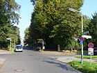
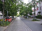
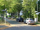
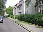
- Image : Photo of the street or an adjacent object.
| Name / location | Length / dimensions (in meters) |
Origin of name | Date of designation | Remarks | image |
|---|---|---|---|---|---|
|
Alsheimer Strasse
( Location ) |
160 | Alsheim , wine town near Alzey in Rhineland-Palatinate | Oct. 24, 1912 | It was set up as street 7 of the development plan. The street is located between Bruchwitzstraße and Edenkobener Weg, here as a dead-end street , named after the surrounding street names as Weinviertel. |

|
| Altenburger Strasse
( Location ) |
280 | Altenburg , district town in Thuringia | Aug 20, 1917 | It was set up as street 34b of the development plan. The street lies between Trippsteinstraße and Wasunger Weg (Thuringian Quarter). |

|
| Alt-Lankwitz
( Location ) |
1130 | The old village center | Apr 4, 1934 | The street was formed from the Dorfstraße , also the main street , including the Mariendorfer Straße leading to Mariendorf (neighboring town) . Alt-Lankwitz lies between Kaiser-Wilhelm-Straße and Bischofsgrüner Weg. |

|
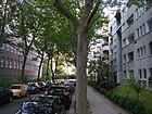
| At the Elsenbruch
( Location ) |
130 | Elsenbruch, formerly located here broken , probably by the Teltow Canal has been eliminated | March 9, 1925 | Set up as street 65d , it is located between Siemensstrasse and Teltowkanalstrasse. |
|
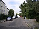
| At the community park
( Location ) |
520 | Lankwitz community park | 1919 | It is located at the Lankwitz community park (laid out around 1900) between Gallwitzallee and Eiswaldtstrasse. From 1911 it was called Am Beyendorffpark and received this name again from 1933 to 1939. On November 1, 1961, the road 513 was included. |
|
| Amalienstraße
( Location ) |
160 | Princess Anna Amalie of Prussia (1723–1787) | before 1878 | It lies between Kaiser-Wilhelmstrasse and Charlottenstrasse. |

|
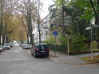
| Annastrasse
( Location ) |
160 | Anna of Prussia (1576–1625) , Princess of Prussia and by marriage Electress of Brandenburg | before 1894 | It is located between Elisabeth- and Kaiser-Wilhelm-Straße, but not through to this one. |
|
| Apoldaer Strasse
( Location ) |
580 | Apolda , middle town in Thuringia | Aug 28, 1917 | It was established as street 37a of the development plan. The street lies between Geraer and Trippsteinstraße. |

|
| Arnstädter Strasse
( Location ) |
320 | Arnstadt , middle town in Thuringia | Aug 20, 1917 | Set up as Straße 34a , it is located between Apoldaer and Hildburghauser Straße. |

|
|
Barbarastrasse
( Location ) |
260 | Barbara , female first name | May 18, 1918 | As street 17b of the development plan was established on June 13, 1930, part of street 17f was included, now it is a one-way street between Ingridpfad and Dillgesstraße. |

|
| Beethovenstrasse
( Location ) |
860 | Ludwig van Beethoven (1770–1827), composer | before 1894 | It is located in a villa colony between Bruno-Walter- and Calandrellistraße in the composer's quarter. |

|
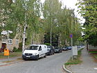
| Bellingstrasse
( Location ) |
320 | Wilhelm Sebastian von Belling (1719–1779), Prussian hussar general | Nov 12, 1925 | Set up as Straße 7 , it is located between Retzoldtstraße and Gallwitzallee. Because of the allotment garden colonies in between, the branch on Kurfürstenstrasse was renamed Goldaper Strasse on October 1, 1977 . |
|
| Belßstrasse
( Location ) |
920 (in the district) |
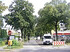
Frank Belß (1841–1919), community leader in Marienfelde | July 31, 1947 | It lies between Malteser Strasse and Friedrichrodaer Strasse, the eastern part up to Marienfelder Allee is in Marienfelde . This part of the street was called Bismarckstrasse before 1912 until July 13, 1934 . Since the beginning of the 1930s, the Mariengarten residential complex has been adjacent to this . |
|
| Bernecker way
( Location ) |
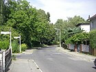
460 | Berneck , town in the Fichtel Mountains, Bavaria | Apr 4, 1934 | It was set up as street 80 of the development plan. The street lies between Holenbrunner Weg and Alt-Lankwitz. |
|
|
Bernkastler Platz
( Location ) |
200 × 180 × 90 | Bernkastel-Kues , wine town in Rhineland-Palatinate | Oct. 24, 1912 | The square, called “Rosengarten”, was set up as square A – B on road 8 according to the development plan . It is located on Bernkastler Strasse between Leonorenstrasse and Bruchwitzstrasse up to the embankment of the Anhalter suburban railway . |

|
| Bernkastler Street
( Location ) |
390 | Bernkastel-Kues , wine town in Rhineland-Palatinate | Oct. 24, 1912 | Set up as Straße 8 , it is located between Leonorenstraße and the Weinviertel garden colony. |

|
| Beselerstrasse
( Location ) |
180 | Hans von Beseler (1850–1921), Prussian general | June 20, 1915 | Created as Hausenstrasse since 1914 , it was renamed in 1915 and is located between Am Gemeindepark and Eiswaldtstrasse in the Generalsviertel. |

|
| Birkbuschstrasse
( Location ) |
270 (in the district) |
Birkbusch, Vorwerk and sheep farm to Gut Steglitz | 1878 | The connecting road to the Vorwerk already had the name, it is located in the district between Siemensstrasse and Teltow Canal and continues in Steglitz . |

|
| Bischofsgrüner Weg
( Location ) |
670 | Bischofsgrün , municipality in the Fichtel Mountains, Bavaria | Aug 25, 1939 | In 1939 part of the Lankwitzer Ring was renamed. It lies between Alt-Lankwitz and Wunsiedler Weg. |

|
| Blankenhainer Street
( Location ) |
220 | Blankenhain , city near Weimar in Thuringia | Jan. 2, 1912 | Set up as Straße 38 , it is located between Trippstein and Tambacher Straße. |

|
| Boraweg
( Location ) |
100 | Katharina von Bora (1499–1552), wife of Martin Luther | Aug 18, 1926 | It was established as street 13b in the development plan. The street is between Gallwitzallee and Mühlenstraße. |

|
| Brieger Strasse
( Location ) |
230 | Brieg , Lower Silesian district town of the Opolskie Voivodeship in Poland | June 1, 1964 | Set up as Straße 514 , it is located between Wedellstraße and Halbauer Weg. |

|
| Brigittenstrasse
( Location ) |
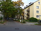
360 | Brigitte , female first name | July 20, 1960 | Already existing as Sedanstrasse before 1894 , it is located between Charlottenstrasse and Elisabethstrasse. |
|
| Brotteroder Straße
( Location ) |
500 | Brotterode , city in Thuringia | Jan. 2, 1912 | It was set up as street 37 in the development plan. The street lies between Tambacher and Trippsteinstraße. |

|
| Bruchwitzstrasse
( Location ) |
380 | August Bruchwitz (1838–1914), community leader in Lankwitz from 1891 | March 23, 1907 | The street 10 was included in the extension of the street on January 2, 1912. It lies between Alsheimer and Mühlenstraße. 1955–1958 the West Prussia settlement was built on Bruchwitzstrasse. In 1930, 89 apartments for small and medium-sized post office workers with 1, 1½, 2 and 2½ room apartments and a central washing facility were built in the Bruchwitzstraße, Mühlenstraße and Lutherstraße district. In addition, this settlement was given green spaces in the courtyard and a sandpit for small children, which was also not a matter of course at the time. |

|
| Brucknerstrasse
( Location ) |
650 | Anton Bruckner (1824–1896), Austrian composer | Dec 3, 1937 | The streets of Lessingstrasse and Gluckstrasse were renamed together in 1937. The street lies between Siemensstrasse and Kaulbachstrasse, over this it continues as a cul-de-sac to the railway embankment . |

|
| Bruno-Walter-Strasse
( Location ) |
130 (in the district) |
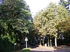
Bruno Walter (1876–1962), German-Austrian conductor, pianist and composer | Sep 15 1966 | When the name was given, the streets of Lankwitzer Blumenstrasse and Lichterfelder Gartenstrasse were combined. In Lankwitz, the eastern section is along the railway line to Beethovenstraße. |
|
|
Calandrellistrasse
( Location ) |
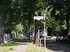
1020 | Alexander Calandrelli (1834–1903), sculptor of Italian descent | before 1878 | The street is in the Rosenthalschen villa colony between Gärtnerstrasse and Leonorenstrasse. At the corner of Gärtnerstrasse is the monument of the Correns mansion, now known as the Siemensvilla, with a residential building, concert hall, gatehouse, gardener's house, garage, tea pavilion and enclosure. The park of the Siemensvilla from the years 1913–1916 is registered as a garden monument. |
|
| Cecilienstraße
( Location ) |
140 | Cecilie Auguste Marie Duchess of Mecklenburg-Schwerin (1886–1954), last Crown Princess of the German Empire | before 1906 | Cecilienstraße was officially named on December 15, 1906 and lies between Kaiser-Wilhelm- and Elisabethstraße. |

|
| Charlottenstrasse
( Location ) |
1030 | Princess Friederike Luise Charlotte Wilhelmine (1798–1860) became Tsarina of Russia by marriage | before 1894 | The street is between Amalienstrasse and Leonorenstrasse. At the corner of Charlottenstrasse and Elisabethstrasse at the former Lichterfelde Ost freight yard, there is a council scale , formerly a public scale for horse-drawn carriages, later for trucks and their loads. |

|
| Corneliusstrasse
( Location ) |
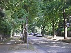
630 | Peter Cornelius (1824–1874), composer | before 1894 | The street is in the composers' quarter between Mozartstrasse and Leonorenstrasse. |
|
|
Derfflingerstrasse
( Location ) |
480 | Georg von Derfflinger (1606–1695), Field Marshal General for the Elector of Brandenburg | before 1894 | The street lies between Jägerstrasse and Seydlitzstrasse. It was laid out as Prinz-Heinrich-Strasse as early as 1870 . |

|
| Dessauerstrasse
( Location ) |
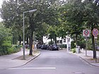
800 | the old Dessauer (1693–1747) Leopold I, Prince of Anhalt-Dessau | before 1894 | The street lies between Lange Straße and Gallwitzallee. The dead-end street opposite Retzowstraße is also called Dessauerstraße. In 1903 an animal sanctuary was opened here. |
|
| Dillgesstrasse
( Location ) |
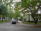
600 | Friedrich Dillges (1852–1912), between 1895 and 1908 mayor of Lankwitz | Dec 15, 1911 | Set up as Straße 16 , it is located between Charlottenstraße and Havensteinstraße. |
|
| Dittersbacher way
( Location ) |
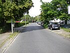
160 | Dittersbach , part of the Lower Silesian district town Waldenburg in Poland | July 24, 1954 | It lies between Alt-Lankwitz and Kamenzer Damm. The road was built in the 1950s and continued south into the 1960s, along the current border between allotment gardens and industrial park. |
|
| Döhlau path
( Location ) |
140 | Döhlau , municipality in the Bavarian Vogtland | Apr 4, 1934 | Set up as road 78a , it goes west of Schneebergstraße as a dead end . At the end there is a passage for pedestrians to the Alt-Lankwitz street. To the north is a playground built in 2011, against whose operation some residents have brought a lawsuit in court. |

|
| Dürkheimer Strasse
( Location ) |
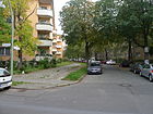
230 | Bad Dürkheim , district town and health resort in Rhineland-Palatinate | Oct. 24, 1912 | Set up as Straße 8a , it is a dead end north of Bruchwitzstraße which ends at KGA Weinviertel. |
|
|
Edenkoben way
( Location ) |
600 | Edenkoben , town and climatic health resort on the southern wine route, Rhineland-Palatinate | Dec 13, 1934 | It lies between Alt-Lankwitz and the Teltow Canal, which belongs to Lankwitz up to the north bank. The road ends as a spur road but can connect as a footpath and bike path through the subsequent Edenkobener Steig to Steglitz . Already before 1894 the Steglitzer Straße ran here as a connection between Lankwitz and Steglitz, which was interrupted when the canal was built. |

|
| Eiswaldtstrasse
( Location ) |
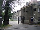
560 | Rudolf Eiswaldt (1839–1905), major general barracked in Lankwitz | Oct. 20, 1932 | From 1914 to 1932 it was called Hindenburgstrasse between Gallwitzallee and Malteserstrasse. |
|
| Elisabethstrasse
( Location ) |
690 | Elisabeth Ludovika of Bavaria (1801–1873), Queen of Prussia, wife of Friedrich Wilhelm IV. | before 1894 | It is located between Dillgesstraße and Amalien- / Charlottenstraße. At the corner of Charlottenstrasse and Elisabethstrasse at the former Lichterfelde Ost freight yard, there is a council scale , formerly a public scale for horse-drawn carriages, later for trucks and their loads. |

|
| Emmichstrasse
( Location ) |
380 | Otto von Emmich (1848–1915), general of the infantry | Oct. 20, 1914 | It is located between Malteserstraße and Maerckerweg in the “Generalsviertel”, it ends in the east as a cul-de-sac at the green corridor of the Hospitalgraben and borders the northern edge of the Lankwitz campus of the FU. |

|
|
Falkenhausenweg
( Location ) |
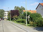
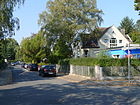
790 | Ludwig von Falkenhausen (1844–1936), general in the First World War | March 11, 1937 | Set up as Straße 32 , it is located between Hanielweg and Friedrichrodaer Straße. In the beginning, semi-detached houses and rows of terraced houses of four or six houses were built in a regular arrangement, each with one to three storeys. In the 1960s, the top floors of many houses were expanded to increase the living space. |
|
| Felgentreustraße
( Location ) |
360 | Friedrich Wilhelm Felgentreu (1786–1809), Prussian officer, member of the Schillschen Jäger | May 3, 1935 | Established as road 61b , its extension on August 8, 1935 was included. It lies between Friedrichrodaer and Wichurastraße. |
|
| Frankenhauser Strasse
( Location ) |
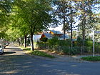
500 | Bad Frankenhausen / Kyffhäuser , spa and recreation town in Thuringia | Jan. 2, 1912 | Set up as Strasse 36 , it is located between Trippsteinstrasse and Tambacher Strasse. It is a quiet residential street with single and multi-family houses built with several green areas and playgrounds. At the eastern end of the street is the Kreuzfriedhof, which is accessible via a turnstile. In a southerly direction, a footpath leads across a playground to Hildburghauser Straße. |
|
| Frankentaler Ufer
( Location ) |
270 | Frankenthal (Pfalz) , independent city in Rhineland-Palatinate | Oct. 24, 1912 | Set up as Straße 11 , it is located between Kaiser-Wilhelm- and Gernsheimer Straße along the Teltow Canal. |

|
| Franzstrasse
( Location ) |
260 | Robert Franz (1815–1892), composer in Halle / Saale | before 1894 | It is located in the composer's quarter between Gärtnerstrasse and Beethovenstrasse. |

|
| Freymüllerweg
( Location ) |
380 | Fritz Freymüller (1882–1950), architect and councilor for community development | May 15, 1997 | It is a narrow cul-de-sac ( traffic-calmed area and 30 km / h zone ) from Wunsiedeler Weg to the east to the embankment of the Dresden Railway , with a ring to the north. The four Upstall ponds are located on lots 10–16 (straight). The upstall of the Lankwitz community was located here . The former KGA Upstall has been dissolved. |

|
| Friedrichrodaer Strasse
( Location ) |
1320 (partly without south side) |
Friedrichroda , town near Gotha in Thuringia | Oct. 20, 1932 | On October 1, 1963, the part of Kiepertstrasse belonging to the district between Malteserstrasse and Friedrichrodaer Strasse was included. The street lies between Keffenbrinkweg and Malteserstraße, it partially forms the border to Mariendorf , so that Mariendorfer properties belong to it. Part of the Kämpfegraben runs along the eastern side of the street with loose single and multi-family houses. |

|
| Frobenstrasse
( Location ) |
1030 | Emanuel Froben (1640–1675), Brandenburg stable master and | 1894 | After 1871 the street was set up as Kaiser-Wilhelm-Straße . The street lies between Parallelstraße and Gallwitzallee. The Pestalozzistift was built in the street in 1905 and completed in 1908. |

|
|
Gabainstrasse
( Location ) |
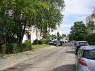
260 | Konstantin Johann Wilhelm Gabain (1786–1809), Prussian officer, member of the Schillschen Jäger | Apr 14, 1936 | The extension to Halbauer Weg on June 1, 1964 was included as road 69b . The street lies between Wedellstrasse and Halbauer Weg. |
|
| Gallwitzallee
( Location ) |
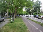
1500 | Max von Gallwitz (1852–1937), General | Aug 6, 1937 | Already leading through Lankwitz as Green Way before 1878 , the street was named in 1937 like others in the area after “heroes” of the First World War . It is located between Paul-Schneider-Strasse (Lankwitz Church) and Blankenhainer Strasse, adjoining Tautenburger Strasse. The former anti-aircraft barracks, which later housed the central bakery shop, were located on Gallwitzallee . |
|
|
Gartnerstrasse
( Location ) |
680 (east side only) |
Reference to the gardens previously located here | Sep 15 1879 | The west side of the street between Siemensstrasse and Franzstrasse lies on the Lichterfeld area, but all of the eastern properties belong to Lankwitz. On the corner of Calandrellistraße is the Correns Manor House (Siemensvilla) with a residential building, concert hall, gatehouse, gardener's house, garage, tea pavilion and enclosure. The park of the Siemensvilla from the years 1913–1916 is registered as a garden monument. |

|
| Geraer Strasse
( Location ) |
530 (in the district) |
Gera , big city in Thuringia | Aug 28, 1917 | Established as street 37b , it lies between Trippsteinstraße and the suburbs on Zerbster Straße, in Lichterfelde it leads to Hildburghauser Straße. After 1925, part of the previously planned Lankwitzer Königspromenade between Zietenstrasse and the district boundary was named in Geraer Strasse but still only included in the development plan. In 1934 the road was laid out and its extension, the Lichterfelder Grenzstraße, was included on July 13, 1934. On May 1, 1963, part of the Sonneberger Weg, which formed the extension of the Geraer to Hildburghauser Strasse, was included. |

|
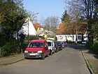
| Gernsheimer Strasse
( Location ) |
260 | Gernsheim , town in the district of Groß-Gerau in Hesse | Oct. 24, 1912 | Set up as street 11a , it is located between Graacher Straße and Edenkobener Weg |
|
| Gluckweg
( Location ) |
470 | Christoph Willibald Gluck (1714–1787), composer | Dec 3, 1937 | Introduced in 1911 as Gluckstrasse , after development in 1937 it was downgraded to the path. It is between Nicolaistrasse and Beethovenstrasse. | |
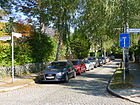
| Goldaper Street
( Location ) |
200 | Goldap , district town in Warmia-Masuria, formerly East Prussia in Poland | Oct 1, 1977 | The smaller part of the Bellingstrasse, which consisted of parts, was renamed in 1977. It is located between Kurfürstenstrasse and the KGA "Tierheim". |
|
| Goldmühler way
( Location ) |
180 | Goldmühl , district of Bad Berneck in Bavaria | Apr 4, 1934 | Set up as street 72 , it lies between Bernecker and Wunsiedeler Weg. |

|
| Graacher Strasse
( Location ) |
200 | Graach an der Mosel , wine-growing place in the Moselle valley in Rhineland-Palatinate | Oct. 24, 1912 | Established as street 11b , it is located between Edenkobener Weg and Gernsheimer Straße. |

|
| Gräfentaler Strasse
( Location ) |
240 | Graefenthal , small town in Thuringia | July 13, 1934 | Set up as street 39b , it lies between Apoldaer and Zerbster Straße, whereby it is a cul-de-sac from Langensalzaer Straße that continues as a footpath. |

|
|
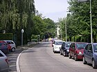
Half way
( Location ) |
420 | Halbau , place in Lower Silesia, Poland | July 24, 1954 | Set up as Straße 501 , it lies between Alt-Lankwitz and Briegerstraße, over which it continues as a dead end . On June 1, 1964, the road 515 was included as an extension of the Halbauer Weg, so it runs on both sides of the Kamenzer Damm. The quiet residential street was not built until the 1960s, which can be clearly seen in the development. |
|
| Hanielweg
( Location ) |
210 (in the district) |
Franz Haniel (1779–1868), social entrepreneur | March 11, 1937 | The street 143 (Marienfelde) was named that way on August 4, 1930. The Lankwitzer Straße 68a between Friedrichrodaer (district boundary) and Pappritzstraße was included on March 11, 1937, so the entire street lies between Marienfelder Allee and Pappritzstraße. |

|
| Hanna-Renate-Laurien-Platz
( Location ) |
Hanna-Renate Laurien (1928–2010), CDU politician | February 16, 2016 | The forecourt of the Lankwitz town hall at Leonorenstraße 70 was nameless before it was named. Hanna-Renate Laurien was President of the Berlin House of Representatives from 1991 to 1995. The official inauguration took place on April 14, 2016. |

|
|
| Havensteinstrasse
( Location ) |
440 | Rudolf Havenstein (1857–1923), lawyer, President of the Reichsbank | May 22, 1915 | Set up as Straße 17 , it is located between Gallwitzallee and Seydlitzstraße. The multi-family residential building on Havensteinstrasse from 1929–1930 was designed by Otto Rudolf Salvisberg (1882–1940) a Swiss architect. |

|
| Haynauer Strasse
( Location ) |
800 | Haynau , town in Lower Silesia, Poland | July 20, 1960 | It is between Belßstrasse and Kamenzer Damm. On August 13, 1976, roads 517 , 518 and 519 were included as spur roads in the industrial park to the north. |

|
| Hildburghauser Strasse
( Location ) |
500 (only north side, partially) |
Hildburghausen , district town in Thuringia | Aug 20, 1917 | Only the plots 74-100 on the north side belong to Lankwitz, although the street in Lankwitz (Thuringian quarter) was laid out as early as 1917. In 1933 Marienfelder Strasse in Lichterfelde and Lichterfelder Strasse in Mariendorf were included, and on August 1, 1965, part of the Lichterfelder Ring was added. |

|
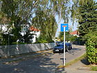
| Hirzbacher way
( Location ) |
150 | Hirzbach , district of Leutenberg in Thuringia | Oct 19, 1934 | Set up as Straße 9 , it is a dead end from Geraer Straße to the north . |
|
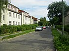
| Hohenbornweg
( Location ) |
240 | Adolf Wild von Hohenborn (1860–1925), Minister of War in the First World War | March 11, 1937 | Set up as Straße 34 , it is located between Friedrichrodaer and Pappritzstraße. |
|
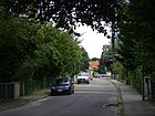
| Holenbrunner Weg
( Location ) |
320 | Holenbrunn , district of Wunsiedel in Bavaria | Apr 4, 1934 | Set up as road 75 , it lies between Bernecker and Wunsiedeler Weg. |
|
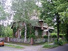
| Humperdinckstrasse
( Location ) |
270 | Engelbert Humperdinck (1854–1921), composer | May 3, 1918 | Already laid out as Verdistraße in 1912 , it was renamed in 1918 and is located between Beethovenstraße and Gluckweg. |
|
|
In the New Gardens
( Location ) |
420 | New gardens, old field name for the cottage gardens directly behind the courtyards of the Angerdorf. | Aug 21, 1968 | As street 524 , part of the older planned street 71 was included in the naming . It lies between the S-shape between Mühlenstrasse and Wedellstrasse. |

|
| Ingrid path
( Location ) |
210 | Ingrid , female name | May 30, 1930 | Set up as street 17d , it is a one-way street between Seydlitz- and Barbarastraße. | |
|
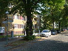
Jaegerstrasse
( Location ) |
110 | Hunter , job title and old military rank | Sep 15 1879 | In Lichterfelde, initially laid out as a cross street , there is only the short stretch between Luisenstrasse (district boundary) and Kurfürstenstrasse with lots 18d – 18f in the district. |
|
|
Kaiser-Wilhelm-Strasse
( Location ) |
2050 | Wilhelm I (1797–1888), Emperor and King of Prussia | before 1894 | The street was already listed as a Kreis-Chaussee before 1871 . It lies between the Teltow Canal (border to the south end ) and the district border to Lichterfelde , which runs between Luisenstrasse and Kurfürstenstrasse. |

|
| Kamenz Dam
( Location ) |
1030 | Kamenz , Lower Silesian city in Poland | July 24, 1954 | Established as street 69a , Kamenzer Damm was a short residential street with block development in the 1950s. In 1964 it was extended in both directions, since then it has stretched from Malteserstrasse to the suburb of Mariendorf on the Lankwitzer Bridge of the Dresden Railway . Today there is heavy through traffic, high-rise buildings with up to 20 floors dominate. The church building on the corner of Halbauer Weg, built in 1970, was the Catholic parish center of the Resurrection of Christ until 2014 ; since 2014 it has been used as St. Immanuel by the Ethiopian Orthodox Tewahedo Church . |

|
| Comrades Way
( Location ) |
210 | Comrade , with reference to the local war settlement after the First World War | Dec 15, 1930 | Husstrasse , which has been running here since 1906, was renamed in 1930 and lies between Gallwitzallee and Mühlenstrasse. |

|
| Kaulbachstrasse
( Location ) |
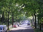
1050 | Wilhelm von Kaulbach (1805–1874), painter | before 1878 | It lies between Leonorenstrasse and Gärtnerstrasse on the district boundary. On June 22, 1964, the Mormon Church at Kaulbachstrasse 56-58 was consecrated. In 1968 the Catholic Church of St. Benedict was inaugurated at Kaulbachstrasse 62-64. |
|
| Keffenbrinkweg
( Location ) |
850 | Karl Gustav von Keffenbrink (1791–1809), Prussian officer, member of the Schill hunters | Feb. 27, 1936 | Set up as Straße 61a , it is located between Trachenbergring and Wedellstraße. |

|
| Gravel road
( Location ) |
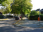
390 | Gravel , loose rock | before 1893 | It lies between the suburbs on the Lichterfelder Mariannenstrasse and Kurfürstenstrasse. The Lankwitz cemetery and the Catholic church Maria Dolorosa are located on the Lankwitz part. Between Mariannenstrasse and Zerbster Strasse, the street width and the northern plots 30–50 (even) and 33–45 (odd) belong to the district. |
|
| Kindelbergweg
( Location ) |
60 | Kindelberg , Berg near Graefenthal (Thuringia) | Dec 13, 1934 | Established as street 215 , it is a dead end street west of Trippsteinstraße. |

|
| Klüberstrasse
( Location ) |
130 | Robert von Klüber (1873-1919), officer in the imperial German army and the Reichswehr | May 20, 1937 | Established as street 61c . The Klüberstraße extended from the Felgentreustraße to Alt-Lankwitz until the early 1960s. Only a small part north of Keffenbrinkweg has been preserved as a cul-de-sac to this day. In this part are all four plots built before the Second World War (nos. 20, 28, 30 and 32). |

|
| Kurfürstenstrasse
( Location ) |
1070 | Great Elector (1620–1688), Elector of Brandenburg | around October 1894 | Karlstrasse , which was laid out here after 1850 , was renamed in October 1894. It is located between Kaiser-Wilhelm- and Geraer Straße. The road was laid out on the Zietemann property. First two streets were laid out, at that time together with Zietemannstraße . Despite the proximity to the Lichterfelde-Ost train station, the settlement stalled primarily with craftsmen, merchants and civil servants from Berlin, and the “Klamottenviertel” was mockingly called. |

|
|
Long street
( Location ) |
80 (in the district) |
In addition to the parallel and cross streets | before 1893 | In the district there is only plot No. 8/9 at the Lankwitz cemetery on the southern edge of the road between Mariannenstrasse and Luisenstrasse ( Lichterfelde ). |

|
| Langensalzaer Strasse
( Location ) |
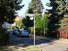
640 | Bad Langensalza , spa town in Thuringia | Aug 20, 1917 | Set up as Straße 39 , it is located between Sondershauserner and Geraer Straße. Between Gräfentaler Straße and Wendehammer from Geraer Straße, the course is interrupted by a footpath and a road. |
|
| Langkofelweg
( Location ) |
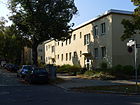
360 | Langkofel , mountain range in the north-western Dolomites (Italy) | Apr 10, 1931 | On March 19, 1938, Friedenstrasse and Strasse 12 were included as Strasse 56a . It is between Bruchwitzstrasse and Alt-Lankwitz. |
|
| Lankwitzer Strasse
( Location ) |
60 | Road to Lankwitz (from Lichterfelde) | Sep 10 1863 | The Lankwitzer Strasse as the directional road to Lankwitz was named on the “ highest decree ”. It runs as a shopping street from Lichterfelde to the district boundary and only the southern properties 10 and 12 east of Luisenstraße belong to Lankwitz. |

|
| Leonorenstrasse
( Location ) |
1180 | Leonore , main character and title of the original version of Beethoven's opera "Fidelio" | May 20, 1937 | The street was laid out before 1878 as Viktoriastraße and, given the location in the “composers' quarter”, it was named after the original name of the Beethoven opera in the 1937 renaming campaign. It is located between the Hannemann Bridge on the Teltow Canal and Kaiser-Wilhelm-Strasse (Lankwitz Church). Along Viktoriastraße (today: Leonorenstraße) the new center of the Lankwitz community developed with the construction of the Dreifaltigkeitskirche (1906), with the separate parts and their residents being brought together. In 1900, the Sanatorium Berolinum was opened at Viktoriastraße 60 (now Leonorenstraße 17-33) by Medical Councilor James Fraenkel . |

|
| Lerbacher way
( Location ) |
170 | Lerbach , district of Osterode am Harz in Lower Saxony | Aug 9, 1929 | Set up as street 24a , it is located east of Gallwitzallee as a cul-de-sac as an access road to the northern plots 1-59 and access to the St. Marien Hospital (No. 2). |

|
|
Lüdeckestrasse
( Location ) |
260 | Fritz Lüdecke , Lankwitz local politician | Nov 2, 1953 | Set up as street B , it is located on the previous property of the Lüdecke family, in the arch between the Belß and a turning hammer , from which a footpath leads to Wedellstraße. The quiet residential street was built in the 1960s, which can be clearly seen in the development, which was fundamentally renovated in the 1990s and connected to a system for using rainwater together with newly built houses . |

|
| Luisenstrasse
( Location ) |
610 | Luise von Mecklenburg-Strelitz (1776–1810), Queen Luise of Prussia | before 1893 | The width of the street is in Lichterfelde between Kaiser-Wilhelm- and Dessauerstraße, only the eastern plots 21-38 belong to Lankwitz. |

|
|
Maerckerweg
( Location ) |
140 | Karl Anton Maerker (1803–1871), 1848 Prussian Minister of Justice, also "Maercker" | Jan. 18, 1936 | In 1915 Mackensenstrasse was set up according to the development plan, but not executed and deleted in 1935. In their escape, the street was rebuilt in 1936, it lies between Emmichstrasse and Belßstrasse. |

|
| Malteserstrasse
( Location ) |
1820 | Maltese , Catholic order of knights | July 21, 1960 | The Marienfelder Lankwitzstraße and the Marienfelder Straße in Lankwitz were merged and renamed in 1960. The wide and busy street with a few apartment buildings is located between Mühlenstraße and the district boundary on Friedrichrodaer Straße; from Paul-Schneider-Straße / Kamenzer Damm it is the main street. The Luther cemetery, the Geo-Campus of the Free University and various sports facilities are adjacent to the Lankwitz district. |

|
| Marchandstrasse
( Location ) |
430 | Hermann Marchand (1864–1945), lawyer and urban developer | Jan. 2, 1912 | Set up as street 28 , it is located between Tambacher and Malteserstraße. |

|
| Melanchthonstrasse
( Location ) |
210 | Philipp Melanchthon (1497–1560), theologian and reformer | 1906 | Established as Straße 15 , it is located between Bruchwitz- and Paul-Schneider-Straße. |

|
| Mozartstrasse
( Location ) |
760 | Wolfgang Amadeus Mozart (1756–1791), Austrian composer | before 1894 | Mozartstrasse was laid out with the villa colony and on December 15, 1911, Strasse 1b was included. It is between Humperdinckstrasse and Siemensstrasse. |
|
| Mudra Street
( Location ) |
540 | Bruno von Mudra (1851–1931), Prussian officer, general of the infantry | Jan. 18, 1936 | Established as General-Kluck-Strasse since 1914 and renamed in 1936, Strasse 49a was included as an extension on June 1, 1964 . It lies between Emmichstrasse and Wedellstrasse. |

|
| Mühlenstrasse
( Location ) |
900 | local former mill | Apr 1, 1909 | A street here had existed since the 19th century when it was named in 1909, it is between Alt-Lankwitz and Gallwitzallee. In 1930, 89 apartments for small and medium-sized post office workers with 1, 1½, 2 and 2½ room apartments and a central washing facility were built in the Bruchwitzstraße, Mühlenstraße and Lutherstraße district. In addition, this settlement was given green spaces in the courtyard and a sandpit for small children, which was also not a matter of course at the time. |

|
|
Nicolaistrasse
( Location ) |
960 | Otto Nicolai (1810–1849), composer | Sep 9 1931 | Established as Luisenstrasse before 1894 , it was renamed to match the Kiez in 1931 (after the formation of Greater Berlin ) because of the neighboring Luisenstrasse in Lichterfelde . It begins on Gluckweg on the embankment of the Anhalter Bahn and ends today on the Teltow Canal . It used to go there over the Kirchnerbrücke in the Steglitzer Johanna-Stegen-Straße. In the summer of 1945, when all the Teltow Canal bridges were destroyed, the first Lankwitz emergency bridge stood here. |
|
|
Orlamünder Weg
( Location ) |
330 | Orlamünde , middle town in Thuringia | March 8, 1957 | Part of Street 511 was named in 1957 and Ettenhauser Street and the remaining part of Street 511 were included on January 2, 1962. It lies between Blankenhainer and Marchandstrasse. |
|
|
Pappritzstrasse
( Location ) |
380 | Günther von Pappritz (1856–1936), general of the cavalry in the First World War | March 11, 1937 | Set up as Straße 31 , it is located between Wichurastraße and Hanielweg. Quiet residential street with multi-family houses on one side. On the north side there is a small park with a playground. The houses are connected to one another by walk-in courtyards. |
|
| Parallel street
( Location ) |
30th | Parallel to the neighboring streets (SW-NE) in the Carstenn settlement colony ( Lichterfelde ) | before 1893 | The western end of the street at the southern corner of Luisenstrasse (which forms the district boundary) belongs to Lankwitz with properties 14a and 14b, since Luisenstrasse continues offset as a cross street. The street continues in Lankwitz as Frobenstraße. |

|
| Paul-Schneider-Strasse
( Location ) |
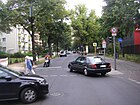
580 | Paul Schneider (1897–1939), “Preacher von Buchenwald”, pastor, victim of the Nazi regime, murdered in the Buchenwald concentration camp by the camp doctor Erwin Ding-Schuler | June 10, 1961 | The street, which has existed as Lutherstraße since 1906 , lies between Kaiser-Wilhelm-Straße (Lankwitz Church) and Malteserstraße. Originally running diagonally towards Malteserstraße, since 1964 it has been bent at the end towards Kamenzer Damm. It is burdened by heavy through traffic to these two streets. |
|
| Preysingstrasse
( Location ) |
700 | Konrad Graf von Preysing (1880–1950), Roman Catholic cardinal, resistance fighter against the Nazi regime | Nov 12, 1960 | The Lankwitzer Ring between Belßstrasse and Malteserstrasse, named since 1925, was renamed in 1960 after one of the main leaders of the Catholic church resistance against Nazi church policy on the 10th anniversary of his death. |

|
| Private way
( Location ) |
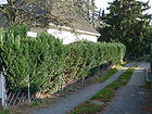
130 | private created | around 1950 | The formerly private (not public) road between Keffenbrinkweg and (eastern) Trachenbergring was dedicated around 1950 and is a four-meter-wide driveway with single-family homes. |
|
|
Reginenweg
( Location ) |
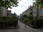
130 | Regina , female name | Apr 14, 1936 | The footpath and driveway set up as street 15a , initially as a private street , lies between Charlottenstrasse and Sibyllenstrasse. |
|
| Rehauer path
( Location ) |
140 | Rehau , town near Hof in Bavaria | Apr 4, 1934 | Set up as Straße 80a , it is located between Goldmühler Weg and Alt-Lankwitz. |

|
| Renatenweg
( Location ) |
190 | Renate , female name | May 17, 1930 | It was named as street 17f between Froben and Havenstein street , including an extension, and is located between Ursula and Froben street . The DeGeWo and Gagfahsiedlung on Renatenweg, which were destroyed in the bombing, were rebuilt in 1952–1954. |

|
| Retzowstrasse
( Location ) |
310 | Wolf Friedrich von Retzow (1699–1758), Prussian general | Nov 12, 1925 | Straße 6 and Straße 42 , which were set up according to the plan , became Retzowstraße and lie between Dessauerstraße and Bellingstraße, over which it continues as a cul-de-sac to the turning hammer in front of the KGA Lankwitz animal shelter. |

|
| Rodacher way
( Location ) |
220 | Bad Rodach town near Coburg in Bavaria | 22 Aug 1936 | Established as Straße 222 and partly including Straße 39a , it was laid out in the arch from and to Langensalzaer Straße. |

|
| Rotenfelser way
( Location ) |
160 | Bad Rotenfels , (now) part of the wine-growing town of Gaggenau in Baden-Württemberg | Dec 13, 1934 | Set up as Strasse 211, it is located between Graacher and Gernsheimer Strasse. |

|
| Rudolf Beyendorff Ring
( Location ) |
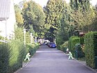
340 | Rudolf Beyendorff (1876–1947), first Lankwitz mayor | Dec 16, 2002 | The newly laid road was handed over on June 20, 2003, the ring opens up new buildings (between Retzowstrasse and Kurfürstenstrasse) south of Dessauerstrasse. The road is designated as a traffic-calmed area and, despite its official recognition, is marked as a private road . |
|
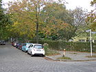
| Ruthstrasse
( Location ) |
230 | Ruth , female first name | July 20, 1960 | The previous name Marienstraße was changed because of the Lichterfeld double name (in the same district). It is between Charlottenstrasse and Barbarastrasse. |
|
|
Saarburger Strasse
( Location ) |
290 | Saarburg , Weinstadt in the Saar-Hunsrück Nature Park in Rhineland-Palatinate | Oct 12, 1912 | Set up as Straße 9 , it is located as a cul-de-sac east of Leonorenstraße. |

|
| Scharzhofberger Strasse
( Location ) |
110 | Wiltinger Scharzhofberg , vineyard in the local community of Wiltingen in the Moselle region in Saarland | after 1910 | Established as street 9a , it was not yet included on a map around 1910, but was mentioned in the documentation for Berlin and the surrounding area in 1914. It goes east as a dead end from Bruchwitzstrasse. |

|
| Schefferweg
( Location ) |
100 | Reinhard von Scheffer-Boyadel (1851–1925), infantry general in the First World War | March 20, 1939 | The street has existed since 1915 until it was renamed Meyer-Waldeck-Straße , it is a dead end street north of Emmichstraße. |

|
| Schneebergstrasse
( Location ) |
540 | Schneeberg , highest mountain in the Fichtelgebirge (Bavaria) | Apr 4, 1934 | Set up as road 78 , it lies between Wunsiedeler Weg and Alt-Lankwitz. |

|
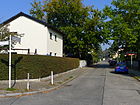
| Schneekoppenweg
( Location ) |
140 | Schneekoppe , highest mountain in the Giant Mountains on the border between the Czech Republic and Poland | July 20, 1960 | Established as street 238 and partly named together with street 55 , it lies between Keffenbrinkweg and Trachenbergring. |
|
| Schulstrasse
( Location ) |
460 | After the community school built here in 1877. Its extension from 1900, the so-called red schoolhouse , is now used by the Alt-Lankwitz primary school . | between 1877 and 1894 | Here was the connection route to Giesensdorf, called Giesensdorfer Straße from after 1850 to before 1894 . Since 1895, the entire length of Schulstrasse was traversed by the electric tram , but it was moved to Kaiser-Wilhelm-Strasse between 1925 and 1936. Due to the residential buildings at Paul-Schneider-Strasse at the corner of Kaiser-Wilhelm-Strasse and a barrier on Mühlenstrasse, it is now closed to car traffic at both ends; access is only possible in the middle via Bruchwitzstrasse. |

|
| Seydlitzstrasse
( Location ) |
880 | Friedrich Wilhelm von Seydlitz (1721–1773), Prussian cavalry general | 1884 | The street was created in 1884 from the previously existing Margaretenstrasse and Prinz-Wilhelm-Strasse . It is located (as an extension of Beethovenstrasse) between the railway line and Dessauer Strasse. There was a racecourse on Seydlitzstrasse from 1880, when the capital was spent two years later the company was closed. |

|
| Sibyllenstrasse
( Location ) |
240 | Sibylle , female name | Oct. 24, 1912 | A part of the extending street 15b was included on February 1, 1965 as street 15a . The street is arched between Kaiser-Wilhelm-Straße and Dillgesstraße. |

|
| Siemensstrasse
( Location ) |
1030 | Werner von Siemens (1816–1892), industrialist and founder of the large corporation | Feb. 24, 1897 | The part of Berliner Strasse between Albrechtstrasse and the Groß-Lichterfeld district boundary was renamed Siemensstrasse. It lies between the district boundary (Lichterfelde with no. 37-41) on Gärtnerstrasse in continuation of the Ostpreußendamm and the Siemens bridge over the Teltow Canal in Lankwitz and continues on Steglitzer Flur (no. 1-10). |

|
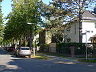
| Sondershauser Strasse
( Location ) |
630 | Sondershausen , district town on Kyffhäuser in Thuringia | Aug 20, 1917 | The established street was named in 1917 with others in the Thuringian Quarter and on November 12, 1925, the Grüne Weg (between Straße 24a and Marienfelder Straße ) was included in Lichterfelde and the extension to the Landweg (today Lichterfelder Ring) on August 9, 1929. In Lankwitz it is only between Geraer and Hildburghauser Strasse. At the corner of Apoldaer Strasse there is a settlement plan for Lankwitz by Hans Poelzig from April 21, 1932 in the Architekturmuseum Berlin. |
|
|
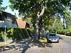
Tambacher Strasse
( Location ) |
520 | Tambach-Dietharz city near Gotha in Thuringia | Jan. 2, 1912 | Set up as Straße 30 , it lies between Blankenhainer Straße and as a cul-de-sac across Frankenhauser Straße. Quiet residential street, which is built on with single and multi-family houses. The Kreuzfriedhof is located on the street and is accessible via a turnstile. |
|
| Tautenburger Strasse
( Location ) |
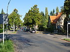
440 | Tautenburg , municipality (today) in the administrative community Dornburg-Camburg in Thuringia | Jan. 2, 1912 | Tambacher Strasse was laid out roughly along the course of Strasse 31 , which was set up according to the plan , and lies between Blankenhaier Strasse and the suburbs. |
|
| Teltowkanalstrasse
( Location ) |
230 | Street running parallel to the Teltow Canal | before 1913 | At this point in time, it was set up as street 65a , it goes from the Birkbuschstraße , runs parallel to it a little further away from the Teltow Canal and goes southwest into the Wiesenweg, which flows into the Siemensstraße. Lankwitz road and the southern properties belong. Löwe-Radio AG (later Opta-Radio and Loewe-Opta ), which was already based there, had an office and factory building built in 1939–1941. The entire building ensemble Teltowkanalstrasse 1–2 / Wiesenweg 9–10 is a listed building . |

|
| Tennstedter Strasse
( Location ) |
580 (in the district) |
Bad Tennstedt, spa town in Hainich in Thuringia | Jan. 2, 1912 | Established as Straße 32 , it was extended to Marienfelder Flur in 1938 and on April 1, 1975 it was extended to Weskammstraße. It is located between the suburbs and Blankenhainer Strasse in Lankwitz, with a piece of dead end going beyond the latter . |

|
| Thaliaweg
( Location ) |
180 | Thalia , muse of comedy | May 17, 1930 | Set up as Straße 17c , it is located between Dillgesstraße and Gallwitzallee. |

|
| Trachenbergring
( Location ) |
1010 | Karl Friedrich Wilhelm von Trachenberg (1784–1809), Prussian officer, member of the Schillschen Jäger | July 20, 1960 | In 1935 the Trachenbergweg was laid out and because of the residential buildings that had been built in 1960, the streets 62a, 63 and 87 on the outskirts of Marienfelde and Mariendorf were included and the ring-shaped street that now adjoins Felgentreustraße was renamed. The plots 71–93 (odd) on the southeast edge of the ring belong to Marienfelde . |

|
| Trippsteinstrasse
( Location ) |
690 (in the district) |
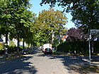
Trippstein , summit in the Schwarzatal with a viewing platform , above Schwarzburg in Thuringia | Jan. 2, 1912 | Set up as Straße 33 , it lies between Geraer Straße and the suburbs. Plots 77 and 79 in the southeast are in Marienfelde . |
|
|
Ursulastrasse
( Location ) |
110 | Ursula , female name | May 15, 1918 | Established as street 17a and after the naming it was renamed street 17a on September 30, 1929 because of the changed alignments , street 17b and street 17f were later included. The road goes northeast from Renatenweg as a dead end . |

|
|
Waldmannstrasse
( Location ) |
430 | Ludolf Waldmann (1840–1919), composer | Jan. 2, 1912 | Set up as Strasse 1 , it is located between Beethovenstrasse and Nicolaistrasse. |

|
| Waltershauser Strasse
( Location ) |
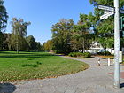
320 | Waltershausen , town near Gotha in Thuringia | July 20, 1917 | Set up as street 34 , it is an (undeveloped) foot and cycle path between Gallwitzallee and Geraer Straße on the south side of the school on Königsgraben and is located in the park strip along the Okengraben . It is not listed as a street in the LOR address directory, but is included in the plans. It complements the street from Geraer Strasse to Preysingstrasse, while KGA Waltershauser Strasse is located on the part between Gallwitzallee and Malteser Strasse, which is also unnamed on the plans. |
|
| Wasunger way
( Location ) |
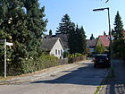
200 | Wasungen , town near Meiningen in Thuringia | Dec 13, 1934 | Laid out in 1913 as Schmalkalder Strasse , it was renamed to Greater Berlin in 1934 due to the duplication of names and is located between Arnstädter and (in the arch back) Altenburger Strasse. |
|
| Wedellstrasse
( Location ) |
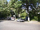
890 | The brothers Karl Lupold Magnus von Wedel-Parlow (1786-1809) and Hans Gustav Albert von Wedel-Parlow (1791-1809), Prussian officers and joined the Schill hunters to | May 3, 1935 | The extension of Straße 516 was established as Straße 44a on June 1, 1964, and Straße 44b on October 1, 1981 . The quiet residential street with block development from the 1960s lies between Belßstrasse and Alt-Lankwitz. |
|
| Wernshauser Strasse
( Location ) |
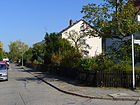
340 | Wernshausen , municipality near Meiningen in Thuringia | Dec 13, 1934 | The streets set up as 214 and 34a were combined and named, it is located between Apoldaer Straße and Wasunger Weg. |
|
| Weygerweg
( Location ) |
270 | Weyger , first pastor known by name (1313) in the village of Lankwitz | Nov 28, 1925 | Set up as street 31a , it is located between Malteserstrasse and Preysingstrasse. |

|
| Wichurastrasse
( Location ) |
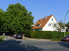
970 | Georg Wichura (1851–1923), General of the Infantry | March 11, 1937 | Streets 33, 19i and 61d were incorporated into Mühlenhofstraße , which had existed since 1925, and the entire street was renamed; on June 5, 1958, the extension was included. It is located between Friedrichrodaer Straße and Keffenbrinkweg. |
|
| Meadow path
( Location ) |
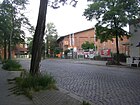
220 | Here the Birkbuschwiesen lay near the Bäke before the Teltow Canal drained | around 1900 | The street lies between the continuing Teltowkanal- and (in the arch to) Siemensstraße. In the 19th there was the meadow path, the course of which was changed by the construction of the Teltow Canal and the Steglitz harbor and which was fortified. The street still belonged to Steglitz, the local border was on Siemensstrasse. As a traffic route it was named Am Wiesenweg and ran between Lankwitzer Feldmark and Birkbuschstrasse / Teltow Canal . Without house numbers there was the “Steglitzer Pumpstation” and a “Waschanstalt zum Rothen Kreuz” here around 1901. In 1910 two more houses named after the owners were added, and the pumping station had become the “Steglitzer Sewer Works” (house no. 5). In 1915, the Tabbertschen Mörtelwerke are located in house number 1. In the 1920s, the “Am” for the 22-meter-wide street between the properties was omitted. On the site Wiesenweg 10 in the spring of 1924 built in Berlin-Friedenau based radio frequency GmbH (1930 Radio AG D. S. Loewe ) a work for the item and receiver manufacturing and moved in 1930 its headquarters there. With the Berlin territorial reform in 1938 , the street and the (southern) properties 8 and 10 fell to Lankwitz, the opposite side of the street with the BSR yard and the power station belongs to Lichterfelde . |
|
| Wunsiedeler way
( Location ) |
570 | Wunsiedel , town in the Fichtelgebirge, Bavaria | Apr 4, 1934 | Set up as road 81 , it lies between Alt-Lankwitz and Freymüllerweg, from the turning hammer there is a driveway next to the oil tank farm to properties (Freymüllerstraße 1–3) and the KGA Lankwitz-Hafen. |

|
|
Zerbster Street
( Location ) |
790 east side only |
Zerbst , district town of Anhalt-Zerbst in Saxony-Anhalt | Jan. 18, 1936 | It lies in its width and with the western side (plots with even house numbering) in Lichterfelde , the odd-numbered plots on the eastern edge of the road belong to Lankwitz, the street lies between Kiesstrasse and Hildburghauser Strasse. |

|
| Zietenstrasse
( Location ) |
680 | Hans Joachim von Zieten (1699–1786), Prussian hussar general in the service of Friedrich II (Zietenritt) | around 1894 | First laid out before 1894 as Zietemannstrasse , it lies between Kaiser-Wilhelmstrasse and Dessauerstrasse. The street was laid out on the Zietemann'schen area at that time together with the Kurfürstenstraße. Despite the proximity to the Lichterfelde-Ost train station, the settlement stalled primarily with craftsmen, merchants and civil servants from Berlin, and the “Klamottenviertel” was mockingly called. The first German film studio was located on the property at Zietenstrasse 10 in 1904. |

|
Planned and former streets
| Surname | from | to | named in | Remarks |
|---|---|---|---|---|
| At the Beyendorffpark | Sep 2 1911 | 1919 | → At the community park |
Rudolf Beyendorff (1876–1947), local politician. On the occasion of the inauguration of the town hall and Beyendorffpark, the street was given its name, was renamed Am Gemeindepark in 1919, renamed Am Beyendorffpark in 1933, and was given its current name again in 1939. |
| Berlin street | before 1878 | Feb. 24, 1897 | → Siemensstrasse | Way to Berlin from Teltow |
| Bismarckstrasse | around 1912 | Jul 13, 1934 | → Belßstrasse | Bismarckstrasse got its name between 1911 and 1912. Otto von Bismarck (1815–1898), Prussian Prime Minister and Reich Chancellor |
| Flower Street | before 1894 | Sep 15 1966 | → Bruno-Walter-Strasse | Because of the flower gardens in the area |
| Village street | 1500 | around 1880 | → Alt-Lankwitz | The historic village meadow of the Angerdorf |
| Ettenhauser Strasse | Jan. 2, 1912 | Jan. 2, 1962 | → Orlamünder Weg | Ettenhausen , place in Thuringia |
| Friedenstrasse | before 1870 | March 19, 1938 | → Langkofelweg | The road ran to the cemetery of Eternal Peace. |
| gardenstreet | before 1878 | Sep 15 1966 | → Bruno-Walter-Strasse | The part of the street in Lichterfelde. |
| General-Kluck-Strasse | Oct. 22, 1914 | Jan. 18, 1936 | → Mudra Street | Alexander von Kluck (1846–1934), Prussian infantry general |
| Giesensdorfer Strasse | after 1850 | before 1894 | → Schulstrasse | Road to Giesensdorf , merged with Lichterfelde to form Groß-Lichterfelde in 1877. |
| Gluckstrasse | Dec 15, 1911 | Dec 3, 1937 | → Brucknerstrasse | Christoph Willibald Gluck (1714–1787), composer |
| Gluckstrasse | Dec 15, 1911 | Dec. 4, 1937 | → Gluckweg | Christoph Willibald Gluck (1714–1787), composer |
| Green way | before 1878 | Aug 6, 1937 | → Gallwitzallee | The way into the green valley north of Lankwitz |
| Main road | before 1878 | Apr 4, 1934 | → Alt-Lankwitz | The most important street in the municipality, Dorfaue |
| Hausenstrasse | Oct. 22, 1914 | Jun 20, 1915 | → Beselerstrasse | Max von Hausen (1846–1922), Saxon Colonel General, Prime Minister of the Kingdom of Saxony |
| Herrmannstrasse | before 1901 | Jan. 18, 1936 | → Zerbster Street |
Hermann (the Cheruscan) (17/16 BC – 21 AD), tribal leader, is a street in Lichterfelde, local border |
| Hindenburgstrasse | Oct. 22, 1914 | Oct. 20, 1932 | → Eiswaldtstrasse | Paul von Hindenburg (1847–1934), Field Marshal General and President |
| Husstrasse | Feb 13, 1906 | Dec 15, 1930 | → Comrades path | Jan Hus (around 1369–1415), Czech reformer |
| Kaiser-Wilhelm-Strasse | after 1871 | before 1894 | → Frobenstrasse | Wilhelm I (1797–1888), from 1861 King of Prussia, from 1871 German Emperor |
| Karlstrasse | after 1850 | around Oct. 1894 | → Kurfürstenstrasse | Friedrich Karl Alexander (1801–1883), Prince of Prussia |
| Kiepertstrasse (Lankwitz branch) | before 1905 | Oct. 1, 1963 | → Friedrichrodaer Strasse | Adolf Kiepert (1820–1892), local politician and farmer |
| King's Promenade | plan | 1925 | → Geraer Strasse | Gerplante promenade through villas |
| Kreis-Chaussee | before 1871 | before 1894 | → Kaiser-Wilhelm-Strasse | The Kreis-Chaussee was the main road to the district town of Teltow. In contrast to the Staatschaussee, the Kreischaussee was built and maintained from the finances of the district. Before the expansion of the Chaussee in 1874, it was a sand road and was so named. |
| Lankwitzer Ring (part) | Nov 12, 1925 | Nov 22, 1960 | → Haynauer Strasse | Annular road on the Marienfeld border |
| Lankwitzer Ring (part) | Nov 11, 1925 | Aug 25, 1939 | → Bischofsgrüner Weg | Annular road on the Marienfeld border |
| Lankwitzer Ring (part) | Nov 13, 1925 | Nov 22, 1960 | → Preysingstrasse | Annular road on the Marienfeld border |
| Lessingstrasse | before 1894 | Dec 3, 1937 | → Brucknerstrasse | Gotthold Ephraim Lessing (1729–1781), poet of the Enlightenment |
| Luisenstrasse | before 1894 | Sep 9 1931 | → Nicolaistrasse |
Luise von Preußen (1808–1870) , Princess of Prussia renamed because of the duplication of names |
| Lutherstrasse | 1906 | Jun 10, 1961 | → Paul-Schneider-Strasse | Martin Luther (1483–1546), reformer |
| Mackensenstrasse | Jul 30, 1915 | Aug 8, 1935 | Deleted from the street directory |
August von Mackensen (1849–1945), Field Marshal General Mackensenstrasse had not been laid out until 1935 and the name was already represented in the districts of Charlottenburg and Schöneberg . |
| Margaretenstrasse | before 1894 | 1894 | → Seydlitzstrasse | Margarethe , female name |
| Mariendorfer Strasse | before 1894 | Apr 4, 1934 | → Alt-Lankwitz | The Mariendorfer Straße appears in the street directory of Lankwitz for the year 1894 as Mariendorfer Weg . In an overview plan for the development plan from 1912 it is called Mariendorfer Straße. Together with Hauptstrasse, it was renamed Alt-Lankwitz in 1934. |
| Marienfelder Strasse | before 1878 | Apr 21, 1960 | → Malteserstrasse | The paved road to Marienfelde. |
| Marienstrasse | Oct 18, 1894 | Jul 20, 1960 | → Ruthstrasse | In Lichterfelde there was a double on Marienstrasse |
| Meyer-Waldeck-Strasse | Jul 30, 1915 | March 20, 1939 | → Schefferweg | Alfred Meyer-Waldeck (1864–1928), Vice Admiral |
| Mühlenhofstrasse | 1925 | March 11, 1937 | → Wichurastraße | The Mühlenhof office was the former local authority, initially the local mills of Cölln and Berlin. |
| Place A – B (Street 8) |
plan | Oct. 24, 1912 | → Bernkastler Platz | |
| Prinz-Heinrich-Strasse | after 1870 | before 1894 | → Derfflingerstrasse | Heinrich Friedrich Ludwig (1726–1802), Prince of Prussia, brother of King Friedrich II, Prussian general |
| Prinz-Wilhelm-Strasse | before 1894 | 1894 | → Seydlitzstrasse | Prince Wilhelm of Prussia, later Emperor |
| Cross street | before 1879 | Sep 15 1879 | → Jägerstrasse | Cross street to the northwest-southeast running streets (Lichterfelde Ost) |
| Schmalkalder Strasse | Aug 20, 1917 | Dec 13, 1934 | → Wasunger Weg | Schmalkalden in Thuringia |
| Sedanstrasse | before 1894 | Jul 20, 1960 | → Brigittenstrasse | Named after the Battle of Sedan in the Franco-Prussian War in 1870. Sedan , town in the Ardennes department (France) |
| Steglitzer Strasse Steglitzer Weg |
before 1894 | Dec 13, 1934 | → Edenkoben way | In the plan of the municipality of Lankwitz from 1894 still as Steglitzer Weg, with the fortification then Steglitzer Straße. |
| Trachenbergweg | May 3, 1935 | Jul 20, 1960 | → Trachenbergring | Karl Friedrich Wilhelm von Trachenberg (1784–1809), Prussian officer, member of the Schillschen Jäger |
| Verdistrasse | Jan. 2, 1912 | May 3, 1918 | → Humperdinckstrasse | Giuseppe Verdi (1813–1901), Italian Romantic composer |
| Viktoriastrasse | before 1878 | May 20, 1937 | → Leonorenstrasse | Victoria of Great Britain and Ireland (1840–1901) , German Empress, daughter of Queen Victoria |
| Zietemannstrasse | before 1894 | around 1894 | → Zietenstrasse | Carl Zietemann, landowner, sold land for the Rosenthal settlement area in Rosenthal |
Further locations in Lankwitz
Allotment gardens
The paths of the allotment gardens are private paths that are not publicly dedicated as private roads and are only used internally for orientation within the complex. The postal address is assigned to the entire system. RBS is the regional reference system for Berlin in which systems are also given a unique street code.
| Allotment garden | address | Area hectares |
Number of parcels |
Form of ownership | Remarks |
|---|---|---|---|---|---|
| Alt-Lankwitz | Kamenzer Damm 68–74
( Location ) |
15,534 | 50 | national | RBS: 06114 |
| Bellingstrasse | Bellingstrasse / Gallwitzallee
( Location ) |
16,779 | 63 | Private | FOAG sub-district of Lichterfelde-Ost Bellingstrasse group (RBS: 09520) |
| Charlottenstrasse | Charlottenstrasse 35 / Hinterland
( Location ) |
4,055 | 14th | Private | FOAG sub-district Lichterfelde-Ost group Charlottenstrasse (RBS: 06238) |
| Dorfaue | Kaiser-Wilhelm-Strasse 123–127
( Location ) |
7,503 | 35 | Railway ownership | The KGA is entered in the land use plan as “green space allotment gardens” and noted as highly secured in the allotment garden development plan. Part of the allotment garden group Berlin - Steglitz - Ost eV |
| unity | Edenkobener Weg 69
( Location ) |
8,906 | 25th | national | Part of the allotment garden group Berlin - Steglitz - Ost eV |
| Lankwitzer Strasse | Kamenzer Damm / Trachenbergring
( Location ) |
10,410 | 24 | Railway ownership | |
| Karl-Lange-Brücke south | Edenkoberner Weg 78
( Location ) |
9.423 | 25th | national | RBS: 06482, part of the allotment garden group Berlin - Steglitz - Ost eV |
| Königsgraben | Tautenburger Strasse 47-49
( Location ) |
24,504 | 75 | national | RBS: 16208 |
| Lankwitz harbor | Wunsiedler Weg 1a
( Location ) |
11,530 | 33 | Railway agriculture | BLW - UB Steglitz Group Lankwitz Hafen, RBS: 16210
|
| Lankwitz tribe III | Dessauer Strasse 27d
( Location ) |
21,986 | 66 | national | RBS: 16215 |
| Lankwitz animal shelter | Goldaper Strasse 10
( Location ) |
18,896 | 61 | national | RBS: 06768 |
| Lankwitz-Zieten | Geraer Strasse 97
( Location ) |
65,745 | 219 | national | RBS: 16216 |
| Leonorenstrasse | Edenkoben way
( Location ) |
14,427 | 42 | Railway agriculture | BLW - UB Steglitz Group Leonorenstraße, RBS: 06410 |
| Scharzhofberger Platz | Kaiser-Wilhelm-Strasse 106b
( Location ) |
5,720 | 20th | national | RBS: 09151 |
| Seydlitzstrasse | Seydlitzstrasse
( Location ) |
1,420 | 4th | national | |
| Waltershauser Strasse | Malteser Strasse 91
( Location ) |
5.133 | 14th | national | RBS: 06801 |
| Weinviertel | Edenkobener Weg 1–31
( Location ) |
27,572 | 106 | mostly private KGA Weinviertel eG |
RBS: 06815, smaller part of the state (19 parcels) in the allotment garden association group Berlin - Steglitz - Ost eV |
Parks and green spaces
- Lankwitz community park ( location )
- Lutherkirchhof ( location )
- Kreuzkirchhof ( location )
- Trinity Cemetery ( location )
- Lankwitz Cemetery ( location )
Commercial space and sports facilities
- Lankwitz port on the Teltow Canal, oil port ( location )
- FU campus Lankwitz (campus of the FU and UdK) ( location )
- industrial Estate
- Sports facilities
- Berlin-Lankwitz station on the Anhalter suburban railway ( location ). The line of the Dresdener Bahn borders on Lankwitz, but belongs to Mariendorf.
See also
literature
- Walter Kaupert (Ed.): Kaupert's street guide through Berlin 2010 . Kaupert Media, Berlin 2009, ISBN 3-941108-01-8 .
Web links
- Street directory Lankwitz. kaupert media gmbh, accessed on December 12, 2011 .
- Office for Statistics Berlin-Brandenburg: List of streets and places in the Steglitz-Zehlendorf district (as of February 2015); pdf
- Map of Berlin 1: 5000 with district boundaries. Senate Department for Urban Development Berlin, 2012, accessed on June 4, 2012 .
- Architekturmuseum.ub.tu-berlin.de: Brix & Genzmer Competition Greater Berlin 1910. Development plan for Berlin-Lankwitz (1908-1910) , accessed on July 17, 2012.
Individual evidence
- ^ Leopold von Zedlitz-Neukirch: Guide through the Prussian state to the neighboring countries and the capitals of Europe . 1831
- ↑ a b c d e Heimatverein Steglitz - local history Lankwitz
- ↑ a b c d e f Lankwitz: daten.html
- ↑ a b On the person of Rudolf Beyendorff
- ↑ a b hu-berlin.de: The settlement "Lankwitz South" includes parts of Friedrichrodaer Street (66-160) and the Falkenhaus path (23-45) ( Memento of 28 December 2011 at the Internet Archive )
- ↑ Rosengarten on Kulturfuehrer-berlin.de
- ↑ To the Vorwerk Birkbusch
- ↑ a b History of the Postheimstätte ( Memento of the original from November 21, 2012 in the Internet Archive ) Info: The archive link was inserted automatically and has not yet been checked. Please check the original and archive link according to the instructions and then remove this notice. Retrieved July 17, 2012
- ↑ a b Correns mansion (Siemensvilla)
- ↑ a b Park: Calandrellistraße 1–9 (odd) and Gärtnerstraße 25–32 (consecutive)
- ↑ a b From Lankwitz S-Bahn station to Königsgraben
- ↑ a b c d city map from 1961 on Blocksignal.de
- ↑ Sylvia Vogt: Noise from children disturbs the garden idyll on Tagesspiegel.de (May 2, 2013)
- ↑ Sandra Dassler: Children are allowed to continue playing undisturbed on Tagesspiegel.de (May 8, 2013)
- ^ About Eiswaldt
- ↑ Frankenhauser Strasse on Berliner-stadtplan.com:
- ↑ on the person of Gabain
- ↑ Halbauer Weg on Berliner-stadtplan.com
- ^ Inauguration of the Hanna-Renate-Laurien-Platz in Lankwitz on April 14th, 2016 . District Office Steglitz-Zehlendorf, press release No. 263, April 6, 2016, accessed on April 14, 2016.
- ↑ Lankwitz on Berlin.de, accessed July 17, 2012
- ↑ On the person of Keffenbrink
- ↑ Klüberstrasse . In: Berliner Adreßbuch , 1943, administrative district Steglitz> Lankwitz, p. 1651.
- ↑ Lüdeckestrasse on Berliner-stadtplan.com
- ↑ City map from 1926 ( page no longer available , search in web archives ) Info: The link was automatically marked as defective. Please check the link according to the instructions and then remove this notice. on Alt-berlin.info
- ↑ Wolfgang Friese: The Teltow Canal in Lankwitz . In: Heimatverein Steglitz (Ed.): Steglitzer Heimat. Volume 51, No. 2, Berlin 2006, pp. 21-25.
- ↑ Pappritzstrasse on Berliner-stadtplan.com
- ↑ Alt-Lankwitz primary school
- ↑ Network plans 1925 and 1936 on Berliner-verkehrsseiten.de
- ↑ architekturmuseum.ub.tu-berlin.de: Settlement in Lankwitz, Berlin-Steglitz (1932)
- ↑ berliner-stadtplan.com/poi Tambacher Strasse on Berliner-stadtplan.com
- ↑ Office building & factory
- ↑ on the person of Waldmann
- ↑ FIS Broker: Address search Walter Straße 1
- ↑ Lankwitz overview map . In: Berliner Adreßbuch , 1915, Part V., p. 96.
- ↑ Wiesenweg . In: Address book for Berlin and its suburbs , 1901, V. Suburbs> 20. Steglitz, p. 239 (Am Wiesenweg).
- ↑ On the meadow path . In: Berliner Adreßbuch , 1913, V. Teil, p. 406. “← Teltowkanalstraße →, construction site, 4: Mortar works A. Tabbert, 5: Tierasyl, Steglitzer sewer works, ← district Lankwitz →, Schröder u. Weigmann's house: laundry and bleaching "Zum Weißen Kreuz", Schmidt's house: P.Schmidt & Co. GmbH wood. Stairs and Railings ”.
- ↑ On sheet 4045 of the official map of the city map of Berlin ( Memento of the original from November 9, 2015 in the Internet Archive ) Info: The archive link was inserted automatically and has not yet been checked. Please check the original and archive link according to the instructions and then remove this notice. (X = 19780, Y = 12780) from 1929, Wiesenweg is given.
- ↑ Muto-Atelier on Cinegraph.de
- ↑ The oldest German film studio was in Lankwitz . In: Heimatverein Steglitz, Steglitzer Heimat 1/2004 ( PDF, pp. 10–16; 1.3 MB ( memento of August 11, 2007 in the Internet Archive ))
- ↑ On the person of Beyendorff
- ↑ Landesarchiv Berlin: Inventory overview ( Memento of the original from October 17, 2013 in the Internet Archive ) Info: The archive link was inserted automatically and has not yet been checked. Please check the original and archive link according to the instructions and then remove this notice.
- ^ Chronicle of Rixdorf
- ↑ Allotment gardens in the district ( Memento of the original from September 29, 2013 in the Internet Archive ) Info: The archive link was automatically inserted and not yet checked. Please check the original and archive link according to the instructions and then remove this notice. (PDF; 26 kB) Senate Department for Urban Development and the Environment, Berlin
- ↑ Highly secured allotment gardens • Level IV: Allotment garden areas which, according to the presentation of the zoning plan, should be preserved. The state-owned areas at this stage are allotment gardens that were established after the BKleingG came into force and are therefore not fictitious permanent allotments.


