List of streets and squares in Berlin-Nikolassee

The list of streets and squares in Berlin-Nikolassee describes the street system in the Berlin district of Nikolassee with the corresponding historical references. At the same time, this compilation is part of the lists of all Berlin streets and places .
overview
statistics
The district of Nikolassee has 16,695 inhabitants (as of December 30, 2019) and includes the postcode areas 14129, 14163 and 14193. The public road network in the entire district of Steglitz-Zehlendorf (including all seven districts) measures 635.4 kilometers. The dedicated streets listed in this list (federal, urban, residential streets) have a total length of 70.27 kilometers. Information on the proportion of the street area in the total area of the district is not accessible, especially since there is ample forest area in the district without a road portion. When adding up the length of roads and paths that are recorded in the regional reference system (including the lanes of the motorway), the result is 97.49 kilometers. In the district there are 96 dedicated streets and paths with a total length of 70 kilometers, as well as three named places. 14 streets that belong in part to the neighboring districts of Wannsee and Zehlendorf remain unnamed in the descriptions insofar as they are of no significance for the district, further data and facts can be found in the corresponding lists of these districts.
history
The location of the streets has been determined by Heimstätten AG since 1890 when they were created for the villa settlements at the Wannsee , Nikolassee and Schlachtensee stations . The First World War and inflation were associated with a slump in road construction and, above all, the expansion of the land. Changes to the streets on the western edge of the district resulted in the 1930s through the expansion of the AVUS to the Reichsautobahn up to the Berliner Ring , so the section of Potsdamer Chaussee was rebuilt and Dreilindenstraße with the previous routing of the Chaussee was put on the sidelines. After 1950, houses were first built on vacant lots and gaps caused by the war. Changes in the road system followed in the 1970s by residential buildings for the US troops at the Lisbon Avenue (Andréezeile) and in the 1980s with the Garden City chaff in an open area east of the Forest cemetery Zehlendorf , which was then on the outskirts to Kleinmachnow in the Berlin Wall was .
Road system

The federal highway 115 ( AVUS ) runs through the district, which crosses Potsdamer Chaussee at junction 4 Zehlendorf ( Kreuz Zehlendorf ). Junction 3 (Spanische Allee) and the southern part of junction 2 (Hüttenweg) are also in Nikolassee. In the area of the district, 2,240 meters of exits and entrances and 15.53 kilometers of lanes on the A 115 form part of the large-scale system in the Berlin road system, plus 3,110 meters of accompanying lanes and entrances / exits of the higher-level system , and a further 1,490 meters of motorway area to and from Spanish avenues have regional importance. The 1500 meters of the lane for the petrol station at the Zehlendorf interchange are only listed under Other. These street areas are not included in the list .
The Potsdamer Chaussee has the rank of a federal highway . The federal highway 1 corresponds to the old Prussian Chaussee from Berlin to Potsdam . The road is laid out as a large-scale road connection in the Berlin road system, with 280 meters at the motorway intersection as a motorway and the access with 1650 meters to Bundesstraße 1. In addition, there are 1850 meters of Potsdamer Chaussee, which is classified as a higher-level main street in the Berlin system, including 60 meters of the Hüttenweg. The main streets in the district of regional importance are parts of the Kronprinzessinnenweg (1,340 meters) and Spanische Allee (2,590 meters), which connects to Potsdamer Straße at both ends and connects it with the Spanische Allee junction, which includes 50 meters of Borussenstraße . The main road system of the district south of Potsdamer Chaussee is supplemented by the Lindenthaler Allee - Lloyd-G.-Wells-Straße - Benschallee - Havelchaussee - Kronprinzessinnenweg.
In terms of rail traffic, the district is accessed through the Nikolassee S-Bahn station , where the Wannseebahn and Wetzlarer Bahn meet, and the Schlachtensee S-Bahn station on the edge of the district . The railway line lies between Altvaterstraße and Am Schlachtensee .
Overview of streets and squares
The following table gives an overview of the streets and squares in the district as well as some related information.
- Name / location : current name of the street or square. Via the link Location , the street or the square can be displayed on various map services. The geoposition indicates the approximate center of the street length.
- Traffic routes not listed in the official street directory are marked with * .
- Former or no longer valid street names are in italics . A separate list may be available for important former streets or historical street names.
-
Length / dimensions in meters:
The length information contained in the overview are rounded overview values that were determined in Google Earth using the local scale. They are used for comparison purposes and, if official values are known, are exchanged and marked separately.
For squares, the dimensions are given in the form a × b for rectangular systems and for (approximately) triangular systems as a × b × c with a as the longest side.
If the street continues into neighboring districts, the addition ' in the district ' indicates how long the street section within the district of this article is. - Name origin : origin or reference of the name.
- Notes : further information on adjacent monuments or institutions, the history of the street and historical names.
- Image : Photo of the street or an adjacent object.
| Name / location | Length / dimensions (in meters) |
Origin of name | Date of designation | Remarks | image |
|---|---|---|---|---|---|
|
Silly way
( Location ) |
230 | Albig , wine town Albig in Rheinhessen | Aug 31, 1937 | The street was laid out by Heimstätten AG and was planned as street 357 of the development plan. The street curves to the north on the street Im Mittelbusch. |

|
| Alemannenstrasse
( Location ) |
780 | Alemanni , ancient and early medieval population group of the West Germanic cultural area | around 1900 | The street runs northeast of the train station parallel to the Wannseebahn between Spanischer Allee and Seeuferstraße. It was laid out by Heimstätten AG around 1890 when the villa colony was founded and was first mentioned in the Berlin address book in 1906. It is in the Germanic district . In the street is the monument "Rathaus Nikolassee with fire station". In 1939 after the construction of the motorway feeder, it ended in front of this as a dead end and was only continued after the Second World War with the newly built "Alemanni Bridge" next to the railway over the motorway to the Wannsee triangle. Before that, there was a temporary wooden footbridge from the end of the cul-de-sac to the former lakeside road at the sewage pumping station (Alemannenstrasse 27). |

|
| Altvaterstrasse
( Location ) |
1210 | Jeseníky Mountains , part of the Eastern Sudetes in the Czech Republic | July 31, 1947 | The street between Breisgauer Straße and Spanischer Allee was laid out by Heimstätten AG around 1894 and named before 1905 as Mariannenstraße after the Princess of Prussia Maria Anna (1785–1846). On March 15, 1939, the anti-royalist renaming took place in Wahrmundzeile after Adolf Wahrmund , eponymous was a pioneer of anti-Semitism in Austria-Hungary. As part of denazification in 1947, the name that still exists today was chosen. The street is only built on on the south side, on the north side there is the embankment and the railway building in number 1.West of Ernst-Ring-Straße, the street is continued as a footpath (sign 239) , the continuation of which is a turning south from the railway line Street that connects to Spanische Allee. This branch is marked as a dead end and traffic-calmed (no turning possibility for trucks), at the railway line (with a connection to the footpath with property 25) it ends in a turning hammer . Plots 27–35 (odd) and 30–36 (even) are on this western branch. |
|
| At the Beelitzhof
( Location ) |
370 | former Beelitzhof, named after the local fisherman Beelitz around 1770 | around 1920 | The street was laid out by Heimstätten AG around 1890 and is located between Borussenstraße and Kronprinzessinnenweg. Beelitz, who gave the farm its name, was a local fisherman around 1770. On the southeast side is the Beelitzhof waterworks (Beelitzhof surface water treatment plant ) and opposite a tennis court. |

|
| At the Rohrgarten
( Location ) |
750 | Rohrgarten, old Zehlendorf field name for the area between the Havel and Schlachtensee | 6 Sep 1985 | The street is located between Lisbonallee and Wasgensteig on the route of street 638 according to the development plan. At the west end of the street is the side entrance to the forest cemetery . On the south side of the street is the Lindenhof children's home at the west end and a primary school at the east end. |

|
| At the Schlachtensee
( Location ) |
1240 (in the district) |
Schlachtensee , a forest lake in the Grunewald | May 15, 1930 | The street runs with the lots 22–60 (even) and 141–151 (odd) north along the railway line and delimits the park at the Schlachtensee to the south. It is located in the Schlachtensee area between Spanischer Allee and the suburbs on Breisgauer Straße. To the east it continues in Zehlendorf to Argentinische Allee / Limastraße. The street is laid out as street 618 of the development plan. On April 8, 1933, the Seestrasse was renamed Am Schlachtensee. The properties Am Schlachtensee 70–148 (even) and 141–151 (odd) belong to the district. Since the road leads along the embankment, the uneven plots are only to the west of the point where the lake shore touches the road and the road is offset to the north. |

|
| At the forest house
( Location ) |
600 | Waldhaus Clinic of the Theodor-Wenzel-Werk is on the road | Jan. 16, 1925 | The road was to 1924/1925 by the owners and the community on the route of the road S created. It lies between Potsdamer Chaussee and Königsweg . The Waldhaus clinic of the “Kliniken im Theodor-Wenzel-Werk” is located on the west side of the road to Potsdamer Chaussee, behind the eastern property is the Zehlendorf forest cemetery . |

|
| At the Hubert houses
( Location ) |
280 | Hubert, 18th century, landowner | Sep 10 1965 | The street 623 of the development plan was named in two sections, on September 10, 1965 and December 1, 1965. The street curves to the east on Kurstraße. The Hubertushäuser or Neu-Zehlendorf are south of Potsdamer Chaussee to Königsweg, but the street is north. The choice of name refers to the regional location, but the reason was the proximity to the evangelical hospital Hubertus. On behalf of Friedrich II. Hubert founded a colony for disused soldiers in 1772 on 240 acres of poor soil southwest of Zehlendorf (later "Colony Neu-Zehlendorf"). The settled and agriculturally developed area was given to the community by the king before 1780 as the Hubert houses . |

|
| At the deer meadow
( Location ) |
1710 | Rehwiese , three-kilometer-long meadow valley (today a protected landscape area) | around 1901 | The street is located on the western edge of the nature reserve between Spanischer Allee and Prinz-Friedrich-Leopold-Straße , where it turns into Libellenstraße at the level of the motorway junction. The street, which was laid out by Heimstätten AG around 1901, is only built on on the west side of An der Rehwiese 1–33 (continuously) facing away from nature, with some plots also being divided. During the construction of the motorway, a wide passage was created at the west end, which could be provided for a planned continuation of the road, but on the other hand can be understood as a structural element of the motorway at Nikolassee , which lies to the north with the western carriageway on a supported route. |

|
|
Bathing path
( Location ) |
130 | The destination of the route is the open-air swimming pools created at Wannsee | around 1895 | The road was laid out between 1890 and 1895 as a dirt connecting and forest path. It is located between Kronprinzessinnenweg / Am Beelitzhof as a footpath to the Wannsee lido. The youth hostel at Wannsee is in the southwest of the street. This path is complemented by the Wannseebadweg road to the north, which lies between Kronprizessinenweg / Spanische Allee and Inselstraße on Schwanenwerder and leads to the parking lot at the Wannsee terraces. As a road, the bathing path with properties 1 and 3, as well as the lido terraces in No. 7, is only 130 meters long, but under this (unofficial) name it extends over 1.3 kilometers in the hinterland of the Wannsee open- air baths to the disabled bathing area Walk and drive (no stopping). For 1920 it is designated as the new outdoor swimming path to the parcel, ladies and gentlemen's pool . |

|
| Barkenhof
( Location ) |
90 | Bark in Brandenburg dialect (Telt'sches Platt) for birch | Aug 13, 1985 | The street on the site of the former Neu-Zehlendorf colony, marked as street 669 in the development plan, was taken over by the Berlin building land agency in the early 1920s, but remained undeveloped. It is located between Am Rohrgarten and Königsweg, as a cul-de-sac with a footpath (closed to motorbikes, sign 255 ) to Königsweg, built on with row houses with front gardens. The street in the "Garden City of Düppel" lies parallel to some streets that are also named with the addition -hof . |

|
| Barnhelmstrasse
( Location ) |
600 | Barnhelm, main character in Minna von Barnhelm von Lessing | Feb 23, 1925 | The road between Katteweg and Am Waldhaus is predominantly built on with detached single houses. It was created around 1925 by the community, the residents and the owners at their expense. The road goes over at the forest house to the east to the edge of the forest cemetery Zehlendorf . The Waldhaus Clinic borders the northeast part of the street. The street is parallel to von-der-Trenck- and Tellheimstraße and crosses Quantzstraße , whose names are related to Barnhelm as a love partner . The noise from the nearby Zehlendorf motorway junction in this residential street is reduced by the adjacent forest . |

|
| Benschallee
( Location ) |
530 | Friedrich Wilhelm Heinrich Bensch (1781–1858), entrepreneur, landowner in Düppel | Oct. 20, 1932 | Benschallee is located between Am Rohrgarten and the city limits (Karl-Marx-Straße in Kleinmachnow) at the former S-Bahn station Düppel and south of Lloyd-G.-Wells-Straße as the main street. To the north there is a section to the Am Rohrgarten, which is blocked off with ratchets. North of the "Schule am Rohrgarten" is the access road to the residential buildings (eleven lots) to the Parforceheide road junction. Before it was named in 1932, it was the Spandauer Weg , which already existed around 1900. The allotment garden colony Schlachtensee Süd and the sports facilities on the road can be reached via Benschallee. In the southern part of the avenue, which is lined with tall trees, there are no residential buildings. The Benschgrab is on the edge of the Dreilinden Stahnsdorfer Damm 3/7 district forester . |

|
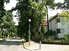
| Beskid Road
( Location ) |
830 | Beskids , traditional name for mountains in the Outer Western and Eastern Carpathians | Aug 4, 1930 | The road C was created by the community and the owners of the early 1920s. It lies between Wasgenstrasse and Normannenstrasse, where it turns into Kirchweg. It is mainly built with single-family houses. |
|
| Borussenstrasse
( Location ) |
1060 | Borussia , Latinized name of the Prussians | around 1901 | The street lies between Nymphenufer (near the border with Wannsee on Kronprinzessinenweg) and Spanischer Allee. In the southern section between Nymphenufer and Paul-Krause-Straße there is a footpath that lies between the lake (Kleiner Nikolassee) at the waterworks / green area on Borussenstraße and the eastern railway line . The road itself begins at the Borussentreppe in continuation of Paul-Krause-Straße and from Am Beelitzhof to Spanische Allee it is a one-way street (lots 14–21 continuously). This runs over the A 115 (Borussenbrücke) and further between the A 115 and the railway line near the Nikolassee S-Bahn station to Spanische Allee and ends there next to the motorway exit to the north. The road was laid out as an industrial road by the railway between 1900 and 1901. According to the street name, it belongs to the Germanic district . |

|
| Breisgauer Strasse
( Location ) |
910 (in the district) |
Breisgau , region in the southwest of Baden-Württemberg between the Upper Rhine and the Black Forest. | July 31, 1947 | The entire length of the street between Am Schlachtensee and Spanische Allee (Guernicaplatz) forms the boundary of the district and, including plots 2-46 (straight) on the west side, belongs to the district, while the eastern plots 1-53 are in Zehlendorf . The street was laid out around 1896 between Schlachtensee station and Potsdamer Chaussee as Viktoriastraße (Battle Lake Post), named after the German Empress Viktoria . In 1925, the extension of Viktoriastraße was included in Wannseestraße (since 1939 Spanische Allee). On August 31, 1937, this royalist street name was replaced by Stöckerzeile , named after the theologian and politician Adolf Stoecker (1835–1909), who, as the founder of the Berlin movement, introduced anti-Semitism into German politics at the end of the 1870s . As part of the denazification , the name was changed to Breisgau in 1947.
Until 2011 there was a bank branch in house number 8, where the bank robbery in Berlin-Zehlendorf took place in 1995 . |

|
| Burgundy Street
( Location ) |
270 | Burgundy , Germanic tribe | before 1905 | The street was laid out in 1903/1904 by Heimstätten AG in the spelling Burgunderstraße. The quiet street, framed by plane trees, is located in the Germanic Quarter between Alemannenstraße ( S-Bahn station Nikolassee ) and An der Rehwiese. Most of the houses date from before the First World War, as the street was spared demolition. |

|
|
Charles H. King Street
( Location ) |
380 | Charles H. King (1922–1948), American military pilot. | Sep 1 1979 | Before that, street 640 of the development plan lies between Lindenthaler and Lisbonallee, but is interrupted by the last from Edwin-C.-Diltz-Straße. The eponymous pilot took off on July 25, 1948 with his co-pilot Lieutenant Robert W. Stuber from Arlington (California), completely exhausted, for another airlift supply flight to West Berlin . His machine crashed over Friedenau . |

|
| Cimbernstrasse
( Location ) |
630 | Cimbri , Germanic tribe | before 1905 | The street was laid out in 1903/1904 by Heimstätten AG. It lies parallel to Teutonenstrasse between Alemannenstrasse and An der Rehwiese in the local area of Nikolassee (Germanic district). The street is covered with linden trees and has renewed cobblestones. The plots are numbered evenly on the left (east side) and oddly numbered on the right (west side), but due to the different parcel widths on the two sides of the street, the plots are not opposite each other: for example, 28 of 13b and 32a of 19 are opposite. |

|
| Clauertstrasse
( Location ) |
800 (in the district) |
Hans Clauert (around 1510–1566), actor, the Mark Eulenspiegel | June 1, 1966 | From Lindenthaler Allee to the main railway line at the former Zehlendorf-Süd S-Bahn station, Clauertstraße forms the boundary of the district. The plots 11-77 (odd) on the west side and in particular the museum village Düppel belong to the district. The road land, all plots on the east side and plots 1–7 (odd) south of the railway area belong to Zehlendorf .
The road follows the course of an old, nameless forest and field path and was laid out around 1910 as road 55 of the development plan. In 1925 it was still undeveloped, in 1931 it was named Andréezeile , and part of it was renamed Clauertstrasse in 1966. The section to Potsdamer Chaussee with connection to Spanische Allee was canceled and the settlement around Edwin-C.-Diltz-Straße was built over. |

|
|
Dreilindenstrasse
( Location ) |
920 | Dreilinden, former hunting lodge | after 1920 | The oak-lined street forms the southern section of the "Wannsee triangle" between Nibelungenstrasse and Lohengrinstrasse. On the latter, only a footpath remained from the old street to the area of the motorway , which leads to Lake Nikolassee via a staircase . The Sancta Maria School (No. 28) and the “House of Saint Hedwig” at No. 24 are located here. The properties at Dreilindenstrasse 2–22 no longer exist, but were canceled when the motorway was built. Odd (southern) properties are 45 (Forestry Office), 49 and 65 (Dreilinden School) and 73–85 (residential buildings). On the map from 1922, Dreilindenstrasse (Post Wannsee) is on the city limits as an extension of Potsdamer Chaussee and continued through Königstrasse in Wannsee drawn. In the address section, the route via Nibelungen-, Walthari-, Isolde-, Lohengrinstraße to the Zehlendorf district is named and of 22 properties (outside on the left) eight are built on and four are gardens, (No. 42) the forest warden's house (today number 16) the oldest remaining building on the street. On January 30, 1933, the section of Potsdamer Chaussee between Lohengrinstrasse and Katteweg was renamed Dreilindenstrasse, only the left side (north) is built on, opposite is forest. This section was omitted when the Zehlendorf motorway junction was built and Potsdamer Chaussee was relocated continuously to the south, so that Dreilindenstraße came to the side. In 1943 the properties at Dreilindenstraße 2–22 (Post Wannsee) are listed as the Reichsautobahn, the course of the road is (right, straight) Potsdamer Chaussee, Lohengrin-, Isolde-, Waltharistraße and mostly built-up, on the left forest to Nibelungenstraße. The street was named after the Dreilinden hunting lodge for Prince Friedrich Karl in the Düppeler Forest, to which it led. The castle was demolished in 1955 and today is the district forester's office. In this area was the " Checkpoint Bravo " border control point for transit traffic through the GDR . The Dreilinden country house settlement south of Berlin is named after the castle . Dreilindenstrasse was a section of Berlin-Potsdamer Chaussee until the autobahn was built , and at the corner of Lohengrinstrasse there was a Chausseehaus in which the workers responsible for maintenance lived. |

|
| Dubrowstrasse
( Location ) |
220 (in the district) |
Wilhelm Dubrow (1823–1907), farm owner, mayor and mayor in Zehlendorf | July 31, 1947 | The western section between Spanischer Allee and Breisgauer Straße with lots 44–52 (even) and 45–51 (odd) is in the district, the street continues to Zehlendorf . The street was laid out (in Schlachtensee) between 1894 and 1899 by the landowners (Zehlendorf-West AG) and residents as Elisabethstraße ; in an area with the names of queens, it is named after the Queen of Prussia Elisabeth Ludovika (1801–1873), wife by Friedrich Wilhelm IV. It lies in 1920 between Heinrichstrasse (Dubrowplatz) and Luisenstrasse in part (east of Viktoriastrasse, now Breisgauer Strasse) in Zehlendorf. On March 15, 1939, this and Zehlendorfer Georgenstrasse were renamed Schemannzeile , with numbers 45-51 (south) and 44 (north) between Stöckerzeile (now Breisgauer Strasse) and Spanischer Allee in the district. It was named after the translator and racial theorist Karl Ludwig Schemann (1852–1938). This street name, named after the honorary member of the National Socialist Reich Institute for the History of New Germany , was then changed to Dubrowstrasse in 1947 in the course of denazification ; the course of the street to Spanische Allee remained unchanged. Dubrow came from a long-established family and was 1883-1889 honorary mayor and 1872-1883 and 1889-1901 mayor in Zehlendorf. |

|
|
Edwin-C.-Diltz-Strasse
( Location ) |
310 | Edwin Cary Diltz (1916–1948), Major in the US Air Force, had a fatal accident while approaching Berlin during the Berlin Airlift | Sep 1 1970 | It is located in a residential area south of Potsdamer Chaussee between Lisbonallee and Charles-H.-King-Straße and was laid out as Straße 639 in the 1930s according to the development plan . In the mid-1960s, when the roads were being laid out in this settlement, the northern section of Andreezeile was abolished, and the south section was renamed Clauertstraße . |

|
| Ernst-Ring-Strasse
( Location ) |
210 | Ernst Ring (1850–1906), Prussian economic adviser | before 1914 | The street lies between Spanischer Allee and Altvaterstraße (up to the railway embankment ). The area on which the street is located was transferred from Prince Friedrich Leopold to Heimstätten AG between 1894 and 1897 . After that, the road was laid out until 1908. 1910 still undeveloped, in 1915 the western plots 5 and 7 are built on, the eastern plots are assigned to the parallel Rolandstraße. |

|
|
Flererhof
( Location ) |
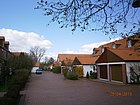
90 | Flerer, in Brandenburg dialect (Telt'sches Platt) for lilac | Aug 13, 1985 | The street on the site of the former Neu-Zehlendorf colony is a dead end between Am Rohrgarten and Königsweg, which is not a road here and forms the northern edge of the “KGA Schlachtensee-Süd”. From Am Rohrgarten as a dead end with a footpath (closed for motorbikes, sign 255 ) to Königsweg, built on with row houses with front gardens. The road 671 of the development plan as traced out the parallel roads in this residential area in the early 1930s. The naming of the streets with the addition “ -hof ” in the “garden city Düppel” did not take place until the mid-1980s. |
|
|
Daisy Path
( Location ) |
60 | Daisies , daisies | Nov 25, 1991 | The road lies between the northern section of Parforceheide and the northern end of Benschallee. The path in the area of the garden city Düppel leads in the southeast around the youth leisure home Düppel and has no property allocation. The path lies on the route of road 673 , which was planned according to the development plan. There is a footpath / cycle path to Lisbonallee (north). |

|
| Gerkrathstrasse
( Location ) |
500 | Franz Gerkrath (1835–1901), German insurance specialist | before 1905 | The street was laid out in 1903/1904 by Heimstätten AG at the expense of the owners. It is located between Spanischer Allee and Normannenstrasse on the eastern edge of the Rehwiese . The street is part of Berlin's main Green Route No. 11, Wannseeweg |

|
| Günter-Pfitzmann-Platz
( Location ) |
30 × 35 × 45 triangular |
Günter Pfitzmann , actor | 8 Apr 2017 | The previously unnamed place between Matterhornstrasse, Wasgenstrasse and Palmzeile was given its name on April 8, 2017 in the presence of his widow Lili Pfitzmann and his sons Andreas and Robert. | |
| Guernica Square
( Location ) |
90 × 70 × 70 (circle segment) |
Gernika , city in the Spanish autonomous region of the Basque Country | Nov 27, 1998 | The previously unnamed place is located on Breisgauer Straße / Spanische Allee, the street area and the area of the square are in the district, the eastern adjacent properties belong to Zehlendorf . The Tewsstrasse opens from the west. Guernica was amended by the Spanish Civil War of aircraft of the German Condor Legion made bombing on April 26, 1937 and the cautionary paintings by Pablo Picasso known. The square was named in response to the Spanish Alley being renamed when the Legion returned in 1939 |

|
| Guntersblumer Weg
( Location ) |
160 | Guntersblum , local community on the left bank of the Rhine between Mainz and Worms in Rheinhessen | July 31, 1947 | The paved birch-lined street is located in the Schlachtensee area between Tewsstraße and Spanische Allee. It was laid out between 1894 and 1899 by the owners and Zehlendorf-West AG. Originally named Elisabethstraße, in 1939 the eastern part was incorporated into Schemannzeile, and since 1947 Dubrowstraße (see there). The western part was named Badenweilerweg . A reference to the Baden spa town of Badenweiler is conceivable, but more likely, given the National Socialist motives in the entire renaming campaign of 1939, an allusion to the Badonviller March , called Badenweiler March during the Nazi era and as Adolf Hitler's favorite march as part of the " Leader cult ”officially highlighted. In 1947, as part of the removal of street names with National Socialist ideas, the section south of Spanische Allee was named in Guntersblumer Weg. Initially, a passage across Tewsstrasse to Potsdamer Chaussee was planned. |

|
|
Haagstrasse
( Location ) |
260 | Adolf Haag (1858–1927), chief engineer, tenant, local politician | Apr 4, 1934 | The road, projected as road A , runs from and to the Beskid Road in the south-east curve. It was created by Heimstätten AG in the early 1930s. Haag and eight other residents were elected to the Nikolassee council on April 6, 1910, when the colony was converted into the Nikolassee rural community by cabinet order. |

|
|
Havelchaussee
( Location ) |
3620 (in the district) |
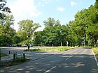
along the Havel | from 1925 | The Havelchaussee in the district continues the Kronprinzessinnenweg (from the height of the pedestrian tunnel under the A 115 to Schlachtensee) as a road, leads northwest to the Havel shore and continues north of the district border to Charlottenburg-Wilmersdorf near the Lieper Bay a little north of the ferry to Lindwerder in the neighboring district . It leads north through Grunewald , Westend to Wilhelmstadt ( Spandau ). The entire street is a 30 km / h zone and leads through the local recreation area of the Berlin Forest Grunewald . It is closed to traffic between midnight and 6 a.m. |
|
| Raspberry dough
( Location ) |
360 | Raspberry, berry-like aggregate stone fruit | Aug 13, 1985 | The road 663 on this route is configured in the development plan. It is located in the "garden city of Düppel" between Am Rohrgarten and Schlehdornsteig. |

|
| Hohenzollernplatz
( Location ) |
70 semicircle radius |
Hohenzollern , German ruling family | around 1900 | The square was created around 1890 by Heimstätten AG with Alemannenstrasse. The forecourt of the Nikolassee S-Bahn station on the west side is on Alemannenstrasse, Normannenstrasse joins from the east and Prinz-Friedrich-Leopold-Strasse runs through the square from the southeast. The Schmuckplatz has been registered as a protected construction area since the early 1980s. In addition to the train station (No. 6), the former town hall of the rural community Nikolassee, the former service building of Heimstätten AG from 1903 and the residential and commercial building with chimney tower are located on the square with lots 1–8. South of the station there has been a "row of shops" on plot 7 since the early 1950s. |

|
| Hoiruper Strasse
( Location ) |
190 | Højrup Sogn , Danish parish in North Schleswig | May 17, 1930 | The road on the western edge of the Schlachtensee with the lots 1–14 (continuous) goes north from the Spanische Allee / Am Schlachtensee and ends at the railway line . The route planned as road G2 was laid out around 1910 by the railway company and the residents. The choice of name is related to the referendum provided for in the Versailles Treaty, after which the town of Hoirup was also ceded to Denmark in 1920. |

|
|
In the middle bush
( Location ) |
470 | Mittelbusch, the formerly wooded area of the Zehlendorfer Heide | around 1920 | The street lies between Von-Luck-Straße and Rehwiese (Julius-Posener-Platz). The road was laid out by Heimstätten AG around 1904 as a middle path and paved in 1907. |

|
| Island road
( Location ) |
1220 | on the island of Schwanenwerder | around 1900 | It is the access road and the ring road on the island of Schwanenwerder from Schwanenwerderbrücke, where it continues the Wannseebadweg. The street was laid out as a private street around the turn of the century by a Berlin manufacturer on behalf of the Schwanenwerder GmbH interest group . It is the only street on Schwanenwerder that came to Berlin in 1920 with the incorporation of Spandau and to Zehlendorf in 1926. The German Aspen Institute and the Schwanenwerder youth hostel are located on the island . |

|
| Isoldestrasse
( Location ) |
290 | Isolde, Queen of Cornwallis is a character from Richard Wagner's opera Tristan und Isolde | before 1905 | The street in the Wagnerviertel lies between Tristanstrasse and Potsdamer Chaussee. The road was laid out around 1897 by Heimstätten AG and the railway company. |

|
|
Jochen Klepper way
( Location ) |
700 | Jochen Klepper (1903–1942), journalist, writer and sacred song poet, victim of the Nazi regime | around 1952 | The Parkweg in the Wonnegauviertel is located in a green corridor (protected green area) east of the Rehwiese between Beskidenstraße (Kirchweg) and Wasgenstraße . It is crossed by Von-Luck-Strasse. 1954 also crossed Krottnauer Strasse, which is now a footpath as Wonnegausteig . |

|
| Julius-Posener-Platz
( Location ) |
100 × 50 roughly rectangular |
Julius Posener (1904–1996), architect | Nov 4, 2004 | The place is in the street An der Rehwiese – Im Mittelbusch on the southern edge of the Rehwiese . From the square leads to northeast Im Mittelbusch, northwest and southwest An der Rehwiese and the Normannenstrasse to northwest. The square was named on the occasion of Posener's 100th birthday. Various places of his life's work such as Haus Mittelbusch, Landhaus Wild (Kirchweg 25), Landhaus Freudenberg (Potsdamer Chaussee 48), his own house (Potsdamer Chaussee 49a) and the Rehwiese, for which he was strongly committed, are in the immediate vicinity. |

|
|
Kaiserstuhlstrasse
( Location ) |
620 | Kaiserstuhl , low mountain range of volcanic origin in the southwest of Baden-Württemberg | July 31, 1947 | The street is between Altvaterstraße and Dubrowstraße. The section south of Matterhornstrasse was laid out between 1894 and 1899 by the owners and Zehlendorf-West AG as Luisenstrasse , named after Queen Luise of Prussia, wife of King Friedrich Wilhelm III. The northern section was laid out around 1890 as Sophienstrasse , named after Queen Sophie of Prussia (1668–1705), wife of King Friedrich I. On March 15, 1939, the street on both streets between (today's) Altvaterstrasse and Dubrowstrasse in Schönererzeile named. The royal names in this area of Schlachtensee were replaced by people who did justice to National Socialist ideas : the Austrian politician Georg von Schönerer (1842–1921) was a radical anti-Semite and had a strong influence on the young Adolf Hitler , who made him one of his Looked at role models. In 1947 these street names were then replaced after people from the Nazi ideology and the street (now without a connection to Spanische Allee) was named after the crossing Matterhornstrasse . |

|
| Katteweg
( Location ) |
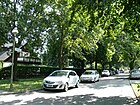
410 | Hans Hermann von Katte (1704–1730), Prussian lieutenant, executed childhood friend of Frederick the Great | Jan. 16, 1925 | The Street V was applied mid-1920s by neighbors and owners. It is located between Königsweg and Von-der-Trenck-Straße, with property 1 beyond the latter directly on the southeast edge of the Zehlendorf motorway junction . In 1943 the street to Potsdamer Chaussee is indicated, however the plots 1 to 5 (according to the counting at the time) are listed as Reichsautobahn and the opposite side as a dead end . In 1926 the Katteweg under Zehlendorf is listed as undeveloped from Potsdamer Chaussee and in 1927 under Zehlendorf with four developed properties between Königsweg and Potsdamer Chaussee. The northern part was built over by the motorway in the 1930s . |
|
| Kesperhof
( Location ) |
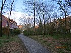
100 | Kesper in Brandenburg dialect (Telt'sches Platt) for cherry | Aug 13, 1985 | The street on the site of the former Neu-Zehlendorf colony , marked as street 670 in the development plan, had been taken over by the Berlin building land agency in the early 1920s, but remained undeveloped. The street is built on with row houses with front gardens and is located in the "garden city of Düppel". From Am Rohrgarten as a dead end with a footpath (closed to motorbikes, sign 255 ) to Königsweg, as the latter is only a footpath and a horse path between a strip of green. Kesperhof lies parallel to some streets that are also named with the addition -hof . |
|
| Kirchweg
( Location ) |
830 | between church and churchyard | around 1900 | The road was laid out in several construction phases between 1900 and 1906 by Heimstätten AG. It is located between Potsdamer Chaussee and Gerkrathstraße ( Rehwiese ) and runs between the Nikolassee Church (west side) and the cemetery (east side). In 1920 there is the southern section between the Waldhaus sanatorium and Mittelweg where the church and cemetery of Nikolassee are located in an enclave of the rural community of Nikolassee in Zehlendorf. |
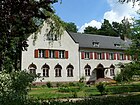
|
|
Royal road
( Location ) |
3540 (in the district) |
related to the Prussian king , historical connection between the royal palaces in Berlin and Potsdam | after 1730 | The Königsweg is primarily a footpath, bike path and bridle path between Stahnsdorfer Damm and Clauertstraße with plots 138–142 (on the grounds of the forest cemetery ) and 200–250 (straight) in the district, partly along the city limits. Only the section between Katteweg and Am Waldhaus is designed as a road. On both sides as a dead end street east on property 200 and west on property 240–250 with turning hammer . Wald and KGA Schlachtensee-Süd are on the south side of the road. The Berlin Wall Trail runs along part of the street . The road (across the district boundaries) continues westwards as a footpath to Wannsee and eastwards as a road to Zehlendorf . The Lindenthaler Allee is crossed as a pedestrian crossing and is marked on both sides as a walking (sign 239) and riding path (sign 238) . In 1900 the Königs = Weg for Zehlendorf with Schlachtensee is listed from Königstraße with a building for six resident families. It is located south of Gut Düppel, the Hubertushäuser (Neu-Zehlendorf) and Potsdamer Chaussee and continues Zehlendorfer Königstraße. |

|
| Kronprinzessinnenweg
( Location ) |
6580 (in the district) |
Crown Princess , in Prussia title of the Crown Prince's wife | 1882 | The Kronprinzessinenweg lies with the plots 21-160 (continuous) between the Scabellstrasse and the Großer Stern (junction Hüttenweg) on the Hüttenweg in the district. To the south it continues in Wannsee . The part north of the Großer Stern in Grunewald is named as the Königsweg. As a main road ( StEP category III ) it is designated as a road up to Spanische Allee to Havelchaussee (into which it merges), the further section is a footpath and cycle path and these 4000 meters are developed as a skater route. The oldest part of the street was laid out in 1882 by the Teltow district as a district road . In the 1901 city map of Berlin, the Kronprinzessinnenweg was marked by name as an extension of the (Charlottenburg) Königsweg, the course changed over the decades, for example due to the construction of the Automobile Road and remained under this name only in Wannsee and Nikolassee, the path initially ran parallel to Wannseebahn , later to AVUS . |

|
| Krottnaurerstrasse
( Location ) |
1210 | Hugo von Krottnaurer (1851–1915), entrepreneur, local politician, founding member and director of Heimstätten AG | before 1905 | The road was laid out and expanded by Heimstätten AG in several construction phases around 1904/1905. It lies between Am Schlachtensee and Wasgenstraße, passes under the railway line, where it bends to the east from Wonnegausteig in the southern part and opens into Wasgenstraße. The southern section ran between Spanischer Allee (formerly Wannseestrasse) and Beskidenstrasse until the early 1930s and was extended and developed through the new development area “Wonnegauviertel” to Wasgenstrasse. On the Nikolasse district map from 1926 three houses (17, 18, 19) are entered, of which the single-family house No. 19, owned by Fritz Schirmer in 1907, is a listed building, house 8 and house 6a are also registered. |
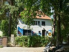
|
| Kurstrasse
( Location ) |
430 | adjoining Hubertus hospital | around 1896 | The street was laid out in 1896 by the municipality on the occasion of the establishment of the sanatorium. It is located between Potsdamer Chaussee and Tewsstrasse. The hospital grounds of the Paul-Gerhard-Diakonie are on the east side of the road to Spanische Allee and the student village Schlachtensee behind the property on the west side . |

|
|
Dragonfly Street
( Location ) |
460 | Dragonflies , an insect order spread around the world | before 1905 | It is located between Cimbernstrasse and Prinz-Friedrich-Leopold-Strasse, where it turns into An der Rehwiese. The southern section was separated from the bank of the Nikolassee by the construction of the motorway and has been running along the federal motorway 115 on the west side since the 1930s . The street was laid out around 1900 by Heimstätten AG and the owners. In 1920 it lies on the western edge of the rural community Nikolassee and along the Nikolassee. In 1910, ten plots of land are listed as developed in the address book. |
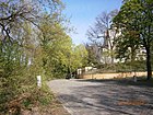
|
| Lindenthaler Allee
( Location ) |
670 (in the district) |
Lindenthal , municipality in the north of Leipzig, since 1999 district of Leipzig | July 31, 1947 | The avenue lies between Lloyd-G.-Wells-Straße and Clauertstraße completely in the district, in the subsequent section up to Potsdamer Chaussee only the west side of the street belongs to it. The street and the eastern plots 56-72 as well as the section north of the Potsdamer Chaussee are in Zehlendorf . The road was laid out between 1892 and 1895 by Zehlendorf-West AG and was lined with linden trees. On December 1, 1934, it was adapted to other streets in Schlachtensee and named after NSDAP member Theodor Fritsch (1852-1933) and publisher of anti-Semitic publications. In 1947, as part of the elimination of Nazi ideas, the name was changed to match the previous name, with Lindenstrasse having been a street name several times since Greater Berlin was formed. To improve the main road connection to Kleinmachnow, there is a green strip in the south as a cleared route to the south at the former S-Bahn station Düppel as a bypass of Lloyd-G.-Wells-Straße and Benschallee. |

|
| Lisbon avenue
( Location ) |
560 | Lisbon , capital of Portugal | May 3rd 1979 | Lisbonallee continues along Spanische Allee south of Potsdamer Chaussee to Lindenthaler Allee. Here road 625 in the development plan was laid out and laid out by the owners and residents in the mid-1920s, and expanded as Andreézeile (Nikolasseer section) around 1930 by the community . In the 1943 address book, this line between Königsweg and Potsdamer Straße is given with construction sites, meaning land that has been awarded but has not been built on. The current course in the arch between the garden city of Düppel and the (US-American) quarter towards Lindenthaler Allee was created by the buildings from the end of the 1970s for the US military in the Zehlendorf district. |

|
| Lloyd-G.-Wells-Strasse
( Location ) |
340 | Lloyd C. Wells (1919–1948), American military | Sep 1 1981 | The residential street is one of the main connections to Kleinmachnow with sometimes high traffic and is located between Benschallee and Lindenthaler Allee. The street name is based on the settlement that was inhabited by soldiers of the US protection power in the 1990s, and it was named during a German-American festival . Wells was an on-board mechanic in the US Air Force and had a fatal accident in 1948 during a mission as part of the Airlift to Berlin . The road 659 of the development plan was built in the mid-1930s by owners and residents. After 1945, American soldiers moved into the neighborhood with their families. Since the Lindenthaler Allee in the south is not developed as it is, the road serves as a supplementary road for local traffic to Kleinmachnow and Benschallee. |

|
| Lohengrinstrasse
( Location ) |
500 | Lohengrin , opera by Richard Wagner | before 1905 | The street is in the "Wagner Quarter" between Nibelungenstrasse and Dreilindenstrasse on the west bank of the Nikolassees . The lakeside, even numbered plots 2–34 are bordered by the Nymphenufer, which is connected to Lohengrinstraße by Nikolassteig (Eichenweg until 1936). Plots 1–31 (odd) are on the opposite side of the street, at the south end on plot 26/34 are the buildings of the children's and youth home “Sancta Maria” with the school on Dreilindenstraße 28. The street was built between 1895 and 1897 by Heimstätten AG laid out and expanded and fortified between 1902 and 1904. |
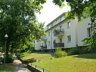
|
| Lückhoffstrasse
( Location ) |
630 | Louis Lückhoff (1838–1913), politician and founding member of Heimstätten AG | before 1905 | The street was laid out by Heimstätten AG around 1900 and expanded after 1905. It is between Spanische Allee and Kirchweg, before 1937 it ended at today's Schopenhauerstrasse. There were never any shops in the quiet residential street with the flesh-red horse chestnut tree . |

|
|
Marine riser
( Location ) |
650 | Navy , the entirety of a state's naval fleet | March 29, 1939 | The road laid out as road 561 in the development plan was laid out in the 1930s for the marine settlement on Schlachtensee and built with residential buildings for senior marine officers . It goes northwards from Am Schlachtensee with lots 1–43 (odd) and 2–46 (even) and lies parallel to this. Willy Brandt lived in No. 14 from 1955 to 1964 . |

|
| Matterhornstrasse
( Location ) |
1010 (in the district) |
Matterhorn, summit of the Valais Alps, Switzerland | July 31, 1947 | Matterhornstrasse is located with plots 55–101 (odd) and 60–106 (even) between Spanischer Allee and Breisgauer Strasse in the district and continues eastward to Zehlendorf to Lindenthaler Allee. After 1893 the Waldemarstrasse was laid out on this route , named after Prince Waldemar of Prussia (1889–1945) . This led from Wannseestraße (today: Spanische Allee) to Viktoriastraße (today: Breisgauer Straße), the southern section of Waldemarstraße (from Heimstättenstraße ) was named in 1939 together with Gertrudstraße in Palmzeile . The northern section of Waldemarstrasse was renamed on March 15, 1939 with Heimstättenstrasse (laid out after 1890) in Schemmstrasse . It was named after Hans Schemm (1891-1935), Gauleiter of the NSDAP and co-founder and leader of the NS teachers' association. In 1947 Schemmstraße was named Matterhornstraße as part of the elimination of National Socialist ideas . |

|
|
Münchowstrasse
( Location ) |
200 | Otto Münchow (1847–1927), entrepreneur, founder and board member of Heimstätten AG | around 1905 | The street was laid out as a footpath by Heimstätten AG in 1904/1905 and then turned into a street. The street is between Am Beelitzhof and Paul-Krause-Straße west of the A 115 . |

|
| Mother Mochow Way
( Location ) |
460 | Anna Mochow (born 1877), innkeeper in Nikolassee | Aug 24, 1987 | The previous name is street 662 of the development plan, the footpath ( Okstra : F) in the garden city of Düppel was named in 1987 in memory of the former "Haus Mochow" in Potsdamer Chaussee 87. This street between Am Rohrgarten and Potsdamer Chaussee is on the eastern edge of the Yehudi Menuhin Park. |

|
|
Nibelungenstrasse
( Location ) |
810 (in the district) |
Nibelungen , opera cycle by Richard Wagner based on the treasure of the dwarf family in German legend | 1905 | The street lies (as an indirect extension of Alemannenstraße) between Lohengrinstraße and Potsdamer Chaussee , it forms the suburb of Wannsee . Road land and eastern plots 1–21 (ongoing) as well as the KGA Wannsee (BLW on railway premises from opposite plot 14a) are located in the district, with villas only on the southeast side. In contrast, the west side with the Wannsee train station belongs to Wannsee. The street was laid out around 1900 in the Nikolassee villa colony (Wannseedreieck) by Heimstätten AG parallel to the railway site, starting at the Wannsee train station between Dreilindenstraße and Lohengrinstraße. The strip on the embankment still belonged to the Teltow district. In the 1930s it was extended over Dreilindenstrasse to the new route as part of the new construction of Potsdamer Chaussee (at the Zehlendorf motorway junction ). At the end of 1918, despite the low price per square meter, 14 of the 21 listed properties were still not sold because of the proximity to the railway. The tenement house Nibelungenstrasse 1 from 1905/1906, which was built together with the house at Dreilindenstrasse 80 (then Dreilindenstrasse 1) by the contractor Klose from Michendorf, was the only one on the street until the early 1920s. |

|
| Nickisch-Rosenegk-Strasse
( Location ) |
200 | Gotthard Ernst Nickisch von Rosenegk (1853–1931), military | before 1905 | The street (3–11a odd and 2–10 odd) is located in the Schlachtensee area between Matterhornstrasse and Spanische Allee, it was laid out in 1897/1898 by the municipality at the expense of Heimstätten AG. The street's namesake was the son of a landowner and attended the knight academy. In 1903, as a colonel, he was given command of the Groß-Lichterfelde main cadet institute . He had close ties to Prince Friedrich Leopold of Prussia and did a lot for Heimstätten AG in Nikolassee. For 1920, the street in the municipality of Zehlendorf with Schlachtensee between Heimstättenstraße, Poetenweg and Wannseestraße has a built-up plot, five garden plots and four undeveloped plots (construction site). | {
|
| Nikolassteig
( Location ) |
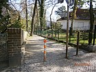
90 | Way to the Nikolassee | Jan. 29, 1937 | It was laid out around 1899/1900 as an oak path with a connection to the Nikolassee and expanded as a public road in 1904 by Heimstätten AG. The footpath (according to RBS) (without assigned land) is between Lohengrinstrasse and Nymphenufer . It leads through Lohengrinstrasse between 18a and 20 and opens up the background pieces 18 and 20a. |
|
| Normannenstrasse
( Location ) |
410 | Normans , not a closed ethnic group, for the Vikings at the time of naming | before 1905 | The lime-tree lined, quiet residential street with a convex curve to the northeast leads through the Rehwiese in the Germanic district between Alemannenstrasse on Hohenzollernplatz and Gerkrathstrasse . It was built on in the years 1905–1907, and in 1912 the villas still existing today stood on seven of 15 plots, some of whose gardens are on neighboring plots. According to the 1920 address book, No. 1 is Heimstätten AG on Hohenzollernplatz, six villas (Villa Luttermöller at 8-12), four houses, a garden (belongs to No. 7) and construction sites are designated for three properties (which is not necessarily here construction started, but only means suitable land that has not yet been built on). |

|
| Nymphenufer
( Location ) |
700 | Nymph , a nature spirit due to the proximity of the Richard-Wagner-Quarter and due to the proximity of the lake in the double meaning nymph (zoology) for winged insects | before 1905 | The riverside path directly on the Nikolassee is a footpath between the Rehsprung, the eastern end of Dreilindenstrasse, built over by the Zehlendorf motorway junction at the "House of Saint Hedwig", and the lakeside road , which winds around its northwestern, built-up property between Normannenstrasse and Alemannenstrasse. This traffic-calmed street leads to car traffic for the Nymphenufer in continuation of the Seeuferstraße between this and the Kronprinzessinnenweg, here the narrow paved street under the name Nymphenufer leads through two height-limited ( signs 265 - 3.1 meters ) and oncoming traffic (sign 308) Tunnel under the Wannseebahn and the Wetzlarer Bahn . The Nymphenufer ends at the west end at the edge of the district because the road area of the Kronprinzessinenweg belongs to Wannsee . Between the two railway bridges are the vehicle-friendly entrances to KGA Nikolassee, the railway farm between the two railway lines at the S-Bahn station. The street was laid out around 1900 by Heimstätten AG, in the 1920 address book gardens belonging to Dreilindenstrasse and Lohengrinstrasse are shown in the address book between Nikolassee and Seeuferstrasse, and construction sites on Seeuferstrasse (without property number). The road connects the Nikolassee with the Kleiner Nikolassee beyond the railway lines, the rest of the silted up former watercourse ( Grunewaldrinne ). |

|
|
Osthofen way
( Location ) |
310 | Osthofen, since 1970 town in Wonnegau, Rhineland-Palatinate | Aug 8, 1935 | The street in the Wonnegauviertel lies between Westhofener Weg and Wasgenstraße and is planned as street 359 of the development plan. It lies parallel to the more northerly Westhofener Straße. In 1943, two of the plots 1–31 (left side) and four on the opposite side 2–32 remained undeveloped. |

|
|
Palm row
( Location ) |
480 | Johann Philipp Palm (1766–1806), bookseller and publisher | March 15, 1939 | The street lies between Krottnaurerstraße and Wasgenstraße, at the latter it opens at an unnamed place on Matterhornstraße. In the section south of the Spanische Allee it was laid out between 1897 and 1900 by Heimstätten AG as Gertrudstrasse , north of the Spanische Allee , the southern Waldemarstrasse , named after Prince Waldemar von Prussia (1889–1945) , was built on the (today's) route after 1893 , created. In 1939 these two were renamed as Palm Row. The remaining section of Waldemarstraße was named as Heimstättenstraße as Schemmstraße (today: Matterhornstraße ). Palm published the anonymous anti-French pamphlet Germany in his deep humiliation in Nuremberg in 1806 , he was therefore arrested on the orders of Napoleon and brought before a court martial in Braunau am Inn and shot dead because he refused to name the author of the book. |

|
| Parallel street
( Location ) |
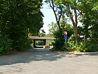
150 | parallel to the Wannseebahn | before 1925 | The street is located westwards through the railway line from Alemannenstraße (near Teutonenstraße) and leads to Südostund, it opens up plots 1, 1a and 2 and leads to the listed Nikolassee S-Bahn substation. The road is right up to the A 115 and the S-Bahn line S 1 . Before the motorway feeder was built in 1939, it ran parallel to the Wannseebahn through a tunnel under the Wannseebahn tracks into the lower Borussenstraße at the level of the stairs to Paul-Krause-Straße. In the course of the construction of the motorway, it was swiveled in the direction of the tram route and the road tunnel to Borussenstrasse was removed. |
|
| Parforce heather
( Location ) |
500 (in three parts) |
Parforceheide, landscape name for the area south of Albrechts Teerofen | Jan. 11, 1985 | It is laid out as road 672 according to the development plan. The street is located in the "Garden City of Düppel" in two courtyard-like sections to the north from Am Rohrgarten and north of a cross section with a connection to the Mutter-Mochow-Weg (Parkostseite). It turns into the daisy path. It opens up the terraced houses (in eleven blocks) with gardens on plots 1–121 (odd) and 2–120 (even) in the estate east of the park area. |

|
| Paul-Krause-Strasse
( Location ) |
150 | Paul von Krause (1852–1923), lawyer and civil servant | before 1905 | The street branches off from Münchowstraße in a south-easterly direction towards Borussenstraße and ends in a turning hammer on the stairs to Borussenstraße that were built around 1903. Before 1903, the street was named after the founding member Hans Roland of Heimstätten AG and today's Rolandstraße in Schlachtensee-West was named after Paul von Krause, although the street names were changed here due to the settlement of Krauses. The properties on the southwest side of the street had free access to the lowlands on Nikolasgraben that belonged to the waterworks, but are now fenced in and not accessible to the public. |

|
| Pfeddersheimer Weg
( Location ) |
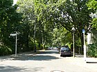
760 | Pfeddersheim , once a free imperial city, has been part of Worms since 1969 | Aug 8, 1935 | The street between Wasgenstraße and Kirchweg is located in the Wonnegauviertel on the route from Straße 360 and Straße 361 of the development plan, as the southern one to the parallel Ost- and Westhofener Straße. |
|
| Potsdamer Chaussee
( Location ) |
3680 (in the district) |
Road to Potsdam, the neighboring town to the west | before 1905 | Potsdamer Chaussee with lots 24–52 and 61–95 (continuous) lies between Nibelungenstrasse and Lisbonallee, with the southern lots up to Lindenthaler Allee in Nikolassee. A western section is in Wannsee , the road continues in the east in Zehlendorf . Until the connection from the AVUS to the Berliner Ring was expanded , the western part of the Chaussee led to Wannsee at Zehlendorfer Kreuz over Dreilindenstrasse through the railway bridge at Wannsee station . Potsdamer Chaussee was a section of the old Potsdamer Strasse, the oldest paved road in Prussia, which was laid out as a connecting road between the royal cities of Berlin and Potsdam in 1792. On a map from 1905, this section was still referred to as the Chaussee von Potsdam . |

|
| Prinz-Friedrich-Leopold-Strasse
( Location ) |
900 | Prince Friedrich Leopold of Prussia did a lot for Heimstätten AG in Nikolassee | before 1905 | The two-lane, linden-lined street lies between Alemannenstrasse on Hohenzollernplatz and Libellenstrasse. It was laid out by Heimstätten AG between 1901 and 1904 and is indicated by name in the Pharus Plan 1905. Most of the houses on the street were built before 1914; in addition to villas and country houses, residential buildings with shops on the ground floor were built at the north end near the train station. The "Hauptstraße Nikolassees" with its predominantly old linden trees on the roadside and on the median was advertised by Heimstätten AG in brochures as the "widest avenue decorated with a garden strip". The road running in a curve to the southeast led to the Nikolassee , but ends today in front of the noise protection wall of the motorway feeder on Libellenstrasse. A prepared implementation, which is typical for the construction of Reichsbahnautobahn, leads somewhat offset, which would have made it possible to continue the road to the lake side, but which was not implemented. At the west end of Prinz-Friedrich-Leopold-Straße a pedestrian tunnel leads through the motorway to the lake side. The eponymous Prince Friedrich Leopold headed the Potsdam cavalry inspection and became inspector general of the army in 1907. From his residence Klein-Glienicke from conveyed it the colonization of the villa colony Nikolassee . Until 1900, Prince Friedrich Leopold owned the “Kuhfenn” in the parish of Nikolassee, which was renamed Rehwiese . |

|
|
Quantzstrasse
( Location ) |
570 | Johann Joachim Quantz (1697–1773), flutist, flute maker, flute teacher of Frederick the Great | Jan. 25, 1925 | The street in the “Waldhaus district” on the southeast edge of the Zehlendorf motorway junction was laid out as street T of the development plan. It lies between Potsdamer Chaussee and Königsweg. In 1943 the lots were mostly built on (18 of 34), plus three summer houses and two garden plots, eight were named as construction sites, with (uneven) plots on the right side of the Potsdamer Chaussee on Königsweg not allocated. |

|
| Quast heather
( Location ) |
140 | Quastheide, Zehlendorfer field and forest designation (Quast = leaf frond, tuft) | Aug 13, 1985 | The street on the site of the former Neu-Zehlendorf colony was laid out as street 664 in the development plan and was taken over by the Berlin building land agency in the early 1920s, but remained undeveloped. It is located in the "Garden City of Düppel" and was built in the 1980s with row houses with front gardens on a courtyard-like access road between Am Rohrgarten and Königsweg. From Am Rohrgarten as a cul-de-sac with a footpath (closed for motorbikes, sign 255 ) to Königsweg, which is a footpath and rider's path here. It lies parallel to some streets that are named with the addition -hof . |

|
| Quendelsteig
( Location ) |
160 | Quendel , medicinal and aromatic plants | Aug 13, 1985 | Laid out as street 665 of the development plan, it is located in the "Garden City Düppel" between Wasgensteig and Himbeersteig with row houses on a courtyard-like driveway to the houses. |

|
|
Deer jump
( Location ) |
1430 | adjacent to the deer meadow | before 1920 | The footpath is on the eastern edge of Rehwiese in continuation of Gerkrathstraße between Normannenstraße and the motorway junction with connection to the street An der Rehwiese. This street on the east side of Rehwiese was laid out as a meadow path by Heimstätten AG between 1910 and 1912 and was interrupted during construction at the motorway junction , so the connection to Dreilindenstraße was lost and the inflow from Rehwiese to Nikolassee was canceled. From Dreilindenstrasse there is a (officially unnamed) footpath between the "House of Saint Hedwig" and the northwest curve of the motorway junction via a staircase down to the Nymphenufer at the Nikolassee, which is still shown as a deer jump on various maps. A passage through the autobahn at the lake is closer to Prinz-Friedrich-Leopold-Straße. At the west end of the Rehsprung in the north-east curve (An der Rehwiese 33) is the pumping station, a facility of Berliner Wasserbetriebe , which also regulates the flow of water between Rehwiese and Nikolassee. In the 1943 address book, the Rehsprung between Gerkrathstraße, Kirchweg, Im Mittelbusch, An der Rehwiese across the Rehwiese to the Nymphenufer and a property called Rehsprung 1 on Kirchweg with a construction site and garden are listed. |

|
| Frost carrier path
( Location ) |
550 | Reifträger , summit in the northwestern Giant Mountains | July 31, 1947 | The street in the town of Schlachtensee lies between Altvaterstrasse and Schopenhauerstrasse and crosses Matterhornstrasse. It was laid out before 1896 in the emerging villa colony as Augustastraße , named after Empress Augusta (1811–1890) and Queen of Prussia, wife of Kaiser Wilhelm I. From an anti-royalist point of view, the street was named Stauffzeile on March 15, 1939 after the Volkish Author and supporter of the Nazi movement Philipp Stauff (1876–1923), prominent journalist and publicist, named. As part of the elimination of Nazi ideas , it was renamed again in 1947 after an ideologically neutral mountain peak. |

|
| Rolandstrasse
( Location ) |
220 | Hans Roland, founding member of Heimstätten AG | 1903 | The street lies between Matterhornstrasse and Altvaterstrasse. The road was laid out around 1895 and expanded by Heimstätten AG in 1900. Initially, the street in the Schlachtensee area was named after the founding member Paul von Krause and was only named after Hans Roland in 1903 through an internal exchange of the founding members for this street, while the Reichstag member Krause was already living in the west of the Nikolassee community at that time. |

|
| Rosemeyerweg
( Location ) |
220 | Bernd Rosemeyer (1909–1938), racing driver | Jan 15, 1965 | The pedestrian path is between the western entrance to the Nikolassee S-Bahn station on Borussenstraße and Kronprinzessinnenweg, and Rosemeyersteg leads 70 meters over the A 115 . Rosemeyer was a works driver at Auto-Union and had an accident while attempting a record on the fatal. |

|
|
Schlehdornsteig
( Location ) |
160 | Blackthorn , rose plant, common hedge plant | Jan. 11, 1985 | This traffic-calmed area and access road to the terraced houses on both sides with a courtyard-like structure are located on the route of road 667 of the development plan . It is located in the "garden city of Düppel" between Wasgensteig and Himbeersteig. |

|
| Schopenhauerstrasse
( Location ) |
1230 (in the district) |
Arthur Schopenhauer (1788–1860), philosopher, author and university lecturer. | Jan. 29, 1937 | The street with lots 18–90 (even) and 19–97 (odd) is located between Lückhoff and Breisgauer Strasse in the district and continues eastward in Zehlendorf . In 1937 it was merged from Kronprinzessinnenstrasse and Sudetenstrasse in the administrative district of Zehlendorf and renamed. The street, named after the title of the (Prussian) wife of the Crown Prince in the German Empire, was laid out around 1905. This street lay between Waldemarplatz , Heinrich -, Viktoria - (today Breisgauer Straße), Luisen -, Wannseestraße (today Spanische Allee) and was only partially built up in 1935. until it was completely renamed “Zehlendorf mit Schlachtensee”. The Sudetenstraße , named after the Silesian-Bohemian mountain range of the Sudetes , was laid out before 1905 between Wannseestraße, Krottnaurer-, Von-Luck-Straße, (Platz an der) Gerkrathstraße and An der Rehwiese in the rural community of Nikolassee . In 1935 the Sudetenstrasse was almost completely built up |

|
| Schwanenwerderweg
( Location ) |
1740 | leads to the Schwanenwerderufer | around 1914 | The (unofficial) road lies between Kronprinzessinnenweg and Havelhöhenweg ( Havel ) and leads for the most part through the forest, it opens up the moorings north of the Schwanenwerderbrücke and the Nikolassee forest ranger's office. For 1943 he is named between Kronprinzessinenweg and Wannsee and opens up the forester's house Wannsee, the sailing house of the Seglervereinigung Berlin e. V. 1903, the property of the yacht club Wannsee e. V. and the water sports association of old corps students, the yacht club Germany Abt. Wannsee, the Brandenburg yacht club EVT, the city-owned property of the Angler Club Klare Lanke and the restaurant Waldhütte im Forst. As recently as 1920, together with today's bathing path, it is superordinate to today's Wannseestrasse, which is only shown as a footpath. The island of Schwanenwerder still belonged to Spandau . |

|
| Seeuferstrasse
( Location ) |
320 | North bank (northwest corner) of the Nikolassees | around 1910 | The street lies between Lohengrinstraße and Nymphenufer, it continues on the railway line in Alemannenstraße and the road traffic to the north is led from the street Nymphenufer through the railway line. The street was laid out as a footpath in 1890 and expanded by Heimstätten AG in 1904/1905. Plots 1, 3, 5 on the north side and houses 6a – 6f on the opposite side belong to the street. House 8a – 8c is assigned to Lohengrinstrasse. |

|
| Spanish Avenue
( Location ) |
2590 (in the district) |
named on the occasion of the return of the Condor Legion from the Spanish Civil War | June 5, 1939 | The Spanische Allee runs through the district as a main street (category III) with regional importance parallel to Matterhornstraße and Potsdamer Chaussee. With the road it lies between Kronprinzessinenweg ( Wannseebadweg ) and Potsdamer Chaussee in the district. Only the northern plots 1-41 (odd) east of Breisgauer Straße belong to Zehlendorf . Before it was renamed by the National Socialists after the “victorious return” of the Condor Legion, the street was called Wannseestrasse with local reference to the Wannsee . On July 5, 1925, the section (Zehlendorf) of Viktoriastraße (today Breisgauer Straße ) between Hubertusstraße (today Tewsstraße ) and Potsdamer Chaussee was included as an extension of Wannseestraße. The road ran through the two railway bridges in 1920 and, when the AVUS was expanded into the Berliner Ring in the 1930s, it was taken over the (now) A 115 and was given junction 3 of the same name. In 1938 the "Wannseestrasse" is given as 1–111 to the district of Zehlendorf and is located in the (right) Wannseebahn, Am Schlachtensee, Hoiruper Strasse (115–169 with Gagfah houses), railway, access to the station keeper's house, property of the "AVUS gas station" and left side 2–70 to Zehlendorf, Wasgen-, Schopenhauer-, Gertrud- Krottnaurer-, Lückhoff-, Von-Luck-, Gerkrathstraße, (parks), An der Rehwiese, Alemannenstraße, railway, construction site and new building on 114–118, Tennis courts, railroad, Borussenstrasse, Wildbahnstrasse, Kronprinzessinenweg.
At Spanische Allee 180, known to insiders as the Spinner Bridge (near the Grunewald rest stop), there is a cult biker meeting place , which has been expanded from a snack bar on the access path to the Wannseebad to a large beer garden . |

|
| Stahnsdorfer Damm
( Location ) |
1350 (in the district) |
Stahnsdorf , southern neighboring town of the Zehlendorf district , today the Potsdam-Mittelmark district, in the state of Brandenburg | July 13, 1934 | The Stahnsdorfer Damm forms the border to Wannsee , the road area also belongs to the neighboring district. The eastern property 3/7 (district forester Dreilinden) as well as the neighboring forest to the east are in the district. The Benschgrab is located on the edge of the forest ranger's office and the Zehlendorf forest school is on the site of the forest ranger's office. The Dreilinden hunting lodge stood on this site until it was demolished in 1954. The beginnings of the road go back to the turn of the century, when a connecting path under the name Havelweg was laid through the forest between Kleinmachnow and Wannsee (at that time still the Alsen colony ). The course of the Havelweg (today: Stahnsdorfer Damm) between the Wannseebahn / Dreilindenstraße and Königsweg is listed for 1930 . Stahnsdorfer Damm is given in the same location for 1938, but the residents have changed and Prince Friedrich Leopold of Prussia is back from Switzerland and now lives in Fahrland . |

|
|
Tellheimstrasse
( Location ) |
250 | Tellheim, main character from Lessing's comedy Minna von Barnhelm | Feb 23, 1925 | The quiet residential street, previously street P of the development plan, is mainly built on with detached single houses. The motorway junction at the Zehlendorfer Kreuz is very close, but the noise is dampened by a wooded area at the western end of the street. The street is between Katteweg and Quantzstraße, south parallel to Barnhelmstraße . |

|
| Teutonenstrasse
( Location ) |
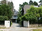
620 | Teutons , according to Roman sources a Germanic people of antiquity | before 1905 | The residential street, which is lined with flesh-red horse chestnut trees , has a slight gradient in a north-west-south-east direction - past some higher-lying properties - between Alemannenstrasse and An der Rehwiese. It was expanded in 1904/1905 by Heimstätten AG. The road surface differs in the upper part, which is asphalted because it is used by the bus as a one-way street, and the cobblestone section to the Rehwiese. At the beginning there was a jewelery square on the corner of Teutonen and Alemannenstrasse, which was replaced by a coal square between the 1950s and 2009. |
|
| Tewsstrasse
( Location ) |
380 | Johannes Tews (1860–1937), educator | July 20, 1938 | The street was laid out around 1905 as Hubertusstraße , named after the theologian and Saint Hubertus of Liège (around 656–727), Bishop of Liège. Due to the ambiguity of the street names after the formation of Greater Berlin in 1920 , this renaming was carried out in 1938. The street is between Spanischer Allee (corner of Breisgauer Straße) and Wasgenstraße. |

|
| Tristanstrasse
( Location ) |
540 | Tristan, main character from Richard Wagner's opera Tristan und Isolde | before 1905 | The street is between Nibelungenstrasse and Lohengrinstrasse in the " Wagner Quarter ". It was created in 1904/1905 by Heimstätten AG. Villas and single-family houses of the bourgeoisie dominate the coveted location on a quiet residential street. Berthold Schenk Graf von Stauffenberg lived in Villa Tiedemann (No. 8-10), built in 1906 . From September 1, 1943, his brother Claus Schenk Graf von Stauffenberg , who planted the bomb next to Hitler during the assassination attempt on July 20, 1944, also lived there temporarily . The Stauffenbergs' apartment was a frequent meeting place for resistance fighters against the Nazi regime . A plaque on the house commemorates the active use of the Hitler assassin . |

|
|
Von-der-Trenck-Strasse
( Location ) |
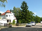
320 | Friedrich von der Trenck (1727–1794), Prussian officer, adventurer and author | June 1, 1966 | Laid out as street A of the development plan and named in 1966, it is located on the northeast corner of the Waldhaus district closest to the Zehlendorf motorway junction between Katteweg and Quantzstraße, which were named after people from the area of Frederick the Great . Von der Trenck joined the Prussian army in 1740 and became an orderly officer of Frederick the Great in 1744; in 1745 he was imprisoned. |
|
| Von-Luck-Strasse
( Location ) |
1060 | Hans-Ulrich von Luck and Witten (1861–1945), military, civil servant | before 1905 | Von-Luck-Straße was laid out by Heimstätten AG around 1901; it lies east of Rehwiese in a north-south direction across the settlement area between Spanischer Allee and Potsdamer Chaussee, and in 1910 between Wannseestraße and Mittelweg. In 1905 two villas, two new buildings and 18 construction sites, mostly owned by Heimstätten AG, are listed between Wannsee, Lückhoff and Sudetenstrasse. First it was built north of Schopenhauerstraße and only built on in the 1930s through the Zehlendorfer Heide to Potsdamer Chaussee. This original development is almost completely preserved. With increasing use as a “secret route” from the autobahn to Potsdamer Chaussee, the cobblestones were poured over with asphalt in the 1960s and this left traces. With the decrease in traffic since the 1990s, Von-Luck-Straße with its young linden trees has become a quiet residential street again. The guard officer Luck was from 1898 chamberlain and court marshal of Prince Friedrich Leopold of Prussia and one of the initiators for the construction of Nikolassee as a villa colony. |

|
|
Waldhauswinkel
( Location ) |
70 | on the street Am Waldhaus (Klinik Waldhaus) | March 19, 1956 | The road goes from Am Waldhaus to the east to the Zehlendorf forest cemetery with plots 2–10 (even) and 3 and 5 (odd) and opens up the divided plots at Am Waldhaus 8–12, so the plot at Waldhauswinkel is transverse and house no. 10 lies as a background piece of Waldhauswinkel 8 and Am Waldhaus 12 on the cemetery fence. Waldhauswinkel is laid out as a continuation of street A of the development plan through the Waldhaus-Klinik in the Theodor-Wenzel-Werk, which has the addresses Am Waldhaus 1, Potsdamer Chaussee 69 and Quantzstraße 4a (Sanatorium Waldhaus). |

|
| Waldrebensteig
( Location ) |
150 | Clematis , also known as clematis, is a buttercup plant | Jan. 11, 1985 | The route 666 in the development plan is located in the "Garden City of Düppel" between Wasgensteig and Himbeersteig with terraced houses at a courtyard-like access that is designated as a traffic-calmed area . |

|
| Wood warrior path
( Location ) |
300 | Wood warbler , songbird, species-rich family of passerine birds | July 31, 1947 | The road between Krottnaurerstraße and Reifträgerweg was laid out between 1890 and 1891 as Dianastraße (Post Schlachtensee) by the owners and Heimstätten AG, named after Diana , the goddess of the hunt. On March 15, 1939, it was renamed after Ottomar Beta (1845-1913, publicist and ethnic anti-Semite) in Beta part . The owner of Dianastraße 17/19 (Post Bln. = Schlachtensee) was Rear Admiral W. Canaris according to the address book in 1938 and 1943 for house Betazeile 17 (Post Bln. = Zehlendorf), no. 19 is given unnamed. |

|
| Waltharistraße
( Location ) |
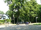
490 | Walthari (dec. 546), Duke of the Longobards on the central Danube, hero of a medieval epic | before 1905 | Waltharistraße, planted with old linden trees, in the Wannsee triangle between Dreilindenstraße and Lohengrinstraße, was laid out by Heimstätten AG around 1890 and named around 1905. Eight parcels of land had been built up by 1908, with tall blood beeches standing on some plots , which were protected as natural monuments. The road surface is cobblestone and requires the 30 km / h zone . Partly total destruction in the Second World War caused these houses to be demolished and replaced with new villas. |
|
| Wannseebadweg
( Location ) |
1740 | leads past the Wannsee swimming pool | Nov 4, 1935 | The road lies between Kronprinzessinnenweg / corner of Spanische Alle and Inselstraße and leads mostly through the forest, in contrast to the driveway of the bathing path it is a developed two-lane and asphalt road with the properties 10 (house in the forest) and 40-46 (on the Clear Lake ) and 25 (Wannseeterrassen), 35 (Wannseefreibad: Versehrtenbad) and 51–57 (at the Schwanenwerder Bridge). The extension of the Wannseebadweg was also included on January 5, 1965, for 1943 the Wannseebadweg (Post Bln. = Wannsee) between Kronprinzessinenweg and Wannsee, to the boathouse and the Wannsee lido is listed. In 1920 it was still subordinate to the bathing path and the Schwanenwerder path in size. |

|
| Wasgensteig
( Location ) |
410 | continues Wasgenstrasse over Potsdamer Allee | Jan. 18, 1965 | It is located on the western edge of the "garden city Düppel" between Potsdamer Chaussee and Königsweg on the eastern edge of the forest cemetery . Wasgen is the earlier German name for the Vosges, a low mountain range in eastern France on the Rhine Graben opposite the Black Forest. |

|
| Wasgenstrasse
( Location ) |
740 | Wasgen , German name for the Vosges, a low mountain range in the east of France on the Rheingraben opposite the Black Forest | around 1920 | Wasgenstrasse is located between Matterhornstrasse and Potsdamer Chaussee, with a small right-angled bend at the school at Tewsstrasse offset the road in the route to the south and westwards. The street was laid out before 1905 as Nordsternstraße, initially between Waldemar- / Heimstättenstraße and Hubertusstraße and is still undeveloped in 1910, for 1915 it lies between Waldemar- and Wannseestraße and is built on three plots. and in 1920 in the same state of development as Wasgenstraße, with a path continuing south of Hubertusstraße (today: Tewsstraße) through the forest to Potsdamer Chaussee. The Nordsternstraße was named after the insurance company of the same name , which was founded in Hamburg in 1857 and which probably insured Heimstätten AG.
The Roman Catholic Church of the Twelve Apostles at Wasgenstrasse 49 was built between 1953 and 1954, designed by Julius Schmidt in the style of homeland security architecture. The student village Schlachtensee is located on Wasgenstraße |

|
| Westhofen way
( Location ) |
500 | Westhofen , place in Wonnegau belonged to the district, today to the city of Worms, Rhineland-Palatinate | Aug 8, 1935 | The road between Wasgenstraße and Kirchweg is in the Wonnegauviertel . It was laid out as street 358 of the development plan by the Berliner Bauland-Vermittlungsgesellschaft. |
|
| Widenhof
( Location ) |
100 | Widen in Brandenburg dialect (Telt'sches Platt) for willow | Aug 13, 1985 | The street on the site of the former Neu-Zehlendorf colony, laid out as street 674 in the development plan, was taken over by the Berlin building land agency in the early 1920s, but remained undeveloped. It is built on with row houses with front gardens between Am Rohrgarten and Königsweg. From Am Rohrgarten as a dead end with a footpath (closed for motorbikes, sign 255 ) to the Königsweg, which is a footpath and a rider's path here. It lies parallel to some streets that are also named with the addition -hof . |

|
| Wiesenschlag
( Location ) |
460 | old field name in Düppel-Nord | Jul 10, 1987 | It was laid out as street 645 of the development plan and is located on the western edge of the Yehudi-Meniun-Park between Am Rohrgarten and Potsdamer Chaussee. In addition to the access road to the parking lot of the single-storey shopping center on Potsdamer Straße, located on Wiesenschlag 3/4, the officially named road is a cycle path and footpath that runs along the back of the row houses on the Himbeersteig. There was no further development of the park area along this plan street, so it is classified as a pedestrian path. |

|
| Delicious dough
( Location ) |
130 | Wonnegau , region in the south of Rheinhessen . | Oct 28, 2008 | The footpath, secured against traffic by a spear fence, crosses the “Park am Jochen-Klepper-Weg” between Krottnauerstrasse and Westhofener Weg. The choice of name for this climb resulted from the surrounding streets named after places in Wonnegau with which some open spaces were built ( Albiger , Osthofener , Westhofener and Pfeddersheimer Weg ). The properties Wonnegausteig 1 and 2 are on the corner of Westhofener Weg. |

|
Further locations of Nikolassee
Allotment colonies
- Railway agriculture sub-district of Lichterfelde-West Group Nikolassee
- KGA Nikolassee (06215, Alemannenstrasse / Am Beelitzhof, Lage ) with 15 lots on 4140 m² of railway land.
- KGA Schlachtensee (06216, Hoiruper Straße / Spanische Allee, location ): 21 parcels on 5,681 m² of railway land.
- KGA Wannsee (06217, on Potsdamer Chaussee, location ): 15 lots on 2845 m² of railway land.
- Allotment garden association Schlachtensee-Süd (06006, Benschallee 30, Lage ) owns 361 parcels on a state-owned lease area of 161,567 m²; according to the 2010 allotment garden development plan, there are eight permanent residents. The allotment garden areas (according to allotment garden development plan level Va) are defined as permanently secured allotment gardens by the development plan. This area is located north of the city limits on the disused S-Bahn line in Düppel , now in the area of the Berlin Wall .
Park and forest areas
- Grunewald : the Nikolasse forest area of this Berlin forest is located in the southwest ( location ) and is located on Hüttenweg (the forest path on the northern edge) from the district of Grunewald , in the east of Zehlendorf, east of the A 115 to the level of the Schlachtensee S-Bahn station. To the west the forest belongs to the district up to the Wannsee / Havel in the amount of the Lieper Bucht.
- Yehudi-Menuhin-Park (Parforceheide 37, Lage ): the Düppeler Gartenstadt-Park is named after Yehudi Menuhin , who gave his first Berlin reconciliation concert here shortly after the end of the war in 1945. The park is located south of Potsdamer Chaussee between Wiesenschlag, Am Rohrgarten and Mutter-Mochow-Weg. The name has not yet been officially recorded.
- Paul-Ernst-Park, the park is mostly located in Zehlendorf and only the smaller area (07809, location ) west of the district boundary in the extension of Breisgauer Straße over the railway line to Schlachtensee is in the town of Schlachtensee.
- Rehwiese is an almost 1½ kilometer long and relatively narrow valley and has been designated as a landscape protection area with an area of 25.6 hectares since 1960. It is located in Nikolassee, between Spanische Allee and Potsdamer Chaussee. ( Location )
- graveyards
- Waldfriedhof Zehlendorf (Potsdamer Chaussee 5, Wasgensteig 30, Lage ) is a celebrity cemetery . Of the 37.58 hectares, 12.48 hectares are earmarked for rededication as forest / green space.
- Nikolassee cemetery (Kirchweg 8–12, Lage ) is a forest cemetery on 17,523 m².
Traffic and other areas in Nikolassee
- Former Dreilinden ( Lage ) checkpoint used as an Allied Bravo checkpoint until 1990 and for motorway transit to West Germany.
- Schlachtensee S-Bahn station on the S-Bahn line ( location )
- S-Bahn station Nikolassee at Wannsee - and Wetzlarer Bahn ( location )
- Museum village Düppel ( location )
- Grunewald Forestry Office
- Revierförsterei Dreilinden (21010, Stahnsdorfer Damm 3, Lage ), formerly Jagdschloss Dreilinden responsible for Berlin's forests in Nikolassee and Wannsee
- Revierförsterei Nikolassee (09373, Ehrenpfortensteig 9, Lage ) responsible for Berlin's forests in Nikolassee, Grunewald and Zehlendorf
- Revierförsterei Saubucht (09369, Havelchaussee 96, Lage ), responsible for forest areas in Nikolassee, Grunewald and Westend
- Grunewald blasting site ( location )
- Beelitzhof waterworks ( location )
- Studentendorf Schlachtensee ( Lage ) was built between 1959 and 1964 as part of the Free University of Berlin.
-
Dog exercise areas
- Benschallee (Jagen 1, Lage ) east of KGA Schlachtensee-Süd, south of the forest cemetery on the city limits.
- Königsweg (Jagen 12, Lage ) is located southeast of the Zehlendorf motorway junction and between Königs- and Katteweg, near the city limits
See also
literature
- Walter Kaupert (Ed.): Kaupert's street guide through Berlin 2010 . Kaupert Media, Berlin 2009, ISBN 978-3-941108-01-1 .
- Henning Schröder, Hans H. Lembke: Nikolassee - houses and residents of the villa colony. Berlin 2008, OCLC 269470889 . (with support from BVV Steglitz-Zehlendorf)
- Andreas Jüttemann: Country houses and villas in Berlin 7: Nikolassee Ost - Wonnegauviertel, Mittelhof and Waldfriedhof Zehlendorf . Bremen 2009, ISBN 978-3-939401-48-3 .
Web links
- Street directory Nikolassee. kaupert media gmbh, accessed on August 12, 2012 .
- Office for Statistics Berlin-Brandenburg: List of streets and places in the Steglitz-Zehlendorf district (as of February 2015); pdf
- History and culture of Nikolassee, with historical maps of the location of Nikolassee
- Map of Berlin 1: 5000 with district boundaries. Senate Department for Urban Development Berlin, 2012, accessed on August 25, 2012 .
Individual evidence
- ↑ a b FIS Broker Detail Network (regional reference system)
- ↑ a b map by Nikolassee . In: Berliner Adreßbuch , 1910, V. Suburbs of Berlin> Nikolassee, p. 313.
- ^ Map from 1906 with buildings by Heimstätten AG ( memento from March 23, 2016 in the Internet Archive ) on www.schroederniko.de
- ↑ Avus - Autobahn feeder: pictures and map
- ↑ a b c d e f g Clarification of the situation on the map 1: 5000, produced by the district surveying offices (Senate Department for Urban Development and the Environment)
- ↑ a b c d e f g h i j k l m see also overview map of Nikolassee (Teltow district) . In: Berliner Adreßbuch , 1920, Part V., p. 841. "In the village a tax surcharge of 175% including district tax is levied."
- ↑ Facts and pictures about Alemannenstraße ( memento from January 18, 2018 in the Internet Archive ) at www.schroederniko.de
- ↑ Address search and clarification of the situation with the help of the Berlin map 1: 5000 produced by the district surveying offices
- ↑ Am Beelitzhof - Beelitzhof waterworks ( Memento from May 9, 2017 in the Internet Archive )
- ↑ a b Am Beelitzhof - Beelitzhof waterworks ( Memento of the original from September 24, 2015 in the Internet Archive ) Info: The archive link was inserted automatically and has not yet been checked. Please check the original and archive link according to the instructions and then remove this notice.
- ↑ a b c d e Pharusplan Berlin 1943 Nikolassee ( page no longer available , search in web archives ) Info: The link was automatically marked as defective. Please check the link according to the instructions and then remove this notice.
- ↑ a b c d e f g h i j Pictures of the garden city of Düppel
- ↑ Data on Barnhelmstrasse, Berlin-Nikolassee
- ↑ to the person of Bensch
- ↑ Facts about Benschallee, Berlin-Nikolassee
- ↑ Viktoriastrasse . In: Berliner Adreßbuch , 1910, V. Suburbs of Berlin> Zehlendorf, p. 709 ff.
- ↑ Information and pictures about Burgunderstraße ( memento of January 22, 2017 in the Internet Archive ) at www.schroederniko.de
- ↑ Cimbernstraße ( Memento from December 4, 2016 in the Internet Archive ) on www.schroederniko.de
- ↑ City map from 1907 on www.blocksignal.de
- ↑ Pharus city map Berlin large edition 1954: Nikolassee around 1954 ( page no longer available , search in web archives ) Info: The link was automatically marked as defective. Please check the link according to the instructions and then remove this notice.
- ↑ Wannseedreieck ( Memento from May 9, 2017 in the Internet Archive ) on www.schroederniko.de
- ↑ Dreilindenstrasse . In: Berliner Adreßbuch , 1922, IV. Streets and houses of Berlin> Administrative District Zehlendorf, p. 1272 (overview map of the Zehlendorf district).
- ↑ Dreilindenstrasse . In: Berliner Adreßbuch , 1922, IV. Streets and Houses of Berlin> Administrative District Zehlendorf, p. 1280.
- ↑ Nikolassee . In: Berliner Adreßbuch , 1934, Part IV. Inhabitants and companies sorted by street> Administrative district Zehlendorf, p. 1364 ff.
- ↑ a b c d e f g Nikolassee . In: Berliner Adreßbuch , 1943, Head of Households, Companies and Commercial Enterprises Registered by the Commercial Court, sorted by street> Administrative District Zehlendorf, p. 1422 ff.
- ↑ a b Pharus city map Berlin large edition 1954 (Wannsee around 1954) ( page no longer available , search in web archives ) Info: The link was automatically marked as defective. Please check the link according to the instructions and then remove this notice.
- ↑ Facts and pictures about Dreilindenstrasse ( Memento from May 9, 2017 in the Internet Archive ) at www.schroederniko.de
- ↑ on the person of Dubrow
- ↑ a b c Pharus city map Berlin large edition 1954 Nikolassee ( page no longer available , search in web archives ) Info: The link was automatically marked as defective. Please check the link according to the instructions and then remove this notice.
- ↑ to the person Ring-Düppel
- ↑ a b Zehlendorf . In: Berliner Adreßbuch , 1910, V. Suburbs of Berlin> Zehlendorf, p. 699 ff.
- ↑ Ernst-Ring-Strasse . In: Berliner Adreßbuch , 1915, V. Suburbs of Berlin> Zehlendorf, p. 905.
- ↑ Urban development Berlin: Berlin tips 20 green main paths invite you to stroll, to take a relaxing walk
- ↑ The Wannseeweg includes the most popular hiking routes in the southwest of Berlin.
- ↑ Wife and neighbors inaugurate Günter-Pfitzmann-Platz. In: Berliner Zeitung , April 8, 2017
- ↑ Sign at Guernicplatz: “The city of Guernica was destroyed by the German flight squadron of the Condor Legion in the Spanish civil war. This crime resulted in many civilian casualties. Spanische Allee got its name on the occasion of the return of the Condor Legion in 1939. "
- ↑ so the entry on www.luise-berlin.de
- ↑ a b Pharus city map Berlin large edition 1954: Zehlendorf ( page no longer available , search in web archives ) Info: The link was automatically marked as defective. Please check the link according to the instructions and then remove this notice.
- ↑ Pictures from Hohenzollernplatz ( Memento from May 9, 2017 in the Internet Archive ) on www.schroederniko.de
- ↑ a b Further information on Kirchweg / Im Mittelbusch ( Memento from August 4, 2017 in the Internet Archive ) at www.schroederniko.de
- ↑ Stadtrand-Nachrichten: Muthesius' savior honored: Stele for Julius Posener inaugurated . 17th August 2012.
- ↑ Katteweg . In: Berliner Adreßbuch , 1926, Part IV. Streets and houses in Berlin> Zehlendorf administrative district> Steinstücke, Wannsee, Zehlendorf, p. 1483.
- ↑ Royal Route . In: Address book for Berlin and its suburbs , 1900, V. Suburbs> 29. Zehlendorf with Schlachtensee, p. 276 (Königs = Weg).
- ↑ Krottnaurerstraße 19
- ↑ Villa from 1899 to 1900 owned by Heimstätten AG
- ↑ Chauffeur's house with garage from 1925
- ↑ Evangelical Hospital Hubertus (website)
- ^ Wannsee triangle - the Wagnerviertel: Lohengrinstraße ( Memento from May 9, 2017 in the Internet Archive )
- ↑ Pictures of Lückhoffstraße ( Memento from May 9, 2017 in the Internet Archive ) Pictures of Lückhoffstraße
- ↑ a b c Pictures and description of the Krause triangle
- ^ Wannsee triangle, the Wagner quarter: pictures of Nibelungenstrasse
- ↑ Nibelungenstrasse . In: Berliner Adreßbuch , 1920, V. Suburbs of Berlin> Nikolassee, p. 842.
- ↑ to the person Nickisch-Rosenegk
- ↑ Normannenstrasse . In: Berliner Adreßbuch , 1920, V. Suburbs of Berlin> Nikolassee, p. 842.
- ↑ Nymphenufer . In: Berliner Adreßbuch , 1920, V. Suburbs of Berlin> Nikolassee, p. 843.
- ↑ to the person Nickisch-Rosenegk
- ^ Prinz-Friedrich-Leopold-Straße between the train station and Teutonenstraße
- ↑ see the comment at Kauperts.de
- ↑ Rolandstrasse . In: Berliner Adreßbuch , 1905, V. Suburbs of Berlin> Nikolassee, p. 203 (Paul Krausestrasse).
- ↑ Schopenhauerstrasse . In: Berliner Adreßbuch , 1935, administrative district Zehlendorf> Zehlendorf> J- Z, p. 1382 (Kronprinzessinen = street).
- ↑ Schopenhauerstrasse . In: Berlin address book , 1935, administrative district Zehlendorf> Albrechts = Teerofen, Dahlem, Kohlhasenbrück, Nikolassee, Schwanenwerder, Steinstücke, Wannsee, p. 1359 (Sudetenstrasse).
- ↑ Spanish Avenue . In: Berlin address book , 1938, administrative district Zehlendorf> Albrechts = Teerofen, Dahlem, KohlhaSenbrück, Nikolassee, Schwanenwerder, Steinstücke, Wannsee, p. 1413 (Wannseestrasse).
- ↑ Havelweg (named for Wannsee) . In: Berliner Adreßbuch , 1930, Part IV, SS 1508. "← Wannseebahn → / ← Dreilindenstrasse → / Forst / ← Kurfürstenweg → / left side (west): German Research Institute for Small Arms (V: Director E. Bachelin, Kfm W. Bick, worker F. Kalisch, civil servant H. (N) ol) / forest / right side (east): Jagdschloss Dreilinden (as owner Prince Friedrich Leopold of Prussia with residence: Switzerland ) administrator H. Weber, district forester O. Brese, coachman A. Wiederhöft / Forst / ← Königsweg → “.
- ^ Stahnsdorfer Damm . In: Berliner Adreßbuch , 1938, administrative district Zehlendorf> Albrechts = Teerofen, Dahlem, Kohlhasenbrück, Nikolassee, Schwanenwerder, Steinstücke, Wannsee, p. 1417.
- ^ Teutonenstrasse: pictures and description
- ^ Von-Luck-Strasse . In: Berliner Adreßbuch , 1905, V. Suburbs of Berlin> Nikolassee, p. 203.
- ↑ Waldsängerpfad . In: Berlin address book , 1938, administrative district Zehlendorf> Albrechts = Teerofen, Dahlem, Kohlhasenbrück, Nikolassee, Schwanenwerder, Steinstücke, Wannsee, p. 1413 (Dianastraße).
- ↑ Waldsängerpfad . In: Berliner Adreßbuch , 1943, heads of households, companies and commercial enterprises registered by the commercial court, sorted by street> Zehlendorf administrative district, p. 1423 (beta line).
- ↑ Wadsgenstrasse . In: Berliner Adreßbuch , 1910, Part V., p. 707.
- ↑ Wasgenstrasse . In: Berliner Adreßbuch , 1915, V. Suburbs of Berlin> Zehlendorf, p. 910 (Nordsternstrasse).
- ↑ Berlin-Stadtgrün allotments in the Steglitz-Zehlendorf district ( memento of the original from September 29, 2013 in the Internet Archive ) Info: The archive link was automatically inserted and not yet checked. Please check the original and archive link according to the instructions and then remove this notice. (PDF; 26 kB)
- ↑ Playground in Yehudi-Menuhin-Park ( Memento of the original from April 30, 2013 in the Internet Archive ) Info: The archive link was inserted automatically and has not yet been checked. Please check the original and archive link according to the instructions and then remove this notice.
- ↑ Yehudi Menuhin: A treasure for Steglitz-Zehlendorf (PDF; 500 kB)
- ↑ Ban on barbecues in Park Düppel-Nord
- ↑ Senate Administration's cemetery development plan
- ↑ Die Berliner Forsten: Dienststellen der Berliner Forsten ( Memento of the original from April 29, 2013 in the Internet Archive ) Info: The archive link was inserted automatically and has not yet been checked. Please check the original and archive link according to the instructions and then remove this notice.
- ↑ www.stadtentwicklung.berlin.de: Dog exercise in the forest - what is allowed where
- ↑ Dog run in Düppel ( page no longer available , search in web archives ) Info: The link was automatically marked as defective. Please check the link according to the instructions and then remove this notice. (PDF; 89 kB)


