List of streets and squares in Berlin-Karow
The list of streets and squares in Berlin-Karow describes the street system in the Berlin district of Karow of the Pankow district with the corresponding historical references. At the same time, this compilation is part of the lists of all Berlin streets and places .
overview
According to the official street directory, the public road network in the district is 121 dedicated streets and squares with a total length of 62.6 kilometers, of which three streets continue under the same name to the neighboring districts. 19,679 residents live in the residential development on Karower Strasse (as of December 30, 2019). 10.3 percent of the 604.7 kilometers of the entire Pankow district (including all 13 districts) are in the district. The Karow district includes the postal code area 13125.
The development of the Karow road network shows some settlement waves. In Karow, the first parceling was carried out in 1898 for settlement purposes on both sides of Bahnhofstrasse ("Bahnhofsviertel") and Pankgrafenstrasse. The "counted" streets of the planning area (west of the Stettiner Bahn ) in the southwest of the district ("Pankgrafenviertel") were laid out from street 1 to 20er streets and named in 1926. East of the Szczecin Railway in the area south of the sloping path - laid out in 1926/1927 - the streets were named after Silesian towns. The area adjacent to the south of Blankenburg at that time was given the name of tributaries of the Rhine in 1927 (“Rheineckviertel”). Another residential area was built in 1932–1934 with the “Buch suburban settlement”. In 1934, streets here were initially named after chicken breeds or locally, and some were renamed in 1938 according to Germanic mythology .
The first streets were systematically numbered (according to the development plan) and later given their own names west of the Szczecin Railway. To the east of Blankenburger Chaussee and south of the village center Alt-Karow lies a larger settlement area, called the "Teichbergviertel", in which the streets are still numbered. A planning grid can be recognized by the fact that the 40s and 70s streets are predominantly in a west-east direction, the 50s and 60s streets in a north-south direction. Some of these streets are still undeveloped in the 21st century.
The expansion of the Berlin outer ring in 1957 led to a change in the district boundaries and resulted in changes in the layout of the streets and renaming (in the vicinity of the railway). The changes in Karow from 1995 to the 2010s according to the development plan affect the new development area Karow-Nord on both sides of Bucher Chaussee, with Achillesstraße as the main street. The residential area, which has been under construction since 1995, is located on the suburb of Buch between the Stettiner Bahn in the west (residential area I) and the city limits with Ingwäonenweg in the east (residential area II). The names of the new streets were selected according to parcels , old resident families or local features such as the court signs . Typical for Karow-Nord are the streets with mixed development of residential houses and new buildings of multi-family houses, the newly named streets partly extend into the previous settlement areas with private homes and single-family houses. In the Karow-Nord residential area, some side streets (access roads to the residential buildings) have been laid out as private roads, some of which have blocked access.
The zoning plan contains building land reserve areas in the southeast of the district. There are obviously differences to planning. The completed home development east and west of the protected landscape component “Karower Teichberg” has now removed the numbered streets 61 and 68 contained in city maps from the 2010s. To the west of the Teichberg, the properties (with the suffixes A – K in the numbering) are assigned to street 42, to the east of it they were assigned to street 67 (which runs south). Not all plans were implemented. A construction site access from Bundesstraße 2 was created for the new development area Karow Nord in order to prevent the settlements from being driven through. At the end of the 1990s, this street was expanded along the city limits, Am Luchgraben (district of the Malchow suburb) as a planned connection between Karow (street 73 and Ingwäonenweg) and Bundesstraße 2 . Since an approximately 300 meter long section is on private property, completion of the road has so far been prevented. The cul-de-sac on the Barnim Dörferweg has since served as the access to the parking lot for the Barnim Nature Park , while the Dörferweg runs a little further south to road 70.
Overview of streets and squares
The following table gives an overview of the streets and squares in the district as well as some related information.
- Name / location : current name of the street or square. Via the link Location , the street or the square can be displayed on various map services. The geoposition indicates the approximate center of the street length.
- Traffic routes not listed in the official street directory are marked with * .
- Former or no longer valid street names are in italics . A separate list may be available for important former streets or historical street names.
-
Length / dimensions in meters:
The length information contained in the overview are rounded overview values that were determined in Google Earth using the local scale. They are used for comparison purposes and, if official values are known, are exchanged and marked separately.
For squares, the dimensions are given in the form a × b for rectangular systems and for (approximately) triangular systems as a × b × c with a as the longest side.
If the street continues into neighboring districts, the addition ' in the district ' indicates how long the street section within the district of this article is. - Name origin : origin or reference of the name.
- Notes : further information on adjacent monuments or institutions, the history of the street and historical names.
- Image : Photo of the street or an adjacent object.
| Name / location | Length / dimensions (in meters) |
Origin of name | Date of designation | Remarks | image |
|---|---|---|---|---|---|
|
Achillesstrasse
( Location ) |
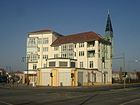
1750 | Hermann Achilles († 1920), Karower blacksmith and chronicler | Feb 13, 1996 | Hermann Achilles was a master blacksmith in Karow. He drew the court signs of the Karow farmers from memory for posterity. Achillesstrasse is located between Karestrasse and Ingwäonenweg and is the central west-east road in the Karow-Nord development area. The street crosses Alt-Karow at the northern end. All shops, schools and a library are located in the street. The street consists of 30 km / h zones at both ends and a main street in the middle section. |
|
| Achtrutenberg
( Location ) |
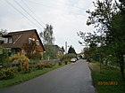
400 | Parcel on eight rods | Feb 13, 1996 | Previously set up as road 82 according to the development plan, it is located in the new development area Karow-Nord between Röländer Straße and Schönerlinder Weg. The Karow parish property with the Achtrutenweg was "in the 3rd field (west) to Buchholz ". The road runs in an arch along the Aue pond. |
|
| Alt-Karow
( Location ) |
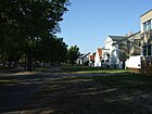
800 | to the old village center | May 11, 1938 | The main street of the Angerdorf Karow has been called Dorfstraße since the settlement . After the incorporation of Karow into Greater Berlin and in the course of the elimination of multiple Berlin street names, a renaming was carried out similar to other districts. The north end of Dorfstrasse continued on Bucher Chaussee. With the use of the areas south of the village center, a further counting followed the horseshoe numbering from Bahnhofstraße to Blankenburg and back to Malchower Weg. The Gasthof Lindenpark had number 47 and was directly adjacent to Angergrundstück 1. In 1926, the Blankenburger Chaussee (continuation south) was changed. The inn got the address Dorfstraße 2 and the smithy the 4, the counting ended opposite at the corner of Bahnhofstraße with 61. This form of numbering was retained when the village streets were renamed across Berlin - here to Alt-Karow. |
|
| On the Danewend
( Location ) |
710 | Danewend, field name on the border with Malchow | before 1920 | Danewend ("there where you turn") was a strip for turning the plow and was also used as a border area to the neighbor. The street lies between Hubertusdamm and Lanker Straße, under the railway line it continues to Leobschützer Straße. It crosses Busonistraße at Danewendplatz. |

|
| At the Elsebrocken
( Location ) |
270 | Hall name, Else belongs to alder | Feb 13, 1996 | The street is in Karow-Nord I between Busoni and Achillesstraße. The parcel "Aufn Elsebrocken" (Schönerlinder Weg) was "in the 1st or buchschen field (north of the village)". The otherwise straight road leads over a sharp bend onto Achillesstrasse. |

|
| At the high field
( Location ) |
650 | Parcel: high field | March 24, 1997 | It was previously set up as Straße 87 and renamed with the planning of Karow-Nord II. The street is between Straße 73 and Achillesstraße. The "Hohe Feld" was one of Karow's three tubs from the time of the three-field economy. The Teichberg (63 meters above sea level), the highest point in Karow, is located on the Hohe Feld. The northern section of the street is marked as the main street. |

|
| At the Kiebitzpfuhl
( Location ) |
210 | Kiebitzpfuhl, traditional name of the water body | Nov 9, 1926 | Initially set up as road 26 according to the development plan, the road is south of the sloping path to Tichauer Straße. |

|
| Amselstrasse
( Location ) |
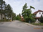
380 | Blackbird , species of bird | before 1920 | The street lies between Wotan and Lanker Straße and crosses Busonistraße. |
|
| On the Laake
( Location ) |
220 | Laake , a local river | March 26, 1997 | The road 88 was renamed in the planning of the residential area II, located between Am Hohen field and road 62nd |

|
|
Bahnhofstrasse
( Location ) |
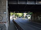
1000 | Karow station of the Szczecin Railway | 1882 | With the establishment of the road between the village center and the train station, a first settlement area developed on both sides at “Dorf Karow”. To the west of the railway line, the route continues as Pankgrafenstraße. |
|
| Balloon field
( Location ) |
110 × 40 (oval) |
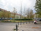
Balloon , an aircraft | Feb 13, 1996 | The square is located in the new development area North I and refers to the balloon flight of the French Jean-Pierre Blanchard on September 27, 1788, who at around 4:30 p.m. in the open field between Buch and Karow on the area of today's square between Achilles- and Pfannschmidtstraße started. |
|
| Bedeweg
( Location ) |
160 | Bede , a feudal tax | June 1, 1997 | As an extension of the street Am Hohen Feld across Achillesstrasse, it limits the (unofficial) space at the casemates in residential area II. |

|
| Beerbaumstrasse
( Location ) |
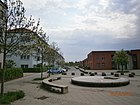
280 | Jacob Beerbaum, Kossät in Karow | Feb 13, 1996 | The street is located in residential area I between Achilles and Pfannschmidtstraße. The Beerbaums were an old resident Karow farming family, their court emblem had been 'Four Eggs' since 1598. |
|
| Beuthener Strasse
( Location ) |
850 | Beuthen , district town in the former province of Upper Silesia since 1945 Bytom (Poland) | Nov 9, 1926 | Previously known as Straße 23 , it is located south of the sloping path, parallel to Tichauer Straße. |

|
| Blanchardstrasse
( Location ) |
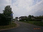
130 | Jean-Pierre Blanchard (1753–1809), French balloonist | Feb 13, 1996 | Previously set up as Straße 99 , it is a cul-de-sac from Schönerlinder Weg with residential buildings towards the Karow-Nord development area. Blanchard carried out a balloon flight in Berlin in 1785 and landed on Karower Flur. |
|
| Blankenburger Chaussee
( Location ) |
1310 | Blankenburg , southern neighboring town | 1878 | The historic Blankenburger Weg from the southern neighboring town and part of the old Heerstraße was renamed Chaussee with the fortification as Aktienchaussee . It is the southern part of the main street in extension of Alt-Karow. The village Karow (developed land) ended in the south of Angers on Malchow and Buchholz way , according to the fields started on the southeast corner of the numbering with village road 1. Due to the use and development on both sides of the road were house numbers needed and the count was at the On the north side of Dorfstraße and led back from the boundary on the south side. In 1926 (since 1920) in the Pankow administrative district of Greater Berlin, this counting method was changed from Dorfstraße / Straße 52 starting with property 1. The Blankenburger Chaussee was numbered independently. |

|
| Boenkestrasse
( Location ) |
1550 | Gerda Boenke (1913–1944), resistance fighter against the Nazi regime | May 10, 1951 | On June 7, 1957, the Karower branch of Rudelsburgstrasse and Strasse 2 (south of the north-west connection at Karower Kreuz ) were incorporated into Boenkestrasse after the Berlin outer ring was built. The street is parallel to the west of the Szczecin Railway from the railway intersection to the "KGA Rosengarten". Named in 1920 as Viktoria-Luise-Straße , it was renamed in 1951 after the victim of the Nazi regime. |

|
| Drill line
( Location ) |
410 | Bohrer , court emblem from Martin Grunow's farm | Feb 15, 1997 | The street between Achillesstraße and Nerthusweg via Krähenfußzeile in WG II was previously called Straße 56 . |

|
|
Böttnerstrasse
( Location ) |
1010 | Johannes Böttner (1861-1919), horticulturist in Frankfurt (Oder) | Nov 9, 1926 | Previously set up as Straße 1 , it lies west of the Rübländer Graben between Bahnaußenring and Sandbergstraße and crosses Pankgrafenstraße. On June 7, 1957, the part of ( Buchholzer ) Frankenstrasse between Krontaler Strasse and the northern outer ring of the Reichsbahn was incorporated into Böttnerstrasse. Böttner made great contributions to the introduction of the tomato. |

|
| Bucher Chaussee
( Location ) |
890 (in the district) |
Berlin district of Buch | 1878 | The historic Bucher Weg to the northern neighboring town and part of the old Heerstraße was renamed as Aktienchaussee with the fortification. Today the northern part of the main street and extension of Alt-Karow. On August 1, 1998, the (northern) part of Karower Chaussee was included in the district. |

|
| Bunzlauer Strasse
( Location ) |
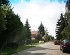
430 | Bolesławiec , district town of the former province of Lower Silesia, after 1945 Bolesławiec in Poland | Nov 26, 1925 | The road south of Bahnhofstrasse crosses Scheilen Weg, Beuthener and Tichaer Strasse and ends in the south at a field. |
|
| Busonistraße
( Location ) |
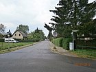
1300 | Ferruccio Busoni (1866-1924), Italian composer | Sep 30 1927 | Called Freyastraße in the northern part since around 1920 , it was combined with Straße 5 in 1927 and renamed. On May 17, 1996, it was extended beyond Pfannschmidtstrasse in WG I and ends in front of the 'drinking water protection zone' along the A 10 . At the same time, Straße 98 was included. |
|
|
Chronisteneck
( Location ) |
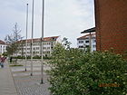
80 × 80 × 50 | Chronicler , here specifically four Karow citizens are meant | Feb 13, 1996 | This triangular square is located along the Achilles at the junction of Beerbaumstrasse. |
|
|
Danewendplatz
( Location ) |
120 × 100 × 100 | Danewend, field name on the border with Malchow | before 1920 | Danewend (because you turn) was a strip for turning the plow and at the same time it could be a border area. The triangular Danewendplatz is enclosed by the street Am Danewend as well as the Heimfriedstraße and the Wotanstraße. |

|
| Three-line way
( Location ) |
390 | "Three lines", court sign | Feb 12, 1997 | A part of the street 59 previously set up was laid out and named, it is located between street 73 and Schmiedebankplatz. The "Drei Linien" court emblem of Paul Seger's Kossaten farmstead existed as early as 1598 and was used until the 20th century. |

|
|
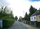
Ebenrotsteig
( Location ) |
250 | Ebenrot , giant of the German hero legend | May 11, 1938 | The road lies between Kappgraben and Ingwäonenweg. |
|
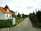
| Erekweg
( Location ) |
530 | Erek , knight from Arthur's round table | May 11, 1938 | It is located between Bucher Chaussee and Nerthusweg, and south of the Kappgraben and the Berlin motorway ring . |
|
|
Florastrasse
( Location ) |
530 | Luise Florentine Bolle (1873–1931), landowner and daughter of Kerkow | around 1920 | Around 1927 the Karow estate belonged to the only daughter (given name Flora) of the Karow community leader and landowner Gottfried Karl Kerkow (1845-1922). The street is between Liebenstrasse and Hagenstrasse. |

|
| Fork line
( Location ) |
250 | Fork , court sign | Feb 15, 1997 | The street lies between Hofzeichenendamm and Achillesstrasse. The fork was the hallmark of Brose Hentze in Karow. |

|
| Frundsbergstrasse
( Location ) |
890 | Georg von Frundsberg (1473–1528), father of the Landsknechte | before 1920 | Before 1920 as Upstallweg . The street is shown in the "Great Berlin Transport Plan" from 1920 and is located between Alt-Karow and Hubertusdamm. |

|
|
Gatterweg
( Location ) |
240 | Gate , old Karow court sign | Feb 15, 1997 | On August 14, 2007, it was extended to Ingwäonenweg. It encloses an area between Siverstorpstrasse and Ingwäonenweg that has been built up with private homes. |

|
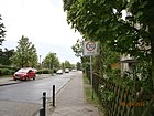
| Gewanneweg
( Location ) |
200 | Gewanne , field complexes of the three-field economy | Feb 13, 1996 | Before that, as Straße 80, it lies between Röländerstraße and Achtrutenberg. The Karow village corridor was divided into three large tubs in which each farmer had to cultivate strips of land depending on the number of hooves . |
|
| Grundackerweg
( Location ) |
260 | Grundacker, an old field name | Feb. 1, 1999 | The street is located north of Bahnhofstrasse and Frundsbergstrasse. |

|
|
Haduweg
( Location ) |
890 | Hadu , Germanic hero | May 11, 1938 | From 1934 it was initially laid out as a Rhodeländersteig in the suburban settlement. It lies between Bucher Chaussee and Ingwäonenweg and is interrupted by a wooded area between plots 51 and 60. |

|
| Hagenstrasse
( Location ) |
580 | Hagen von Tronje, figure from the Nibelungenlied | before 1920 | The road is north between the sloping way and Am Danewend. |

|
| Half-hooves way
( Location ) |
160 | Parcel, Ulricis Directory of parish properties "On the half hooves" in the tub of the "2. or high field " | Feb 13, 1996 | The street, previously called Straße 97 , is located between Busoni and Matestraße and still belongs to the apartment buildings in Karow-Nord I. |

|
| Heimfriedstrasse
( Location ) |
580 | Heimfried, a warrior from Dietrich von Bern | before 1920 | The street is between Hubertusdamm and Lanker Straße. |

|
| Hentzeweg
( Location ) |
60 | Hentze, occupied as a farm owner in Karow in 1738 | Oct. 1, 1996 | This street between Ingwäonenweg and Münchehagenstraße, which is built with private homes, has only been developed with a few houses, so that the further planned course of the street is still incomplete. |

|
| Hofzeichenendamm
( Location ) |
1040 | Court signs are a mark of rural property | Feb 12, 1997 | Established as street 76 of the development plan, it was named in the course of the path called Lindenberger Weg after the direction . The dam lies between Alt-Karow and Ingwäonenweg, to the east beyond the city limits it merges into Karower Weg. |

|
| Hubertusdamm
( Location ) |
900 | Hubertus , Bishop of Liege | before 1920 | It is located north of Bahnhofstrasse as far as Blanchardstrasse and runs east parallel to the Stettiner Bahn . |

|
|
Ingwäonenweg
( Location ) |
1210 | Ingwäons , Germanic tribal group | May 11, 1938 | From 1934 to 1938 the name was at the border , as this path runs along the city limits north of a wasteland from road 73 to over the Ebenrotsteig a little south of the A 10 . It is a residential street on the edge of the field with a village character, with the development predominantly consisting of single-family houses, organizationally it belongs to the residential area Karow-Nord and in the southern part to the local building reserve area. On March 21, 1997 part of the road 64 was included. |

|
|
Karestrasse
( Location ) |
310 | Kare, landowning family of the 13th century, namesake for Karow | Feb 13, 1996 | It is located in the northwest corner south of the Stettiner Bahn and the A 10 between Achilles and Pfannschmidtstraße. In 1251, Kare was probably the first fiefdom holder of the knight seat Karow near Berlin. Karow was owned by the von Kare family until 1513. |

|
| Katowice Street
( Location ) |
210 | Katowice , Upper Silesian district town (Poland) | Nov 9, 1926 | Previously set up as Straße 30 according to the development plan, it is located between Bunzlauer and Steinauer Straße. |

|
| Kerkowstrasse
( Location ) |
610 | Gottfried Karl Kerkow (1845–1922), local politician | before 1920 | On November 9, 1926, the street 28 was included to Kerkowstrasse , whereby it was extended from the Frundsbergstrasse to the sloping way. The village blacksmith's court sign was a 'K' for Kerkow, the family owned the brickworks and the mill. After his daughter, Kerkow had Viktoria-Luise-Strasse named (now Boenkestrasse). “Gerardus Kercow” was named as a witness when Friedrich von Kare's land title was drawn up on May 22, 1251. |

|
| Kernerstrasse
( Location ) |
280 | Justinus Kerner (1786–1862), late Romantic poet | Nov 9, 1926 | Previously set up as Straße 13 according to the development plan, it is located between Böttnerstraße and Boenkestraße. |

|
|
Crow footer
( Location ) |
390 | Crow's foot , a court sign | Feb 12, 1997 | Previously set up as road 78 according to the development plan, it is located between Bucher Chaussee and Zum Kappgraben. There were two such court signs, (1) a simple crow's foot from Georg Wendlandt's farm, (2) double for the Kossatenhof and Bartholomäus Dame's jug . |

|
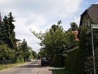
| Kreuzburger Strasse
( Location ) |
280 | Kreuzburg , Upper Silesian district town (Poland) | Nov 9, 1926 | Previously set up as road 27 according to the development plan, it is located north of the sloping path and the Florastraße. |
|
| Krontaler Strasse
( Location ) |
740 in the district |
Kronthal , mineral bath in the Hochtaunus district | before 1920 | Coming from the district boundary of French Buchholz , it bends eastwards from the outer ring of the railway in Karow to the Stettiner Bahn . The street is mentioned in the Berlin address book from 1927. It is a mostly paved residential street with single-family houses and sidewalks on both sides, alternating with lawn edges. |

|
| Short ends way
( Location ) |
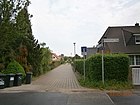
120 | Parcel "Short Ends" in the "2nd or high field " | Feb 13, 1996 | It is located in the Karow-Nord I development area between Gewanne- and Schönerlinder Weg. |
|
|
Lanker Strasse
( Location ) |
1000 | Lanke , place in the district of Barnim | Nov 9, 1926 | Previously set up as Straße 32 according to the development plan, it was given the name in 1926 and Siegfriedstraße was included on September 30, 1927 . It lies between the sloping and the Schönerlinder Weg. |

|
| Lanzelotstrasse
( Location ) |
370 | Lancelot , knight of the round of Arthur. | June 1, 1998 | It lies east parallel to Bucher Chaussee between Erekstrasse and (as a dead end over) Swantewitstrasse. |

|
| Leobschützer Strasse
( Location ) |
440 | Leobschütz , Upper Silesian district town (Poland) | Nov 9, 1926 | Previously set up as Straße 7 according to the development plan, it lies between Straße 94 and through the railway underpass to Hubertusdamm, from which a built-up ring of the same name with new buildings goes to the north to the west of the railway. |

|
| Love street
( Location ) |
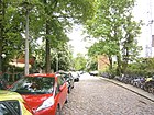
840 | Robert von Lieben (1878–1913), Austrian physicist. | May 31, 1951 | Directly east of the Szczecin Railway south of Bahnhofstrasse it leads to the junction between the Szczecin Railway and the outer ring. The one already named as Friedrich-Karl-Straße before 1921 got its current name during the renaming of the city council of Greater Berlin in 1951. |
|
|
Loensstrasse
( Location ) |
230 | Hermann Löns (1866–1914), poet of the Lüneburg Heath. | Nov 9, 1926 | Previously set up as Straße 11 , it lies between Böttner and Streckfußstraße. |

|
| Lossebergplatz
( Location ) |
40 × 40 (round) | Losseberg in neighboring Malchow . | Feb 15, 1997 | It is a square with a roundabout at the intersection of Achillesstrasse and Zum Kappgraben, which runs diagonally northeast-southwest across the square. A round area overgrown with grass forms the core. |

|
|
Matestrasse
( Location ) |
290 | Mate , local field name. | Feb 13, 1996 | Set up as Straße 81 , it is located in the Karow-Nord residential area between Schönerlinder Weg and Am Elsebrocken. Pastor Ulrici mentions, geese Maten 'in the second or high field and in the list of bird field names (field Register of 1725) is, Rec Kesematen' in , the first system or Carowschem field from the field Schwanebecker called. |

|
| Möserstrasse
( Location ) |
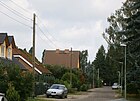
180 | Möser, old resident farming family. | Nov 9, 1926 | Previously set up as street 14a according to the development plan, it is located between Hubertusdamm and Wotanstraße. |
|
| Münchehagenstrasse
( Location ) |
800 | Münchehagen, long-established kossa family. | Feb 15, 1997 | The road lies between Zum Kappgraben and Ingwäonenweg. The western area is built on with newly built multi-family houses, the eastern area is still undeveloped. In 1598 Torben Münchehagen owned a farm that had the “smith's bench” as a court emblem. |

|
|
Nahestrasse
( Location ) |
320 | Close , left tributary of the Rhine | Feb. 18, 1927 | Previously set up as Straße 28 according to the development plan, it is located between Liebenstraße and Nettestraße, also known as the Rheinviertel after the local street names. |

|
| Nerthusweg
( Location ) |
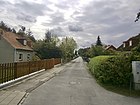
630 | Nerthus , Germanic goddess | May 11, 1938 | It lies between Bucher Chaussee and Zum Kappgraben and is extended by Ebenrotstraße. |
|
| Nettestrasse
( Location ) |
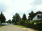
250 | Nice , left tributary of the Rhine | Feb. 18, 1927 | Previously known as Straße 30 , it is located between Nahestraße and Straße 10 in the area known as the “Rheinviertel” or “Rheineck”, as the streets here bounded by the railway lines are named after tributaries of the Rhine. |
|
| Neustädter Strasse
( Location ) |
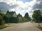
350 | Neustadt , Upper Silesian district town (Poland) | Feb. 18, 1927 | Before that, it was set up as Straße 12 according to the development plan. It extends the sloping path through the Stettiner Bahn to the west and lies between Boenkestrasse and Böttnerstrasse. |
|
| Nordic street
( Location ) |
240 | with reference to the local situation in Berlin | May 2, 2007 | It was recently laid out as an access road for single-family houses on background pieces and lies parallel to streets 49 and 50. It lies between streets 44 and 45 and is, however, laid out as a dead end from street 47 and not continuous to street 45. The first eponymous street name in the area of numbered streets was given to them. On the west side there are plots 1–33 (odd), on the east side only plot 16. |

|
|
Pankgrafenstrasse
( Location ) |
630 in the district |
Pankgraf , member of a Berlin association with reference to the Panke flowing through | before 1920 | It extends Bahnhofstrasse and lies between Boenkestrasse and the western boundary of the district, while its character changes from a main street with single-family houses to adjoining allotment gardens and becomes a tree-lined country road in French Buchholz . |

|
| Pfannschmidtstrasse
( Location ) |
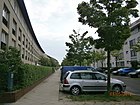
590 | Martin Eckart Pfannschmidt (1861–1947), theologian and local chronicle | Feb 13, 1996 | It is located in the Karow-Nord development area between Karestrasse and Beerbaumstrasse. |
|
|
Röländer Strasse
( Location ) |
600 | Field name 'Aufn Röländer Stücken' in the 2nd or high field | Feb 13, 1996 | Established as Straße 83 , it is located in the new development area Karow-Nord between Schönerlinder Weg (Hubertusdamm) and Pfannschmidtstraße. The western side of the street is a green and fallow area facing the Szczecin Railway . |

|
|
Rübländerstrasse
( Location ) |
410 | Rübländer Graben | before 1920 | It is located between Pankgrafenstrasse and Sandbergstrasse near the Rübländer Graben. Rübländer itself is derived from a parcel in the 3rd field (west to Buchholz ) . |

|
| Rod line
( Location ) |
160 | Field name "On the 6 rested " | Feb 13, 1996 | Set up as Straße 90 , it is located in the Karow-Nord development area between Halbe-Hufen-Weg and Teichbergstraße. |

|
| Rybniker Strasse
( Location ) |
400 | Rybnik , Upper Silesian district town (Poland) | Feb. 18, 1927 | Previously set up as Straße 28 according to the development plan, it lies between Nahestraße and Schräger Weg and is extended by Kerkowstraße. |

|
|
Sägebockweg
( Location ) |
520 | Sawhorse , court emblem from Hans Bötzow | Feb 15, 1997 | Previously known as Straße 58 , it is located between Straße 71 and Siverstorpstraße and is built on with single-family houses. |

|
| Sandbergstrasse
( Location ) |
240 | Field name of the Karow-Bucher Feldmark | Nov 9, 1926 | Previously registered as street 8 , it is located between Streckfußstrasse and Böttnerstrasse. The eponymous Sandberg is probably the Achtrutenberg. |

|
| Blacksmith bench
( Location ) |
140 × 60 | Schmiedebank , the emblem of an old Karower Kossatenhof | Feb 15, 1997 | The Schmiedebankplatz is a rectangular widening of the Hofzeichenendamm and separates the western section (with multi-family houses on the north side) and the eastern residential area. |

|
|
Schönerlinder way
( Location ) |
1260 | Schönerlinde , north-western neighboring town | handed down | The old connecting path between the villages of Karow and Schönerlinde, today it is lost west of the Panke as a dirt road through the north of the NSG Karower Teiche. This and the path through the district is part of the Barnimer Dörferweg hiking trail . The path is between Alt-Karow / Bucher Chaussee and the Pankebrücke in the west. |

|
| Sloping path
( Location ) |
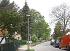
960 | At an angle to the surrounding streets | before 1920 | The traditional name Buchholzer Weg (way to French-Buchholz) was named as Schräger Straße around 1900 and "downgraded" as Schräger Weg around 1920 . It runs from Bahnhofstrasse near Alt-Karow to Liebenstrasse, where it runs under the Stettiner Bahn . |
|
| Settlement ring
( Location ) |
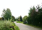
1500 | opens up the local settlement in the ring | Aug 2, 1972 | It opens up settlement II of the “Buch suburban settlement” - set up as a ring road in the east - between Kappgraben and A 10 and Bucher Chaussee and extends to the eastern boundary of the district. |
|
| Siegstrasse
( Location ) |
260 | Sieg , right tributary of the Rhine | Nov 9, 1926 | Previously known as Straße 29 , it is located between Straße 10 and Nahestraße in an area that is also known as the “Rheineck” because of its location at the railway crossing and the local tributaries of the Rhine that give it its name. |

|
| Siverstorpstrasse
( Location ) |
820 | Siverstorp, farm owner in the 15th century | Feb 15, 1997 | Previously set up as Straße 75 , it is located between Strömannstraße and Ingwäonenweg. A more northerly course is built on with multi-family houses from Karow-Nord II, but residential development dominates to the east and south. Siverstorp is mentioned as the first farm owner in the fiefdom register of 1483 for Karow. |

|
| Spinolastrasse
( Location ) |
690 | Carl Robert Alexander Spinola (19th / 20th century), local politician | before 1920 | The street is on both sides of Bahnhofstraße between Schräger Weg and Am Danewend. Before 1915, Spinola was the administrator of the Malchow estate in Berlin and head of the Malchow and Karow offices. |

|
| Steinauer Strasse
( Location ) |
350 | Steinau , Lower Silesian district town (Poland) | Nov 26, 1925 | When it was named, the street was laid out in the course of Straße 31 and Straße 40 according to the development plan, it lies between Beuthener Straße and Schräger Weg. |

|
| Street 10
( Location ) |
300 | Existing name as in the development plan | before 1914 | It is located in the “Rheineck” between Siegstrasse and the end of the property on Nettestrasse and directly merges into Strasse 40, which connects to the Chaussee through arable land. |

|
| Street 34
( Location ) |
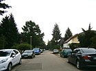
190 | Existing name as in the development plan | before 1914 | It is located between Steinauer Strasse and Strasse 41. |
|
| Street 36
( Location ) |
310 | Name as in the development plan | before 1914 | It lies between Street 39 and Street 40, but goes beyond these streets as a dead end on both sides , in the south it leads to the railway embankment and the suburbs. |

|
| Street 38
( Location ) |
30th | Name as in the development plan | before 1914 | It is a short cross street with the only property No. 1 at the southern end of street 36 parallel to the embankment. It is the paved access to the AKO signal box on the outer ring of Berlin . |

|
| Street 39
( Location ) |
140 | Name as in the development plan | before 1914 | It is located between Straße 36 and Blankenburger Chaussee. It begins immediately west of the Karow bridge ramp to the Sellheim bridge. |

|
| Street 40
( Location ) |
250 | Name as in the development plan | before 1914 | It lies between Straße 36 and Straße 10 and leads through arable land, it connects the main street Blankenburger Chaussee with the “Rheinviertel”, where the streets are in a local peripheral location due to the rail connection between the Stettiner Bahn and the Berlin outer ring. |

|
| Street 41
( Location ) |
340 | Name as in the development plan | before 1914 | The paved road with trees and settlement character lies between Tarnowitzer Strasse and Schräger Weg. |

|
| Street 42
( Location ) |
770 | Name as in the development plan | before 1914 | It is located between Blankenburger Chaussee and the pond on the protected landscape component Teichberg. The conversion to a newly built home area opens up the southern properties to the west of the pond with access roads through road 42, the properties west of the pond are made accessible through access roads from road 67 to the north. |

|
| Street 43
( Location ) |
300 | Name as in the development plan | before 1914 | It is located between Blankenburger Chaussee and Straße 52. In the eastern part, the previous street course that ran around a residential area 1–19 (odd) was changed. Now, so far fallow areas with two rows of houses with several three-story apartment blocks have been built with condominiums. Road 50 was extended to the north for this purpose. |

|
| Street 44
( Location ) |
550 | Name as in the development plan | before 1914 | It is located between Blankenburger Chaussee and Straße 52. |

|
| Street 45
( Location ) |
710 | Name as in the development plan | before 1914 | It is located between Blankenburger Chaussee and Straße 52. |

|
| Street 46
( Location ) |
260 | Name as in the development plan | before 1914 | It lies parallel to street 47 and 45 between Blankenburger Chaussee (on the bridge ramp of the Sellheim bridge) and street 49. |

|
| Street 47
( Location ) |
820 | Name as in the development plan | before 1914 | It is located between Blankenburger Chaussee below the Sellheimbrücke to Straße 50 and further in the arch to Straße 45. |

|
| Street 48
( Location ) |
800 | Name as in the development plan | before 1914 | It is located between Street 45 and Street 42 in the home area. |

|
| Street 49
( Location ) |
500 | Name as in the development plan | before 1914 | The paved road with lawn shoulders on both sides is between road 47 and road 44. |

|
| Street 50
( Location ) |
660 (in the district) |
Name as in the development plan | before 1914 | The paved residential street with lawns on both sides and built with (partly older) single-family houses is located between street 31/33 in Blankenburg and merges with the Laake bridge in the district of Karow, it crosses street 47, 45 and 44 and ended on fallow land , which has since built in the 1910s with new apartment blocks. This straightened the previous bent course of road 43 and road 50 was extended to the north with a connection to road 52. |

|
| Street 51
( Location ) |
160 | Name as in the development plan | before 1914 | The unpaved residential street with grass verges on both sides is located between Straße 45 and Straße 44 with ten single-family houses from the 1960s and 1970s on each side. |

|
| Street 52
( Location ) |
1100 | Name as in the development plan | before 1914 | The residential street with a village-like character and mostly single-family houses is located between Blankenburger Chaussee / Alt-Karow and the district boundary, across the street 45 it leads as a dead end . As a footpath and hiking trail of the same name, it leads to Blankenburg and the suburb of Malchow through the suburban park Neue Wiesen. |

|
| Street 58
( Location ) |
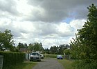
310 | Name as in the development plan | before 1914 | It is located on road 70 to the south as a cul-de-sac and between road 69 and road 52. Road 58 has a branch north of the wasteland to road 70, this belongs to the colony "Karow Straße 70". According to the surrounding numbering, especially in comparison to road 58, it is in an unfinished grid of building reserve area. |
|
| Street 59
( Location ) |
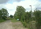
110 | Name as in the development plan | before 1914 | It goes south with a plot of land from road 70 and ends on farmland . According to the surrounding numbering, especially in comparison to road 58, it is in an unfinished grid of building reserve area. |
|
| Street 60
( Location ) |
110 | Name as in the development plan | before 1914 | It lies between road 70 as a dead end and ends at the field. According to the surrounding numbering, especially in comparison to road 58, it is in an unfinished grid of building reserve area. |

|
| Street 62
( Location ) |
270 | Name as in the development plan | before 1914 | Road 62 lies south of Sivertorpstrasse up to a little over road 70 and is divided in its course by a fallow area. According to the surrounding numbering, especially in comparison to road 58, it is in an unfinished grid of building reserve area. Plots 10-104 (even) and 81-101 (odd) are reserved for street 62. |

|
| Street 63
( Location ) |
50 | Name as in the development plan | before 1914 | It goes with plot 3 (continuously) from road 70 south and ends on farmland . According to the surrounding numbering, especially in comparison to road 58, it is in an unfinished grid of building reserve area. |

|
| Street 64
( Location ) |
50 | Name as in the development plan | before 1914 | It goes with the plots 1–3 (continuous) from road 70 south and ends on farmland . According to the surrounding numbering, especially in comparison to road 58, it is in an unfinished grid of building reserve area. A northern part of street 64 (parallel to street 62) was incorporated into Ingwäonenweg on March 21, 1997 and built on. |

|
| Street 66
( Location ) |
30th | Name as in the development plan | before 1914 | A dedicated but almost undeveloped road that leads to wasteland . It goes from the road 52 to the east and consists of the lots 1–3 (continuous) on the north side. In the version of K5 (color edition), building areas are shown between street 67 (south) and 66 (north), but in the mid-2010s [out of date] there was still arable land here. |

|
| Street 67
( Location ) |
650 | Name as in the development plan | before 1914 | The residential street with single-family houses is located between Straße 52 and the district boundary on the Laake . On the south side there are 120 meters of plots 2–12a and on the north side 400 meters of plots 1–43. To the west of the “pond” (named for the adjoining pond mountain), the plots are 180 meters (33–33f to 39–39g). The road turns eastward as a footpath into wasteland. The streets 65 and 68 projected here have not yet been created and are in the current "Map of Berlin 1: 5000 (K5 color edition)". |

|
| Street 69
( Location ) |
580 | Name as in the development plan | before 1914 | It lies between Road 52 and Road 58 and continues as a dead end into the wasteland . Only the south side of the street is built on with settlement houses, the north side is grassland. |

|
| Street 70
( Location ) |
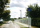
1100 | Name as in the development plan | before 1914 | The residential street, built with single-family houses with a village character, is on the Barnimer Dörferweg hiking trail between Strömannstraße and Straße 64. There is also a short branch that branches off to the east of Alt-Karow. |
|
| Street 71
( Location ) |
170 | Name as in the development plan | before 1914 | It lies between Strömannstrasse and Sägebockweg. |

|
| Street 72
( Location ) |
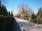
170 | Name as in the development plan | before 1914 | It lies between Strömannstrasse and Alt-Karow, with parts of the cemetery of the Karow village church to the south and north. The continuation beyond Strömannstrasse belongs to Strasse 73. |
|
| Street 73
( Location ) |
880 | Name as in the development plan | before 1914 | It is located between Strömannstrasse and Ingwäonenweg. |

|
| Street 74
( Location ) |
230 | Name as in the development plan | before 1914 | It lies between Alt-Karow and Strömannstrasse. |

|
| Street 86
( Location ) |
220 | Name as in the development plan | before 1914 | It is located between Straße 101 and Krontaler Straße on both sides as a dead end street. |

|
| Street 94
( Location ) |
860 | Name as in the development plan | before 1914 | It is between Sandbergstrasse and Schönerlinder Weg. On the west side it borders allotment gardens and on the east side it is accompanied by the Rübländer Graben. |

|
| Street 100
( Location ) |
190 | Name as in the development plan | before 1914 | It lies between Krontaler Strasse and the embankment of the Berlin outer ring and opens up street 101. |

|
| Street 101
( Location ) |
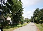
140 | Name as in the development plan | before 1914 | It is located between Straße 86 and 100 along the embankment of the Berlin outer ring . |
|
| Streckfußstrasse
( Location ) |
1260 | Adolf Carl Streckfuß (1823–1895), writer and historian. | May 31, 1951 | The street runs parallel between Böttnerstrasse (west) and Boenkestrasse (east). On June 7, 1957, Street 5 and the part of Street 2 north of the Karow railway connection to the outer ring to the west were included in Streckfußstraße. |

|
| Strömannstrasse
( Location ) |
800 | Brose Strömann, farm owner in Karow since 1572 | Feb 15, 1997 | Set up as Strasse 56 , it is located between Strasse 70 in the south and Zum Kappgraben in the north. |

|
| Swantewitstrasse
( Location ) |
850 | Swantewit , main old Slavic deity | May 11, 1938 | Initially set up in 1934 as Leghornsteig in the "outskirts of Buch", it lies west of Bohrerzeile and Ingwäonenweg in the east. |

|
|
Tarnowitzer Strasse
( Location ) |
320 | Tarnowitz , Upper Silesian district town (Poland) | Nov 9, 1926 | Previously set up as Straße 35 , it is located between Steinauer Straße and Blankenburger Chaussee. |

|
| Teichbergstrasse
( Location ) |
400 | Field name "Aufm Deich-Berge" | Feb 13, 1996 | The parish property "Aufm Deich-Berge" was in the "2nd or high field (east of the village) ”, the Teichberg is the highest point in Karow and the pond there is a sand pit that has been filled with water since 1871. The so-called street is located in the new development area Karow-Nord far away between Busonistraße and Bucher Chaussee, the Teichberg ( protected landscape component ) at 63 meters above sea level. NN is between Straße 42 and Straße 67. |

|
| Tichauer Strasse
( Location ) |
680 | Tichau , Upper Silesian city | Nov 9, 1926 | Previously set up as Straße 24 of the development plan, it is located between Liebenstraße and Bunzlauer Straße. |

|
|
Wotanstrasse
( Location ) |
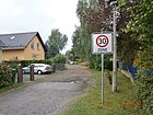
470 | Wotan , Nordic god | before 1920 | It lies between Am Danewend and Schönerlinder Weg. |
|
|
To the Kappgraben
( Location ) |
1110 | Kappgraben , local river | Feb 15, 1997 | The historical connection route to the neighboring town was handed down as Schwanebecker Weg until 1938 , but was officially designated as Straße 57 in 1938 . The Kappgraben was the boundary of the Buch and Karow districts until the 18th century; the course of the border was adjusted by the construction of the motorway. There is a footpath and bike path across the Kappgraben to the settlement ring. |

|
Planned and former streets
Some of the streets named with numbers have not been completely renamed in the district.
| Formerly | from | to | renamed to | Remarks |
|---|---|---|---|---|
| On the border | 1934 | 1938 | → Ingwäonenweg | On the eastern city limits |
| Blankenburger way | 19th century | 1878 | → Blankenburger Chaussee | Before the fortification as a road |
| Bucher way | 19th century | 1878 | → Bucher Chaussee | Before the fortification as a road |
| Village street | 18th century | 1938 | → Alt-Karow | Central street of the Angerdorf |
| Freyastrasse | 1920 | 1927 | → Busonistraße | Busoni, a Germanic goddess |
| Friedrich-Karl-Strasse | before 1921 | 1951 | → Liebenstrasse | Namesake Friedrich Karl Nikolaus (1828–1885), Prince of Prussia |
| Leghornsteig | 1934 | 1938 | → Swantewitstrasse | Leghorn: breed of chicken |
| Lindenberger way | before 1870 | 1997 | → Hofzeichenendamm | Historical connection to the neighboring town. |
| Rhodeländersteig | 1934 | 1938 | → Haduweg | Rhodeland chicken breed |
| Schwanebecker way | 19th century | 1938 | → Street 57 | Historical connection to the neighboring town. |
| Siegfriedstrasse | 1927 | → Lanker Strasse | Siegfried , also Sigurd, figure of the Nordic heroic legend. | |
| Upstallweg | handed down | before 1920 | → Frundsbergstrasse | The path led from the village to the upstall . |
| Viktoria-Luise-Strasse | before 1920 | 1951 | → Boenkestrasse | Viktoria Luise Kerkow, wife of the community leader → Gottfried Karl Kerkow . |
Further locations of Karow
Allotment gardens (colonies)
As far as included, the information was taken from the Berlin allotment garden development plan of the Senate Department for Urban Development 2004. The parcels intended for local recreation, called colonies when they are divided , are uniformly designated as allotment gardens (KGA) in all street lists .
- KGA Am Teichberg ( Lage ) on 7.7 hectares .
- KGA Bullenwiese ( Lage ) on 8.1 hectares with 136 plots.
- KGA Kastanienhain ( Lage ) on 7.7 hectares with 128 plots.
- KGA Pankeniederung ( Lage ) on 13.1 hectares with 224 plots.
- KGA Rosengarten ( Lage ) with 94 plots on 5 hectares with 205 plots.
- KGA Rübländer Graben ( Lage ) on 6.5 hectares with 133 plots.
- KGA Karow (Straße 70) ( location ) on 2 hectares with 51 parcels, it is located along Straße 70.
Parks and other open spaces
- Wrought Bank space ( location ), a rectangular ( 130 m x 50 m ) green area in the course of Hofzeichendamms. It was named on February 15, 1997 after the court emblem of Torbe Münchehagen's Kossatenhof since 1598 - a blacksmith's bench. This place is not listed in the LOR list.
- The square at the casemates ( location ) is a rectangular ( 230 m × 60 m ) green area planted with trees at the end of Achillesstrasse, bordered by Bede and Ingwäonenweg. It is named after the parcel "Aufn Kesematen" in the "1st district" in the directory of Buch field names (field register from 1725). tem or Carow's field, from the Schwanebecker field ”. This place is not listed in the LOR list.
- Especially east of the main street Blankenburger Chaussee / Alt-Karow / Bucher Chaussee there are several as yet undeveloped wasteland areas that are not used for agriculture, along the Karower drainage ditch and the Laake ( Lage ) and to the west along the Upstallgraben ( Lage ).
- Protected landscape component "Karower Teichberg"
See also
literature
- Ines Rautenberg: Street names in Berlin-Pankow. Origin and history. Kulturamt Pankow and Friends of the Chronicle Pankow, Berlin 1999.
Web links
- Map of Berlin 1: 5000 with district boundaries. Senate Department for Urban Development Berlin, 2009, accessed on January 11, 2011 .
- Street directory Karow. kaupert media GmbH, accessed on December 5, 2011 . This source also contains streets that are not listed in the official directory.
- Office for Statistics Berlin-Brandenburg: List of streets and places in the Pankow district (as of February 2015); pdf
- List of monuments Pankow (pdf; 2.2 MB) Retrieved January 9, 2012
Individual evidence
- ^ Pankow civil engineering department
- ↑ a b c Urban planning Karow.gif ( Memento of the original from June 8, 2016 in the Internet Archive ) Info: The archive link was inserted automatically and has not yet been checked. Please check the original and archive link according to the instructions and then remove this notice.
- ↑ Markus Hesse, Ulrike Wolff: The "new suburb" - urbanization of the periphery through density (PDF; 292 kB)
- ↑ A protective wall should reduce motorway noise . In: Berliner Zeitung , March 10, 1994
- ↑ There is a poor data situation for the municipality of Karow before it was incorporated into Greater Berlin in 1920. The information "before 1920" refers to the areas around the town center that were settled and built up from 1900 onwards, for which the access roads were gradually created, expanded and named. The indication “before 1914” refers to the development plans of the municipality and the Niederbarnim district for the suburb and suburbs settlement. The development of this street and with it the creation and expansion as streets, especially the settlement opposite other areas in the urban area of Greater Berlin, went more slowly. This probably also explains why the streets are primarily distinguished by numbers.
- ↑ a b c d Pastor Pfannschmidt (1861–1947) quotes in his book History of the Berlin Suburbs Buch and Karow , published in 1927 , the list of parish properties in Karow written by Pastor Ulrici (1740–1773)
- ↑ Chronicle of Alt-Karow ( Memento of the original from April 24, 2010 in the Internet Archive ) Info: The archive link was inserted automatically and has not yet been checked. Please check the original and archive link according to the instructions and then remove this notice.
- ↑ The houses and properties on Dorfstrasse with illustrations and further information.
- ↑ On the person of Gerda Boenke
- ↑ (1) Bartholomäus Augustin, († 1605), sexton of the church in Buch and Karow, put on a directory of the villages Buch and Karow in 1598; (2) Johann George Friedrich Ulrici (1711–1773), pastor in Buch und Karow from 1740, compiled a list of farms with associated court symbols; (3) Hermann Achilles, master blacksmith, owner of the Bucher Laufschmiede, which closed in 1899, provided details from the memory of his work and (4) Martin Pfannschmidt (1861–1947), pastor, continued the directories.
- ↑ Chronisteneck at Kauperts.de
- ↑ kauperts.de Gewanneweg
- ↑ The 1st or Buch field was north, the 2nd or Hohe Feld was east of the village and the 3rd field was west to Buchholz .
- ↑ Landbuch Kaiser Karls IV. (1316-1378) from 1375: The henchman knight Friedrich von Kare of the margrave Johann I was mentioned on May 22nd, 1251 as the landowner of the village Karow. The brothers Bernardus and Tilo von Kare had received from Johannes von der Gröben six hooves belonging to the knight's seat as fiefdoms (afterlehen), the bede and the high court in 1370.
- ↑ a b Berlin Address 1930> Part IV streets and houses of Berlin> administrative district of Pankow. Karow
- ↑ a b Barnimer-Doerferweg-Reinickendorf-Pankow-and-Lichtenberg
- ↑ a b c d K5 (color edition) produced by the district surveying offices of Berlin as of January 2012
- ↑ More details about Adolf Streckfuß
- ↑ Allotment gardens - individual systems in the Pankow district, p. 29 (PDF; 319 kB)


