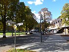
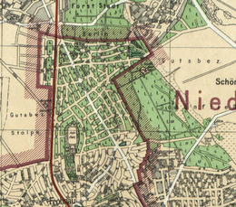
List of streets and squares in Berlin-Frohnau

The list of streets in Berlin-Frohnau shows the streets in the Berlin district of Frohnau with their historical references. At the same time, this compilation is part of the lists of all Berlin streets and squares .
overview
Statistical
There are four squares and 136 dedicated roads in the district, the latter also including a forest road and the dedicated forest paths in the north. The street directory also contains named forest paths . Four streets of the same name continue with their properties in Hermsdorf . The total length of all streets and lanes in Frohnau is 76.4 kilometers, where 16,814 inhabitants (as of December 30, 2019) live, and which all belong to the postal code area 13465.
Development of roads

As in the southern Berlin suburbs, the connection to the rail network through the construction of the Frohnau station led to settlement plans. The station was inaugurated on May 1, 1910 on the northern line , which had existed since 1877 . The "Berlin Terrain-Centrale" of the Upper Silesian Prince von Donnersmarck acquired the forest area from the von Veltheim family for the "Garden City Frohnau" in 1907 . In the period 1908–1910 streets and squares were planned and laid out for a villa colony. The plans envisaged the settlement of around 30,000 people. The type of development of Frohnau on the grounds of the Stolpe manor district was essentially in the country house style of Hermann Muthesius . “In 1909, the streets and squares began to be laid out. The original paving made of granite paving stones can still be discovered on various streets in Frohnau or after a severe winter when the first potholes appear on Frohnau's asphalt roads. Frohnau was officially founded in 1910 and the development of the squares began, e.g. For example, the casino building on Ludolfingerplatz and the first settlement houses were built […] “In 1910, Frohnau became an independent administrative unit in the Niederbarnim district .
In 1920 Frohnau came to Greater Berlin and the Reinickendorf administrative district against the resistance of the landowners . Frohnau is only shown in the Berlin address book from 1922, while the Frohnau road system is shown in almost its current form on the “Kiessling's Great Special Map of the Area around Berlin”. With the expansion of the land in 1930, in addition to the naming of newly laid streets, some renaming were necessary - for example because of double names in Greater Berlin .
In the northeast of the district in the “Waldgelände Frohnau” nature reserve, the streets, some of which are already paved, show that not all projects have been successfully implemented. These forest roads are therefore private roads of the forest administration. A ring road was planned to the west of the railway line, on which the disabled settlement, which was moved from the city center, is located. The Fürst Donnersmarck Foundation had the building constructed. Other roads remained in the state of forest paths and are now used as hiking trails through the Bieselheide .
The “walled in” outskirts of the city during the time of the Berlin Wall (1961–1990) was also not conducive to the extensive expansion of roads. “During the Cold War Frohnau was part of West Berlin . The GDR was on three sides ; to the west, north and east stood the wall. There were only three roads on which you could leave Frohnau, and they led south. ”Incidentally, Frohnau consists of the area to the west and east of the S-Bahn line, which is crossed by two bridges ( Fischgrundbrücke and Frohnauer Brücke ) and two underpasses (Staehleweg to Invalidensiedlung and Neubrücker / Schönfließer Straße ), there is also the railway bridge on Gollanczstraße under which a footpath leads to the Wall Path .
Valid road system
The streets in Frohnau are mostly paved , partly asphalted and have wide sidewalks lined with trees on both sides. Typical is the existing gas lighting on sidewalks, which is defended against changes by a citizens' association. It is also typical that in Frohnau numerous paths and streets have a curved (looped) course and no street courses go beyond the city limits to the surrounding area. The Frohnauer Strasse running south ends at the “ Entenschnabel ”, the area that cuts to the west along the Am Sandkrug road belonging to the Brandenburg municipality of Glienicke / Nordbahn . There was a special access situation for this area during the time of the Berlin Wall. The Bieselheider Weg may be an example of the streets ending at the city limits , which, with its westward curve, ends at the southern and northern end of the street at the city limits in front of the Bieselheide on the Brandenburg field.
Part of the federal highway 96 runs on Oranienburger Chaussee, part of the street belongs to Glienicke / Nordbahn (state of Brandenburg) along the district and thus the city limits, and in the northern section it leads directly through Frohnau. The east-west connection is formed by the main road, Zeltinger Strasse (from Oranienburger Chaussee ) and Frohnauer Strasse (south of Hermsdorf) via Sigismundkorso and Am Eichenhain to Hermsdorf to Roten Chaussee . After the planning phase at the beginning of the 20th century, the Frohnau road system was influenced by the city limits with their west, north and east boundaries of the district towards Brandenburg (Glienicke / Nordbahn and Hohen Neuendorf ). Frohnau is only indirectly connected to the nearby A 10 , A 111 and A 114 motorways .
The latest settlement is the “Am PoloTeich” residential complex between Gollanczstrasse and the railway line, where, on behalf of GEWOBAG, 131 semi-detached and terraced houses were built in the idea of the Frohnau garden city on an area of around 60,000 m². The names of the streets were chosen according to the breed of horse. The seven access roads to the houses in the residential complex are publicly accessible private roads .
Overview of the streets
The following table gives an overview of the streets and squares in the district as well as some related information.
- Name / location : current name of the street or square. Via the link Location , the street or the square can be displayed on various map services. The geoposition indicates the approximate center of the street length.
- Traffic routes not listed in the official street directory are marked with * .
- Former or no longer valid street names are in italics . A separate list may be available for important former streets or historical street names.
-
Length / dimensions in meters:
The length information contained in the overview are rounded overview values that were determined in Google Earth using the local scale. They are used for comparison purposes and, if official values are known, are exchanged and marked separately.
For squares, the dimensions are given in the form a × b for rectangular systems and for (approximately) triangular systems as a × b × c with a as the longest side.
If the street continues into neighboring districts, the addition ' in the district ' indicates how long the street section within the district of this article is. - Name origin : origin or reference of the name.
- Notes : further information on adjacent monuments or institutions, the history of the street and historical names.
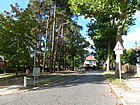
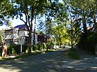
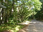
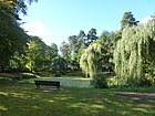
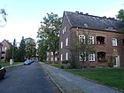
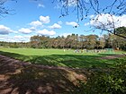
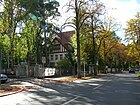
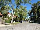
- Image : Photo of the street or an adjacent object.
| Name / location | Length / dimensions (in meters) |
Origin of name | Date of designation | Remarks | image |
|---|---|---|---|---|---|
|
Alemannenstrasse
( Location ) |
1560 | Alemanni , Germanic tribe | before 1922 | The street 142 of the development plan lies between Welfenallee and Neubrücker Straße. The quiet residential street is mostly built with single-family houses. At the northern end of the street, beyond the city limits, the Pechpfuhlweg leads as a bike or footpath to the village of Stolpe and the Wall Trail . |

|
| At the view
( Location ) |
190 | after an increase that offers an outlook | Aug 4, 1930 | The quiet street between Maximiliankorso and Am Kringel was laid out as street 150 of the development plan. |

|
| At the beaver den
( Location ) |
210 | street name related to the forest area | Aug 4, 1930 | Before street 119 according to the development plan, this residential street was named in 1910 and is located between Burgfrauenstraße and Am Rosenanger. |

|
| At the oak grove
( Location ) |
1620 | Oak grove, small, light oak forest | 1910 | According to the development plan, the traffic route was first called Straße 164 . It is located between Hainbuchenstrasse and Rote Chaussee in the Tegeler Forest and at the time it was named it ran directly past the Stolper Heide into the Tegeler Forest. There are mostly single-family houses along the quiet residential street on the outskirts of Berlin. The southern part of the street has through traffic and cobblestones, so there is a little more traffic noise than in the northern part of the street, which is only built on one side. There is a small pond on the corner of Neubrücker Strasse. Due to its proximity to the city limits, the Wall Trail runs here . The road is important from the Roten Chaussee as the main western road to Frohnau, which was particularly important during the West Berlin period and also as an access to the A 111 . |

|
| At the Green Court
( Location ) |
470 | Name requested by the owner of the first property | 1910 | At first it was street 148 of the zoning plan. It is a quiet, cobblestone street and mostly single-family houses with gardens on the outskirts of Berlin and is located between Sigismundstraße and Maximiliankorso. |

|
| At the green tip
( Location ) |
170 | Name requested by the first resident without reference to the environment | 1910 | It is routed as road 138 between Sigismundkorso and Karmeliterweg. The house at Am Grünen Zipfel 5–7, built by Franz Scholz in 1912, noted in the address book in 1922 as Scholz'sches Haus (corner of Dominikanerweg ), is a monument ensemble . |

|
| At the clear cut
( Location ) |
290 | Clear cutting, completely cleared forest | Aug 4, 1930 | For road 159 according to the development plan, the forest that had existed up to that point had been cleared. It lies between the Karmeliterweg and Sigismundkorso in an arc that is convex to the west. |

|
| At the ring
( Location ) |
190 | Squiggles , indefinite curvature | Aug 4, 1930 | The road 151 of the development plan was probably named after a neighborhood special. The street is convexly curved to the west between Benediktinerstraße and Ludolfingerweg. |

|
| On the Pfingstberg
( Location ) |
130 (in the district) |
Pfingstberg, local elevation | Aug 4, 1930 | In Frohnau there are lots 29–41 (odd) and 30–36 (even), the road continues south to Hermsdorf . The Pfingstberg is an elevation in this landscape, as can be seen on a map section from 1868 north of the Fenne. The street was named from Street 121 and Street 62 in 1930. It lies between Am Rosenanger and Odilostraße across Burgfrauenstraße, in the northern part there is a conspicuous arc to the west, which evades the duck's bill from Glienicke. |

|
| On the mushroom
( Location ) |
290 | mushroom-shaped shelter on Oranienburger Chaussee (built in 1910 by Carl Stahl-Urach) | Aug 4, 1930 | The road curves northwards around the mushroom pond between Oranienburger Chaussee and Bieselheider Weg. The street was laid out with the development of street 58 of the development plan. |

|
| At the polo field
( Location ) |
100 | Polo field of the riding and jumping school | Apr 1, 1967 | The road 37 of the development plan on the western edge of the district near the wall goes east from the Gollanczstraße . It leads as a two-lane paved road with a strip of lawn in the middle to the "Landhaus Am Poloplatz" (formerly the casino of the sports field), assigned to the plots north 1–9 (odd) and 2 (even). The polo field is used by the riding club and on the sports field to the south by the football club. The polo pitch was created with the garden city around 1910 in order to use the polo passion of Kaiser Wilhelm II. To promote real estate interests. With the location on the northern edge of the garden city, the Zerndorfer Allee was divided, along the course of which this complex was built. The area around the polo field was a gift from Prince von Donnersmarck to Kaiser Wilhelm II and the Berliners. Until 1932, the Frohnauer could enjoy themselves playing polo. On the Silva map from 1925, street 37 is shown between street 57 and street 34 (Gollanczstraße) to the polo field. The avenue of chestnuts located here goes back to the original planting from 1910, which was then carried out with 1,100 chestnuts from the Netherlands. |

|
| On the priest mountain
( Location ) |
220 | Priesterberg, built over inland dune | 1910 | The name was chosen by the residents for street 173 in the development plan. The road is curved to the north between Speerweg and Hainbuchenstraße. |

|
| At the cross passage
( Location ) |
150 | Cross passage , a cross street | Aug 4, 1930 | Routed as road 147 of the development plan, it lies diagonally between the main traffic routes Benediktinerstraße and Ludolfingerweg. It is a two-lane paved road with two sidewalks and partly newer single-family houses. |

|
| At the Rosenanger
( Location ) |
820 | Rosenanger, north of the street lying jewelry place with roses | 1910 | The building plan road 113 was named with the name chosen by the residents . The continuously paved road with sidewalks and built on the edge with single and multi-family houses lies between Im Fischgrund and Langohrzeile, via the latter further as a dead end eastwards to the forest strip along the Chaussee. The Rosenanger is located behind the northern properties and Im Fischgrund, so the road is curved in a southward curve. |

|
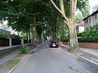
| At the beech
( Location ) |
350 | eye-catching beech | 1910 | A single, conspicuous beech tree is said to have served as the basis for naming Street 136 in the development plan. The street lies between Sigismundkorso and Welfenallee. |
|
| Ansgarstrasse
( Location ) |
290 | Ansgar (801–865), Archbishop of Hamburg-Bremen, saint | Aug 4, 1930 | At first it was street 194 of the development plan. It runs between Speerweg and Neubrücker Straße in the northwestern tip of Frohnau to Hohen Neuendorf to Stolper Heide. In this corner of the city at the western end of the street along Speerstrasse is the Frohnau cemetery. |

|
| Ariadnestrasse
( Location ) |
360 | Ariadne , figure of the Greek legend | Aug 4, 1930 | The previous road 71 in the development plan is between Gollanczstrasse and Zeltinger Strasse. |

|
| Arthur's Wall
( Location ) |
720 | Arthur , legendary king of the Celtic British | Aug 4, 1930 | The street 161 was named together with the street 170 and is located between Karmeliterweg and Speerweg. In the narrow, quiet residential street on the outskirts of Berlin, there are mostly single-family houses with gardens. There is a pedestrian connection around a silted pond between Artuswall and Olwenstrasse. |

|
| Ascalonian way
( Location ) |
250 | Ascalon , a place in Syria, known from the crusades | Jan. 23, 1931 | The street lies between Frohnauer and Kreuzritterstraße and on the route of the road 133 of the development plan. |

|
| Auber Steig
( Location ) |
140 | Aub , Lower Franconian town in the district of Würzburg, Bavaria | Aug 4, 1930 | The train 118 of the development plan was applied between the fishing grounds and Walporzheimer road in 1930 and named. |

|
|
Barthstrasse
( Location ) |
170 | Theodor Barth (1849–1909), politician and publicist | Apr 10, 1961 | The street goes westward from Gollanczstraße as a dead end and turns north in front of the equestrian sports field. In the development plan it was listed as street 385 . |

|
| Benediktinerstrasse
( Location ) |
1130 | Benedictines , Catholic monastic order | 1910 | The road west of the railway line runs in gentle curves between Tannenstrasse and Artuswall. It originated from the street 144 . There are numerous villas on it. |

|
| Bergfelder Stadtweg (forest path)
( Location ) |
450 | Bergfelde , since 1993 part of Hohen Neuendorf , neighboring town in Brandenburg | 1910 | The forest path west of the Hubertussee belongs to the villa settlement planned around 1910, which, however, was not implemented, since 1959 the "Frohnau forest area" has been secured as a landscape protection area LSG-16. The Hubertussee was artificially created when the settlement was planned. In the address book from 1943, the Bergfelder Stadtweg is recorded as an undeveloped road from Jägerstieg to the city limits. The private road as a hiking trail is not signposted with this name, but is marked north of Utestraße as part of the Wall Trail and leads as a footpath over the former wall strip . |

|
| Bergfelder Weg
( Location ) |
280 | Bergfelde , since 1993 part of Hohen Neuendorf , neighboring town in Brandenburg | July 1, 1976 | The settlement road is between Senheimer and Schönfließer Strasse, east of the equestrian sports field, previously Strasse 465 . |

|
| Bieselheider way
( Location ) |
810 | Bieselheide , field name | Aug 4, 1930 | The street forms a westward arch from the city limits on Rödernstrasse in Glienicke and the city limits on Schwarzkittelweg. The street, previously street 95 and street 57 , led through the Bieselheide, where the forester's house with the name "Bieselhaus" (on formerly Schönfließer Flur) stands. The connection to Oranienburger Chaussee between plot 21 and 27 has the same name, plots 23 and 25 are missing. |

|
| Bifröstweg
( Location ) |
140 | Bifröst , the bridge between heaven and earth in Norse mythology, rainbow | Jan. 23, 1931 | Set up as road 167 lies west from Am Eichenhain as a dead end street to the (western) city limits on the Stolper Heide. |

|
| Bulgenbachweg
( Location ) |
250 | Hans Müller , (called: von Bulgenbach, † 1525), peasant leader of the German Peasant War in the Black Forest | Apr 1, 1931 | The road 95 created by the development plan, is between Rosenplüterweg and the eastern city limits, there she goes road across the Glienicker stumbling. |

|
| Bundschuhweg
( Location ) |
270 | Bundschuh , symbol for "the peasant" and during the Peasants' War in southwest Germany | Aug 4, 1930 | The street on both sides of Oranienburger Chaussee is between Remstaler Straße and Bieselheider Weg, previously Straße 92 . |

|
| Burgfrauenstrasse
( Location ) |
740 (in the district) |
Castle women, residents of a castle | 1910 | Plots 3–51 (odd) are in Frohnau (the straight side of the street has no properties), the road continues south to Hermsdorf with plots 53–133 (odd) and 60–132 (even) on Entenschnabel eastwards. Before that, Straße 112 and Platz Z of the development plan were named as the street of the garden city Frohnau. On August 4, 1930, the extension (now) in Hermsdorf between S-Bahn-Trasse and Berliner Straße, Straße 64 , was included. In West Berlin between 1952 and 1990, traffic coming from Berliner Strasse (in Hermsdorf) had to be diverted via Burgfrauenstrasse and Zeltinger Strasse to Oranienburger Chaussee, as the latter are not used as far as Edelhofdamm and especially Entenschnabel in GDR territory could. |

|
|
Criolloweg
( Location ) |
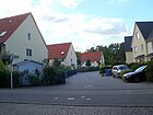
310 | Criollo , Argentine breed of horse | Feb 2, 2001 | The street is between Gollanczstraße and Fuchsring, which it continues as a dead end northwards. The northern section lies along the railway line and this is where the residential garages are located. The street in the "Am Poloplatz residential complex" is named "horse-related". This publicly accessible private road was laid out when the new residential complex was built in the early 2010s, which was based on the garden city character of the district. With 131 semi-detached houses and terraced houses, 60,000 m² were laid out on Gollanczstrasse between Poloplatz and the city limits along the railway line . From the building's layout, the Lipizzanerweg continues the road to the north in the northern part of the layout, but is only connected by a footpath. |
|
|
The kennel
( Location ) |
130 | Zwinger , part of medieval city fortifications | 1910 | The street east of the railway line lies between Burgfrauenstraße and Fürstendamm and was listed as street 110 in the development plan . |

|
| Dinkelsbühler Steig
( Location ) |
280 | Dinkelsbühl , town in the Ansbach district, Bavaria | March 11, 1937 | The street was laid out before 1922 as Trabener Straße , after a town in Rhineland-Palatinate . It is located between Edelhof- and Fürstendamm and was renamed because of the similarity of street names in other districts when Greater Berlin was formed in 1920. |

|
| Donnersmarckallee
( Location ) |
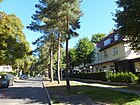
580 | Henckel von Donnersmarck (1830–1916), land and industrial owner | Aug 4, 1930 | The Königsallee was laid out in the course of the street before 1922 , but in 1930 street 158 along with the northern part of the Königsallee was named in honor of Donnersmarck and his foundation. Guido Graf Henckel Fürst von Donnersmarck is the founder of the Fürst Donnersmarck Foundation in Berlin, which designs offers with and for people with disabilities. The road lies between Sigismundkorso at Donnersmarckplatz and as a dead end over the forest path to the suburbs at Forst Tegel . |
|
| Donnersmarckplatz
( Location ) |
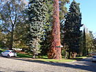
140 × 80 | Henckel von Donnersmarck (1830–1916), land and industrial owner | Nov 9, 1926 | Place D1 was planned in the development plan ; it is located to the southwest in the corner of Alemannenstrasse and Sigismundkorso and Donnersmarckallee on the western edge. Between 1928 and 1929, the street Am Donnersmarckplatz , which formed the southern end of the square, was included in Donnersmarckplatz. Guido Graf Henckel Fürst von Donnersmarck founded the Fürst Donnersmarck Foundation in Berlin in Frohnau , which designs offers with and for people with disabilities. After the experiences from the First World War, he donated an area for this facility in 1916. Incidentally, Donnersmarck pushed ahead with the execution of the garden city of Frohnau with BTC. |
|
|
Edelhofdamm
( Location ) |
850 | Edelhof, favorite place of King Heinrich I. | Aug 31, 1937 | Before 1925 this road was laid out in the area northeast of the railway line as the Kaiserpark . The road between Zeltinger Platz and Oranienburger Chaussee is one of the main connecting roads in Frohnau and is mainly built on with single-family houses. The road has two lanes which are divided by a park-like median (since 2011: Josef Brix and Felix Genzmer Park ). A pavilion designed by Lesser in 1910 on Oranienburger Chaussee marks the entrance to the garden city. On the corner of Enkircher Straße there is a temple mountain ( Buddhist house ), which is also open to visitors. Opposite in the park there is a memorial stone for Herbert Bauer and a fragment of a Corinthian column capital from the old Berlin Cathedral. The street used to be called (Am) Kaiserpark . |

|
| Elfriedestraße (forest path)
( Location ) |
870 | Elfriede , female first name | 1910 | The paved forest path in this fully developed forest area was created during the development of the garden city Frohnau into a villa suburb. The property speculations here from 1909/1910 failed to complete and the forest took back its territory. In the 1943 address book, Elfriedestrasse is recorded as an undeveloped cul-de-sac from Oranienburger Chaussee. The "Frohnau forest area" has been a protected landscape area since 1959 . On the Silvakarte from 1925 , the street between Straße 22 and Bergfelder Stadtweg is drawn in parallel to Elisabethstraße to the south. The street 10 is its extension to the west over the Oranienburger Chaussee to the railway line at the city limit |

|
| Eltviller Street
( Location ) |
190 | Eltville am Rhein , largest Hessian city in the Rheingau wine-growing region | 1910 | The street 116 of the development plan of the garden city Frohnau was named after a wine-growing center in 1910 to match the (northwest) parallel streets. It is located between Fürstendamm and Markgrafenstraße. |

|
| Enkircher Strasse
( Location ) |
720 | Enkirch , municipality in the wine-growing region on the Moselle, below Traben-Trarbach | Aug 4, 1930 | The street between Edelhof- and Fürstendamm was named Kirchsteig before 1922 , whereby the Buddhist house, completed in 1923, gave its name, the Protestant church was not built until 1936 according to plans by Krüger. When the name was given in 1930, this path was combined with Straße 99 and, like the surrounding streets, was named after a wine-growing center. |

|
| Esslinger Steig (*)
( Location ) |
520 | Eßlingen am Neckar , city ten kilometers southeast of the city center of Stuttgart am Neckar | Aug 4, 1930 | The Eßlinger Steig lies in the area of the former wall strip . In the address book of 1933 and 1943 it is recorded as undeveloped from Oppenheimer Weg. The current official map shows it from Zerndorfer Weg to Fürstendamm 40, a built-up property. This path is marked on the map of the district surveying office, but it is located in the 100 meter wide forest strip west of the Oranienburger Chaussee, on the western edge of which lies the city limits. This marked course has driveways from Oppenheimer Weg 16-22 and those from the properties Oppenheimer Weg 6 and Enkircher Straße 43 are built over here. This road is not included in the RBS database of the urban development plan traffic, it is ultimately on the inland dune that determined the course of the Oranienburger Chaussee to the west. It lies on the route of Route 46, which led over the Am Fürstendamm bridge that existed between 1911 and 1944 and led to today's Am Rosenanger. The wooden bridge burned down in 1944 and only the northern bridge tower remained, in which there is a substation. In the 21st century, a footpath leads along the wooded inland dune, during the time of the Wall it was a border forest path with a view to the east to Glienicke / Nordbahn . |

|
|
Forest path
( Location ) |
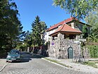
1190 | Path along the Tegel forest | before 1910 | The forest path between Frohnauer Straße and Pirschweg is in the south of the district, behind the southern property is the district boundary with the Tegel forest . Before Straße 140 of the development plan, the western extension of the way, Straße 157 , was included on August 4, 1930 . |
|
| Franziskastraße (forest path)
( Location ) |
1460 | Franziska , female name | 1910 | It is a paved forest path that was created during the development of the garden city Frohnau into a villa suburb, secured as a landscape protection area since 1959 . Unsuccessful property speculations from the early 20th century are visible in this fully developed forest area. All forest paths have street names, are paved and some have curbs. A villa suburb was to be built here as early as 1909. Instead, forest has grown there and the artificially created Hubertussee serves as a local recreation area . In the 1943 address book, Franziskastraße is listed as an undeveloped cul-de-sac from Oranienburger Chaussee. |

|
| Frohnauer Strasse
( Location ) |
830 (in the district) |
Cheerfulness , lying here hamlet in the district of Reinickendorf direction of Hermsdorf ago | Aug 6, 1937 | The plots 112–168 (even) and 113–165 (odd) are located in the district between Sigismundkorso and the district boundary. The road continues to Hermsdorf to Hermsdorfer Damm. The street in the district was initially called Hermsdorfer Steige (before 1922) and was probably planned and laid out as street 7 during the planning of the garden city in 1909 as a villa colony on the grounds of the Stolpe manor district . In 1910 Frohnau was an independent administrative unit in the Niederbarnim district . The Frohnauer Straße from Hermsdorf is marked by name on a map from 1908 and was an access road when the "Garden City" was created. On August 6, 1937, the Hermsdorfer Steige was renamed Frohnauer Strasse. |

|
| Fox ring
( Location ) |
470 | Fox , horse with fur, mane and tail in brown | Feb. 22, 2002 | The Fuchsring goes south from and to the Criolloweg and extends it in the southern section. It is located in the "residential complex on Poloplatz", which also influenced the naming of the publicly accessible private street. This ring road was created when a new residential complex was built, which was based on the garden city character of the district. With 131 semi-detached houses and terraced houses, 60,000 m² were laid out on Gollanczstrasse between Poloplatz and the city limits along the railway line . The residents' garage complex is located on the western section of the ring along the railway line. |

|
| Fuchssteinerweg
( Location ) |
580 | Count von Fuchssteiner (16th century), Palatine Chancellor, (allegedly) author of the program of the farmers' survey in the Allgäu | Jan. 31, 1931 | The road 81 projected according to the development plan was laid out and named in 1931. It is an S-shaped arch between Zeltinger Strasse and Hofjägerallee. |

|
| Fürstendamm
( Location ) |
1360 | Prince , highest nobility title, to which the margraves belonged | 1910 | The road 109 of the development plan was named in 1910 and is located between Zeltinger Platz and Oranienburger Chaussee, but the city limits in here already east of Glienicke / Nordbahn is, he Markgrafenstraße exits. There are several cultural monuments on the street , such as the Frohnau transformer house at number 40. To the north of the street is the Fürstenteich. The Fürstendamm is originally the entrance gate from Glienicke / Nordbahn . The road runs northwest to the Frohnauer Bridge (formerly Bahnhofsbrücke ) and from there through Im Fischgrund to reach the Fischgrundbrücke in the south. Between 1911 and the fire in 1944, the “Brücke am Fürstendamm” crossed the road, which breaks through an inland dune nearly ten meters high at the eastern end. This bridge led a path to the level of the inland dune, which influenced the location of the eastern Oranienburger Chaussee in Glienicke , over what was then the "town entrance". Due to the duck's bill, this road / path 96 led in the south, turning westwards to the Rosenanger . |

|
|
Gawan Street
( Location ) |
690 | Gawan , legendary figure of Welsh mythology and from it the Arthurian legends and the search for the Grail | Aug 4, 1930 | The street 152 and street 153 were combined with reference to the names of the streets to the southwest named after a "Grail theme". It lies between Alemannenstrasse and Benediktinerstrasse. |

|
| Vulture trail
( Location ) |
200 | Vulture , common name for a number of birds of prey, mostly scavengers | Aug 4, 1930 | The road goes next to the city limits (in the east of the district) as a dead end from Schwarzkittelweg and then continues as a forest path to Jägerstieg. In this northern part, it belongs to the unrealized project of a villa settlement, formerly Straße 24 . Part of this development is the Fürst Donnersmarck-Haus rehabilitation center . The Wall Trail runs over this street and is located here on what was previously West Berlin's territory. |

|
| Glambeck way
( Location ) |
20 (in the district) |
Glambeck, since 2002 part of Friedrichswalde near Joachimsthal in Barnim | June 13, 1936 | Plots 44 and 45 belong to Frohnau (according to LOR), the road to the south belongs to Hermsdorf . The street in Frohnau has the direction to the intersection Frohnauer Straße / Kammgasse, but the plots in between are aligned with that street, which means that the Glambecker Weg, street 2 of the development plan, which was (probably) later , did not enter Frohnau. |

|
| Gollanczstrasse
( Location ) |
1380 | Victor Gollancz (1893–1967), British-Jewish publisher | July 26, 1955 | The street continues Ariadnestraße in the south and goes at the northern end over the Ponyweg as a dead end with the property 145 (west) to the road bridge under the railway line, it ends at the city limits, which here forms a point to the west. In the Brandenburg area ( Hohen Neuendorf ), a footpath and road, which is marked with a traffic sign, driving ban and barriers, leads to the Wall Trail . A footpath continues east along the railway line (city limits), which originally belonged to the Kniggeweg , on this property 144 (just on the eastern side of the street), whose buildings are 350 meters away, can be reached. To the east of the street there is Ludwig-Lesser-Park and to the north of Neubrücker Strasse is the polo pitch. The street was named Speestrasse before 1922 , after the officer of the Imperial Navy Maximilian von Spee (1861-1914) who fell off the Falkland Islands in the First World War . It was then named on September 28, 1935 after the spy Carl Hans Lody (1877-1914), who was captured and executed in England during the First World War . During Reinickendorf's brief affiliation to the British Sector, she was named after Edith Cavell (1865-1915), a British nurse who was executed in Belgium during World War I for helping Allied soldiers to escape. This renaming by the Allies was probably never officially confirmed until 1955 the street was named after Gollancz. On February 9, 1956, Strasse 34 and on September 1, 1981, Strasse 60 were included. On the Silvakarte from 1925 , Speestrasse is drawn north as Strasse 34 to Jägerstieg / Strasse to Zerndorf on the city limits. |

|
| Gralsburgsteig
( Location ) |
890 | Grail Castle , repository of the Grail | Aug 4, 1930 | The street between Maximiliankorso and Neubrücker Straße was street 123 of the development plan. The eastern side of the street runs along the railway line. |

|
| Grail Knights Path
( Location ) |
350 | Knight of the Grail , keeper of the Grail on the Grail Castle | Aug 4, 1930 | The road 179 and road 195 of the development plan was in 1930, named as several surrounding roads to themes of Norse mythology. On April 1, 1967, the northern section of the path was renamed Gurnemanzpfad , as the road was interrupted by a school building. The street is thus between Stolzingstrasse and Laurinweg. |

|
| Graneweg
( Location ) |
190 | Grane, Sigurd's horse in Norse mythology | Apr 10, 1931 | The road 165 of the development plan is a dead-end road between On oak grove and the city limits to Stolper Heide. It belongs to the west of the district and is parallel to the Helweg to the south . The choice of name refers to the effect of Richard Wagner's Götterdämmerung in the 1930s, in which the horse Grane is mentioned in the foreplay. 1932 the street is still undeveloped According to the 1936 address book, plots 1–15 (13 is built on) and on the right side plots 2–16 are parceled out, of which 4, 13 and 16 are built up and inhabited and 2 is still undeveloped. |

|
| Gurnemanz path
( Location ) |
350 | Gurnemanz von Graharz, old man in Wolfram von Eschenbach's poem Parzival | Apr 1, 1967 | A quiet residential street on the outskirts with mostly single-family houses. The street ends as a dead end both in the northern (on the city limits) and in the southern part , even for pedestrians. In 1967, the northern section of the Grail Knights' Way , interrupted by a school, was renamed, as were other streets in this area from Norse mythology. |

|
| Gutshofstrasse
( Location ) |
670 | Manor, in Prussia mostly the administrative and economic center of the manor district | Nov 9, 1926 | The name was given as street 78 in 1926. The developed settlement street with single and multi-family houses and newly built single-family houses in the south lies between Edelhofdamm and Weislingenstraße and thus in the area of the former estate. |

|
|
Haflinger Trail
( Location ) |
80 | Haflinger , mountain horse, later a robust leisure horse for riding | Feb. 22, 2002 | The street lies between Lipizzanerweg and Mustangweg and was laid out when the new Am Poloplatz residential complex was built at the beginning of the 2010s and, with 131 semi-detached houses and terraced houses on 60,000 m², is based on the garden city character of the district, located between Poloplatz and the city limits along the railway line . The polo pitch influenced the naming of the streets according to horse breeds and types. The publicly accessible private road opens up the properties between Gollanczstrasse and Lipizzanerweg on the railway embankment. |

|
| Hainbuchenstrasse
( Location ) |
1080 | Hornbeam , a medium-sized, deciduous tree found in Europe and Western Asia | 1910 | The street is located in the northwest corner of the district between Maximiliankorso and Am Eichenhain, previously street 174 . |

|
| Hambacher way
( Location ) |
170 | Hambach , an independent municipality until 1969 | Aug 4, 1930 | Laid out as Straße 117 , the path goes south from Fürstendamm as a dead end to Walporzheimer Straße. Hambach has been part of the urban district of Neustadt an der Weinstrasse in Rhineland-Palatinate, other streets here are named after wine towns. The eponymous place became known through the Hambach Festival . |

|
| Hillside path
( Location ) |
150 | The path climbs to the Stolper Heide | Sep 24 1936 | The street is west of Am Eichenhain to the city limits. Set up as road 168 according to the development plan . The quiet residential street with single-family houses surrounded by gardens is narrow and connects to the Wall Trail . The elevation here is based on an inland dune . |

|
| Hattenheimer Strasse
( Location ) |
350 | Hattenheim , district of Eltville am Rhein , Rheingau-Taunus-Kreis | Aug 4, 1930 | The street lies between Im Fischgrund and Fürstendamm. The road 113 according to the development plan was named in 1930 like the surrounding streets after wine villages. |

|
| Heerruferweg
( Location ) |
200 | Heerrufer , for advertising soldiers and mercenaries for the army in charge | Sep 24 1936 | The street is between Hainbuchenstraße and Speerweg, previously Straße 176 . |

|
| Helweg
( Location ) |
140 | Hel , goddess of the subterranean realm of the dead in Norse mythology | Aug 4, 1930 | The street is a dead end west of Am Eichenhain to the city limits, parallel to Bifröst - and Graneweg and was laid out as street 166 in the development plan. The choice of name refers to the effect of Richard Wagner's Götterdämmerung in the 1930s and the prevailing preference in Frohnau for street names with reference to Germanic mythology. In 1936 the street was still vacant. For 1943, lots 3 and 5 are built on and inhabited, 7 is a summer house, and summer houses are also recorded on the right (northern) side facing the forest. |

|
| Hofjägerallee
( Location ) |
400 | Hofjäger, hunters employed at the court | 1910 | The street lies between Markgrafenstraße and Zerndorfer Weg on Konzer Platz, street 80 of the development plan. |

|
| Hohenheimer Strasse
( Location ) |
620 | Hohenheim , part of Stuttgart since 1942 | 1910 | The street lies between Dinkelsbühler Steig and Enkircher Straße and is street 106 according to the development plan . |

|
| Horandweg
( Location ) |
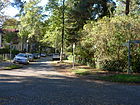
510 | Horand, singer from the Gudrun song | Aug 4, 1930 | The way is a quiet residential street on the outskirts with single-family houses. It lies between Alemannenstrasse and Neubrücker Strasse and ends on this in the north as a dead end street, there is no way for pedestrians to get to the Wall Trail . It was formed from road 180 and in 1936 private road 200 was also included. |
|
| Hubertusweg
( Location ) |
980 | Hubertus (around 656–727), Bishop of Liège, saint | 1910 | This road, paved along its entire length, with sidewalks and visible curbs, is located in the “ Frohnau forest area ” in the north of the district, since 1959 a protected landscape area . Around 1910, this area was intended for a villa suburb of the garden city of Frohnau. The Hubertusweg is laid out along road 4 of the development plan. Most of the forest at that time has been preserved because the property speculation around 1900 did not succeed. The forest road leads east of the Oranienburger Chaussee as a dead end street to the south located "Künstlerhof Frohnau" (address Hubertusweg 60).
Its buildings, erected during the Nazi era , originally served as a hospital , but wounded, sick and in some cases also refugees were accommodated here after the war until 1998. At the end of the 1990s, the 'Verein Künstlerhof Frohnau' took over the property. After extensive restorations, some permanent residents have now settled on the farm, but above all painters, sculptors, ceramists, glass artists, graphic artists, musicians and video artists: 36 studios were registered here at the end of 2015. Closed off with a barrier and therefore only occasionally accessible to the public, the forest road continues as a private road and forest path to the artificially created Hubertussee . The street ends at the intersection with Franziskastraße in front of the Bieselfließ and the triple point of the borders of Frohnau, Glienicke / Nordbahn and Hohen Neuendorf . On April 23, 1971, the section of Hubertusweg west of Oranienburger Chaussee to the Invalidensiedlung was renamed Staehleweg . In the 1943 address book, Hubertusweg is named with the new buildings of the Invalidenhaussiedlung between Albert-Heinrich-Straße and Eberhardstraße and east of the northern railway with an undeveloped section between Knigge and Wildkanzelweg. In the following, the “Landhaus am Hubertusweg” of the Fürst Donnersmarck Institute Foundation is named, which probably became the Künstlerhof. The route between the western and eastern city limits is marked on the Silva map from 1925 . |

|
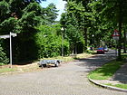
| Huttenstrasse
( Location ) |
400 | Ulrich von Hutten (1488–1523), publicist, humanist | 1910 | The street is between Senheimer and Schönfließer Straße. Marked as street 64 in the development plan . |
|
| Idastraße (forest path)
( Location ) |
110 | Ida , female name | 1910 | Idastraße is a closed forest road in the " Frohnau forest area ". In the 1943 address book it is recorded as an undeveloped cul-de-sac from Franziskastraße. The paved road was laid out as an access road for the unrealized villa suburb of the garden city Frohnau, but not built on, since the project failed, secured as a landscape protection area since 1959 . |

|
|
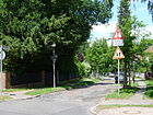
In the Amseltal
( Location ) |
920 | Valley with blackbirds | 1910 | The street is between Ludolfingerweg and Neubrücker Straße. The road 186 was named to landowners proposal. On June 2, 1937, the road 146 , which is located in the extension to the north, was included. |
|
| In the fishing ground
( Location ) |
930 | Fischtal, old field name | Aug 4, 1930 | The street was initially called Fischtalweg (before 1922) and, extended in 1930 by street 132 , got its current name between Burgfrauenstraße and Langohrzeile. "For the health of the Frohnau population, which was not very numerous at that time, [...] Dr. Weydemann in his practice at Fischgrund 1 (formerly Fischtalweg) [...] At that time there was no pharmacy in Frohnau. ”( Rudolf Neumann (1915) :) In 1922 only half of the property was built on, but there were construction sites. Right from the start, the road took the route from the (planned) entrance to the town, the Oranienburger Chaussee in Glienicke / Nordbahn , which was marked 1911–1944 by the “Brücke am Fürstendamm”, to the Fischgrundbrücke (initially: Black Bridge ) and thus provided access in the Frohnau part west of the railway line . The railway bridge was called the Crusader Bridge until April 11, 1986 and was renamed the Fischgrundbrücke on that day. |

|
| Invalid settlement
( Location ) |
1270 | Invalid settlement , through relocation of the invalids' house for war invalids in Berlin | 1938 | After 1967 all street names were dropped within this settlement, so that as a whole it is an official and postal object with houses 1–53 (odd) and 2–46 (even). The settlement is located directly on the Berlin city limits to Hohen Neuendorf in the northernmost corner of Berlin and goes back to the Invalidenhaus at the Charité in Berlin-Mitte . The road through it connects to Staehlestrasse and after the fall of the Berlin Wall in 1990 there is also a connection northwards on Brandenburg territory to Neuendorfer Florastrasse, albeit as a dead end for cars . The apartments are only rented to severely disabled people with a disability of at least 50%. |

|
|
Jägerstieg (forest path)
( Location ) |
920 | meaning "way for the hunter " | 1910 | The street, laid out in 1910, lies between Zerndorfer Allee (corner of Gollanczstraße) and Bergfelder Stadtweg across the Oranienburger Chaussee. The streets in the area were planned, laid out, partially laid out and named for a villa village to the garden city of Frohnau, and since 1959 they have been secured as a landscape protection area . The Jägerstieg corresponds to street 18 of the development plan. On this forest path, part of the Wall Path runs along the border patrol and customs paths in the area of the Berlin Wall that was once here . In the address book from 1943, the Jägerstieg is recorded as an undeveloped cul-de-sac from the Kniggestraße between the western and eastern city limits. The stairway is signposted from Oranienburger Chaussee to the east. It is designated as a private road and blocked off by a barrier at the entrance. The 358 meter high “telephone relay tower” of the Berlin-Frohnau radio relay system stood north of Jägerstieg from 1977 until it was blasted in 2009 . From 1980 - in addition to the systems at the Berlin-Schäferberg telecommunications tower - it provided directional radio links to West Germany in order to ensure telephone and radio / television transmissions to and from West Germany during the time of the Wall . The system was only used for directional radio and at no time for broadcasting radio programs . |

|
| Jostweg
( Location ) |
200 | Joß Fritz (1470–1525), leader in the peasant war for the Bundschuh | Jan. 31, 1931 | Before Straße 31 , it is between Remstaler Straße and Oranienburger Chaussee. |

|
|
Kammgasse
( Location ) |
370 | (probably) after the ridge on the elevation of the inland dune lying here | Aug 4, 1930 | Kammgasse, a three-meter-wide paved, traffic - calmed one-way street with wide tree-covered sidewalks, is located between Frohnauer Strasse and Mattersburger Weg on the southern edge of the district, partly built with multi-family houses. It was laid out in the course of road 139 of the development plan. In 1933 it was still vacant as a dead end from Hermsdorfer Steige . |

|
| Carmelite Way
( Location ) |
930 | Carmelite order , Catholic mendicant order | Aug 4, 1930 | Street 41 , named before 1922 as Dominikanerweg after the order of the preachers , was located between Bahnhofplatz and Hermsdorfer Steige . Including the westward branch of the Königsallee projected before 1922 ( Straße 143 ) but still undeveloped at that time , the new street was named in 1930. The street is between Ludolfingerplatz and Am Eichenhain across Donnersmarckallee. |

|
| Casino Walk
( Location ) |
400 | 'Das Casino', the first café in Frohnau | 1910 | The Kasinoweg is between Welfenallee / Knappenpfad and Kreuzritterstrasse / Fischgrundbrücke, along the railway line . The casino in the garden city of Frohnau was touted in a 1915 “Pocket Book for the Surrounding Area of Berlin”. "The casino tower was completed as part of an ensemble that also included the train station and the casino on May 1, 1910, six days before the founding ceremony of the garden city." |

|
| Cat footbridge
( Location ) |
130 | 'Katzensteg', novel by Hermann Sudermann (1857–1928) | Aug 4, 1930 | Before street 82 it is between Edelhofdamm and Fuchssteiner Weg. |

|
| Klarastraße ( forest path )
( Location ) |
400 | Klara , female name | 1910 | The street lies between Hubertusweg and Utestraße and belongs to the Frohnau forest area , for which a villa village was planned at the beginning of the 20th century; streets have already been laid out and named without the project being implemented. In the address book of 1943 it is recorded as an undeveloped cul-de-sac from Franziskastraße, initially the spelling was Clarastraße . On the Silvakarte from 1925 , the street between Oranienburger Chaussee / corner street 10 and Gertrudstraße is drawn up to the northern city limits. The "Frohnau forest area" has been a protected landscape area since 1959 . | |
| Knappenpfad
( Location ) |
210 | Scarce , knightly man who learned the craft of weapons from a knight | Aug 4, 1930 | The Knappenpfad is in the route of road 131 between Kasinoweg / Welfenallee and Kreuzritterstraße. The naming here is related to the Kreuzritterstrasse. |

|
| Kniggeweg
( Location ) |
350 | Adolph Knigge (1752–1796), writer | Aug 4, 1930 | The Kniggeweg lies on the route of before 1922 existing between Goebenstraße and Speestraße located Weddigenstraße , named after the U-boat commander in World War Otto Weddigen (1882-1915). The Kniggeweg lies between Gollanczstrasse and Schönfließer Strasse, initially at right angles to the railway line and then northwards along it. The street that was named in 1930 comprised Weddigenstraße as well as Straße 7, Straße 61 and Straße 62 . The 1943 address book shows a crossing with Hubertusweg (since 1971 Staehlestrasse) east of the northern railway in the area of the “ Frohnau forest area ”. A path named in this way is also shown on later maps on Gollanczstraße opposite Utestraße. Since 1959 it has been part of the landscape protection area / secured forest area. On the Silvakarte from 1925 , the route is marked as road 51 to the east alongside the railway line to the northern city limits. |

|
|
Königsbacher line
( Location ) |
590 | Königsbach an der Weinstrasse , wine-growing area, since 1969 district of Neustadt an der Weinstrasse, Rhineland-Palatinate | Aug 4, 1930 | The street between Senheimer and Schönfließer Straße was named in 1930 by merging Sickingenstraße, Straße 20 and part of Straße 19 . The Sickingenstrasse was named before 1920 after the Imperial Knight Franz von Sickingen (1481–1523) a leader of the Rhenish and Swabian knighthood. |

|
| Concert place
( Location ) |
100 × 60 × 90 × 60 | Konz , town in the district of Trier-Saarburg, Rhineland-Palatinate | Sep 24 1936 | The square is on Zeltinger Straße and is bordered to the northeast by Zerndorfer Weg and Hofjägerallee. When the name was assigned, street 65a, which bordered the south of Platz U, was included. |

|
| Paddock
( Location ) |
120 | Paddock, fenced pasture land | Sep 24 1936 | The street is between Hofjägerallee and Gutshofstraße. As road 83 of the development plan, it is in the area of the pastures of the former estate. |

|
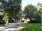
| Crusader Street
( Location ) |
440 | Crusader , participant in the crusades to conquer the Holy Land of Palestine | Feb. 18, 1927 | The road 130 according to construction plan was partially named 1927 and August 4, 1930, the extension of the road which was also the number 130, included. In the address book from 1929 the road between Barbarossakorso and the forest is recorded with three lots, in 1943 already with the lots 1–39 (odd) and 2–34 (even) to the cemetery and the casino path. The traffic-calmed street leads from Welfenallee over Askaloner Weg and Knappenpfad in two branches, on the one hand as a dead end to the Hermsdorf II cemetery (located on Frohnauer Flur) and on the other hand past Kasinoweg to the Fischgrundbrücke over the railway line to Burgfrauenstrasse. The railway bridge was called the Crusader Bridge until April 11, 1986 . |
|
|
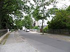
Long-eared line
( Location ) |
180 | Long-eared, term for rabbits because of the proverbial long ears | Jan. 9, 1961 | The section of the Hasensprungs between Fürstendamm and Am Rosenanger, named before 1922, was renamed according to the topic in 1961 , as the street name existed several times in Berlin . The remainder of the path leading to the duck's beak remained without a name when the wall was built as street 114a . |
|
| Laurinsteig
( Location ) |
910 | King Laurin is the legendary dwarf king of the rose garden | Aug 4, 1930 | The street is laid out by combining Straße 175, Straße 181 and Straße 182 in the development plan and is located between Speerweg and Neubrücker Straße. Parallel to Horandweg there is a pedestrian passage to Neubrücker Straße, which leads past a drained pond. |

|
| Clearing path
( Location ) |
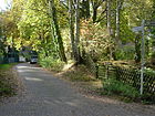
190 | leads to the Stolper Heide | Aug 4, 1930 | The road lies between Speerweg and Am Eichenhain, from which it leads as a dead end to the city limits to Stolpe . Beyond the city limits, the path continues to the Wall Trail , which is here in Brandenburg . The short, narrow and quiet residential street is built on with single-family houses surrounded by gardens. The street lies on the route of street 127 and street 172 of the development plan. At the oak grove, both branches of the path flow in an offset manner. |
|
| Lipizzanerweg
( Location ) |
270 | Lipizzaner , breed of horse | Feb 2, 2001 | The road goes westwards from Gollanczstraße and turns to the north at the railway line - built on one side - and continues over Mustangweg as a dead end . This street was laid out when a new residential complex was built, which was based on the garden city character of the district. With 131 semi-detached houses and terraced houses, 60,000 m² were included on Gollanczstrasse between Poloplatz and the city limits along the railway line . The polo pitch influenced the naming. The Lipizzanerweg is a public private road. |

|
|
Ludolfingerplatz
( Location ) |
90 × 75 (oval) |
Ludolfinger , old Saxon ruling family | May 20, 1937 | The square was created as a counterpart to Zeltinger Platz at the western end of the Frohnauer Bridge. From its creation until 1937 it was called Bahnhofsplatz . Since 1877 there was a stop of the northern railway , the route of which was lowered for the development of the Berlin area at that time and in 1910 the Frohnau train station was opened. The circular square was laid out in 1908 according to plans by the garden architect Ludwig Lesser. Both places are connected to the Frohnau S-Bahn station by the Frohnauer Bridge . They form the entrance to the then projected garden city Frohnau. Residential and commercial buildings were built around the square, which was renamed in 1937. Squares and the train station are the center of public life in Frohnau. A fountain, flower beds, benches and lawns dominate the square. A staircase leads up to the Frohnauer bridge. |

|
| Ludolfingerweg
( Location ) |
1010 | Ludolfinger , German ruling dynasty, named Ottonen after the imperial coronation | May 20, 1937 | In the quiet residential street on the outskirts there are mostly single-family houses. Already laid out before 1925 as the Franciscan Way, named after the order founded by Francis of Assisi. The street, renamed in 1937, lies between Ludolfingerplatz and Maximiliankorso. |

|
| Malwinestrasse ( forest path )
( Location ) |
210 | Malwine , feminine given name | after 1990 | The road is classified as a forest path and goes 215 meters north of Hubertusweg eastwards from the B 96 (Oranienburger Chaussee) and leads to Klarastraße. It belongs to the Frohnau forest area , for which a villa village was planned at the beginning of the 20th century. It is not listed in the 1943 address book, but is listed in the current detailed network of the regional reference system for the Frohnau district. The "Frohnau forest area" has been a protected landscape area since 1959 . |

|
|
Markgrafenstrasse
( Location ) |
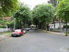
1610 | Margrave , title for a count as an official who had a border mark as a fief | 1910 | The street is between Fürstendamm and Minheimer Straße, previously Straße 73 of the development plan. |
|
| Mattersburger way
( Location ) |
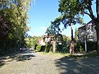
190 | Mattersburg , district capital in Burgenland, Austria | Aug 4, 1930 | The street 141 was named in 1930 after the place in which the Republic of Heinzenland was proclaimed in 1918 when it came to the assignment of Burgenland ( German- West Hungary) before it was assigned to Austria in the treaties of St. Germain and Trianon in 1919. The paved road lies between Welfenallee and Kammgasse and ends beyond these at plots 11 and 13 (odd) and 12 and 14 (even) at a pedestrian staircase in the Tegel district boundary to the dog run area in the Tegel forest. |
|
| Maximilian parade
( Location ) |
1400 | Maximilian I (1459–1519), Holy Roman Emperor | 1910 | One of the main connecting roads in Frohnau is predominantly built with stately single-family houses. The road between Ludolfingerplatz and Sigismundkorso opens up the northern settlement roads west of the railway line. |

|
| Mehringer Strasse
( Location ) |
720 | Mehring , wine town on the Moselle, Rhineland-Palatinate | Jul 10, 1933 | The street, laid out before 1922 as Berlichingenstraße , was named after the Imperial Knight Götz von Berlichingen (1480–1562). It runs between Markgrafenstrasse and Schönfließer Strasse. In 1922, six plots were already built on and seven listed as construction sites; in the 2010s there were 59 plots here. The traffic route is paved with pavement , it has wide tree-lined sidewalks, and to the southeast of it lies the Mehring pond. |

|
| Merlinweg
( Location ) |
160 | Merlin the magician and advisor to King Arthur in the Arthurian legend | Apr 4, 1961 | In the quiet residential street on the outskirts of Berlin there are mostly single-family houses with gardens in the narrow street. Before, as road 392 according to the development plan, it lies between Speerweg and Am Eichenhain. |

|
| Minheimer Strasse
( Location ) |
590 | Minheim , wine town in a loop of the Moselle between Piesport and Wintrich in Rhineland-Palatinate | 23 Sep 1938 | The Goebenstraße was built before 1922 and after the Prussian General August Karl von Goeben named (1816-1880). In 1938 this street was renamed to match the surrounding streets after wine villages, it is located between Wiltinger Straße and Kniggeweg. |

|
|
Munchener Strasse
( Location ) |
790 | Munich , capital of Bavaria | 1910 | The quiet street with single-family houses is located between Maximilianskorso and Neubrücker Straße. The street, which is an elongated S-bend in an east-west direction, was created from street 178 and street 814 of the development plan. |

|
| Mustangweg
( Location ) |
90 | Mustang , North America's Wild Horses. | Feb. 22, 2002 | The road lies westward between Gollanczstrasse and Lipizzanerweg. This street was laid out when the new Am Poloplatz residential complex was built at the beginning of the 2010s and is publicly accessible as a private street . The settlement was based on the garden city character of the district and was built with 131 semi-detached houses and terraced houses on an area of 60,000 m² on Gollanczstrasse between Poloplatz and the city limits along the railway line . The neighboring polo field influenced the naming of the seven streets here. Mustangweg is the entrance to the northern part of the residential complex. |

|
|
Neubrücker Strasse
( Location ) |
1410 | Neubrück , former settlement on the Havel in the Stolper Heide, east of Hennigsdorf, since 1998 part of Stolpe Süd , Brandenburg | Jan. 9, 1961 | The quiet residential street on the outskirts of the city is built on with single and multi-family houses and was set up as Hennigsdorfer Straße before 1922 , named after the industrial city located northwest. In 1961 the street 193 was included and renamed. The southern part of Neubrücker Straße has through traffic and cobblestones, the northern part of the street, which is partly directly on the city limits, is only built on one side and is located in a quieter location. There is a small pond on the corner of Am Eichenhain street. Another, drained pond is on a pedestrian passage to the Laurinsteig. |

|
| Nibelungenstrasse
( Location ) |
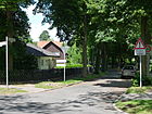
780 | Nibelungen , dwarf family in the Germanic hero saga | 1910 | The street previously laid out as street 185 of the development plan, asphalted and partly with paved and tree-lined sidewalks, lies between Maximiliankorso and Neubrücker Straße. The Nibelungenteich is located to the northwest of the intersection with Stolzingstrasse. |
|
|
Olwenstrasse
( Location ) |
1060 | Olwen , figure of the Arthurian legend | Aug 4, 1930 | The narrow and quiet residential street is located between Alemannenstraße and Paul-Poser-Platz on Welfenallee, with the name it was formed from Straße 163 and Straße 155 . |

|
| Oppenheimer way
( Location ) |
420 | Oppenheim , Weinstadt am Oberrhein (Rheinhessen), located between Mainz and Worms | Aug 4, 1930 | The road leads over a small elevation (built over inland dune) in an arc to the northeast from and to Enkircher Straße. According to the development plan, it is street 100 . |

|
| Oranienburger Chaussee
( Location ) |
3890 (in the district) |
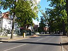
Oranienburg , city in the north | after 1933 | This road is part of the B 96 . The Oranienburger Chaussee lies between the northern edge of the duck bill and the outskirts of Frohnau. Plots 13–68a (continuously) belong to the district, while plots 68 and 68a are on the north side of Leipziger Strasse in Glienicke. In the southern section from Im Fischgrund to Edelhofdamm, only the west side of the street belongs to the district, below number 13 there is a 110 meter wide strip of forest on Frohnauer Flur next to the street. The street itself is outside of Berlin in Glienicke / Nordbahn in Brandenburg . North of Schönfließer Straße (west side, plot 39) and Schwarzkittelweg 2 / 2a (east side), the Chaussee leads through the Frohnau forest area . With the project of the garden city Frohnau, the path located here was named Oranienburger Strasse before 1912 and then renamed “Chaussee” between 1935 and 1938. |
|
| Ortwinstrasse
( Location ) |
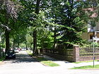
440 | Ortwin , male first name, also name in the Nibelungen and Gudrun sagas. | Feb 12, 1935 | The street was named as Richard-Wagner-Straße after the composer Richard Wagner as early as 1912 and was renamed in Berlin in 1935 because of the repeated street name . The street lies between Alemannenstraße and Gralsburgsteig. In 1933 Richard-Wagner-Straße - still noted as "Forst" between Gralsburgsteig and Im Amseltal - has seven developed properties and seven construction sites. According to the official register in June 2012, there are 32 built-up plots on the road. |
|
| Otternweg
( Location ) |
270 | Otter , amphibious subfamily of the martens | Feb 12, 1935 | The street is between Burgfrauenstraße and Am Pfingstberg, according to the development plan it is Straße 120 . |

|
|
Boy Scout Path
( Location ) |
470 | Boy Scouts , Movement, an international, religiously and politically independent educational movement for children and young people | Feb 12, 1935 | Between Am Eichenhain and Gawanstraße is the road 160 according to the development plan . |

|
| Pilgersdorfer Weg
( Location ) |
150 | Pilgersdorf , town in Burgenland, Austria | Aug 4, 1930 | Quiet residential street on the outskirts of Berlin. The quiet, narrow residential street is mostly built up with single-family houses and garden plots and is located between Olwenstraße and Am Eichenhain, previously: Straße 163 . |

|
| Stalking path
( Location ) |
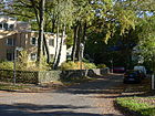
80 | Stalking , a form of individual hunting | Sep 24 1936 | The road lies between the Karmeliter- and Forstweg and leads over the latter as a cul-de-sac to the Tegel Forest, and ends at the suburb of Tegel . According to the development plan, it is Street 149 . |
|
| Pony path
( Location ) |
70 | Pony , riding horse breed | Feb. 22, 2002 | The street is a dead end from Gollanczstraße westwards to the embankment . Plots 1–13 (odd) are located south of the street that has a turning hammer . The street was laid out when the new Am Poloplatz residential complex was built at the beginning of the 2010s. With 131 semi-detached houses and terraced houses on 60,000 m² on Gollanczstrasse between Poloplatz and the city limits along the railway line, seven publicly accessible private roads open up the properties. The neighboring polo field influenced the naming of the streets. The Ponyweg is on the northern edge of the residential complex and is directly accessible, the residential buildings are located south of the residential garages opposite on the northern edge of the street. |

|
|
Rappenweg
( Location ) |
100 | Rappe , horse whose mane, tail and coat are black | Feb. 22, 2002 | The street lies between Gollanczstraße and Fuchsring (western branch) and ends there in front of the railway embankment. It is the access to the southern part of the residential complex. Plots 1–13 (odd) lie south of the street, north 2 and 4. The street was laid out when a new residential complex was built, which was based on the garden city character of the district. With 131 semi-detached houses and terraced houses, 60,000 m² were included on Gollanczstrasse between Poloplatz and the city limits along the railway line . The neighboring polo field influenced the naming, the residential complex is called Am Poloplatz. |

|
| Rauentaler Strasse
( Location ) |
540 | Rauenthal , wine-growing town in the Rheingau, since 1977 district of the sparkling wine, wine and rose town of Eltville am Rhein | 1910 | Located on the route of Straße 21 , it is linked to Hubertusweg in the address book from 1922 and then built on in the southern part to Schwarzkittelweg in 1943 and noted further north and undeveloped. It crosses the one from Straße 54, Straße 39, Straße 40 , Rosamundeweg, after which Jägerstieg and Hubertusweg are crossed. The road goes northwards from the “Pilz” on Oranienburger Chaussee and over the Schwarzkittelweg as a dead end further west past the rehabilitation center of the Donnersmarck Foundation and continues as a wide forest path into the Frohnau forest area . The Berlin area has been a protected landscape area since 1959 . The road between Hubertusweg and Schönfließer Straße is shown on the Silvakarte from 1925 . |

|
| Remstaler Strasse
( Location ) |
590 | Remstal , river valley east of Stuttgart, wine-growing region | Jan. 23, 1931 | The street lies in an elongated Z-arch between Edelhofdamm and Weislingenstraße, which was previously laid out as street 77 of the development plan. The Frohnau volunteer fire brigade is located at Remstaler Straße 9 |

|
| Toboggan run
( Location ) |
220 | neighboring toboggan run | Sep 24 1936 | The street 104 between Enkircher and Markgrafenstraße was named in 1936. |

|
| Rosamundeweg ( forest path )
( Location ) |
620 | Rosamund , feminine given name | 1910 | This partially paved private road was part of a project for a villa suburb in the north of Berlin, which was planned around 1910 but not implemented. The forest area has been secured as a landscape protection area since 1959 . In the 1943 address book it is recorded as vacant between Gertrudstrasse and Jägerstieg . |

|
| Rosenplüterweg
( Location ) |
300 | Hans Rosenplüt (around 1400–1460), Nuremberg gunsmith and poet (mastersinger) | Aug 4, 1930 | Before road 94 it is between Bieselheider Weg and as a dead end over Bulgenbachweg to a turning hammer on property 35. The built-up southern property at this eastern end is in Glienicke / Nordbahn . |

|
| Rudesheimer Strasse
( Location ) |
540 | Rüdesheim am Rhein , Hessian wine town in the Rheingau at the southern gateway to the Middle Rhine Valley | 1910 | The paved road, laid out as road 105 according to the development plan and running in a wide S-bend, lies between Fürstendamm / Dinkelsbühler Steig and Enkircher Strasse. |

|
|
Schönfließer Strasse
( Location ) |
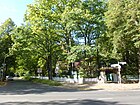
1730 | Schönfließ , a neighboring town to the east in the district. In the address book 1943 Oberhavel, state of Brandenburg | before 1912 | The street is an extension of the Neubrücker Straße between the bridge over the railway line and the city limits to Glienicke / Nordbahn , it leads at the "Pilz" over the Oranienburger Chaussee and the Bieselheider Weg and continues in the neighboring town as Frohnauer Weg. There are several sports facilities here, which extend to the polo field. |
|
| Schwarzkittelweg
( Location ) |
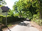
490 | Black coat , colloquially and in the hunter's language a wild boar | Aug 4, 1930 | It is located between Senheimer Straße and Bieselheider Weg. The road 44 in 1930 east named Oranienburger Chaussee, the western section of Lichtensteinallee (Senheimer Street) remained unnamed and went on into the forest environment Frohnau. |
|
| Senheimer Strasse
( Location ) |
1130 | Senheim , wine village on the Moselle in the district of Cochem-Zell, Rhineland-Palatinate | Aug 4, 1930 | The street was laid out before 1922 as Lichtensteinallee , named after Martin Hinrich Lichtenstein (1780–1857), doctor, researcher, zoologist and initiator of the Berlin zoo. In 1930 this was renamed and extended by the route of street 19 of the development plan. The road lies between Zeltinger Straße and Bergfelder Weg, over which it continues as a cul-de-sac east of the polo field into the " Frohnau forest area ". The street is marked on the Silva map from 1925 . |

|
| Sigismund Parade
( Location ) |
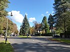
1599 | Sigismund (1368–1437), Roman-German Emperor, Elector of Brandenburg. | 1910 | The street designed as a parade was named according to the development plan from street 126 using place G1 and place F1 . The Sigismundkorso, one of the main roads in Frohnau, mainly built with stately single-family houses, is located between Ludolfingerplatz and Am Eichenhain. There is a wide, planted median at Ludolfingerplatz and a small park at the corner of the Maximilianskorso. |
|
|
Söllerpfad
( Location ) |
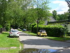
100 | Söller , elevated place within a knightly castle | Sep 24 1936 | Before street 190 of the development plan, it lies between Wahnfriedstraße and Gralsburgsteig, the name (probably) also refers to the latter. |
|
| Speerweg
( Location ) |
1020 | Spear , defensive and hunting weapon, sports equipment | Aug 4, 1930 | In the narrow, quiet residential street on the outskirts of Berlin, there are mostly single-family houses with gardens. The road laid out as road 171 according to the development plan lies between Maximiliankorso and Ansgarstrasse and, as a dead end, still along the western edge of the Frohnau cemetery. The road opens up the north-western tip of the district to the city limits to Hohen Neuendorf . There is a small pond between Neubrücker Straße, Am Eichenhain and Speerweg. There is a retirement home on the corner of the Maximiliankorso. |

|
| Staehleweg
( Location ) |
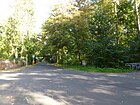
500 | Wilhelm Staehle (1877–1945), last commandant of the Invalidenhaus , resistance fighter against the Nazi regime | Apr 23, 1971 | The street lies between Oranienburger Chaussee and Invalidensiedlung. It was laid out around 1910 as Hubertusweg and its branch west of Oranienburger Chaussee was expanded and renamed. |
|
| Stolzingstrasse
( Location ) |
930 | Walther von Stolzing, figure from the opera Die Meistersinger von Nürnberg by Richard Wagner | Jan. 9, 1961 | Kastanienallee had been laid out before 1922 and was renamed in 1961 by adding street 191 and street 192 . Since then, the street has been located between Maximiliankorso and Neubrücker Straße. |

|
| Road 52 (forest path)
( Location ) |
260 + 600 | numbered according to the development plan | before 1930 | Road 52 is a footpath according to RBS class and is currently marked on the map of Berlin 1: 5000 (K5 color edition) and is located along the city limits to Glienicke / Nordbahn going south from Jägerstieg. A crossing with Jägerstieg is indicated at the southeast corner of the grounds of the Künstlerhof. The street is covered in this course with the Wall Trail , which here probably corresponds to the former West Berlin Zollweg and continues south to the Geierpfad on Schwarzkittelweg. The northern continuation of the Jägerstieg is the Rosamundeweg. |

|
| Street 114a (Hasensprung)
( Location ) |
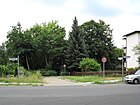
40 | numbered according to the development plan | Jan. 9, 1961 | The street lies between Am Rosenanger and the city limits at Entenschnabel opposite Am Sandkrug (Glienicke / Nordbahn). In the 1922 address book, the Hasensprung between Fürstendamm and Rosenanger is shown with two houses and construction sites. In 1961 it was renamed between Fürstendamm and Am Rosenanger, with the development plan designation Straße 114a remaining from then to the Entenschnabel . The road is marked with a sign "No traffic for over 2.8 t", but the paved road ends after a few meters at a transverse barrier. |
|
|
Tannenstrasse
( Location ) |
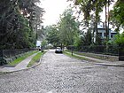
300 | Firs , conifer species | Nov 9, 1926 | The road 137 between Carmelites and Ludolfingerweg in 1926 probably named after standing here firs. |
|
|
Unclean path
( Location ) |
170 | Unkel , town in the district of Neuwied, Rhineland-Palatinate | Feb. 19, 1938 | The former private road opens up from Markgrafenstraße to the east, between this and Rodelbergpfad, Enkircher Straße and Fürstendamm. |

|
| Utestrasse
( Location ) |
100 + 860 | Ute , female first name | Jan. 9, 1961 | The street was laid out and named as Getrudstraße before 1912 , and in 1961 it was renamed Utestraße to include Straße 11 . The private road between Oranienburger Straße and Hubertusweg (on the eastern city limits) is only marked in the RBS in a section from Rosamundeweg westwards to a built-up property on the city limits under this name and according to RBS class a forest road . The street name probably refers to Oda , the ancestor of the Liudolfinger family. This street is located in the forest area Frohnau , which was intended as a villa suburb, but was not implemented at the beginning of the 20th century due to a lack of investors. The access and access roads were partly paved at that time and laid out and named with sidewalks. The forest area has been a protected landscape area since 1959 . In the address book of 1943, the (then) is Gertrudenstraße with many construction sites and "home Rhineland" and the "Sand mushroom" of Donnersmarck Foundation stated in ostwestgerichteten section with the cross streets Franciscan, Klara-, Augusta Street , bent in the eastern area of South it crosses Franziska- and Elfriedestrasse again. In contrast to the current route (of the forest path), the connection to Oranienburger Chaussee was assigned to Franziskastraße in 1943. The street leads to property 1 (a residential building) and is signposted on Oranienburger Chaussee with your name and with a reference to the traffic restrictions on the left side of the street. To the east of property 1, a road continues, which is also signposted as " Mauerweg " on the northern edge of western Berlin , and all paths and forest roads leading north across the border to Hohen Neuendorf are marked as Mauerweg. In the further course (east of number 1) a southern forest path branches off, which is marked on maps as Franziskastraße . |

|
|
Wahnfriedstrasse
( Location ) |
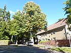
670 | Wahnfried , Richard Wagner's house in Bayreuth | March 23, 1925 | The street 187 was named in 1925 in memory of the composer Richard Wagner , whose works have already been immortalized with local street names from Nordic mythology. The street lies between Maximiliankorso and Stolzingstraße. |
|
| Walporzheimer Strasse
( Location ) |
430 | Walporzheim , wine-growing town in the Ahr Valley, Rhineland-Palatinate | 1910 | The street lies between Im Fischgrund and Fürstendamm on the route of street 115 fixed in the development plan . |

|
| Weislingenstrasse
( Location ) |
400 | Weislingen, leader in the German Peasants' War | Aug 4, 1930 | The road 79 after the development plan is between Mehringer and Oranienburger Chaussee. |

|
| Welfenallee
( Location ) |
1080 | Welfen , originally a Frankish noble family | May 11, 1938 | The quiet residential street, mostly built with single-family houses, lies in an elongated S-bend between Ludolfingerplatz and Forstweg, over which it is a dead end street to the suburbs at the Tegeler dog run area. Before 1925, the Barbarossakorso , whose name goes back to Emperor Barbarossa , was laid out in relation to the other streets called the Korso . |

|
| Wildkanzelweg
( Location ) |
350 | Wildkanzel, hunter's language for the high seat | Aug 4, 1930 | The road is from Am Pilz northwards and over the Schwarzkittelweg as a dead end to the forest area . It is projected as street 22 in the development plan . According to the address book of 1943, it was planned to lead further north over the Hubertusweg at that time. The forest area, previously planned as a villa suburb, has been secured as a landscape protection area since 1959 . |

|
| Wilsbergzeile
( Location ) |
110 | Wilsberg, elevation in the vicinity, meanwhile built over inland dune | Sep 24 1936 | The road 197 , which was laid out according to the development plan , has been a traffic-calmed dead end since the 21st century . It lies between Am Eichenhain and the (western) city limits and ends directly at the Stolper Heide, until 1990 at the Berlin Wall . |
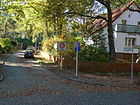
|
| Wiltinger Strasse
( Location ) |
400 | Wiltingen , municipality on the Saar 20 km south of Trier with Grand Cru vineyards, Rhineland-Palatinate | Apr 20, 1937 | The street lies between Zeltinger Platz and Markgrafenstraße and consists of two lanes. The Kronprinzenallee , which was laid out before 1922 and named after Crown Prince Wilhelm of Prussia (1882–1951) , was renamed in 1937 together with the square-like extension in the north. At the time of the renaming in 1937, Wiltingen was still an exclave of Luxembourg , which was then occupied by German troops in 1940 . On the triangular square associated with the street name at the north end of Markgrafenstrasse is the "Monument to the Dead of the World Wars" between the trees. |

|
|
Zeltinger Platz
( Location ) |
150 × 75 (semicircle, with arch away from the web) |
Zeltingen-Rachtig , municipality in Rhineland-Palatinate | June 8, 1937 | At first it was called Cecilienplatz and was given its current name in 1937 , along with street 125a . The semicircular square was laid out in 1908 according to plans by the garden architect Ludwig Lesser, the counterpart on the other side of the railway line is Ludolfingerplatz , with the Frohnauer Bridge between the two. The station facility and both squares form the entrance to the planned garden city Frohnau and at the same time its center. Around the square there are residential and commercial buildings as well as the Johanneskirche. |

|
| Zeltinger Strasse
( Location ) |
1250 | Zeltingen-Rachtig , municipality in Rhineland-Palatinate | Aug 6, 1937 | The street lies between Oranienburger Chaussee (Schönfließer Straße) and Zeltinger Platz. It was initially laid out around 1912 as the Veltheim promenade, named after Franz von Veltheim (1785–1839), a Prussian chief miner and owner of Gut Schönfließ. According to the address book in 1943 all properties were already built on, for 1933 (still Veltheimpromenade) 13 construction sites are given for the 64 properties, for 1922 there are 17 houses, 11 construction sites and “Forst” is given at the northeast end to Oranienburger Chaussee. At Zeltinger Straße 6 there is a villa that was built by the architects Poser and Bamm in 1925. It was built for Herbert Worch, the general manager of the insurance company Deutscher Herold . In the Third Reich, this was the seat of the local branch of the NSDAP local group Frohnau. From May 1945 the Soviet local commander moved in, from July 9, 1945 the British Allies took over the building and from August 12, 1945 the house came into the possession of the French, who set up an officers' mess there and the villa was named “Center Bagatelle” " gifts. From 1950 there were also cultural events, French language and literature courses for German interested parties. In 1993 the property and house were taken over by the Reinickendorf District Office. |

|
| Zerndorfer Weg
( Location ) |
1270 | Zerndorf, a desert since the 14th century, later as the Vorwerk Zerndorf | Aug 4, 1930 | The Zerndorfer Allee from the Oranienburger Chaussee to the Vorwerk Zerndorf, which was located southeast of Stolpe, was already here before 1899 . In 1930 the avenue was named Zerndorfer Weg along with street 98 . The street connects the Schönfließer Straße over the Edelhofdamm as a dead end street to the city limits, which is here in front of the Oranienburger Chaussee. Until 1990 the Zernsdorfer Weg ended in front of the Berlin Wall . There are mostly single-family houses along the quiet residential street. At the corner of Edelhofdamm you can see remains of the wall with a sun symbol . The Zerndorfer Weg was discussed after the CSCE in 1975 for the establishment of the northern crossing with transit traffic to Poland and Scandinavia , as a continuous opening of the Oranienburger Chaussee as a transit road prevented its use because of the duckbill . The course of the Zerndorfer Allee was interrupted with the construction of the polo field, so that at the northeast end only the unpaved wall path through the railway bridge on Gollanczstraße between Frohnau in Berlin and Stolpe in Brandenburg, as shown on the Silvakarte from 1925 on the western city limits. |
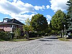
|
| Dwarf path
( Location ) |
180 | Dwarfs, earth spirits of small form (popular belief) | Aug 4, 1930 | The road 158 is applied to the development plan and extends between Olwenstraße and forest in the south of the district. |

|
Abrogated streets
With the planning of the "villa town" Frohnau, a development plan was drawn up with the locations of the streets. The forest of Bieselheide remained unparceled for a few years. In the north of the district along Oranienburger Chaussee and Hubertusweg, a villa suburb was planned that could have been reached from Stolpe train station. However, this project did not materialize. This area now serves as a reference area for the Berlin Forest Administration. However, the forest area in the north is criss-crossed by prepared roads, partly paved, partly with sidewalks. The forest has recaptured this area and it is a local recreation area near the city limits, secured as a landscape protection area since 1959 . Some of these originally laid out forest paths are still named and noted as forest roads or hiking and cycling paths . Others have been canceled since the villa project was abandoned or only partially implemented in the southern section, such as Rauentaler Straße . Others are built over with new housing estates, such as the Kniggeweg along the western city limits of Stolpe, which belongs directly to the east of the railway line to the Mauerweg , but has been replaced by the newly named streets of a housing estate at Poloplatz. Streets that have been created but not named (for example only numbered) are ignored in this table.
| Surname | from | to | Remarks | image |
|---|---|---|---|---|
| Albert-Heinrich-Strasse | before 1923 | around 1968 |
Albert Heinrich von Prussia (1862–1929), Prussian Crown Prince, gave this street its name. It is mentioned in the address book from 1922 limited to the district Stolpe. In 1933 it is still undeveloped between Hubertusweg and the city limits of Stolpe, in the northeast square of the district west of the northern railway parallel to the border with the district of Stolpe, Eberhardstraße runs parallel to the east. It was located in the invalid housing estate, which was completed shortly before the start of the Second World War . This settlement for war invalids was established in 1938 when the inmates, who at the time were reluctant to part with the invalids' house in the city center , moved to the "Invalidensiedlung in Berlin-Frohnau". It was transferred from the Reich Treasury (Army) to the “Invalidenhaus Berlin” foundation. After 1967 all roads within this settlement fell away and the disabled settlement is officially a single piece of land. |
|
|
Augustastrasse
( Location ) |
1910 | Aug 4, 1930 | It was named after Augusta (1811–1890), she was the wife of Kaiser Wilhelm I , she was German Empress and Queen of Prussia. The road lay on both sides of the Oranienburger Chaussee near the Jägersteige and was drawn in. | |
|
Eberhardstrasse
( Location ) |
before 1922 | around 1968 | The street lost its name when the ring road in the Invalidensiedlung was developed as a single piece of land. The street was planned because of its proximity to Stolpe station on the northern line . It leads west along the railway line and led northwards from Hubertusweg to Albert-Heinrich-Straße at the northern end of the settlement. With the establishment of the Invalidensiedlung for the war disabled from the Invalidenhaus in Berlin-Mitte , it has been one of the built-up streets in the Frohnau forest area since 1938 . In 1974 at the latest, all street names within this settlement were abolished. The exact reason for the assignment of the name "Eberhard" is unknown. Eberhard is a male name. |
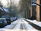
|
|
Elisabethstrasse
( Location ) |
1910 | Aug 4, 1930 | The street is listed in the 1922 address book with a building of the Donnersmarck Foundation under the administration of the War Ministry on Oranienburge Chaussee and many construction sites; it is located on the parallel Gertrudstraße (since 1961 Utestraße ) and Elfriedestraße between Gertrudstraße via Clara-, Ida-, Augusta -, Gertrud- and Bergfelder Stadtweg in the " Frohnau forest area ". Elisabethstrasse is no longer included in the 1933 address book. On the map in the address book from 1922 it is drawn as far as the Bergfelder Stadtweg. The course has been changed since 1910 and has probably been partially incorporated into Franziskastraße . The route between Gertrudstrasse (near Oranienburger Chaussee) and Bergfelder Stadtweg is shown on the Silvakarte from 1925 . | |
|
Gertrudstrasse
( Location ) |
1912 |
Renamed Jan. 9, 1961 |
Gertrudstraße was on the northern edge of the Frohnau residential area and turned south to Hubertusweg in front of the Hubertussee (artificially created around 1910) . Gertrudstraße was renamed as Utestraße in 1961 with some changes . Gertrudstrasse was located in the previously undeveloped Frohnau forest area , which now serves as a reference area for the Berlin forest administration . The renamed Utestraße is classified as a forest road, a section of the former street. On the Silvakarte from 1925 , the road between Oranienburger Chaussee and Hubertusweg is drawn, with the longer northern section lying parallel to the city limits. | |
|
Marie-Luise-Strasse
( Location ) |
before 1922 | after 1938 | The street is named after the female first name Maria-Luise, although it remained unclear whether a noblewoman or the wife of a property owner was the reason for the naming. The Marie-Luise-Straße was lying area between the north of the (forest) Road 7 on the railway embankment and the road 10, which was parallel to Hubertusweg. As street 8 there was an extension to Jägerstieg, compare the Silvakarte from 1925 . The road fell away before 1964. She is still indicated by name in the Berlin city map from 1938. The entire area belongs to the Berlin Forest ( Frohnau forest area ). | |
| Margaretenstrasse | before 1922 | Jan. 9, 1961 | Margarethe is a female given name that goes back to Margaret of Antioch, one of the most popular saints of the people. The road was planned between Marie-Luisen-Straße and Klarastraße across Oranienburger Chaussee and, as can be seen from the entry on the Silvakarte from 1925 , it was already largely planned. However, there was no development on the northern Frohnau site near the Stolpe station. This had been dismantled around 1924 as part of the electrification, when the line was raised on a dam, whereby the poor economic circumstances also played a role after the First World War and the post-war years and the inflation of 1923 . The area belongs to the Berlin Forest ( Frohnau ). |
Other locations in Frohnau

Allotment gardens
Due to the garden city character with the forest area in the north and a lot of green on the streets and gardens of the properties, allotment gardens are limited to two railway farms along the S-Bahn line . They are listed in the allotment garden development plan under the number 12211 KGA Frohnau (Frohnauer Brücke / Gollanczstrasse). These allotment gardens with 16 parcels on 4598 square meters of railway-owned land are listed as railway agriculture (allotment gardens of the DB AG) with status Ib according to the Berlin allotment garden development plan.
- BLW colony - Frohnau subdistrict Gralsburgsteig group ( location )
- BLW colony - Frohnau subdistrict Kniggeweg group ( location )
Parks and open spaces
- Ludwig-Lesser-Park ( Lage ), named after Ludwig Lesser , who at the time designed all the green spaces in the garden city (number RBS 08058).
- Joseph Brix-Felix Genzmer-Park on Edelhofdamm ( location ), previously Edelhofpark (number RBS 08182)
- Rosenanger ( Lage , number RBS 08054)
- Poloplatz ( location ), it was completed and handed over in 1910 together with the inauguration of the train station and garden city as an attraction of the new settlement. With the polo field, the restoration (today's country house), the sports field and the tennis courts were built according to plans by Ludwig Lesser . The idea for the polo game was a gift from Donnersmarck in favor of Kaiser Wilhelm II. The polo field was accepted by the suitable Berlin audience, but the First World War and inflation caused a decline. The polo club resumed training in 1925, but disbanded in 1932 as a result of the Great Depression. In 1945 the French military government confiscated the space for horse racing. In 1952 the riders moved to the Napoléon quarter and the place went to German clubs.
- Paul-Poser-Platz ( location ), named on November 21, 2008 after the architect Paul Poser , who u. a. designed the Barbarossa settlement adjacent to the square
- Frohnau cemetery ( location ). The Berlin garden architect Ludwig Lesser designed the Frohnau cemetery in 1910/11 as a forest and park cemetery. The chapel was built in 1911/1912 according to a design by the architect Carl Stahl-Urach, who also designed the enclosure for the cemetery area.
- Hermsdorf II cemetery ( location ), the definition of the boundaries of the districts meant that the New Hermsdorf cemetery is located on Frohnau territory.
- Reference area Frohnau forest area ( location ) Between 1977 and 2009, the 358 meter high lattice mast of the Berlin-Frohnau radio relay system stood on Jägerstieg , which during the time of the Wall - next to the systems at the Berlin-Schäferberg telecommunications tower - radio links to western Germany in the telephone and radio transmission network of the Deutsche Bundespost made possible.
- The railway line of the Berliner Nordbahn (S-Bahn line to Oranienburg) divides the district, at Frohnau station ( Lage ) the Frohnauer Bridge (street number 7489, as a local road connection to StEP traffic) connects Zeltinger and Ludolfingerplatz, another bridge is in the south of the district the Fischgrundbrücke (number RBS 17203), to the north of the train station Staehleweg, Gollanczstrasse and Schönfließer / Neubrücker Strasse are underpassed.
See also
- List of bodies of water in Berlin-Frohnau
- List of cultural monuments in Berlin-Frohnau
- List of stumbling blocks in Berlin-Frohnau
Web links
- Street directory Frohnau. Retrieved January 14, 2014 .
- Map of Berlin 1: 5000 with district boundaries. Senate Department for Urban Development Berlin, 2009, accessed on January 14, 2014 .
- Office for Statistics Berlin-Brandenburg: Directory of streets and places in the Reinickendorf district (as of February 2015); pdf
- History of Frohnau at Kulturgeschichte Reinickendorf.
- History of the Invalidensiedlung in Frohnau .
- Rudolf Neumann: Memories of the old Frohnau 1910–1920
- Stadtentwicklung.berlin.de: Tips for trips
Individual evidence
- ↑ a b Digitized from: Kiessling's large special map of the area around Berlin. 1: 75,000. Berlin: Kiessling. 1 ct .: multicolored - No edition description ( page no longer available , search in web archives ) Info: The link was automatically marked as defective. Please check the link according to the instructions and then remove this notice. , accessed December 26, 2012. The web link indicates around 1900, but based on the location in Frohnau it is more likely 1908/1910.
- ↑ The demarcation between Glienicke and Stolpe zu Frohnau is not always recognizable on the exit map.
- ↑ ba-reinickendorf: gartenstadt_frohnau.html ( memento of the original from October 12, 2013 in the Internet Archive ) Info: The archive link was inserted automatically and has not yet been checked. Please check the original and archive link according to the instructions and then remove this notice.
- ↑ a b The district of Frohnau (Reinickendorf district office)
- ^ Klaus Pegler: Stories from Frohnau: Parking in Frohnau
- ^ Wolfram Sternbeck: The Invalidensiedlung in Berlin-Frohnau.
- ↑ a b c d e f g h i j k l m n Reinickendorf district> Frohnau . In: Berliner Adreßbuch , 1922, Part IV, p. 1836.
- ↑ Dr. Rudolf Neumann: Memories of the old Frohnau from 1910–1920 ( Memento of the original from October 12, 2013 in the Internet Archive ) Info: The archive link was inserted automatically and has not yet been checked. Please check the original and archive link according to the instructions and then remove this notice.
- ↑ a b c d e f g h i j k l m n o factual data on the LSG-16
- ↑ "The 40 kilometer long road network [run] paved streets with sidewalks in the middle of the forest [...] and Frohnau is probably the only place where you can stroll through the wooded area on cobblestones." After 100 years Frohnau . In: Berliner Morgenpost , June 18, 2010.
- ↑ The Garden City ( Memento of the original from May 27, 2012 in the Internet Archive ) Info: The archive link was inserted automatically and has not yet been checked. Please check the original and archive link according to the instructions and then remove this notice.
- ↑ Berlin gas street lighting cultural property
- ↑ Berlin gas lanterns: The most beautiful light is priceless on www.zeit.de
- ↑ stadt-berlin.de: description / detailnetz.html
- ↑ 09011788
- ↑ Coffee house tradition in Frohnau: Title line From the people's restaurant to the wallflower
- ^ Rudolf Neumann: Memories of the old Frohnau. 1910–1920 ( Memento of the original from October 12, 2013 in the Internet Archive ) Info: The archive link was inserted automatically and has not yet been checked. Please check the original and archive link according to the instructions and then remove this notice.
- ↑ Entry allowed but for how long . In: Der Tagesspiegel , February 24, 2003
- ↑ a b c d e f g h i j k l m n o Situation clarification with FIS: Map 1: 5000 forest area Frohnau, produced by the district surveying offices of Berlin
- ↑ a b c d e f g h i j k l m n FIS broker map display detail network Berlin
- ↑ a b c d e f g h i j k l Franziskastraße in 13465-Berlin-Frohnau
- ↑ a b c d e f g h i j k l m n o p q Frohnau, Heiligensee . In: Berliner Adreßbuch , 1943, IV, p. 2480.
- ↑ ba-reinickendorf: buddhistisches_haus.html ( memento of the original dated December 31, 2011 in the Internet Archive ) Info: The archive link has been inserted automatically and has not yet been checked. Please check the original and archive link according to the instructions and then remove this notice.
- ↑ Herbert-Bauer-Berlin-Frohnau
- ^ Edelhofdamm, Berlin-Frohnau
- ↑ a b c d e f Reinickendorf administrative district: Frohnau, Heiligensee, Hermsdorf, Konradshöhe . In: Berliner Adreßbuch , 1933, IV, p. 2258.
- ↑ Frohnau substation
- ↑ Address directory LOR 12.pdf ( Memento of the original from October 30, 2013 in the Internet Archive ) Info: The archive link was inserted automatically and has not yet been checked. Please check the original and archive link according to the instructions and then remove this notice.
- ↑ Graneweg . In: Berliner Adreßbuch , 1932, Part IV, p. 2256.
- ↑ a b Graneweg . In: Berliner Adreßbuch , 1936, Part IV, p. 233.
- ↑ Helweg . In: Berliner Adreßbuch , 1943, Part IV, p. 2483.
- ↑ Iris Brennberger: Invitation to Paradise. In: Berliner Zeitung , December 4, 2015, p. 17.
- ↑ Memories of the old Frohnau 1910–1920
- ^ Invalidensiedlung Berlin-Frohnau
- ^ History of the Frohnau Invalid Settlement ( Memento of the original from September 9, 2012 in the Internet Archive ) Info: The archive link has been inserted automatically and has not yet been checked. Please check the original and archive link according to the instructions and then remove this notice.
- ↑ Invalidensiedlung in Berlin Frohnau ( Memento of the original from October 15, 2013 in the Internet Archive ) Info: The archive link was inserted automatically and has not yet been checked. Please check the original and archive link according to the instructions and then remove this notice.
- ^ A b Klaus Pegler: Stories from Frohnau. The telecommunications tower at first unloved and then mourned
- ↑ a b Reinickendorf administrative district> Conradshöhe, Frohnau, Heiligensee, Hermsdorf . In: Berliner Adreßbuch , 1929, Part IV, p. 2175.
- ↑ Zeltinger coffee house - tradition in Frohnau
- ↑ Little stories from the casino tower Frohnau
- ↑ Frohnau> Knappenpfad . In: Berliner Adreßbuch , 1931, Part IV, p. 2246.
- ↑ Berlin.de city map
- ↑ Berlin city map: Coordinates 52.65687 ° N 13.28998 ° E
- ↑ Speerweg in Berlin-Frohnau
- ↑ "Here, where my imagination found peace, let Wahnfried call this house." ( Richard Wagner )
- ↑ Zeltinger-Platz in Berlin-Frohnau
- ↑ District Office Reinickendorf: Frohnau ( Memento of the original from October 14, 2013 in the Internet Archive ) Info: The archive link was inserted automatically and has not yet been checked. Please check the original and archive link according to the instructions and then remove this notice.
- ↑ The north crossing
- ↑ a b Overview plan of the administrative district Reinickendorf with adjoining districts in the Berlin address book 1922, Conradshöhe, Frohnau, Heiligensee . In: Berliner Adreßbuch , 1922, Part IV, p. 1837.
- ↑ Allotment garden development plan for the Reinickendorf district ( memento of the original from September 29, 2013 in the Internet Archive ) Info: The archive link was automatically inserted and not yet checked. Please check the original and archive link according to the instructions and then remove this notice. (PDF; 537 kB)
- ↑ The name was given at the suggestion of the citizens' association by the BVV on April 6, 2011. ( Memento of the original from April 21, 2013 in the Internet Archive ) Info: The archive link was inserted automatically and has not yet been checked. Please check the original and archive link according to the instructions and then remove this notice.
- ↑ Dirk Wohltorf: Poloplatz .
- ↑ Our Frohnau , CDU Frohnau magazine, December 2008.
- ↑ The mysterious grave
- ↑ ba-reinickendorf: friedhof_frohnau.html ( memento of the original from October 29, 2013 in the Internet Archive ) Info: The archive link was inserted automatically and has not yet been checked. Please check the original and archive link according to the instructions and then remove this notice.
- ↑ Hermsdorf cemetery: cemetery history ( page no longer available , search in web archives ) Info: The link was automatically marked as defective. Please check the link according to the instructions and then remove this notice.
- ↑ demolition-frohnauer-transmission-mast-beautiful-collapsed


