List of streets and squares in Berlin-Lichterfelde

The list of streets and squares in Berlin-Lichterfelde describes the street system in the Berlin district of Lichterfelde with the corresponding historical references. At the same time, this compilation is part of the lists of all Berlin streets and places .
overview
Lichterfelde has 86,206 inhabitants (as of December 30, 2019) and includes the postcode areas 12203, 12205, 12207, 12209 and 14167. The public road network in the entire Steglitz-Zehlendorf district (including all seven districts) is 635.4 kilometers. This means that the district has the longest road system in the capital, ahead of the Treptow-Köpenick district (628.1 km) and the Pankow district (604.7 km). In the district there are a total of 293 dedicated streets and 24 dedicated squares. 27 of these streets continue under the same name into neighboring districts. The total length of all streets in the district is 154.3 kilometers.
In the area of Lichterfeld, Bundesstraße 1 runs alongside Unter den Eichen . This gives the connection to the motorway system with the federal motorway 103 , planned in 1960 as a connection to the center and to junction 4 - Zehlendorf - the federal motorway 115 as part of the AVUS . The Wolfensteindamm was built in 1966 to connect the district to Steglitz and the federal highway 113 .
The street system in Lichterfelde is largely determined by the activities of Johann Anton Wilhelm von Carstenn in the 19th century. By buying the Lichterfelde and Giesensdorf estates , he created building land for the construction of villa colonies near Berlin, as he had got to know in England. The villa colony of Lichterfelde-West was built as planned in 1866 through Drakestrasse (connection to the Königschaussee to Potsdam ), Bahnhofstrasse to connect the still outstanding train station (in 1872 the Lichterfelde train station was opened on the Berlin-Potsdam main line) and Marienplatz as the central square of the new settlement implemented; since then it has determined the Lichterfeld road system. The Baseler Straße leads in a straight line to the train station, the Ringstraße as such runs around the settlement, in honor of Carstenn the western part of the ring became Carstennstraße in 1899. Carstenn offered the Prussian military 20 hectares of space for the new building of the main cadet institute (in what would later become Finckensteinallee) and promoted the move of the elite Prussian Guard Corps to the new guard barracks on Gardeschützenweg. And the construction of the Lichterfelde-West and Lichterfelde-Ost train stations, which he financed , also drew the residents here. The development of the road system up to the turn of the 20th century can be read from the date of the naming .
Various construction companies influenced the expansion of the streets in the south with their own home estates, for example the “Thuringian Quarter” around Hildburghauser Strasse, realized in 1917, or the streets in the “Flower Quarter” near the Botanical Garden , which was relocated here in the 1890s, and in October 1908 the "Swiss Quarter". In the 1950s and 1960s, the streets in the “Swiss Quarter” and “Westphalian Quarter” were added, the new “ Thermometeriedlung ”, whose main streets were named in October 1969 after Celsius , Reaumur and Fahrenheit , the namesake of the temperature classifications.
In June and September 2000 new streets were built in the “Swiss Quarter” and on the area of the barracks of the former US armed forces in Berlin. The last name to date (as of the end of 2014) was Eugen-Gerstenmaier-Platz, a previously unnamed forecourt of the Botanical Garden S-Bahn station . The naming campaign also led to naming of space-like extensions in other districts. As of March 2015, the list shows a total of 316 streets and squares in Lichterfelde.
Overview of streets and squares
The following table gives an overview of the streets and squares in the district as well as some related information.
- Name / location : current name of the street or square. Via the link Location , the street or the square can be displayed on various map services. The geoposition indicates the approximate center of the street length.
- Traffic routes not listed in the official street directory are marked with * .
- Former or no longer valid street names are in italics . A separate list may be available for important former streets or historical street names.
-
Length / dimensions in meters:
The length information contained in the overview are rounded overview values that were determined in Google Earth using the local scale. They are used for comparison purposes and, if official values are known, are exchanged and marked separately.
For squares, the dimensions are given in the form a × b for rectangular systems and for (approximately) triangular systems as a × b × c with a as the longest side.
If the street continues into neighboring districts, the addition ' in the district ' indicates how long the street section within the district of this article is. - Name origin : origin or reference of the name.
- Notes : further information on adjacent monuments or institutions, the history of the street and historical names.
- Image : Photo of the street or an adjacent object.
| Name / location | Length / dimensions (in meters) |
Origin of name | Date of designation | Remarks | image |
|---|---|---|---|---|---|
|
Aarauer Strasse
( Location ) |
370 | Aarau , city in Switzerland | Jan. 29, 1937 | It was created as street 217 of the development plan and leads from Züricher Straße to Osteweg. Like all streets with a city name from Switzerland, it belongs to the Swiss Quarter . In it there are predominantly single-family houses of the same architectural style and four identical two-family houses. At the end of the street, after the bombing in World War II, there is an unsuitable new building as well as a settlement house rebuilt as a bungalow. Living in the street a. Johannes Wendt , Manfred Günther and a Swiss historian from Aarau , who hoists the flags in the front yard on certain occasions. |

|
| Aarberger Strasse
( Location ) |
100 | Aarberg , city in Switzerland | Oct 3, 1908 | The street in the Swiss Quarter was laid out as street 21 of the development plan. It goes from the Ruthnerweg. |

|
| Achenseeweg
( Location ) |
960 | Achensee , lake in Tyrol | May 17, 1930 | The first names according to the development plan were Straße 55 , Straße 56 and Straße 61 . The Achenseeweg is a quiet residential street, mostly built with spacious single-family houses. It leads from Hildburghauser Straße to Jenbacher Weg. |

|
| Adolf-Martens-Strasse
( Location ) |
400 | Adolf Martens (1850–1914), materials scientist and material tester | Nov 10, 1971 | The street was laid out as Fontanestrasse before 1893 . It first goes south from Unter den Eichen , makes a bend after about 140 meters and then leads east to Knesebeckstraße. See also: House No. 14 |

|
| Ahlen way
( Location ) |
270 | Ahlen , town in North Rhine-Westphalia | July 1, 1964 | Laid out as road 520 of the development plan, the path connects Lippstädter Strasse with the city limits of Teltow . The extension to Lippstädter Strasse was included on May 1, 1980. |

|
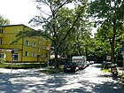
| Akazienstrasse
( Location ) |
80 | Acacia , tree species | Sep 15 1879 | It is a cul-de-sac south of Morgensternstrasse. |
|
| Alsterweg
( Location ) |
1000 | Alster , tributary of the Elbe in Schleswig-Holstein and Hamburg | Jan. 29, 1937 | First street 158 of the development plan, the street between Darser Straße and Goerzallee belonged to Zehlendorf until the Berlin regional reform on April 1, 1938 . |

|
| Altdorfer Strasse
( Location ) |
1180 | Altdorf , place in Switzerland | Oct 3, 1908 | Already laid out as Waldstraße before 1893 until it was renamed (1908) , Straße 27 to the Zehlendorfer border was included on December 31, 1924, but renamed Hochbaumstraße on March 20, 1929. On April 4, 1934, Brienzer Strasse and the section of Waldstrasse that remained after the renaming in 1908 were incorporated into Altdorfer Strasse. On October 13, 2004, the part of the street between Glarner and Baseler Strasse that was rebuilt on the former site of the Andrews barracks was opened to public transport. |

|
| Altenauer way
( Location ) |
160 | Altenau , mountain town in Lower Saxony | July 20, 1960 | Lutherstrasse , which was laid out before 1893, was renamed in 1960; it is located east of Heinersdorfer Straße as a dead end . |

|
| Altensteinstrasse
( Location ) |
1500 only SE side |
Karl vom Stein zum Altenstein (1770–1840), Prussian politician | May 2, 1905 | In 1901 the street was laid out as Altensteinallee and further expanded by the commission for the division of the Dahlem domain in 1902 and completed in 1911. Since the Berlin regional reform on April 1, 1938, the south side of the street with the even house numbers belonged to Lichterfelde. It connects the Königin-Luise-Straße with the Habelschwerdter Allee and forms the border to the Dahlem district .
Nobel laureate Otto Hahn lived in house number 48 from 1928 to 1944 , as indicated by a plaque on the house. The botanical garden , whose co-founder Adolf Engler lived in house no. |

|
| On the Fichtenberg
( Location ) |
280 (in the district) |
Fichtenberg , elevation in the neighboring district of Steglitz | Oct. 20, 1913 | The names according to the development plan were Straße 1, Straße 4 and Straße 5 . The south-west side of the street with house numbers 17-25 belongs to Lichterfelde. The street and the eastern properties belong to Steglitz . |

|
| At the carp pond
( Location ) |
300 | old field name, referring to a former carp pond | 1928 | The road 140 of the development plan, laid out in 1921, lies between Schottmüllerstrasse and Gütlingstrasse and belonged to Zehlendorf until the Berlin regional reform on April 1, 1938 . |

|
| At the Pfarracker
( Location ) |
600 | former agricultural land that was available to the respective pastor | December 31, 1924 | Established as street 1 of the development plan, the street was part of the “Gemeinnützige Bauverein Kriegerheim” (non-profit building association) at the time it was named. Parcels 29 to 52 were in Lichterfelde (east), the previous ones were in Steglitz. It is located between Brauerplatz and Hildburghauser Straße. |

|
| At the lake
( Location ) |
340 | "Pole pool" previously present here | December 31, 1924 | First street 4 of the development plan, its extension was included in the name on May 17, 1930. |

|
| At the branch canal
( Location ) |
1350 | Zehlendorfer branch sewer | Jan. 1, 1972 | The road 537 of the development plan has been named, including the leading Goerzallee the road 1972nd On the road there are industrial companies, some allotment gardens and the Zeiss settlement, a factory settlement built in 1918 for the employees of the Goerzwerk , which was taken over by Zeiss in 1926 . The traffic route on the branch canal opens up a peninsula that the branch canal forms together with the Teltow Canal , here was the Teltower See. |

|
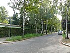
| At the sheep farm
( Location ) |
190 | Sheep farm of the former Giesensdorf manor | March 9, 1925 | Established as Straße 77 , it was named Neue Straße after 1911 and renamed in 1925. |
|
| Anna-Mackenroth-Weg
( Location ) |
230 | Anna Mackenroth (1861–1936), Swiss lawyer | 25 Sep 2000 | The private street in the “Swiss Quarter” is between Altdorfer and Lausanner Straße. |

|
| Appenzeller Strasse
( Location ) |
220 | Appenzell , place in Switzerland | Oct 3, 1908 | Set up as Straße 23 , it is located in the “Swiss Quarter” between Thuner Platz and Goerzallee. |

|
| Aster square
( Location ) |
150 × 60 | Asters , genus of plants | Oct 6, 1908 | It was set up as place A of the development plan on both sides of the street Unter den Eichen . Limonenstrasse, Enzianstrasse and Tulpenstrasse flow into it. |

|
| Augustaplatz
( Location ) |
100 (circular) |
Augusta von Sachsen-Weimar-Eisenach (1811–1890), German Empress and Queen of Prussia | before 1878 | Augustastraße opens out on two sides, with the course of the road being angled. Manteuffel-, Viktoria- and Memlingstraße also flow onto the square. Police Section 45 is located in the former buildings of the Guards Rifle Barracks , which are used by the Federal Intelligence Service. |

|
| Augustastrasse
( Location ) |
960 | Augusta von Sachsen-Weimar-Eisenach (1811–1890), German Empress and Queen of Prussia | before 1878 | The street lies between Hindenburgdamm and Drakestraße and turns at an obtuse angle over Augustaplatz. |

|
| Auguststrasse
( Location ) |
300 | August of Prussia (1779–1843), Prussian prince and general | before 1893 | The street is between Jägerstraße and Oskar-Lange-Platz. |

|
|
Bahnhofstrasse
( Location ) |
640 | after the station Lichterfelde Ost | 1866 | The road between Jungfernstieg and Ostpreußendamm was laid two years before the opening of the train station, as the "terrain speculator" Carstenn, as a colonizer in southern Berlin, tried to connect the local villa colony to the rail network as a matter of priority. The Lichterfelde-Ost train station is located in part of the Jungfernstieg. |

|
|
Bäkestrasse
( Location ) |
450 | Bäke , at the time it was named it was a stream that was bridged by the road. Since the construction of the Teltow Canal (1906) there is only a small remainder in Steglitz . | before 1893 | It lies between Ostpreußendamm and Hindenburgdamm and connects the two banks of the Teltow Canal via the Bäkebrücke . House no. 8 (at that time still Bahnhofstrasse 23) was built in 1884 and was a bakery until 1937. |

|
| Bansiner way
( Location ) |
120 | Bansin , Baltic seaside resort in Mecklenburg-Western Pomerania | Jan. 29, 1937 | First street 162 of the development plan, it belonged to Zehlendorf until the Berlin regional reform on April 1, 1938. |

|
| Barnackufer
( Location ) |
600 | Oskar Barnack (1879–1936), designer of the Leica Camera | June 10, 1961 | On the eastern edge of the port of Lichterfelde (top picture, 1906) it was laid out as Hafenstrasse until 1907 or around 1911 and renamed Am Hafen in 1920 . Until 1961 it ran almost in a straight line and parallel to the Teltow Canal past the harbor. The southern part was de-dedicated and the Lichterfelde thermal power station , which went into operation in 1972, is located there . A former cross street (according to the development plan street H ) was included in the Barnackufer. At the other end it was swiveled to the east from the north, which is now the back of a gas station.
In the meantime, the street curves from and to Giesensdorfer Straße and is dominated by commercial and some industrial buildings, there is only one apartment block on the corner of Giesensdorfer Straße. |

|
| Baseler Strasse
( Location ) |
2150 | Basel , city in Switzerland | Oct 3, 1908 | The street was laid out as Karlstrasse before 1878 . In 1908 the southern section between Finckensteinallee and Luzerner Strasse was renamed, and around 1935 the northern section between Hans-Sachs-Strasse and Finckensteinallee at the Lichterfelde West train station was also renamed.
According to the address book of 1935, the following residents were worth mentioning: Parcels 1–4 Police Authority Steglitz Zehlendorf , Parcels 5–7 Landesfinanzamt Berlin , numbers 12, 12a, 21 and 22 belonged to the Deutsche Reichspost and on the opposite side of the street (without number) on the corner Finckensteinallee there was the barracks b. General Goering Police Group . |

|
| Bassermannweg
( Location ) |
420 | Albert Bassermann (1867–1952), actor, victim of the Nazi regime | July 20, 1960 | It was laid out as Mittelstrasse before 1893 , paved in 1904, and lies between Jungfernstieg and Hartmannstrasse. |

|
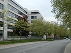
| Beeskow dam
( Location ) |
430 (south side only) |
Besckow, name of a family of landowners from Schönow | Oct 24, 1922 | The southern side of the street with lots 3-19 belongs to Lichterfelde, and to the east it merges into Goerzallee. The road area and the northern side of the road belong to Zehlendorf . |
|
| Begonia Square
( Location ) |
90 × 60 | Begonias , genus of plants | Oct 6, 1908 | It was laid out as space B of the development plan. The square is located between Unter den Eichen , Geranienstraße and Tulpenstraße, near the Botanical Gardens. |

|
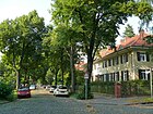
| Berner Strasse
( Location ) |
830 | Bern , capital of Switzerland | Oct 3, 1906 | It is located in the "Swiss Quarter" between Finckensteinallee and Rütliplatz, which it delimits to the west as a cul-de-sac . |
|
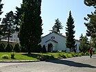
| Billy Wilder Promenade
( Location ) |
460 | Billy Wilder (1906–2002), American film director of Austrian origin | 22 Aug 2007 | It is located between Goerzallee and Osteweg on the former barracks and industrial area, on September 28, 2007 it was ceremoniously named. Here is the preserved and re-used 'McNair Chapel' McNair . |
|
| Blanckertzweg
( Location ) |
290 | Heinrich Siegmund Blanckertz (1823–1908), pen manufacturer | May 20, 1937 | Established as Straße 9 , it is located between Hildburghauser and Osdorfer Straße. |

|
| Blue tit path
( Location ) |
150 | Blue tit , species of bird | December 31, 1924 | Established as street 8 , it is located between Am Pfuhl and Schöffenstraße in the settlement of the former "non-profit building association Kriegerheim". |

|
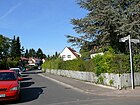
| Blochmannstrasse
( Location ) |
560 | Rudolf Sigismund Blochmann (1784–1871), inventor and entrepreneur | May 20, 1937 | Established as street 10 of the development plan, on May 20, 1958 the extension that had been made in the meantime was included. |
|
| Blücherstrasse
( Location ) |
470 | Gebhard Leberecht von Blücher (1742–1819), Prussian Field Marshal General | March 3, 1893 | As street 28 and street 28b it was laid out between Lindenstrasse and Feldstrasse. |

|
| Bogenstrasse
( Location ) |
340 | curved road | before 1893 | This street is between Ostpreußendamm (north) and Prinzenstraße (east) on the railway embankment. |

|
| Boninstrasse
( Location ) |
110 | Eduard von Bonin (1793–1865), Prussian general | before 1893 | The street lies between Müllerstrasse and Feldstrasse. Bonin was commandant of Berlin for two months and from 1852 to 1854 and from 1858 to 1859 Prussian Minister of War. |

|
| Boothstrasse
( Location ) |
600 | John Cornelius Booth (1836–1909), arborist | before 1878 | It lies between Jungfernstieg and Ostpreußendamm. From 1869 Booth advised Johann Anton Wilhelm von Carstenn , the founder of the colonies of Lichterfelde East and West, on horticultural issues. The Ethiopian embassy is in no. 20a . |

|
| Brahmsstrasse
( Location ) |
520 | Johannes Brahms (1833–1897), composer | July 24, 1908 | Set up as street A , it is between Haydnstraße and Benjamin Franklin Clinic . The southern part of the street runs on the clinic premises. |

|
| Brauerplatz
( Location ) |
70 × 40 | Groß-Lichterfelde Brewery | December 31, 1924 | The square is located along Brauerstrasse and Jägerstrasse and Am Pfarracker flow from the southeast. |

|
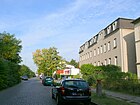
| Brauerstrasse
( Location ) |
940 | Groß-Lichterfelde Brewery | Sep 15 1879 | Even before 1879, the Bahnstrasse ran parallel to the Berlin-Anhalter railway line . The section between Brauerplatz and Hochstraße was included on November 4, 1935. |
|
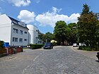
| Bremer Strasse
( Location ) |
130 | Bremen , city state and federal state | Oct 5, 1908 | Established as Straße 18b , the alignment of Bremer Straße between Goerzallee and the port of Lichterfelde was changed in 1915. |
|
| Brilon way
( Location ) |
200 | Brilon , city in North Rhine-Westphalia | Nov 5, 1942 | Established as street 284 , it is a cul-de-sac south of Schwatlostraße. |

|
|
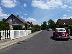
Brondbystrasse
( Location ) |
550 | Brøndby , Danish partner municipality in the Steglitz-Zehlendorf district | June 1, 1969 | It lies in the route of the streets 78, 79 and 81 parallel to Goerzallee from Wismarer Straße, at the KGA Aegirbad it is swept to the Prettauer path. |
|
|
Brothers Street
( Location ) |
160 | Brothers , community of mostly only men who refer to each other as brothers and who pursue common interests | before 1878 | It is between Kadettenweg and Baseler Straße. |

|
| Bruno-Walter-Strasse
( Location ) |
220 (in the district) |
Bruno Walter (1876–1962), German-Austrian conductor | Sep 15 1966 | It was created in 1966 from the Lankwitzer Blumenstraße , which was laid out before 1894, and the Gartenstraße, which was in the district, which was laid out before 1878 . The north-eastern branch of the street is in Lankwitz, belonging to the district, plots 9-18 (continuous). |

|
| Bürgipfad
( Location ) |
230 | Jost Bürgi (1552–1632), Swiss watchmaker and inventor | May 17, 1930 | Set up as Straße 52 , it is a cul-de-sac south of the Lichterfelder Ring. |

|
|
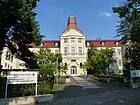
Carstennstrasse
( Location ) |
1050 | Johann Anton Wilhelm von Carstenn (1822–1896), real estate entrepreneur and founder of Lichterfeld villa colonies | Apr 27, 1899 | It is the main road between Finckensteinallee and Luzerner Straße. |
|
| Celsiusstrasse
( Location ) |
760 | Anders Celsius (1701–1744), Swedish astronomer, mathematician and physicist | Oct. 1, 1969 | Established as street 531 , it is part of the " Thermometeriedlung " residential area in the south of the district, which was built in 1970 and whose main streets are named after the founders of temperature measurement. |

|
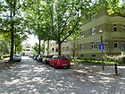
| Chlumer Strasse
( Location ) |
60 | Chlum , place in the Czech Republic and one of the scenes of the battle of Königgrätz | 17 Sep 1912 | Set up as Straße 10 , it is located between Gardeschützenweg and Neuchateller Straße. The Guard Rifle Battalion from Lichterfelde was involved in the fighting in Chlum on July 3, 1866 . |
|
| Chur line
( Location ) |
100 | Chur , city in Switzerland | 25 Sep 2000 | The private road is in the "Swiss Quarter", angled between Lausanner Strasse and Johanna-Spyri-Weg. |

|
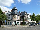
| Curtiusstrasse
( Location ) |
1430 | Ernst Curtius (1814–1896), archaeologist | Aug 8, 1895 | The street 12a of the development plan was named Curtiusstraße in 1895 and in 1916 the eastern extension to Drakestraße was included. On July 31, 1934 Rankestrasse was added as a western extension of Curtiusstrasse. |
|
|
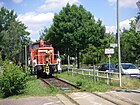
Dahlemer way
( Location ) |
3280 (only west side) |
Dahlem , neighboring district of Lichterfelde | around 1892 | The road was laid out around 1892 as a connection between the village of Dahlem and the town of Teltow . Part of the route to Dahlem was renamed Cecilienstraße in 1907 and Cecilienallee in 1909, and another section was renamed Thielallee in 1949 . The street used to serve as a connection between Gut Schönow and Dahlem. The entire length of the Dahlemer Weg forms the border between the districts of Lichterfelde and Zehlendorf. A railroad track of the Goerzbahn for freight traffic runs along the road . |
|
| Darser Street
( Location ) |
510 | Darß , peninsula on the Baltic Sea in Mecklenburg-Western Pomerania | Jan. 29, 1937 | Laid out as street 159 of the development plan, it got its name in the Nazi era with the misspelling without "ß". If the Senate Administration wanted to correct this, there would be a street with the same name in the Malchow suburb . On June 1, 2000, the traffic route was extended to the newly established McNair Promenade. |

|
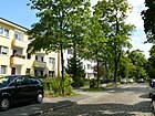
| Devrientweg
( Location ) |
330 | Ludwig Devrient (1784–1832), actor | March 20, 1929 | The previous names were Parkstrasse II (before 1893 to before 1901) and Hobrechtstrasse (1995–1929). It connects Ostpreußendamm and Marienstraße. |
|
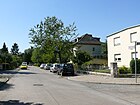
| Dollartstrasse
( Location ) |
300 | Dollart , bay of the North Sea near Emden | Jan. 29, 1937 | Established as street 152 of the development plan, it lies between Seehofstraße and Dahlemer Weg, until the Berlin territorial reform on April 1, 1938, the street belonged to Zehlendorf . |
|
| Dorstener Strasse
( Location ) |
110 | Dorsten , city in North Rhine-Westphalia | Aug 4, 1930 | Set up as Straße 20 , it is located between Schöppinger Straße and Ostpreußendamm. |

|
| Draisweg
( Location ) |
180 | Karl Drais (1785–1851), inventor | Nov 3, 1938 | Established as street 265 , it is located between Resselsteig and Scheelestraße. |

|
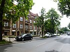
| Drake Street
( Location ) |
1920 | Friedrich Drake (1805–1882), sculptor | 1866 | The street was laid out as a main street as early as 1866 when the villa colony was built by Carstenn . There is a shopping center with small shops around the Lichterfelde West S-Bahn station, and Drakestrasse is a thoroughfare with urban villas.
The Steglitz local history museum is located in house 64a . |
|
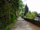
| Drei-Zinnen-Weg
( Location ) |
460 | Drei Zinnen , mountain range in South Tyrol | July 1, 1979 | It runs as a cul-de-sac south of the Lichterfelder Weg into the industrial park. |
|
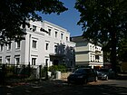
| Dürerstrasse
( Location ) |
980 | Albrecht Dürer (1471–1528), painter and graphic artist | before 1893 | It lies between Hindenburgdamm and Drakestrasse. |
|
|
Eduard Spranger Promenade
( Location ) |
910 | Eduard Spranger (1882–1963), philosopher, educator and psychologist | May 13, 1964 | The naming of the former riverside path on the Teltow Canal between Königsberger and Krahmerstrasse is an internal resolution of the Steglitz district council. | |
| Elisabeth-Feller-Weg
( Location ) |
240 | Elisabeth Feller (1910–1973), Swiss entrepreneur and art patron | 25 Sep 2000 | The private road is in the "Swiss Quarter" between Altdorfer and Lausanner Strasse. |

|
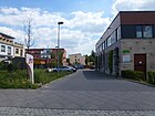
| Ellen Widmann Path
( Location ) |
100 | Ellen Widmann (1894–1985), Swiss actress | 25 Sep 2000 | The private road is in the "Swiss Quarter" east of Glarner Strasse. |
|
| Elmshorner Strasse
( Location ) |
650 | Elmshorn , town in Schleswig-Holstein | Jan. 29, 1937 | Established as Straße 144 , Straße 150 was included on July 20, 1960 . Until the Berlin regional reform on April 1, 1938, the street belonged to Zehlendorf. |

|
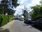
| Engadine way
( Location ) |
220 | Engadin , high valley in Switzerland | May 13, 1957 | The previous name was Lübecker Straße (1908–1957), which was merged with the road 510 of the development plan. |
|
| Engelberger Strasse
( Location ) |
120 | Engelberg , place in Switzerland | Oct 3, 1908 | As Straße 22 equipped walk is the angels Str. In "Swiss Quarter" between Luzernerstraße and Ruthnerweg. |

|
| Enzianstrasse
( Location ) |
230 | Gentians , genus of plants | Oct 6, 1908 | The first name according to the development plan was Straße 14 . It is between Asternplatz and Gardeschützenweg, where it turns into Moltkestrasse. The Botanischer Garten S-Bahn station is located here . |

|
| Eugen-Gerstenmaier-Platz | 40 × 40 | Eugen Gerstenmaier (1906–1986), theologian and politician | 25 Sep 2010 | The square is in front of the Botanischer Garten S-Bahn station . |

|
|
Fabeckstrasse
( Location ) |
420 (in the district) |
Hugo von Fabeck (1828–1870), Prussian major and commander of the Guard Rifle Battalion | 1924 | The historic Dahlemer Strasse was expanded from 1903 by the "Commission for the division of the Dahlem domain" and renamed Fabeckstrasse in 1905 in Dahlem and then in 1924 in Lichterfelde. It is located between Königin-Luise-Strasse in Dahlem and the Strasse Unter den Eichen . The section north of Altensteinstrasse belongs to Dahlem. At the request of the emperor, the road was given a bridle path around 1905, which was primarily intended for the guardsmen on their way from their barracks in Lichterfelde to the Grunewald . The section between Unter den Eichen and the village green of Lichterfelde existed until 1936 as Dahlemer Straße and was then named Tietzenweg. |

|
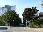
| Fahrenheit Street
( Location ) |
400 | Daniel Gabriel Fahrenheit (1686–1736), physicist | Oct. 1, 1969 | Laid out as street 532 , it is located in the " Thermometeriedlung " residential area that was built in 1970 , the main streets of which were named after the founders of temperature measurement. |
|
| Feldstrasse
( Location ) |
600 | Way to the Giesensdorfer fields | May 15, 1879 | The previous name was Bismarckstrasse (after 1871–1879). The field road used to be a field path, popularly known as the Grüner Weg , which led to the fields of the Giesensdorf farmers. Historical photos of the street are available on the internet. |

|
| Ferdinandstrasse
( Location ) |
600 | Ferdinand , male first name | before 1878 | It is located between Lange and Lankwitzer Straße. |

|
| Finckensteinallee
( Location ) |
2020 | Karl Wilhelm von Finckenstein (1714–1800), Prussian minister | June 9, 1933 | The street was laid out as Zehlendorfer Strasse before 1878 and renamed in 1933.
Worth mentioning is the listed swimming pool at Finckensteinallee 73 , which was built in 1937/1938 and opened to the public in August 2014 after extensive renovation. In addition, during the time of the cadet institute there was a Catholic and Protestant church on the area. |

|
| Flotowstrasse
( Location ) |
130 | Friedrich von Flotow (1812–1883), composer | July 24, 1908 | Set up as street C , it is located in the “composers' quarter” between Hindenburgdamm and Undinestraße. |

|
| Floyd L. Parks Walk
( Location ) |
180 | Floyd L. Parks , American general and 1945 member of the first Allied Command of Berlin | 25 Sep 2000 | The private road is on the site of the former McNair barracks. |

|
| Frank L. Howley Way
( Location ) |
420 | Frank L. Howley (1903–1993), American general and city commander in Berlin | 25 Sep 2000 | The private road is on the site of the former McNair barracks. |

|
| Frauenstrasse
( Location ) |
190 | former homes for women in the nearby Bismarckstrasse | before 1893 | It is between Königsberger and Schillerstrasse. |

|
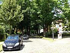
| Freiwaldauer Weg
( Location ) |
490 | Freiwaldau, since 1945 Jeseník , city in the Czech Republic | July 13, 1934 | The previous name was Arndtstrasse (1905-1934). It connects Curtiusstrasse (northwest) with Geibelstrasse (southeast). |
|
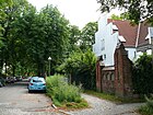
| Friedrichstrasse
( Location ) |
480 | Friedrich III. (1831–1888), German Emperor | before 1893 | It is located between Baseler Strasse and Jägerndorferzeile, between Jägerndorfer and Köhlerstrasse only as a footpath and road. |
|
| Fügener way
( Location ) |
420 | Fügen , place in Tyrol | May 17, 1930 | Traffic routes laid out as roads 66 and 66a of the development plan. |

|
| Fürstenstrasse
( Location ) |
700 | Prince , high title of nobility | before 1893 | On January 23, 1931, part of the Fürstenstrasse between Lindenstrasse and Schwatlostrasse was renamed Wiedenbrücker Weg. It runs from Lindenstrasse to Holtheimer Weg. This is where the western entrance to the Lichterfelde-Süd S-Bahn station is located . |

|
|
Gardeschützenweg
( Location ) |
1450 | Guard Rifle Battalion stationed here from 1884 to 1918 | Nov 4, 1935 | The previous name was Steglitzer Straße (before 1893-1935). It runs as an extension of Gélieustraße from Hindenburgdamm to Drakestraße. The guard rifle barracks that existed here were used by the guard rifle battalion until 1920 . Afterwards it served the Berlin police , during the time of National Socialism it was an army fireworks school. On July 3, 1945, the US Army confiscated the area and used it as barracks under the name Roosevelt Barracks . From 1950 to 1958 it was the seat of the 6941st Guard Battalion , a guard unit made up of Germans. From 1991 the building was used by the German Armed Forces , which finally handed it over to the Federal Intelligence Service in 2003 , which has been using the building since then. |

|
|
Gartnerstrasse
( Location ) |
680 (only west side) |
Gardener , job title | Sep 15 1879 | The east side of the street between Ostpreußendamm and Jungfernstieg belongs to Lankwitz , the street itself is in the district. |

|
| Geibelstrasse
( Location ) |
450 | Emanuel Geibel (1815–1884), poet and translator | Aug 8, 1895 | Established as Straße 12 , the section between Friedrichstraße and Curtiusstraße was renamed Jägerndorferzeile in 1934. |

|
| Geitnerweg
( Location ) |
580 | Ernst August Geitner (1783–1852), chemist, doctor, botanist and inventor | May 17, 1930 | Established as Straße 68 , it lies between Koloniestraße and Kaiserstraße. |

|
|
Gélieustraße
( Location ) |
250 | Bernhard von Gélieu (1828–1907), Prussian general | May 5, 1914 | The Schützenstrasse , which was previously located here, was renamed Gélieustraße in Lichterfelde, but the name remained in Steglitz . |

|
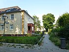
| Geneva way
( Location ) |
140 | Geneva , city in Switzerland | Aug 9, 1929 | The previous name was Geneva Street (1908–1929). |
|
| Georgenstrasse
( Location ) |
110 | Georg , male first name | before 1901 | It lies between Zerbster and Mariannenstrasse. |

|
| Geraer Strasse
( Location ) |
710 (in the district) |
Gera , city in Thuringia | Aug 28, 1917 | The eastern part of the street runs in Lankwitz . Plots 2–50 (even) and 3–47b belong to Lichterfelde. |

|
| Geranienstraße
( Location ) |
310 | Geraniums , genus of plants | Oct 6, 1908 | It was created as street 9 of the development plan. Geranienstraße not far from the Botanical Garden runs between Hindenburgdamm and Begonia Square and turns into Tulpenstraße. |

|
| Tanner's Path
( Location ) |
300 | Heinrich Gottfried Gerber (1832–1912), civil engineer and inventor | May 20, 1937 | It lies between Blanckertzweg and Woltmannweg. |

|
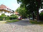
| Gersauer Weg
( Location ) |
130 | Gersau , place in Switzerland | Dec 15, 1930 | Established as Straße 15 , it is located between Finckensteinallee and Kornmesserstraße. |
|
| Giesensdorfer Strasse
( Location ) |
720 | Giesensdorf , former village and manor, was dissolved in Lichterfelde in 1878 | before 1878 | The old connection route to Giesensdorf ran here. Together with Wilhelmstrasse , the section up to Hindenburgdamm was renamed on December 1, 1964. The street lies between Königsberger Straße and Ostpreußendamm. |

|
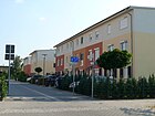
| Gland line
( Location ) |
100 | Gland , place in Switzerland | 25 Sep 2000 | As a private street, it is located in the “Swiss Quarter” between Lausanner Straße and Ruthnerweg. |
|
| Glarner Strasse
( Location ) |
250 | Glarus Alps , mountain group in Switzerland | Oct 1, 2000 | The road was laid out on the site of the former Andrews barracks between Thekla and Lausanner Strasse and opened to public traffic on November 4, 2004. |

|
| Glauberstrasse
( Location ) |
350 | Johann Rudolph Glauber (1604–1670), pharmacist and chemist | Aug 9, 1929 | Established as Straße 72 , it is located between the KGA “Südpark” on Scheelestraße and Hildburghauser Straße, although there is no connection to the latter. |

|
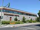
| Goerzallee
( Location ) |
3500 | Carl Paul Goerz (1854–1923), founder of the Goerz Optical Institute , later part of Zeiss Ikon | Jan. 16, 1925 | It was laid out in what was then Zehlendorf before 1925. With the Berlin territorial reform on April 1, 1938, the entire street came to the Steglitz administrative district. The Teltower Straße in Lichterfelde was included on March 27, 1939, making Goerzallee the longest street in the district. The southwest end is characterized by industry ( Assa Abloy / IKON ), in the middle area is the listed former Telefunkenwerk Zehlendorf (after 1945 US barracks McNair Barracks , today residential building). The Swiss quarter to the northeast between Goerzallee and Baseler Strasse was expanded after the Allies withdrew. |
|
| Goethestrasse
( Location ) |
550 | Johann Wolfgang von Goethe (1749–1832), poet | before 1878 | It lies between Königsberger Strasse and Ostpreußendamm. The former town hall of Lichterfelde and the fire station are located here. |

|
| Grabenstrasse
( Location ) |
890 | Königsgraben used to run here | Sep 15 1879 | The Grabenstrasse was created by merging parts of the Ringstrasse and Lorenzstrasse . The other road sections have been preserved with these names. It runs in an arch, corresponding to the original course of the former Königsgraben, from Jägerstrasse (north) to Heimkehlenstrasse (southeast). |

|
|
Graefenberger way
( Location ) |
260 | Bad Graefenberg, since 1945 part of Jeseník in the Czech Republic | July 13, 1934 | The previous name was Humboldtstrasse (before 1925-1934). The path connects Curtiusstraße over Jägerndorfer Weg with Weißwasserstraße. |

|
| Gronauer way
( Location ) |
170 | Gronau , city in North Rhine-Westphalia | July 1, 1964 | Established as road 522 , it is a spur road going from the Westfalenring to the southwest and belongs to the "Westphalian Quarter". |

|
| Großbeerenstrasse
( Location ) |
220 | Battle of Großbeeren | before 1893 | It lies between Woltmannweg and Saaleckplatz; In contrast to streets of the same name in other districts, it was not a connection route to Großbeeren. |

|
| Gütlingstrasse
( Location ) |
250 | Gottfried Gütling, village mayor in Schönow in the 19th century | Sep 14 1927 | Established as Straße 141 , it belonged to Zehlendorf until the Berlin regional reform on April 1, 1938 . It runs from Hochbaumstraße (No. 1) to Am Karpfenpfuhl and comprises 18 parcels, numbered in a zigzag shape. |

|
|
Habelschwerdter Allee
( Location ) |
70 (in the district) |
Habelschwerdt, a town in Lower Silesia, since 1945 Bystrzyca Kłodzka in Poland | July 13, 1937 | The street was laid out as Werderstraße at the turn of the 20th century in several construction phases and leads as a northern extension of Drakestraße to Thielallee. Only house number 1 is in Lichterfelde; most of the road runs in Dahlem . |

|
|
Handelplatz
( Location ) |
50 × 40 × 30 | Georg Friedrich Handel (1685–1759), composer | July 24, 1908 | Set up as space C of the development plan, the space is between Wolfensteindamm and Gélieustraße. The Steglitz-Zehlendorf branch of the Federal Employment Agency is located here . |

|
| Hans-Sachs-Strasse
( Location ) |
200 | Hans Sachs (1494–1576), poet, master singer and playwright | before 1901 | It is located west of Drakestrasse on Baseler Strasse as a spur road parallel to Curtiusstrasse and the railway line. The Lichterfelde West train station is located here . From 1947 to 1993 it was an American military station (RTO - Railroad Transportation Office) |

|
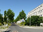
| Harry S. Truman Avenue
( Location ) |
460 | Harry S. Truman (1884–1972), 33rd President of the United States of America | June 1, 2000 | The street is located on the site of the former McNair barracks and was opened to public transport after the occupiers moved away. |
|
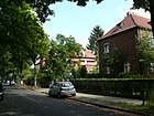
| Hartmannstrasse
( Location ) |
510 | Eduard von Hartmann (1842–1906), philosopher | July 13, 1934 | The previous names were Annastrasse (before 1893-1934) and Eduard-von-Hartmann-Strasse (1909-1934). Both streets were renamed Hartmannstrasse in 1934. |
|
| Hasselfelder Weg
( Location ) |
260 | Hasselfelde , part of the town of Oberharz am Brocken in Saxony-Anhalt | May 17, 1930 | It lies between Am Pfarracker and Wienroder path. |

|
| Haydnstrasse
( Location ) |
330 (in the district) |
Joseph Haydn (1732–1809), Austrian composer | before 1909 | The first name was street A of the zoning plan. The longer eastern section of the road runs in Steglitz , part of it also in Lankwitz. Only parcels 1 and 2 belong to Lichterfelde. |

|
| Heimkehlenstrasse
( Location ) |
490 | Heimkehle , gypsum cave in Saxony-Anhalt | Apr 8, 1933 | It was laid out as Mariendorfer Strasse before 1893 . It is located between Geraer Straße and Oskar-Lande-Platz. |

|
| Heinersdorfer Strasse
( Location ) |
870 | Heinersdorf , district of Großbeeren in Brandenburg | Sep 15 1879 | The street is a historical connecting route. The renaming of the southern part of Heinersdorfer Straße in Steinstraße (the later Schütte-Lanz-Straße) took place before 1893. It connects Oberhofer Platz with Saaleckplatz (which was first called Kaiserplatz ) in a straight north-east-south-west route and comprises 41 house numbers. |

|
| Heinrichstrasse
( Location ) |
240 | Heinrich Hundertmark (1834–1914), innkeeper in Giesensdorf | before 1901 | As a cul-de-sac , it runs south from Ostpreußendamm to before the embankment of the Anhalter Bahn at the gardens of the same name. |

|
| Heiterwang path
( Location ) |
490 | Heiterwang , place in Tyrol | May 17, 1930 | Established as street 59 of the development plan, it is located between Achenseeweg and Sondershauser Straße. |

|
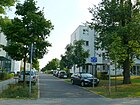
| Helene-von-Mülinen-Weg
( Location ) |
240 | Helene von Mülinen (1850–1924), Swiss women's rights activist | 25 Sep 2000 | The route is between Altdorfer and Lausanner Strasse in the "Swiss Quarter". |
|
| Henleinweg
( Location ) |
280 | Peter Henlein (1485–1542), inventor | Apr 4, 1934 | The path was set up as road 11 of the development plan. |

|
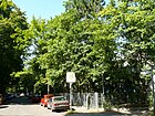
| Herwarthstrasse
( Location ) |
420 | Wilhelm Oskar Herwarth (1853–1916), painter | around 1901 | It lies in the arch between Königsberger Straße and Ostpreußendamm. The Sierra Leonean Embassy in Berlin is located at Herwarthstrasse 4 . |
|
| Hildburghauser Strasse
( Location ) |
2280 (in the district) |
Hildburghausen , district town in Thuringia | Aug 20, 1917 | The previous names were Marienfelder Strasse (before 1878-1933) and Lichterfelder Strasse (after 1914-1933). The house numbers 74-100 on the north side of the street are in Lankwitz and the eastern part of the street is in Marienfelde . At number 224 is the former Coca-Cola bottling factory, which became famous through the film " Eins, Zwei, Drei " by Billy Wilder . |

|
| Hindenburgdamm
( Location ) |
2700 (in the district) |
Paul von Hindenburg (1847–1934), Field Marshal General and President | Nov 16, 1914 | It was laid out as Chausseestrasse before 1878 . North of Wolfensteindamm, the road area and the east side with house numbers 64–65e belong to Steglitz . It runs as an extension of Wolfensteindamm through the old village center of Lichterfeld with the village church of Lichterfelde (also Pauluskirche ) to Königsberger Strasse, where it merges into Goerzallee. Until 1963 the tram drove through the Hindenburgdamm. |

|
| Hochbaumstrasse
( Location ) |
730 (in the district) |
Karl Louis Eduard Hochbaum (1848–1916), community representative in Zehlendorf | March 20, 1929 | In 1929 the street 87 and the street 143 in Zehlendorf as well as a section between Carstenstraße and the district border named in 1924 in Steglitz in Altdorfer Straße were given the name Hochbaumstraße. The western part of the street is in Zehlendorf. |

|
| Hochbergplatz
( Location ) |
50 (circular) |
Bolko von Hochberg (1843–1926), diplomat and composer | Feb. 27, 1936 | The previous name was Ulmenplatz (before 1893-1936). |

|
| Hochbergweg
( Location ) |
50 (circular) |
Bolko von Hochberg (1843–1926), diplomat and composer | Feb. 27, 1936 | The previous name was Ulmenstrasse (before 1893-1936). |

|
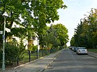
| Elevated road
( Location ) |
310 | Leading to the higher-lying railway area | before 1893 | It lies between Hildburghauser and Brauereistraße and continues as a cul-de-sac to the embankment. |
|
| Holbeinstrasse
( Location ) |
1270 | Holbein , artist family | before 1893 | It lies between Kadettenweg and Augustastrasse. It is a narrow, quiet street with villas close to the center at the Lichterfelde West train station. | |
| Holtheimer way
( Location ) |
490 | Holtheim , district of Lichtenau in North Rhine-Westphalia, | Apr 10, 1931 | The path was first established as road 20a of the development plan. |

|
| Hydrangea Square
( Location ) |
60 × 20 | Hydrangeas , genus of plants | Aug 16, 1928 | The square is between Hortensienstrasse and Tulpenstrasse. |

|
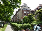
| Hortensienstrasse
( Location ) |
770 | Hydrangeas , genus of plants | Oct 6, 1908 | Initially set up as street 10 of the development plan, it is an extension of Resedenstraße between Nelkenstraße and Tulpenstraße. |
|
| Huntestrasse
( Location ) |
360 | Hunte , tributary of the Weser in Lower Saxony | Jan. 29, 1937 | The traffic route was first established as road 160 of the development plan. |

|
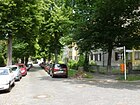
| Hyacinth Street
( Location ) |
90 | Hyacinths , genus of plants | Oct 6, 1908 | First part of street 10 of the development plan, it lies between street Unter den Eichen and Tulpenstraße, near the botanical garden . |
|
|
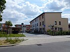
Ines Bolla Path
( Location ) |
100 | Ines Bolla (1888–1953), Swiss women's rights activist | 25 Sep 2000 | The street is in the "Swiss Quarter" between Goerzallee and Glarner Straße. |
|
|
Jägerndorfer line
( Location ) |
970 | Jägerndorf, German name of Krnov , city in the Czech Republic | July 13, 1934 | The previous name was Esmarchstrasse (before 1925-1934). It runs between Curtiusstraße (northeast) and Weißwasserweg (southwest). |

|
| Jaegerstrasse
( Location ) |
860 | Hunter , person who goes hunting | Sep 15 1879 | The previous name was Querstrasse (before 1879–1879). |

|
| Jenbacher way
( Location ) |
1210 | Jenbach , place in Tyrol | May 17, 1930 | Initially set up as road 88 of the development plan, the path lies on the border with the community of Großbeeren. The Wall Trail runs along the former border area . |

|
| Johanna-Spyri-Weg
( Location ) |
250 | Johanna Spyri (1827–1901), Swiss writer | 25 Sep 2000 | The private road is in the "Swiss Quarter" between Altdorfer and Lausanner Strasse. |

|
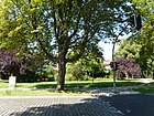
| Johanneskirchplatz
( Location ) |
70 × 50 | Forecourt of the Johanneskirche | Apr 9, 1956 | The previous name was Friedrichplatz (1895-1956). The square is on both sides of the Ringstrasse. |
|
| Jungfernstieg
( Location ) |
730 | Jungfernstieg in Hamburg | before 1878 | The naming could be suggested by Booth, who came from Hamburg and horticultural adviser to the founder Carstenn , for a main street of the founder villa colony. It leads from Königsberger Strasse to Boothstrasse, where it bends, to Gärtnerstrasse. The western entrance to the Berlin-Lichterfelde Ost train station is at a branch of the Jungfernstieg. The electric tram of Lichterfelde – Kadettenanstalt , which is considered to be the world's first electric tram, operated here. In the Villa Folke Bernadotte , used as a youth center, the research laboratory for electron physics, founded by Manfred von Ardenne , was located from 1928 .
At the beginning of the 20th century, the Berlin address books show a sanatorium for mentally ill people under Jungfernstieg 14 . |

|
|
Cadet path
( Location ) |
1100 | Former Prussian main cadet institute on today's Finckensteinallee | May 3, 1935 | The previous name was Sternstrasse (before 1893-1935). The Kadettenweg leads from the embankment north of Curtiusstrasse in a straight line to the southeast, at the mouth of Marthastrasse it makes a slight swivel to the south and ends at Weddingenweg. |

|
| Kaiserstrasse
( Location ) |
500 | Emperor , title of ruler | before 1893 | It lies in the arch around the Saaleckplatz from and to Koloniestraße. |

|
| Chamomile Road
( Location ) |
500 | Chamomile , plant species | Oct 6, 1908 | On November 3, 1950, Bastianstrasse was included as an extension of Kamillenstrasse. |

|
| Karlplatz
( Location ) |
70 × 60 × 50 | Karl , male first name | 1910 | The triangular square is spanned by Ringstrasse, Baseler Strasse and Kadettenweg; Friedrichstrasse opens out from the west. |

|
| Karwendelstrasse
( Location ) |
650 | Karwendel , mountain range in Tyrol and Bavaria | Feb. 27, 1936 | The previous name was Mühlenstrasse (1866-1936). |

|
| Kastanienstraße
( Location ) |
140 | Chestnuts , tree genus | before 1893 | It is located between Jägerstrasse and Brauereistrasse, the railway line continues as Akazienstrasse. |

|
| Gravel road
( Location ) |
470 (in the district) |
Gravel , small stones cut round by nature | before 1893 | The eastern part of the street (old spelling Kießstraße ) runs in Lankwitz , from the east side of Lorenzstraße to Kurfürstenstraße and did not get its name until 1934.
The street section belonging to Lichterfelde connects Oberhofer Platz from the northwest with the intersection of Lorenzstrasse. At the time the Kießstraße was set up, there was only one large plot of land owned by the Groß-Lichterfelder Bauverein directly on the square. |

|
| Kirchmeisterweg
( Location ) |
200 | Kirchmeister , lay office in the Evangelical Church | March 8, 1935 | It opens up the background pieces in an arch west of Am Pfarracker. |

|
| Klingsorplatz
( Location ) |
80 (semicircular) |
Klingsor , wizarding figure of mythology | May 17, 1930 | The previous name was Richard-Wagner-Platz (before 1909–1930). |

|
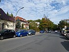
| Klingsorstrasse
( Location ) |
410 (in the district) |
Klingsor , wizarding figure of mythology | May 17, 1930 | The previous names were Belfortstrasse (1909–1930; only in Steglitz) and Richard-Wagner-Strasse (before 1909–1930). Plots 95–121 (odd) and 98–120 (even) are in the district, the eastern section of the street runs through Steglitz . |
|
| Knesebeckstrasse
( Location ) |
270 | Leo Wilhelm Robert Karl von dem Knesebeck (1808–1883), district administrator of the Teltow district | before 1893 | It lies in the arch between Drakestrasse and Unter den Eichen , north of the Lichterfelde-West S-Bahn station . |

|
|
Köhlerstrasse
( Location ) |
670 | Erich Köhler (1873–1914), naval officer and commander of a cruiser in the First World War | Sep 20 1916 | Before 1893, the Bahnstraße was laid out here as an access to the train station and renamed in 1916. |

|
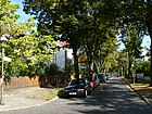
| Koloniestrasse
( Location ) |
430 | garden colonies existing here | before 1893 | The extension of the existing Koloniestrasse was included on May 20, 1958. On July 1, 1982, the section between Blochmannstrasse and Helmertweg was de-dedicated. |
|
| Kommandantenstrasse
( Location ) |
850 | Commanders of the nearby barracks | before 1893 | The section of Kommandantenstrasse between Carstennstrasse and Zehlendorfer Strasse was renamed Berner Strasse on October 3, 1908. The street leads from Kadettenweg via Johanneskirchplatz to Finckensteinallee and then turns into Berner Strasse. |

|
|
Queen-Luise-Strasse
( Location ) |
220 (in the district) |
Luise von Mecklenburg-Strelitz (1776–1810), Queen of Prussia | March 1, 1906 | The traditional connecting route between Steglitz and the Grunewald hunting lodge was expanded as a fortified road from 1889 and was named in 1906 after the Luisenstift present here . The south side of the street east of the Königin-Luise-Platz with the Botanical Museum and the properties 2–8 (straight) belongs to Lichterfelde . |

|
|
Koenigsberger Strasse
( Location ) |
1240 | Königsberg , former capital of East Prussia | Dec. 1, 1964 | The previous name was Wilhelmstrasse (after 1866–1964). The section of Giesensdorfer Strasse between Wilhelmstrasse and Hindenburgdamm was renamed Königsberger Strasse together with Wilhelmstrasse in 1964.
It runs from the bridge over the Teltow Canal (as a continuation of Drakestrasse) in slight swings to the Ostpreußendamm eastwards. From this intersection, your route is straight and flows southeast onto Kranoldplatz. |

|
| Kopernikusstrasse
( Location ) |
170 | Nicolaus Copernicus (1473–1543), astronomer | May 23, 1903 | It is located between Potsdamer Strasse and Kadettenweg. |

|
| Kornmesserstrasse
( Location ) |
340 | Joachim Friedrich Kornmesser (1641–1715), medic and Berlin mayor | Dec 18, 1895 | Previously set up as Straße 16 in the development plan, the extension Straße 15 in Kornmesserstraße was named on July 14, 1904 . The Catholic Church of the Holy Family is located here . It runs between west and east between Glarner Straße and Goerzalle. |

|
| Krahmerstrasse
( Location ) |
460 | Adelheid Krahmer (1841–1929), head of the secondary girls' school in Lichterfelde | Nov 12, 1925 | The previous name was Parkstrasse I (before 1893-1925). At the Teltow Canal the road ends as a dead end for cars . The eastern part to the Ostpreußendamm is a foot and cycle path that runs from the Krahmersteg over the Teltow Canal and crosses the Eduard-Spranger-Promenade. The Charité Institute for Hygiene and Environmental Medicine is in the street, and the Lichterfelde Castle Park is directly adjacent to the street. |

|
| Kranoldplatz
( Location ) |
90 × 80 × 40 | Viktor Ferdinand von Kranold (1838–1922), Prussian railway official | July 1905 | The previous name was Anhalter Platz (before 1893). The square is located directly at the Lichterfelde Ost S-Bahn station . A weekly market takes place in the square on Wednesdays and Saturdays from 7 a.m. to 2 p.m. |

|
| Kreutzerweg
( Location ) |
300 | Conradin Kreutzer (1780–1849), composer | Oct. 30, 1936 | Initially set up as street 223 of the development plan, the path lies between Klingsorstrasse and Marschnerstrasse. |

|
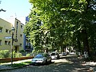
| Crooked road
( Location ) |
150 | crooked road | June 23, 1902 | The traffic route was set up as Road 52 of the development plan. |
|
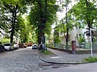
| Kyllmannstrasse
( Location ) |
360 + 100 | Walter Kyllmann (1837–1913), architect | before 1893 | Kyllmannstrasse lies between Augustastrasse and Prausestrasse and is interrupted by Viktoriaplatz. |
|
|
Land route
( Location ) |
330 | Part of the old connection route between Marienfelde and Teltow | July 27, 1905 | The previous name was Landstrasse (1895-1905). This land route as a section of the former road from Teltow to Marienfelde was the official name. |

|
| Long street
( Location ) |
570 (in the district) |
Length of the street (lengthways) in the residential area | before 1893 | It is between Schöffen- and Dessauerstrasse. On December 31, 1924, the subsequent section in the Kriegerheimsiedlung between the Blaumeisenweg and Am Pfarracker was spun off as Schöffenstraße . The eastern part of the street runs in Lankwitz . Plots 1–7b and 11–24 (consecutive) are located in the district. |

|
| Lankwitzer Strasse
( Location ) |
370 (in the district) |
Lankwitz , neighboring district of Lichterfelde | Sep 10 1863 | Lankwitzer Strasse is one of the streets that was named by the “Most Highest Decree”, that is, by royal order. The street was named as a directional road to Lankwitz. It lies between Kranoldplatz and Kaiser-Wilhelm-Straße, lots 1–9 and 13–26 (consecutive) belong to the district. It is a shopping street with old buildings and houses from the 1950s and 1960s, which runs from the Lichterfelde Ost S-Bahn station to the district boundary. |

|
| Lausanne Street
( Location ) |
650 | Lausanne , city in Switzerland | Oct 1, 2000 | The street on the site of the former Andrews barracks, now part of the "Swiss Quarter", was opened to public traffic between Goerzallee and Obwaldenerzeile on November 4, 2004, and between Obwaldenerzeile and Baseler Straße on January 14, 2005. As an extension of Züricher Straße, it leads to Goerzallee. |

|
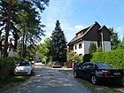
| Lechtal way
( Location ) |
280 | Lechtal , alpine valley in Austria | Nov 5, 1942 | Initially set up as Straße 240 in the development plan, it is located between Sondershauser Straße and Lichterfelder Ring. |
|
| Lermooser Weg
( Location ) |
530 | Lermoos , place in Tyrol | May 17, 1930 | Initially set up as street 63 and street 63a of the development plan, the path lies between Hildburghauser Straße and Heiterwanger Weg and is a quiet residential street predominantly built with single-family houses. |

|
| Lichterfelder Ring
( Location ) |
1450 (in the district) |
Lichterfelde , Berlin district | Apr 21, 1932 | The previous name was Teltower Weg (before 1905-1932). The eastern part of the street runs in Marienfelde , the district includes plots 123–255 (odd) and 126–240 (even). It is located between Waldsassener and Osdorfer Straße. |

|
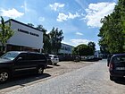
| Lichterfelder Weg
( Location ) |
490 | Lichterfelde , Berlin district | Nov 30, 1942 | The path, which was initially set up as road 240 of the development plan, leads from Goerzallee to an industrial park that was used as a parking area for vehicles until the US Army withdrew . |
|
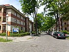
| Lilienstraße
( Location ) |
160 | Lilies , genus of plants | Oct 6, 1908 | First established as street 13 of the development plan, it is located between Unter den Eichen and Hortensienstrasse. |
|
| Limonenstrasse
( Location ) |
550 (in the district) |
Lime , citrus fruit | Oct 6, 1908 | It was laid out as street 3b of the development plan in Dahlem . Since the Berlin regional reform on April 1, 1938, only lots 16 and 16a belong to Dahlem and most of the street is in Lichterfelde. Limonenstraße is located in a district that is also known as the “flower district” because of its street name. |

|
| Lindenstrasse
( Location ) |
480 | Linden , tree genus | Sep 15 1879 | It is between Ostpreußendamm and Fürstenstrasse. |

|
| Lipa Street
( Location ) |
660 | Lipa , place in the Czech Republic and one of the scenes of the battle of Königgrätz | Sep 12 1912 | First street 9 of the development plan, the renaming of Elisabethstraße as a connecting street was made on July 20, 1960. Since then it has been running between Augusta and Neuchateller Strasse. |

|
| Lippstädter Strasse
( Location ) |
380 | Lippstadt , city in North Rhine-Westphalia | May 1, 1980 | The previous name was Bergstrasse (before 1893-1980). Lippstädter Straße also included the southern part of Bergstraße, which was closed in 1962. On the east side of the street is the upper level center for office management and administration. |

|
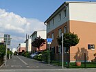
| Locarnoweg
( Location ) |
70 | Locarno , city in Switzerland | Apr 12, 2007 | It is located between Thurer and Glandzeile in the "Swiss Quarter". |
|
| Lorenzstrasse
( Location ) |
700 | Lorenz , male first name | before 1879 | The origin of the name is not clearly proven. Allegedly the name took place after a family member of Johann Anton Wilhelm von Carstenn . The street lies between Lankwitzer and Kiesstraße. |

|
| Lotzestrasse
( Location ) |
500 | Rudolf Hermann Lotze (1817–1881), philosopher | Nov 12, 1925 | Kantstrasse, laid out in 1905, and Fichtestrasse , laid out around 1900, were combined in 1925 and named Lotzestrasse. It is between Curtiusstrasse and Ringstrasse. |

|
| Ludwig-Beck-Platz
( Location ) |
150 × 100 × 90 | Ludwig Beck (1880–1944), general and resistance fighter of July 20, 1944 | Feb. 2, 1986 | The square, which had existed since the turn of the 20th century, had not been officially named. Since a market was held on it, it was called Marktplatz or Moltkeplatz because it was on Moltkestrasse. These unofficial names can be found in evidence and on plans up to 1986. It was not until January 2, 1986 that the place was officially named Ludwig-Beck-Platz. |

|
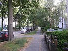
| Luisenstrasse
( Location ) |
300 + 160 + 160 | Luise von Mecklenburg-Strelitz (1776–1810), Queen of Prussia | before 1893 | It lies between Lankwitzer Strasse and Lange Strasse, with the street layout on Derfflingerstrasse and Frobenstrasse being offset by around 30 meters. The east side of the street belongs to Lankwitz , the district includes plots 1–19a. |
|
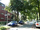
| Lukas-Cranach-Strasse
( Location ) |
190 | Lucas Cranach the Elder (1472–1553), painter and graphic artist | Jun 23, 1902 | Initially set up as street 8 of the development plan, it is located between Stockweg and Tietzenweg. |
|
| Lucerne Street
( Location ) |
260 + 200 | Lucerne , city in Switzerland | Oct. 3, 1910 | Initially set up as street 20 of the development plan, it lies between Carstennstraße and Goerzallee and is divided by Thuner Platz. |

|
|
Maggy Breittmayer Path
( Location ) |
90 | Maggy Breittmayer (1888–1961), Swiss violinist | 25 Sep 2000 | The path is a dead end between Glarner Strasse and Goerzallee in the "Swiss Quarter". |

|
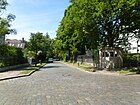
| Malvenstrasse
( Location ) |
220 | Mallow , genus of plants | Oct 6, 1908 | Established as street 5 of the development plan, it lies between Willdenowstrasse and Kamillenstrasse. |
|
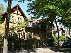
| Manteuffelstrasse
( Location ) |
680 | Edwin von Manteuffel (1809–1885), Prussian Field Marshal General | before 1893 | Previously set up as street 2 of the development plan, it is located between Augustaplatz and Hindenburgdamm. |
|
| Margaretenstrasse
( Location ) |
450 | Margarete , female first name | before 1893 | It runs between Drakestrasse and Tietzenweg. The residential complex of the “Gemeinnützigen AG for salaried homes” is located here. |

|
| Mariannenstrasse
( Location ) |
800 | Maria Anna Amalie von Hessen-Homburg (1785–1846), Prussian princess | before 1901 | It runs as an extension of Lorenzstrasse between Kiesstrasse and Hildburghauser Strasse. |

|
| Marienplatz
( Location ) |
120 × 120 rhombus, which is placed across the intersection of Marienstraße and Promenadenstraße |
Maria , after the planned Marienkirche | around 1870 | The square forms the center of the Lichterfelde villa colony founded by Carstenn in 1868. The central church for the new Lichterfelde - the Marienkirche - was to be built on it. Therefore the square in Marienplatz and the street in Marienstraße were named. But the church did not come to the execution. The Bethel Berlin Hospital is located on the east side and in Promenadenstrasse. The place is a listed garden monument. |

|
| Marienstrasse
( Location ) |
600+ 440 | Maria , after the planned Marienkirche | before 1893 | It lies between Hochbergplatz and Gärtnerstraße and is interrupted by Marienplatz. |

|
| Marie-Vögtlin-Weg
( Location ) |
250 | Marie Heim-Vögtlin (1845–1916), Swiss physician | 25 Sep 2000 | The private street in the “Swiss Quarter” is between Altdorfer Straße and Lausanner Straße. |

|
| Marschnerstrasse
( Location ) |
600 | Heinrich Marschner (1795–1861), composer | Oct 3, 1908 | The street in the “Composers' Quarter” was established as street H of the development plan and is located between Haydnstraße and Kreutzerweg. |

|
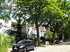
| Marthastrasse
( Location ) |
180 | Martha , female name | before 1893 | Marthastrasse is between Kadettenweg and Potsdamer Strasse. |
|
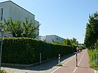
| McNair Promenade
( Location ) |
390 |
Lesley J. McNair (1883-1944),
American general |
Jun 1, 2000 | The road is on the site of the former McNair barracks and was opened to traffic on July 4, 2000. |
|
| Memlingstrasse
( Location ) |
380 | Hans Memling (between 1433 and 1440–1494), painter of the Dutch school | July 20, 1960 | From 1893 to 1960 it was called Albrechtstrasse ; it lies between Dürerstrasse and Augustaplatz. |

|
| Mercatorweg
( Location ) |
190 | Gerhard Mercator (1512–1594), cartographer | Oct. 1, 1969 | The spur road laid out as road 533 of the development plan goes off from Osdorfer Strasse and is part of the “ Thermometeriedlung ” that was created in 1970 . The Mercator Elementary School is located here. |

|
|
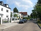
Möllerpfad
( Location ) |
170 | Reinhard Möller (1855–1927), theologian | Sep 14 1927 | The path was established as road 139 of the zoning plan. |
|
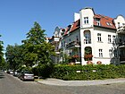
| Moltkestrasse
( Location ) |
1030 | Helmuth Karl Bernhard von Moltke (1800-1891), Prussian Field Marshal General | Apr 27, 1899 | The previous name was Dorotheenstrasse (before 1893-1899). As an extension of Enzianstrasse, it leads to Hindenburgdamm. The Lichterfelde cemetery is located here . |
|
| Mommsenstrasse
( Location ) |
260 | Theodor Mommsen (1817–1903), historian and Nobel Prize for Literature | before 1893 | It connects Drakestrasse with Kyllmannstrasse. |

|
|
Mörchinger Strasse
( Location ) |
200 (in the district) |
Mörchingen , a place in Lorraine and the scene of a battle in the First World War | Sep 9 1931 | Most of the street is in Zehlendorf . Originally located entirely in Zehlendorf, the short section to Lichterfelde came at the end of the 1930s and runs as a dead end from Dahlemer Weg, parallel to Unter den Eichen, in an easterly direction. On the north side there are plots 16–20d (straight) with residential buildings. The street leads to a turning area, behind which is the entrance to the premises of the Federal Institute for Materials Testing. This area also includes the entire south side of the street in the district, plots 11-11u, where a tree nursery was located until at least 1943. |

|
| Morgensternstrasse
( Location ) |
650 | Otto Morgenstern (1860–1942), philologist, Lichterfeld local politician and victim of National Socialism | June 10, 1961 | The previous name was Bismarckstrasse (before 1893-1961). It runs from Ostpreußendamm to Königsberger Straße. |

|
|
Müllerstrasse
( Location ) |
630 | Müller of the Giesensdorfer Mühle in this street, which was demolished in 1939 | Sep 15 1879 | The previous name was Ringstrasse (1877–1879). It lies in the arch between Lindenstrasse and Fürstenstrasse. Historical photos are available on the Internet. |

|
| Murten Street
( Location ) |
430 | Murten , city in Switzerland | Oct 3, 1908 | At first it was street 17 of the development plan, which lies between Karlstraße and Carstennstraße . On November 8, 1966, the street 523 was included. It is located between Carstenn Strasse and Baseler Strasse. |

|
| Mürwiker Strasse
( Location ) |
380 | Mürwik , district of Flensburg in Schleswig-Holstein | Jan. 29, 1937 | It goes from Seehofstrasse and ends after Elmshorner Strasse as a cul-de-sac at the allotment garden “Abendruh”. Mürwik became known, among other things, for its base in Flensburg-Mürwik with the Mürwik naval school and as the seat of the executive government under Karl Dönitz . Today the Federal Motor Transport Authority is located in Mürwik . |

|
|
Carnation Street
( Location ) |
120 | Carnations , genus of plants | Oct 6, 1908 | Its previous name was Straße 11 of the development plan. It is located between Hortensienstrasse and Begonia Square. |

|
| Neuchateller Strasse
( Location ) |
700 | Neuchâtel , city in Switzerland | 17 Sep 1912 | Previously part of Straße 8 in the development plan, the road runs not far from the barracks of the former Guard Rifle Battalion , which was set up in the then Principality of Neuchâtel in 1814, stationed in Berlin and relocated to Lichterfelde in 1884. His Berlin nickname was "Neffschateller". |

|
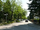
| Neuwerker way
( Location ) |
450 | Neuwerk , North Sea island belonging to the state of Hamburg | Jan. 29, 1937 | Before that were in the course of road 151 and Straße153 set up of the development plan. The path leads from Seehofstraße to Pinnauweh. |
|
| Nidwalden line
( Location ) |
100 | Nidwalden , canton in Switzerland | 25 Sep 2000 | The private road is located in the “Swiss Quarter” and is a cul-de-sac from Züricher Straße to the south. |

|
|
Oberhofer Platz
( Location ) |
180 × 80 | Oberhof , city in Thuringia | March 29, 1939 | Wilhelmplatz was already laid out here before 1878 . Oberhofer Weg and across it the parallel street cross over the square, which is bounded by Jägerstraße to the north, and Kiesstraße and Heinersdorfer Straße to the south. | |
| Oberhofer Weg
( Location ) |
1170 | Oberhof , city in Thuringia | March 29, 1939 | The name of the street laid out before 1878 was Extended Wilhelmstrasse . The quiet residential street with existing villas is interrupted by Oberhofer Platz and is located between the Lichterfelde Ost S-Bahn station on Kranoldplatz and Hildburghauser Straße. |

|
| Obwalden line
( Location ) |
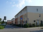
100 | Obwalden , canton in Switzerland | 25 Sep 2000 | The private road is located in the “Swiss Quarter” and goes south from Lausanner Strasse as a dead end . |
|
| Ortlerweg
( Location ) |
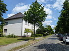
430 | Ortler , mountain in South Tyrol | Jul 31, 1947 | The street is between Goerzallee and Wismarer Straße. It was laid out after 1935 as the Leibstandartenweg past what was then the Lichterfelde retirement home (Hs. 39/41). The Hamburger Strasse that ran there previously was omitted, as was Danziger and Stralsunder Strasse further north. The old name, deleted in 1947, referred to the Leibstandarte SS Adolf Hitler , whose barracks was the former cadet institute not far away . |
|
| Osdorfer Strasse
( Location ) |
1600 (in the district) |
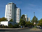
Osdorf , district of Großbeeren in Brandenburg | before 1878 | Part of the former Osdorfer Straße, which connected Giesensdorf with Osdorf, was renamed Heinersdorfer Straße on September 15, 1879. The Osdorf-Teltower Weg, which also existed around 1890, with two houses directly on Osdorfer Strasse on Lichterfelder Flur, was included in the remaining section of this street around 1900. The street continues with the same name over the city limits. |
|
| Oskar-Lange-Platz
( Location ) |
40 × 40 | Oskar Lange (1851–1937), local politician in Lichterfelde and in the Steglitz district | Oct 9, 2006 | The square divides the crossing Lange Straße and Heinersdorfer Straße, Auguststraße joins from the north and Heimkehlenstraße from the south. |

|
| Osteweg
( Location ) |
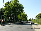
1070 | Oste , tributary of the Elbe in Lower Saxony | Jan. 29, 1937 | Initially intended as road 157 in the development plan, the Osteweg was actually laid out when it was named in 1937. On June 1, 2000, the path was extended to the newly created McNair Promenade. |
|
| Ostpreussendamm
( Location ) |
3950 | East Prussia , former Prussian province | Oct. 1, 1961 | The previous name of the street, which was laid out before 1878, was Berliner Straße . The Giesensdorf village church stood on plot 63. A small cross street, street J south of the Lichterfelde thermal power station , which was later built here , was included in the naming.
The Ostpreußendamm is a busy residential street with commercial units and shops, which as an extension of Siemensstraße leads from the Lichterfelde stadium to the city limits and continues in Teltow as Lichterfelder Allee. After Walter Linse was kidnapped on this street in 1952, the border crossing at the city limits on the West Berlin side was closed to vehicle traffic. The tram that ran along Ostpreußendamm south of Goethestrasse was withdrawn from the city limits on Lindenstrasse in 1962 and completely stopped in 1966. Historical photos of the southern part of the Ostpreußendamm are available on the Internet. |

|
|
Parallel street
( Location ) |
870 | parallel to Jägerstrasse and Lange (n) Strasse | before 1893 | The street is between Am Pfarracker and Luisenstraße, parallel to Lange Straße and Jägerstraße. |

|
| Patschkauer way
( Location ) |
350 (in the district) |
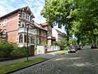
Patschkau , town in Upper Silesia (Poland) | July 13, 1934 | From 1893 to 1934 the traffic route was called Goebenstrasse . It lies between Unter den Eichen and Schwendenerstrasse. The section north of Altensteinstrasse belongs to Dahlem , in the district there are plots 1–43 (odd) and 2–40 (even). |
|
| Paulinenstrasse
( Location ) |
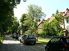
470 | Pauline , female first name | before 1893 | The origin of the name or a specific reference to the choice of name are not known.
The end points of Paulinenstraße are Kadettenweg (until 1933 Sternstraße ) and Finckensteinallee (until 1933 Zehlendorfer Straße ). The house numbers range from 1 to 29 and have a horseshoe shape . The Petruskirche is located in this street (address Oberhofer Platz 2) . |
|
| Persantestrasse
( Location ) |
460 | Persante , river in Poland | Jan. 29, 1937 | Persantestrasse between Dahlemer Weg and Goerzallee belonged to Zehlendorf until the Berlin regional reform on April 1, 1938 . |

|
| Pertisauer Weg
( Location ) |
460 | Pertisau , place in Tyrol | May 17, 1930 | The path arose from the planned streets Street 65 and Street 65a in the development plan. It runs in a slight curve between Heiterwanger Weg and Hildburghauser Straße and opens up a residential complex. |

|
| Pestalozzi Square
( Location ) |
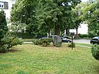
60 × 60 × 60 | Johann Heinrich Pestalozzi (1746–1827), Swiss educator | after 1945; unexplained | The triangular square is bordered by Ring-, Lotzestrasse and Weißwasserweg and Steinäcker-, Spindelmühler and Weddingenweg flow here. The date of the naming or creation of the place cannot be determined from the online sources. According to the Berlin address and telephone books until 1943, there was no Pestalozziplatz in Lichterfelde, but Pestalozzistraße . |
|
| Pfleidererstrasse
( Location ) |
280 | Otto Pfleiderer (1839–1908), theologian | Feb 8, 1909 | Initially set up as street 13 of the development plan, it leads from the Ringstraße to Geibelstraße, with the section between Köhlerstraße and Geibelstraße running as a footpath. | |
| Pinnauweg
( Location ) |
390 | Pinnau , tributary of the Elbe in Schleswig-Holstein | Jan. 29, 1937 | At first it was Straße 154 and Straße 155 of the development plan. The path is between Seehofstrasse and McNair Promenade. |

|
| Place of the US Berlin Brigade
( Location ) |
140 × 140 | Berlin Brigade of the US armed forces stationed in Lichterfelde until 1994 | June 1, 2000 | The square is located between Billy-Wilder-Promenade and Harry-S.-Truman-Allee on the former barracks area. |

|
| 4th of July Square
( Location ) |
470 × 60 | July 4th , National Day of the United States of America | Dec 3, 1976 | The previous name was Fourth Ring (1976). The section of Speer's ring system got its name on the occasion of the 200th anniversary of the US Declaration of Independence . It is a wide asphalt area on which a road is led through lane markings on the western edge. The square borders the Lichterfelde Park Cemetery to the east . |

|
|
Pößnecker Strasse
( Location ) |
420 | Pößneck , city in Thuringia | July 13, 1934 | The previous name was Katharinenstrasse (before 1901-1934). As an extension of Oberhofer Straße, it initially runs eastwards and then bends south. Here the Pößneckerstrasse joins the Georgenstrasse. |

|
| Potsdamer Strasse
( Location ) |
1120 in the district |
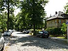
Potsdam , city in Brandenburg, towards which the road leads | before 1893 | It lies between Finckensteinallee and Baseler Straße and includes parcels 1 to 67 (even and odd) in the district. However, individual numbers are assigned to the district of Zehlendorf according to the street overview of the Office of Statistics (No. 1, 2, 3–7, 4–8, 11–53 and 12–54). |
|
| Prausestrasse
( Location ) |
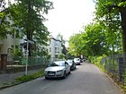
470 | Oswald Prause (1844–1921), Lichterfeld local politician | Sep 14 1927 | The previous names were Richardstrasse (before 1905-1927) and Hedwigstrasse (before 1901-1927). Prausestrasse runs south of the railway line and connects Drakestrasse with Tietzeweg with two bends. Uniformly designed rows of multi-family houses stand on their southern side. |
|
| Prettau path
( Location ) |
470 | Prettau , place in South Tyrol | Dec 15, 1930 | The path emerged from street G and partly street 80 of the development plan. It goes southwest from Wismarer Straße and flows into Bröndbystraße. He also has a cross branch. |

|
| Prinzenstrasse
( Location ) |
250 | Prince , male descendant of a royal family | before 1893 | It lies between Morgensternstrasse and Bogenstrasse. |

|
| Promenade Street
( Location ) |
630 | Promenade character of the street | before 1893 | The street between Ostpreußendamm and Jungfernstieg is interrupted by Marienplatz, which was intended to be the central square of the residential area with the intersecting Promenadenstrasse and Marienstraße. |

|
|
Réaumurstrasse
( Location ) |
700 | René-Antoine Ferchault de Réaumur (1683–1757), French scientist | Oct. 1, 1969 | The previous name was Landstrasse (1895-1905). In 1969, part of the Lichterfelder Landweg and road 530 in the development plan were named Réaumurstrasse. The street belongs to the " thermometer settlement ", which was built in 1970 and whose main streets are named after the founders of temperature measurement. |
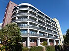
|
| Reichensteiner way
( Location ) |
260 (in the district) |
Reichenstein, town in Lower Silesia, after 1945 Zloty Stok in Poland | July 13, 1934 | The street was called Zietenstraße from 1895 to 1934 . It is located between Schwendener Straße and Unter den Eichen . The section north of Altensteinstrasse is in Dahlem , the district includes plots 1–21 (odd) and 2–22 (even). |
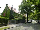
|
| Reinacher line
( Location ) |
100 | Reinach , place in Switzerland ( Canton Basel-Country ) | 25 Sep 2000 | The private road is in the “Swiss Quarter” and branches off southwards from Lausanner Strasse. |
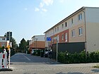
|
| Resedenstrasse
( Location ) |
290 | Reseda plants, plant family | Oct 6, 1910 | It was established as street 10a of the development plan and is located between Hindenburgdamm and Nelkenstraße. |

|
| Resselsteig
( Location ) |
280 | Josef Ressel (1793–1857), Austrian forest clerk and inventor | Nov 3, 1938 | The Resselsteig was created by merging and naming streets 73 and 264 in the development plan. It leads from Scheelestrasse in a north-westerly direction, then makes a right-left turn and leads to Koloniestrasse. |

|
|
Ring road
( Location ) |
2340 | planned ring through Lichterfelde West | before 1878 | The section of the Ringstrasse between Zehlendorfer and Luzerner Strasse was renamed Carstennstrasse on April 27, 1899. The Lilienthal-Gymnasium and the district court of Lichterfelde are located in the remaining part of the Ringstrasse . It is a quiet street with villas. |
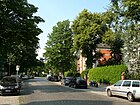
|
| Ritterstrasse
( Location ) |
330 | J. Ritter (before 1870 – after 1901), local politician, from 1885 to 1901 poor worker in Steglitz | before 1901 | It lies between Marienplatz (western corner) and Ostpreußendamm (at the time it was named Berliner Straße ). |

|
| Roonstrasse
( Location ) |
560 | Albrecht von Roon (1803–1879), Prussian Field Marshal General | before 1878 | It is between Hindenburgdamm and Moltkestrasse. |
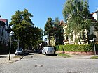
|
| Rotdornweg
( Location ) |
200 | Hawthorn , species of plant | December 31, 1924 | The street is located on the settlement area of the "Groß-Berliner Heimstätten- ,kaufs- und Baugenossenschaft". |
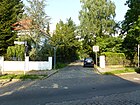
|
|
Rühmkorffstrasse
( Location ) |
160 | Heinrich Daniel Rühmkorff (1803–1877), mechanic and electrical engineer | Aug 9, 1929 | Initially set up as road 71 in the development plan, it connects Scheelestrasse with the Steinheilpfad. |
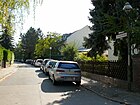
|
|
Rütliplatz
( Location ) |
100 × 100 × 50 acute-angled triangle |
Rütli , mountain meadow in Switzerland and place of the Rütli oath | Oct 3, 1908 | It was set up as place I of the development plan. Rütliplatz is surrounded by Carstennstrasse (west), Genfer Weg (north) and Berner Strasse (east). |

|
| Ruthnerweg
( Location ) |
410 | Anton von Ruthner (1817–1897), Austrian mountaineer, geographer and writer | Aug 9, 1929 | Initially set up as street A of the development plan, it was named including two access streets . |

|
|
Saaleckplatz
( Location ) |
80 × 50 | Saaleck Castle , castle ruins in Saxony-Anhalt | Aug 6, 1937 | Established before 1893 as Kaiserplatz in the center of the Thuringian Quarter, it was renamed in 1937. |

|
| Salty path
( Location ) |
220 | Bad Salzungen , district town in Thuringia | May 17, 1930 | The path was established as road 6 of the zoning plan. It runs north-south between Hasselfelder Weg and Am Pfuhl. Its northern section opens up villa plots, in the southern area rows of multi-family houses were built. |
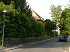
|
| Sandhofweg
( Location ) |
250 | Sandhof , estate of the family of Andreas Hofer in South Tyrol | Jan. 18, 1936 | The path was set up as road 207 of the development plan. It goes westward from Schütte-Lanz-Straße, after about 95 meters it bends south, crosses Silzer Weg and ends as a dead end . |
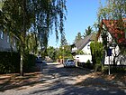
|
| Sarntaler way
( Location ) |
340 | Sarntal , mountain valley with the municipality of the same name Sarntal in South Tyrol | May 17, 1930 | The path was set up as road 58 of the development plan. It goes northwest from the Lichterfelder Ring, after the intersection with the Tuxer Steig it makes a bend to the east and ends at the Graben. |

|
| Scheelestrasse
( Location ) |
1040 | Carl Wilhelm Scheele (1742–1786), German-Swedish chemist and pharmacist | Aug 9, 1929 | First established as street 69 of the development plan, the extension was included on November 2, 1953 in Scheelestrasse. A branch leads to the club area of the tennis club "BTTC Grün-Weiss". |

|
| Schiller Street
( Location ) |
760 | Friedrich Schiller (1759–1805), poet | before 1893 | It lies between Giesensdorfer and Morgensternstraße and continues over the latter as a spur road to the railway embankment. At the end of the 19th century there was a pedagogy on an area between Schillerstraße, Berliner Straße , Marienstraße and Wilhelmstraße - an elite boys' educational institution (see map from 1892 in the introduction). |
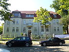
|
|
Schlossstrasse
( Location ) |
200 (in the district) |
Steglitz manor , also known as the “castle” | around 1860 | The previous name was Potsdamer Chaussee (1792 to around 1860). Only the area between Hindenburgdamm and Am Fichtenberg with plots 60–63 is in Lichterfelde. The roads and the much larger part of Schlossstrasse are in Steglitz . |
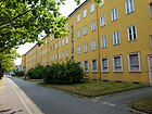
|
|
Schöffenstrasse
( Location ) |
210 | Aldermen | December 31, 1924 | In 1924 the extension of Langen Strasse in the Kriegerheimsiedlung between Blaumeisenweg and Am Pfarracker in Schöffenstrasse was named. Plots 1, 1a, 2 are located on Schöffenstrasse on the north side and opposite 2a – 6 (continuous); the plots at the corner of Zeisigweg belong to this. |

|
|
Schöppinger Strasse
( Location ) |
170 | Schöppingen , municipality in North Rhine-Westphalia | Aug 13, 1930 | It was set up as road 41b of the development plan. It goes eastward from Schwelmer Strasse and after a swivel leads to Dunstener Strasse. On both sides of the street there are two-storey apartment buildings in uniform development. |

|
| Schottmüllerstrasse
( Location ) |
1330 | Konrad Schottmüller (1841–1893), historian | Sep 14 1927 | Until the Berlin territorial reform on April 1, 1938, the street between Finckensteinallee and Osteweg belonged to Zehlendorf. |
|
| Schubertstrasse
( Location ) |
70 | Franz Schubert (1797–1828), Austrian composer | before 1907 | The street from Curtiusstraße belonged to Zehlendorf until the Berlin regional reform on April 1, 1938 . |

|
|
Schütte-Lanz-Strasse
( Location ) |
1100 | Johann Schütte (1873–1940) and Karl Lanz (1873–1921), founders of the Schütte-Lanz company | March 3, 1933 | Already laid out as Steinstrasse before 1893 , it was renamed in 1933. The Lilienthal memorial and the Lilienthalpark with the Fliegeberg are located on the street . |
|
| Schwarzdornweg
( Location ) |
170 | Blackthorn , species of plant | December 31, 1924 | The previous name was Tannenweg (1922-1924). The street is located on the settlement area of the "Groß-Berliner Heimstätten- ,kaufs- und Baugenossenschaft". |

|
| Schwatlostrasse
( Location ) |
450 | Carl Schwatlo (1831–1884), architect | before 1878 | It is between Lindenstrasse and Osdorfer Strasse. |
|
| Schwelmer Strasse
( Location ) |
330 | Schwelm , district town in North Rhine-Westphalia | Aug 13, 1930 | It was set up as street 41a of the development plan. Schwelmer Straße begins with plot 1 on Ostpreußendamm, then leads in a straight line through the residential area with the uniformly built two-storey apartment buildings and ends at plot 45 on Holtheimer Weg. Birch trees in particular line the street on both sides. |

|
| Seehofstrasse
( Location ) |
660 (in the district) |
Seehof , part of the city of Teltow in Brandenburg | around 1896 | The north-western part of the street runs through Zehlendorf , in the district there are plots 101–151a (odd) and 102–152 (even). The street was named around 1896 and in the 1929 street guide it is only entered for Zehlendorf. In Steglitz, today's route was set up as Straße 9 and from 1919 as Straße 161 in the development plan. The extension in Lichterfelde from Dahlemer Weg to Osteweg was laid out between 1929 and 1937. |

|
| Siemensstrasse
( Location ) |
150 (in the district) |
Werner von Siemens (1816–1892), inventor and entrepreneur | Feb. 24, 1897 | Most of the road runs in Lankwitz . Plots 37-41 belong to Lichterfelde. The part of Berliner Straße between Albrechtstraße and Groß-Lichterfelder district boundary was renamed Siemensstraße. |
|
| Silzer way
( Location ) |
230 | Silz , place in Tyrol | May 17, 1930 | The path arose from street 53 and street 57 of the development plan. It connects the Stanzer line (east) with the Achenseeweg (west). At this point, it forms a small further spur road. |
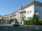
|
| Moral line
( Location ) |
100 | Sion , Swiss city | 25 Sep 2000 | The private road is located in the “Swiss Quarter”, south of Lausanner Straße. |

|
| Soester Strasse
( Location ) |
400 | Soest , district town in North Rhine-Westphalia | Aug 8, 1935 | It was laid out as Schmidtstrasse before 1893 and renamed in 1935. It runs between Lindenstrasse and Feldstrasse. At the intersection with Müllerstraße it is slightly angled. |

|
|
Söhtstrasse
( Location ) |
330 | Alfred Söht (1859–1897), landscape gardener and local politician in Lichterfelde | June 23, 1902 | It was set up as Street 50 of the development plan. The Söhtstraße goes northwest from the Wüllenweberweg makes a bend to the southwest and flows into the Ringstraße. |

|
| Sondershauser Strasse
( Location ) |
520 (in the district) |
Sondershausen , district town in Thuringia | Aug 20, 1917 | On November 12, 1925, the Green Way between Straße 24a and Marienfelder Straße was incorporated into Sondershauser Straße and on August 9, 1929, the extension to Landweg (the later Lichterfelder Ring). The northern part of the street runs in Lankwitz . |

|
| Sonneberger way
( Location ) |
320 | Sonneberg , district town in Thuringia | Jul 20, 1960 | The path was laid out as Ahornstrasse before 1893 . The part of the Sonneberger Weg between Geraer Strasse and Hildburghauser Strasse was renamed Geraer Strasse as an extension on May 1, 1963. |

|
| Sophienstrasse
( Location ) |
160 | Sophie , female first name | before 1893 | It is located between Kyllmannstrasse and Tietzenweg. |

|
| Sophie-Taeuber-Arp-Weg
( Location ) |
260 | Sophie Taeuber-Arp (1889–1943), Swiss painter, sculptor and dancer | 25 Sep 2000 | The private road is in the “Swiss Quarter” between Lausanner and Altdorfer Strasse. |
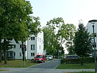
|
| Spindelmühler way
( Location ) |
420 | Spindle mill , holiday resort in the Czech Republic | July 13, 1934 | In 1905 Schenkendorfstrasse and in 1900 Körnerstrasse were laid out in the street and renamed together in 1934. |
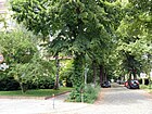
|
| Stadtilmer way
( Location ) |
120 (in the district) |
Stadtilm , city in Thuringia | Apr 14, 1936 | The eastern part of the street runs in Marienfelde , in the district there are plots 1–9 (odd) and 4–14 (even). In Steglitz the street, previously street 212 in the development plan, was named on April 14, 1936. In 1965, the streets 441 and 149 in Tempelhof were also given the name Stadtilmer Weg. |
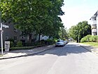
|
| Punch line
( Location ) |
780 | Stanz bei Landeck , a place in Tyrol | May 14, 1930 | The traffic route was set up in the parts of street 62, street 64 and street 64a of the development plan. The row is a quiet residential street, which is predominantly built on with spacious single-family houses. |

|
|
Steinäckerstrasse
( Location ) |
390 | Eduard von Steinaecker (1818–1896), Prussian general | before 1893 | It is located between Pestalozziplatz and Kommandantenstrasse. |

|
| Stone healing path
( Location ) |
190 | Carl August von Steinheil (1801–1870), physicist and entrepreneur | Aug 9, 1929 | The path was laid out as road 70 of the development plan. It lies between Hildburghauser Straße (plot 1) and initially runs southwards. After about 70 meters the Rühmkorffstraße branches off to the southeast, the Steinheilpfad continues westwards from here and joins the Glauberstraße (plot 17). |
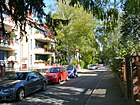
|
| Steinmetzstrasse
( Location ) |
490 | Karl Friedrich von Steinmetz (1796–1877), Prussian field marshal | before 1893 | It lies between Boninstrasse and Fürstenstrasse. |

|
| Stephaniweg
( Location ) |
110 | Karl Friedrich Stephani (1812–1894), pastor in Giesensdorf and Steglitz | Nov 4, 1935 | The Stephaniweg was an unnamed private path between Brauerstraße and Haselfelder Weg until 1935 . |

|
| Stockweg
( Location ) |
140 | Julius August Stock (1863–1924), pastor in Lichterfelde | Jan. 23, 1931 | The Neue Dorfstrasse had already been laid out here before 1893 . |

|
|
Störstrasse
( Location ) |
430 | Sturgeon , tributary of the Elbe in Schleswig-Holstein | Jan. 29, 1937 | It was set up as street 161 of the development plan. It runs in a gentle curve between Darser Strasse and Persantestrasse. To the south-west of Persantestrasse, an impasse, designated as a play street, leads to a park-like garage complex. |

|
| Stubenrauchstrasse
( Location ) |
230 | Ernst von Stubenrauch (1853–1909), District Administrator of the Teltow District | before 1893 | The quiet residential street is built on with city villas and is located between Drakestrasse and Augustastrasse. |

|
|
Teltower Dam
( Location ) |
180 (in the district) |
Teltow , town in Brandenburg, in the direction of which the street runs | July 13, 1934 | The previous names or sections were Teltower Straße (before 1878– before 1912), Teltower Chaussee (around 1912–1934) and Hauptstraße (before 1878–1934). In 1892 there was a Soolbad and a community bathing establishment on the Chaussee , as can be seen on the map from 1892 (see above right). And north of the village center there was the convalescent house of the Order of St. John .
The Teltower Chaussee and the section of the main street between the Zehlendorf train station and Berliner Straße were renamed Teltower Damm in 1934. In 1991 the part of the street Am Gutshof in Schönow located on Teltower Damm was also named Teltower Damm. Most of the street runs in Zehlendorf . Only properties 279–283 (odd) south of Beeskowdamm belong to Lichterfelde. |

|
| Teltowkanalstrasse
( Location ) |
50 (in the district) |
Teltow Canal | before 1913 | First street 65a of the development plan, the street runs parallel to the nearby Teltow Canal. Most of the street is in Lankwitz , the district includes plots 16 and 17. |
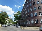
|
| Theklastrasse
( Location ) |
430 | Thekla , female name | before 1893 | It is located between Altdorfer Straße and Finckensteinallee. |

|
| Thuner Platz
( Location ) |
70 × 70 semicircular |
Thun , city in Switzerland | Oct 3, 1908 | Initially set up as space H in the development plan, it is bounded to the south by Luzerner Straße and Thuner Straße joins from the north and the Appenzell from the south. The J. S. Bach Church is in the northeast of the square . |

|
| Thuner Strasse
( Location ) |
300 | Thun , city in Switzerland | Oct 3, 1908 | First street 23 of the development plan, it is located between Lausanner Straße and Thuner Platz. |

|
| Tietzenweg
( Location ) |
1610 | Richard Tietzen (1858–1935), architect | Oct 10, 1936 | It lies between Unter den Eichen and Hindenburgdamm. Before 1893-1936 it was called Dahlemer Straße and at the beginning of the 20th century it reached from the Lichterfelder Dorfaue in the south to Dahlem-Dorf in the north and was the directional road to Dahlem . In 1903 the "Commission for the division of the Dahlem domain" began to expand the road to the Dahlem area. In 1905 it was renamed Fabeckstraße in the Dahlem area, the Lichterfeld part was only given this name in 1924. The section between the street Unter den Eichen and the village green Lichterfelde existed until 1936 as Dahlemer Straße and was then named Tietzenweg. |

|
| Tollensestrasse
( Location ) |
620 | Tollense , tributary of the Peene in Mecklenburg-Western Pomerania | Jan. 29, 1937 | First street 165 of the development plan, it is between Alsterweg and Darser Straße. |
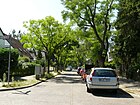
|
| Troppauer Strasse
( Location ) |
450 | Opava , city in the Czech Republic | July 13, 1934 | After 1910 it was laid out as Reuterstraße . |

|
| Tulip Street
( Location ) |
720 | Tulips , genus of plants | Oct 6, 1908 | Initially set up as street 9 of the development plan, it is located in the "flower district". |
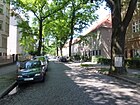
|
| Tuxer Steig
( Location ) |
150 | Tux , place in Tyrol | May 17, 1930 | Initially set up as street 60a of the development plan, the path is located in the "Swiss Quarter" between Sarntaler and Achenseeweg. |

|
|
Undine Street
( Location ) |
730 | Undine , opera by Albert Lortzing | June 9, 1933 | Laid out in 1908 as Lortzingstrasse , it was merged with Schumannstrasse in 1933 and renamed. In 1959 the section of the former Schumannstrasse was abolished, as the Steglitz Clinic of the Free University was built on this site . |

|
|
Under the oaks
( Location ) |
2360 | Oak trees with which the street was planted on both sides | Jan. 6, 1911 | From 1792 to 1911 the street was the connecting route Potsdamer Chaussee . The north side of the street west of Habelschwerdter Allee belongs to Dahlem , the district includes plots 1–63, 84e – 96 (continuous) and 97–135 (retrograde). The Botanical Garden and the Federal Institute for Materials Testing are located on the street . It is a busy one-way and arterial road on which Bundesstraße 1 runs, with a wide median and mainly two lanes in each direction, some with closed residential blocks. |
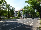
|
|
Violet Road
( Location ) |
120 | Violets , genus of plants | Oct 6, 1908 | Before that, it was the extension of Margaretenstrasse between Dahlemer Strasse and Strasse 10 . It is between Tietzenstrasse and Tulpenstrasse / Hortensienstrasse. |

|
| Extended Georgenstrasse
( Location ) |
150 | western extension of the Georgenstrasse named after the first name Georg | before 1937 | Initially set up as street 76 of the development plan, it is located between Hildburghauser and Pößnecker Straße, a footpath leads to Georgenstraße. |

|
| Viktoriaplatz
( Location ) |
60 circular |
Victoria of Great Britain and Ireland (1840–1901), Queen of Prussia and German Empress | before 1893 | The square served as a weekly market at the turn of the century. It is divided by Gardeschützenweg, Kylmannstraße is interrupted and Viktoriastraße flows from the southeast. |

|
| Viktoriastrasse
( Location ) |
440 | Victoria of Great Britain and Ireland (1840–1901), Queen of Prussia and German Empress | before 1893 | It lies between Viktoriaplatz and Augustaplatz. |
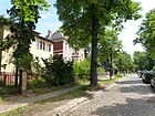
|
|
Waadter line
( Location ) |
120 | Vaud , Swiss canton | 25 Sep 2000 | The private road is located in the Swiss Quarter between Lausanner Strasse and Goerzallee. |

|
| Wallendorfer way
( Location ) |
200 | Wallendorf , part of the town of Neuhaus am Rennweg in Thuringia | July 13, 1934 | Initially set up as road 210 of the development plan, the path is between Pößnecker and Extended Georgenstrasse. |

|
| Walter-Linse-Strasse
( Location ) |
270 | Walter Linse (1903–1953), lawyer and victim of Stalinism , lived on this street and was kidnapped from here to the GDR | June 10, 1961 | The previous names were Reichenheimstrasse (before 1893– before 1901) and Rechtsstrasse (before 1901–1961). It connects Drakestrasse with the Ringstrasse and has a southern branch. |

|
| Waltroper Platz
( Location ) |
130 × 30 | Waltrop , city in North Rhine-Westphalia | Apr 10, 1931 | At first, the square was just a square-shaped extension of the Waltroper Weg street. |

|
| Waltrop way
( Location ) |
200 | Waltrop , city in North Rhine-Westphalia | Apr 10, 1931 | Before that, it was a dividing street on the property of Weber's heirs. It lies between Berliner Strasse and Schwatlostrasse. |

|
| Weddigenweg
( Location ) |
1250 | Otto Weddigen (1882–1915), lieutenant captain and submarine commander in the First World War | May 26, 1915 | Already laid out as Bellevuestrasse before 1893 , it was renamed in 1915. |

|
| Hawthorn Trail
( Location ) |
160 | Hawthorn , genus of plants | December 31, 1924 | The street is located on the settlement area of the "Groß-Berliner Heimstätten- ,kaufs- und Baugenossenschaft". |

|
| Weißwasserweg
( Location ) |
500 | Weißwasser , source river of the Elbe in the Czech Republic | Apr 1, 1969 | Pestalozzistraße was laid out here in 1905 and Helmholtzstraße before 1925 , which were then merged and renamed in 1969. For 1906, the Berlin address book shows three parcels of completed buildings for Pestalozzistraße (one side of the street between the Ringstraße and the Zehlendorf district ), construction sites are on the other side of the street. |
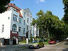
|
| Westfalenring
( Location ) |
670 | Westphalia , former Prussian province | Jul 1, 1964 | First the ring was set up as road 521 of the development plan. It forms a semicircular street, which branches off to the south from Holtheimer Weg, at its turning point the Gronauer Weg branches off. |

|
| Wiedenbrücker Weg
( Location ) |
200 | Wiedenbrück , district of Rheda-Wiedenbrück in North Rhine-Westphalia | Jan. 23, 1931 | It is located in the "Westphalian Quarter" between Schwatlostrasse and Lindenstrasse. |

|
| Wienroder path
( Location ) |
190 | Wienrode , district of Blankenburg in Saxony-Anhalt | May 17, 1930 | Initially set up as street 5 of the development plan, it is located between Hasselfelder Weg and Am Pfuhl. |
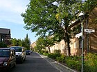
|
| Meadow path
( Location ) |
220 | after the "Birkbuschwiesen" to which the path led | around 1900 | The road land and the eastern side of the road belong to Lankwitz , the district includes plots 1–6a. |
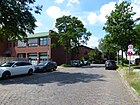
|
| Willdenowstrasse
( Location ) |
620 | Carl Ludwig Willdenow (1765–1812), botanist | before 1910 | It runs on the west side of the Botanical Garden between Altensteinstrasse and Unter den Eichen . |

|
| William-H.-Tunner-Strasse
( Location ) |
500 | William H. Tunner (1906–1983), American Lieutenant General | June 1, 2000 | It was created on the site of the former McNair barracks. |

|
| Wismarer Strasse
( Location ) |
660 | Wismar , port city in Mecklenburg-Western Pomerania | Oct 5, 1908 | It was created by merging road 24 with parts of road 80 in the development plan. The extension of Wismarer Strasse was included on August 18, 1926. It is a wide residential street with allotment gardens (KGA "Neues Leben", "Giesendorf" and "Eugen-Kleine-Brücke"). A memorial on the Eugen-Kleine-Brücke over the Teltow Canal commemorates the former Lichterfelde satellite camp . It is crossed by the Teltower Dörferweg (marker 15) and the Teltowkanalweg (marker 17). Historical photos are available on the Internet. |

|
| Wolfensteindamm
( Location ) |
200 (in the district) |
Moses Wolfenstein (1838–1907), merchant | March 15, 1966 | The Wolfensteindamm was created as a new road in connection with the construction of the west bypass . The entire eastern section runs in Steglitz . The width of the street from the boundary (the Bäkelauf in a line between Bäkepark and Am Bäkequell) belongs to the district, the district boundary is here on the northern edge of the road. |
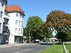
|
| Woltmannweg
( Location ) |
220 | Reinhard Woltman (1757–1837), hydraulic engineer | Apr 4, 1934 | Initially set up as street 13 of the development plan, it is located between Hildburghauser and Osdorfer Straße. |
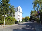
|
| Wormbacher way
( Location ) |
250 | Wormbach , part of the town of Schmallenberg in North Rhine-Westphalia | Apr 10, 1931 | The way was first the road 41c of the development plan. It is located in the "Westfalenviertel" between Schöppinger Straße and Holtheimer Weg. |

|
|
Wüllenweberweg
( Location ) |
170 | Walther Wüllenweber (1860–1941), school director and community representative in Lichterfelde (member of the poor commission) | March 23, 1925 | At first the traffic route was the street 9 of the development plan. It connects the Ringstrasse (southwest) with the Tietzenweg (east). |

|
| Wupperstrasse
( Location ) |
550 (partially) |
Wupper , tributary of the Rhine in North Rhine-Westphalia | Oct 24, 1922 | Initially set up as street 11 of the development plan, part of the western side of the street is in Zehlendorf , the district includes plots 1–9 and 17 (odd) and 2–14 (even). The southern part of the road (in the background) has been abandoned. The road originally led over the Teltow Canal to Teltow and was continued there under the same name. For the Fritz Schweitzer Bridge that used to stand here, see also the list of bridges over the Teltow Canal . |

|
|
Zeisigweg
( Location ) |
340 | Siskin , genus of songbirds | December 31, 1924 | First street 24 of the development plan, Zeisigweg is located in the settlement of the former "non-profit building association Kriegerheim". |

|
| Zerbster Street
( Location ) |
800 (without east side) |
Zerbst / Anhalt , city in Saxony-Anhalt | Jan. 18, 1936 | Laid out as Hermannstrasse before 1901 , it is located between Kiesstrasse and Hildburghauser Strasse. The east side of the street belongs to Lankwitz , in the district there are plots 4-72 (straight) and the street across its entire width. |
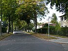
|
| Zimmerstrasse
( Location ) |
210 | Julius Assmann's carpentry shop, which was located here | Sep 15 1879 | It goes south from Schwatlostraße as a spur road . |

|
| Zurich Street
( Location ) |
370 | Zurich , city in Switzerland | Oct 3, 1908 | Established as Straße 18 , the extension was included on January 29, 1937. It is located in the “Swiss Quarter” between Aarauer and Basler Strasse. |

|
Former streets (selection)
The streets contained in this list are reciprocally linked to the currently valid ones.
The streets named according to their direction to neighboring towns and unambiguous names such as Bahnstrasse, Parkstrasse, Gartenstrasse, Hauptstrasse, Mittelstrasse or Querstrasse, which are self-explanatory, are not included here. Exceptions to these restrictions have been made if there is a specific reference to the name or if something worth reporting was found in the former streets.
| Previous street name, view if applicable |
Origin of name | from | to | renamed to | Remarks |
|---|---|---|---|---|---|
| Albrechtstrasse | Friedrich Ludwig Leopold von Albrecht (1797–1873), District Administrator of the Teltow District (1822–1851), to which Groß-Lichterfelde belonged | before 1893 | July 20, 1960 | → Memlingstrasse | Albrechtstrasse branched off from Dürerstrasse and led to Augustaplatz. Before the renaming, there were eight Albrechtstrasse in Greater Berlin. |
| Hitchhiker's Place | Anhalt , historical area; the place name refers to the adjacent train station | before 1893 | around July 1905 | → Kranoldplatz | The station of the Berlin-Anhalter Bahn in Groß-Lichterfelde was called “Anhalter Bahnhof” . |
| Annastrasse | Anna , female name | before 1893 | 1934 | in the → Hartmannstraße included | A first section of this street was named Eduard-von-Hartmann-Straße in 1909. The remainder were included in the street that was now reduced to the surname in 1934. |
| Arndtstrasse | Ernst Moritz Arndt (1769–1860), poet and politician | Jan. 13, 1905 | July 13, 1934 | → Freiwaldauer Weg | The traffic route was laid out as road 86 according to the development plan . |
| Bastianstrasse | Adolf Bastian (1826–1905), ethnologist | 1907 | Nov 3, 1950 | → Chamomile Road | Until the administrative reform in 1938, Bastianstrasse belonged to Dahlem. |
| Bellevuestrasse | 'Bellevue', French for "beautiful view" | before 1893 | May 26, 1915 | → Weddigenweg | It ran between Drakestrasse and Ringstrasse. A specific reference to a lookout point or a castle-like facility has not been handed down. |
Bismarckstrasse
|
Otto von Bismarck | 1871 |
1879 1961 |
divided into → Feldstrasse and → Morgensternstrasse |
It ran between Wilhelmstrasse and Berliner Strasse / Bogenstrasse. Post office I with a “public telephone station” was located at Bismarckstrasse 3, lots 11–16 belonged to the Koch & Rohlfs tree nursery .
In the Berlin address book from around 1900, a Bismarck monument is mentioned as a sight in Groß-Lichterfelde. The colored picture postcard from 1910 shows the corner of Berliner Straße No. 149/150 and Bismarckstraße with a Wilhelminian-style house. |
| Dorotheenstrasse | Dorothea, Electress of Brandenburg (1636–1689) | before 1893 | April 27, 1899 | → Moltkestrasse | |
| Esmarchstrasse | Johann Friedrich August von Esmarch (1823–1908), physician | before 1925 | July 13, 1937 | → Jägerndorfer line | |
| Fontanestrasse | Theodor Fontane (1819–1898), writer | before 1896 | Nov 10, 1971 | → Adolf-Martens-Strasse | |
| Court Street | District Court of Lichterfelde | around 1901 | June 10, 1961 | → Walter-Linse-Strasse | |
| Goebenstrasse | August Karl von Goeben (1816–1880), Prussian general and military writer | before 1893 | July 13, 1934 | → Patschkauer Weg | |
| Hedwigstrasse | Hedwig , female name | before 1901 | 1927 | Renamed together with Richardstrasse in → Prausestrasse | According to research by the Luisenstädtischer Verein , St. Hedwig could also be the eponym . The traffic route was laid out as road 10 according to the development plan. |
| Helmholtzstrasse | Hermann Ludwig Ferdinand von Helmholtz (1821–1894), natural scientist | before 1925 | April 1st 1969 | Renamed together with Pestalozzistraße in → Weißwasserweg | |
| Herrmannstrasse | Herrmann , male first name | before 1901 | Jan. 18, 1936 | → Zerbster Street | |
| Hobrechtstrasse | Arthur Hobrecht (1824–1912), lawyer and politician, brother of city planner James Hobrecht | 1895 | March 20, 1929 | → Devrientweg | |
| Humboldtstrasse | Wilhelm von Humboldt (1767–1835), scientist and politician | before 1925 | July 13, 1934 | → Graefenberger Weg | As a result of the incorporation of surrounding towns, there were eight streets of the same name in Berlin; this Humboldtstrasse first belonged to Zehlendorf . |
| Karlstrasse (Carlstrasse) | Karl , male first name | before 1878 | before 1935 | → Baseler Strasse | The southern section was renamed in 1908. |
| Katharinenstrasse | Katharina , female name | before 1901 | July 13, 1934 | → Pößnecker Strasse | |
| Körnerstrasse | Theodor Körner (1791–1813), writer | 1900 | 1933 | Renamed together with Schenkendorfstrasse in → Spindelmühler Weg | |
| Leibstandartenweg | Leibstandarte SS Adolf Hitler (LSSAH) | 1937 | 1947 | → Ortlerweg | The road past the Lichterfelde retirement home was laid out after 1935. LSSAH barracks was the former cadet institute not far away . |
| Lorenzstrasse | Lorenz, male first name | before 1879 | Aug 15, 1879 | Sub-section outsourced as → Grabenstrasse | The greater part of this street was preserved by name. The researchers of the Luisenstädtischer Verein speculate that a close relative of the locator Carstenn could be the namesake . |
| Lortzingstrasse | Albert Lortzing | 1908 | 1933 | Renamed together with Schumannstrasse in → Undinestrasse | |
| Lutherstrasse | Martin Luther (1483–1546), reformer | before 1893 | 1960 | → Altenauer Weg | |
| Pestalozzistrasse | Johann Heinrich Pestalozzi (1746–1827), Swiss educator and social reformer | 1905 | 1969 | Renamed together with Helmholtzstraße in → Weißwasserweg | |
| Rankestrasse | Leopold von Ranke (1795–1886), historian | around 1900 | July 31, 1934 | in the → Curtius road included | Rankestrasse was laid out as an extension of Curtiusstrasse, which existed at the end of the 19th century, and was incorporated into it in 1934. |
| Reichenheimstrasse | Leonor Reichenheim (1814–1868), entrepreneur, politician, a. a. also city council in Berlin (1867) | before 1893 | before 1901 | → Richtstrasse | |
| Reuterstrasse | Fritz Reuter (1810–1874), writer | 1910 | July 13, 1934 | → Troppauer Strasse | |
| Richardstrasse | Richard , male first name | before 1905 | 1927 | Renamed together with Hedwigstrasse in → Prausestrasse | It was laid out at the end of the 19th century as street 10 of the development plan. |
| Richard-Wagner-Platz | Richard Wagner (1813–1883), composer | before 1909 | 1930 | → Klingsorplatz | With the redesign of the Berlin administrative districts, street and square names that occurred several times in Greater Berlin due to the merger were reduced. |
| Richard-Wagner-Strasse | Richard Wagner (1813–1883), composer | before 1909 | 1930 | → Klingsorstrasse | With the redesign of the Berlin administrative districts, street and square names that occurred several times in Greater Berlin due to the merger were reduced. |
| Schenkendorfstrasse | Max von Schenkendorf (1783–1817), writer | Jan. 13, 1905 | July 13, 1933 | Renamed together with the Körnerstraße in → Spindelmühler Weg | Before it was named in 1905, the traffic route was laid out as Road 7 in accordance with the development plan . |
| Schmidtstrasse | Erich Schmidt (1868–1936), local politician (before 1893 to 1921) | before 1893 | Aug 8, 1935 | → Soester Strasse | The name Schmidtstraße was given during the lifetime of the community leader. |
| Schumannstrasse | Robert Schumann (1810-1856), composer | July 24, 1908 | June 9, 1933 | Renamed together with Lortzingstraße in → Undinestraße | |
| Schützenstrasse | Guardsmen who were stationed in Lichterfelde and used this route between their barracks and the training grounds | before 1893 | 1914 | → Gélieustraße | The longer section of Schützenstrasse was in Steglitz, which kept its name there. |
| Sternstrasse | Julius Stern (1820–1883), music teacher and founder of the Stern Conservatory | before 1893 | May 3, 1935 | → Cadet path | The name was changed during the Nazi era for ideological reasons, as Stern was a Jew . |
| Elm Square | Elms | before 1893 | Feb. 27, 1936 | → Hochbergplatz | |
| Wilhelmplatz | Wilhelm I. | after 1871 | 1939 | → Oberhofer Platz | The name was given as a result of Wilhelm I's coronation as German Emperor in 1871. A major reason for the later renaming was the large number of places with the same name in Greater Berlin , which were available through the incorporation in 1920 (a total of 10). |
| Wilhelmstrasse | Wilhelm I. | after 1871 | Dec. 1, 1964 | → Koenigsberger Strasse | The name was given as a result of Wilhelm I's coronation as German Emperor in 1871. A major reason for the later renaming was the large number of streets with the same name in Greater Berlin , which were available through the incorporation in 1920 (24 in total). - The coronation ceremony took place in Königsberg . |
| Zietenstrasse | Hans Joachim von Zieten (Ziethen) (1699–1786), a successful Prussian officer at the time | Sep 12 1895 | July 13, 1934 | → Reichensteiner Weg |
Other locations of Lichterfelde
Allotment gardens
The garden colonies - officially allotment gardens (KGA) - in Lichterfelde are partly within the residential development, also bordering on industrial areas and several areas along the two railway lines are added. The population was particularly threatened before the fall of the Berlin Wall . There are several railway farms (ELW) in the area of Lichterfeld near the railway lines.
| Surname | location | Size in m² | Number of parcels | property | founding | Remarks |
|---|---|---|---|---|---|---|
| KGA evening rest | Elmshorner Strasse 35-51
( Location ) |
171,145 | 499 | private / national | 1919 | |
| KGA Am Aegirbad | Drei Zinnen Weg 15f
( Location ) |
21,349 | 38 | Private | 1920/1921 | |
| KGA at the branch canal | At branch channel 32
( Location ) |
50.110 | 167 | private / national | 1967 | |
| KGA Am Wäldchen | Osdorfer Strasse 71-79
( Location ) |
45.003 | 134 | national | 1946 | |
| KGA At the toboggan run | Lichterfelder Ring 239-253
( Location ) |
39,451 | 115 | national | 1958 | |
| ELW UB Lichterfelde West | Botanical Garden Group
( Location ) |
1,099 | train | |||
| ELW UB Lichterfelde Ost | Celsiusstrasse group
( Location ) |
4,091 | train | |||
| KGA Erbkaveln (weed) | Ostpreußendamm 95b
( Location ) |
23,799 | 70 | national | 1959 | |
| KGA Eugen-Kleine-Brücke | Wismarer Strasse 3–17
( Location ) |
29,264 | 66 | private / national | 1949 | |
| ELW UB Lichterfelde Ost | Fürstenstrasse group
( Location ) |
7,305 | train | |||
| Giesensdorf garden settlement | Wismarer Strasse / Ostpreußendamm
( Location ) |
87,787 | Private | |||
| KGA Heinrichstrasse | Heinrichstrasse 8/9
( Location ) |
28,485 | 85 | national | 1911 | |
| ELW UB Lichterfelde Ost | Hildburghauser Strasse group
( Location ) |
6.106 | train | |||
| ELW UB Lichterfelde Ost | Jungfernstieg group (central tower)
( Location ) |
5,865 | train | |||
| ELW UB Lichterfelde West | Group Neuchateller Strasse
( Location ) |
5,436 | train | |||
| KGA New Life | Wismarer Straße 19 / Prettauer path
( Location ) |
30,075 | 82 | national | 1947 | |
| KGA Osdorf | Lichterfelder Ring 255–267
( Location ) |
24,805 | 86 | national | 1977 | |
| ELW UB Lichterfelde Ost | Osdorfer Strasse group
( Location ) |
4,867 | train | |||
| ELW UB Lichterfelde Ost | Ostpreußendamm group
( Location ) |
73,780 | train | |||
| KGA Parkkolonie Süd | Goerzallee 146
( Location ) |
14,665 | 34 | Private | 1932 | |
| KGA Parkkolonie Nord | Goerzallee 146
( Location ) |
53.505 | 115 | Private | 1932 | |
| KGA Pfarracker | Brauerstraße 24–27 and Wienroder path
( Location ) |
24,946 | 91 | private / national | 1934 | |
| ELW UB Lichterfelde West | Resedenstrasse group
( Location ) |
4,861 | train | |||
| KGA Rütli | Elmshorner Strasse 53-59
( Location ) |
42,230 | 93 | national | 1930 | |
| KGA Swiss country | Schottmüllerstrasse 123 / Osteweg
( Location ) |
99,963 | 288 | national | 1928 | |
| KGA Sunshine | Schottmüllerstrasse 47-53
( Location ) |
72,081 | 299 | national | 1919 | |
| KGA Steglitzer Hafen | Krahmerstrasse
( Location ) |
6,196 | Private | |||
| KGA Südpark | Scheelestrasse 45d (A – B)
( Location ) |
35,656 | 102 | private / national | 1923 (1934) | |
| (KGA) Südpark - At the sheep farm | At the sheep farm 9
( Location ) |
4,107 | 10 | national | ||
| KGA Teltower Seeboden | At the branch canal 13–15
( Location ) |
29,580 | 81 | Private | 1918/1920 | |
| KGA future | Bremer Strasse 4f
( Location ) |
54,404 | 158 | national | 1918 |
Parks and green spaces
- Botanical garden ( location )
- Schlosspark Lichterfelde (partly NSG) ( location )
- Eduard-Spranger-Promenade ( Lage ), Park on the Teltow Canal, colloquially (analogous to the park dedicated to the Steglitz district) also Bäkepark
- Lilienthalpark with carp pond (Königsgraben) ( location )
- Parkfriedhof Lichterfelde ( location )
- Lichterfelde cemetery ( location )
- Campus Benjamin Franklin ( location )
- Johann-Baptist-Gradl-Grünzug ( location )
- Parks Range (former military training area) ( location ), open space with so far [obsolete] unexplained use
Other locations
-
Wannseebahn
- Lichterfelde West S-Bahn station ( Lage ), laid out in the 1870s to develop the Lichterfelde-West villa colony.
- Botanischer Garten S-Bahn station ( location )
- Güterbahnhof Lichterfelde ( location )
- Hitchhiker's train
- Teltow Canal with the Teltow Canal Path on the north-western bank is marked as a hiking trail with 17 and in the western part of the Teltower Dörferweg marked with 15
- Zehlendorfer branch canal ( location )
- Lichterfelde port ( location )
- Lichterfelde power plant ( location )
- Commercial area between Goerzallee and Teltow Canal ( location )
- Sewage treatment plant ( location )
See also
literature
- Walter Kaupert (Ed.): Kaupert's street guide through Berlin 2010 . Kaupert Media, Berlin 2009, ISBN 3-941108-01-8 .
Web links
- Street directory Lichterfelde. kaupert media gmbh, accessed on December 12, 2011 .
- Office for Statistics Berlin-Brandenburg: List of streets and places in the Steglitz-Zehlendorf district (as of February 2015); pdf
- Map of Berlin 1: 5000 with district boundaries. Senate Department for Urban Development Berlin, 2009, accessed on June 30, 2012 .
Individual evidence
- ↑ statistik-berlin-brandenburg.de: Strassenumbenennungen.pdf
- ↑ berliner-stadtplan.com: Achenseeweg
- ↑ The Police President in Berlin : 4 - Section 45 ( page no longer available , search in web archives ) Info: The link was automatically marked as defective. Please check the link according to the instructions and then remove this notice. on Berlin.de, accessed on August 23, 2012.
- ↑ Bakery tradition in Lichterfelde - House at Bäkestrasse 8 ( page no longer available , search in web archives ) Info: The link was automatically marked as defective. Please check the link according to the instructions and then remove this notice. in: Heimatverein Steglitz, Steglitzer Heimat 2/2005 (PDF, pp. 13–19)
- ↑ City map from 1907 on www.blocksignal.de
- ↑ Kauperts: Barnackufer
- ↑ Barnackufer Berlin-Lichterfelde
- ↑ Baseler Strasse . In: Berliner Adreßbuch , 1935, IV, p. 1534.
- ↑ About Booth
- ↑ Embassy of Ethiopia: Website of the Ethiopian Embassy (English) accessed on September 1, 2012.
- ↑ Steglitz Local History Museum
- ↑ Feldstrasse on www.lichterfelde-süd.de (historical photographs)
- ↑ Sebastian Höhn: A bath for 13 million. In: Berliner Zeitung from 23./24. August 2014, page 18.
- ^ Catholic Church in the Cadet Institute, 1905
- ^ According to kauperts.de A reference from the Gélieu family to an entry in the diary of General Bernhard de Gélieu's widow on July 4, 1914 says: “The riflemen celebrated their anniversary. In honor of my blessed husband, a street in Lichterfelde was named Gélieu Street. Everything went very harmoniously, despite the rain. The emperor was very gracious. ”Ms. von Gélieu refers to the centenary of the Guards Rifle Battalion, garrisoned in Lichterfelde, which was founded in Neuchâtel on May 19, 1814 and, as the jubilee newspaper shows, celebrated this event from May 26th to 28th, 1914.
- ↑ BA for work: Steglitz-Zehlendorf office ( Memento of the original dated May 13, 2012 in the Internet Archive ) Info: The archive link was inserted automatically and has not yet been checked. Please check the original and archive link according to the instructions and then remove this notice. , accessed on August 23, 2012.
- ^ Gross-Lichterfelde> Hans Sachsstrasse . In: Address book for Berlin and its suburbs , 1901, V, p. 120.
- ↑ Berlin Brigade RTO - DUTY TRAIN ( page no longer available , search in web archives ) Info: The link was automatically marked as defective. Please check the link according to the instructions and then remove this notice.
- ↑ BA Steglitz-Zehlendorf Monument of the Month July 2012 ( Memento of the original from April 2, 2015 in the Internet Archive ) Info: The archive link was inserted automatically and has not yet been checked. Please check the original and archive link according to the instructions and then remove this notice. , accessed November 25, 2012.
- ↑ 2 photos of the Hindenburgdamm with tram see Tram Forum , 6th and 7th picture from above
- ↑ There are several streets with the same name similar to the railway embankment in Berlin
- ↑ berliner-stadtplan.com: Holbeinstrasse Lichterfelde
- ↑ Jungfernstieg . In: Address book for Berlin and its suburbs , 1901, V, p. 119.
- ^ About the person Kornmesser
- ↑ Long Street . In: Berliner Adreßbuch , 1923 (Lange Strasse: so named after its long extension).
- ↑ Long Street . In: Berliner Adreßbuch , 1923, IV. Part, p. 1467. “← Kriegerheim settlement →, 1, 1a: settlement house, ← Grabenstrasse →, 2–4: settlement houses, ← Heinersdorfer Strasse →, ← Mariendorfer Strasse →, 5/6 : Retirement home (Berl. Logenheim UOBBEB), ← Verl. Wilhelmstrasse →, construction sites, ← Ahornstrasse →, ← Kiesstrasse →, construction sites, ← Lorenzstrasse →, 8/9: churchyard / ← district Lankwitz → / 10: go to Luisenstrasse 20, ← Luisenstrasse →, 10a: construction site, 11: single-family house, 12: Nursery, ← Lorenzstrasse →, 13, 14. Construction sites, ← Ferdinandstrasse →, ← Kiesstrasse →, 15: Construction site, ← Verl. Wilhelmstraße →, 16,17: construction sites, ← Auguststraße →, 18: go z. Auguststrasse 14, 19: construction site, 20, 21: settlement house, ← Grabenstrasse →, construction site, 22, 23: settlement houses, ← settlement Kriegerheim → “(In the 1925 address book the same information is available between Schöffenstrasse and the Lankwitz district).
- ^ Kauperts: Ludwig-Beck-Platz
- ↑ Residential complex Gemeinnützige AG for employee homes
- ^ Kauperts: Marienplatz
- ↑ Diakoniewerk Bethel: Hospital Bethel Berlin ( Memento of the original from November 14, 2012 in the Internet Archive ) Info: The archive link was inserted automatically and has not yet been checked. Please check the original and archive link according to the instructions and then remove this notice. , accessed September 1, 2012.
- ↑ On the person Morgenstern
- ↑ a b Müllerstraße on www.lichterfelde-süd.de (17 historical photographs)
- ^ Kauperts: Neuchateller Strasse
- ^ Berlin address book 1893> Groß-Lichterfelde> Osdorf-Teltower Weg
- ↑ Ostpreußendamm on www.lichterfelde-süd.de (historical photographs)
- ^ Kaupert: Réaumurstrasse
- ↑ Groß-Lichterfelde> Ritterstrasse . In: Address book for Berlin and its suburbs , 1901, V, p. 129 (Ritterstraße is already available in the address book of 1901 and is completely built on. It must therefore have been laid out in the previous years.).
- ↑ Schöffenstrasse . In: Berliner Adreßbuch , 1925, part IV., P. 1572. “← Lange Strasse →, 1: bookseller, ← Zeisigweg →, 2: gas inspector., ← am Pfarracker →, 3: cartographer, 4: writer, ← Zeisigweg → , 5: Prov.Ob. School secretary with two tenants, 6: Ob.Sekr. (Owner), factory owner, ← Meisenweg → “.
- ^ Schöffenstraße FIS-Broker (map of Berlin 1: 5000 (K5 color edition)) of the Senate Department for Urban Development and Environment Berlin
- ^ Kauperts: Seehofstrasse
- ^ Kauperts: Sondershauser Strasse
- ↑ berliner-stadtplan.com: Stanzer-Linie Lichterfelde
- ↑ Berlin history: Dahlemer Strasse
- ↑ Pestalozzistraße . In: Berliner Adreßbuch , 1906, V, p. 203.
- ↑ berliner-stadtplan.com: Wismarer-Straße Lichterfelde
- ↑ Senate Department for Urban Development: 20 main green paths
- ↑ Wismarer Straße on www.lichterfelde-süd.de (historical photographs)
- ↑ On the person of Moses Wolfenstein
- ↑ Map of Berlin 1: 5000 with district boundaries. Senate Department for Urban Development Berlin, 2009, accessed on June 30, 2012 . Map of Berlin 1: 5000
- ^ Berlin address book 1905: Commission for the poor in Groß-Lichterfelde
- ↑ a b c Groß-Lichterfelde . In: Berliner Adreßbuch , 1893, V, pp. Ff (Part II, list of houses with details of owners and tenants).
- ↑ Community overview> Sights . In: Berliner Adreßbuch , 1910, V, p. 264.
- ↑ Hedwigstrasse on berlingeschichte.de
- ↑ According to the Luisenstadt Association, Erich Schmidt is said to have been born in 1878 and was head of the municipality before 1893, when he was almost 15 years old! see [1] . Therefore the year of birth of user: 44Penguins has been brought forward; but it could also be that he took office in 1878, because the address book actually shows Schmidtstrasse in Groß-Lichterfelde in 1893.
- ↑ kleingaertner-sind.net ( Memento of the original from May 31, 2012 in the Internet Archive ) Info: The archive link was inserted automatically and has not yet been checked. Please check the original and archive link according to the instructions and then remove this notice.
- ↑ Allotment garden inventory_06.pdf according to the allotment garden development plan 2010 ( memento of the original from September 29, 2013 in the Internet Archive ) Info: The archive link was inserted automatically and has not yet been checked. Please check the original and archive link according to the instructions and then remove this notice.
- ↑ Steglitzer Anzeiger Keyword allotment gardener ( page no longer available , search in web archives ) Info: The link was automatically marked as defective. Please check the link according to the instructions and then remove this notice.
- ↑ Strassenumbenennungen.pdf

