List of streets and squares in Berlin-Altglienicke

The list of streets and squares in Berlin-Altglienicke describes the street system in the Berlin district of Altglienicke with the corresponding historical references. At the same time, this compilation is part of the lists of all Berlin streets and places .
overview
Altglienicke has 29,357 inhabitants (as of December 30, 2019) and includes the postcode area 12524. There are 157 dedicated streets in the district, nine of which continue with the same name across the border from Altglienicke (partly to Schönefeld in Brandenburg), and there are six official streets in Altglienicke Places. The total length of all these roads in Altglienicke is 70.7 kilometers. In the central street list of the regional reference system, 77.08 kilometers are given for the classes streets, private streets and footpaths (without motorway).
The district is limited - starting in the north - clockwise as follows: Teltow Canal to the railway line of the Görlitzer Bahn , Bundesstraße 96a (Am Seegraben), southwest of the Grünbergallee S-Bahn station across the property to Grünbergallee, Weidenweg, Bohnsdorfer Chaussee, Uranusstraße, landscape park Rudow-Altglienicke and federal highway 113 . The district boundaries with Berlin-Bohnsdorf in the south were redefined between 1978 and 1988 and again when the districts were merged in 2001. Since then, it has been running from the Adlergestell along the B 96a to the level of the Grünbergallee station and then north to Weidenweg. The location of Falkenberg therefore belongs entirely to Bohnsdorf, while the area between Weidenweg and B 96a now belongs to Altglienicke.
The parts of the A 113 leading over the area of the district are assigned to the large-scale road system according to the road development plan (StEP). There are 510 meters of entry and exit between AD Treptow and Zubringerstraße, 4250 meters of main carriageway from the “Feeder Dresden” and 2440 meters of tunnel lanes (Altglienicke and Rudower Höhe tunnels). The superordinate road system includes 3,300 meters of federal highway 96a , and the regional (main road system) includes 1,330 meters of streets
- Neudecker Weg (coming from Rudow) - Rudower Straße (both one-way streets) - Grünauer Straße - Am Falkenberg
- Köpenicker Strasse - Schönefelder Chaussee
- and since the construction of the Wegedorn Bridge - 1330 meters of Wegedornstrasse in an east-west direction.
9,850 meters are planned as supplementary streets (level IV): the streets Ortolfstraße and Ewaldstraße in north-south direction belong to this level: Bohnsdorfer Weg, Brigittenweg, Cimbernstraße, Ewaldstraße, Germanenstraße, Grünbergallee, Kirschweg, partly Köpenicker Straße, Malvenweg, Normannenstraße, Siriusstrasse and some parts of Schönefelder Chaussee and Wegedornstrasse (including the Wegedornbrücke). According to StEP, the Semmelweisstrasse street is only classified as another street (level V).
The streets named first are named after the surrounding districts to which they lead and after the waterworks built on the Falkenberg . In 1906, several streets were named after the Prussian military who kept their name even during the GDR era. The exception is Walderseestrasse (after Alfred von Waldersee ). In 1906, more than 20 streets and squares were given names from prehistoric Germanic tribes . As the development progressed in the 1920s and 1930s, the streets in the new quarters were given names of plants and male "Nordic" first names. During the GDR era, Wilhelmstrasse was renamed Besenbinderstrasse and Friedrichstrasse was renamed Semmelweisstrasse, and several streets whose names had been in use since the 1930s and 1940s were officially named. In 1959, several residential streets were given names of fruit varieties and in 1973 names of reptiles. The streets in the Kosmosviertel were named in 1989. With the construction of the Cologne Quarter, several new streets were created from 1995, which were named after Cologne localities. From 1996 onwards, naming was based on fairy tales, 1997 after doctors and 2002 again after plants. By resolution of the District Assembly (BVV), Rheingoldstrasse was given the name of Lutz Schmidt on August 1, 2009 , who was shot here in 1987 while trying to escape.
Overview of streets and squares
The following table gives an overview of the streets and squares in the district as well as some related information.
- Name / location : current name of the street or square. Via the link Location , the street or the square can be displayed on various map services. The geoposition indicates the approximate center of the street length.
- Traffic routes not listed in the official street directory are marked with * .
- Former or no longer valid street names are in italics . A separate list may be available for important former streets or historical street names.
-
Length / dimensions in meters:
The length information contained in the overview are rounded overview values that were determined in Google Earth using the local scale. They are used for comparison purposes and, if official values are known, are exchanged and marked separately.
For squares, the dimensions are given in the form a × b for rectangular systems and for (approximately) triangular systems as a × b × c with a as the longest side.
If the street continues into neighboring districts, the addition ' in the district ' indicates how long the street section within the district of this article is. - Name origin : origin or reference of the name.
- Notes : further information on adjacent monuments or institutions, the history of the street and historical names.
- Image : Photo of the street or an adjacent object.
| Name / location | Length / dimensions (in meters) |
Origin of name | Date of designation | Remarks | image |
|---|---|---|---|---|---|
|
Agnes-Hacker-Strasse
( Location ) |
100 | Agnes Hacker (1860–1909), Berlin's first female police doctor | 3rd Sep 1997 | The access road between Mohnweg and Sieboldstraße is in the doctor's quarter. |

|
| Alemannenstrasse
( Location ) |
440 | Alemanni , ancient and early medieval population group, which is assigned to the West Germanic cultural area. | May 9, 1958 | The residential street runs between Preußenstraße and Sachsenstraße. The original Alemannenstrasse was retracted in its former course by the construction of the outer ring road . For this reason , the path to the west of the outer ring was given the name Alemannenstrasse. |

|
| Old Schönefeld way
( Location ) |
310 | Schönefeld , municipality in the district of Dahme-Spreewald, Brandenburg | around 1900 | The street connects Rudower Straße with Schönefelder Chaussee on the west side of the Altglienicker town center and turns into Schönefelder Straße. It is part of the old connection between the villages of Altglienicke and Schönefeld . The Altglienicke stadium is located here. |

|
| Altglienicker reason
( Location ) |
500 | Altglienicker Grund settlement | March 1, 1996 | The residential street leading from Schönefelder Chaussee to Ortolfstraße was created by merging streets 157, 160 and 161 . |

|
| At the old cemetery
( Location ) |
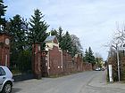
470 | Altglienicke Evangelical Cemetery | March 1, 1996 | The street, previously street 130, runs from Wegedornstraße to Rudower Straße. Due to the location at the cemetery, the name was already in use before the official name. |
|
| At the breakland
( Location ) |
280 | Bruchland, old field name | Oct 27, 1998 | The residential street connects Semmelweisstraße and Korkedamm and was previously called Straße 197 . Until the construction of the Teltow Canal in 1901–1906, the area on which the road is located today was swampy terrain. |

|
| At the Falkenberg
( Location ) |
1810 (in the district) |
Falkenberg , elevation in the neighboring Bohnsdorf | 1902 | It is located between Bohnsdorfer Richterstraße and Strohblumenweg , where the street turns into Grünauer Straße . In the district lies the section between the bridge under the B 96a (see Am Seegraben ) in the east and west. Plots 19–61 and 62–111 (consecutive) belong to the district. 110, 111 and the unnumbered land opposite to the west of the railway bridge is reserve area of the railway line. This road is classified as a regional road connection in the Berlin road network (Category III). |

|
| At the Falkenberg waterworks
( Location ) |
250 × 210 | Am Falkenberg waterworks | The address of the only assigned property is 1, and it is located on the site of the “Am Falkenberg” waterworks. The property adjoins the Am Pumpwerk to the west, with the Grünauer Kreuz railway lines to the northwest and northeast (branches south to east and east to north). The Plumpengraben flows through it. In the RBS, the path (# 44489) is included in the FUWE class (footpath) with a length of 100 m. |

|
|
| At the Glinigk
( Location ) |
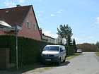
60 | Old town center, which was first mentioned in 1375 as "Glinik" | Dec. 19, 2000 | The short residential street between Semmelweisstraße and Zur Rothen Laake was previously called Straße 215 . |
|
| At the Kiesberg
( Location ) |
600 | nearby gravel mountain | around 1920 | It leads from Rudower Straße to the Hornkleepfad. Narrow residential street mainly built with single-family houses. |

|
| At the pumping station
( Location ) |
260 | Wasserwerk 'Am Falkenberg' is located here | Dec. 1, 2003 | It goes off as a cul-de-sac from Am Falkenberg and opens up the waterworks and the KGA Falkenbrunn. |

|
| At the Seegraben (*)
( Location ) |
270 (in the district east side) |
Moat that passes north of the Schönefelder See | around 1961 | This road is classified as a higher-level road connection in the Berlin road network (Category II) and a section of the federal highway 96a , it connects the Adlergestell von Grünau over the A 117 with the community of Schönefeld. There the route continues as a Mittelstrasse. The road was rebuilt for civilian use after Schönefeld Airport opened and after the Wall was built in 1961. Am Seegraben is not officially designated in the Berlin area, but is included by name in some city maps. The official name according to the map 1: 5000, produced by the district surveying offices is "B 96a (South)". At the Seegraben forms the south-eastern boundary between Altglienicke and Bohnsdorf.
Between 2010 and 2011 the entire route was “completely renewed ” in order to improve its condition as a feeder to the planned BER airport . |

|
| At the angle
( Location ) |
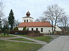
130 | right-angled course | June 1, 1995 | The residential street laid out as street 181 runs from Rosestraße at right angles to Germanenstraße. |
|
| Anne Frank Street
( Location ) |
360 | Anne Frank (1929–1945), victim of the Holocaust | Feb. 2, 1987 | The residential street leads from Ortolfstraße to Nelkenweg. |

|
| Apple path
( Location ) |
230 | Apples , genus of pome fruits within the rose family | March 2, 1959 | The residential street was called Straße 177 when it was built and leads from Renettenweg to Mohnweg. |

|
| Auerswaldstrasse
( Location ) |
310 | Hans Adalbert von Auerswald (1822–1870) Colonel, commander of the 1st Guard Regiment | June 6, 1906 | The residential street runs from Schönefelder Chaussee to Bohnsdorfer Weg and Ortolfstraße. |

|
|
Railway path
( Location ) |
200 | Berlin outer ring of the railway | March 2, 1959 | The residential street in the Falkenhöhe settlement, located right next to the railway line, runs from Ontarioweg to Quittenweg. |

|
| Baltenstrasse
( Location ) |
180 | Balts , residents of the Baltic States | Dec 5, 1911 | The short settlement path in the Sachsenberg settlement between Sachsenstrasse and Rosestrasse belongs to a group of more than 20 streets and squares in the Altglienicke district that are named after various prehistoric tribes, tribal associations and ethnic groups. These names reflect the increased interest in the peoples of prehistoric times, which can be seen in connection with the increased level of knowledge of prehistoric research and the development of this scientific discipline towards the end of the 19th century. |

|
| Beelitzer Weg
( Location ) |
180 | Beelitz , town in the Potsdam-Mittelmark district, Brandenburg | May 25, 1973 | The road leads from Geltower Weg to Bohnsdorfer Chaussee. The construction of the rail outer ring that has been road 163 (Frog Bridge) separately. The section of the settlement route south of the outer ring was named Beelitzer Weg, the northern part Froschsteg. |

|
| Bernulfstrasse
( Location ) |
320 | Bernulf, male first name | Jan. 18, 1936 | Before street 121 . The street is in a settlement where the roads and streets were named after male first names. It leads from Ortolfstraße to Salierstraße. |

|
| Besenbinderstrasse
( Location ) |
290 | Broom-maker , a craft occupation that has largely disappeared | May 10, 1951 | The name refers to the broom-makers who used to live in Alt-Glienicke. The previous name from 1891 to 1951 was Wilhelmstrasse . The renaming took place in the course of the change of street names, which were considered monarchist or militaristic origin. According to the municipal bill, the street should be named Kirchstraße. However, since this name was to be used in the city center, it was only decided to rename it and the responsible city council was authorized to determine a new name for the street. |

|
| Pear Path
( Location ) |
500 | Pears , genus of plants, the pome fruit plants in the rose family | March 2, 1959 | The residential street laid out as street 114 leads in an L-shape from Ortolfstraße to Ontarioweg. The development consists mainly of single-family houses. At the connection with Lehmusstrasse, a footbridge leads over the freight railway into the Cologne quarter. |

|
| Blind creep
( Location ) |
450 | Slow worm , a species of lizard within the sneak family | May 23, 1973 | The original road 154 (blind crawl) in the Eigenheim II settlement was divided into two parts by the construction of the outer ring road . The part to the north of it was named Blindschleichgang, the part to the south was named Geltower Weg. At the same time, the properties were renumbered. The Cabuwazi children's circus has one of its circus tents here. |

|
| Bohnsdorfer Chaussee
( Location ) |
570 (in the district) |
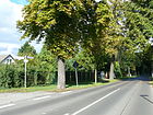
Bohnsdorf , neighboring district | around 1900 | The street forms the border to Schönefeld, only the land is in Altglienicke. As a continuation of the Weidenweg, it leads to Waltersdorfer Chaussee in Schönefeld. |
|
| Bohnsdorfer Weg
( Location ) |
1710 1210 + 500 |
Bohnsdorf , neighboring district | around 1900 | It is classified as a supplementary road connection in the Berlin road network (Category IV) and part of the old connection between Altglienicke and Bohnsdorf. It runs from Köpenicker Chaussee to Markomannenstrasse, where an unnamed path continues to Lutizenstrasse. On Salierstrasse it opens up a settlement with several branches. With the construction of the outer ring , the southern part between Rosestraße and Ewaldstraße was separated and will soon be included in Wegedornstraße. The quiet street is mostly built with single-family houses. For pedestrians there is a connection along the railway line to Lutizenstrasse and a footbridge on Wegedornstrasse to the southern part of Bohnsdorfer Weg. |

|
| Braunellenplatz
( Location ) |
70 × 40 | Braunellen , genus of plants from the mint family | Dec. 4, 1930 | The fallow area laid out as place III is today a protected biotope for many small animals and endangered plants. |

|
| Braunellensteig
( Location ) |
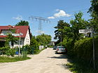
150 | Braunellen , genus of plants from the mint family | Dec. 4, 1930 | The residential street laid out as street 134 is located between Wegedornstraße and Hornkleepfad. Narrow residential street that is built on with single-family houses. |
|
| Brigittenweg
( Location ) |
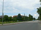
440 | Brigitte, female first name | May 23, 1973 | The settlement path, which was called Straße 150 (Brigittenweg) before it was named , originally extended as far as Bohnsdorfer Chaussee. Today it runs as an extension of Siriusstrasse from Ortolfstrasse to the railway line. When the outer ring was built, it was divided into two parts. One section was named Brigittenweg in 1973. The eastern part was named Kirschweg as early as 1959. This road is classified as a supplementary road connection in the Berlin road network (Category IV). The Brigittenweg is named for the enclosed Brigitten Bridge. |
|
| Brunolfweg
( Location ) |
190 120 + 70 |
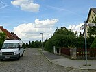
Brunolf, male first name | Jan. 4, 1938 | The residential street laid out as street 145 is interrupted by a green area. Numbers 1–14 go from Wegedornstraße and no. 15–43 from Damarksteig. |
|
|
Chorweilerstrasse
( Location ) |
280 | Chorweiler , a district in the north of Cologne | Jan. 1, 1997 | The residential street in the Cologne quarter runs from Coloniaallee to Kalker Straße and then as a footpath to Müngersdorfer Straße. The Colonia Park is on its northern side . The two connecting streets to Ehrenfelder Straße belong half to this and to Chorweilerstraße. The multi-family houses in the Cologne quarter were built in the mid-1990s. The individual streets are connected by footpaths through the houses, the inner courtyards are green and serve as communal areas. The northern part of the street borders on the Coloniapark. |

|
| Cimbernstrasse
( Location ) |
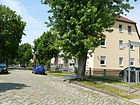
710 | Cimbri , Germanic tribe | June 6, 1906 | The residential street leads from Bohnsdorfer Weg to Wendenstrasse. This road is classified as a supplementary road connection in the Berlin road network (Category IV). |
|
| Coloniaallee
( Location ) |
330 | old Roman name for Cologne Colonia Claudia Ara Agrippinensium , later Colonia Agrippina | June 1, 1995 | The street in the "Cologne Quarter", which was newly built in 1995 south of the outer railway ring, was named after Treptow's twin town Cologne (since November 1990). Other streets in this quarter were named after Cologne districts. It leads from Porzer Straße to Weidenweg. The multi-family houses in the Cologne quarter were built in the mid-1990s. The individual streets are connected by footpaths through the houses. The inner courtyards are green and serve as communal areas. At the northern end of the street, a footbridge leads over the freight railway to Lehmusstraße and Altglienicker Aue. |

|
|
Dankmarsteig
( Location ) |
880 (in the district) |
Dankmar, male first name | Aug 24, 1936 | The residential street laid out as street 143 runs from Ortolfstraße to the district border. Over the tunnel of the A 113 it continues as a footpath to Rudow , where it leads to "Friedel road", the former Allied patrol route and reaches a part of the street of the same name. |

|
| Deutzer Steig
( Location ) |
120 | Köln-Deutz , district of Cologne on the right bank of the Rhine | Nov 17, 2004 | The residential street connects Müngersdorfer Straße and Klettenberger Straße. |

|
| Dorothea-Viehmann-Strasse
( Location ) |
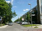
540 | Dorothea Viehmann (1755–1815), one of the most important sources for the Grimm Brothers' fairy tale collection | Dec. 1, 1996 | The residential street leads from Wegedornstraße to Rudower Straße |
|
| Drössestrasse
( Location ) |
300 | Hermann Drosse (1846–1914), laundry owner, chairman of the supervisory board of the "Terrain-Gesellschaft Altglienicke" | Dec 5, 1911 | The residential street leads from Am Falkenberg to Preußenstraße. The name was one of seven that were decided during the meeting of the local council on December 5, 1911. |

|
|
Ehrenfelder Platz
( Location ) |
50 × 50 | Cologne-Ehrenfeld , part of the city district of the same name | March 1, 1997 | The square is on both sides of Ehrenfelder Strasse in the Cologne district. The same group of figures by Tünnes and Schäl by the sculptor Wolfgang Reuter can be found here as in Cologne's old town. The small square is the center of the Cologne quarter and is reserved for pedestrians, it connects Coloniaallee with Ehrenfelder Straße. |

|
| Ehrenfelder Strasse
( Location ) |
520 | Cologne-Ehrenfeld , part of the city district of the same name | March 1, 1997 | The residential street leads from Coloniaallee via Ehrenfelder Platz to Kalker Straße. Half of the two connecting streets to Chorweilerstraße also belong to Ehrenfelder Straße and half to Chorweilerstraße. The multi-family houses in the Cologne quarter were built in the mid-1990s. The individual streets are connected by footpaths through the houses. The inner courtyards are green and serve as communal areas. |

|
| Erxlebenstrasse
( Location ) |
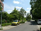
430 | Dorothea Erxleben (1715–1762), Germany's first female doctor with a doctorate | 3rd Sep 1997 | The residential street runs from Mohnweg to Birnenweg. A footpath then leads over the railway line to Rebenweg / Porzer Straße. |
|
| Ewaldstrasse
( Location ) |
2030 | Ewald, male first name | Nov 5, 1942 | The street leads from Preußenstraße to Grünbergallee. As a result of the new road construction along the S-Bahn line (connecting road between the Altglienicke and Grünbergallee stations), the extension of Straße 105 between Richard-Günther-Straße and Grünbergallee was incorporated into Ewaldstraße by resolution of the municipal authorities on November 18, 1966. This road is classified as a supplementary road connection in the Berlin road network (Category IV). |

|
|
Falkenbrunnstrasse
( Location ) |
710 | at the time of naming the waterworks on Falkenberg ( fountain ) | around 1906 | It runs from Preußenstraße via Am Falkenberg and on to Grünauer Kreuz on the Berlin – Görlitz railway line , where it ends as a dead end. The part north of Am Falkenberg, formerly Straße 186 , was included in 1935. | |
| Frankenstrasse
( Location ) |
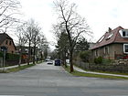
550 | Franconia , a West Germanic ethnic group | June 6, 1906 | The residential street leads from Bohnsdorfer Weg to Lutizenstraße and continues to Germanenplatz. |
|
| Friesenstrasse
( Location ) |
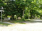
90 | Frisians , population group that lives on the North Sea coast in the Netherlands and Germany | June 6, 1906 | The short residential street leads from Sorbenstrasse to Wendenstrasse. |
|
| Frog bridge
( Location ) |
290 | Frogs , an order of vertebrates | May 25, 1973 | The dead-end street goes from Otterstraße. The settlement route laid out in 1929/1930 originally ran as road 163 (Froschsteg) from Bohnsdorfer Chaussee (city limits) in a westerly direction. It was divided by the construction of the outer ring. The southern part was named Beelitzer Weg, the northern part Froschsteg. |

|
|
Gärtnerweg
( Location ) |
280 | Gardener , job title for people who work in horticulture | March 2, 1959 | The residential street is a dead end from Kirschweg and ends at the railway line. Through the construction of the outer ring, the street 151 , which was built in the 1930s, was divided, the southern part was named Gärtnerweg. |

|
| Geltower way
( Location ) |
110 | Geltow , part of the community Schwielowsee in Brandenburg | May 23, 1973 | The residential street runs from Beelitzer Weg to Glindower Weg. After the construction of the outer ring of the railway, the sections of road 150 (Brigittenweg) and road 154 (blind crawl) south of the railway ring were renamed to Geltower Weg, and the properties were renumbered at the same time. On March 1, 2004, the part of the Geltower Weg with the numbers 24, 26, 28 and 30 was included in the Kirschweg, since then the Geltower Weg only runs from Beelitzer to Glindower Weg. |

|
| Germanenplatz
( Location ) |
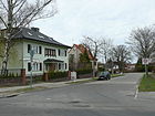
70 × 40 | Germanic tribes , a number of former tribes in Central Europe and southern Scandinavia, whose ethnic identity is traditionally determined in research by language | June 6, 1906 | Germanenplatz is located between Teutonenstraße and Germanenstraße, the two connecting streets in between also bear this name. |
|
| Germanenstrasse
( Location ) |
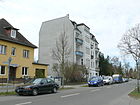
1730 | Germanic tribes , a number of former tribes in Central Europe and southern Scandinavia, whose ethnic identity is traditionally determined in research by language | June 6, 1906 | It leads from Normannenstraße via Ewaldstraße and continues there to Altglienicke train station , which can be reached via a pedestrian bridge. It is a quiet residential street with moderate traffic and mainly built with one and two family houses. There is a footpath through the Preussensiedlung to Preußenstraße. This road is classified as a supplementary road connection in the Berlin road network (Category IV). |
|
| Barley dough
( Location ) |
490 | Gero (around 900–965), the first and only margrave of the Saxon East Mark | Feb 22, 1957 | The residential street runs from Schönefelder Chaussee to Ortolfstraße. It was given the name Gerostraße in 1942 , but Gerosteg was used on street signs as well as in official documents, which is why the official renaming took place in 1957. |

|
| Glindower Weg
( Location ) |
170 | Glindow , district of Werder (Havel) | May 25, 1973 | The residential street connects Kirschweg and Bohnsdorfer Chaussee with a junction to Geltower Weg. Road 161 (Krötengasse) was divided by the construction of the outer ring road . The part of this road south of the outer ring was named Glindower Weg together with road 167 (Libellenweg) . |

|
| Goldsternweg
( Location ) |
670 | Gold star alternative name for yellow stars , a lily plant | Oct 1, 2002 | The residential street created as street 72 leads from Köpenicker Straße to Taubnesselweg and ends at the railway line as a dead end. It opens up the colonies 'Lunapark I' and 'Bodenreform' and the Spreetal settlement. |

|
| Gotenstrasse
( Location ) |
140 | Goths , an East Germanic people | June 6, 1906 | The residential street laid out in 1904 leads from Salierstrasse to Frankenstrasse. |

|
| Grünauer Strasse
( Location ) |
710 | Berlin-Grünau , neighboring district | before 1890 | Grünauer Straße goes from Köpenicker Straße and into Am Falkenberg street. It is part of the old connection from Rudow via Altglienicke and Bohnsdorf to Grünau . This road is classified as a regional road connection in the Berlin road network (Category III). |

|
| Grünbergallee
( Location ) |
350 (in the district) |
Alfred Grünberg (1901–1942), KPD member and resistance fighter against National Socialism | Apr 20, 1948 | Grünbergallee leads in the Altglienicker area as an extension of Kirschallee to Grünbergallee station. In the Bohnsdorf area, the eastern part runs to the village square. It was divided by the construction of the outer ring and the street Am Seegraben. At first the traffic route was called Schönefelder Weg (18th century) and Schönefelder Straße (from 1925–1948) after its direction. It led from the village square of Bohnsdorf to Bohnsdorfer Chaussee. This road is classified as a supplementary road connection in the Berlin road network (Category IV). |

|
| Guntherstrasse
( Location ) |
590 | Gunther, figure from the Nibelungenlied | July 22, 1993 | The residential street runs between Lutz-Schmitz-Straße (formerly: Rheingoldstraße ) via Nibelungenweg to Gerosteig, Rehpfuhl settlement. In the street directory it was shown as street 170 (Guntherstraße) until 1993 . The unofficial name Guntherstrasse has been used since the late 1930s. A residential street with single-family houses in the Rehpfuhl settlement. The road runs parallel to the A 113 and ends in a bend as a dead end directly on the motorway. At this point, noise barriers reduce the noise level of the busy motorway. At this point, pedestrians and cyclists can get to the Rudow-Altglienicke Landscape Park and the Rudower Höhe via a footbridge that crosses the motorway. |

|
| Gustelstrasse
( Location ) |
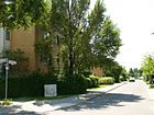
300 | Gustel, form of August, male first name | Oct. 1, 1996 | The residential street, previously designated as street 141 (Gretelstraße) , runs from Dankmarsteig to Kasperstraße. |
|
|
Harrosteig
( Location ) |
300 | Harro, male first name | Jan. 24, 1938 | The residential street between Dankmarsteig and Gerosteig is located in a settlement in which the paths and streets were named after male first names. |

|
| Hassoweg
( Location ) |
270 | Hasso, male first name | Jan. 18, 1936 | The residential street between Wolfmarsteig and Anne-Frank-Straße was created as Straße 211 . In this quarter the streets and paths are named after male first names. |

|
| Henningweg
( Location ) |
210 | Henning, male first name | Nov 5, 1942 | The residential street is between Rosestrasse and Ewaldstrasse. |

|
| Herulerstrasse
( Location ) |
240 | Heruler , (East) Germanic tribe that first appeared historically on the Black Sea in the 60s of the 3rd century AD | Nov 9, 1926 | The residential street originally led from Drösslerstraße to Preußenstraße. It was interrupted by the construction of the outer ring, so that it now ends as a dead end at the railway line. |

|
| Horn clover path
( Location ) |
300 | Horn clover , genus of plants in the subfamily Faboideae within the legume family | Dec. 4, 1930 | The partially unpaved residential road lies between Am Kiesberg and Braunellenweg. It was initially referred to as Street 136 . The narrow residential street is built on with single-family houses. |

|
|
Iselersteig
( Location ) |
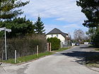
250 | Jean Paul Julius Iseler (1865–1933), theologian, pastor in Altglienicke | Dec. 19, 2000 | The residential street, laid out as street 188 , leads from Semmelweisstraße to Zur Rothen Laake. |
|
|
Jungfernsteg
( Location ) |
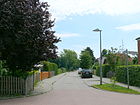
310 | Maiden , originally a young noblewoman. Similar to the Junker, then split to designate young female servants and is now synonymous with the virgin | Dec. 1, 1996 | The residential street appears in the address book for the first time in 1936 with the reference to the Eigenheim I settlement . The parcels are not yet indicated with house numbers, but 12 houses with the names of the owners. According to official information, the name is related to fairy tales, as it is surrounded by streets that are named after characters from fairy tales and legends. It leads from Dorothea-Viehmann-Straße via Rapunzelstraße to Schönefelder Chaussee. The street name Jungfernsteg (16954) was changed to "Straße 128 (Jungfernsteg)" (41464) in the official entry on January 19, 1995, but was returned to Jungfernsteg (now with street number 6749) the following year on December 1, 1996. |
|
|
Kalker Strasse
( Location ) |
330 | Köln-Kalk , district of Cologne | March 1, 1997 | The residential street in the Cologne quarter leads from Chorweilerstraße to Ewaldstraße. |

|
| Kasperstrasse
( Location ) |
500 | Kasper , the comical hero of the puppet theater | Oct. 1, 1996 | The residential street with several spur streets opens up a new building area and branches off from Schönefelder Chaussee. |

|
| Kattenstrasse
( Location ) |
190 | Chatten (also Katten), Germanic tribe, which had its settlement focus in the area of the valleys of Eder, Fulda and the upper reaches of the Lahn | June 6, 1906 | The residential street leads from Gotenstraße to Bohnsdorfer Weg. |

|
| Keltensteig
( Location ) |
130 | Celts , term for ethnic groups of the Iron Age in Europe since ancient times | Nov 23, 1931 | From before 1891 to 1931 the small connecting route between Grünauerstrasse and Teutonenstrasse was called Bergstrasse after the climb from the Spreeniederung to the Teltow . |

|
| Cherry Tree Street
( Location ) |
170 | Jesekiel David Kirszenbaum (1900–1954), (also known as Kirschenbaum in Germany), Polish-Jewish painter and caricaturist, victim of the Nazi regime | Jan. 31, 1997 | The residential street in the new district runs between Ortolfstrasse and Hassoweg. |

|
| Cherry path
( Location ) |
240 | Cherry , or sweet cherry from the rose family | March 2, 1959 | It connects Grünbergallee with Brigittenweg and leads between Rebenweg and Weidenweg over the Schönefeld area. The road 150 (Brigittenweg) was divided by the construction of the outer ring road . The part to the east of the outer ring was named Kirschweg in 1959, the western part was named Brigittenweg in 1973 . Both are connected by a pedestrian bridge. On March 1st, 2004 the numbers 24, 26, 28 and 30 of the Geltower Weg were included in the Kirschweg and thus the Kirschweg was extended by the numbers 25, 27, 29 and 31. This road is classified as a supplementary road connection in the Berlin road network (Category IV). |

|
| Shamrock Street
( Location ) |
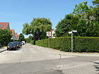
340 | Klee , genus of the butterflies from the legume family | Jan. 1, 1992 | The residential street was created as street 106 between Rosestraße and Ewaldstraße. From 1960 to 1992 it was called Richard-Günther-Straße . |
|
| Small poppy path
( Location ) |
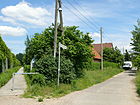
420 | Poppy , genus of plants from the poppy family | Oct 22, 2001 | The section of the Mohnweg located southeast of the railway line was renamed the Kleiner Mohnweg on August 31, 2001. |
|
| Klettenberger Strasse
( Location ) |
520 | Cologne-Klettenberg , district of Cologne | Sep 1 1996 | The street between Ewaldstraße and Mohnweg in the Cologne district was created as Straße 110 . |

|
| Bud base
( Location ) |
140 | Bud , the youthful state of a shoot | Aug 9, 2000 | The private road (footpath) leads from Kleeblattstraße to Bohnsdorfer Weg with connecting roads to Sprossengrund. |

|
|
Köpenicker Strasse
( Location ) |
1100 (in the district) |
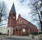
Berlin-Köpenick , the eponymous district of the Treptow-Köpenick district | before 1890 | The Köpenicker Straße as an important connection to Adlershof leads from the Adlergestell to the Schönefelder Chaussee. It leads over the Altglienicker Bridge (formerly Oppenbrücke), which was closed in 1993 due to dilapidation and has been bypassed by a temporary bridge since 1995. When the bridge was closed, tram line 84 had to be closed. In the area of the intersection of Köpenicker Straße / Grünauer Straße was the core of the street village Altglienicke, which extends in a west-east direction. On October 1, 2002 the house numbers 141-145 of the street 72 were included in the Köpenicker street. At 620 meters, this road is classified as a regional road connection in the Berlin road network (category III), a section in the district of 240 m as a supplementary road connection (category IV) and the rest of the road is categorized as an access road to the houses. |
|
| Cork dam
( Location ) |
980 | August Korke (1844–1900), Altglienicker farmer | 1901 | The residential street leads from Köpenicker Straße to Semmelweisstraße. It originally led as far as Adlershof and was the farm road of the farmer Korke in the 19th century. With the construction of the Teltow Canal, it was declared a public route. |

|
| Tooth Alley
( Location ) |
180 | Toads , family within the order of the frogs | May 23, 1973 | It goes off as a spur road from Otterstrasse. The settlement route, originally called Straße 162 (Krötengasse) , ran from Bohnsdorfer Chaussee to Otterstraße. It was divided by the construction of the outer ring of the railway. The part to the south of the outer ring was named Glindower Weg in 1973, and the part to the north was named Krötengasse. |

|
| Kunibertstrasse
( Location ) |
280 | Kunibert, male first name | Jan. 18, 1936 | The residential street between Anne-Frank-Straße and Wolfmarsteig was called Straße 210 at the plant . |

|
|
Liver Flower Path
( Location ) |
500 | Hepatica (Anemone hepatica) belongs to the buttercup family | Oct 1, 2002 | The residential street in the Spreetal settlement was built as street 78 . It leads from the Schachtelhalmweg to the Stechapfelweg. There is a non-dedicated footpath from the Schachtelhalmweg to the Goldsternweg. |

|
| Lehmfeldsteig
( Location ) |
110 | Clay field, reference to the former soil conditions | Nov 15, 2001 | The traffic-calmed area leads from Rudower Straße to Semmelweisstraße. |

|
| Lehmusstrasse
( Location ) |
610 | Emilie Lehmus (1841–1932), first German medical student | 3rd Sep 1997 | The residential street on the outer ring in the Ärztinnenviertel leads from Mohnweg to Erxlebenstraße. At the height of Tiburtiusstrasse and Erxlebenstrasse there are two crossings over the railway line to the Cologne district. Lehmusstraße consists of a block of apartment buildings that lie between the Altglienicker Aue and a freight railway line. A wall towards the railway protects against the noise of the freight trains. Between Lehmusstrasse and Sieboldstrasse, the Altglienicker Aue is a park with seating, lawns and playgrounds. At the connection with the Birnenweg a pedestrian walkway leads over the freight railway into the Cologne quarter, another crossing connects the street with the Coloniaallee and the Coloniapark. |

|
| Lianenweg
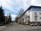
( Location ) |
280 | Liana , a woody climber | Dec. 4, 1930 | It leads from Köpenicker Straße to Normannenstraße, but is closed to through traffic on Köpenicker Straße. |
|
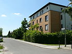
| Lieselstrasse
( Location ) |
210 | Liesel, female name | Oct. 1, 1996 | Before it was named, the residential street was shown in the street directory as street 140 a (Lieselstraße) . The unofficial name Lieselstraße was already used towards the end of the 1930s. In the 1943 address book it is shown as street 140a . |
|
| Lutizenstrasse
( Location ) |
480 | Liutizen , a loose association of some north-west Slavic tribes that populated the south-east of what is now Mecklenburg-Western Pomerania and the north of what is now Brandenburg in the Middle Ages | Jul 21, 1999 | The residential / residential street leads from Kattenstrasse to Wendenstrasse and from there further to the outer ring. It emerged from the street 55 (Kattenstraße to Markomannenstraße) and a section of the Sachsenstraße (Markomannenstraße to the outer ring). |

|
| Lutz-Schmidt-Strasse
( Location ) |
170 | Lutz Schmidt (1962–1987), athlete, GDR junior cycling champion, victim of the Berlin Wall | Aug 1, 2009 | The street was first called Straße 174 (Rheingoldstraße) . By decision of BVV Treptow-Köpenick, the street at the end of which Schmidt was shot while attempting to escape was the first traffic route in Berlin to be named after a victim of the Wall . |

|
|
Malvenweg
( Location ) |
150 | Mallow , a genus of plants in the mallow family | July 22, 1993 | The residential street leads from Mohnweg to Bohnsdorfer Weg and was designated as street 184 (Malvenweg) until it was officially named . On June 12, 2002, the part of the Wolfmarsteig between the railway line and Malvenweg was included in the Malvenweg. The quiet little street is built on with single-family houses. For pedestrians there is a bridge over the railway line on Wegedornstrasse. 20 meters of the road are classified as a supplementary road connection in the Berlin road network (Category IV). |

|
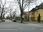
| Markomannenstrasse
( Location ) |
700 | Marcomanni , Suebian tribe of the Germanic peoples | Sep 9 1912 | The residential street leads from Teutonenstraße to Bohnsdorfer Weg. From 1911 to 1912 it was called Cheruskerstrasse . The renaming of the street, which was carried out again after a year, is due to the establishment of the "Zweckverband Groß-Berlin" in 1911, in which streets should be avoided with identical names. The quiet street is mostly built with single-family houses. For pedestrians there is a connection along the railway line to Lutizenstraße and a pedestrian bridge on Wegedornstraße leads over the railway line. |
|
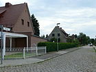
| Markulfweg
( Location ) |
300 | Markulf, male first name | Jan 25, 1938 | Before it was named, it was called Strasse 147 . It leads from the Dankmarsteig to the Gerostige. |
|
| Mehldornpfad
( Location ) |
120 | Mehldorn or hawthorn, a genus of shrubs or small trees of the pome fruit family within the rose family | Dec. 4, 1930 | The short residential street, laid out as street 132 , leads from Am Kiesberg to Teichrohrweg. |

|
| Meinolfstrasse
( Location ) |
50 | Meinolf, male first name | Jan. 18, 1936 | The short spur road leading from Wolfmarsteig was created as road 211a . |

|
| Mirabellenweg
( Location ) |
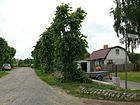
90 | Mirabelle , also known as yellow plum, a subspecies of the plum | March 2, 1959 | The original road 152 (Molchsteg) was divided by the construction of the outer ring of the railway . The part to the east of the outer ring was named Mirabellenweg in 1959, the western part was named Molchstraße in 1973. |
|
| middle way
( Location ) |
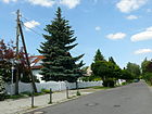
410 | after the middle position in the Wegedorn settlement | July 22, 1993 | The settlement path runs from Mohnweg to Bohnsdorfer Weg. The previous name was Straße 120 (Mittelweg) . |
|
| Poppy path
( Location ) |
820 | Poppy , genus of plants from the poppy family | July 22, 1993 | Before it was officially named, the settlement route was shown in the street directory as Strasse 176 (Mohnweg) . With the construction of the outer ring of the railway, it was divided into two parts, the eastern part is called Kleiner Mohnweg. |

|
| Pig road
( Location ) |
160 | Newt , different, not necessarily closely related, amphibian species from different families of the tailed amphibian order | May 23, 1973 | It leads from Ortolfstraße via blind creep. The original road 152 (Molchsteg) was divided by the construction of the outer ring of the railway . The part to the west of the outer ring was named Molchstrasse in 1973. The eastern part of street 152 was named Mirabellenweg in 1959. |

|
| Mundolfstrasse
( Location ) |
300 | Mundolf, male first name | Jan. 24, 1938 | Before it was named, it was called Strasse 148 . It leads from the Dankmarsteig to the Gerostige. |

|
|
Müngersdorfer Strasse
( Location ) |
620 | Müngersdorf , district of Cologne | Sep 1 1996 | The street in the Cologne quarter was previously called Straße 111 (Fliederweg) . It lies between Ewaldstrasse and Mohnweg. |

|
|
Daffodil Path
( Location ) |
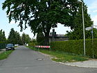
180 | Daffodils , genus of plants in the Amaryllidoideae subfamily within the Amaryllis family | July 22, 1993 | The residential street connects Mohnweg and Wolfmarsteig. The previous name since the late 1930s was Straße 178 (Narzissenweg). |
|
| Carnation Path
( Location ) |
340 | Carnations , genus of plants in the carnation family | July 14, 1997 | The residential street connects Mohnweg and Wolfmarsteig. The previous name since the late 1930s was Straße 179 (Nelkenweg). |

|
| Nibelungenweg
( Location ) |
180 | Nibelungen , in the Germanic heroic saga a dwarf people, the men around Siegfried and the men around King Gunther | July 27, 1993 | The residential street runs from Schönefelder Chaussee over Guntherstrasse. The previous name since the late 1930s was Straße 158 (Nibelungenweg). |

|
| Nippeser Strasse
( Location ) |
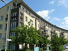
170 | Köln-Nippes , district of the city of Cologne | June 1, 1995 | The cul-de-sac in the Cologne district to the south of the outer ring of the railway runs from Porzer Strasse. The multi-family houses in the Cologne quarter were built in the mid-1990s. The individual streets are connected by footpaths through the houses. The inner courtyards are green and serve as communal areas. The street ends as a dead end for cars in the residential area. |
|
| Normannenplatz
( Location ) |
40 × 40 | Normans , also called Vikings. Two regionally different communities: on the one hand Northern Germanic, on the other hand Romanized Normans, who spread from Normandy from the 9th century. | Jun 6, 1906 | It lies between Normannenstrasse, Germanenstrasse and Lianenweg. It's not a dedicated space. |

|
| Normannenstrasse
( Location ) |
470 | Normans , also called Vikings. Two regionally different communities: on the one hand Northern Germanic, on the other hand Romanized Normans, who spread from Normandy from the 9th century. | Jun 6, 1906 | The residential street is between Grünauer Straße and Bohnsdorfer Weg. 110 meters of the road are classified as a supplementary road connection in the Berlin road network (Category IV). |

|
|
Ontarioweg
( Location ) |
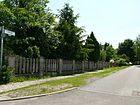
130 | Ontario apple , a variety of apple | March 2, 1959 | Road 151 was divided by the construction of the outer ring road . The part running north of the outer ring was named Ontarioweg, the part running south of the outer ring was named Gärtnerweg. |
|
| Ortolfstrasse
( Location ) |
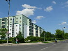
1960 | Ortolf, male first name | Jan. 18, 1936 | The street between Bohnsdorfer Weg and Brigittenweg was previously called Straße 156 . On July 28, 1989, the section between Birnenweg and Uranusstraße that was created with the housing construction was included in Ortolfstraße. The road is classified as a supplementary road connection in the Berlin road network (Category IV). |
|
| Otterstrasse
( Location ) |
190 | Otters or vipers, a family of mostly viviparous venomous snakes widespread in America, Africa and Eurasia | May 23, 1973 | The residential street between Brigittenweg and Froschsteg was created as street 164 (Otterstraße) . |

|
|
Peenestrasse
( Location ) |
460 | Peene , river in Mecklenburg-Western Pomerania | Oct. 1, 1996 | The street between Ortolfstraße and Wegedornstraße was created as street 125 . |

|
| Pegasuseck
( Location ) |
260 | Pegasus , constellation just north of the celestial equator | Jul 27, 1989 | The residential street in the Kosmosviertel consists of an access road for the primary school located here on Pegasuseck as well as a section on both sides of the Glienicker Grund and an unpaved section on Gerostige. These are connected with footpaths. |

|
| Pfarrwöhrde
( Location ) |
150 | Wöhrde, North German name for the arable land around the house | before 1911 | The street runs in the former village center of Altglienicke from Rudower Straße to Semmelweisstraße |

|
| Peach path
( Location ) |
120 | Peach , species of the genus Prunus from the rose family (Rosaceae) | March 2, 1959 | The short residential street between Apfelweg and Erxlebenstraße was created as Straße 208 . |

|
| Porzer Strasse
( Location ) |
1020 | Cologne-Porz , eponymous district of the Cologne district of Porz | Jun 1, 1995 | The street in the Cologne quarter leads from Klettenberger Weg to Bohnsdorfer Weg. It has four access roads to the residential complex. |

|
| Preussenstrasse
( Location ) |
1090 790 + 300 |
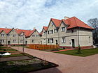
Prussians , also Old Prussians, Baltic tribe, to which the geographical name Prussia goes back | Dec 5, 1911 | The settlement street originally ran from Am Falkenberg street in a south-easterly direction to Ewaldstraße. The road was divided by the construction of the outer ring road. In 1958, a cul-de-sac that branches off from Preußenstrasse and runs parallel to the outer ring of the railroad was incorporated into Preußenstrasse. Here is the 2012 renovated small house settlement Altglienicke of Hermann Muthesius . |

|
|
Quittenweg
( Location ) |
350 | Quince , the only species of the genus Cydonia within the rose family | March 2, 1959 | The residential street connects Renettenweg and Bahnweg and was previously called Straße 150 . |

|
|
Randolfstrasse
( Location ) |
300 | Randolf, male first name | Dec. 19, 2000 | The residential street laid out as street 124 lies between Bohnsdorfer Weg and Bernulfstraße. |

|
| Rapunzelstrasse
( Location ) |
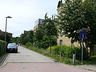
410 | Rapunzel , fairy tale by the Brothers Grimm | Dec. 1, 1996 | Rapunzelstraße runs between Zum Alten Windmühlenberg and Wegedornstraße, but is only accessible from Wegedornstraße for residents, as it is blocked by a barrier. |
|
| Rebenweg
( Location ) |
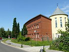
220 | Grapevines or grapevines , genus of plants in the grapevine family | March 2, 1959 | Before it was named, the settlement route between Porzer Strasse and Grünbergallee was the part of Strasse 120 south of the outer ring of the railway . Many streets in the area are dedicated to fruit varieties. The development consists mainly of single-family houses. A footbridge leads over the freight railway to Altglienicker Aue. |
|
| Renettenweg
( Location ) |
230 | Renette or Reinette, group of apple varieties with dense, pithy flesh and mostly distinctive taste | March 2, 1959 | The settlement path between Apfelweg and Erxlebenstraße was called Straße 155 at the facility . |

|
| Riedgrasweg
( Location ) |
100 | Sedge , family in the order of the sweet grass-like | Oct 1, 2002 | The short cul-de-sac in the Spreetal settlement starts from Schachtelhalmweg. It was built as Straße 77 . |

|
| Rodenkirchener Strasse
( Location ) |
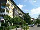
290 | Cologne-Rodenkirchen , eponymous district of the Rodenkirchen district of Cologne | Jun 1, 1995 | The dead-end street from Porzer Straße is in the Cologne district. The multi-family houses in the Cologne quarter were built in the mid-1990s. The individual streets are connected by footpaths through the houses. The inner courtyards are green and serve as communal areas. The street ends as a dead end for cars in the residential area. |
|
| Rosestrasse
( Location ) |
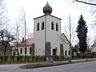
1210 | Paul Rose, founding member of the Falkenberg landowner association (1902) and head of the Schirner & Rose entrepreneurial consortium that laid the road | 1906 | The residential street runs from Am Falkenberg via Schirnerstraße to Bohnsdorfer Weg, where it ends as a dead end. The quiet street is mostly built with single-family houses. For pedestrians there is a bridge over the railway line on Wegedornstrasse. |
|
| Ruben-Wolf-Strasse
( Location ) |
170 | Martha Ruben-Wolf (1887–1939), doctor | 3rd Sep 1997 | The residential street in the Ärztinnenviertel leads from Mohnweg to Sieboldstraße. |

|
| Rudower Strasse
( Location ) |
1200 (in the district) |
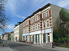
Berlin-Rudow , part of the Berlin district of Neukölln | before 1890 | The street is the connection between Rudow and the old town center of Altglienicke. It runs under the A113 motorway and turns into Neudecker Weg in the Rudow district. The Adlershof sports center of the Humboldt University is located on the corner of Wegedornstrasse. When the autobahn was built, the road was swiveled; today it merges into Neudecker Weg, which has been expanded into a connecting road. It was previously connected to Köpenicker Strasse. This road is classified as a regional road connection in the Berlin road network (Category III). |
|
| Rübezahlallee
( Location ) |
450 | Rübezahl , mountain spirit (Schrat) of the Giant Mountains | Jul 22, 1993 | The street from Schönefelder Chaussee to Dorothea-Viehmann-Straße was laid out at the end of the twenties and was designated as Straße 127 (Rübezahlallee) before it was named . |

|
|
Sachsenstrasse
( Location ) |
440 | Saxony , West Germanic tribe (Old Saxons), especially in today's Lower Saxony and England | Dec 5, 1911 | The road leads from Rosestraße via Semnonenweg to the railway line and ends there as a dead end. The road in the Sachsenberg settlement was divided by the construction of the outer ring road. It led from Wendenstrasse west of the outer ring to Rosestrasse. The western part was named Lutizenstrasse. The elementary school at the Altglienicker Wasserturm is located on the corner of Schirmerstrasse. |

|
| Salierstrasse
( Location ) |
880 | Salier , Salfranken, a part of the Germanic Franks | Jun 6, 1906 | The street originally led from Teutonenstraße to Bohnsdorfer Straße. In 1936 it was extended south to Wolfmarsteig. |

|
| Saturn ring
( Location ) |
220 | Saturn ring , ring system that surrounds the planet Saturn | Jul 28, 1989 | The private street on the grounds of the Anne Frank High School in the Kosmosviertel leads from Siriusstraße to Uranusstraße. |

|
| Horsetail path
( Location ) |
830 | Horsetail , genus in the genus Equisetopsida within ferns | Oct 1, 2002 | The settlement route in the Spreetal settlement was previously called Strasse 76 . It leads from the Taubnesselweg via Leberblumenweg to the Plumpengraben. |

|
| Shadow path
( Location ) |
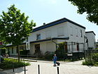
320 | Shadows , here reference to a shaded path | Jul 1, 2003 | The sidewalk, which is also open to cyclists, is partially dedicated to public transport. It runs from Erxlebenstrasse to Agnes-Hacker-Strasse. In the RBS, the path is included in the FUWE class (footpath) with a length of 320 m. |
|
| Schirnerstrasse
( Location ) |
830 | Adolf Schirner, founding member of the Falkenberg landowners' association (1902) and head of the Schirner & Rose consortium of entrepreneurs that laid the road | 1906 | The residential street leads from Am Falkenberg to Rosestraße. Quiet residential street with cobblestone pavement, which is mainly built up with one and two family houses. The school at the Altglienicker water tower and a listed water tower are located on the street . | |
| Snow White Street
( Location ) |
370 | Snow White , fairy tale character from the fairy tale collection of the Brothers Grimm | Jul 22, 1993 | The residential street between Schönefelder Chaussee and Dorothea-Viehmann-Straße was designated as Straße 127 a (Schneewittchenstraße) before it was named . |

|
|
Schönefelder Chaussee
( Location ) |
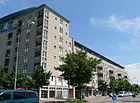
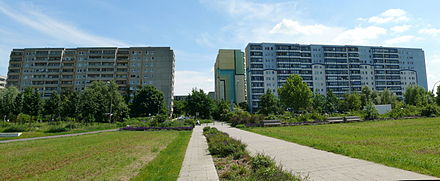
2380 | Schönefeld , municipality in the district of Dahme-Spreewald, Brandenburg | around 1920 | It is the traditional connection to Schönefeld and runs from Köpenicker Straße, Alter Schönefelder Weg and Bohnsdorfer Weg to the city limits, where it then continues as Altglienicker Chaussee. After it was chaused, the street was sometimes referred to as Cöpenicker Chaussee or just Chaussee at the beginning of the 20th century. To the north of the Altglienicke cemetery was the espionage tunnel built by the Americans for Operation Gold between Rudow and Schönefelder Chaussee. The southeast part of the street is made up of large prefabricated buildings from the GDR era. The southwest side of the street borders the Rudow-Altglienicke Landscape Park, the Rehpfuhl settlement and the Altglienicke cemetery. There is direct access to the landscape park via the A 113 motorway tunnel. This road is classified as a regional road link in the Berlin road network (Category III), and another 550 meters as a supplementary road link in the Berlin road network (Category IV). |

|
|
Schützenstrasse
( Location ) |
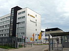
220 | Origin unclear, possibly after the former shooting club, which had its shooting range or shooting range here | around 1985 | The road leads from Schwalbenweg to the city limits (Schönefeld) with an access from the B 96a (at Seegraben). The main part of the Siedlungsstraße south of the Grünbergallee S-Bahn station is in the area of the community of Schönefeld, for which the street name was already recorded at the end of the 1930s. In the mid-1980s, a new building area was built in Berlin, to which the street leads. Here is the Lufthansa Flight Training Berlin with eleven flight simulators. |
|
| Schwalbenweg
( Location ) |
530 (in the district) |
Swallows , a species-rich family in the order of the passerine birds | around 1985 | The road in the Kosmossiedlung leads from the B 96a (Am Seegraben) over the city limits to the Seeweg in Schönefeld. |

|
| Schwarzkoppenstrasse
( Location ) |
100 | Luise von Schwartzkoppen (1902–1986), lawyer, librarian, one of the initiators for the establishment of the library at the Free University of Berlin | 3rd Sep 1997 | The access road leads from Mohnweg to Sieboldstraße. The spelling is incorrect. |

|
| Sebaldweg
( Location ) |
260 | Sebald, male first name | Nov 5, 1942 | The residential street runs from Rosestraße to Ewaldstraße. |

|
| Semmelweisstrasse
( Location ) |
930 | Ignaz Semmelweis (1818–1865), Hungarian doctor in what was then Austria-Hungary | May 10, 1951 | The residential street leads from Köpenicker Strasse over Wegedornstrasse to the Autobahn route, where it ends as a dead end. Before the wall was built, it led to Rudower Chaussee, which led from Rudower Strasse to Adlershof. Today the motorway bridge over the Teltow Canal is at this point. The name was changed to Semmelweisstrasse in 1951, partly including Strasse 197 . In 1988 the western part of the road 197 was added. Previous names were Dorfstrasse (until around 1890) and Friedrichstrasse (around 1890 to 1951). | |
| Semnonenweg
( Location ) |
240 | Semnones , tribal people of the Elbe Germanic Suebi | May 9, 1958 | The residential street is between Sachsenstraße and Germanenstraße. It was created with the construction of the outer ring of the railway. |

|
| Sieboldstrasse
( Location ) |
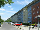
440 | Josepha von Siebold (1771–1849), was the first woman in Germany to receive an honorary doctorate in “the art of childbirth” (obstetrics) in 1815 | 3rd Sep 1997 | The street in the Ärztinnenviertel is between Mohnweg and Erxlebenstraße. Sieboldstrasse and Lehmusstrasse form a block of apartment buildings around the Altglienicker Aue, a spacious park with seating, lawns and playgrounds. It's a quiet residential street. A pedestrian connection via the freight railway line to the Cologne quarter connects to Coloniaallee and Coloniapark. |
|
| Siriusstrasse
( Location ) |
350 | Sirius , double star system of the constellation "Big Dog", the brightest star in the night sky | Jul 28, 1989 | The residential street in the Kosmossiedlung leads from Schönefelder Chaussee to Ortolfstraße and turns into Brigittenweg. The street was created when the residential area 2 was built in the Kosmossiedlung and, like other streets here, was named after celestial bodies. The road is classified as a supplementary road connection in the Berlin road network (Category IV). |

|
| Sorbenstrasse
( Location ) |
200 | Sorbs , including Wends, West Slavic people | Jun 6, 1906 | The residential street is between Cimbernstrasse and Lutizenstrasse. |

|
| Rung base
( Location ) |
230 | Shoot , young shoot or a young, newly growing part of a plant | Aug 9, 2000 | The private road between Kleeblattstraße and Bohnsdorfer Weg opens up the settlement that has arisen here. The last stretch to Bohnsdorfer Weg is not yet finished. |

|
| Thorn Apple Path
( Location ) |
300 | Thorn apples , genus of the nightshade family | Oct 1, 2002 | The residential street in the Spreetal settlement goes from Am Falkenberg to Leberblumenweg. Before it was named, it was called Straße 81 . |

|
| Everlasting Flower Path
( Location ) |
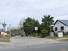
390 | Everlasting flowers , genus of the sunflower family | Oct 1, 2002 | The residential street in the Spreetal settlement goes from Am Falkenberg to Leberblumenweg. Before it was named, it was called Straße 79 . |
|
| Suevenstrasse
( Location ) |
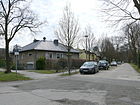
380 | Suebi , tribal group of Germanic peoples | Dec 5, 1911 | The residential street is between Preußenstraße and Sachsenstraße. |
|
|
Dead nettle trail
( Location ) |
300 | Dead nettles , genus of plants from the mint family | Oct 1, 2002 | The residential street in the Spreetal settlement goes from Goldsternweg via Schachtelhalmweg. Before it was named, it was called Straße 75 . |

|
| Teichrohrweg
( Location ) |
270 | Pond reed, reed, type of sweet grass, is commonly referred to as reed | Dec. 4, 1930 | The Teichrohrweg, previously street 131 , leads from the Mehldornpfad to Wegedornstraße. |

|
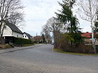
| Teutonenstrasse
( Location ) |
770 | Teutons , Germanic people of antiquity who originally lived in what is now Jutland | Jun 6, 1906 | The residential street leads from Preußenstraße past Germanenplatz to Salierstraße and ends there as a dead end. |
|
| Tiburtiusstrasse
( Location ) |
260 | Franziska Tiburtius (1843–1927), German doctor | 3rd Sep 1997 | The residential street in the Ärztinnenviertel is between Mohnweg and Sieboldstrasse. The “Primary School on Mohnweg” is located here. Tiburtiusstrasse is built on the east side with multi-family houses. On the west side is the primary school on Mohnweg and a daycare center. |

|
| Deadly nightshade
( Location ) |
180 | Deadly nightshade, a genus of the nightshade family | Oct 1, 2002 | The settlement path between Strohblumenweg and Stechapfelweg lies in the Spreetal settlement. It was called Straße 80 before it was named . |

|
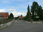
| Tulip path
( Location ) |
300 | Tulips , genus of plants in the lily family | Jul 17, 1997 | The residential street is between Wolfmarsteig and Mohnweg. At the end of the 1930s, the unofficial name Straße 149 a (Tulpenweg) was first mentioned in maps. |
|
|
Uranus Strait
( Location ) |
440 (in the district) except Berlin |
Uranus , the 7th planet in our solar system | Jul 28, 1989 | The street in the Kosmosviertel between Schönefelder Chaussee via Saturnring and Wehrmathen is on the border with Schönefeld. |

|
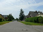
| Usedomstrasse
( Location ) |
420 | probably Guido von Usedom (1805–1884), lawyer and diplomat | June 6, 1906 | The residential street leads from Wegedornstraße to Auerswaldstraße. It was named at the same time as that of Auerswaldstrasse and Walderseestrasse . It was named after "famous, but already deceased and deserved men". The street is therefore probably named after the diplomat Karl Georg Ludwig Guido Graf von Usedom. Naming it after Admiral Guido von Usedom (1854–1925) or the Prussian General Ernst Friedrich Usedom (1840–1913) does not appear to be appropriate, although this is given in the Berlin address book. On December 7, 2004, the street 125a between Wegedornstraße and Usedomstraße , not officially called Jupiterstraße, was included in Usedomstraße. Naming it after the island of Usedom also seems inappropriate, as the adjacent Warnow and Peenestrasse were only named in 1956 and 1996 respectively. |
|
|
Venus Street
( Location ) |
460 + 150 + 480 (NE branch) |
Venus neighboring planet of the earth |
Jul 28, 1989 | The street in the "Kosmossiedlung" lies between the Schönefelder Chaussee (700 meters to the city limits) and the Birnenweg with a northern branch and angled guidance of the road area. The buildings addressed as Venusstraße were built after the establishment of the street on the site that was then still abandoned up to the city limits. In the RBS of the official representation of Berlin streets, Venusstraße is included with a total of 1363 m as G (= municipal street) and category V as other street with no particular traffic significance. Of this, 75 meters are included in the “PSTR” (private road) class, so there is no public responsibility with OKSTRA class “N” . Plots 1-49 (odd, as statistical block 126.612) are located north of Venusstrasse in a “square folded” block of flats on Schönefelder Chaussee. A similarly designed apartment block (statistical area 126.613) is located in the east at an angle to Ortolfstrasse, but only the directly adjacent (southern) house numbers 63–79 (odd) are addressed as Venusstrasse. The houses on the western and northern rows are numbered as Pegasuseck 2–20 (even), the eastern row of the block is numbered Ortolfstrasse 142–158.
On the southern side of the street (statistical block 126.609) behind the parking lots, the WBS-70/11 residential building line 20-28 - (straight) belongs to Venusstraße and also on the linear street (640 meters) the apartment block 40-46 (straight). Between those eastern and western blocks of flats there is a free, green strip to the north with the school on Pegasuseck and the day care center at Venusstrasse 57/59. A branch of the street leads northwards between the apartment block and the school to the area of the residential buildings "Altglienicker Grund" and from there at a right angle on the edge of the settlement, here is the sports hall and the sports field, to Ortolfstrasse. Subsequently, the settlement plots 52, 61, 61c and 61d were addressed to Venusstraße by division. Other house numbers are the commercial building 38 on the green strip south of the school, which addresses the play and sports areas as numbers 30, 32 and 34. A playground and the children's and youth circus south between Ortolfstrasse and Birnenweg are shown as statistical area 126.602 on property 88/90. At the triangle Venusstrasse / Ortolfstrasse / Birnenweg (126.604) there is a publicly used building owned by the district office with the address Venusstrasse 81. All properties and buildings on Venusstrasse belong to statistical area 126, a division of the district that serves the structure and planning. It should be noted that there is a street of the same name (number 4622) in the Reinickendorf part of the district of the same name. It is only 90 meters long and has eight adjacent lots. |

|
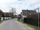
| Extended Werderstrasse
( Location ) |
840 as a ring and parallel paths |
Bernhard von Werder (1823–1907), Prussian infantry general | after 1937 | The residential street runs from Werderstraße and Besenbinderstraße to Goldsternweg with two further branches and further spur streets. The long unmarked street forms the connection to Werderstrasse, which is probably named after the Prussian general and diplomat Wilhelm von Werder. It is also possible to name it after an existing river valley known as Werder. |
|
|
Warnowstrasse
( Location ) |
360 | Warnow , river in Mecklenburg-Western Pomerania | Dec 18, 1956 | The residential street leads from Schönefelder Chaussee to Ortolfstraße. It was called Walderseestrasse between June 6, 1906 and December 14, 1956 . |

|
| Wegedornstrasse
( Location ) |
3100 | Way or buckthorn, genus within the family of Buckthorn family | Dec 15, 1930 | This street is classified in the district with 1330 meters as a regional road connection in the Berlin road network (category III), 1360 meters of the street as a supplementary road connection (category IV) and the remaining section is uncategorized. It begins on Rudower Chaussee in the Adlershof district and crosses the Teltow Canal, then continues in a south-easterly direction to the outer ring, which it crosses over the Wegedornstrasse bridge, which opened in April 2012, and flows into Bohnsdorfer Weg. Originally only the part of the street 119 in Wegedornstraße located northwest of the Schönefelder Chaussee in the Weiss settlement was named in 1930 . In 1936 the southern part of the street 119 up to the Bohnsdorfer Weg and finally in 1989 the newly created street in the northern extension to the Rudower Chaussee was included in the Wegedornstraße. On October 22, 2001, the part of the Bohnsdorfer Weg located southeast of the railway line was also named Wegedornstrasse. |

|
| Pasture path
( Location ) |
690 (in the district) |
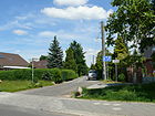
Willows , genus of trees and shrubs | Reported on 1800 | The Weidenweg leads from Ewaldstraße to Grünbergallee. The section between Rebenweg and Grünbergallee forms the border to Schönefeld, it is unpaved. Today's settlement path originated historically as a border path between the corridors of Bohnsdorf and Altglienicke and was incorporated into the road network of the Teltow district under its traditional name as a continuation of the Bohnsdorfer Chaussee at the end of the 19th century. The Weidenweg was partially built over by the construction of the motorway access. Its eastern section between Bundesstrasse 96a and Glienicker Strasse was incorporated into Glienicker Strasse on April 12, 2000. |
|
| Wendenstrasse
( Location ) |
630 | Wenden , western Slavs who lived in large parts of northern and eastern Germany from the 7th century, today mostly referred to as Elbe Slavs | Jun 6, 1906 | The residential street leads from Teutonenstraße to Bohnsdorfer Weg. The section between Bohnsdorfer Weg and Straße 558 , Straße 65 of the development plan, was included in Wendenstraße in 1956. |

|
| Werderstrasse
( Location ) |
90 | Bernhard von Werder (1823–1907), Prussian infantry general | May 1, 1906 | The short residential street is between Besenbinderstraße and Grünauer Straße. |

|
| Wido dough
( Location ) |
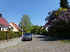
250 | Wido, male first name | Jan. 18, 1936 | The residential street, previously street 123 , lies between Bernulfstraße and Randolfstraße. The part leading from Randolfstrasse is unpaved. |
|
| Wolfmarsteig
( Location ) |
830 | Wolfmar, male first name | Jan. 18, 1936 | The residential street leads from Ortolfstraße via Narzissenweg to the railway line, where it ends as a dead end. The previous name was Street 146 . The part between the railway line and Malvenweg was included in the Malvenweg on June 12, 2002, since then the Wolfmarstein has only led to the outer ring of the railway. |

|
| Wunnibaldstrasse
( Location ) |
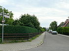
300 | Wunnibald, male first name | Jan. 24, 1938 | The residential street between Dankmar- and Gerosteig was previously called Straße 148a . |
|
|
To the old windmill mountain
( Location ) |
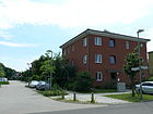
560 | after a windmill that was located here until the 1920s | Dec. 1, 1996 | The road leads from Alter Schönefelder Weg to Am Alten Friedhof. The previous name was Street 126 . The Altglienicker high plateau begins at the end of Köpenicker Straße. In the triangle Bohnsdorfer Weg and Schönefelder Chaussee there was a windmill that was mentioned in 1541 until the mid-1920s. |
|
| To Rothen Laake
( Location ) |
210 | Rothe Laake, old field name | Dec. 19, 2000 | The road between the Teltow Canal Bridge and the Autobahn can be reached via Am Glinigk and Iselersteig. |

|
Former and planned streets
| Surname | Origin of name | when named | until when valid | possibly today's name | Remarks |
|---|---|---|---|---|---|
| Friedrichstrasse | Friedrich III. , German Emperor for 99 days | around 1890 | May 10, 1951 | → Semmelweisstrasse | The street was renamed in the course of changes in street names that were monarchist and militarist in origin. |
| Gerostrasse | Gero (around 900–965), the first and only margrave of the Saxon East Mark | 1942 | Feb 22, 1957 | → Barley dough | The street was officially named Gerostraße in 1942; But since it was referred to as Gerostige on both street signs and in official documents, it was also given the official name Gerostige in 1957 |
| Rheingoldstrasse | the Nibelung treasure sunk in the Rhine after the Nibelungenlied | Aug 1, 2009 | → Lutz-Schmidt-Strasse | The street was first called Straße 174 (Rheingoldstraße) , but then, by decision of the BVV-Treptow, was given the name of the wall victim who was shot here in 1987. | |
| Walderseestrasse | Alfred von Waldersee (1832–1904), Prussian Field Marshal General | 1906 | Dec 18, 1956 | → Warnowstrasse | The renaming of the street to Warnowstraße was made at the request of the population through a municipal resolution of December 14, 1956. |
| Wilhelmstrasse | Wilhelm I , first German Emperor | 1891 | May 10, 1951 | → Besenbinderstrasse | The renaming of Wilhelmstrasse in 1951 took place in the course of changing street names that were considered to be of monarchist or militarist origin. According to the municipal bill, the street should be named Kirchstraße. However, since this name was to be used in the city center, it was only decided to rename it and the responsible city council was authorized to determine a new name for the street. |
| Wredebrücke / Köpenicker Straße / Rudower Chaussee
( Location ) |
around 1890 | around 1961 | dedicated | Where the motorway crosses the Teltow Canal today was the Wredebrücke, which established the connection between Adlershof and Rudow / Altglienicke. Köpenicker Strasse (Rudow) and Rudower Strasse and Rudower Chaussee from Adlershof were connected by a crossing structure. The former southern section of the Rudower Chaussee, from the Wredebrücke over the Teltow Canal to the Rudower Straße, was previously part of the Köpenicker Straße, which was mainly located in Neukölln, and was included in the Rudower Chaussee by resolution of November 20, 1959. After 1973, Rudower Chaussee was shortened and the section leading over the canal to Rudower Strasse in Altglienicke was canceled. |
Other locations in Altglienicke
Allotment gardens
The information relates to the allotment garden development plan (KGEP 2010) of the State of Berlin for the Treptow-Köpenick district. The systems are systematized in the development plan with a KGA number and as an organizational address unit in the regional reference system (RBS) with a street number. The Alt-Glienicker associations belong to the district association of garden friends Berlin-Treptow e. V. “Highly secured” in the following illustration means that evacuation or residential development is not planned in the foreseeable future (status: autumn 2014). However, it does not mean that barbed wire and / or video cameras secure or monitor the parcel area.
- KGA, Am Plumpengraben '( Strohblumenweg 109 + 119, Lage ) is a highly secured allotment garden with 60 plots on 30,151 m² of state-owned leased land. (KGEP: 09010, RBS: 44120)
The Plumpengraben was a long river with its headwaters in Johannisthal. From there it drained through Alt-Glienicke (past the Altglienicke pumping station) on the Falkenberg either further through Bohnsdorf into the Zeuthener See or northwards towards the Spree at the level of the Stubenrauchbrücke . Large sections were later drained for the purpose of reclaiming building land. He is the namesake of the KGA, which comprises 60 parcels and was founded in 1984. - KGA, Bachespe '( Besenbinderstraße 29, Lage ) is a highly secured complex with 62 parcels on 32,522 m² of private land. (KGEP: 09013, RBS: 44140) The facility, founded in 1982, is located south of KGA 'Lunapark I' and is separated from it by the Plumpengraben between Köpenicker and Werderstraße.
- KGA 'Birkenwäldchen' ( Stechapfelweg , Lage ) is a highly secured facility with 43 plots on 15,750 m² of state-owned leased land (KGEP: 09015, RBS: 44148). The facility was founded in 1920 and is located north of Plumpengraben opposite the KGA 'Meisengrund'.
- KGA, Bodenreform '( Goldsternweg 110), is highly secured with 113 plots (ten of which are permanent residents) on 62,512 m² of state-owned land. (KGEP: 09016, RBS: 44170) The facility, founded in 1924, is located between Goldsternweg and Teltow Canal, east of the KGA 'Lunapark'.
- KGA, Erlengrund '( Semmelweisstrasse 24, Lage ); 37 parcels on 19,973 m² of private space, only nine of which are permanently secured. 28 parcels are only secured until 2020, after which residential development is to take place here.
- The allotment garden association was founded in 1931, the facility is located south of Plumpengraben opposite the KGA 'Neuer Garten'.
- KGA, Falkenbrunn I '( Falkenbrunnstraße 51, Lage ) is a permanently secured garden with 97 plots on 60,201 m² of state-owned leased land, (KGEP: 09024, RBS: 44197) that is north of Plumpengraben to the railway site at Grünauer Kreuz. The association was founded in 1947.
- KGA, Helmutstal '( Tollkirschenweg 106, Lage ) consists of 5,035 m² of private land with 13 plots and is unsecured. (KGEP: 09037, RBS: 44243) The small complex from 1926 is located south of the Belladonna Path between Thorn Apple and Sunflower Path.
- KGA, Lunapark '( Goldsternweg 110, Lage ) is permanently secured, with 36 parcels and five of them permanent residents, it is 16,757 m² of state-owned land. (KGEP: 09056, RBS: 44275) The system consists of three parts south of the Teltow Canal around Werderstrasse and Köpenicker Strasse. 'Lunapark' between the Teltow Canal, the 'Bodenreform' facility, Goldsternstrasse and Alt-Glienicker Bridge, 'Lunapark I' to the west and then between Plumpengraben and Köpenicker Strasse and 'Lunapark II' in the subsequent corner on the other side of the Köpenicker Strasse between Teltow Canal and Korkedamm. The garden club founded in 1907 is the oldest in the district.
- KGA 'Meisengrund' ( Stechapfelweg 128, Lage ) is permanently secured and consists of ten parcels on 4,700 m² of state-owned land and twelve parcels on 6,835 m² of private land. It is located south of Plumpengraben to lots 49-56 on Am Falkenberg street, west of the Grünauer Kreuz railway site. The association was founded in 1985.
- KGA, Rudower Straße '( Rudower Straße 99/100, Lage ) is a weakly secured complex founded in 1982 with 31 parcels (including six permanent residents) on 14,142 private land and three further parcels on 1,710 m² of state-owned land. (KGEP: 09077, RBS: 44358) The facility is located to the west of the property on the extended Wegedornstrasse between Semmelweisstrasse and Rudower Strasse, to the east of the A 113 in the area of the Weiß estate .
- KGA, Spreetal / Kanne '( Taubnesselweg 98, Lage ) owns 28 plots on permanently secured state-owned leased land (KGEP: 09071, RBS: 05882) and is located on a triangular area on the western edge of the Grünauer Kreuz towards Taubnesselweg and south of the properties at Goldsternweg 31– 35. The association was founded in 1926.
Housing estates
In the beginning Altglienicke was a village group of numerous settlements with their own character, Spreetal, Altglienicker Höhe, Grüneck, Sachsenberg, Falkenhöhe, Altglienicker Grund. With the new buildings after 1990, Cologne, Kosmos and doctors quarters were added.
- Doctors' quarter ( location ): to the southeast of the Falkenhöh settlement, around the Altglienicker Aue
- Altglienicker Grund ( location ) around the street of the same name, north of Venusstraße
- Altglienicker Höhe ( location ): between Wegedornstraße and Dankmarsteig, east of Schönefelder Chaussee
- Anne-Frank-Carée ( location )
- Falkenhöhe ( location )
- Spreetal ( location ): is located in the north of the district. The "Spreetal" settlement is predominantly characterized by residential use. Accordingly, it was shown as a “non-canalised settlement area” in the land use plan.
- Kleinhaussiedlung Altglienicke ( Preußensiedlung ) ( location ): Preußenstrasse, Schirnerstrasse, east of the railway line
- Kosmosviertel ( location ): in the southwest of the district, east of Schönefelder Chaussee
- Kölner Viertel ( location ): in the southeast of the district
- Wegedorn settlement ( location ): around Hassostraße, south of Wegedornstraße
- Sachsenberg settlement ( location ): west of the railway line, around Lutizenstrasse and Markomannenstrasse
- White settlement ( location ): north of Rudower Strasse on both sides of Wegedornstrasse in the north-west
- Settlement Meier ( location ): around the street Am Alten Friedhof, east of Wegedornstrasse, south of Rudower Strasse
- Grüneck settlement ( location ): west of Schönefelder Chaussee, north of the cemetery
- Rehpfuhl settlement ( location ): west of Schönefelder Chaussee, south of the cemetery
- Settlement Boba II ( location ): around the Märchenstraßen, to the north in the corner Wegedornstraße / Schönefelder Chaussee
- Eigenheim II settlement ( location ): north and south of Brigitten- / Kirschweg, between Kosmos and Cologne districts
Other areas
- Altglienicker Aue ( location ): a park between Sieboldstrasse and Lehmusstrasse with sunbathing, play areas and benches. It was designed in the course of the new building measures.
- Coloniapark ( location ): an extensive green area between Chorweilerstraße and Porzer Straße with a large lawn and playground. The name goes back to the old Roman name of Cologne , which is a twin town of the former Treptow district . The surrounding new building area in the district got street names after Cologne districts.
- Landscape Park Rudow-Altglienicke ( location ): The 64-hectare park was created as a compensatory measure for construction work on the A 113 motorway and to reduce noise from passing cars. It lies on the area of the former wall strip and the decades-long division of the districts Neukölln (district Rudow) and Treptow (district Altglienicke) by the Berlin Wall was created on the former wall strip. The meadows and fields of the Mendler dairy farm were integrated into the planning so that cows and horses graze here. In addition to newly created bodies of water, puddles filled in were exposed again. Green areas were created on the tunnel tubes (Altglienicke and Rudower Höhe tunnels). Remains of the wall can be seen at the north end of the park. The park was opened to the public in May 2009. The Wall Trail and the Teltower Dörferweg , which run on the same route, have an asphalt runway for cyclists and skaters over two kilometers long and 4.5 meters wide and form an “inner-city promenade” with other connecting paths in the park.
- graveyards
Other roads
- The Dresden motorway slip road ( BAB 113 ) runs on the former strip of the wall between Altglienicke and Rudow. It leads through two tunnels under the Rudow-Altglienicke Landscape Park, the 'Rudower Höhe' tunnel and the 'Altglienicke tunnel'. The length of the main carriageway is specified in the RBS as 6240 meters.
- There is also the A 117 with the exit to the B 96a (south, 230 m), the entrance to the B 96a (north, 280 m) and 470 meters of the main carriageway.
- In addition to the routes with traffic significance mentioned in the above list (in particular Am Falkenberg Wasserwerk , Schattenweg ), a connection route has been included in the district in the official FIS broker map display Berlin 1: 5000 (color edition). Connecting path between Kirschweg and Glindower Weg (90 meters): It is 10 meters wide in the residential estate II from Kirschweg on Brigittenbrücke to the south between the shooting range and the properties Kirschweg 25, 27 and Glindower Weg 8. The further continuation to the south to the The city limits to Schönefeld are assigned to Glindower Weg with lots 1–7 (odd).
See also
Web links
- Map of Berlin 1: 5000 with district boundaries. Senate Department for Urban Development Berlin, 2009, accessed on July 13, 2011 .
- Berlin-Brandenburg Statistics Office: Directory of streets and squares in the Treptow-Köpenick district (as of February 2015); pdf
- Streets in Altglienicke by Kaupert Media
- Diether Huhn: Altglienicke in the bourgeois wind on berlinstreet.de
- Ingo Drews: Everything about Altglienicke. Bürgererverein Altglienicke eV, February 8, 2013, accessed on February 13, 2013 .
- Strolling in Berlin - How real is reality . Klaus Gaffron, accessed March 14, 2013
- www.berliner-stadtplan.com with points of interest
Individual evidence
- ↑ a b c d e streets in the district to FIS-Broker map display detailnetz_wms_spatial @ senstadt
- ↑ In the Berlin book plan from 1988 this section of the B96 a is so designated in its southwest area.
- ↑ RBS address search
- ↑ There was no information available to the Treptow-Köpenick building authority at the time of the naming. On the other hand, it was announced: “The section of Bundesstraße 96a in the state of Berlin (Treptow-Köpenick district) between the state border with Brandenburg and the Adlergestell does not have a street name.” The name “Am Seegraben” does not exist in Berlin.
- ↑ Press release of the BA Treptow-Köpenick on behalf of the Senate Department for Urban Development: Renewal of the B 96a South "Am Seegraben" , October 21, 2010; Retrieved January 20, 2013.
- ^ Kaupert's Baltenstrasse
- ↑ Kauperts Besenbinderstrasse
- ↑ Cabuwazi Zeltstandort Altglienicke ( Memento of the original from February 23, 2013 in the Internet Archive ) Info: The archive link was inserted automatically and has not yet been checked. Please check the original and archive link according to the instructions and then remove this notice. Retrieved March 8, 2013.
- ^ Kauperts Ewaldstrasse , accessed on February 12, 2013.
- ^ Kaupert's Froschsteg , accessed on February 12, 2013.
- ↑ Kauperts Geltow way , accessed on February 13, 2013.
- ↑ Schönefelder Weg . In: Berliner Adreßbuch , 1943, Part IV, p. 2069.
- ↑ Jungfernsteg . In: Berliner Adreßbuch , 1936, IV, p. 1933.
- ^ Kauperts Kirschweg , accessed on February 18, 2013.
- ↑ Kauperts Toad Alley , accessed on February 19, 2013.
- ↑ Press release of the BA Treptow-Köpenick on the assignment of street names to Lutz Schmidt , accessed on November 8, 2011.
- ↑ Kauperts Newt Road
- ↑ Michael Zajonz: The dream is out. Der Tagesspiegel, December 14, 2012, accessed on February 3, 2013 .
- ↑ Kaupert's Rosestrasse
- ↑ saawt Schule am Altglienicker Wasserturm ( Memento of the original from December 7, 2012 in the Internet Archive ) Info: The archive link has been inserted automatically and has not yet been checked. Please check the original and archive link according to the instructions and then remove this notice. Retrieved February 26, 2013.
- ↑ Kaupert's Schirnerstrasse
- ^ Lufthansa Flight Training [1] accessed on February 26, 2013.
- ^ Kauperts Semmelweisstrasse , accessed on February 27, 2013.
- ↑ Map of Berlin 1: 5000 (K5 - color edition): Location of Venusstrasse
- ↑ compare the plan of Berlin. ( Memento of the original from November 9, 2015 in the Internet Archive ) Info: The archive link was automatically inserted and not yet checked. Please check the original and archive link according to the instructions and then remove this notice. Sheet 3021 and 302B from 1970 and 1982.
- ^ Kaupert's Extended Werderstrasse , accessed on February 27, 2013.
- ↑ Allotment gardens in the Treptow-Köpenick district (partial systems) (pdf; 38 kB) ( Memento of the original from September 29, 2013 in the Internet Archive ) Info: The archive link was inserted automatically and has not yet been checked. Please check the original and archive link according to the instructions and then remove this notice.
- ↑ Anniversaries of allotment gardens and associations in the district association of garden friends Berlin-Treptow e. V. ( Memento of December 10, 2008 in the Internet Archive )
- ↑ a b c d e f g Level Vb: Fictitious permanent allotment gardens according to §§ 16 and 20a BKleingG. The fictitious permanent allotment gardens are additionally protected by the representation in the FNP as green areas - allotments.
- ↑ Cöllnische Heide on adlershoferbuergerverein.de ( Memento from December 14, 2012 in the Internet Archive )
- ↑ a b c d Anniversaries of the allotment garden associations (indication of the founding years) ( Memento from December 10, 2008 in the Internet archive ), overview of the association in the district association of gardening friends Berlin-Treptow e. V. ( Memento from April 9, 2008 in the Internet Archive )
- ↑ a b Level IV: allotment garden areas that are to be retained according to the representation in the FNP The state-owned areas at this stage are allotment gardens that were established after the BKleingG came into force and are therefore not fictitious permanent allotments.
- ↑ a b c Address search on the map of Berlin 1: 5000 (K5 color edition), produced by the district surveying offices
- ↑ Level Va: allotment garden areas that are defined as permanent allotment gardens by the development plan.
- ↑ a b c Level Ia: Allotment gardens on private areas which, according to the FNP, are intended for another use. A termination is possible at any time in compliance with the allotment garden regulations.
- ^ The property , Journal des VDGN, 11 / 12-2016, p. 7.
- ↑ Level II: Fictitious permanent allotment gardens *, the areas of which are intended for transport, social or technical projects that are implemented at short notice.
- ^ Altglienicke: Living between the ink box settlement and the spy tunnel
- ^ Senate Department for Urban Development: Landscape program change
- ↑ Prussian settlement Altglienicke
- ↑ Peter Wensierski: Terminal suburb. Der Spiegel, February 28, 2011, accessed on February 27, 2013 .
- ↑ Altglienicke - Kosmosviertel
- ↑ Altglienicke - Cologne Quarter
- ^ POI: Altglienicker Aue, Berlin-Altglienicke
- ↑ POI: Coloniapark Berlin-Altglienicke and Kölner Viertel
- ↑ Altglienicke24.de: everything about the landscape park
- ↑ POI: Landscape Park Rudow-Altglienicke and wall strips to the A113 with a map of the area of the park in 1906.
- ↑ Cemetery development plan, Annex 12, Treptow-Köpenick planning (PDF; 790 kB)
- ↑ FIS broker address search for connection route in Altglienicke


