
Muleshoe National Wildlife Refuge: Difference between revisions
mNo edit summary |
Citation bot (talk | contribs) Removed parameters. | Use this bot. Report bugs. | #UCB_CommandLine |
||
| (44 intermediate revisions by 28 users not shown) | |||
| Line 1: | Line 1: | ||
{{Short description|National Wildlife Refuge near Muleshoe, Texas}} |
|||
| ⚫ | |||
| ⚫ | |||
| alt_name = |
|||
| iucn_category = |
|||
| photo = SandhillCranesMuleshoeNWR.jpg |
|||
| photo_alt = |
|||
| photo_caption = Sandhill cranes at Muleshoe NWR photo by [[Wyman Meinzer]] |
|||
| photo_width = 300 |
|||
| map = Texas |
|||
| map_alt = |
|||
| map_caption = |
|||
| map_width = |
|||
| relief = yes |
|||
| label = Muleshoe NWR |
|||
| label_position = right |
|||
| location = [[Bailey County, Texas]] |
|||
| nearest_city = [[Muleshoe, Texas]] |
|||
| coords = {{coord|33|57|14|N|102|45|44|W|format=dms|display=inline,title}} |
|||
| coords_ref = |
|||
| area_acre = 6440 |
|||
| established = 1935 |
|||
| visitation_num = |
|||
| visitation_year = |
|||
| governing_body = [[U.S. Fish and Wildlife Service]] |
|||
| url = https://www.fws.gov/refuge/muleshoe/ |
|||
| child = |
|||
| embedded = |
|||
}} |
|||
'''Muleshoe National Wildlife Refuge''' is a {{convert|6440|acre|km2|adj=on}} [[wildlife refuge]] located about {{convert|20|mi|km|abbr=on}} south of [[Muleshoe, Texas]], on [[Texas State Highway 214]]. It is the oldest [[national wildlife refuge]] in [[Texas]], having been established as the '''Muleshoe Migratory Waterfowl Refuge''' by [[executive order]] of President [[Franklin D. Roosevelt]] in 1935.<ref name="tsha">{{cite web|last1=Lively|first1=Jeanne F.|title=Muleshoe National Wildlife Refuge|url=https://tshaonline.org/handbook/online/articles/gkm01|website=Handbook of Texas Online|publisher=Texas State Historical Association|access-date=28 March 2018}}</ref> Roosevelt issued a proclamation in 1940 to change the name to the Muleshoe National Wildlife Refuge.<ref>{{cite web|title=Proclamation 2416|url=https://en.wikisource.org/wiki/Proclamation_2416|website=Wikisource|access-date= 28 March 2018}}</ref> In 1980, Muleshoe National Wildlife Refuge was designated as a National Natural Landmark by the National Park Service.<ref>{{Cite web |
|||
'''Muleshoe National Wildlife Refuge''' is the oldest [[National Wildlife Refuge]] in the state of [[Texas]], having been established in 1935. It is located about twenty miles south of [[Muleshoe, Texas|Muleshoe]], the seat of [[Bailey County, Texas|Bailey County]]. It is some fifteen miles north of [[Morton, Texas|Morton]] on [[Texas State Highway 214]]. |
|||
|url=https://www.nps.gov/subjects/nnlandmarks/site.htm?Site=MULE-TX |
|||
|title=National Natural Landmarks - National Natural Landmarks (U.S. National Park Service) |
|||
|website=www.nps.gov|language=en |
|||
|quote="Year designated: 1980" |
|||
|access-date=2019-03-30}}</ref> |
|||
The refuge is a stop for migratory waterfowl flying between [[Canada]] and [[Mexico]]. The refuge includes several intermittent salt lakes, some of which have been modified to extend their wet periods. Paul's Lake, on the east side of Highway 214, is spring-fed, and hosts wildlife during times when the other lakes are dry. If sufficient water is present during the winter, the refuge hosts tens of thousands of [[sandhill crane]]s.<ref>{{Cite web|last=Webber|first=Tammy|date=2021-09-09|title=Farmers restore native grasslands as groundwater disappears|url=https://apnews.com/article/business-science-environment-and-nature-texas-aquifers-db7cc8b855ac2e0f7b184d36ac716346|access-date=2021-09-10|website=AP News|language=en}}</ref> The largest number of cranes ever recorded was 250,000, during February, 1981. |
|||
| ⚫ | |||
| ⚫ | |||
The refuge includes several intermittent salt lakes, some of which have been modified to extend their wet periods. Paul's Lake, on the east side of Highway 214, is spring fed, and hosts wildlife during times when the other lakes are dry. |
|||
| ⚫ | |||
The 5,000-acre refuge is a stop for migratory waterfowl flying between [[Canada]] and [[Mexico]]. If sufficient water is present, during the winter it hosts tens of thousands of [[sandhill crane]]s. The largest number of cranes ever recorded was 250,000, during February, 1981. |
|||
| ⚫ | |||
The cranes are most visible at dawn and at dusk, as they leave the lakes during the day to feed in nearby fields. |
|||
<gallery widths=150px> |
|||
| ⚫ | |||
File:Muleshoe Refuge IMG_0390.JPG|Entrance to Muleshoe National Wildlife Refuge |
|||
File:Muleshoe Sandhill Cranes Meinzer 2008.jpg|Sandhill cranes in flight, Muleshoe National Wildlife Refuge |
|||
File:Muleshoe Goose Lake Meinzer 2008.jpg|Upper Goose Lake, Muleshoe National Wildlife Refuge |
|||
File:Muleshoe NWR Map.jpg|Official map of refuge |
|||
</gallery> |
|||
==See also== |
|||
| ⚫ | |||
*[[Grulla National Wildlife Refuge]] |
|||
*[[Buffalo Lake National Wildlife Refuge]] |
|||
*[[Blackwater Draw]] |
|||
*[[Llano Estacado]] |
|||
==References== |
|||
| ⚫ | |||
{{reflist}} |
|||
==External links== |
==External links== |
||
{{Commons category|Muleshoe National Wildlife Refuge}} |
|||
*[ |
*[https://www.fws.gov/refuge/muleshoe/ Muleshoe National Wildlife Refuge Official Site] |
||
*[http://www.tshaonline.org/handbook/online/articles/gkm01 Handbook of Texas Online: Muleshoe National Wildlife Refuge] |
|||
*[https://www.ars.usda.gov/plains-area/lubbock-tx/cropping-systems-research-laboratory/wind-erosion-and-water-conservation-research/docs/llano/ Public domain images of the Llano Estacado] |
|||
{{ |
{{Protected areas of Texas}} |
||
{{National Wildlife Refuges of the United States}} |
|||
{{National Natural Landmarks in Texas}} |
|||
{{authority control}} |
|||
[[Category:National Wildlife Refuges in Texas]] |
[[Category:National Wildlife Refuges in Texas]] |
||
[[Category:National Natural Landmarks in Texas]] |
[[Category:National Natural Landmarks in Texas]] |
||
[[Category:Bailey County, Texas]] |
[[Category:Protected areas of Bailey County, Texas]] |
||
[[Category:Protected areas established in 1935]] |
|||
[[Category:1935 establishments in Texas]] |
|||
| ⚫ | |||
{{ |
{{Texas-protected-area-stub}} |
||
{{BaileyCountyTX-geo-stub}} |
|||
Latest revision as of 00:06, 27 September 2023
| Muleshoe National Wildlife Refuge | |
|---|---|
 Sandhill cranes at Muleshoe NWR photo by Wyman Meinzer | |
 Muleshoe NWR | |
| Location | Bailey County, Texas |
| Nearest city | Muleshoe, Texas |
| Coordinates | 33°57′14″N 102°45′44″W / 33.95389°N 102.76222°W |
| Area | 6,440 acres (26.1 km2) |
| Established | 1935 |
| Governing body | U.S. Fish and Wildlife Service |
| www | |
Muleshoe National Wildlife Refuge is a 6,440-acre (26.1 km2) wildlife refuge located about 20 mi (32 km) south of Muleshoe, Texas, on Texas State Highway 214. It is the oldest national wildlife refuge in Texas, having been established as the Muleshoe Migratory Waterfowl Refuge by executive order of President Franklin D. Roosevelt in 1935.[1] Roosevelt issued a proclamation in 1940 to change the name to the Muleshoe National Wildlife Refuge.[2] In 1980, Muleshoe National Wildlife Refuge was designated as a National Natural Landmark by the National Park Service.[3]
The refuge is a stop for migratory waterfowl flying between Canada and Mexico. The refuge includes several intermittent salt lakes, some of which have been modified to extend their wet periods. Paul's Lake, on the east side of Highway 214, is spring-fed, and hosts wildlife during times when the other lakes are dry. If sufficient water is present during the winter, the refuge hosts tens of thousands of sandhill cranes.[4] The largest number of cranes ever recorded was 250,000, during February, 1981.
Other wildlife includes wood warblers, meadowlarks, raptors, burrowing owls, black-tailed prairie dogs, jackrabbits, cottontail rabbits, coyotes, black-footed ferrets, spotted chorus frogs, and badgers.
The prairie ecosystem includes plant life such as wildflowers, grasses, yucca, cacti, and mesquite. Rangeland management techniques include controlled burning and grazing.
Northeast of White Lake is a small area of white gypsum dunes, similar to those found at White Sands National Park in New Mexico, though these are much less expansive.
-
 Entrance to Muleshoe National Wildlife Refuge
 -
 Sandhill cranes in flight, Muleshoe National Wildlife Refuge
 -
 Upper Goose Lake, Muleshoe National Wildlife Refuge
 -
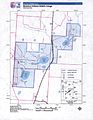 Official map of refuge


See also[edit]
- Grulla National Wildlife Refuge
- Buffalo Lake National Wildlife Refuge
- Blackwater Draw
- Llano Estacado
References[edit]
- ^ Lively, Jeanne F. "Muleshoe National Wildlife Refuge". Handbook of Texas Online. Texas State Historical Association. Retrieved 28 March 2018.
- ^ "Proclamation 2416". Wikisource. Retrieved 28 March 2018.
- ^ "National Natural Landmarks - National Natural Landmarks (U.S. National Park Service)". www.nps.gov. Retrieved 2019-03-30.
Year designated: 1980
- ^ Webber, Tammy (2021-09-09). "Farmers restore native grasslands as groundwater disappears". AP News. Retrieved 2021-09-10.
External links[edit]
- Muleshoe National Wildlife Refuge Official Site
- Handbook of Texas Online: Muleshoe National Wildlife Refuge
- Public domain images of the Llano Estacado
This article related to a protected area in Texas is a stub. You can help Wikipedia by expanding it. |
 | This article about a location in Bailey County, Texas is a stub. You can help Wikipedia by expanding it. |