San Antonio Missions
| San Antonio Missions | |
|---|---|
|
UNESCO world heritage |
|
| National territory: |
|
| Type: | (ii) |
| Criteria : | Culture |
| Surface: | 300.8 ha |
| Reference No .: | 1466 |
| UNESCO region : | Europe and North America |
| History of enrollment | |
| Enrollment: | 2015 ( session 39 ) |
| San Antonio Missions National Historical Park | ||
|---|---|---|
|
|
||
| Location: | Texas , United States | |
| Next city: | San Antonio | |
| Surface: | 3.8 km² | |
| Founding: | April 1, 1983 | |
| Visitors: | 1,358,911 (2016) | |
San Antonio Missions (San Antonio Spanish Missions) is a group of historic buildings in Bexar County , Texas , United States. These were part of Christian proselytizing .
From the 17th to the 19th century, Roman Catholic orders tried through mission stations to convert the indigenous population to the Christian faith; most of the stations originated when today's Texas was part of the viceroyalty of New Spain .
UNESCO World Heritage Site
The San Antonio Missions have been a UNESCO World Heritage Site since 2015 .
National Historical Park
The land belonging to the buildings and their surroundings were declared a National Historical Park on April 1, 1983 . Some buildings have previously been declared cultural monuments. In 2012, the 300.8 hectare park had 614,810 visitors.
List of structures
(incomplete) Map with all coordinates: OSM
![]()
| Illustration | designation | Construction year | surface | location | Note |
|---|---|---|---|---|---|

|
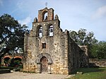
Misión San Francisco de la Espada | 1690 | 94.7 ha | 29 ° 19 ′ 41 ″ N , 98 ° 27 ′ 36 ″ W. | |

|
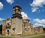
Mission San José y San Miguel de Aguayo (formerly Misión San Jose de los Nazoni s) | 1720 | 94.7 ha | 29 ° 21 ′ 42 " N , 98 ° 28 ′ 48" W. | San Jose Mission National Historic Site since 1941 |

|
Misión Nuestra Señora de la Purísima Concepción de Acuña ("Mission Concepcion") | 1716 | 13.3 ha | 29 ° 23 '26 " N , 98 ° 29' 32" W. | |

|
Mission San Antonio de Valero | 1716 | 1.7 ha | 29 ° 25 ′ 33 ″ N , 98 ° 29 ′ 9 ″ W. | |

|
Rancho de las Cabras | 1750–? | 40 ha | 29 ° 5 ′ 42 " N , 98 ° 10 ′ 0" W. |
(following the course of the San Antonio River to the south): Mission Nuestra Señora de la Purísima Concepción de Acuña, Mission San Jose, Mission San Juan and Mission Espada.
See also
- List of entries on the National Register of Historic Places in Bexar County
- Alamo
- Spanish missions in California
Web links
- Official website of San Antonio Missions National Historical Park
- Entry on the UNESCO World Heritage Center website ( English and French ).
References and comments
- ^ Stats Report Viewer. National Park Service , accessed on December 27, 2017 (select the appropriate entry under "Park").
- ↑ http://whc.unesco.org/en/list/1466/
- ↑ https://www.nps.gov/saan/planyourvisit/basicinfo.htm
- ↑ https://irma.nps.gov/Stats/Reports/National


